Antique maps catalogue
- All recent additions
-
Antique maps
- World and Polar
-
Europe
- Europe Continent
- Belgium
- Belgium - Cities
- The Low Countries
- The Netherlands
- The Netherlands - Cities
- Luxembourg
- France
- France - Cities
- Germany
- Germany - Cities
- Austria
- Italy
- Italy - Cities
- Spain and Portugal
- Greece & Greek Islands
- Switzerland
- British Isles
- British Isles - Cities
- Northern Europe
- Central Europe
- Eastern Europe
- Southeastern Europe
- America
- Asia
- Africa
- Mediterranean Sea
- Australia
- Oceans
- Celestial Maps
- Curiosities
- Books
- Medieval manuscripts
- Prints
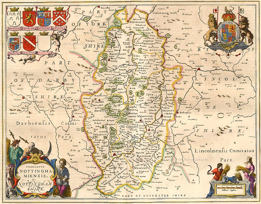
Nottinghamshire, by J. Janssonius. 1658
Comitatus Nottinghamiensis Sive Nottinghamshire
[Item number: 13948]
![[No title - On verso:] Principium Europae.](https://sanderusmaps.com/assets/WEBP/m30646.webp)
Rare 1525 edition in nice old colour.
Ptolemy map of the British Isles by Lorenz Fries, after Martin Waldseemüller 1525
[No title - On verso:] Principium Europae.
[Item number: 30646]
Rare 1525 edition in nice old colour
Ptolemy map of the British Isles by Lorenz Fries, after Martin Waldseemüller. 1525
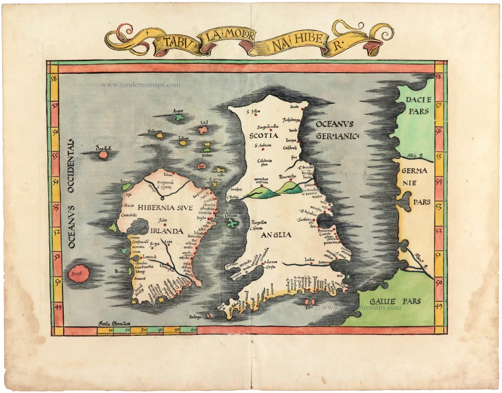
Tabula Moderna Hiber.
[Item number: 30663]
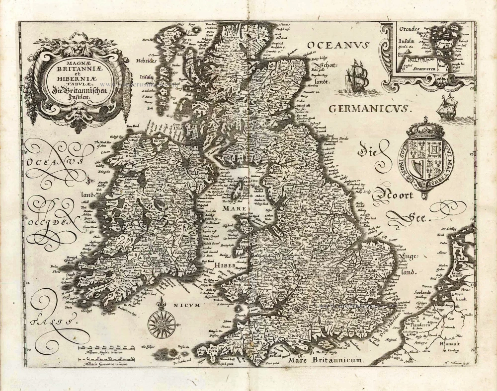
The British Isles, by M. Merian. 1638
Magnae Britanniae et Hiberniae Tabulae. - Die Britannischen ...
[Item number: 25904]
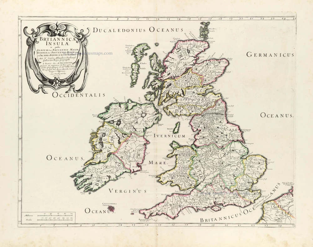
Ancient British Isles by Melchior Tavernier and Nicolas Sanson. 1659
Britannicae Insulae in quibus Albium Sive Britannia Maior ...
[Item number: 30014]
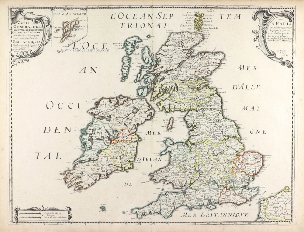
British Isles by Nicolas Sanson, published by Melchior Tavernier / Pierre Mariette. 1652
Carte Générale des Royaume d'Angleterre Escosse et Irlande.
[Item number: 29604]
![Brtiannicae [sic] Insulae in quibus Albium sive Britannia Maior Iuernia sive Britannia Minor tum et Orcades, Ebudes, Cassiterides.](https://sanderusmaps.com/assets/WEBP/m29623.webp)
Ancient British Isles by Nicolas Sanson. 1652
Brtiannicae [sic] Insulae in quibus Albium sive Britannia Maior ...
[Item number: 29623]

Central England by Nicolas Sanson. 1658
Anciens Royaumes de Mercie, et East-Angles ou sont les Comtés, ...
[Item number: 29626]
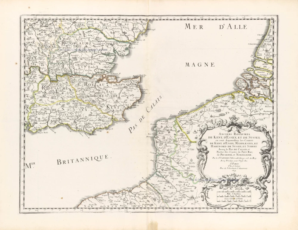
Southeast England with the adjacent coastline of France and Belgium, by Nicolas Sanson. 1658
Anciens royaumes de Kent, d'Essex, et de Sussex ou sont ...
[Item number: 29627]
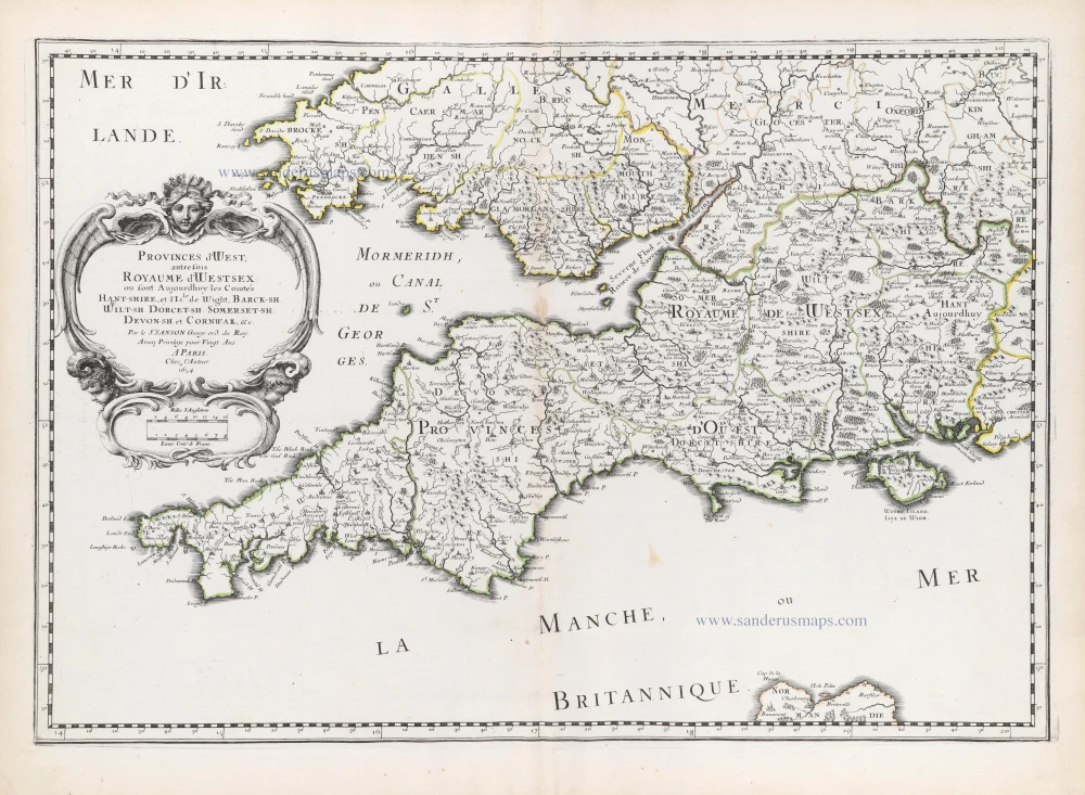
Southwest England by Nicolas Sanson. 1658
Provinces d'West; autrefois Royaume d'Westsex: ou sont ...
[Item number: 29642]
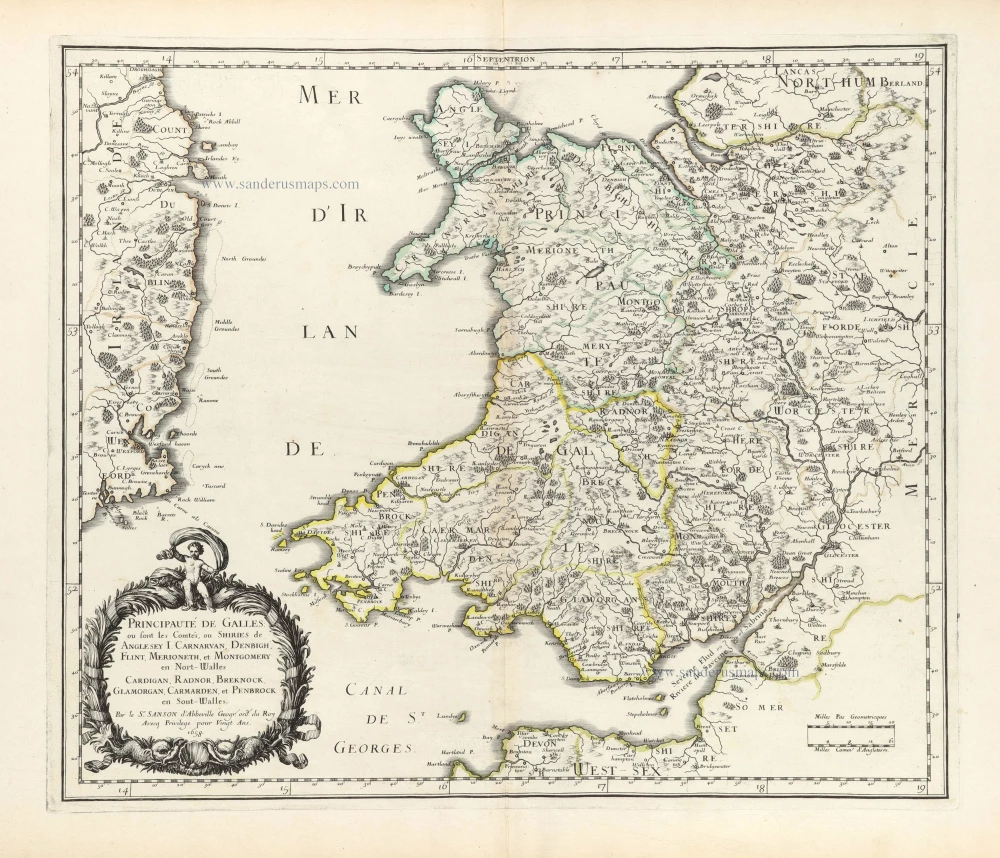
Wales by Nicolas Sanson. 1658
Principauté de Galles: ou sont les Comtés, ou Shiries de A ...
[Item number: 29643]
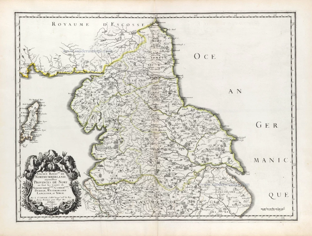
Northern England by Nicolas Sanson. 1658
Ancien Royaume de Northumberland, aujourdhuy Provinces de Nort: ...
[Item number: 29666]

Scotland, by Petrus Bertius. 1618
Scotia.
[Item number: 18211]
![Scotia Septentrion [in set with] Scotia Australis.](https://sanderusmaps.com/assets/WEBP/m18212.webp)
Scotland (North and South), by Petrus Bertius. 1618
Scotia Septentrion [in set with] Scotia Australis.
[Item number: 18212]
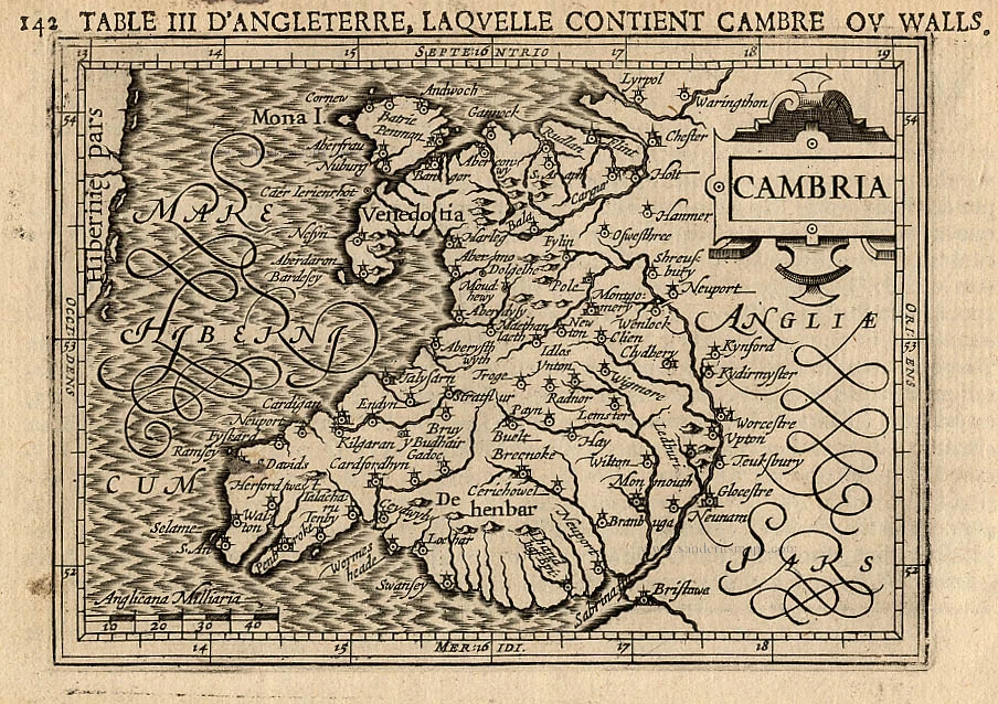
Wales, by Petrus Bertius. 1618
Cambria.
[Item number: 18216]
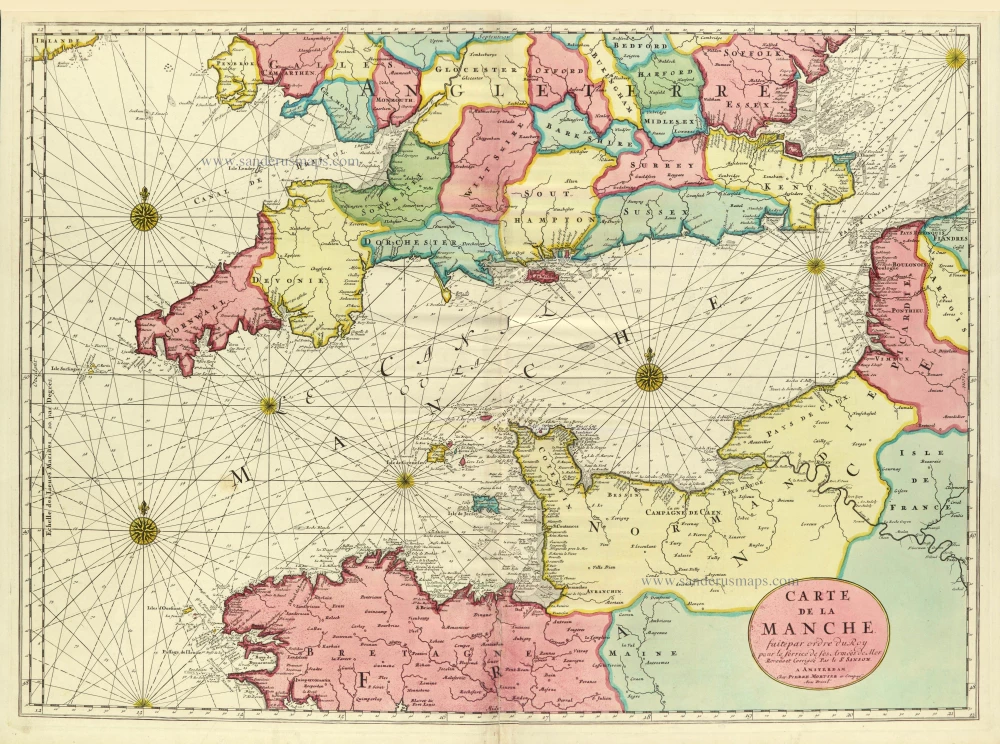
Channel, by Pierre Mortier. c. 1705
Carte de la Manche.
[Item number: 28001]
Heightened in gold
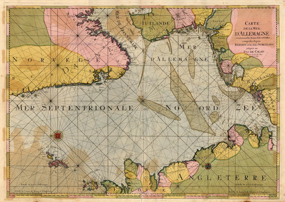
The North Sea by P. Mortier. 1693
Carte de la Mer d'Allemagne ...
[Item number: 15485]
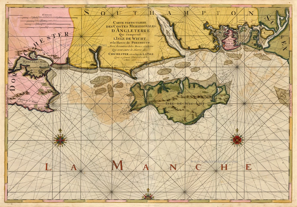
England, Isle of Wight & Hampshire, by P. Mortier. 1693
Carte Particulière des Costes Méridionales d'Angleterre Qui c ...
[Item number: 15482]
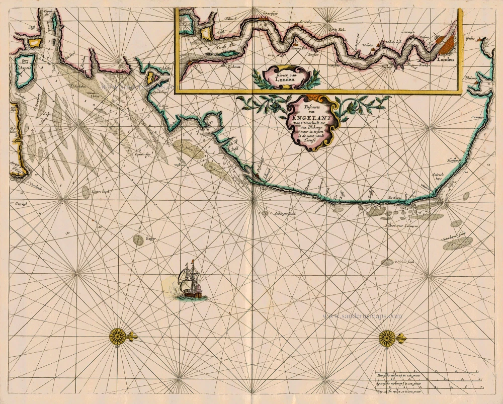
Sea chart of England - Thames River - London, by Pieter Goos. 1667
Pascaarte van Engelant van t' Voorlandt tot aen Blakeney waer in ...
[Item number: 19032]

The British Isles, by Pieter Goos. 1667
Paskaarte om Achter Yrlandt om te Zeylen van Hitlant tot aen ...
[Item number: 19046]
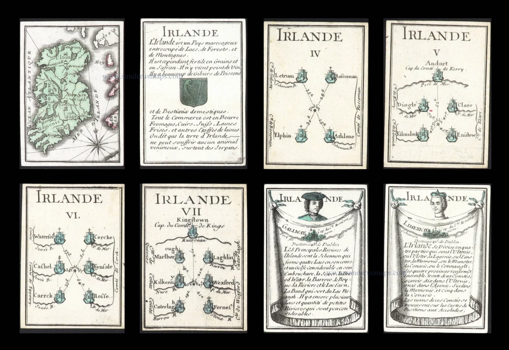
Ireland, eight geographical playing cards, designed by Nicolas Jean Baptiste de Poilly and printed by Jean-Baptiste Mitoire. c. 1763
Irlande.
[Item number: 30327]
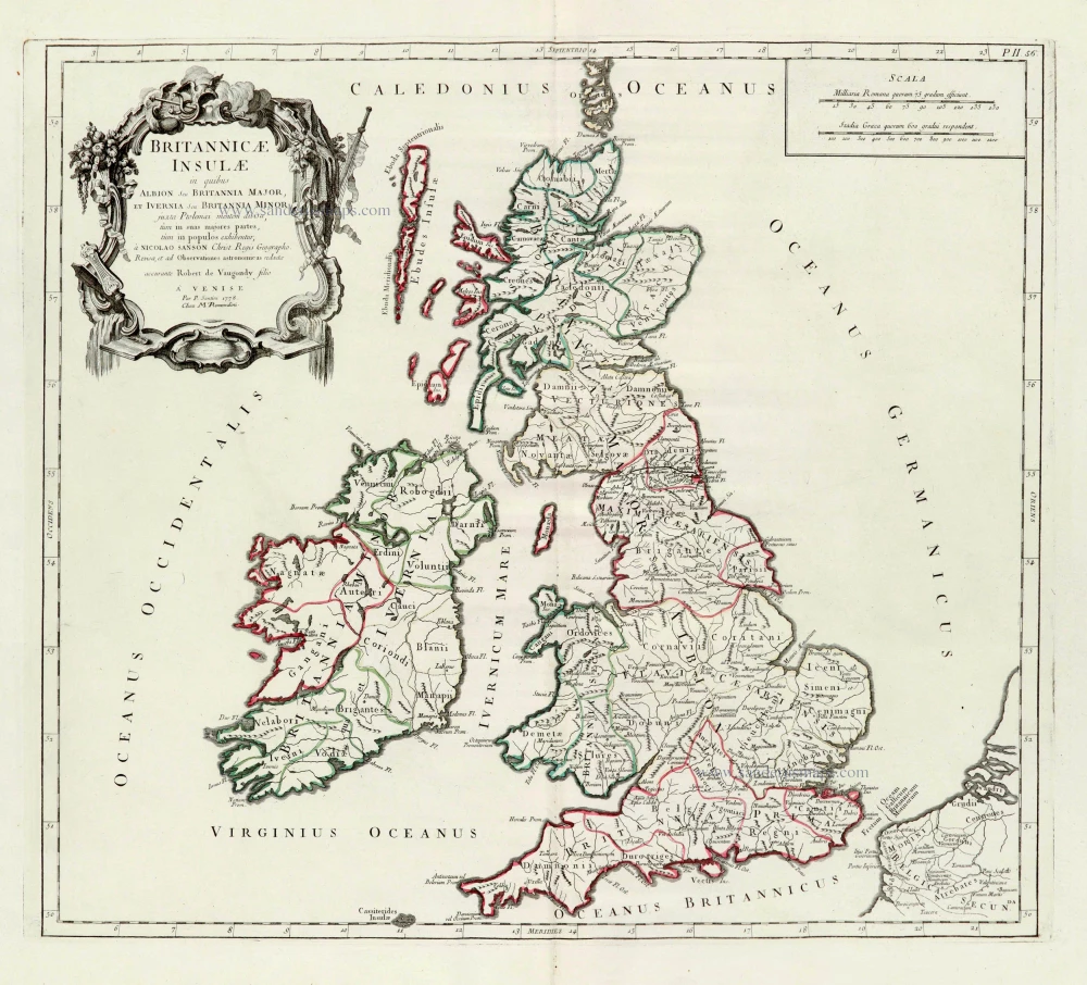
British Isles, by Paolo Santini, after Nicolas Sanson & Sr. Robert de Vaugondy. 1776-79
Britannicae Insulae in quibus Albion Seu Britannia Major, et ...
[Item number: 28105]

British Isles, by Francesco Santini. 1776-79
Les Isles Britanniques Comprenant les Royaumes d'Angleterre, ...
[Item number: 26959]
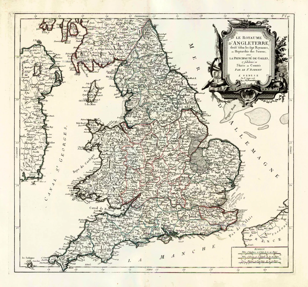
England, by Francesco Santini. 1776-79
Le Royaume d'Angleterre, Divisé Selon les Sept Royaumes, ou ...
[Item number: 26960]
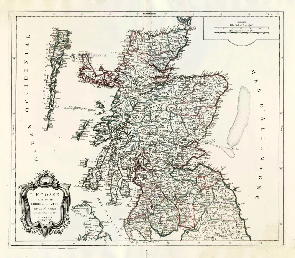
Scotland, by Francesco Santini. 1776-79
L'Ecosse Divisée en Shires ou Comtés.
[Item number: 26961]
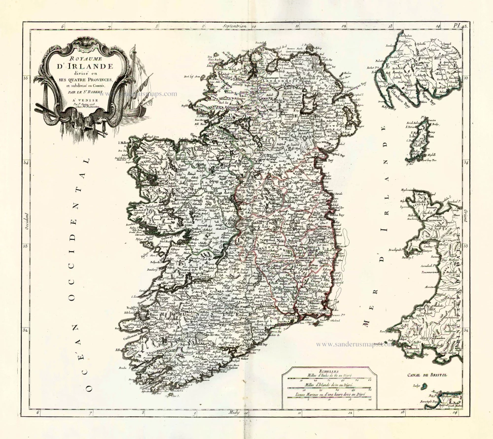
Ireland by Francesco & Paolo Santini 1776-79
Royaume d'Irlande divisé en ses quatre provences, et subdivisé e ...
[Item number: 26962]
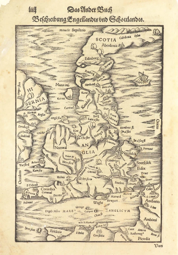
Great Brittain by Sebastian Münster. 1578
Beschreibung Engellandts und Schottlandts.
[Item number: 29468]
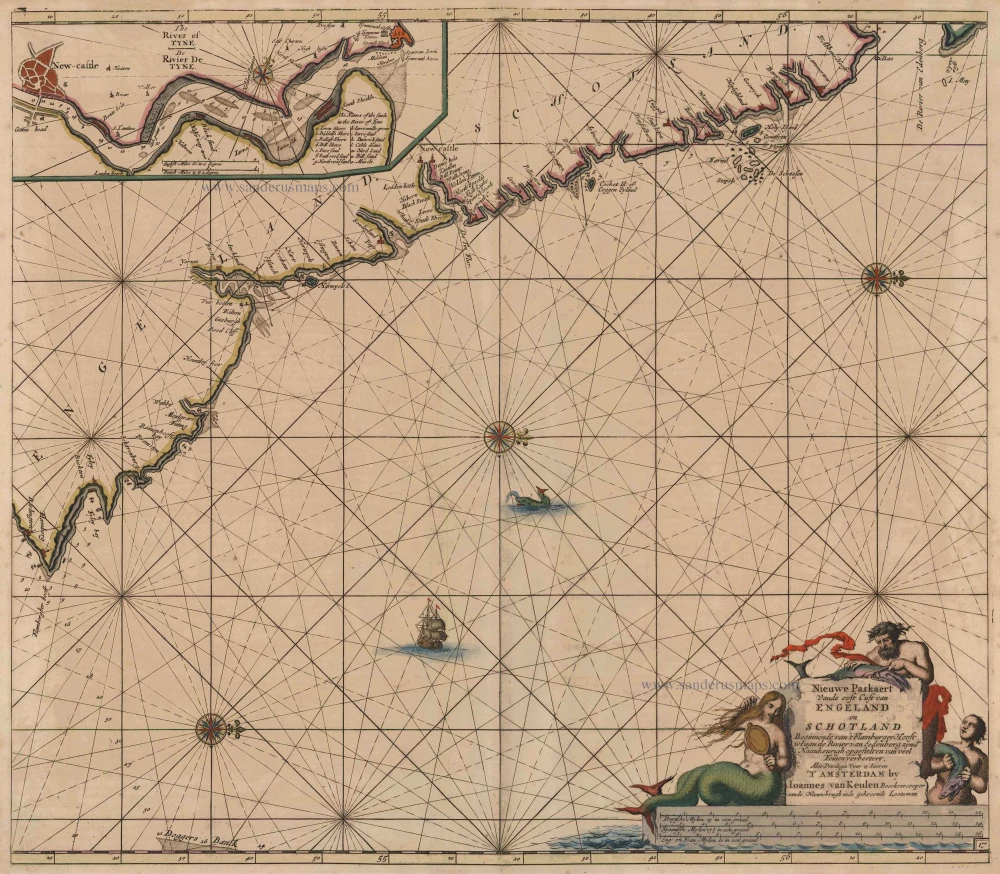
Sea chart of the East coast of England & Scotland, by Van Keulen Johannes 1697-1709
Nieuwe Paskaert vande Oost Cust van Engeland en Schotland ...
[Item number: 8077]

Scotland, with Lewis Island, by J. Van Keulen. Sea chart. 1697-1709
Pascaert, vande Westkust van Schotlant, als mede een Gedeelte ...
[Item number: 12461]
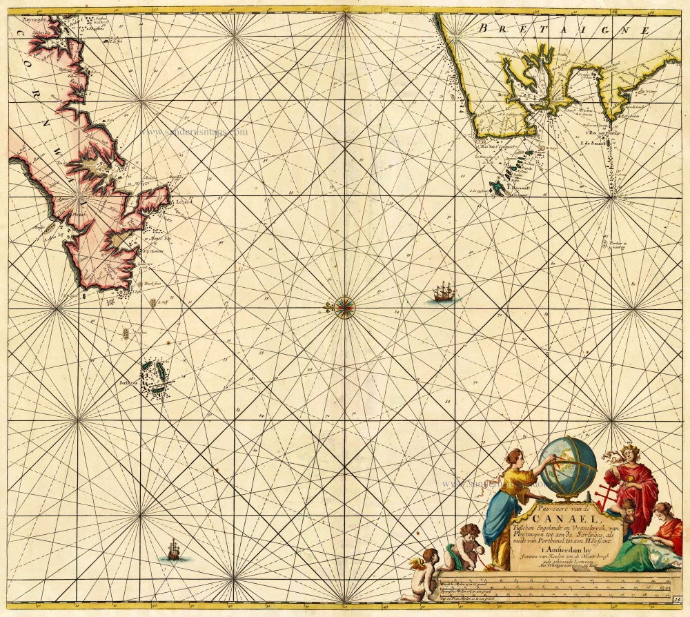
The Channel, by Van Keulen Johannes. 1697-1709
Pas-Caert van de Canael, tusschen Engelandt en Vranckryck, van ...
[Item number: 14588]
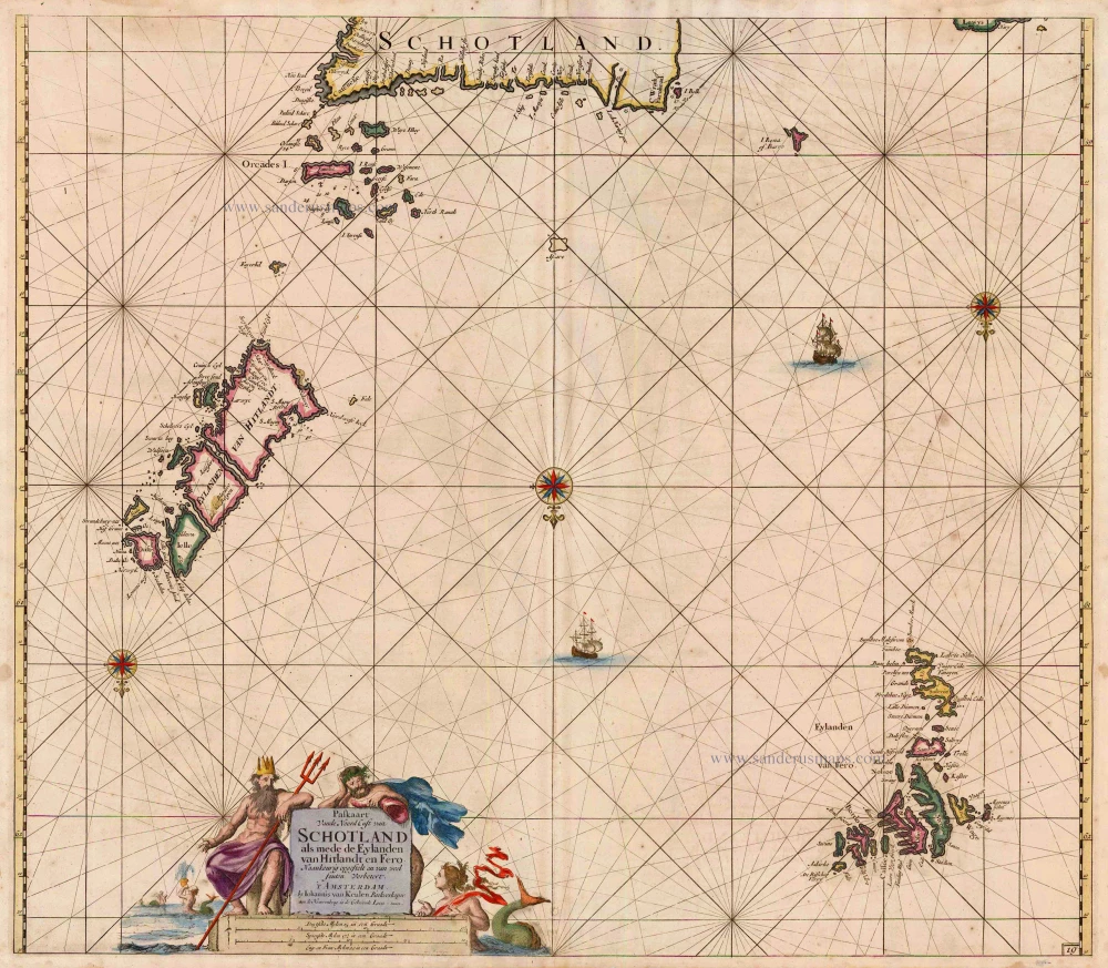
Northern Scotland, by Van Keulen Johannes. 1697-1709
Paskaart vande Noord Cust van Schotland als mede de Eylanden van ...
[Item number: 5399]
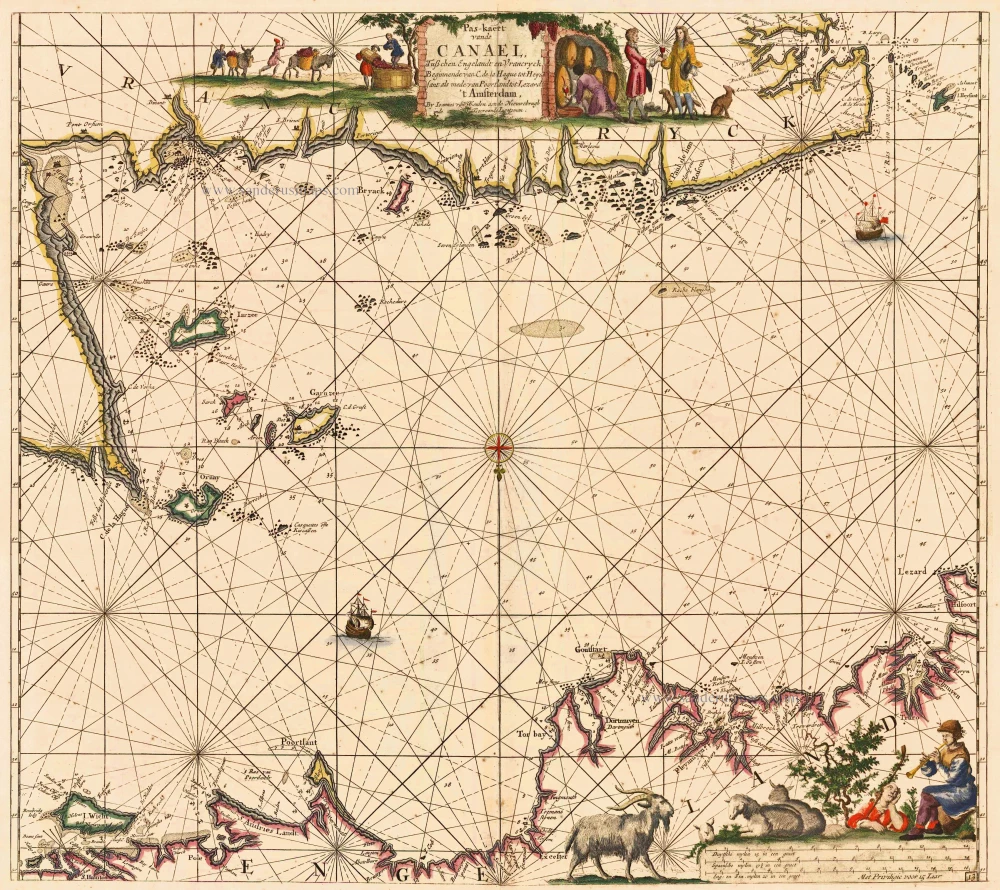
Bretagne and the Channel, by Van Keulen Johannes. 1697-1709
Pas-kaert vande Canael, Tusschen Engelandt en Vrancryck ...
[Item number: 5406]
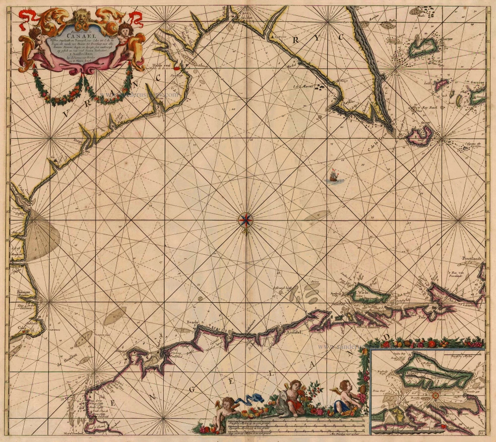
Channel, by Van Keulen Johannes. 1697-1709
Pascaert van de Canael Tusschen Engelandt en Vrancryck, van ...
[Item number: 13639]
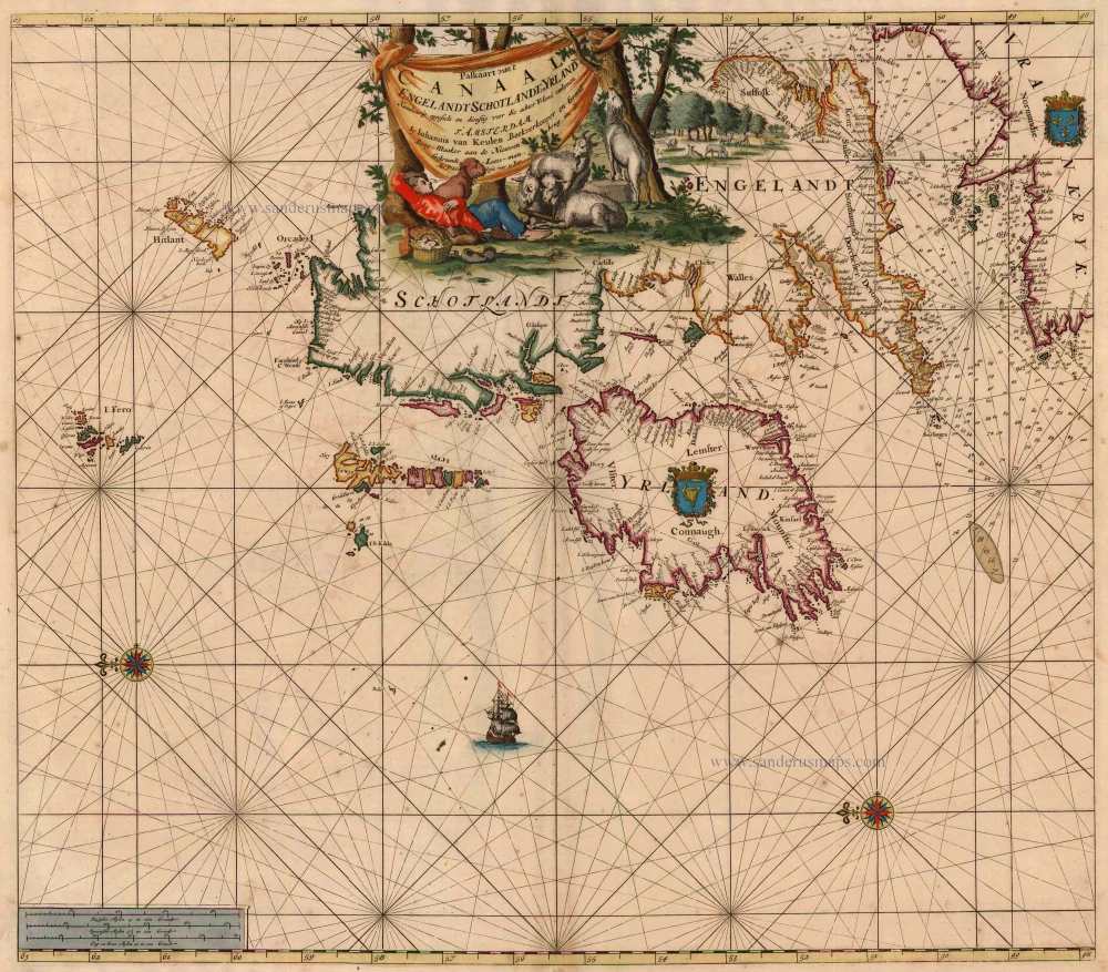
British Isles, by Van Keulen Johannes. 1697-1709
Paskaart van 't Canaal Engelandt Schotlandt en Yrland
[Item number: 5817]
![Irlanda. - [Above map :] Descrittione dell'Isola d'Irlanda](https://sanderusmaps.com/assets/WEBP/m29734.webp)
Ireland, by Thomaso Porcacchi. 1590
Irlanda. - [Above map :] Descrittione dell'Isola d'Irlanda
[Item number: 29734]
![Inghilterra. - [Above map :] Descrittione dell'Isola d'Inghilterra.](https://sanderusmaps.com/assets/WEBP/m29755.webp)
British Isles, by Thomaso Porcacchi. 1590
Inghilterra. - [Above map :] Descrittione dell'Isola ...
[Item number: 29755]