Antique maps catalogue
- All recent additions
-
Antique maps
- Polar maps
- World
-
Europe
- Europe Continent
- Belgium
- Belgium - Cities
- The Low Countries
- The Netherlands
- The Netherlands - Cities
- Luxembourg
- France
- France - Cities
- Germany
- Germany - Cities
- Austria
- Italy
- Italy - Cities
- Spain and Portugal
- Greece & Greek Islands
- Switzerland
- British Isles
- British Isles - Cities
- Northern Europe
- Central Europe
- Eastern Europe
- Southeastern Europe
- America
- Asia
- Africa
- Mediterranean Sea
- Australia
- Oceans
- Celestial Maps
- Curiosities
- Title Pages
- Books
- Medieval manuscripts
- Prints

Bourgogne - Franche Comté, by Janssonius J. c. 1630-1633
Burgundiae Comitatus, Franche Comté.
[Item number: 31113]

Bresse by Hondius - Janssonius. 1636
Bresse
[Item number: 8602]

Bresse, by Blaeu W. 1642-43
Bressia Vulgo Bresse
[Item number: 14369]

Brie by Blaeu W. 1642-43
Le Pais de Brie
[Item number: 14382]

Rare first state
Brie by Jodocus Hondius, published by J. Janssonius. c. 1631
Le Comté de la Brie.
[Item number: 33122]
![Caletensium et Bononiensium ditionis acurata delineatio. [on sheet with:] Veromanduorum eorumque confinium Exactissima Descript.](https://sanderusmaps.com/assets/IMG/webp/m22884.webp)
Calais & Vermandois by Abraham Ortelius. 1603
Caletensium et Bononiensium ditionis acurata delineatio. [on...
[Item number: 22884]
![Caletensium et Bononiensium ditionis acurata delineatio. [on sheet with:] Veromanduorum eorumque confinium Exactissima Descript.](https://sanderusmaps.com/assets/IMG/webp/m05754.webp)
Calais & Vermandois, by Abraham Ortelius. 1601
Caletensium et Bononiensium ditionis acurata delineatio. [on...
[Item number: 5754]

French Flandres (West) by E.H. Fricx, published by Covens & Mortier. 1745
Carte Particulière des Environs de Dunkerque, Bergues, Furnes,...
[Item number: 30544]

Cambrai, by Blaeu W. 1642-43
Archiepiscopatus Cameracensis
[Item number: 14378]
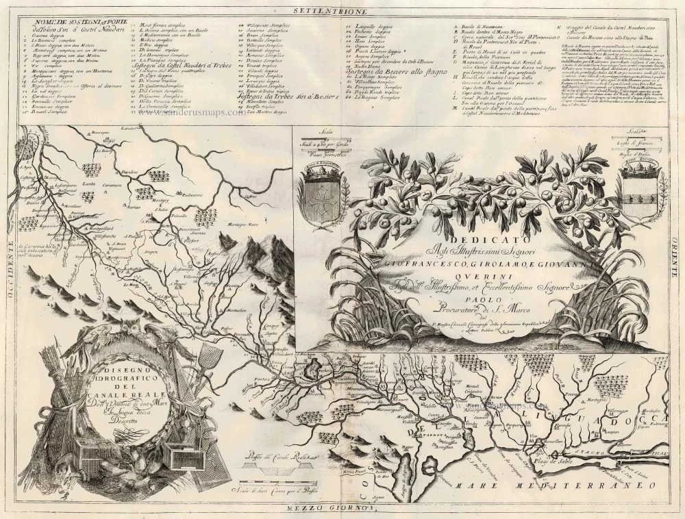
Canal du Midi, by Coronelli V.M. 1691
Disegno Idrografico del Canale Reale ...
[Item number: 23172]

The Cévennes with the bishopric of Montpellier, by C. Allard - Covens & Mortier. 1721-41
Les Bas Cevennes, Dans le Languedoc, ou le Diocese de...
[Item number: 23791]

Champagne by Willem & Joan Blaeu 1644-45
Champagne latine Campania Comitatus
[Item number: 14877]

Champagne, by J. Hondius. 1623
Champagne Comitatus Campania
[Item number: 24957]

Champagne, by Pieter van der Aa. 1713
Carte du Gouvernement de Champagne.
[Item number: 26191]

The Channel, by Van Keulen Johannes. 1697-1709
Pas-Caert van de Canael, tusschen Engelandt en Vranckryck, van...
[Item number: 14588]

Channel by N. Sanson, so-called published by Hubert Jaillot. (Pirated edition by Pierre Mortier). 1692
Carte de la Manche.
[Item number: 31172]
![Nieuwe Zeekaart van t' Eerste Gedeelte van t' Canaal Tusschen Engeland en Vrankrijk. [Title also in French, English, Spanish, and Italian]](https://sanderusmaps.com/assets/IMG/webp/m31427.webp)
Sea chart of the Channel by Gerard van Keulen. 1704
Nieuwe Zeekaart van t' Eerste Gedeelte van t' Canaal Tusschen...
[Item number: 31427]

Sea chart of the Channel - between France and England & Wales, by Jacques Nicolas Bellin. 1765
Carte Réduite des Isles Britanniques en cinq feuilles Pour...
[Item number: 31445]
![Partie Septentrionale de l'Evesche de Chartres ... [joint with] Partie Meridionale de l'Evesche de Chartres ...](https://sanderusmaps.com/assets/IMG/webp/m23780.webp)
Chartres, by N. Sanson - Jaillot - Covens & Mortier. c. 1695
Partie Septentrionale de l'Evesche de Chartres ... [joint with]...
[Item number: 23780]

Comtat Venaissin (Provence) - Orange, by Vincenzo Coronelli. 1696
Contado de Venaissino, e Prencipato d'Oranges,
[Item number: 29436]

Corse & Sardegna, by G. Mercator - J. Hondius. 1607
Corsica - Sardinia
[Item number: 25303]

Corse (Corsica), by P. Bertius. 1618
Corsica.
[Item number: 26538]
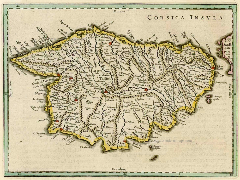
Corse, by W. & J. Blaeu. 1664-65
Corsica Insula
[Item number: 22050]
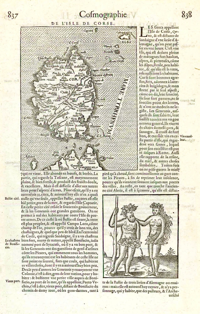
Corsica, by François de Belleforest. 1575
De L'Isle de Corse.
[Item number: 27286]

Corsica & Sardinia, by F. De Wit. c. 1680
Insularum Sardiniae et Corsicae Descriptio.
[Item number: 25914]
![Descriptio Corsicae Insulae [on sheet with:] Descriptio Sardinae Insulae.](https://sanderusmaps.com/assets/IMG/webp/m24455.webp)
CORSICA - SARDINIA by Mercator G. - Hondius H. 1639
Descriptio Corsicae Insulae [on sheet with:] Descriptio Sardinae...
[Item number: 24455]
![Corsica [on sheet with:] Sardinia.](https://sanderusmaps.com/assets/IMG/webp/m31321.webp)
Corsica - Sardinia by Gerard Mercator c. 1610-1650
Corsica [on sheet with:] Sardinia.
[Item number: 31321]
![Isle de Corse. - Isle et Roy[au]me de Sardaigne.](https://sanderusmaps.com/assets/IMG/webp/m29674.webp)
Corsica & Sardinia (Sardegna) by Nicolas Sanson. 1652
Isle de Corse. - Isle et Roy[au]me de Sardaigne.
[Item number: 29674]
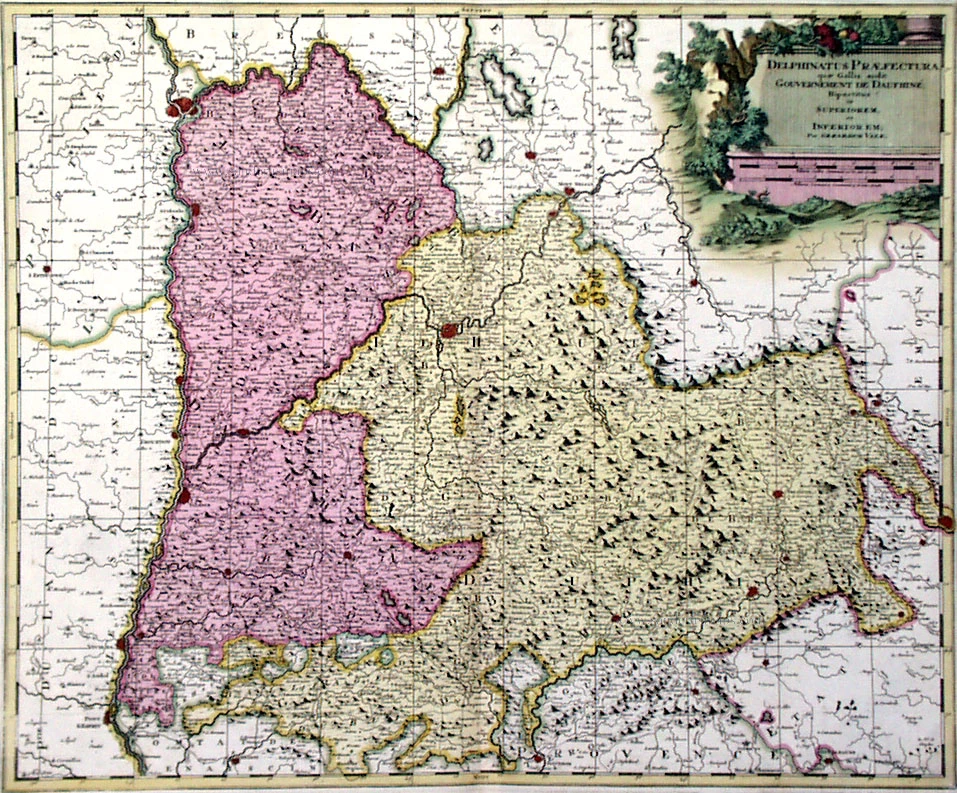
Dauphiné, by Valk G.& L. c. 1700
Delphinatus Praefectura ...
[Item number: 1277]

Dauphiné, by Blaeu W. 1642-43
Delphinatus vulgo Dauphiné.
[Item number: 14352]

The Dauphiné, by Henricus Hondius. 1630
Carte et Description Générale de Dauphiné Avec les Confins des...
[Item number: 16174]

Dauphiné, by Jaillot - Covens & Mortier. 1710
Le Gouvernement General du Dauphiné, Divisé en Haut et Bas, ...
[Item number: 23796]

Le Dauphiné by Frederick de Wit. c. 1680
Le Gouvernement du Dauphiné.
[Item number: 28300]
Rare!
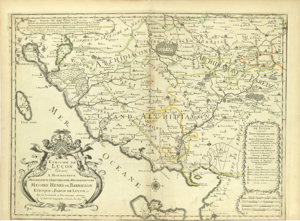
Diocese of Luçon by Guillaume Sanson. 1679-1710
Partie du Bas Poictou où sont Parties des Seneschaussées de...
[Item number: 28626]

Dombes, by Blaeu W. 1642-43
La Souverainete de Dombes
[Item number: 14370]

Dombes by Joannes Janssonius. 1631
La Principaute de Dombes.
[Item number: 30084]