Antique maps catalogue
- All recent additions
-
Antique maps
- World and Polar
-
Europe
- Europe Continent
- Belgium
- Belgium - Cities
- The Low Countries
- The Netherlands
- The Netherlands - Cities
- Luxembourg
- France
- France - Cities
- Germany
- Germany - Cities
- Austria
- Italy
- Italy - Cities
- Spain and Portugal
- Greece & Greek Islands
- Switzerland
- British Isles
- British Isles - Cities
- Northern Europe
- Central Europe
- Eastern Europe
- Southeastern Europe
- America
- Asia
- Africa
- Mediterranean Sea
- Australia
- Oceans
- Celestial Maps
- Curiosities
- Books
- Medieval manuscripts
- Prints
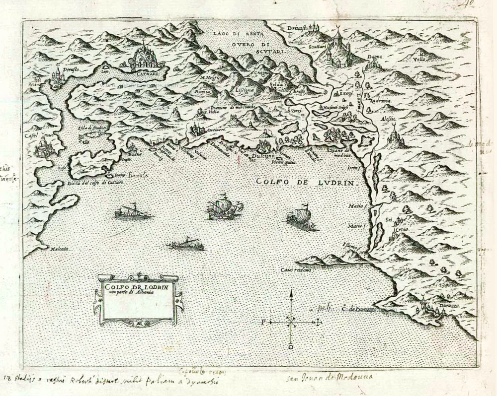
Montenegro by Giovanni Francesco Camocio After 1575
Golfo de Lodrin con parte di Albania.
[Item number: 27547]
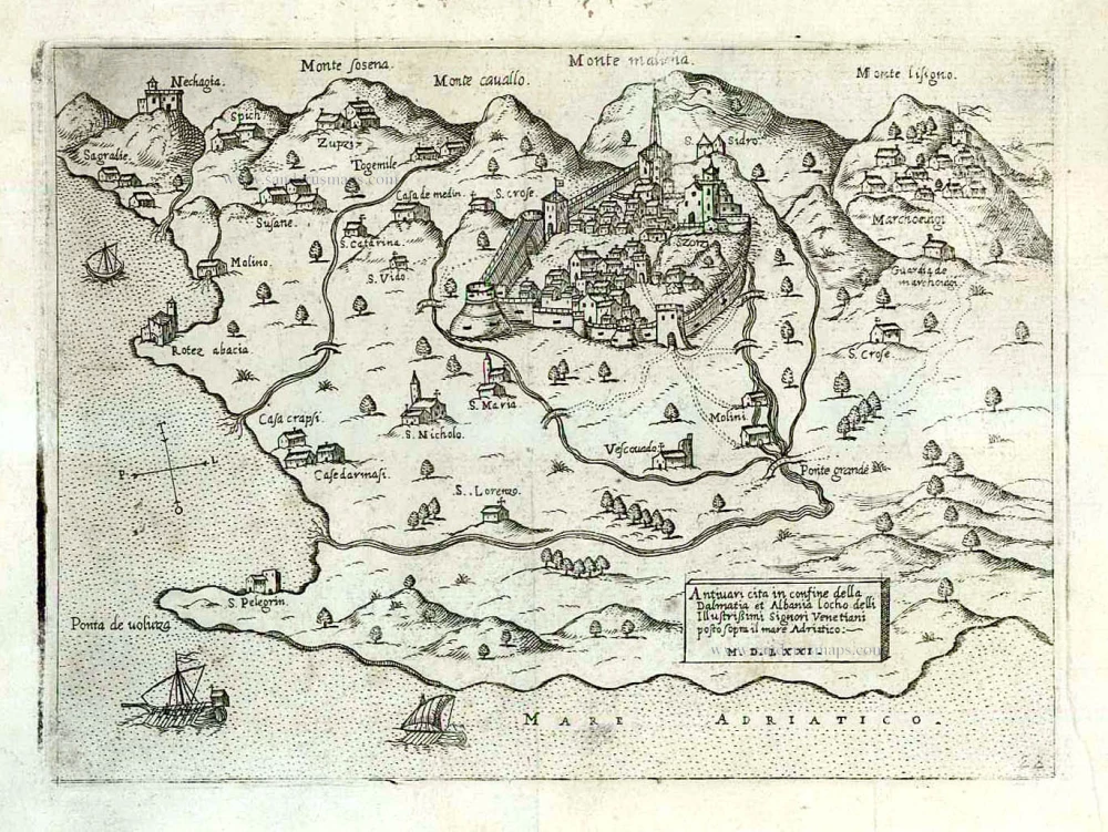
Montenegro - Bar by Giovanni Francesco Camocio After 1575
Antivari cita in confine della Dalmatia et Albania ...
[Item number: 27551]
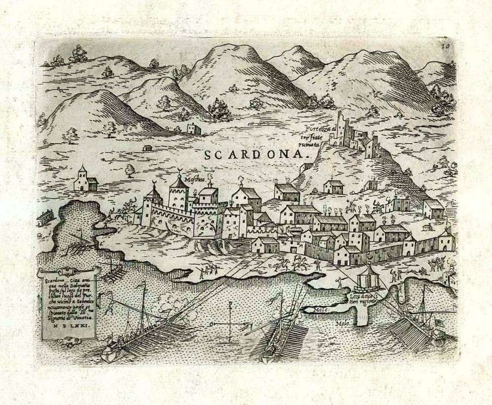
Croatia - Skradin (Scardona) by Giovanni Francesco Camocio After 1575
Scardona citta antiqua nella Dalmatia posta su lago de pruchlian ...
[Item number: 27552]
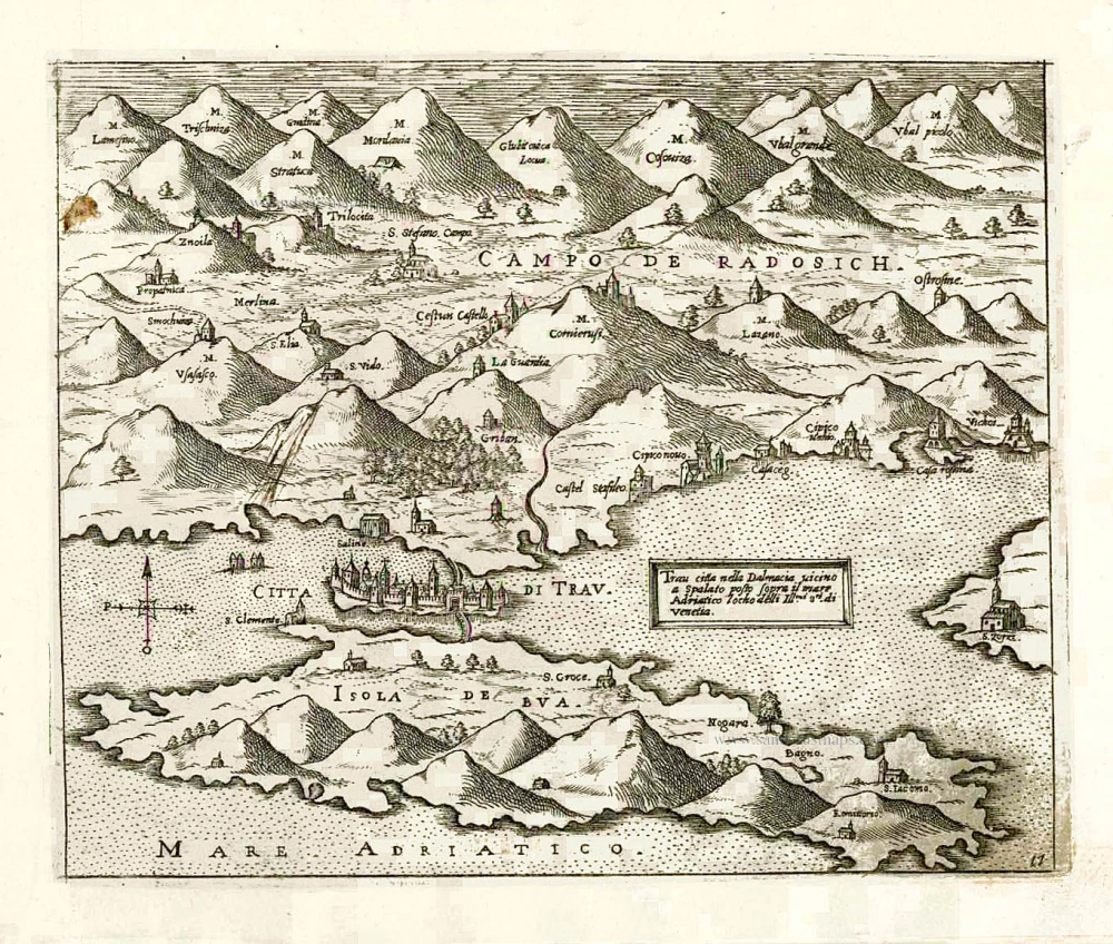
Croatia - Trogir (Traù) by Giovanni Francesco Camocio After 1575
Trau citta nella Dalmacia vicino a Spalato posto sopra il mare ...
[Item number: 27554]
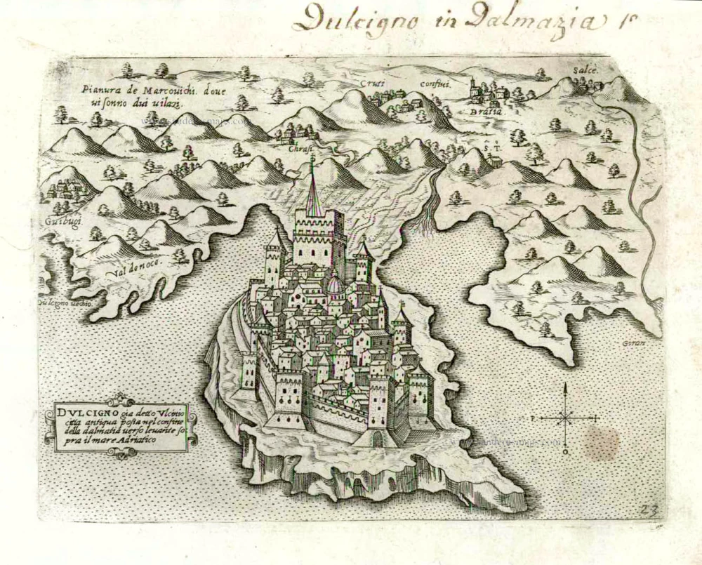
Ulcinj (Montenegro) by Giovanni Francesco Camocio After 1575
Dulcigno gia detto Ulcinio citta antiqua post nel confine della ...
[Item number: 27556]
![[No title - Castel Novo, Citta di Ragusi, Citta di Cataro.]](https://sanderusmaps.com/assets/WEBP/m27548.webp)
(Croatia - Montenegro) Dubrovnik, Herceg Novi, Kotor (Cattaro) by Giovanni Francesco Camocio After 1575
[No title - Castel Novo, Citta di Ragusi, Citta di Cataro.]
[Item number: 27548]
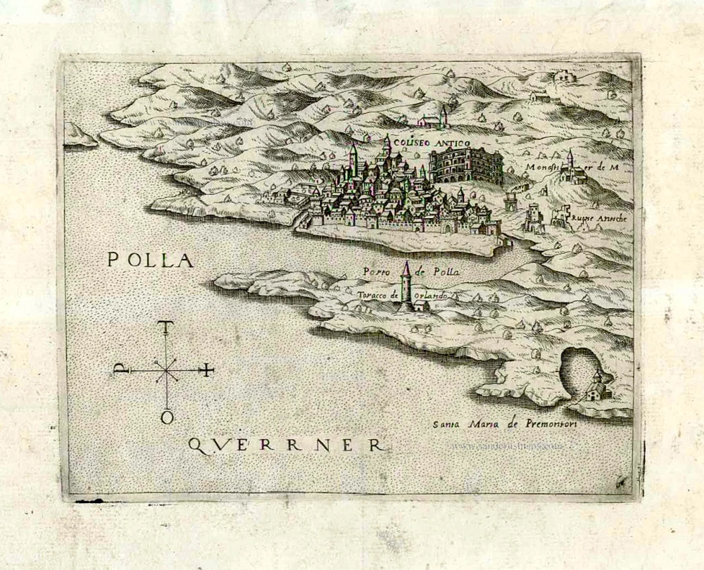
Croatia - Pulla by Giovanni Francesco Camocio After 1575
Polla.
[Item number: 27090]
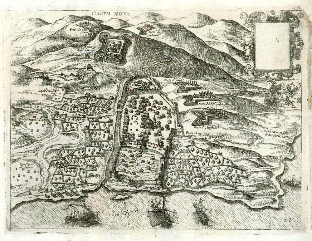
Montenegro - Herceg Novi (Cattaro) by Giovanni Francesco Camocio After 1575
Castel Novo.
[Item number: 27550]
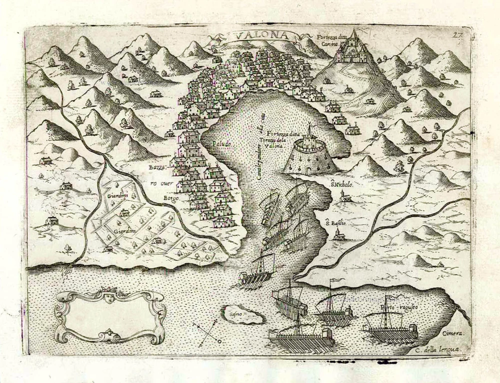
Vlorë (Valona - Avlona) by Giovanni Francesco Camocio After 1575
Valona.
[Item number: 27592]
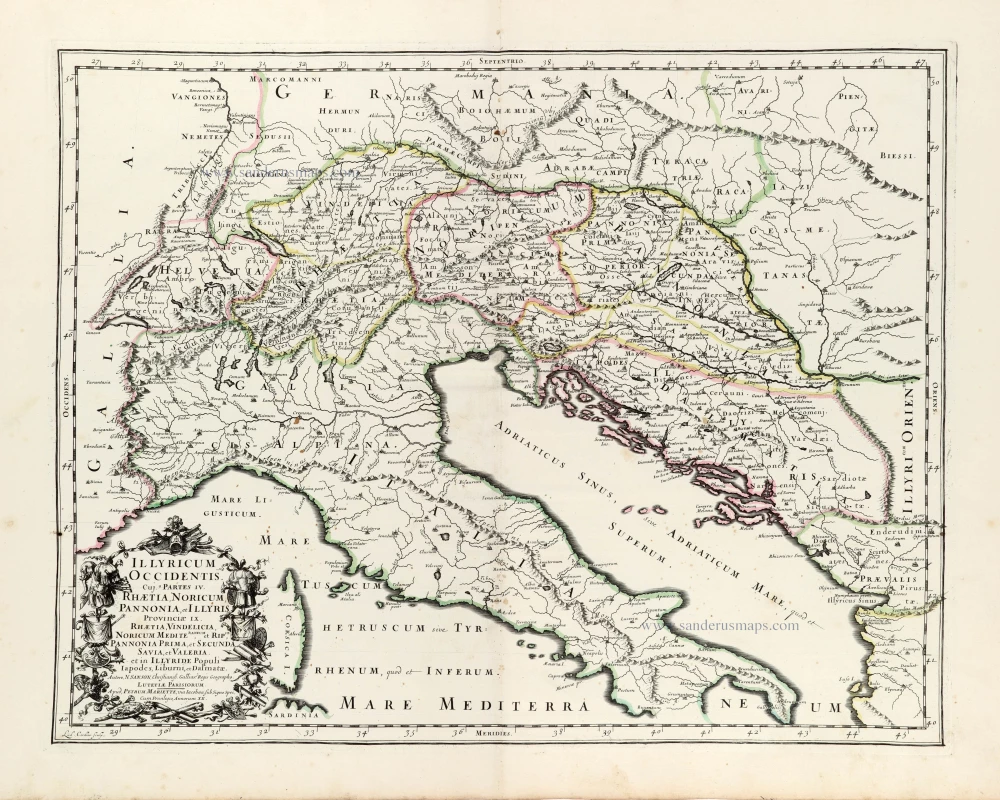
Western Illyricum (today's Switzerland, Austria, Dalmatia, and Northern Italy), by Guillaume Sanson. 1665
Illyricum Occidentis, Cuj. 9 Partes IV. Rhaetia, Noricum, ...
[Item number: 30042]

Eastern Illyricum (today's Bulgaria - Rumania), by Guillaume Sanson. 1665
Illyricum Orientis In quo Partes II. Moesia et Thracia.
[Item number: 30041]
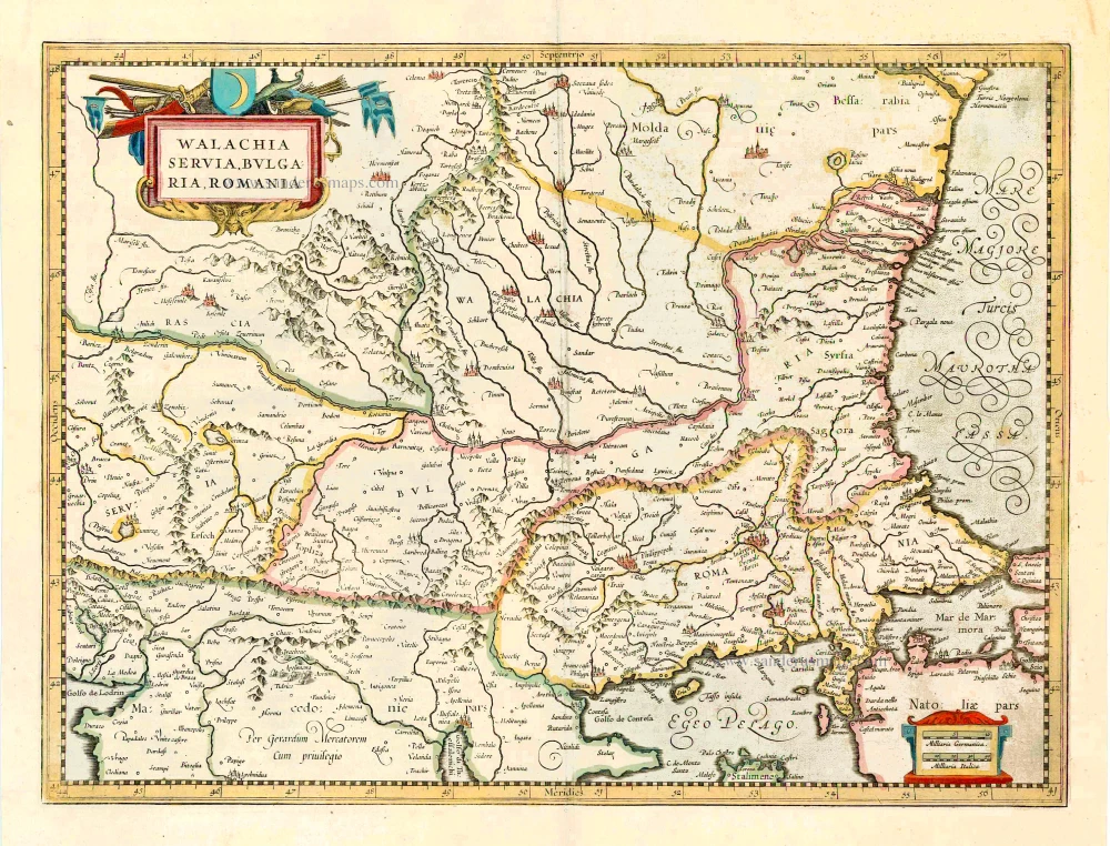
Balkans (East), by Henricus Hondius. 1641
Walachia Servia, Bulgaria, Romania.
[Item number: 27512]
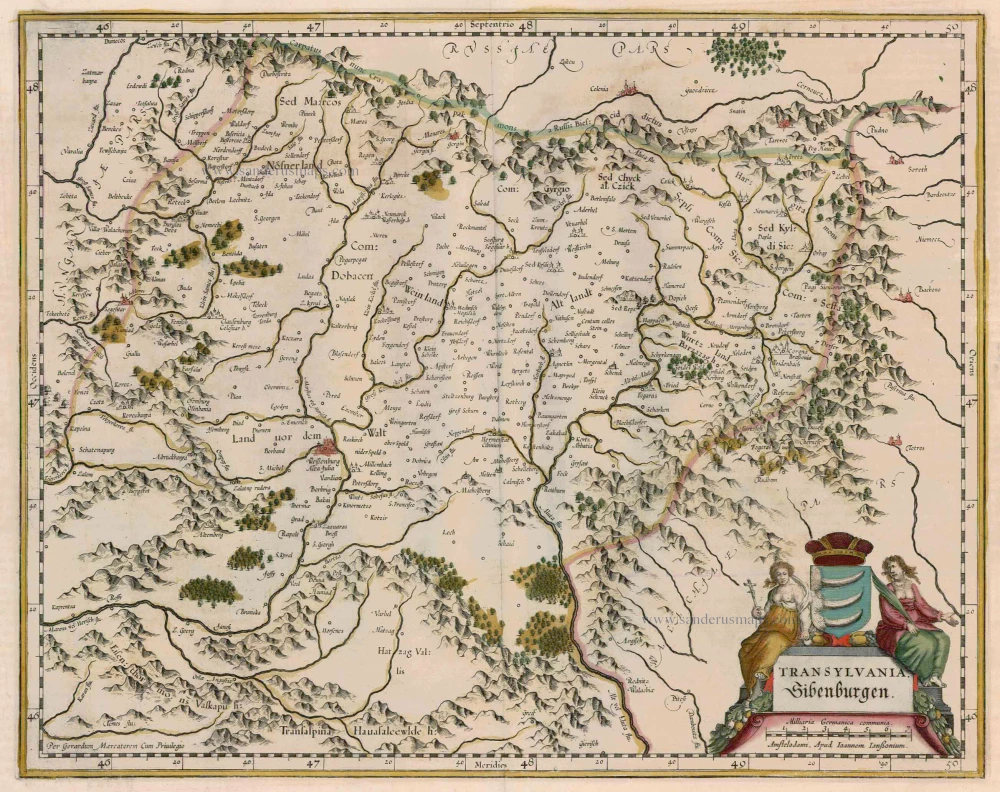
Transylvania, by Janssonius J. - Hondius H. 1644-58
Transylvania, Sibenburgen
[Item number: 7642]
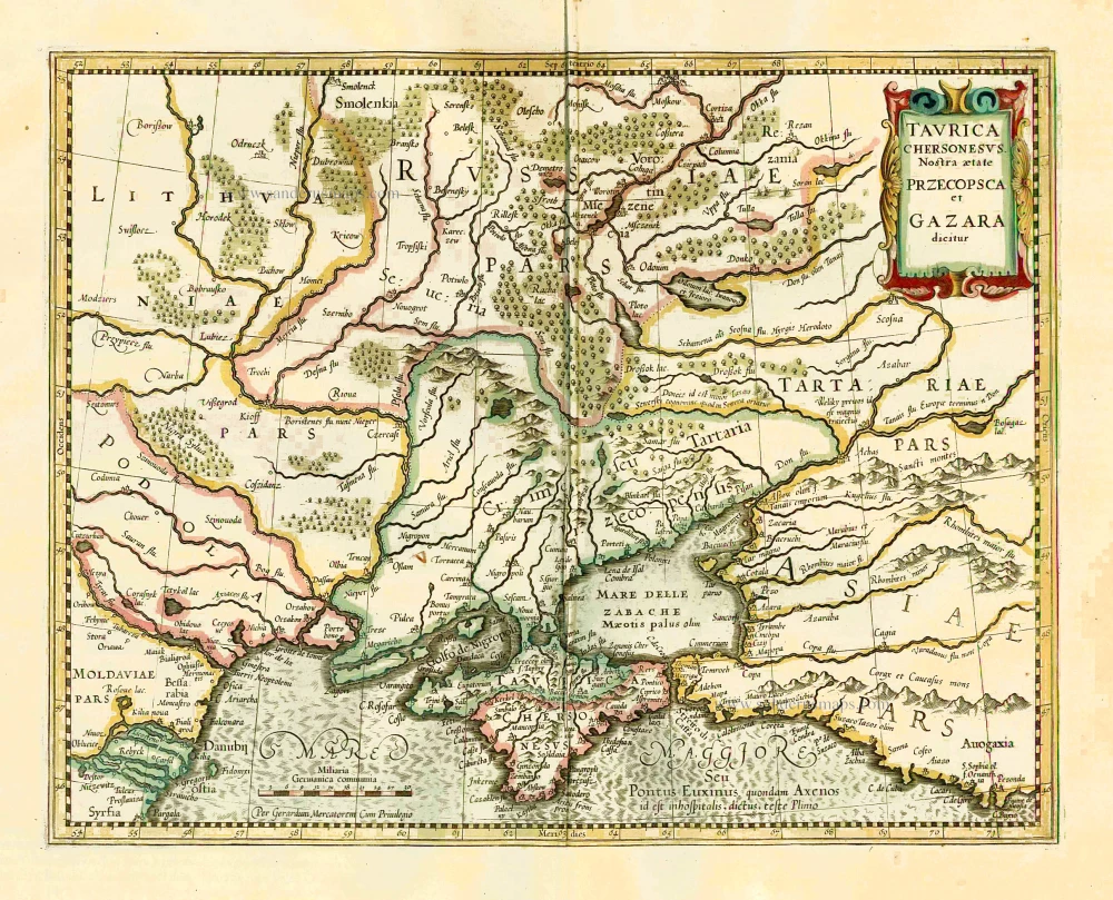
Ukraine - Crimea by Henricus Hondius. 1641
Taurica Chersonesus VS. nostra Aetate Przecopsca et Gazara ...
[Item number: 26264]
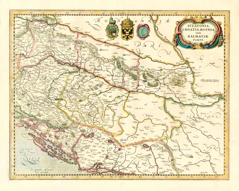
The western Balkans, by Henricus Hondius. 1641
Sclavonia, Croatia, Bosnia cum Dalmatiae Parte.
[Item number: 27085]
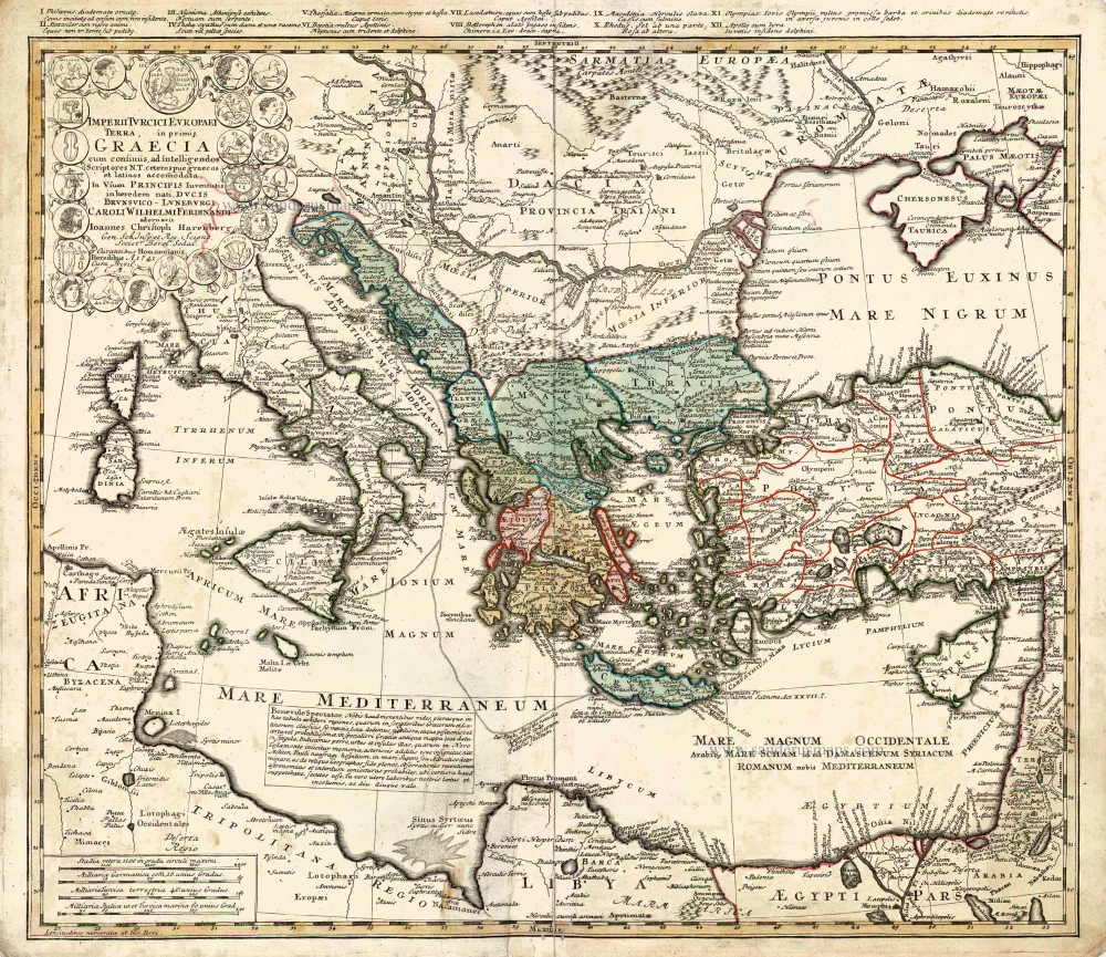
Southeastern Europe - Turkey by Homann Heirs 1752-1775
Imperii Turcici Europaei Terra in Primis Graecia.
[Item number: 26592]
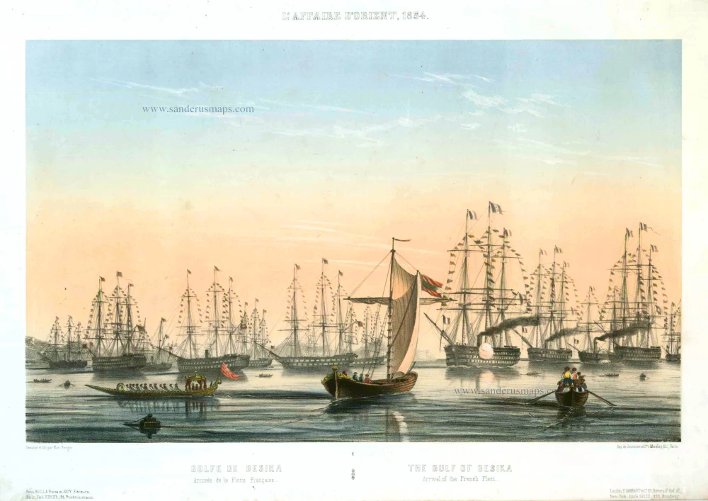
Bésika or Tenedos (Turkey), by Max Beeger. 1854
Golf de Besika. - Arrivée de la Flotte Française. / The Gulf of B ...
[Item number: 27439]
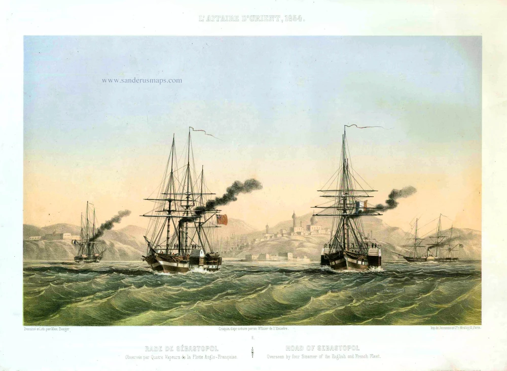
Sebastopol (Ukraine), by Max Beeger. 1854
Rade de Sébastopol. Observée par quatre Vapeurs de la Flotte A ...
[Item number: 27436]
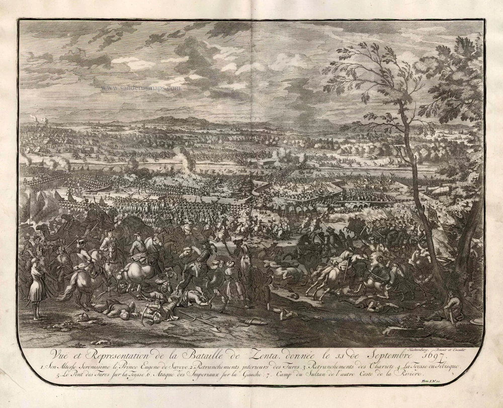
View of the Battle of Zenta (Senta), by Jean Dumont. 1729
Vue et Representation de la Bataille de Zenta donnée en 1697.
[Item number: 25987]
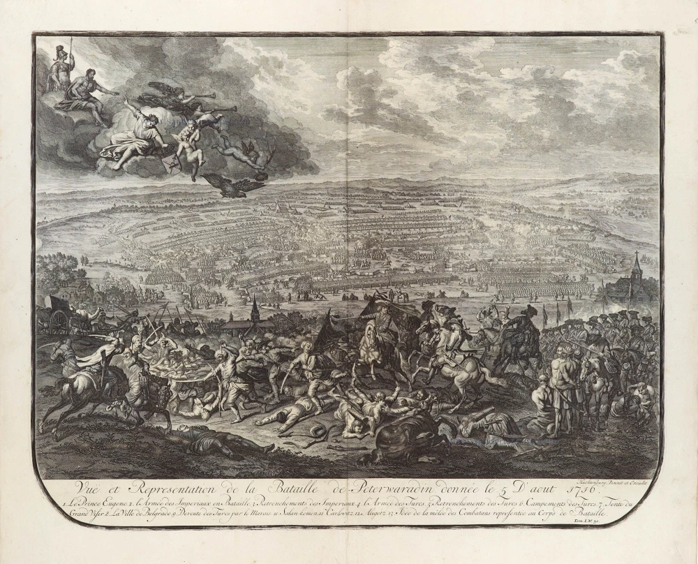
View of the Battle of Petrovaradin, 1716. 1729
Vuë et Representation de la Bataille de Peterwaradin donnée le 5 D ...
[Item number: 29305]
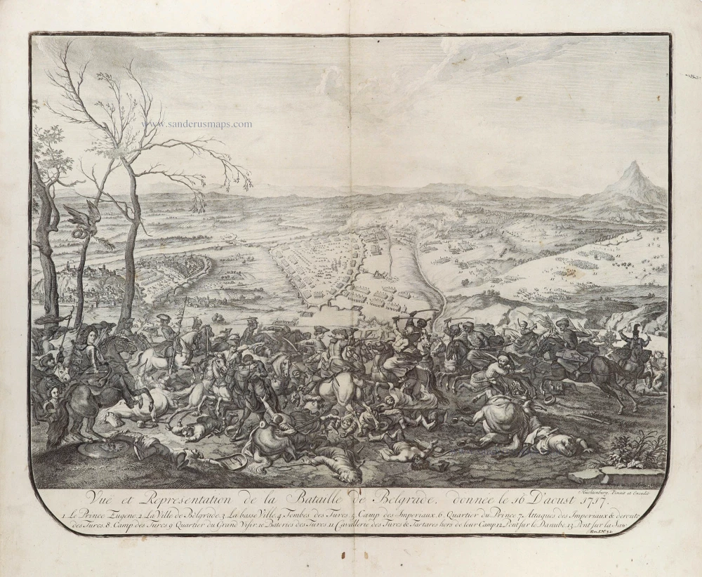
View of the Battle of Belgrade, 1717. 1729
Vuë et Representation de la Bataille de Belgrade, donnée le 16 D ...
[Item number: 29306]
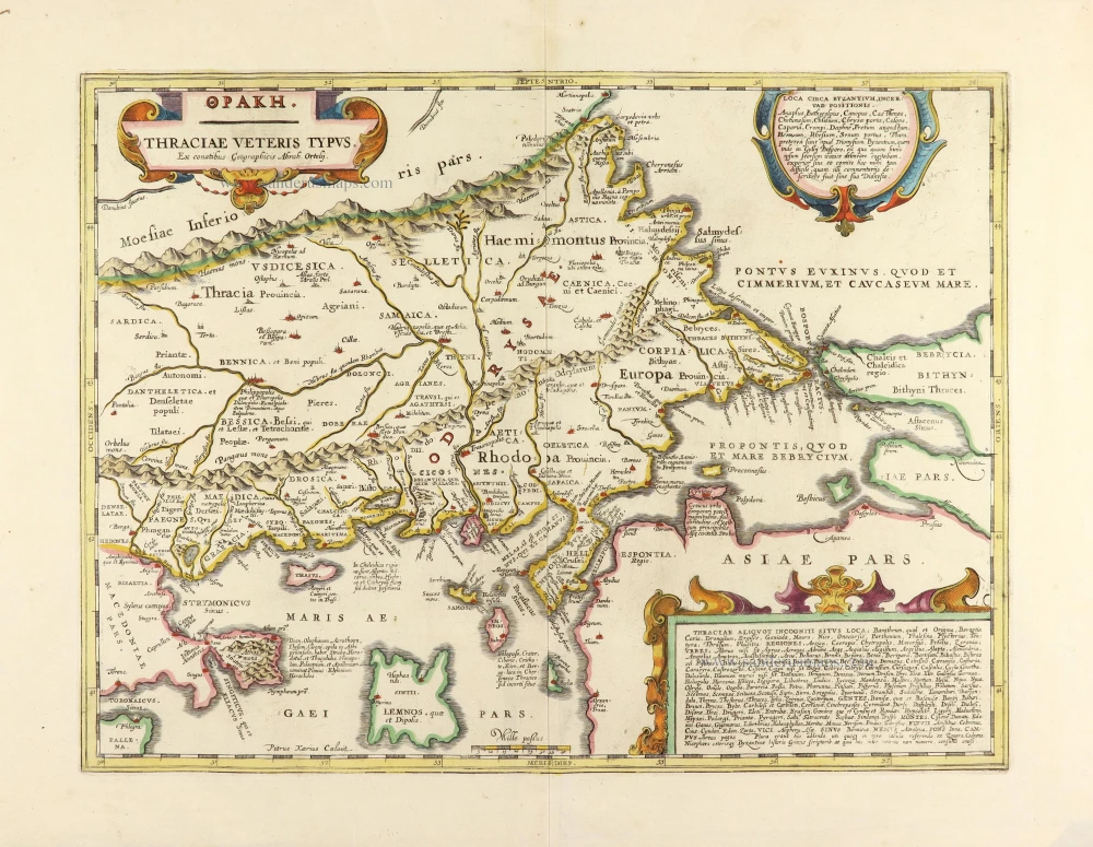
Thrace, by Janssonius à Waesberghe. 1684
Thraciae Veteris Typus.
[Item number: 20765]
![[No title] - [On verso:] Tabula .V. Europae.](https://sanderusmaps.com/assets/WEBP/m27959.webp)
Balkans - Dalmatia, by Lorenz Fries. 1525
[No title] - [On verso:] Tabula .V. Europae.
[Item number: 27959]
![Ta Moder Bossinae, Serviae, Graeciae, et Sclavoniae. [From verso]](https://sanderusmaps.com/assets/WEBP/m28117.webp)
Greece (Balkan), by Lorenz Fries after Martin Waldseemüller. 1525
Ta Moder Bossinae, Serviae, Graeciae, et Sclavoniae. [From verso]
[Item number: 28117]
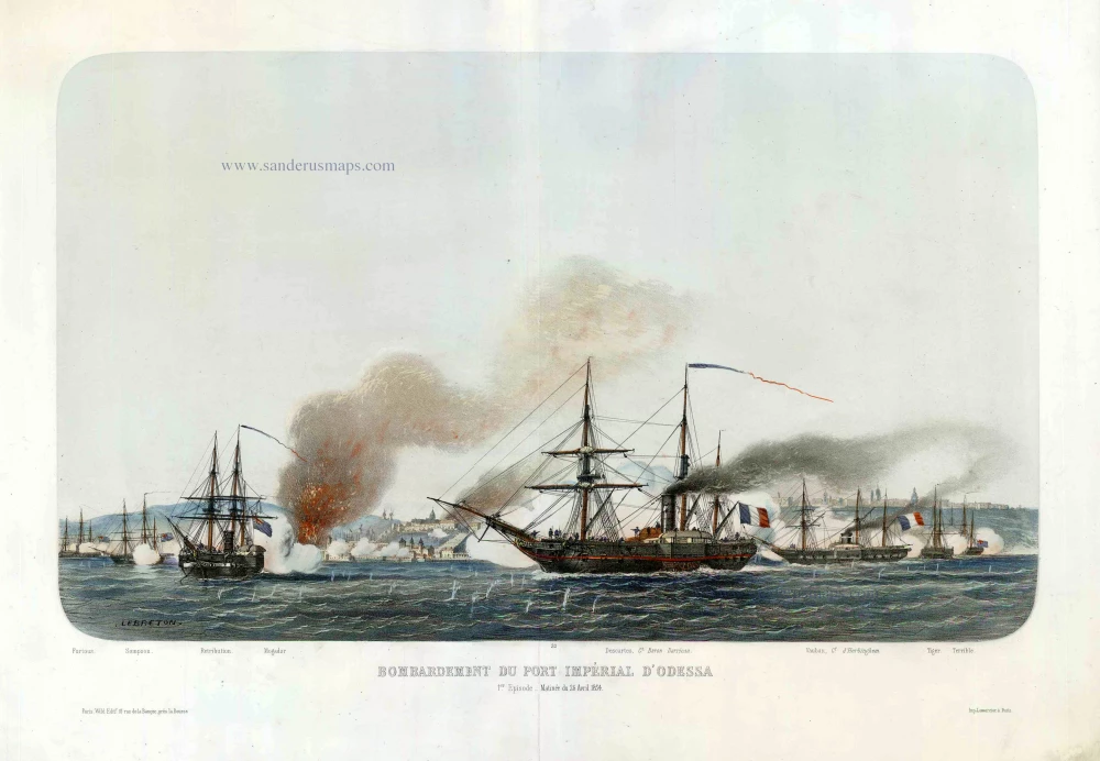
Odessa (Ukraine), by Louis Le Breton. c.1854
Bombardement du Port Impérial d'Odessa.
[Item number: 27443]
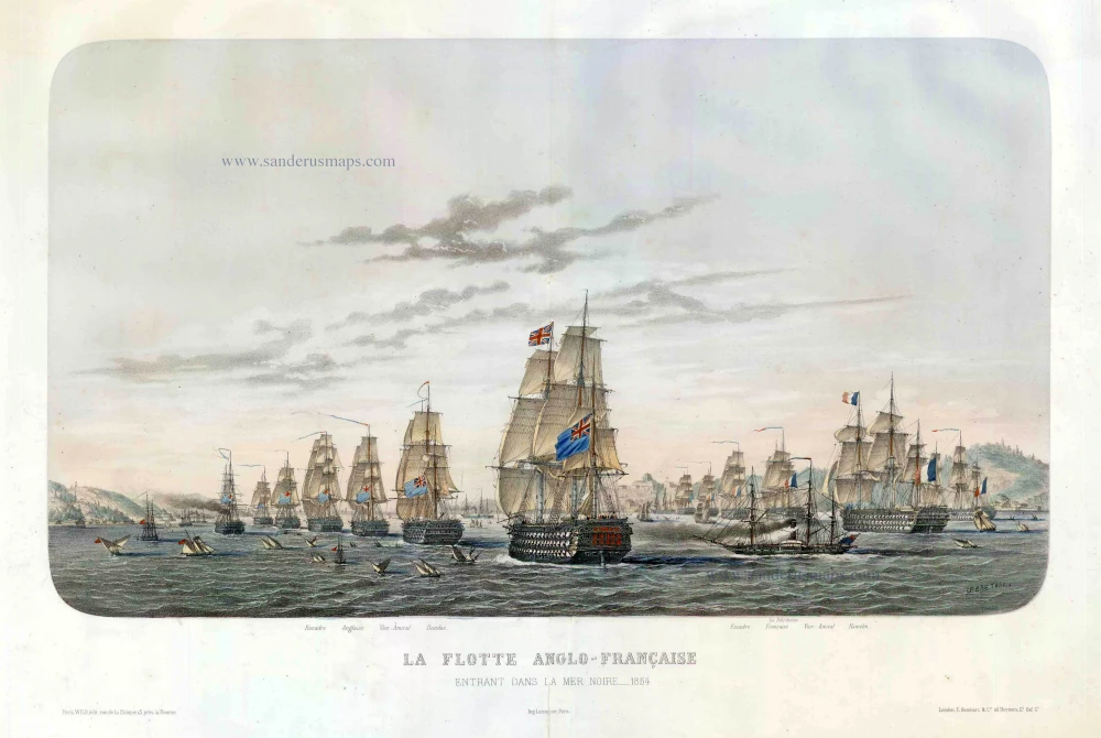
The Anglo-French Fleet entering the Black Sea, by Louis Le Breton. c.1854
La Flotte Anglo-Française, entrant dans la Mer Noire 1854.
[Item number: 27444]
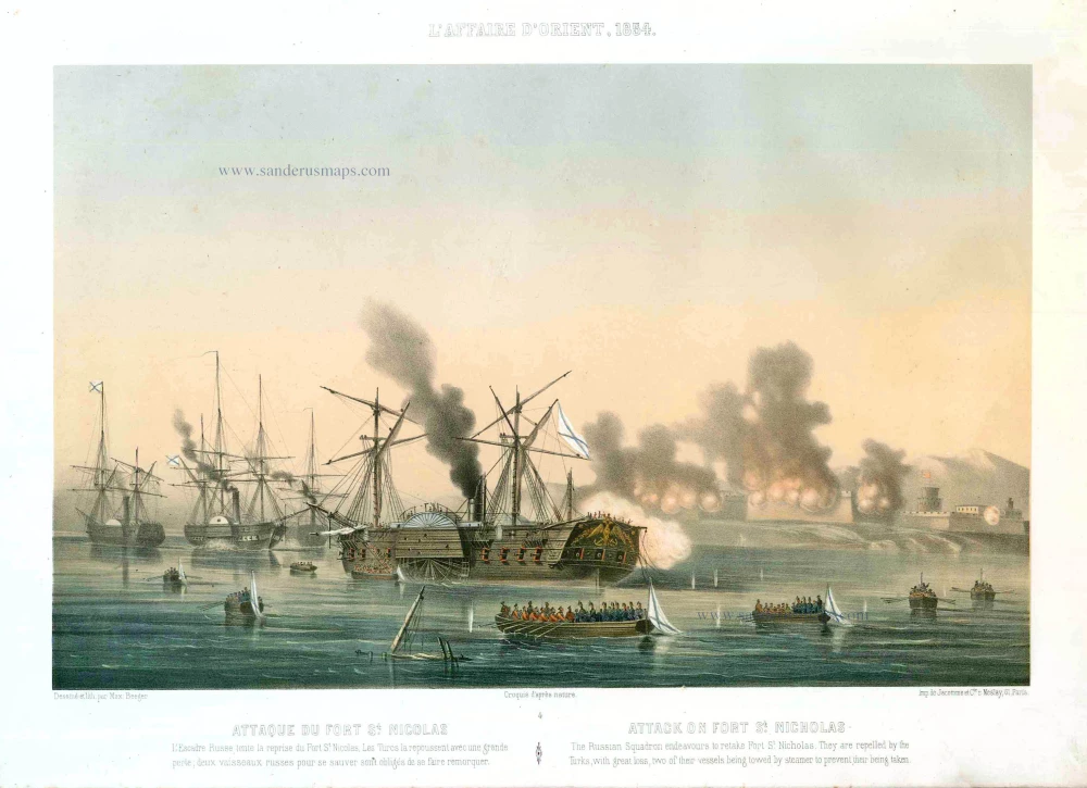
Fort St.-Nicholas (Batumi), by Max Beeger. 1854
Attaque du Fort St. Nicolas. / Attack on the Fort St. Nicholas.
[Item number: 27441]

Very rare map of the siege of Belgrade in 1717.
Belgrade (Serbia) and three panoramic views by Joachim Ottens. 1717-1725
Nieuwe en Accurate Caart van de onderliggende Lande van Belgrado ...
[Item number: 30237]
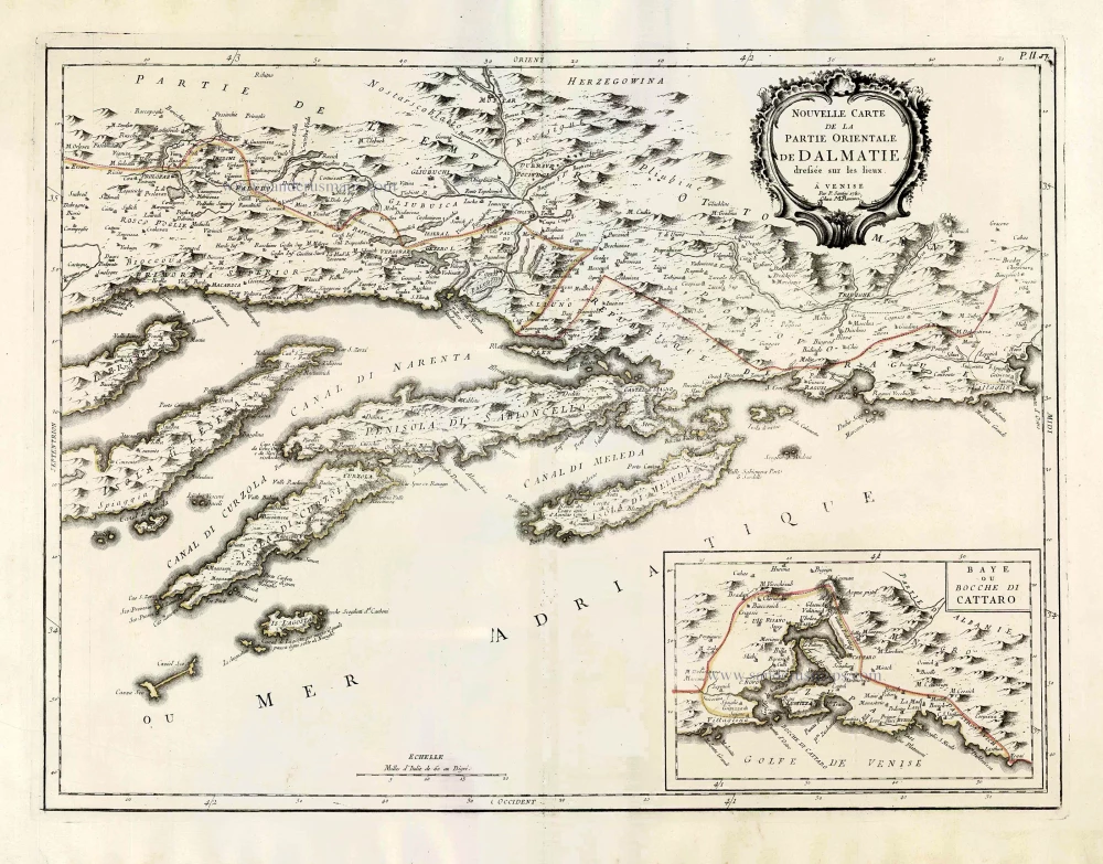
Southern Dalmatia, by Paolo Santini. 1776-79
Nouvelle Carte de la Partie Orientale de Dalmatie.
[Item number: 27722]
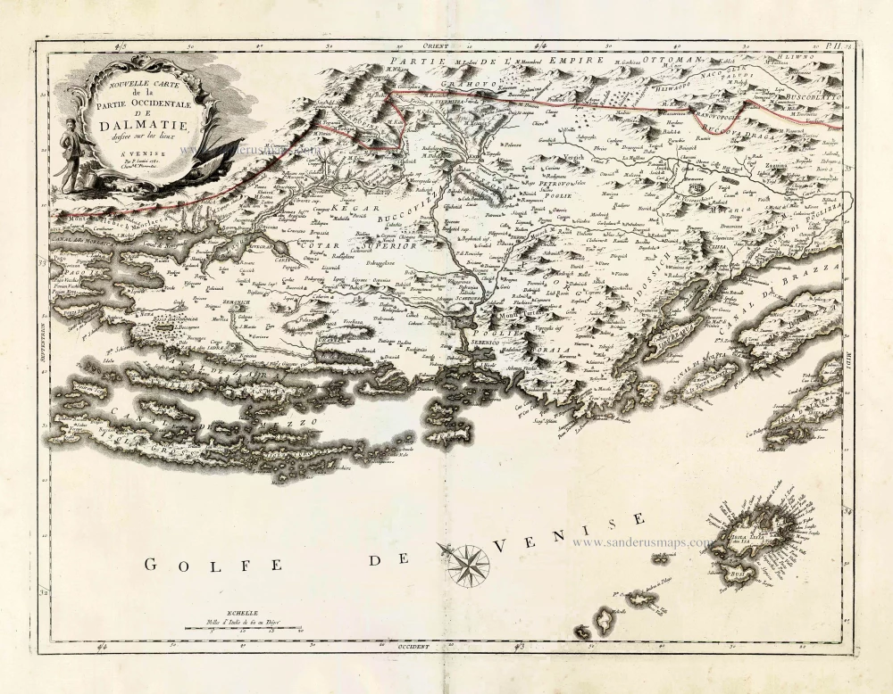
Northern Dalmatia, by Paolo Santini. 1776-79
Nouvelle Carte de la Partie Occidentale de Dalmatie.
[Item number: 27723]
Black Sea and surroundings, by Francesco Santini. 1776-79
Carte de la Partie Septentrionale de l'Empire Otoman Contenant ...
[Item number: 26973]
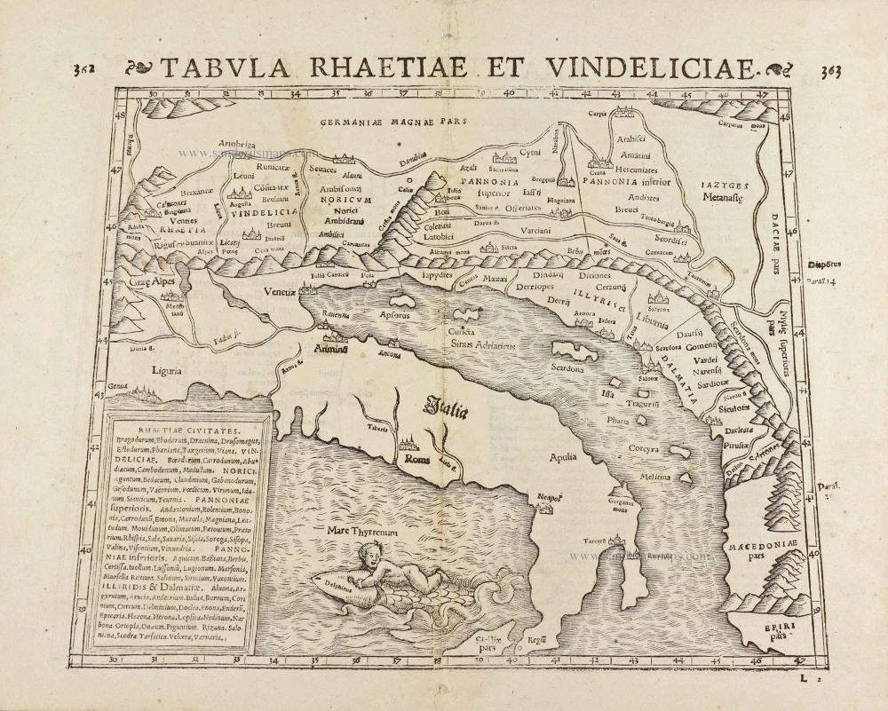
Adriatic Sea by Münster S. 1571
Tabula Rhaetiae et Vindeliciae.
[Item number: 29054]
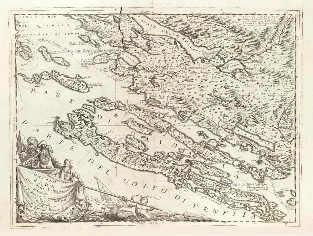
Zara (Dalmatia), by Vincenzo Coronelli. 1696
Contado di Zara.
[Item number: 29000]
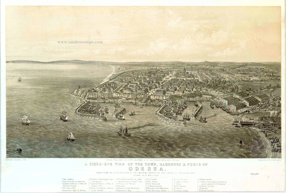
Odessa (Ukraine), by H. Whittock. 1854
A bird's-eye view of the Town, Harbours & Forts of Odessa.
[Item number: 27448]