Antique maps catalogue
- All recent additions
-
Antique maps
- Polar maps
- World
-
Europe
- Europe Continent
- Belgium
- Belgium - Cities
- The Low Countries
- The Netherlands
- The Netherlands - Cities
- Luxembourg
- France
- France - Cities
- Germany
- Germany - Cities
- Austria
- Italy
- Italy - Cities
- Spain and Portugal
- Greece & Greek Islands
- Switzerland
- British Isles
- British Isles - Cities
- Northern Europe
- Central Europe
- Eastern Europe
- Southeastern Europe
- America
- Asia
- Africa
- Mediterranean Sea
- Australia
- Oceans
- Celestial Maps
- Curiosities
- Title Pages
- Books
- Medieval manuscripts
- Prints

Early 1525 edition
China - Japan, by Lorenz Fries after Martin Waldseemüller. 1525
Ta. Superioris Indiae et Tartariae Maioris.
[Item number: 27928]

Rare 1525 edition in nice old colour.
China - Japan by Lorenz Fries, after Martin Waldseemüller. 1525
No title - on verso: Ta. Superioris Indiae et Tartariae Maioris.
[Item number: 30659]
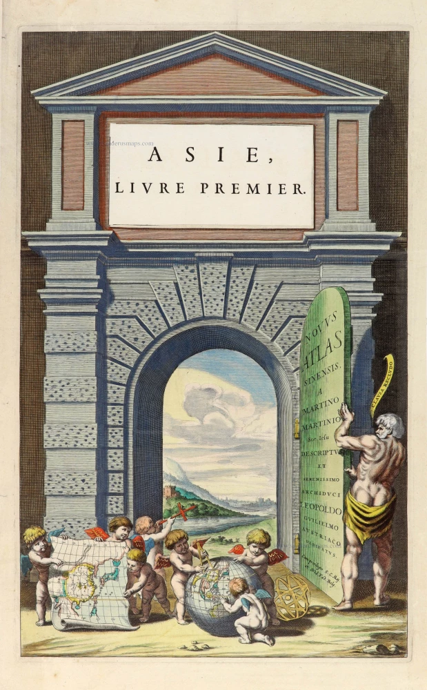
Title page for Blaeu's atlas of China as part of the Theatrum Orbis Terrarum. 1655
Novus Atlas Sinensis a Martino Martinio Soc. Iesu Descriptus et...
[Item number: 30153]

China by Nicolas Sanson, published by Simon de Vries. 1682
Royaume de la Chine.
[Item number: 30235]

China by Petrus Bertius, published by Jodocus Hondius II. 1618
China.
[Item number: 32151]

Tianjin (Tientsin - China), by Petrus Schenk. 1702
Kuchin een Sineesche stadt in het lantschap Peking, aen de...
[Item number: 26659]
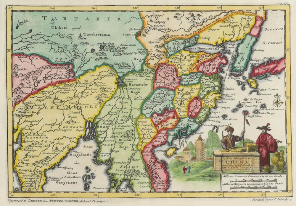
China by Pieter Van der Aa. 1706
't Koninkryk van China, met d'aangrensende Landen van Siam en...
[Item number: 31842]

China, by Pieter van der Aa. 1713
La Chine, Suivant les Nouvelles Observations.
[Item number: 27095]

In rare original colour
Formosa and the Pescadores, by Pieter van der Aa. 1713
L'Île de Formosa ou sont exactement marquez les Bancs de Sables,...
[Item number: 26098]

Scarce
Bay of Bengal and Thailand, by Pieter Van der Aa. 1707
Scheeps-Togt van Malacca na de Golf van Bengale, en de Kusten...
[Item number: 32330]

Northern China and Korea by Jacques-Nicolas Bellin, published by A.F. Prévost. 1747
Carte du Katay ou Empire de Kin.
[Item number: 31884]
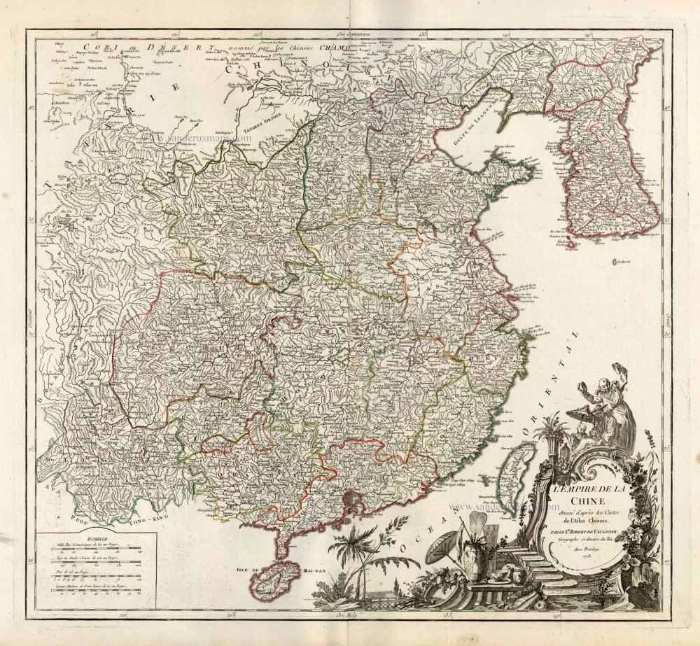
China, by Robert de Vaugondy. c. 1757
L'Empire de la Chine Dresse d'apres les Cartes de l'Atlas...
[Item number: 5093]

China with Korea and Japan, by Paolo Santini. 1776-79
L'Empire de la Chine, avec la Tartarie Chinoise d'après l'Atlas...
[Item number: 26974]

Taiwan by J. Stöcklein. (Formosa) 1726
Die Insel Formosa neu abgemessen auf Befehl Kaysers Kamhi.
[Item number: 30143]
Exceptional good condition
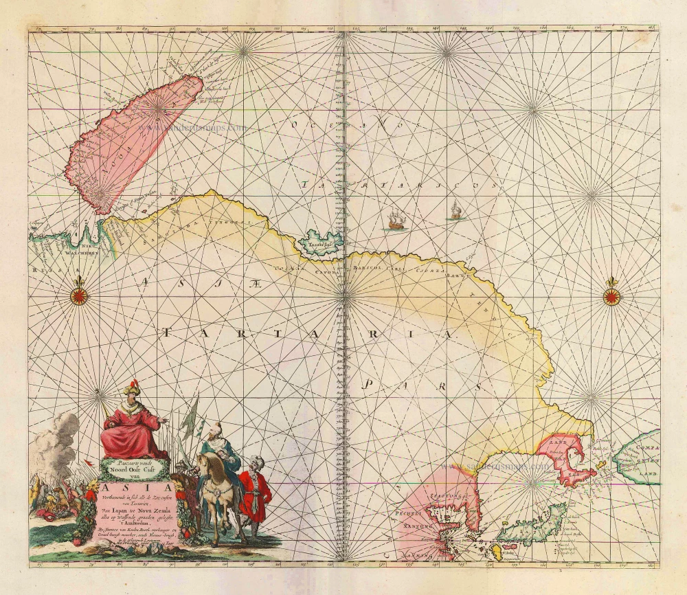
Sea chart of Northeast Asia, by J. Van Keulen. 1683
Pascaarte vande Noord Oost Cust van Asia Verthoonende in sich...
[Item number: 2443]

Extremely rare first edition
Formosa (Taiwan) by a French missionary, engraved by Gonzalez. 1753-57
Mapa de la parte de la Isla Formosa, perteneciente al Emperador...
[Item number: 33076]
new
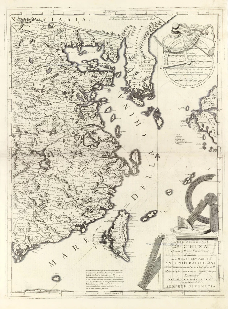
Eastern part of China with Korea and Formosa (Taiwan), by Vincenzo Coronelli. 1696
Parte Orientale della China,
[Item number: 28775]

China - Japan - Korea - Taiwan by Nicolaes Visscher I After 1665
Imperii Sinarum Nova Descriptio.
[Item number: 28559]

In rare original colour
Habits of Chinese nobles., by Z. Châtelain. 1719
Habillement de l'Empereur de la Chine & des Dames de son Palais...
[Item number: 31432]