Antique maps catalogue
- All recent additions
-
Antique maps
- Polar maps
- World
-
Europe
- Europe Continent
- Belgium
- Belgium - Cities
- The Low Countries
- The Netherlands
- The Netherlands - Cities
- Luxembourg
- France
- France - Cities
- Germany
- Germany - Cities
- Austria
- Italy
- Italy - Cities
- Spain and Portugal
- Greece & Greek Islands
- Switzerland
- British Isles
- British Isles - Cities
- Northern Europe
- Central Europe
- Eastern Europe
- Southeastern Europe
- America
- Asia
- Africa
- Mediterranean Sea
- Australia
- Oceans
- Celestial Maps
- Curiosities
- Title Pages
- Books
- Medieval manuscripts
- Prints
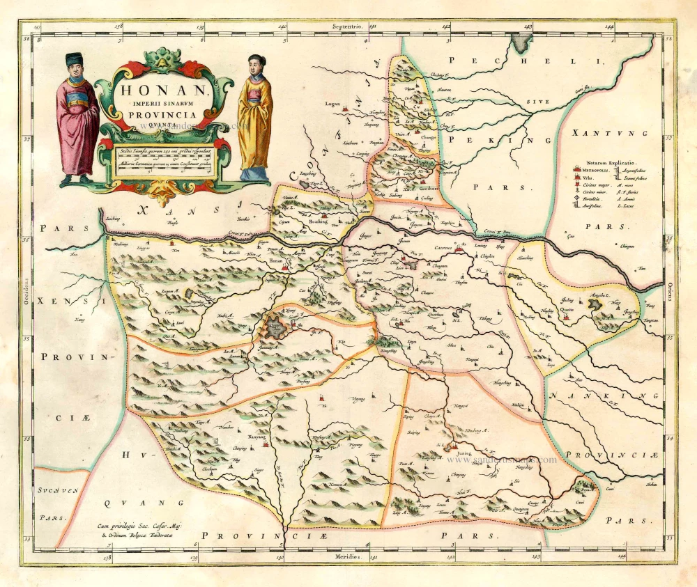
China - Honan, by J. Blaeu. 1655-1659
Honan, Imperii Sinarum Provincia Quinta.
[Item number: 26423]
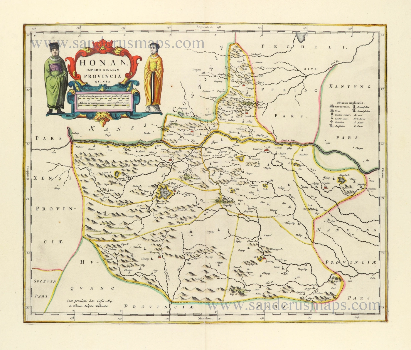
Honan by Joan Blaeu 1655-1659
Honan, Imperii Sinarum Provincia Quinta.
[Item number: 28593]

China - Shan-hsi (Shensi), by J. Blaeu. 1655-1659
Xensi, Imperii Sinarum Provincia Tertia.
[Item number: 26421]
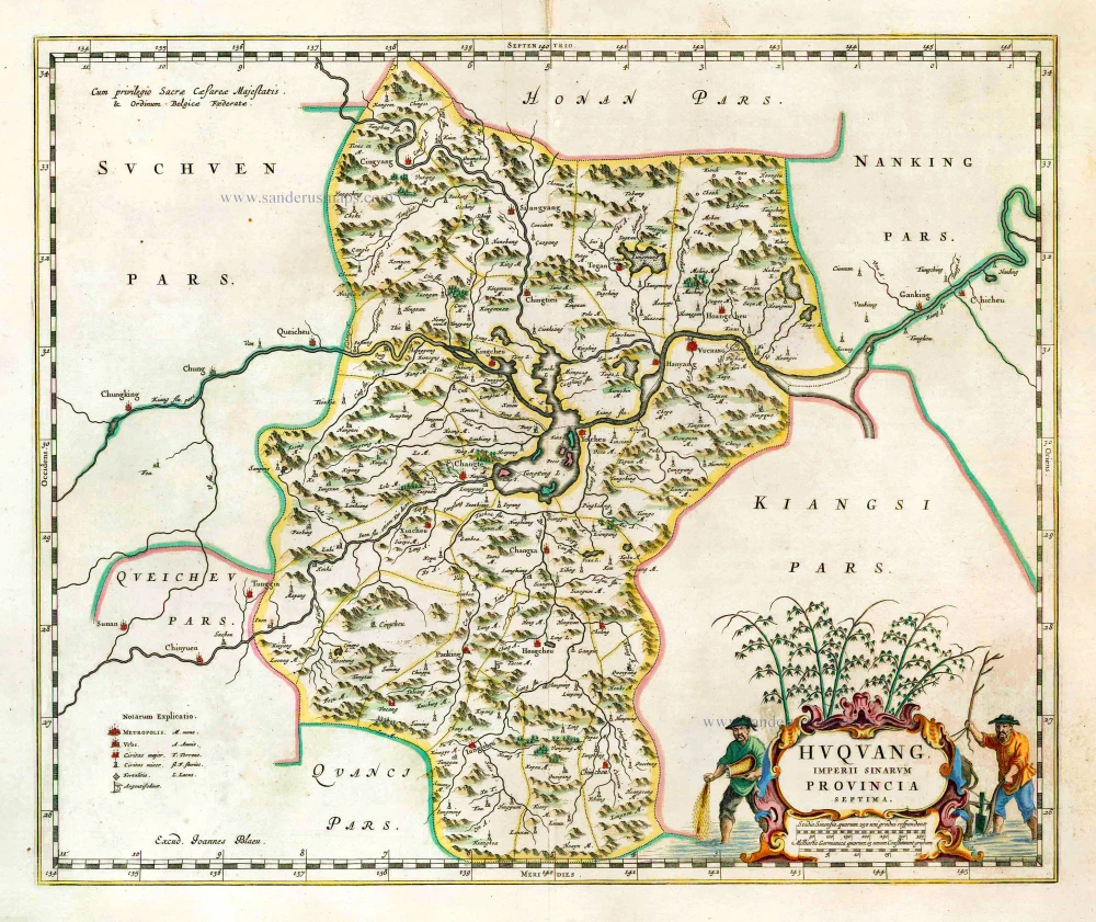
Hukuang (China), by J. Blaeu. 1655-1659
Huquang, Imperii Sinarum Provincia Septima.
[Item number: 26359]
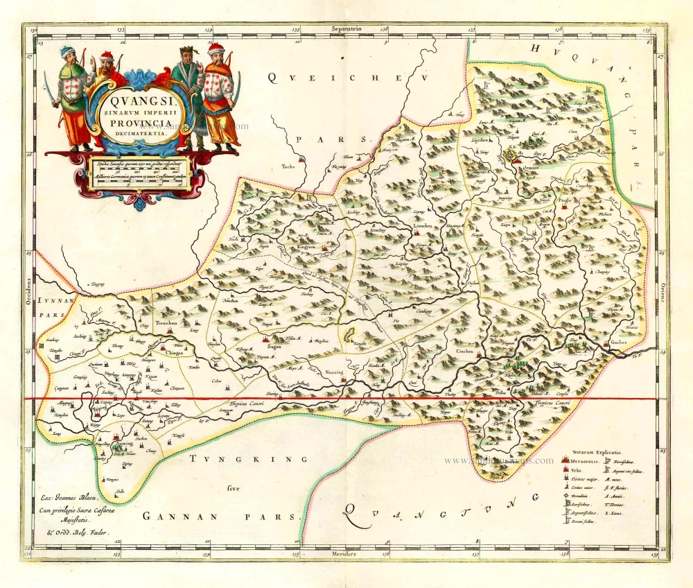
Kuang-hsi (China), by J. Blaeu. 1655-1659
Quangsi, Sinarum Imperii Provincia Decimatertia.
[Item number: 26361]
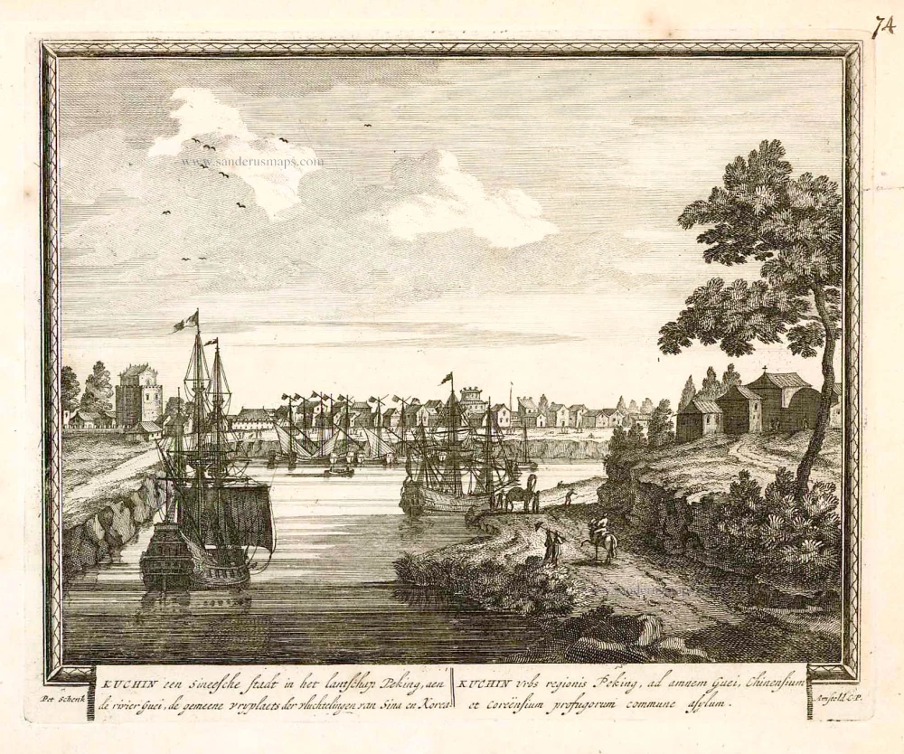
Tianjin (Tientsin - China), by Petrus Schenk. 1702
Kuchin een Sineesche stadt in het lantschap Peking, aen de...
[Item number: 26659]
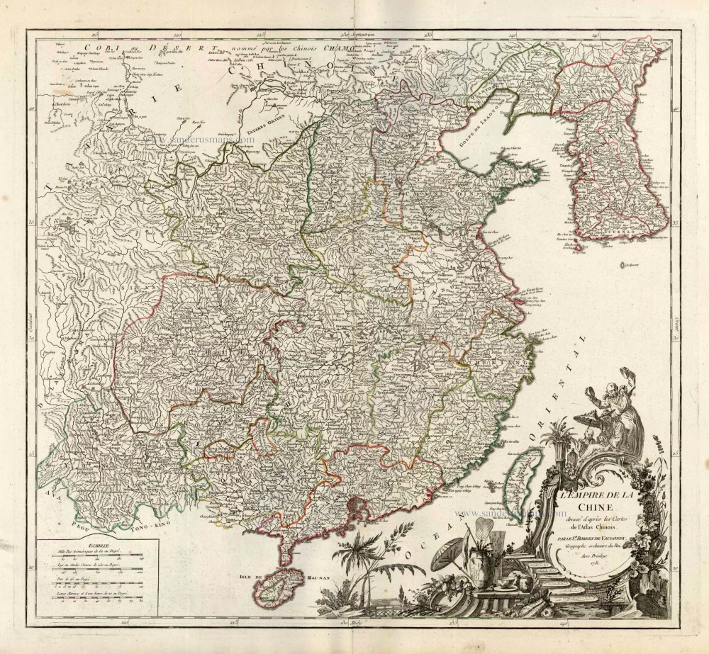
China, by Robert de Vaugondy. c. 1757
L'Empire de la Chine Dresse d'apres les Cartes de l'Atlas...
[Item number: 5093]
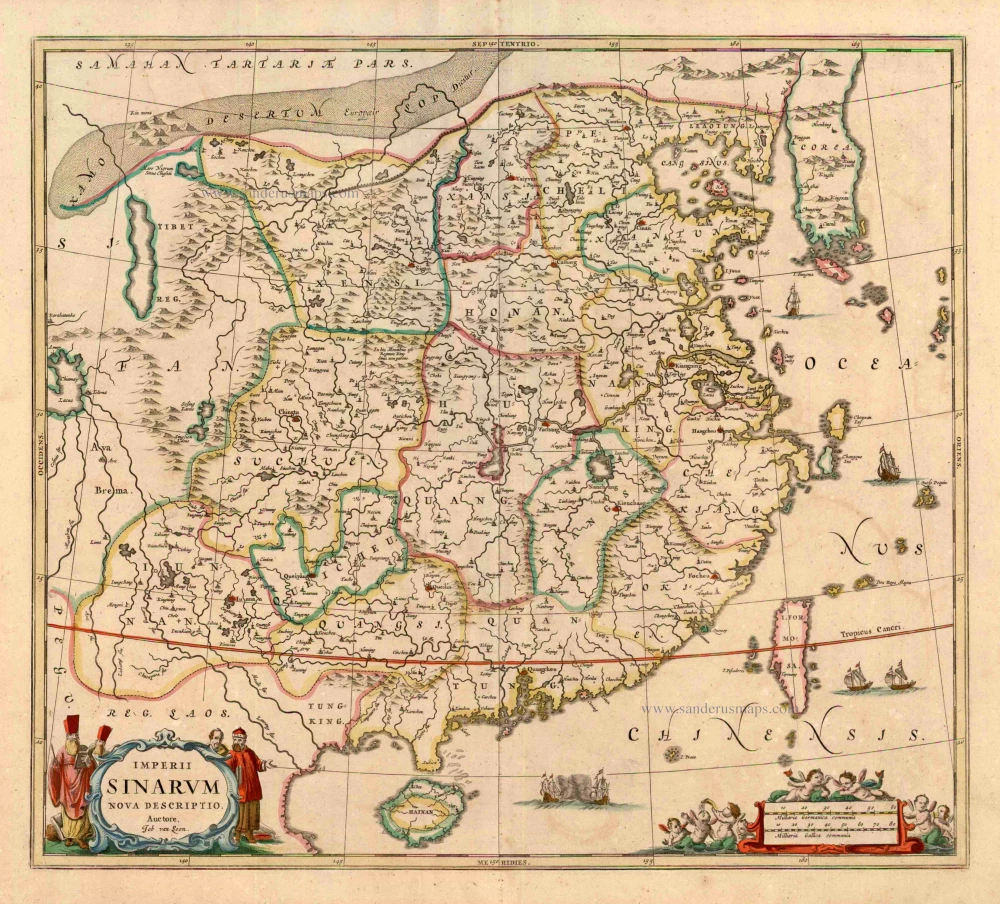
China with Japan, Korea and Taiwan, by J. Janssonius. c. 1680.
Imperii Sinarum Nova Descriptio.
[Item number: 2618]
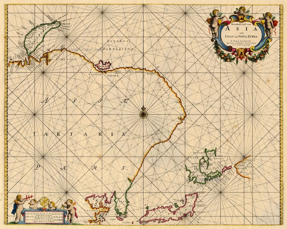
Northeast Asia, by Doncker H. 1688
Noordoost Cust van Asia van Iapan tot Nova Zemla
[Item number: 18466]
Extremely rare
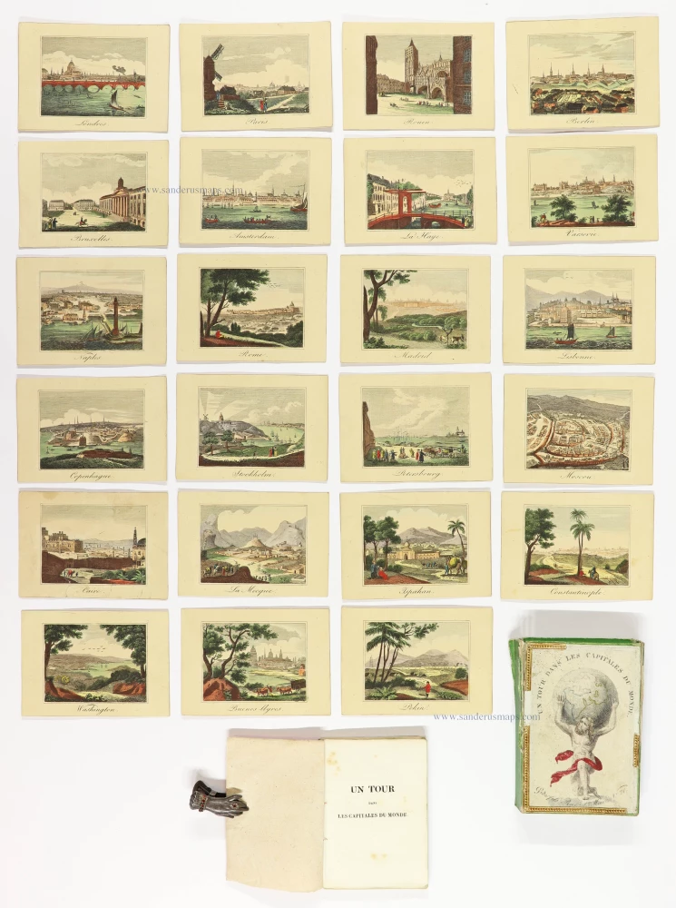
Playing cards of the capitals of the world
Un Tour dans les Capitales du Monde. Jeu instructif.
[Item number: 30802]
Exceptional good condition
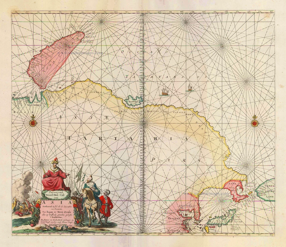
Sea chart of Northeast Asia, by J. Van Keulen. 1683
Pascaarte vande Noord Oost Cust van Asia Verthoonende in sich...
[Item number: 2443]
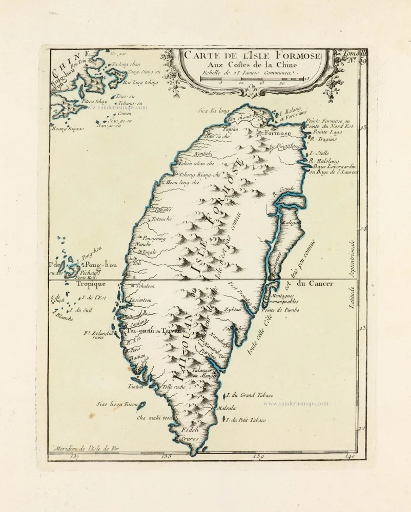
Taiwan (Formosa) by J.N. Bellin. 1764
Carte de l'Isle Formose aux Costes de la Chine.
[Item number: 30030]
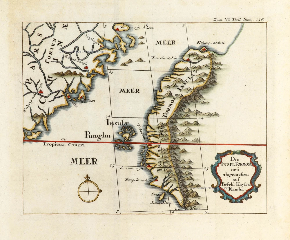
Taiwan by J. Stöcklein. (Formosa) 1726
Die Insel Formosa neu abgemessen auf Befehl Kaysers Kamhi.
[Item number: 30143]
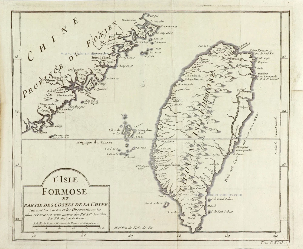
Taiwan (Formosa), by Jacques Nicolas Bellin. 1763
L'Isle Formose et Partie des Costes de la Chine.
[Item number: 29304]
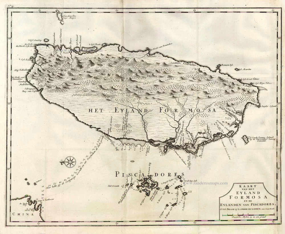
Taiwan (Formosa) by François Valentyn (Valentijn). 1724-26
Kaart van het Eyland Formosa en de Eylanden van Piscadores.
[Item number: 26885]
Beautiful map in excellent condition
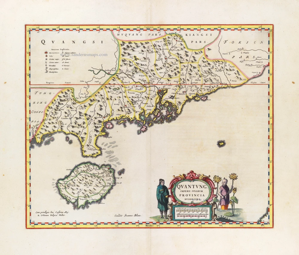
Joan Blaeu, the Province of Canton with the Pearl River delta and the Island of Hainan. 1655-1659
Quantung, Imperii Sinarum Provincia Duodecima.
[Item number: 29248]
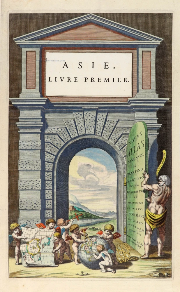
Title page for Blaeu's atlas of China as part of the Theatrum Orbis Terrarum. 1655
Novus Atlas Sinensis a Martino Martinio Soc. Iesu Descriptus et...
[Item number: 30153]
SCARCE !
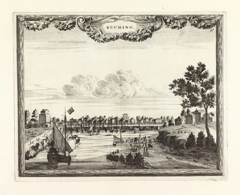
View of Tianjin (Tientsin - China), by Carel Allard. 1685/90
Kuching.
[Item number: 30585]
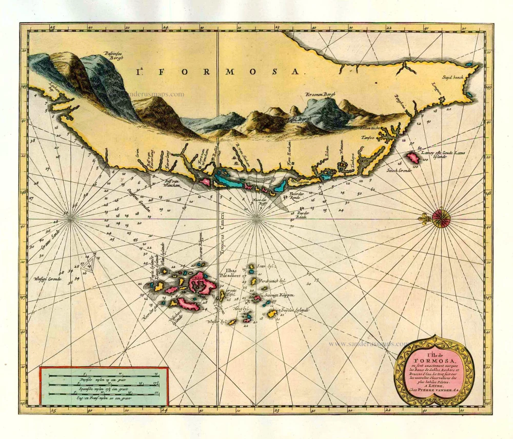
In rare original colour
Formosa and the Pescadores, by Pieter van der Aa. 1713
L'Île de Formosa ou sont exactement marquez les Bancs de Sables,...
[Item number: 26098]