Antique maps catalogue
- All recent additions
-
Antique maps
- World and Polar
-
Europe
- Europe Continent
- Belgium
- Belgium - Cities
- The Low Countries
- The Netherlands
- The Netherlands - Cities
- Luxembourg
- France
- France - Cities
- Germany
- Germany - Cities
- Austria
- Italy
- Italy - Cities
- Spain and Portugal
- Greece & Greek Islands
- Switzerland
- British Isles
- British Isles - Cities
- Northern Europe
- Central Europe
- Eastern Europe
- Southeastern Europe
- America
- Asia
- Africa
- Mediterranean Sea
- Australia
- Oceans
- Celestial Maps
- Curiosities
- Books
- Medieval manuscripts
- Prints
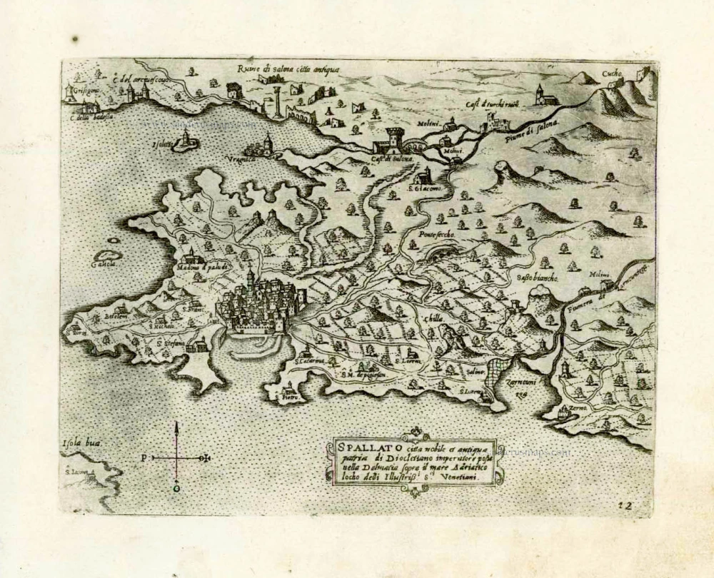
Croatia - Split by Giovanni Francesco Camocio After 1575
Spallato citta nobile et antiqua patria di Diocletino imperatore ...
[Item number: 27542]
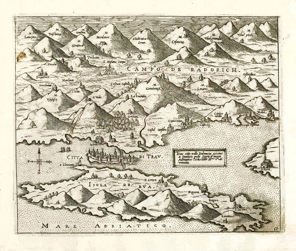
Croatia - Trogir (Traù) by Giovanni Francesco Camocio After 1575
Trau citta nella Dalmacia vicino a Spalato posto sopra il mare ...
[Item number: 27554]
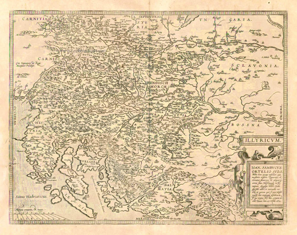
Dalmatia, by A. Ortelius. 1601
Illyricum
[Item number: 13173]
![[No title] - [On verso:] Tabula .V. Europae.](https://sanderusmaps.com/assets/WEBP/m27959.webp)
Balkans - Dalmatia, by Lorenz Fries. 1525
[No title] - [On verso:] Tabula .V. Europae.
[Item number: 27959]
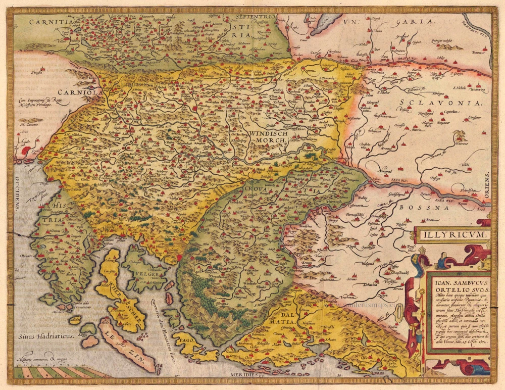
Dalmatia, by Abraham Ortelius. 1612
Illyricum.
[Item number: 20025]
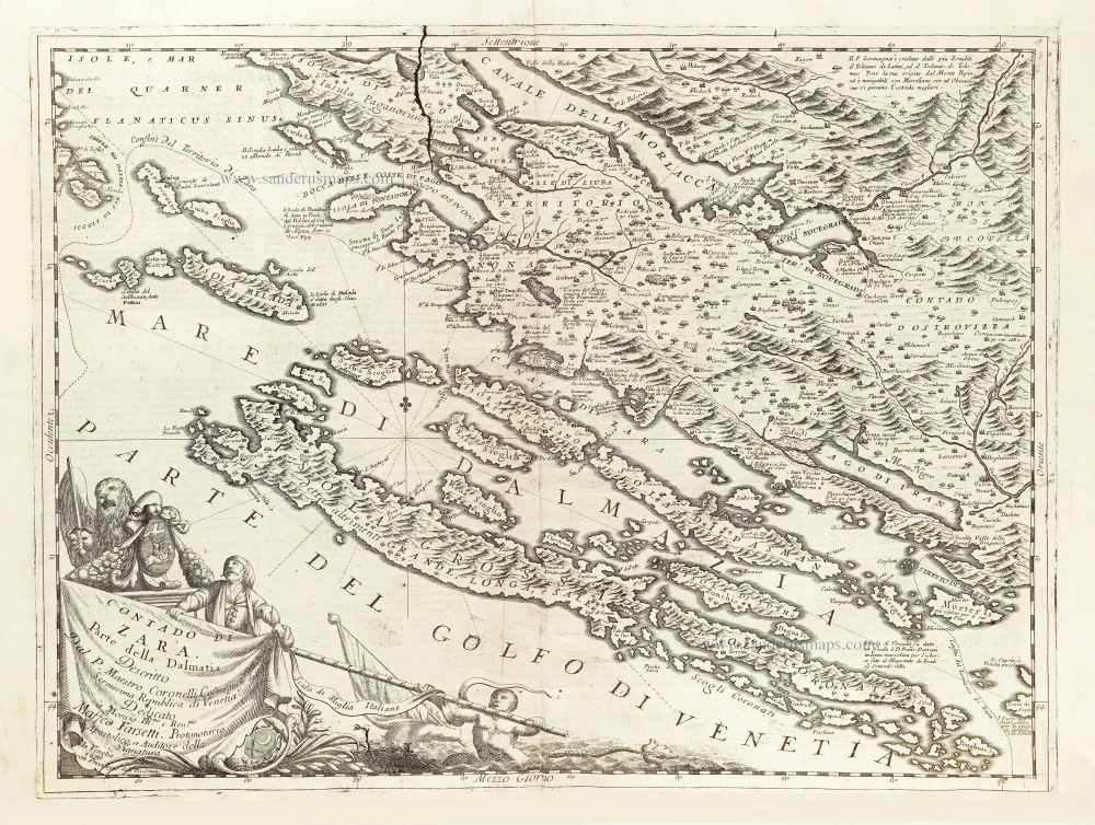
Zara (Dalmatia), by Vincenzo Coronelli. 1696
Contado di Zara.
[Item number: 29000]
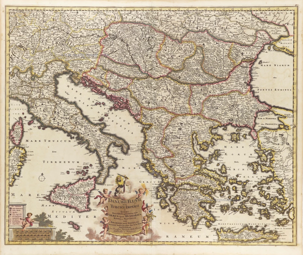
Danube and European Ottoman Empire, by Frederick de Wit. c. 1705
Danubii Fluvii Sive Turcici Imperii in Europa.
[Item number: 29279]
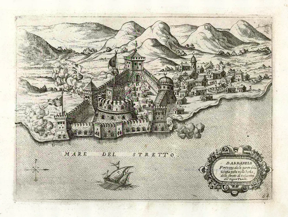
Dardanelles (Ottoman Fort) by Giovanni Francesco Camocio c. 1575
Dardanelo Fortezza dala parte dela Gretia posta nellabochadella ...
[Item number: 27624]
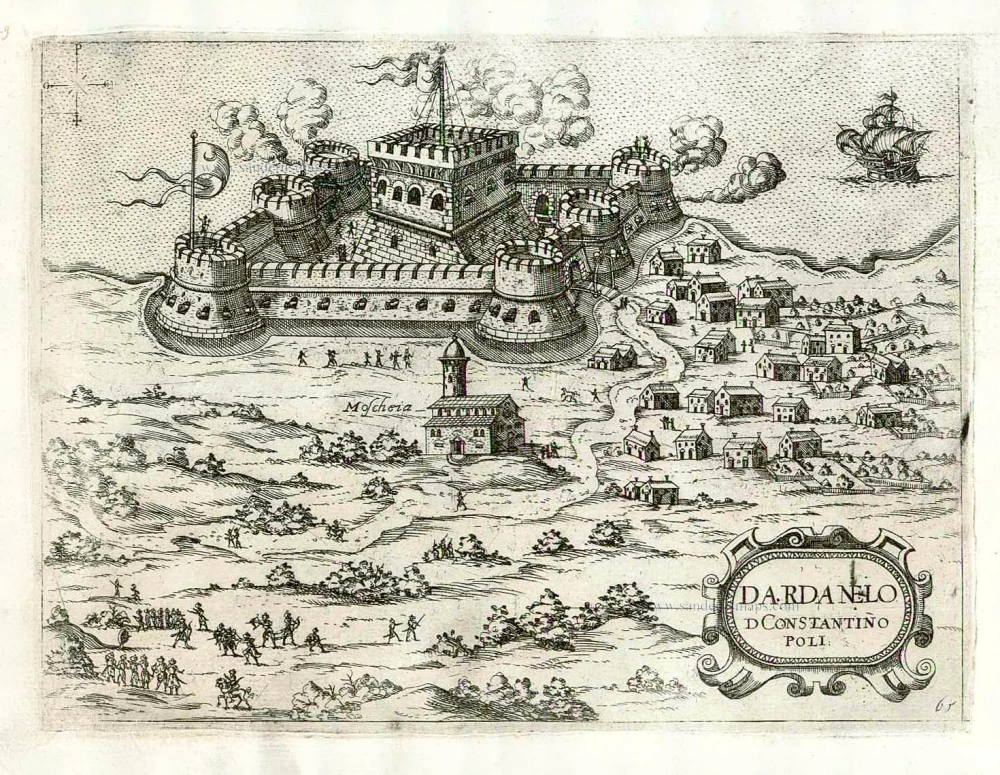
Dardanelles (Ottoman Fort) by Giovanni Francesco Camocio c. 1575
Dardanelo D Constantinopoli.
[Item number: 27625]

Eastern Illyricum (today's Bulgaria - Rumania), by Guillaume Sanson. 1665
Illyricum Orientis In quo Partes II. Moesia et Thracia.
[Item number: 30041]
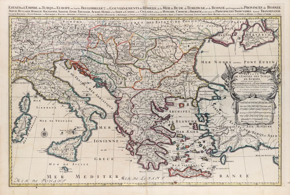
European Ottoman Empire by N. Sanson, so-called published by Hubert Jaillot. (Pirated edition by Pierre Mortier). 1692
Estats de l'Empire des Turqs en Europe.
[Item number: 31199]
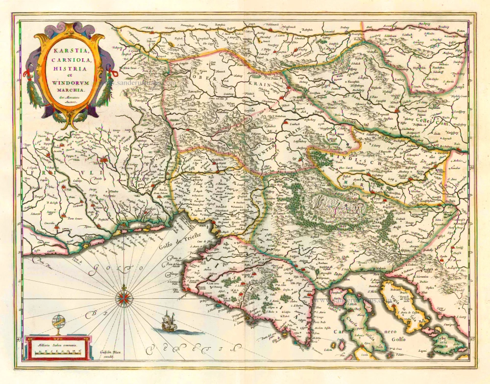
Carniola (Krain), Istria by Blaeu W. & J. 1644-45
Karstia, Carniola, Histria et Windorum Marchia.
[Item number: 2128]
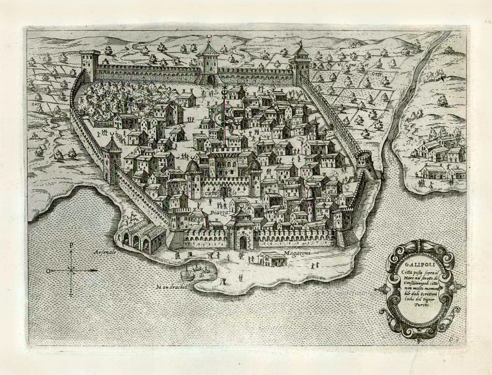
Gallipoli (Gelibolu) by Giovanni Francesco Camocio After 1575
Galipoli Citta posta sopra il Mare nel stretto di Constatinopoli ...
[Item number: 27623]
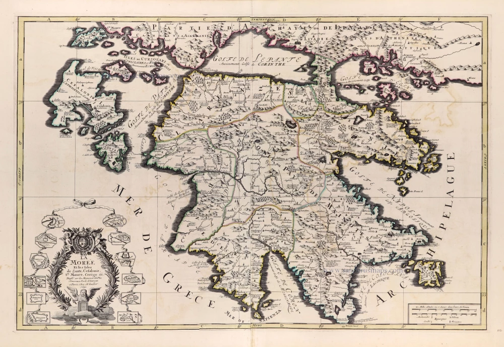
Greece - Peloponnese by N. Sanson, so-called published by Hubert Jaillot. (Pirated edition by Pierre Mortier). 1692
La Moree et les Isles de Zante, Cefalonie, Ste Maure, Cerigo &c.
[Item number: 31197]

Istria by Petrus Bertius, published by Jodocus Hondius II. 1618
Histria.
[Item number: 31651]
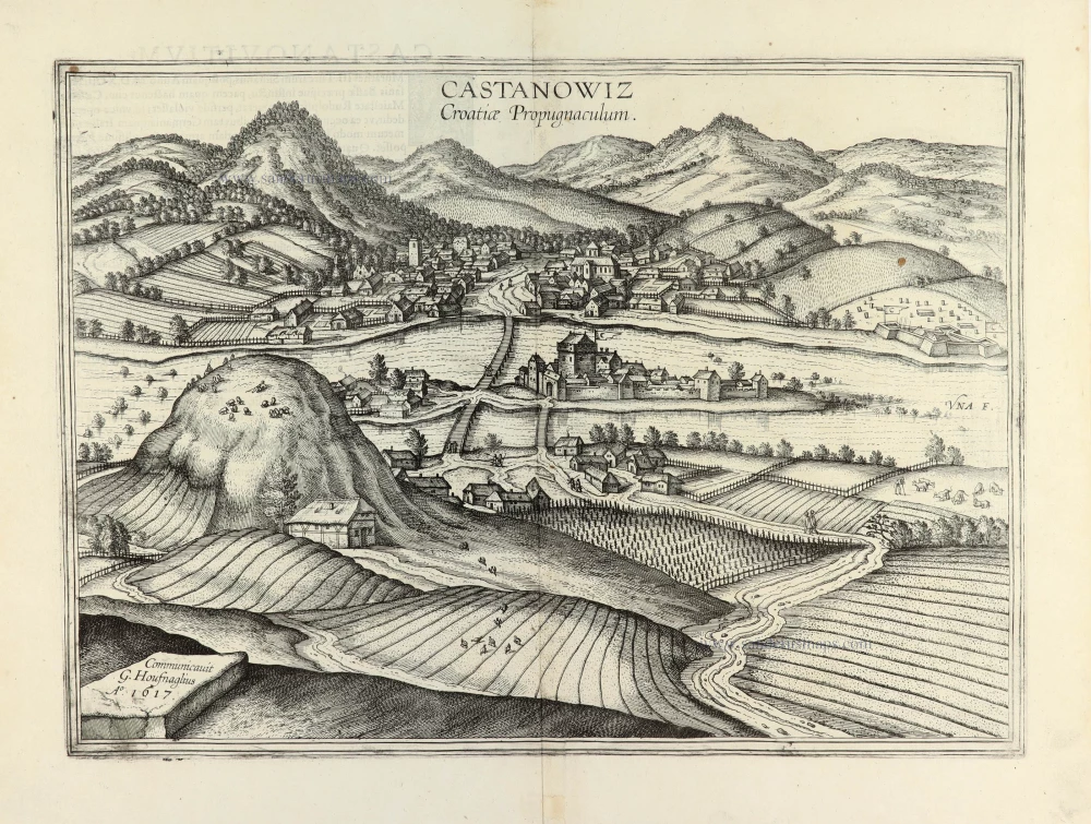
Kostajnica (Croatia) by Georg Braun & Frans Hogenberg. 1635
Castanowiz Croatiae Propugnaculum.
[Item number: 31766]
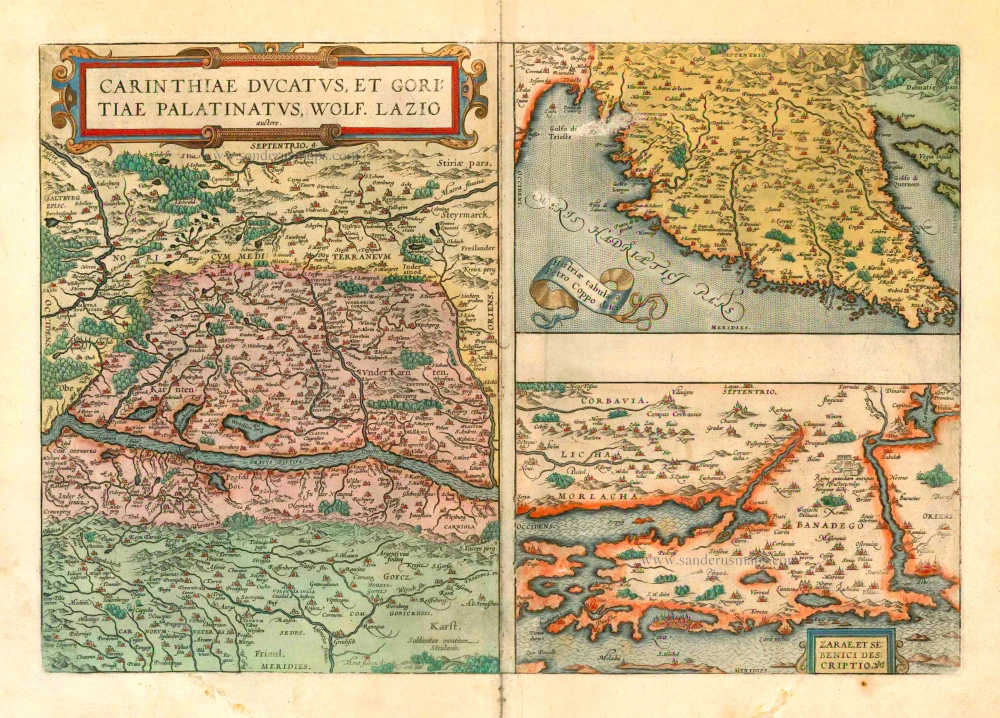
Kärnten and Istria, by A. Ortelius. 1601
Carinthiae Ducatus - Histriae Tabula - Zarae et Sebenici ...
[Item number: 8083]
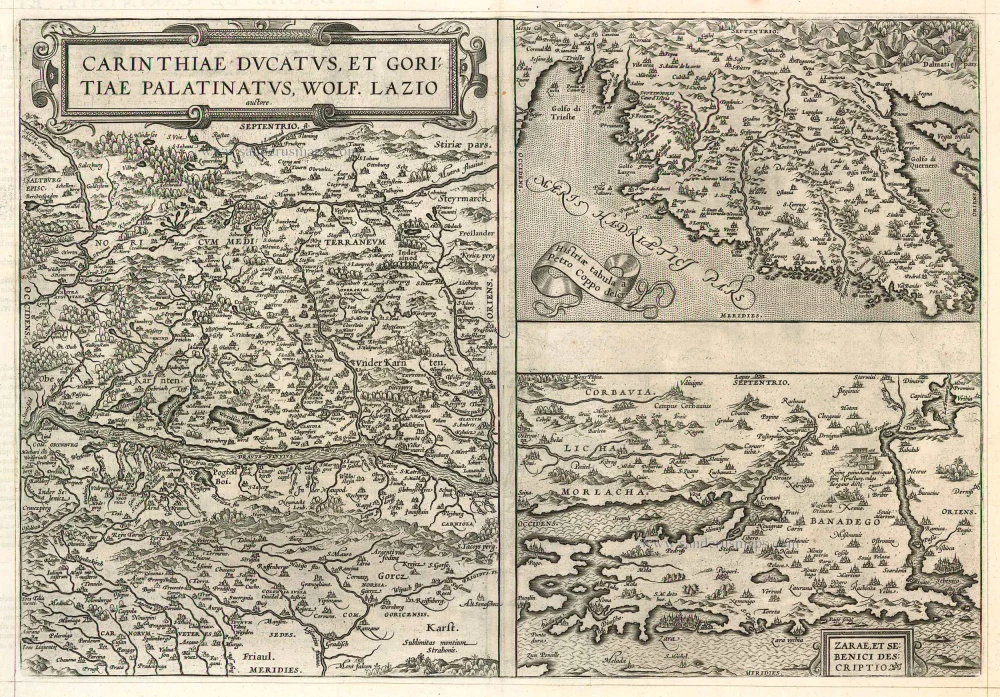
Kärnten and Istria by Abraham Ortelius. 1598
Carinthiae Ducatus, et Goritiae Palatinatus. - Histriae Tabula - ...
[Item number: 22922]
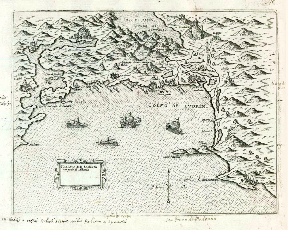
Montenegro by Giovanni Francesco Camocio After 1575
Golfo de Lodrin con parte di Albania.
[Item number: 27547]
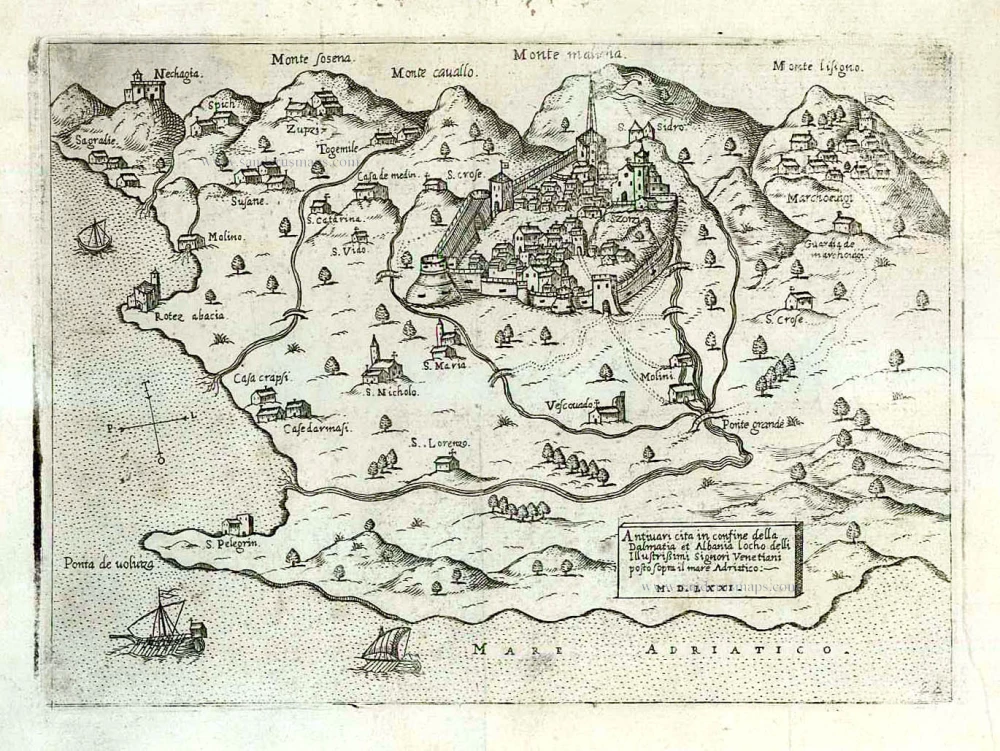
Montenegro - Bar by Giovanni Francesco Camocio After 1575
Antivari cita in confine della Dalmatia et Albania ...
[Item number: 27551]
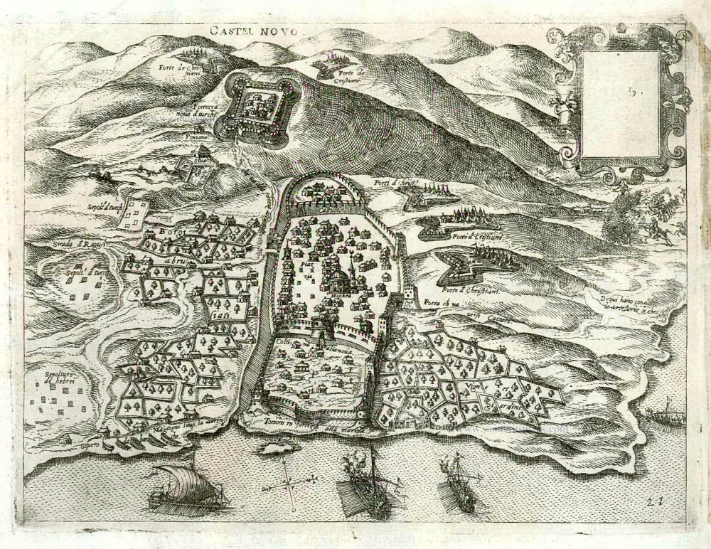
Montenegro - Herceg Novi (Cattaro) by Giovanni Francesco Camocio After 1575
Castel Novo.
[Item number: 27550]

Nógrád (Hungary) by J. Peeters. c. 1690
Novigrad.
[Item number: 31404]
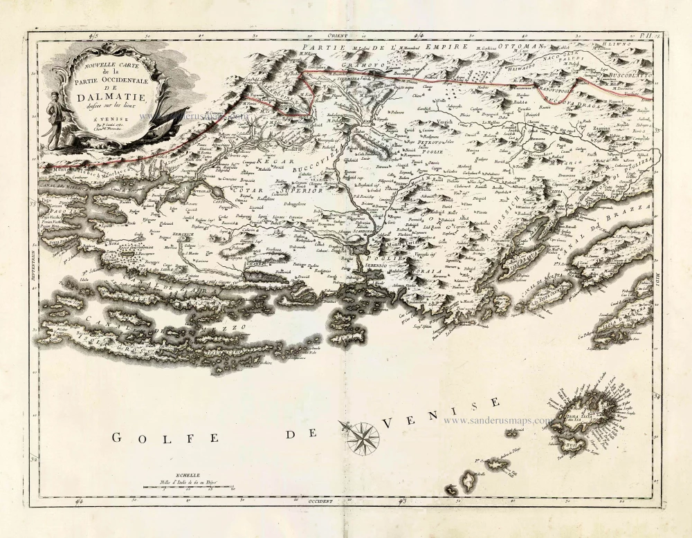
Northern Dalmatia, by Paolo Santini. 1776-79
Nouvelle Carte de la Partie Occidentale de Dalmatie.
[Item number: 27723]
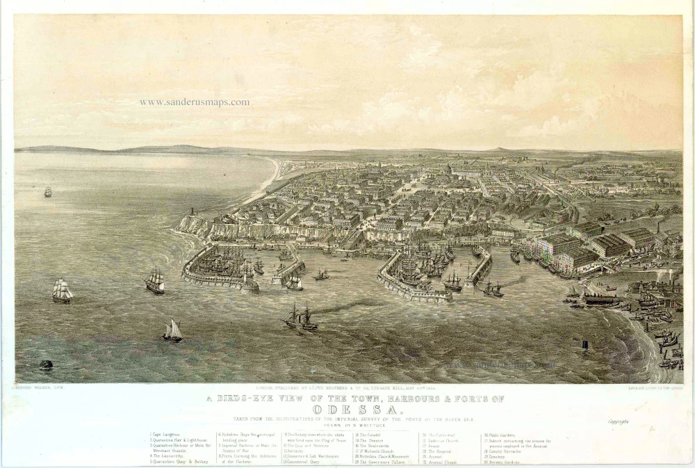
Odessa (Ukraine), by H. Whittock. 1854
A bird's-eye view of the Town, Harbours & Forts of Odessa.
[Item number: 27448]
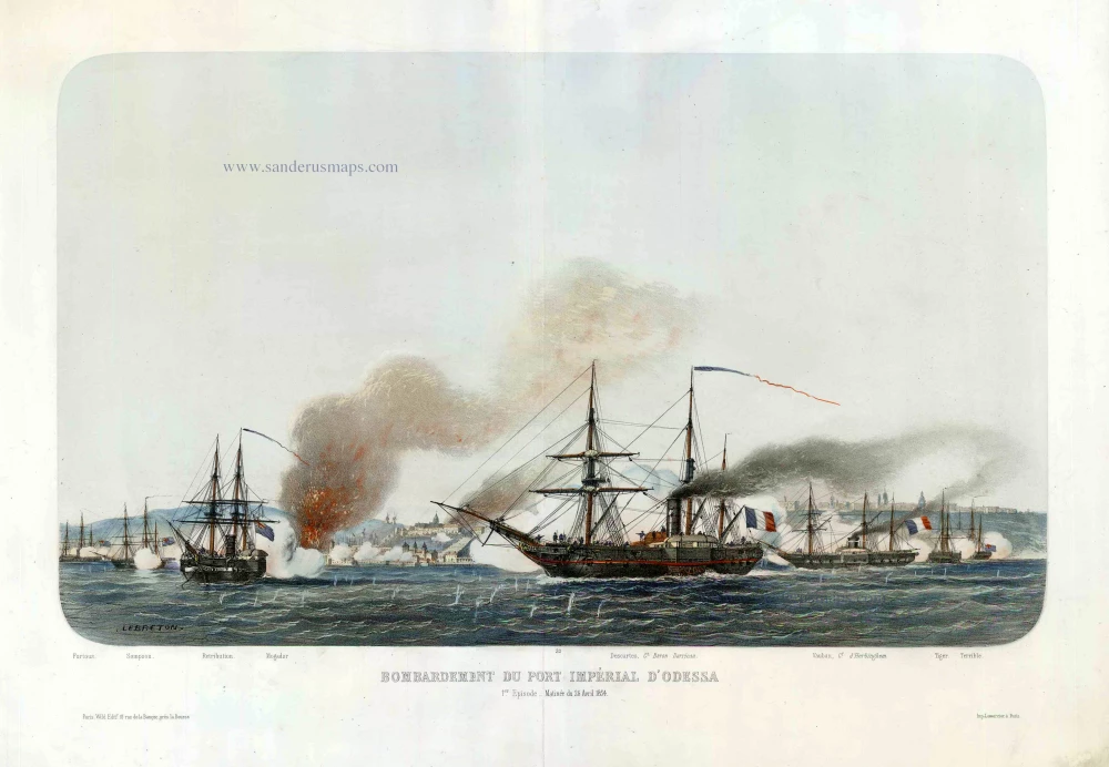
Odessa (Ukraine), by Louis Le Breton. c.1854
Bombardement du Port Impérial d'Odessa.
[Item number: 27443]
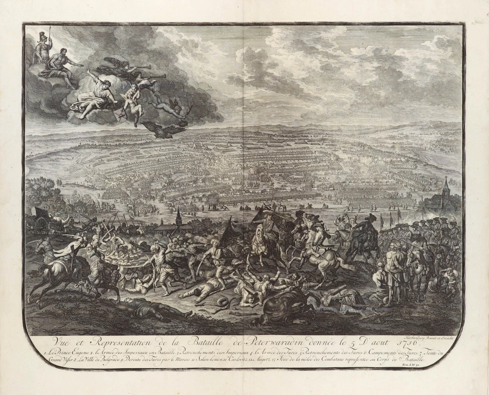
View of the Battle of Petrovaradin, 1716. 1729
Vuë et Representation de la Bataille de Peterwaradin donnée le 5 D ...
[Item number: 29305]

Romania - Transylvania by Gerard Mercator, published by Henricus Hondius. c. 1610-1650
Transylvania.
[Item number: 31206]
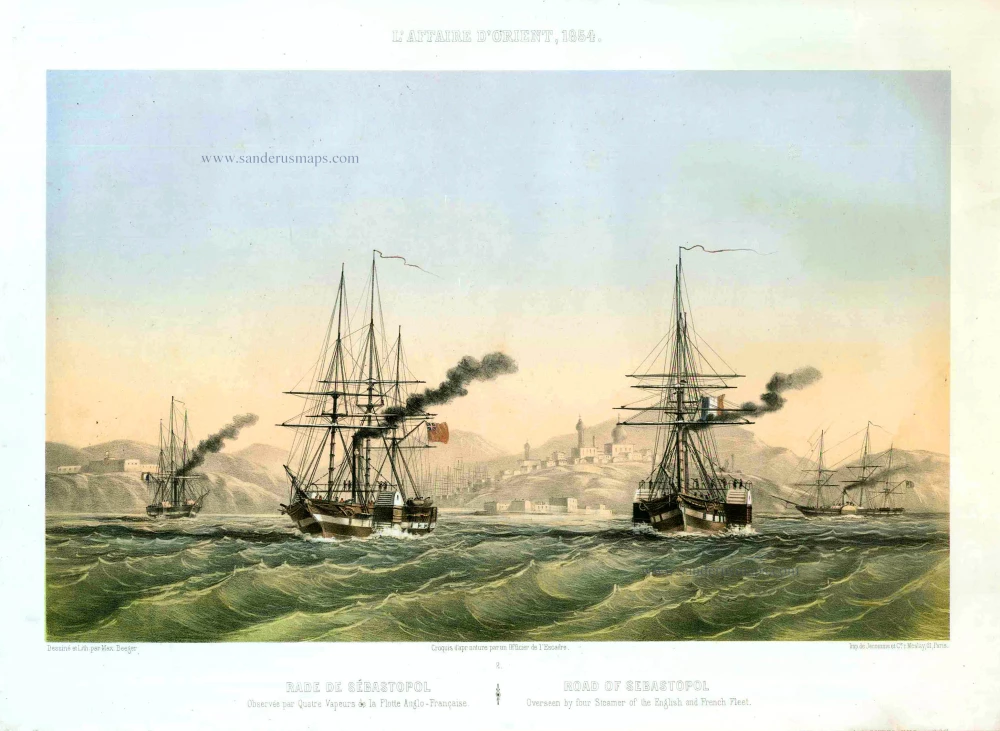
Sebastopol (Ukraine), by Max Beeger. 1854
Rade de Sébastopol. Observée par quatre Vapeurs de la Flotte A ...
[Item number: 27436]

Very rare map of the siege of Belgrade in 1717.
Belgrade (Serbia) and three panoramic views by Joachim Ottens. 1717-1725
Nieuwe en Accurate Caart van de onderliggende Lande van Belgrado ...
[Item number: 30237]

Sibenik and Zadar by Petrus Bertius, published by Jodocus Hondius II. 1618
Liburnia.
[Item number: 31644]
![Sibinium, Ptolemeo Sicum vulgo Sibenicho. Dalmatie Opp. [on sheet with] Parens, sive Parentium vulgo, Parenzo Histriae Opp. [and] Modon, sive Modona, quondam Methone, Civitas est Littoralis Pelopponesi, in Morea.](https://sanderusmaps.com/assets/WEBP/m23288.webp)
Sibernik, Porec and Modon, by Georg Braun and Frans Hogenberg. 1597
Sibinium, Ptolemeo Sicum vulgo Sibenicho. Dalmatie Opp. [on ...
[Item number: 23288]
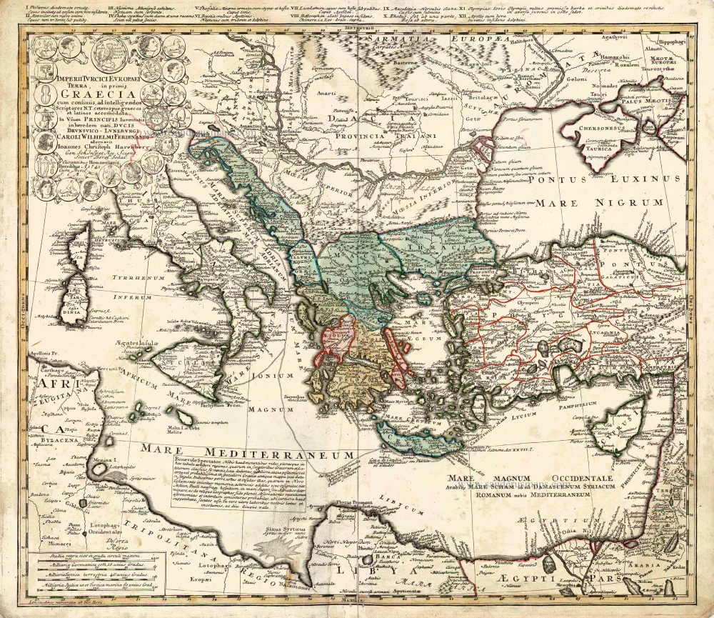
Southeastern Europe - Turkey by Homann Heirs 1752-1775
Imperii Turcici Europaei Terra in Primis Graecia.
[Item number: 26592]
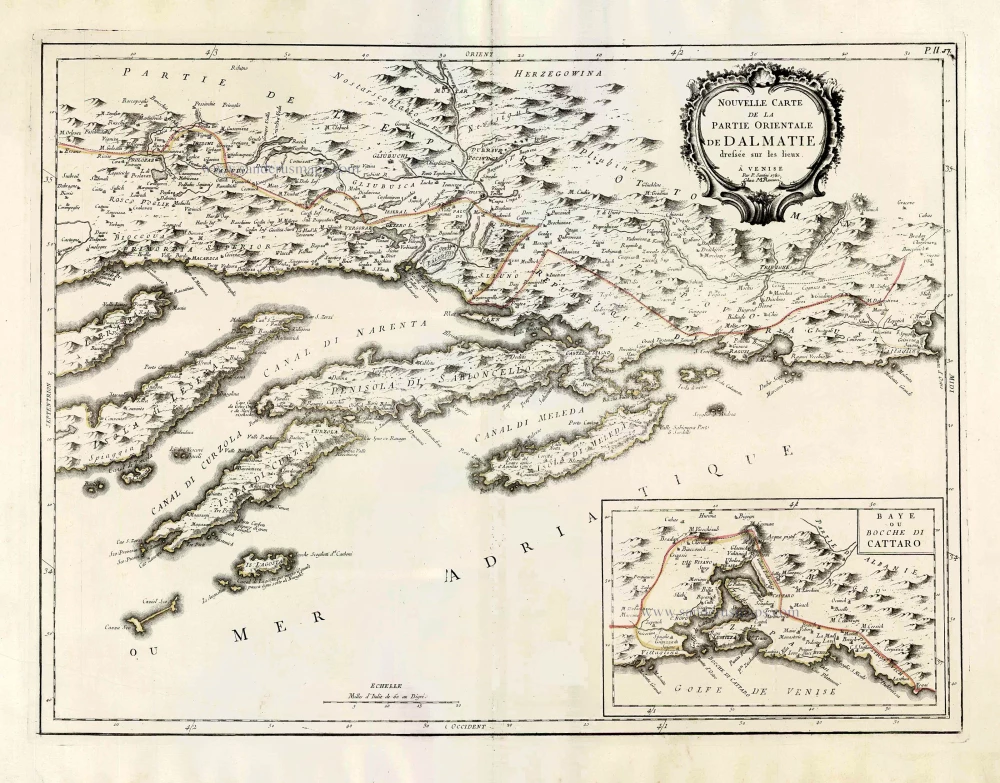
Southern Dalmatia, by Paolo Santini. 1776-79
Nouvelle Carte de la Partie Orientale de Dalmatie.
[Item number: 27722]
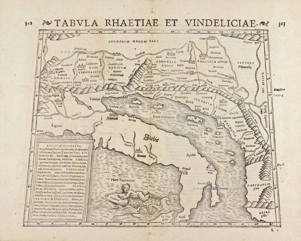
Adriatic Sea by Münster S. 1571
Tabula Rhaetiae et Vindeliciae.
[Item number: 29054]
Parergon map
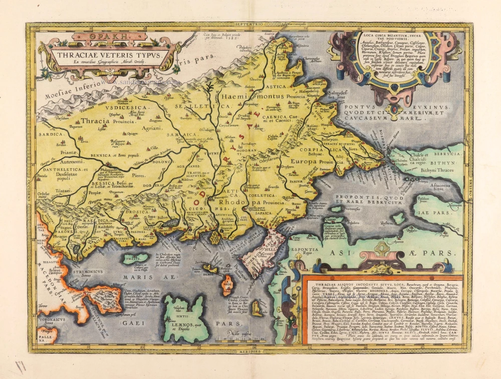
Thrace by Abraham Ortelius. 1595
Thraciae Veteris Typus.
[Item number: 30637]
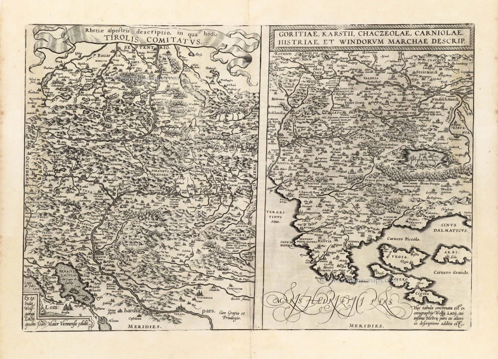
Tirol - Friuli, Carniola, and Istria by Abraham Ortelius. 1601
Rhetiae alpestris descriptio in qua hodie Tirolis Comitatus. - ...
[Item number: 13144]