Antique maps catalogue
- All recent additions
-
Antique maps
- Polar maps
- World
-
Europe
- Europe Continent
- Belgium
- Belgium - Cities
- The Low Countries
- The Netherlands
- The Netherlands - Cities
- Luxembourg
- France
- France - Cities
- Germany
- Germany - Cities
- Austria
- Italy
- Italy - Cities
- Spain and Portugal
- Greece & Greek Islands
- Switzerland
- British Isles
- British Isles - Cities
- Northern Europe
- Central Europe
- Eastern Europe
- Southeastern Europe
- America
- Asia
- Africa
- Mediterranean Sea
- Australia
- Oceans
- Celestial Maps
- Curiosities
- Title Pages
- Books
- Medieval manuscripts
- Prints

Sebastopol (Ukraine), by Max Beeger. 1854
Rade de Sébastopol. Observée par quatre Vapeurs de la Flotte...
[Item number: 27436]
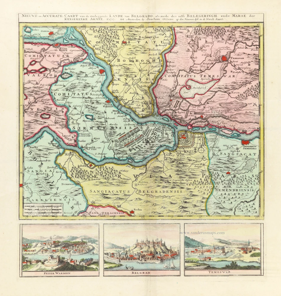
Very rare map of the siege of Belgrade in 1717.
Belgrade (Serbia) and three panoramic views by Joachim Ottens. 1717-1725
Nieuwe en Accurate Caart van de onderliggende Lande van Belgrado...
[Item number: 30237]

Sibenik and Zadar by Petrus Bertius, published by Jodocus Hondius II. 1618
Liburnia.
[Item number: 31644]
![Sibinium, Ptolemeo Sicum vulgo Sibenicho. Dalmatie Opp. [on sheet with] Parens, sive Parentium vulgo, Parenzo Histriae Opp. [and] Modon, sive Modona, quondam Methone, Civitas est Littoralis Pelopponesi, in Morea.](https://sanderusmaps.com/assets/IMG/webp/m23288.webp)
Sibernik, Porec and Modon, by Georg Braun and Frans Hogenberg. 1597
Sibinium, Ptolemeo Sicum vulgo Sibenicho. Dalmatie Opp. [on...
[Item number: 23288]
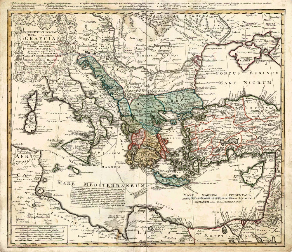
Southeastern Europe - Turkey by Homann Heirs 1752-1775
Imperii Turcici Europaei Terra in Primis Graecia.
[Item number: 26592]

Southern Dalmatia, by Paolo Santini. 1776-79
Nouvelle Carte de la Partie Orientale de Dalmatie.
[Item number: 27722]

Adriatic Sea by Münster S. 1571
Tabula Rhaetiae et Vindeliciae.
[Item number: 29054]
![De expugnatione Co[n]sta[n]tinopolis.](https://sanderusmaps.com/assets/IMG/webp/m32744.webp)
The siege of Constantinople in 1453, by Hartmann Schedel. 1493
De expugnatione Co[n]sta[n]tinopolis.
[Item number: 32744]

Parergon map
Thrace by Abraham Ortelius. 1595
Thraciae Veteris Typus.
[Item number: 30637]
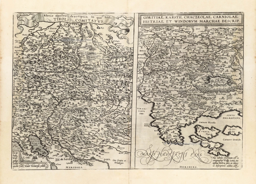
Tirol - Friuli, Carniola, and Istria by Abraham Ortelius. 1601
Rhetiae alpestris descriptio in qua hodie Tirolis Comitatus. -...
[Item number: 13144]

Tyrol and Slovenia, by Abraham Ortelius. 1601
Rhetiae alpestris descriptio in qua hodie Tirolis Comitatus. -...
[Item number: 8057]

Ulcinj (Montenegro) by Giovanni Francesco Camocio After 1575
Dulcigno gia detto Ulcinio citta antiqua post nel confine della...
[Item number: 27556]
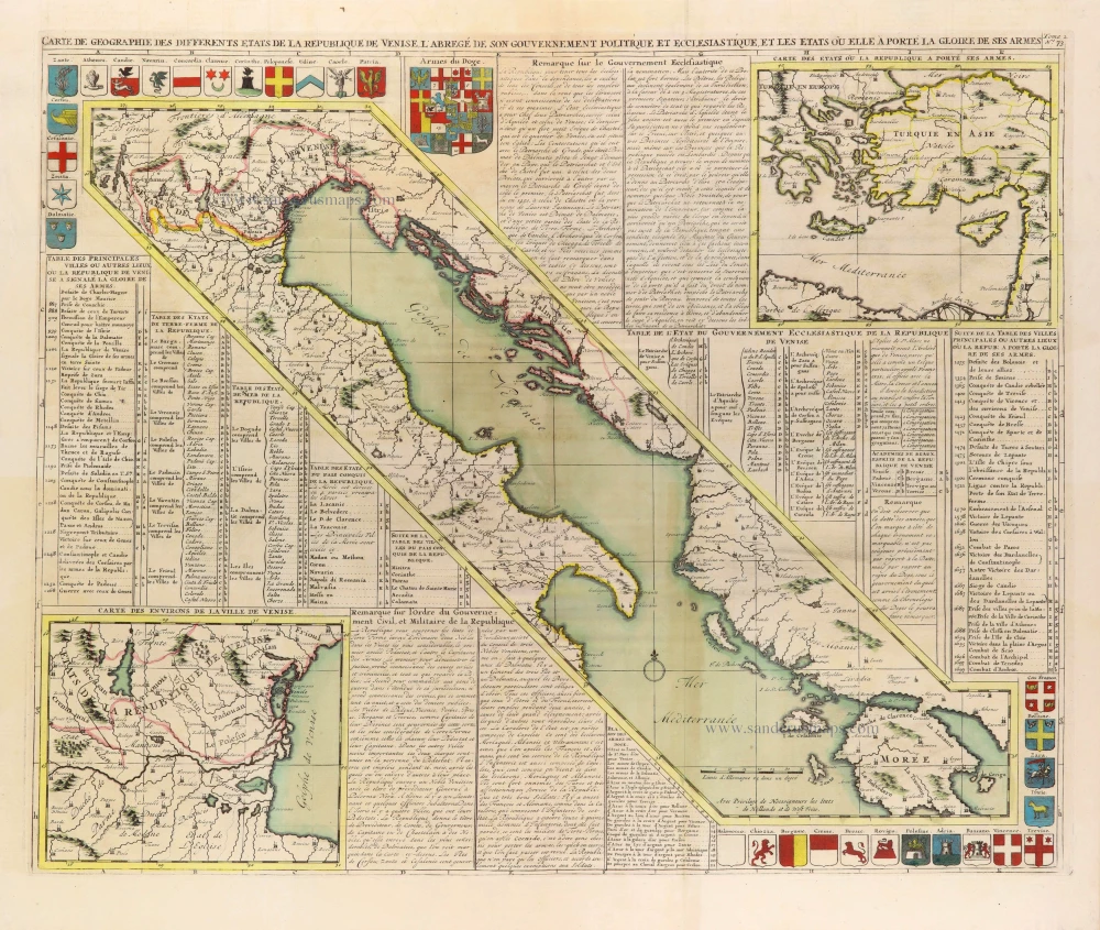
In rare original colour
Gulf of Venice, by Zacharias Châtelain. 1708
Carte de Géographie des differents Etats de la République de...
[Item number: 31420]
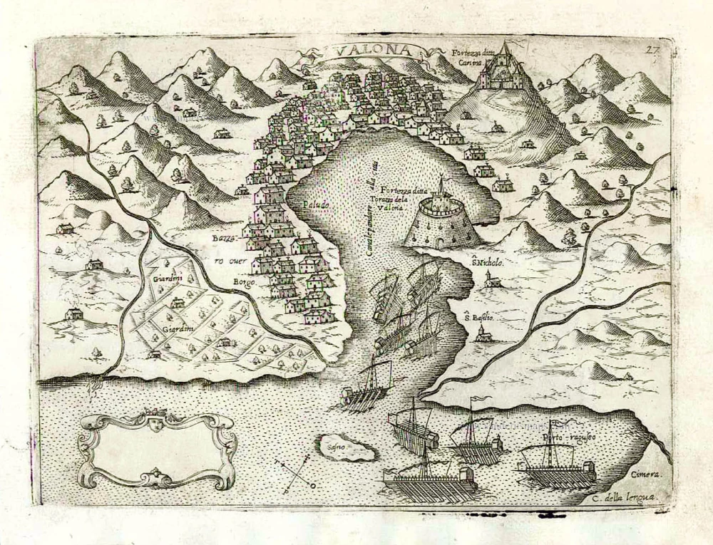
Vlorë (Valona - Avlona) by Giovanni Francesco Camocio After 1575
Valona.
[Item number: 27592]

Western Balkans and Central Europe, by Guillaume Sanson, published by Giovanni de Rossi. 1687
Il Regno d'Ungaria Transilvania, Schivonia, Bosnia, Croatia,...
[Item number: 32954]

View of the Battle of Zenta (Senta), by Jean Dumont. 1729
Vue et Representation de la Bataille de Zenta donnée en 1697.
[Item number: 25987]

Western Balkans by Willem Blaeu. 1635
Sclavonia, Croatia, Bosnia cum Dalmatiae Parte.
[Item number: 6491]