Antique maps catalogue
- All recent additions
-
Antique maps
- World and Polar
-
Europe
- Europe Continent
- Belgium
- Belgium - Cities
- The Low Countries
- The Netherlands
- The Netherlands - Cities
- Luxembourg
- France
- France - Cities
- Germany
- Germany - Cities
- Austria
- Italy
- Italy - Cities
- Spain and Portugal
- Greece & Greek Islands
- Switzerland
- British Isles
- British Isles - Cities
- Northern Europe
- Central Europe
- Eastern Europe
- Southeastern Europe
- America
- Asia
- Africa
- Mediterranean Sea
- Australia
- Oceans
- Celestial Maps
- Curiosities
- Books
- Medieval manuscripts
- Prints
Pacific Ocean (North) by Francesco & Paolo Santini 1776-79
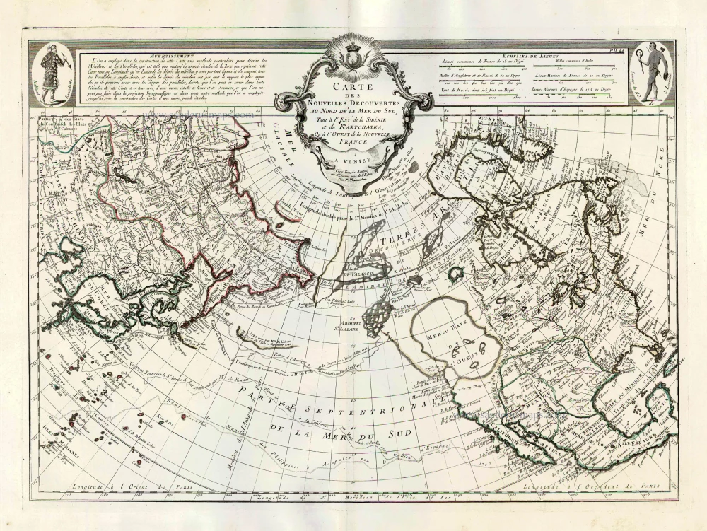
Carte des Nouvelles Decouvertes au Nord de la Mer du Sud, tant à ...
[Item number: 26979]
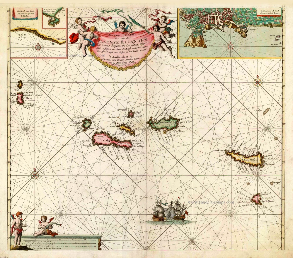
The Azores, by Johannes Van Keulen. 1681
Nieuwe Pascaert van Alle de Vlaemse Eylanden
[Item number: 12094]

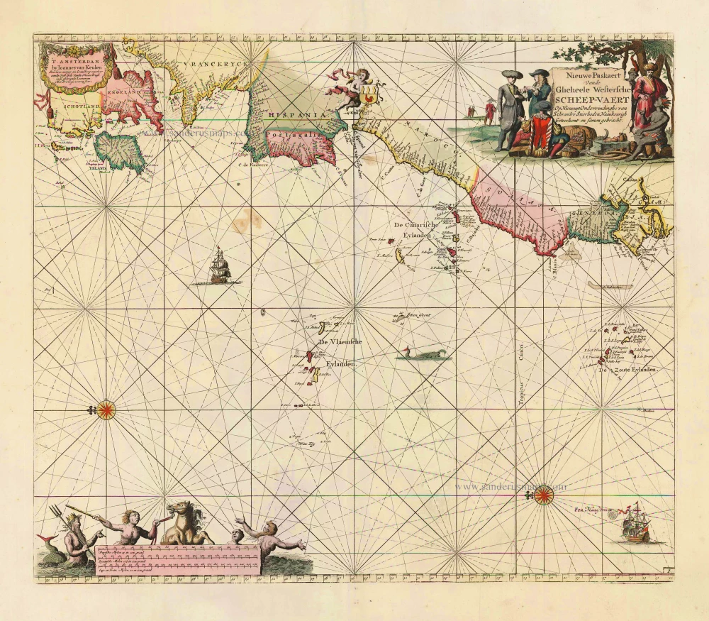
Sea chart of the northwest coast of Africa, with the Azores, Canary Islands and Cape Verde Islands, by Johannes Van Keulen. 1680-1694
Paskaart van de Cust van Portugal, Barbaria, en Genehoa ...
[Item number: 26808]

Secret Atlas Chart - very rare
Sea chart of Mauritius, by J. Van Keulen II. 1753
Paskaart van 't Eyland MAURITIUS, geleegen in de Oostindische ...
[Item number: 30986]
new
The Atlantic Ocean, by J. Van Keulen. 1697-1709
Nieuwe Paskaert vande Gheheele Westersche Scheep-Vaert, op Nieus ...
[Item number: 11218]
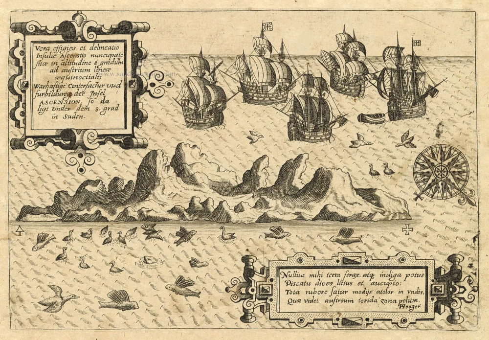
Old antique map of Ascension by Th. de Bry 1598-1613
Vera Effigies et Delineatio Insulae, Ascenstio Nuncupatae Sitae ...
[Item number: 20732]
![[No title]](https://sanderusmaps.com/assets/WEBP/m30730.webp)
Heightened in gold and silver
Atlantic Ocean by Theodore De Bry, Great Voyages, 1599
[No title]
[Item number: 30730]
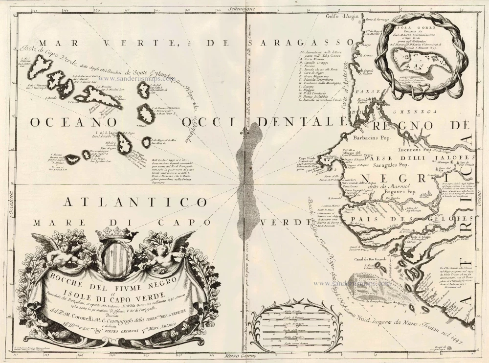
Cape Verde Islands, by Coronelli V.M. 1691
Bocche del Fiume Negro et Isole di Capo Verde
[Item number: 23167]
![[No title]](https://sanderusmaps.com/assets/WEBP/m28826.webp)
Half globe gore of the Indian Ocean - Madagascar. 1696
[No title]
[Item number: 28826]
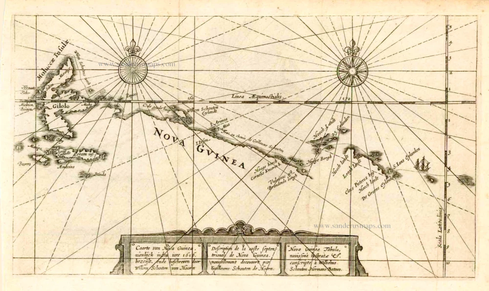
New Guinea, by W.C. Schouten 1618
Caarte van Nova Guinea, Nieulijck inden iare 1616 bezeijlt, ende ...
[Item number: 25400]
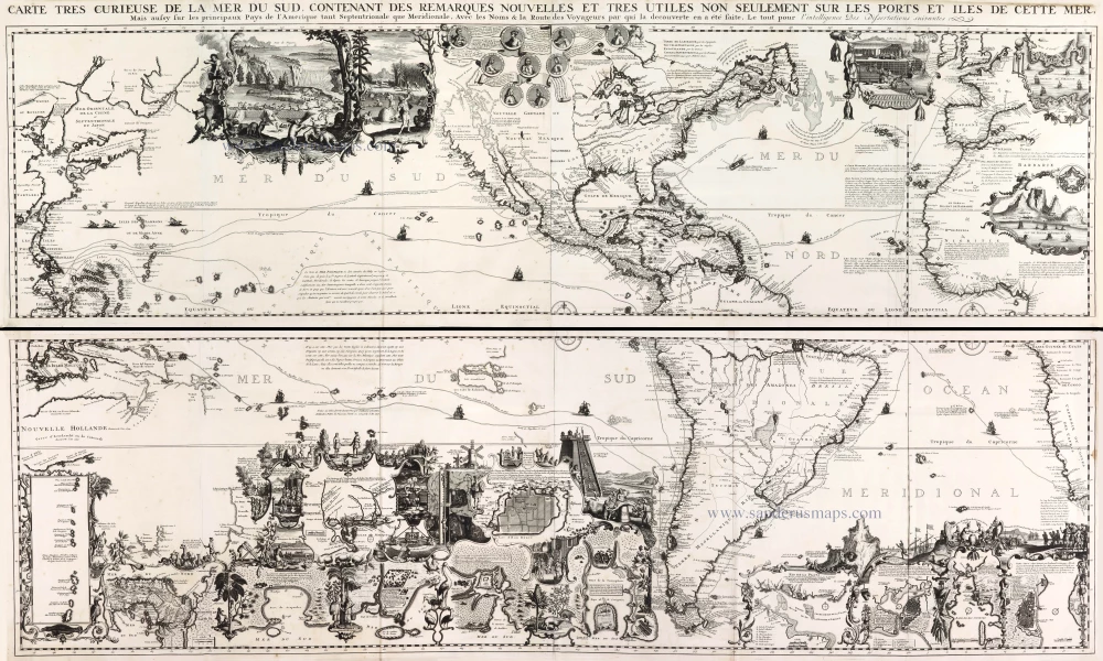
One of the most elaborately engraved maps ever published.
Pacific by Zacharias Châtelain after Nicolas de Fer. 1719
Carte tres Curieuse de la Mer du Sud, Contenant des Remarques ...
[Item number: 29466]