Antique maps catalogue
- All recent additions
-
Antique maps
- Polar maps
- World
-
Europe
- Europe Continent
- Belgium
- Belgium - Cities
- The Low Countries
- The Netherlands
- The Netherlands - Cities
- Luxembourg
- France
- France - Cities
- Germany
- Germany - Cities
- Austria
- Italy
- Italy - Cities
- Spain and Portugal
- Greece & Greek Islands
- Switzerland
- British Isles
- British Isles - Cities
- Northern Europe
- Central Europe
- Eastern Europe
- Southeastern Europe
- America
- Asia
- Africa
- Mediterranean Sea
- Australia
- Oceans
- Celestial Maps
- Curiosities
- Title Pages
- Books
- Medieval manuscripts
- Prints

One of the most elaborately engraved maps ever published.
Pacific by Zacharias Châtelain after Nicolas de Fer. 1719
Carte tres Curieuse de la Mer du Sud, Contenant des Remarques...
[Item number: 29466]

New Guinea, by W.C. Schouten 1618
Caarte van Nova Guinea, Nieulijck inden iare 1616 bezeijlt, ende...
[Item number: 25400]

Cape Verde Islands, by Coronelli V.M. 1691
Bocche del Fiume Negro et Isole di Capo Verde
[Item number: 23167]
![[No title]](https://sanderusmaps.com/assets/IMG/webp/m28826.webp)
Half globe gore of the Indian Ocean - Madagascar. 1696
[No title]
[Item number: 28826]
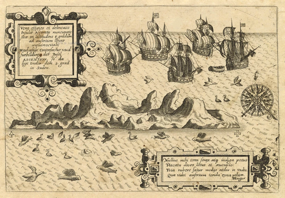
Old antique map of Ascension by Th. de Bry 1598-1613
Vera Effigies et Delineatio Insulae, Ascenstio Nuncupatae Sitae...
[Item number: 20732]
![[No title]](https://sanderusmaps.com/assets/IMG/webp/m30730.webp)
Heightened in gold and silver
Atlantic Ocean by Theodore De Bry, Great Voyages, 1599
[No title]
[Item number: 30730]

Secret Atlas Chart - very rare
Mauritius, by J. Van Keulen II. 1753
Paskaart van 't Eyland MAURITIUS, geleegen in de Oostindische...
[Item number: 30986]
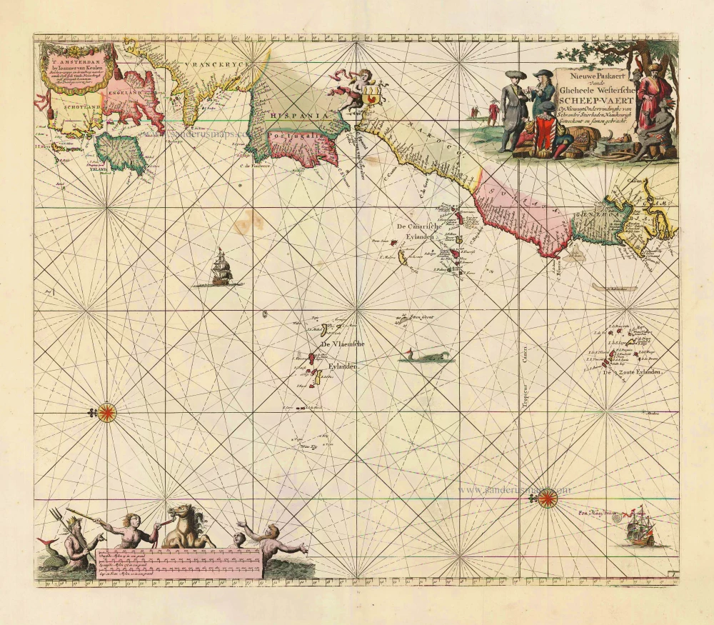
The Atlantic Ocean, by J. Van Keulen. 1697-1709
Nieuwe Paskaert vande Gheheele Westersche Scheep-Vaert, op Nieus...
[Item number: 11218]

The Azores, by Johannes Van Keulen. 1681
Nieuwe Pascaert van Alle de Vlaemse Eylanden
[Item number: 12094]
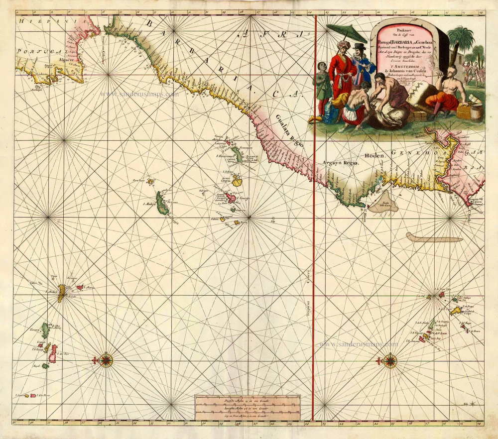
Sea chart of the northwest coast of Africa, with the Azores, Canary Islands and Cape Verde Islands, by Johannes Van Keulen. 1680-1694
Paskaart van de Cust van Portugal, Barbaria, en Genehoa...
[Item number: 26808]

An extremely decorative sea chart (Norwhich)
Indian Ocean - Southeast Asia - Australia by Johannes Van Keulen 1683
Nieuwe Pascaert van Oost Indien Verthoonende hen van C. De Bona...
[Item number: 33150]
new

Pacific Ocean (North) by Francesco & Paolo Santini 1776-79
Carte des Nouvelles Decouvertes au Nord de la Mer du Sud, tant à...
[Item number: 26979]
![[No title] Svalbard](https://sanderusmaps.com/assets/IMG/webp/m32420.webp)
Scarce and decorative map
Spitzbergen by Samuel Purchas 1625
[No title] Svalbard
[Item number: 32420]

Scarce
Indian Ocean by Pieter Vander Aa 1714
Basora En de Landschappen Tussen den Eufrat en Tiger stroom, een...
[Item number: 31082]

Scarce
Indian Ocean & Southeast Asia by Pieter Van der Aa. 1707
Zee-togt van Alfonso d'Albuquerque na de Roode Zee, d'Arabize en...
[Item number: 32321]

Scarce
Indian Ocean, India, Thailand, and Siam by Pieter Van der Aa. 1707
De Kusten van Guzaratte, Malabar, Bengale en Malacca met die...
[Item number: 32323]
Scarce
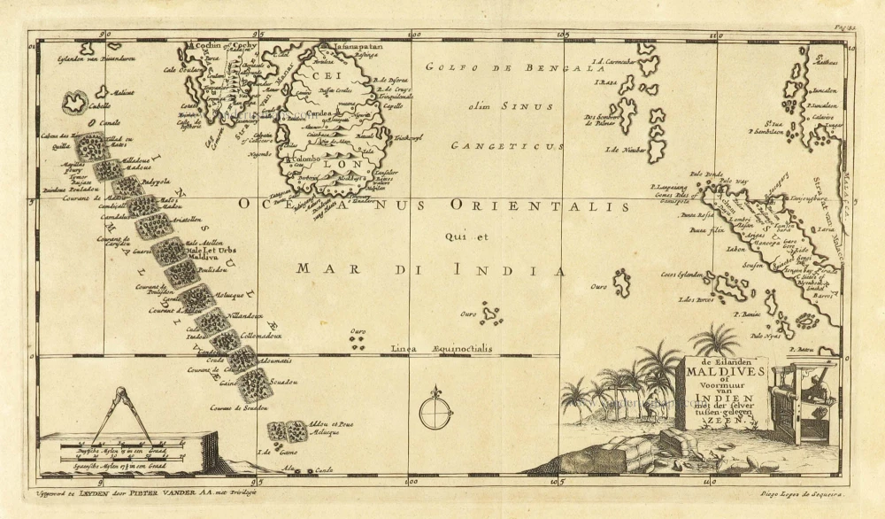
Maldives and Ceylon, by Pieter Van der Aa. 1707
De Eilanden Maldives of Voormuur van Indien met der selver...
[Item number: 32342]

Canary Islands by Pieter van der Aa. 1713
Canaries, ou Iles Fortunées.
[Item number: 26163]

Rare and interesting map
Voyage of Magellan from Spain to Asia, by Pieter Van der Aa. 1707
Scheeps-Togt door Ferdinand Magellaan uit Kastilien gedaan na R....
[Item number: 32347]
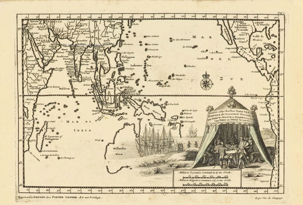
Southeast Asia and Australia, by Pieter Van der Aa. 1707
Indien onder den Heer Lopo Vaz de Sampayo, als Gouverneur...
[Item number: 32359]

Sea chart of Guinea, by Pieter Goos. 1667
Pas-Caart van Guinea en de Custen daer aen Gelegen van Cabo...
[Item number: 19060]

Sea chart of South African Coast, by Pieter Goos. 1667
Pas-Kaarte van de Zuyd-West-Kust van Afrika; van Cabo Negro tot...
[Item number: 19073]
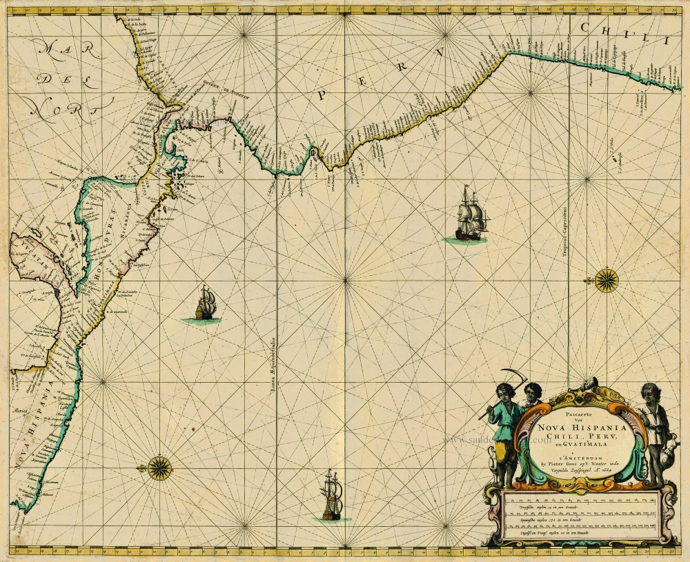
Central America, by Pieter Goos. 1667
Pascaerte van Nova Hispania Chili, Peru, en Guatimala
[Item number: 19031]
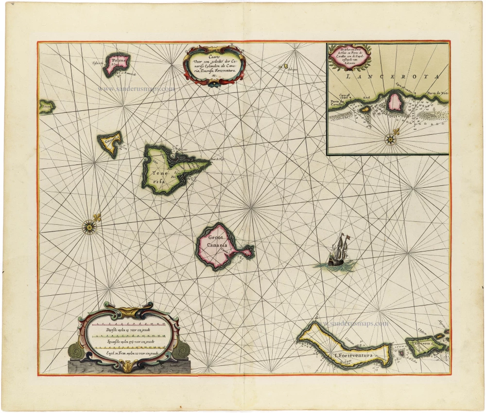
Heightened in gold!
The Canary Islands, by Pieter Goos. 1666
Caarte voor en Gedeelte der Canarise Eylanden als Canaria,...
[Item number: 25612]

The first sea chart - wall map - relating to North America to use the Mercator projection
Atlantic Ocean. by P. Goos - J. Van Keulen c. 1680
West-Indische Paskaert waer in de graden der breedde over...
[Item number: 25938]

Luxury colouring with gold
North-West African Coast by Pieter Goos. 1666
De Cust van Barbaria, Gualata, Arguyn, en Genheo, van Capo S....
[Item number: 33067]
new
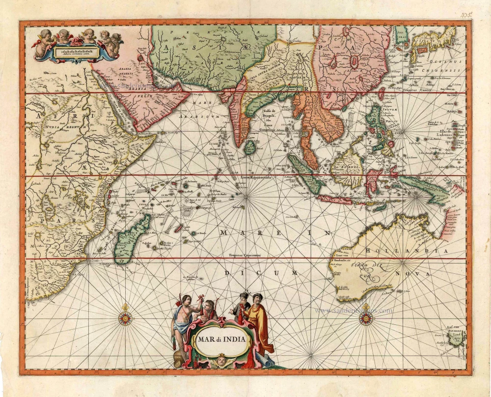
Very rare second state, including the Tasman discoveries (Australia).
Indian Ocean, by Petrus Schenk c. 1700
Mar di India.
[Item number: 27775]
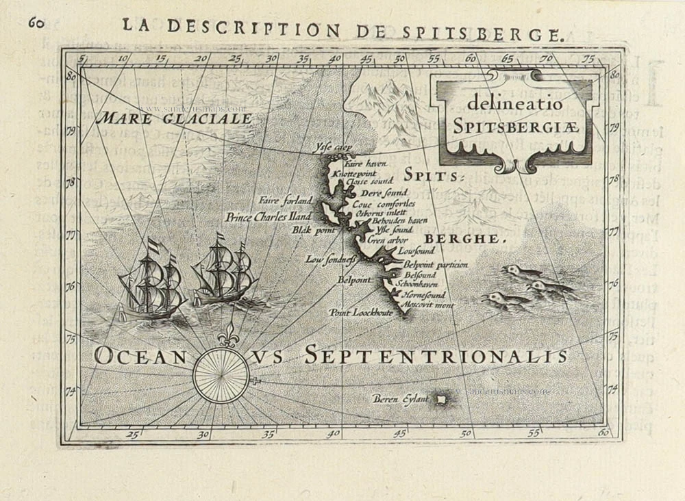
Spitsbergen (Svalbard) by Petrus Bertius 1618
Delineatio Spitsbergiae.
[Item number: 31456]
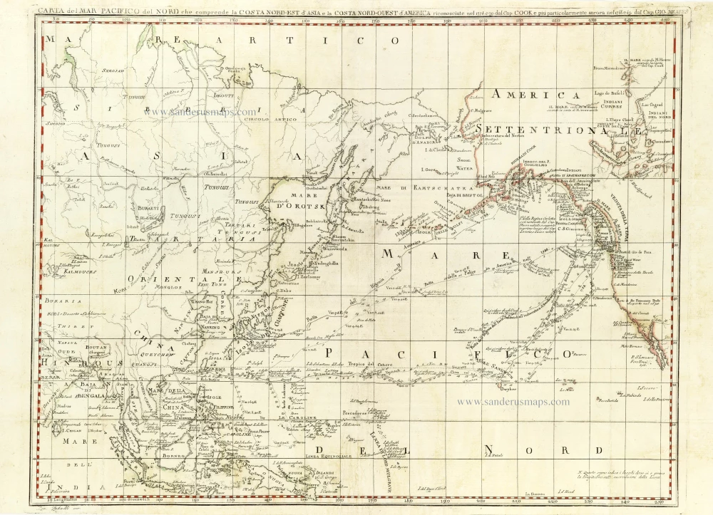
Chart of the Northern Pacific Ocean, Northeastern Asia, and Alaska by John Meares. 1796
Carta del Mar Pacifico del Nord che comprende la Costa...
[Item number: 30731]

The Northern Pacific Ocean, by T.C. Lotter. 1780
Carte de l'Ocean Pacifique au Nord de l'Equateur, et des Cotes...
[Item number: 11984]
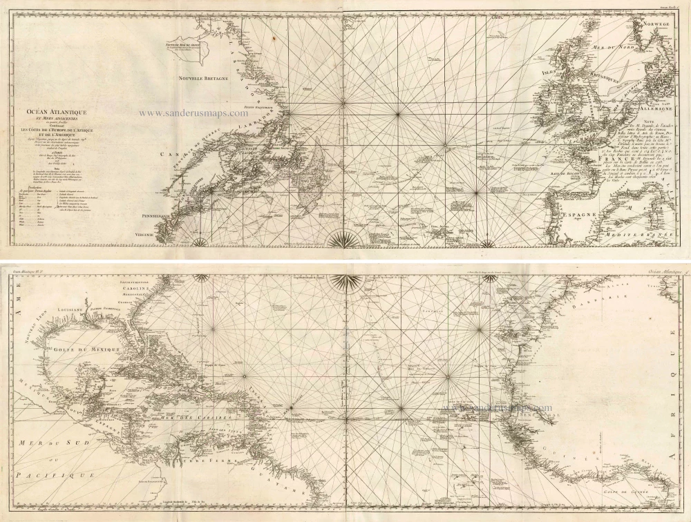
The Atlantic Ocean, by G.L. Le Rouge. 1778
Ocean Atlantique et Mers Adjacentes en Quatre Feuilles Contenant...
[Item number: 14086]

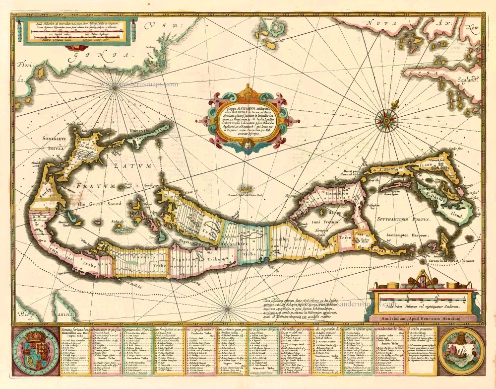
Bermuda by Joannes Janssonius. 1666
Mappa Aestivarum Insularum alias Barmudas dictarum, ...
[Item number: 29951]

First folio sea chart from the Dutch Golden Age
Indian Ocean by J. Janssonius 1650
Mar di India.
[Item number: 32184]
Bermuda, by Johannes Janssonius. 1641
Mappa Aestivarum Insularum alias Barmudas dictarum, ...
[Item number: 26460]
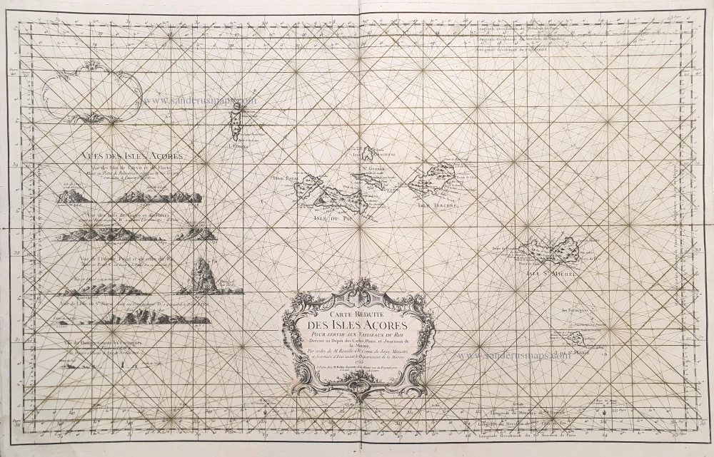
The Azores, by J.N. Bellin. 1756-1770
Carte Réduite des Isles Açores.
[Item number: 28977]
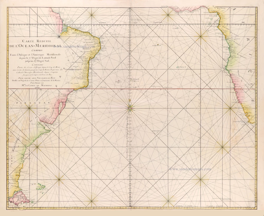
Southern Atlantic Ocean by Jacques Nicolas Bellin. 1765
Carte réduite de l'Océan-méridional, compris entre l'Afrique et...
[Item number: 31446]