Antique maps catalogue
- All recent additions
-
Antique maps
- Polar maps
- World
-
Europe
- Europe Continent
- Belgium
- Belgium - Cities
- The Low Countries
- The Netherlands
- The Netherlands - Cities
- Luxembourg
- France
- France - Cities
- Germany
- Germany - Cities
- Austria
- Italy
- Italy - Cities
- Spain and Portugal
- Greece & Greek Islands
- Switzerland
- British Isles
- British Isles - Cities
- Northern Europe
- Central Europe
- Eastern Europe
- Southeastern Europe
- America
- Asia
- Africa
- Mediterranean Sea
- Australia
- Oceans
- Celestial Maps
- Curiosities
- Title Pages
- Books
- Medieval manuscripts
- Prints
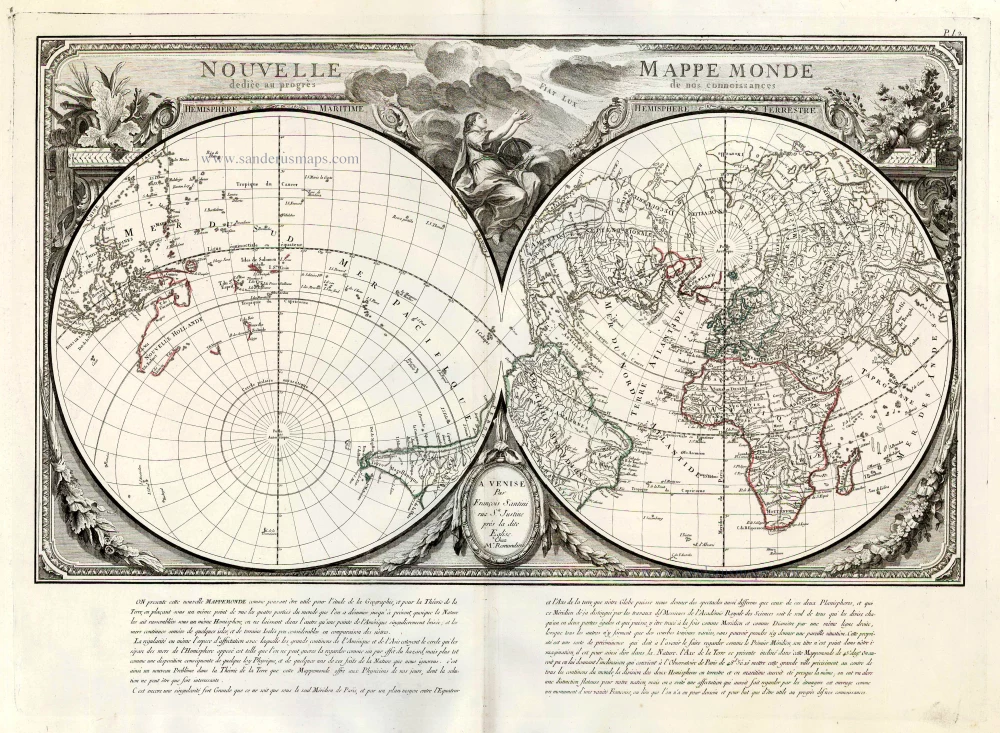
World by Francesco Santini. 1776-79
Nouvelle Mappe Monde Dediee au Progres de nos Connoissances.
[Item number: 26946]
Superb old colouring, heightened with gold.
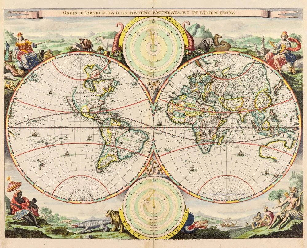
World - Double Hemisphere, by Daniel Stoopendaal 1714
Orbis Terrarum Tabula Recens Emendata Et In Lucem Edita
[Item number: 30635]

World map by Nicolas Sanson, so-called published by Hubert Jaillot. (Pirated edition by Pierre Mortier). 1692
Mappe-Monde Geo-Hydrographique, ou Description Generale du Globe...
[Item number: 31136]
![[No title]](https://sanderusmaps.com/assets/WEBP/m30725.webp)
Drake map heightened in gold and silver
World by Theodore De Bry, Great Voyages, 1599
[No title]
[Item number: 30725]
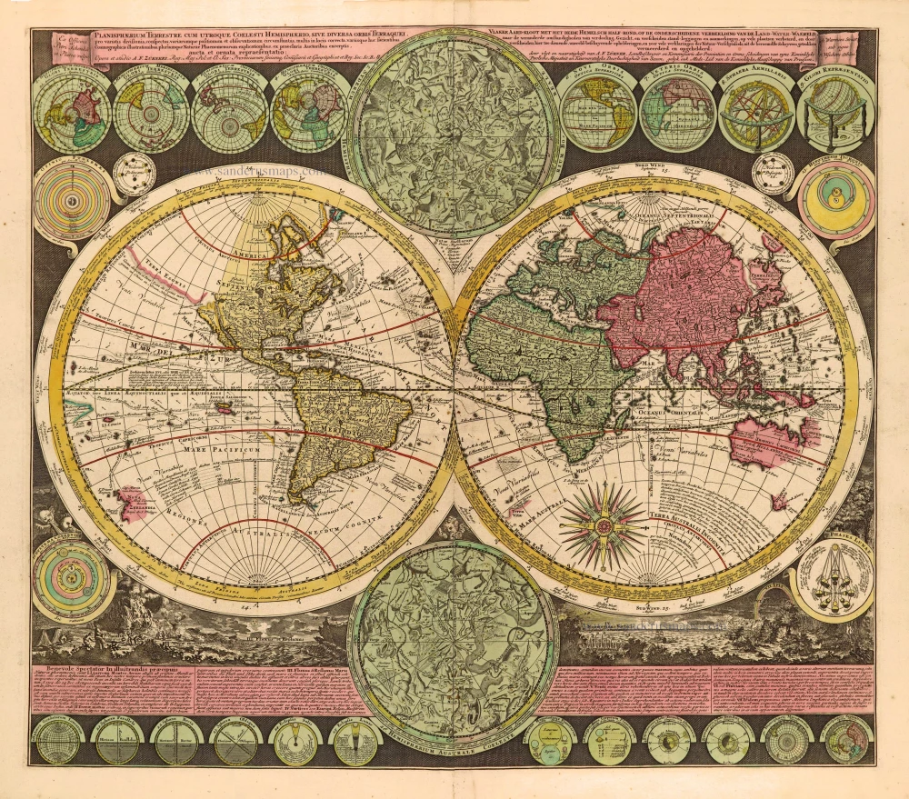
World by Zürner A.F., double hemisphere. c. 1700
Planisphaerium Terrestre cum utroque Coelesti Hemisphaerio, sive...
[Item number: 28229]
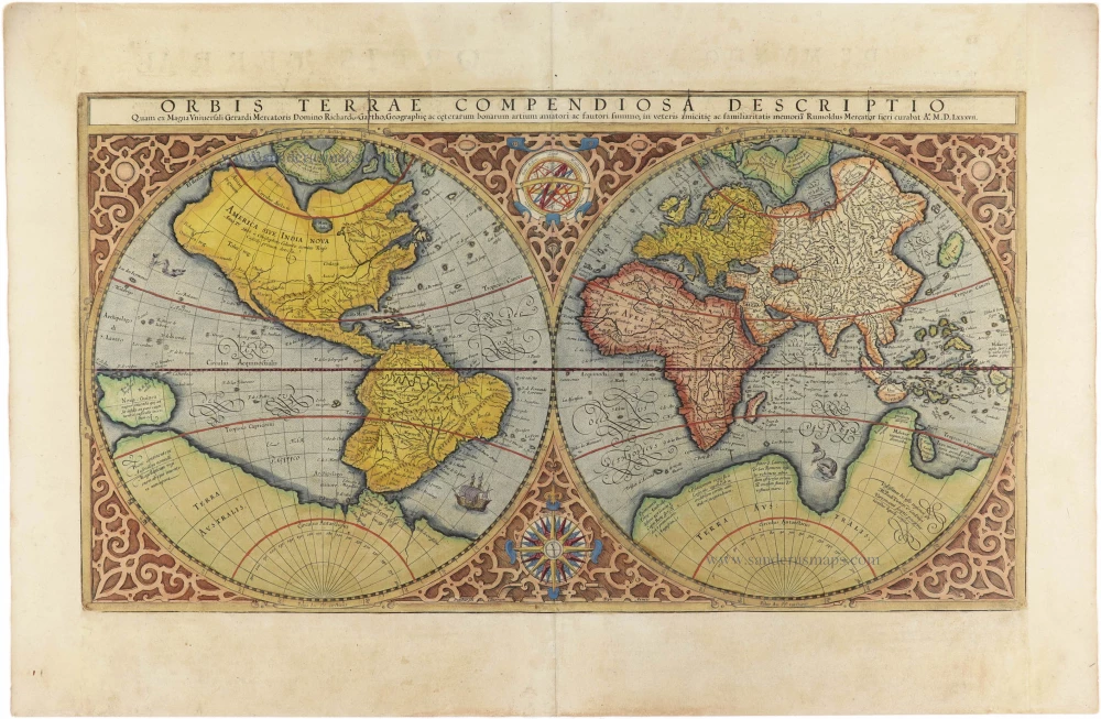
World by Mercator Rumold, double hemisphere. 1613
Orbis Terrae Compendiosa Descriptio.
[Item number: 30942]
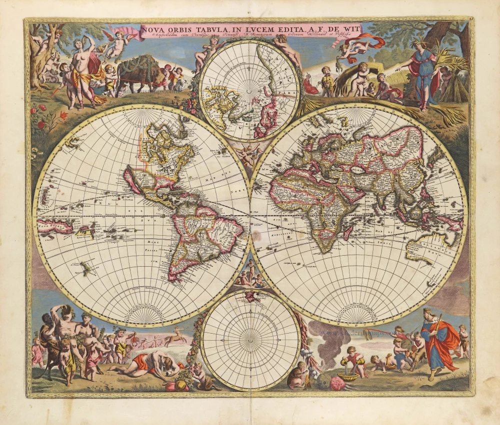
World by Frederik De Wit, double hemisphere. c. 1690
Nova Orbis Tabula in Lucem Edita, A. F. De Wit.
[Item number: 29231]
![[No title]](https://sanderusmaps.com/assets/WEBP/m30649.webp)
Rare 1525 edition in nice old colour.
Ptolemaic world by Lorenz Fries after Martin Waldseemüller. 1525
[No title]
[Item number: 30649]
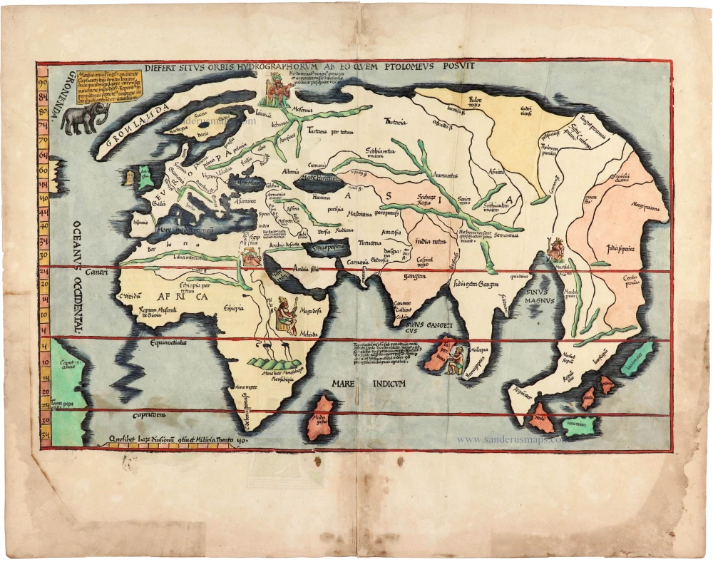
Rare 1525 edition of the second modern world map by Fries, in nice old colour.
Modern world map, by Lorenz Fries, after Martin Waldseemüller. 1525
Diefert Situs Orbis Hydrographorum Ab Eo Quem Ptolomeus Posuit.
[Item number: 30661]

Rare first state of Danckerts beautiful world map
Double hemisphere world map by Justus Danckerts c. 1680
Nova Totius Terrarum Orbis Tabula..
[Item number: 32456]
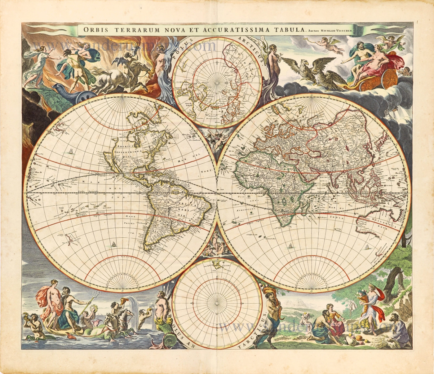
World by Nicolaas Visscher, double hemisphere. c. 1678
Orbis Terrarum Nova et Accuratissima Tabula.
[Item number: 28628]

Luxury colouring.
Double-hemisphere world map, by Nicolaas Visscher I. c. 1678
Orbis Terrarum Nova et Accuratissima Tabula.
[Item number: 28934]

Beautiful example of this important world map
World by Abraham Ortelius. 1584
Typus Orbis Terrarum.
[Item number: 32090]

A fine ornate example of the decorative cartography of the time.
Double-hemisphere world map by Henricus Hondius. 1641
Nova Totius Terrarum Orbis Geographica ac Hydrographica Tabula....
[Item number: 28768]

'One of the supreme examples of map maker's art' (Shirley)
World by Willem Blaeu, in Mercator projection. 1635
Nova Totius Terrarum Orbis Geographica ac Hydrographica.
[Item number: 32683]
new
![Typus Orbis Terrarum [in set with] Africae Tabula Nova [and] Americae sive Novi Orbis, Nova Descriptio [and] Asiae Nova Descriptio [and] Europae.](https://sanderusmaps.com/assets/WEBP/m29259.webp)
Superb world set.
Abraham Ortelius, 1584 World and Continents 1584
Typus Orbis Terrarum [in set with] Africae Tabula Nova [and]...
[Item number: 29259]
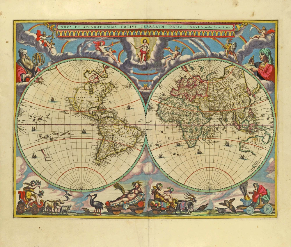
The engraving and layout and elegance of decoration are all of the highest standards.
World by Joan Blaeu, double hemisphere. 1659
Nova Et Accuratissima Totius Terrarum Orbis Tabula.
[Item number: 28336]

'One of the supreme examples of map maker's art' (Shirley)
World by Willem Blaeu, in Mercator projection. 1643
Nova Totius Terrarum Orbis Geographica ac Hydrographica.
[Item number: 30271]