Antique maps catalogue
- All recent additions
-
Antique maps
- World and Polar
-
Europe
- Europe Continent
- Belgium
- Belgium - Cities
- The Low Countries
- The Netherlands
- The Netherlands - Cities
- Luxembourg
- France
- France - Cities
- Germany
- Germany - Cities
- Austria
- Italy
- Italy - Cities
- Spain and Portugal
- Greece & Greek Islands
- Switzerland
- British Isles
- British Isles - Cities
- Northern Europe
- Central Europe
- Eastern Europe
- Southeastern Europe
- America
- Asia
- Africa
- Mediterranean Sea
- Australia
- Oceans
- Celestial Maps
- Curiosities
- Title Pages
- Books
- Medieval manuscripts
- Prints
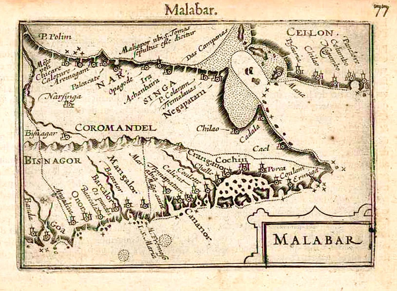
Malabar by Barent Langenes & Cornelis Claesz c. 1600
Malabar.
[Item number: 26997]
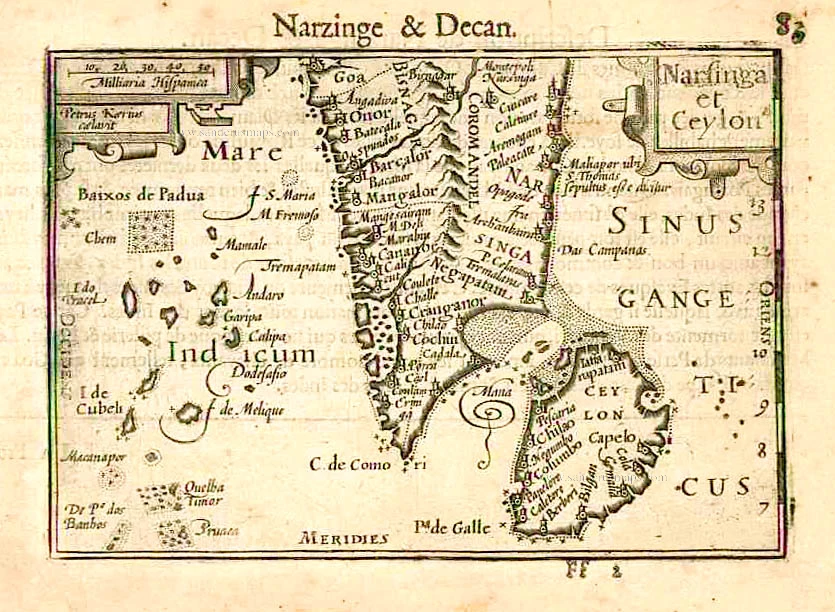
South India and Ceylon by Barent Langenes & Cornelis Claesz c. 1600
Narsinga et Ceylon.
[Item number: 26999]
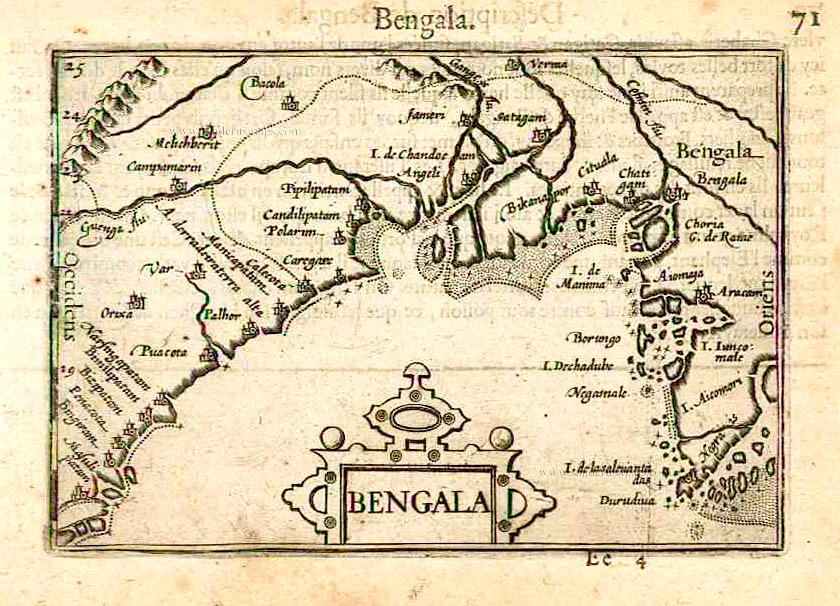
Bengal, by Barent Langenes & Cornelis Claesz. c. 1600
Bengala.
[Item number: 27001]
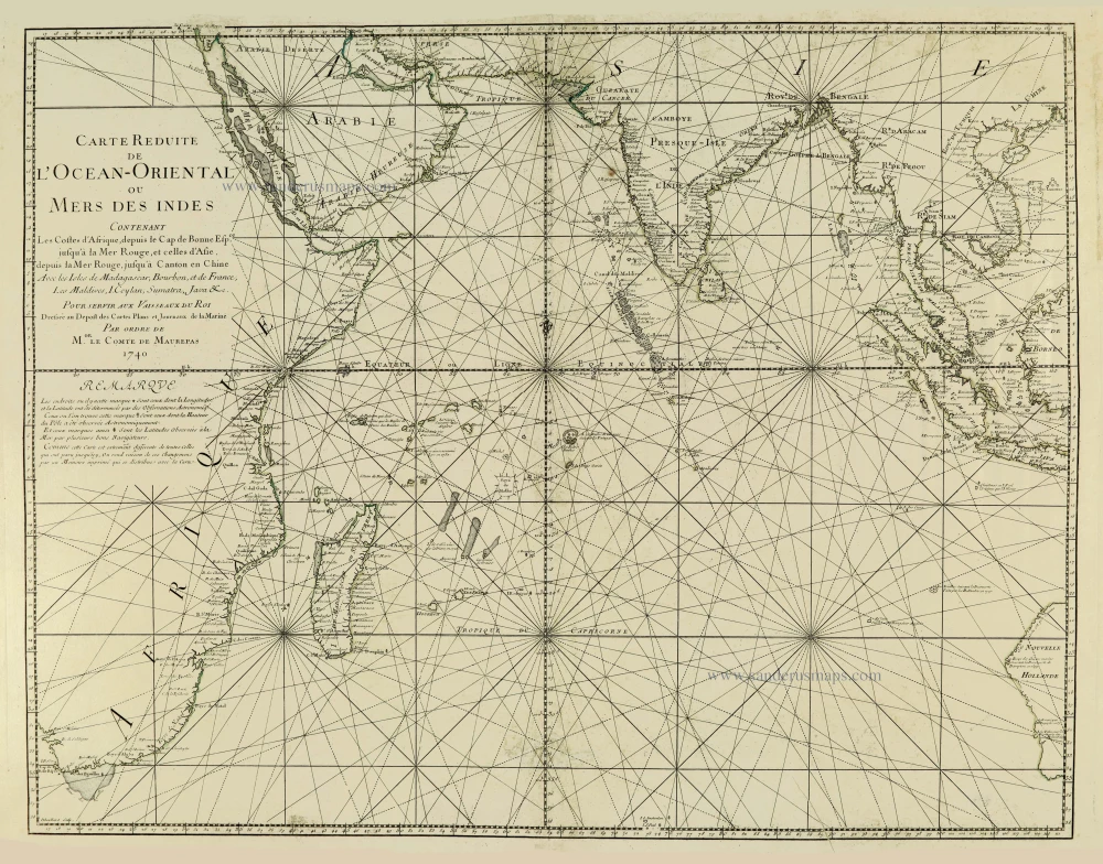
Indian Ocean, by J.N. Bellin. 1756-1770
Carte Réduite de l'Océan Oriental ou Mers des Indes.
[Item number: 28148]
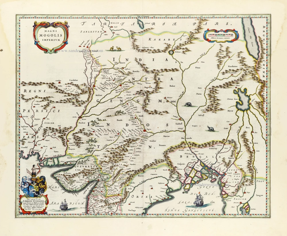
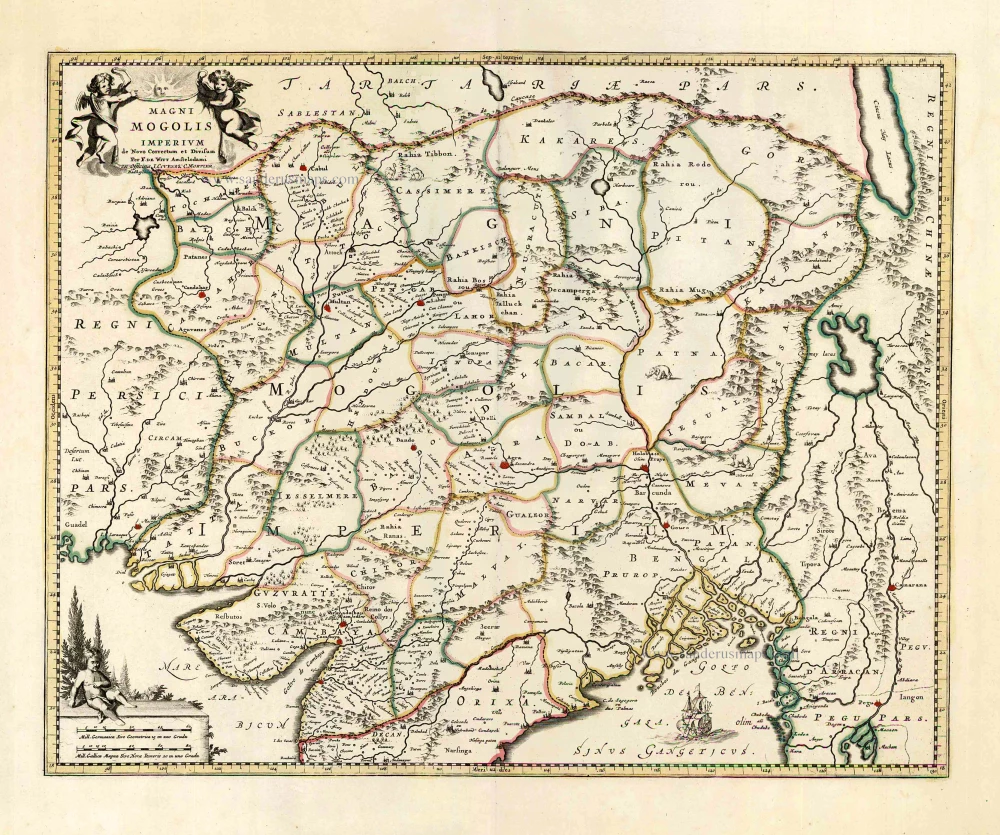
India, by Joan Blaeu. 1640
Magni Mogolis Imperium.
[Item number: 30140]
SCARCE !
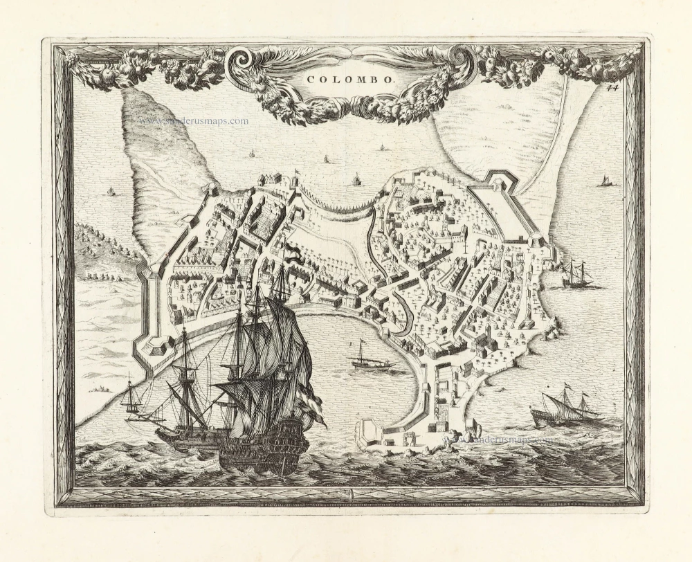
Ceylon (Sri Lanka) - Colombo, by Carel Allard. 1685/90
Colombo.
[Item number: 30576]
SCARCE !
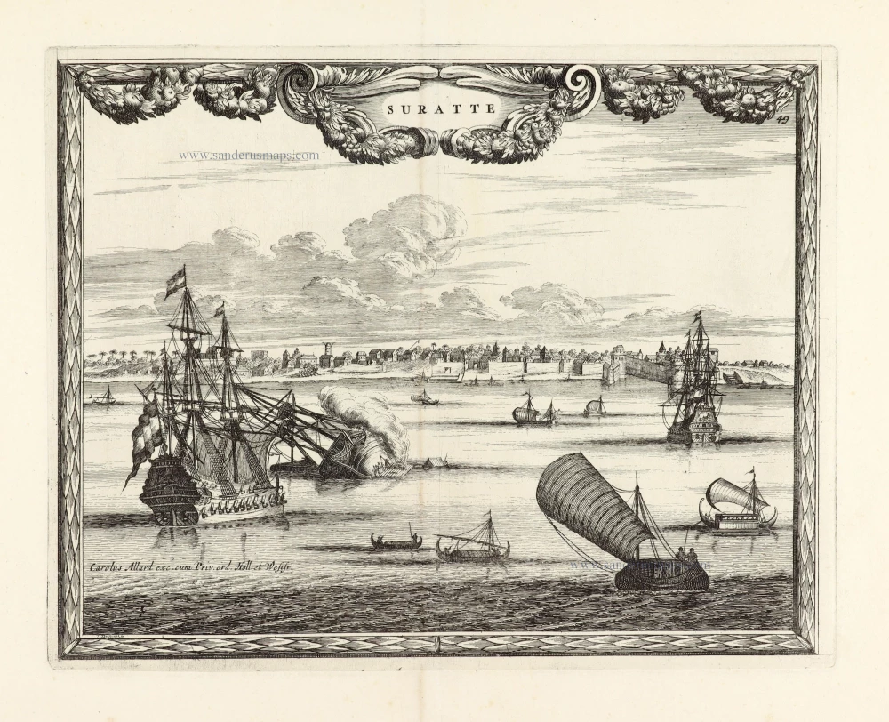
View of Surat (India), by Carel Allard. 1685/90
Suratte.
[Item number: 30590]
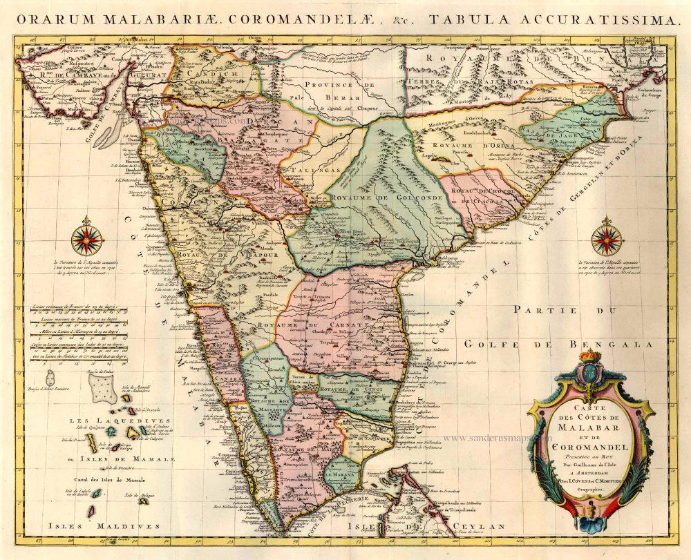
India by Guillaume Delisle, published by Covens & Mortier. 1721-41
Carte des Cotes de Malabar et de Coromandel.
[Item number: 23609]
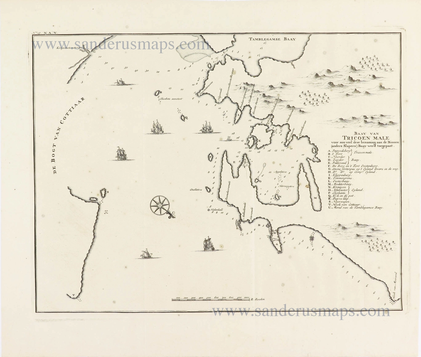
Sri Lanka (Ceylon) - Trincomalee Bay by François Valentyn (Valentijn). 1724-26
Baay van Tricoen Male.
[Item number: 28627]
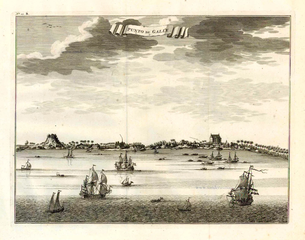
Galle (Ceylon - Sri Lanka) ,by François Valentyn (Valentijn). 1724-26
Punto de Galle.
[Item number: 26902]
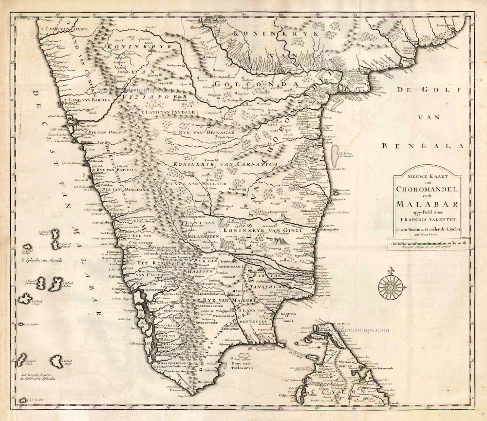
Southern India, by François Valentyn (Valentijn). 1724-26
Nieuwe kaart van Choromandel ende Malabar.
[Item number: 26896]
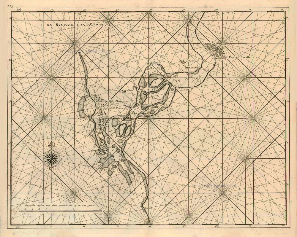
Surat (India), by François Valentyn (Valentijn). 1726
De rivier van Suratta.
[Item number: 27940]

Mongol Empire, by Frederick de Wit. c. 1691-97
Magni Mogolis Imperium.
[Item number: 29092]
Mongol Empire, by Frederick de Wit - Covens & Mortier. After 1721
Magni Mogolis Imperium.
[Item number: 25838]
![Calechut Celeberrimum Indiae Emporium [on sheet with] Ormus [and] Canonor [and] S. Georgii Oppidum Mina.](https://sanderusmaps.com/assets/WEBP/m22223.webp)
Kozhikode (Calicut) - Hormuz (Ormus) - Kannur - Elmina, by Georg Braun & Frans Hogenberg. 1572
Calechut Celeberrimum Indiae Emporium [on sheet with] Ormus...
[Item number: 22223]
![Calechut Celeberrimum Indiae Emporium [on sheet with] Ormus [and] Canonor [and] S. Georgii Oppidum Mina.](https://sanderusmaps.com/assets/WEBP/m23243.webp)
Kozhikode (Calicut) - Hormuz (Ormus) - Kannur - Elmina by Georg Braun & Frans Hogenberg 1599
Calechut Celeberrimum Indiae Emporium [on sheet with] Ormus...
[Item number: 23243]
![Anfa, quibusdam Anaffa [on sheet with] Azaamurum [and] Diu [and] Goa](https://sanderusmaps.com/assets/WEBP/m23246.webp)
Casablanca (Anfa) - Azemmour (Azamor) - Diu - Old Goa (Velha Goa), by Georg Braun and Frans Hogenberg. 1599
Anfa, quibusdam Anaffa [on sheet with] Azaamurum [and] Diu [and]...
[Item number: 23246]
![Anfa, quibusdam Anaffa [on sheet with] Azaamurum [and] Diu [and] Goa.](https://sanderusmaps.com/assets/WEBP/m25333.webp)
Casablanca (Anfa) - Azemmour (Azamor) - Diu - Old Goa (Velha Goa), by Braun & Hogenberg. 1582
Anfa, quibusdam Anaffa [on sheet with] Azaamurum [and] Diu [and]...
[Item number: 25333]
![Anfa, quibusdam Anaffa [on sheet with] Azaamurum [and] Diu [and] Goa.](https://sanderusmaps.com/assets/WEBP/m28048.webp)
Casablanca - Azimur - Diu - Goa, by Georg Braun & Frans Hogenberg. 1574
Anfa, quibusdam Anaffa [on sheet with] Azaamurum [and] Diu [and]...
[Item number: 28048]
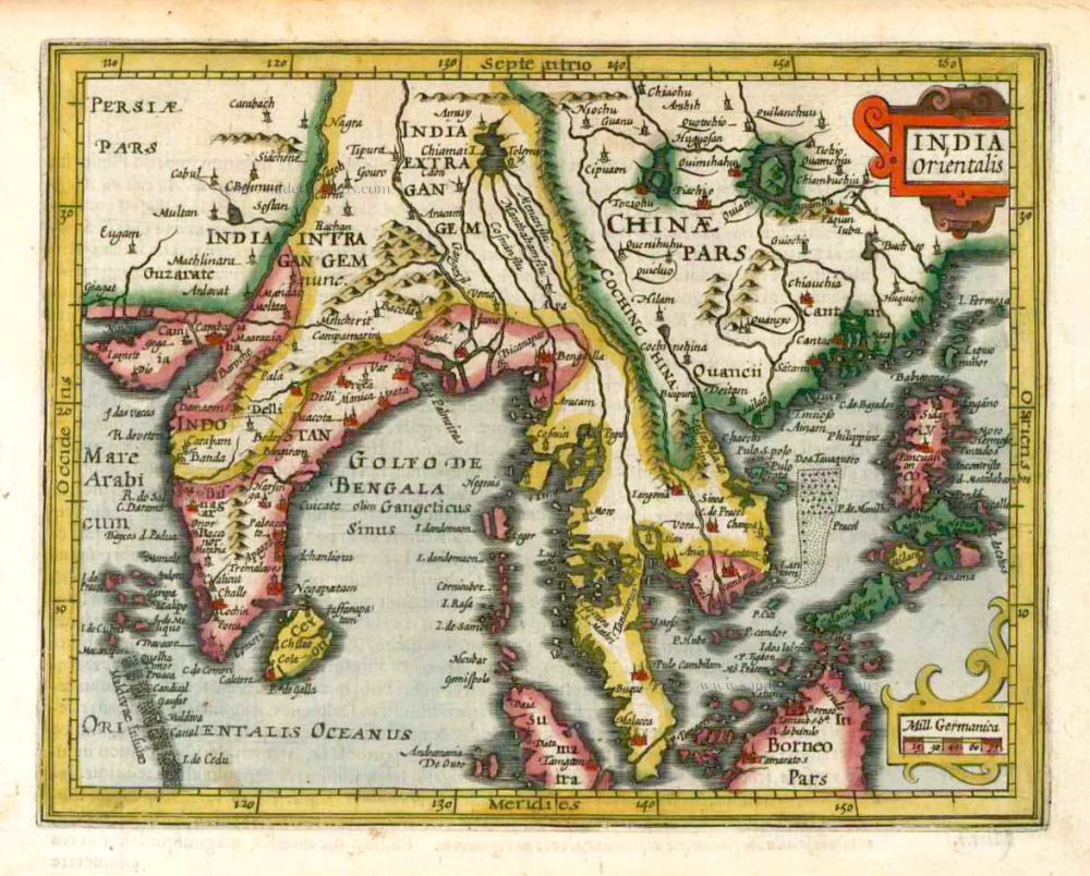
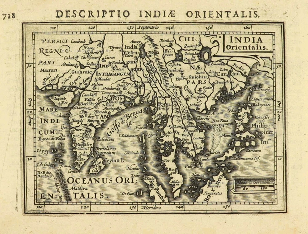
Southeast Asia, by G. Mercator - J. Hondius (small) 1607
India Orientalis.
[Item number: 25186]
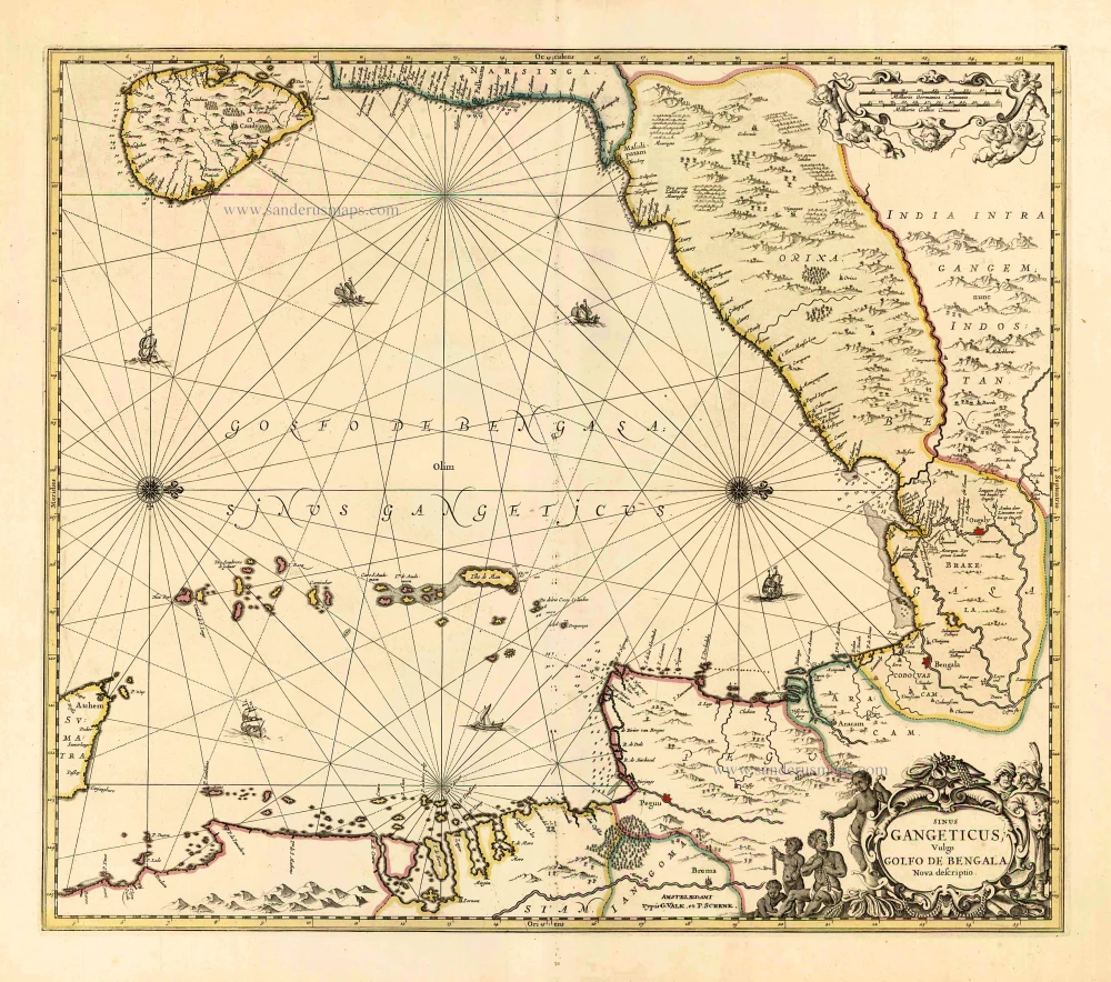
Gulf of Bengal, by G. Valk & P. Schenk. c. 1700
Sinus Gangeticus Vulgo Golfo de Bengala Nova Descriptio.
[Item number: 25835]
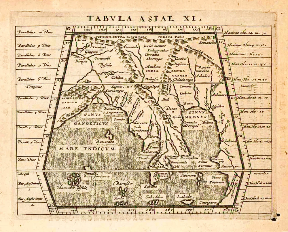
India, by Giovanni Magini 1597
Tabula Asiae XI.
[Item number: 26522]
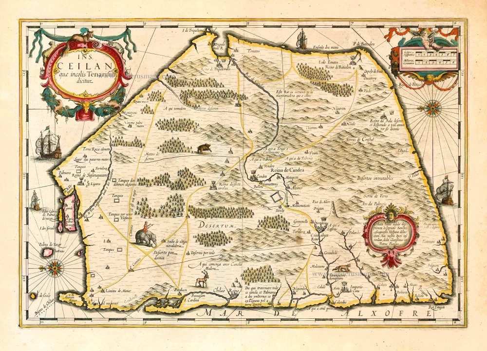
Sri Lanka (Ceylon), by Jodocus Hondius. 1638
Ins. Ceilan quae incolis Tenarisin dicitur.
[Item number: 26006]
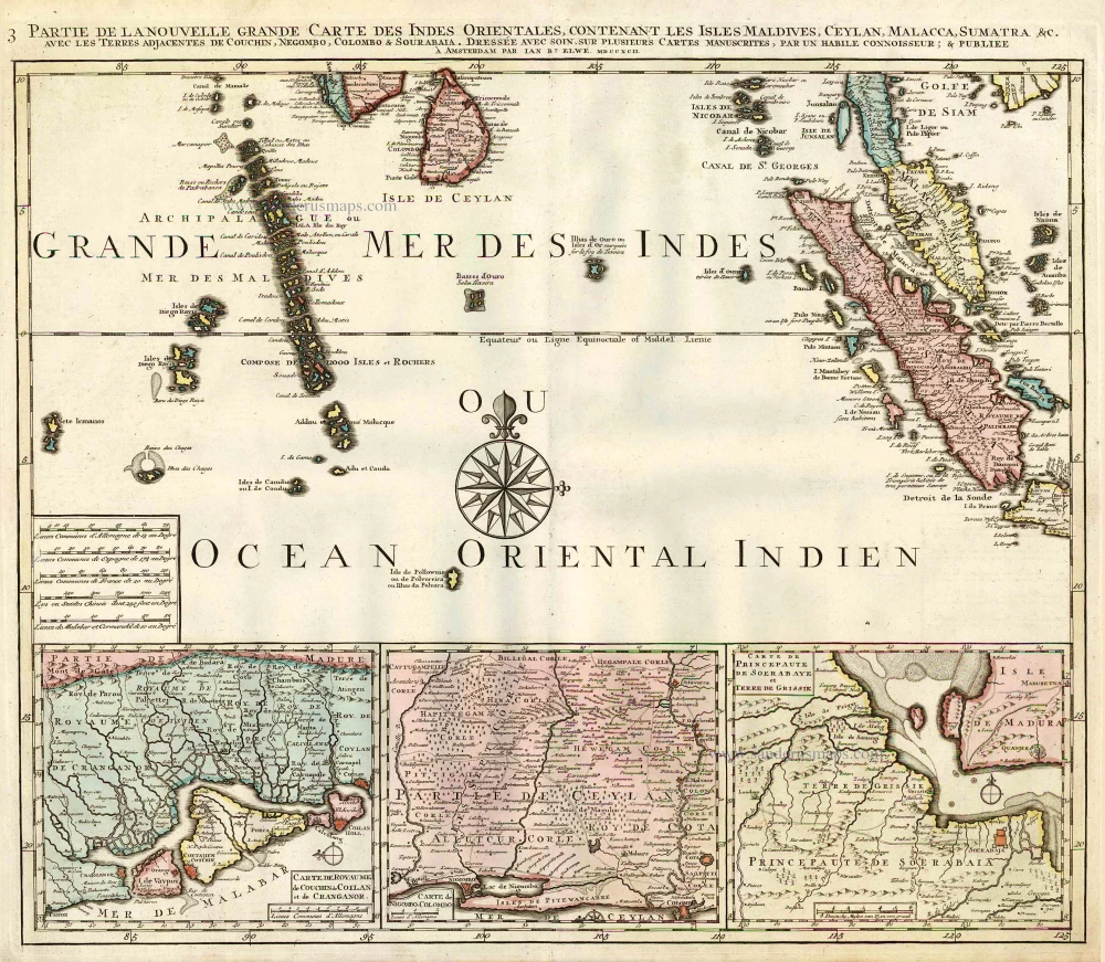
Indian Ocean (North), by J.B. Elwe. 1792
Partie de la Nouvelle Grande Carte des Indes Orientales,...
[Item number: 2363]

India & Ceylon, by Homann Heirs. c. 1737
Peninsula Indiae citra Gangem, hoc est Orae Celeberrimae Malabar...
[Item number: 26752]
![Tabula .X. Asiae. [On verso]](https://sanderusmaps.com/assets/WEBP/m28198.webp)
Ptolemy map of India by Lorenz Fries, after Martin Waldseemüller. 1525
Tabula .X. Asiae. [On verso]
[Item number: 28198]

Fries 1525 edition of the first modern map of Southeast Asia
South Asia by Lorenz Fries. 1525
Tab. Moderna Indiae.
[Item number: 27929]
![[No titel - from verso:] Tab. Moderna Indiae.](https://sanderusmaps.com/assets/WEBP/m30650.webp)
Rare 1525 edition in nice old colour.
Ptolemy map of southern Asia by Lorenz Fries, after Martin Waldseemüller. 1525
[No titel - from verso:] Tab. Moderna Indiae.
[Item number: 30650]
![[No title]](https://sanderusmaps.com/assets/WEBP/m27932.webp)
Ceylon (Sri Lanka), by Lorenz Fries. 1525
[No title]
[Item number: 27932]

Goa, by M. Merian. 1638
Goa.
[Item number: 25903]
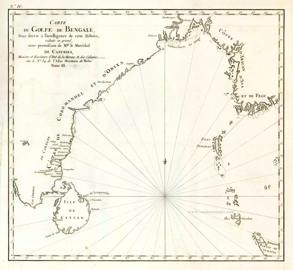
The Gulf of Bengal, by O.J. Boucher. 1787
Carte du Golf de de Bengale, ...
[Item number: 26775]

India - Cambay by Petrus Bertius, published by Jodocus Hondius II. 1618
Cambaia
[Item number: 32145]

India - Malabar by Petrus Bertius, published by Jodocus Hondius II. 1618
Malabar.
[Item number: 32146]
East Indies by Petrus Bertius. 1616
India Orientalis.
[Item number: 28162]

India - Bengal by Petrus Bertius, published by Jodocus Hondius II. 1618
Bengala.
[Item number: 32148]
![[Map of the Maldives] [and] Ceylon I.](https://sanderusmaps.com/assets/WEBP/m32170.webp)
Maldives and Ceylon, by Petrus Bertius 1618
[Map of the Maldives] [and] Ceylon I.
[Item number: 32170]