Antique maps catalogue
- All recent additions
-
Antique maps
- World and Polar
-
Europe
- Europe Continent
- Belgium
- Belgium - Cities
- The Low Countries
- The Netherlands
- The Netherlands - Cities
- Luxembourg
- France
- France - Cities
- Germany
- Germany - Cities
- Austria
- Italy
- Italy - Cities
- Spain and Portugal
- Greece & Greek Islands
- Switzerland
- British Isles
- British Isles - Cities
- Northern Europe
- Central Europe
- Eastern Europe
- Southeastern Europe
- America
- Asia
- Africa
- Mediterranean Sea
- Australia
- Oceans
- Celestial Maps
- Curiosities
- Books
- Medieval manuscripts
- Prints

Scarce
Gelderland and Veluwe, by C.J. Visscher. 1634
Den Ysel-Stroom van Arnhem tot beneden Deventer met een gedeelte...
[Item number: 24503]
Big and spectacular map
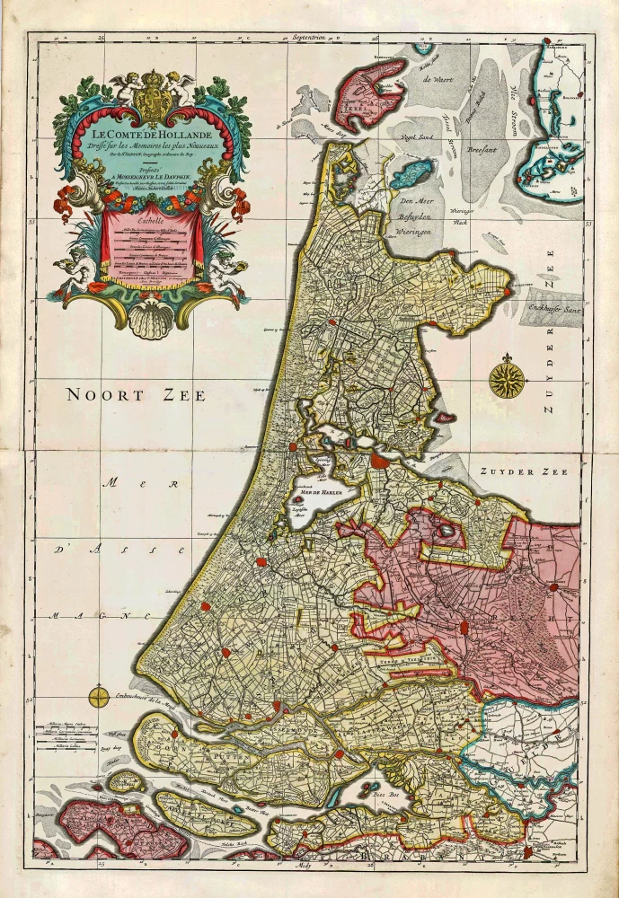
Holland, by Pieter Mortier. c. 1705
Le Comté de Hollande.
[Item number: 27807]
Scarce map by Vrients
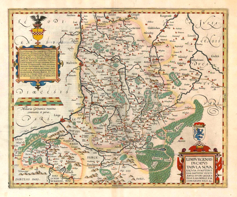
Limburg, by Ortelius A. 1612
Limburgensis Ducatus Tabula Nova.
[Item number: 22979]
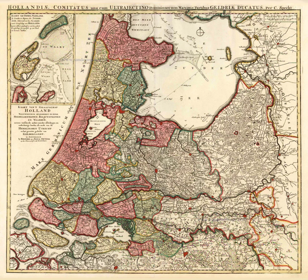
Holland by C. Specht, published by R. & J. Ottens. 1730-45
Kaart van 't Graafschap Holland Naauwkeurig Afgedeelt in zyne...
[Item number: 25706]
Very nice colouring
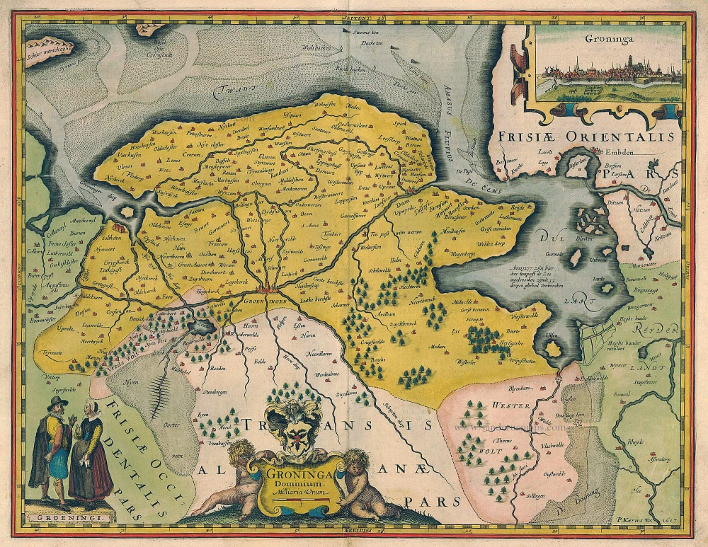
Groningen by Kaerius Petrus 1617
Groninga Dominium / P. Kaerius Ex. 1617.
[Item number: 20513]
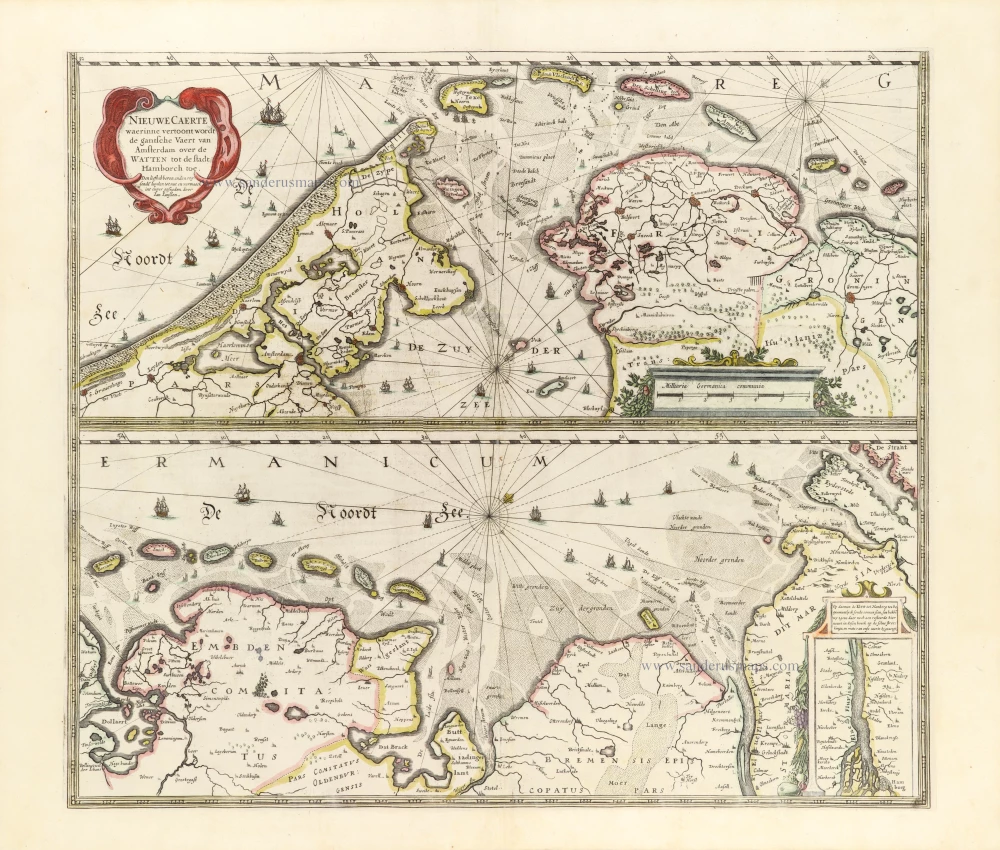
The Wadden Sea, by Henricus Hondius. 1653
Nieuwe Caerte waerinne vertoont wordt de gantsche Vaert van...
[Item number: 30375]
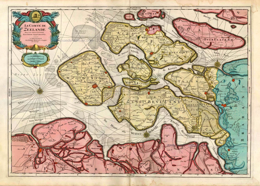
Zeeland, by Pieter Mortier. c. 1705
Le Comté de Zeelande.
[Item number: 27806]
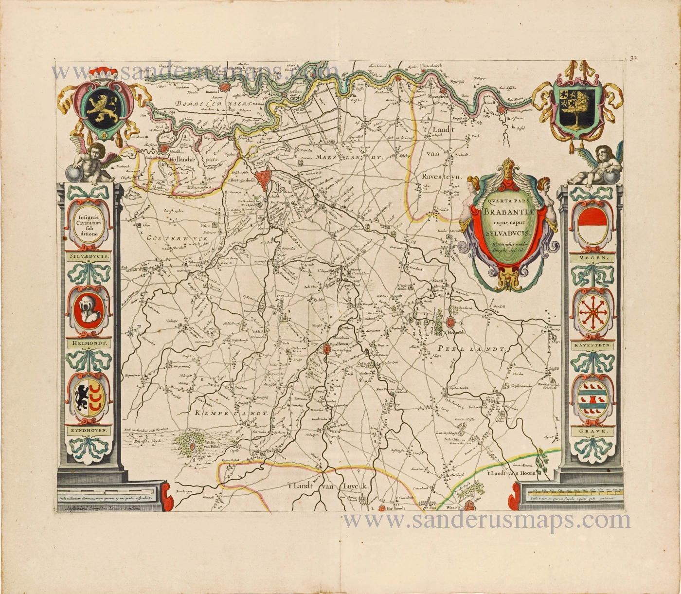
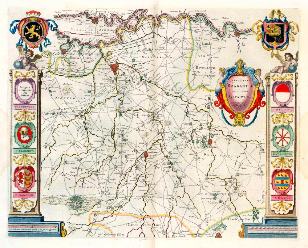
Northern Brabant, by Joannes Janssonius. c. 1680
Quarta Pars Brabantiae cujus caput Sylvaducis.
[Item number: 28622]
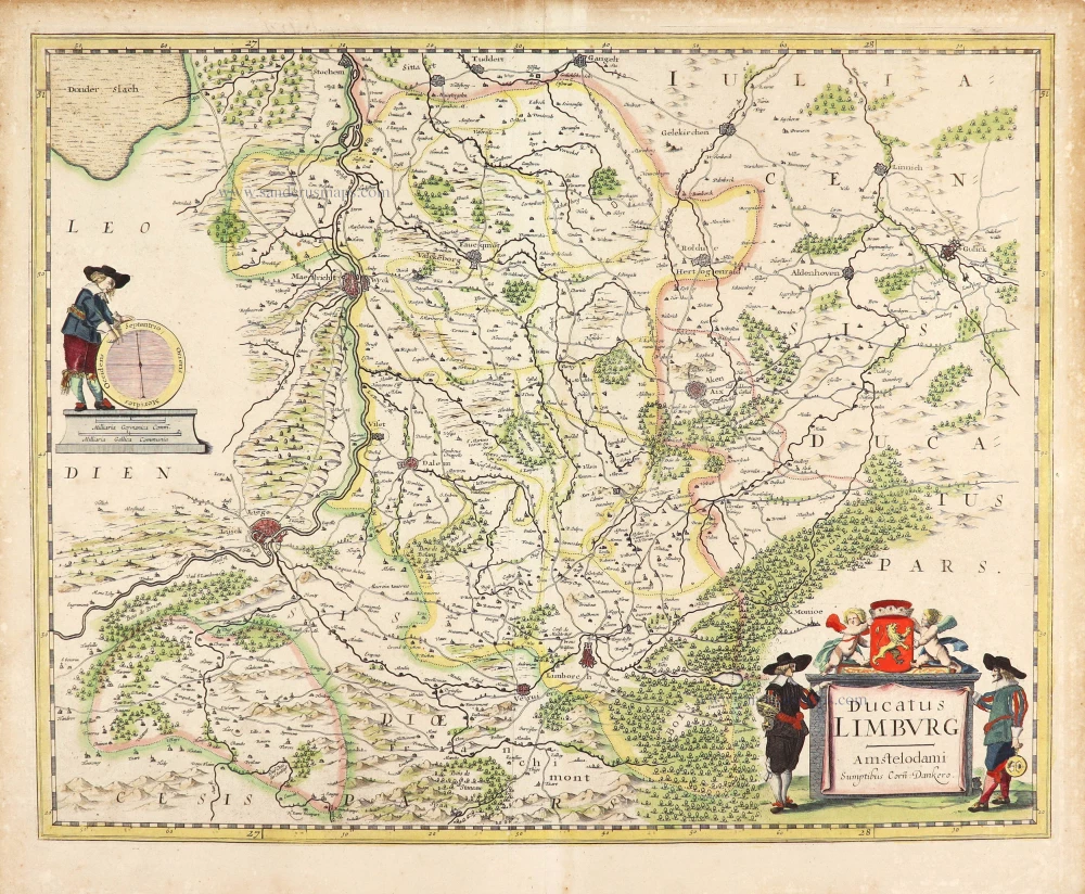
Limburg by Cornelis Danckerts. c. 1636
Ducatus Limburg.
[Item number: 28772]
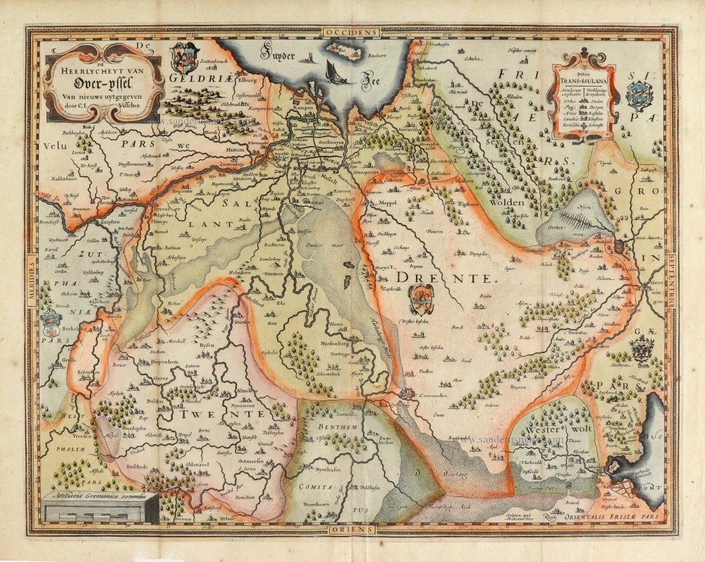
![Ditio Transisulana [with inset view of the town of Deventer:] Deventer [and costume figures:] Transisulani.](https://sanderusmaps.com/assets/WEBP/m31872.webp)
Overijssel by Petrus Kaerius (Pieter Van den Keere). 1617
Ditio Transisulana [with inset view of the town of Deventer:]...
[Item number: 31872]
Scarce map
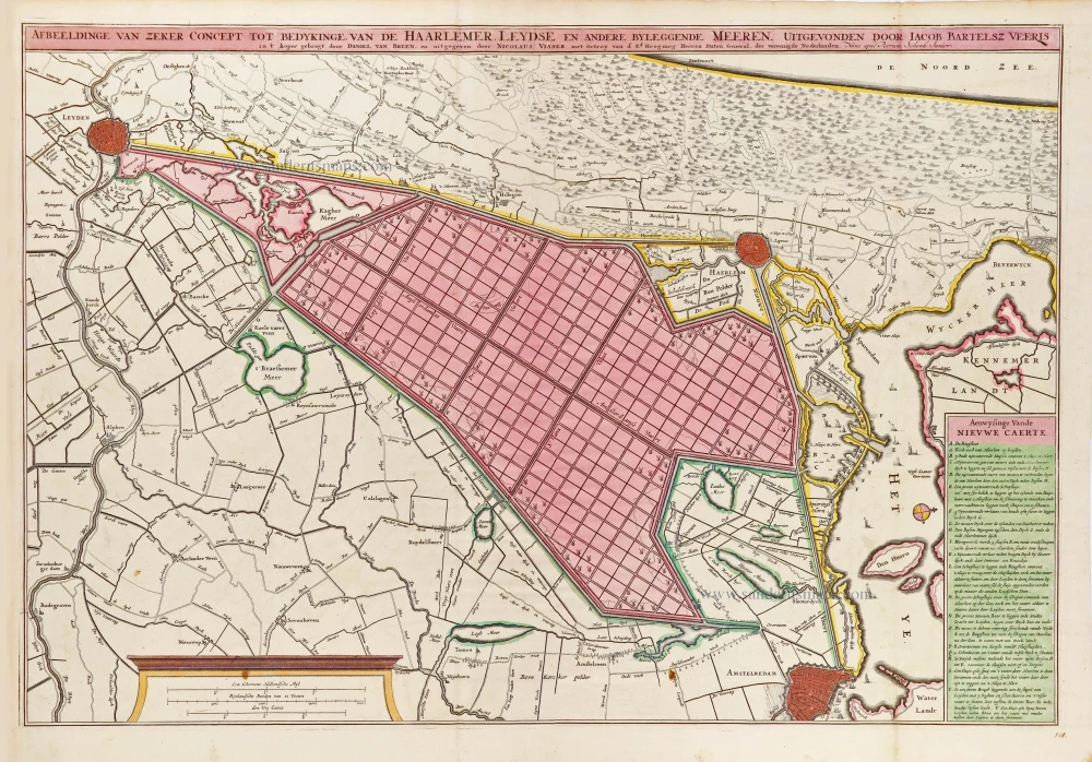
Polder map of Holland, by Nicolaas Visscher, published by Petrus Schenk Jr. c. 1750
Afbeeldinge van zeker concept tot bedykinge van de Haarlemer,...
[Item number: 28918]
Northern Brabant, by W. Blaeu. 1643-50
Quarta Pars Brabantiae cujus caput Sylvaducis.
[Item number: 26304]
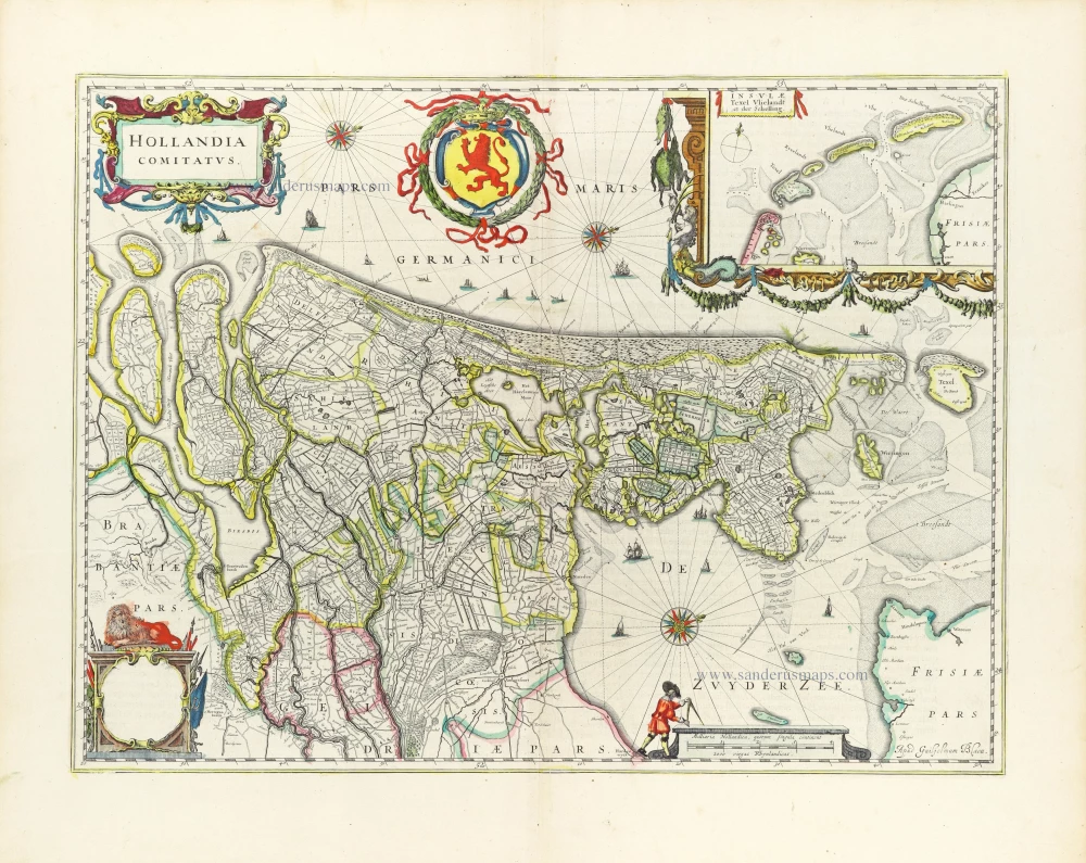
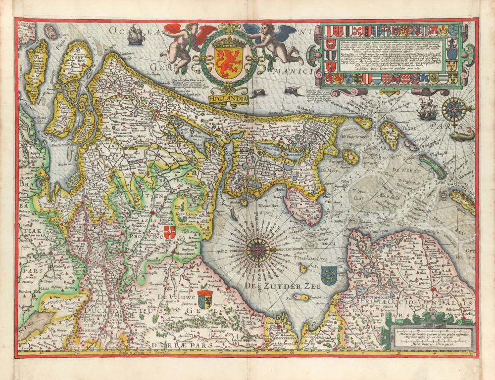
Holland by Willem Blaeu 1643
Hollandia Comitatus.
[Item number: 30182]
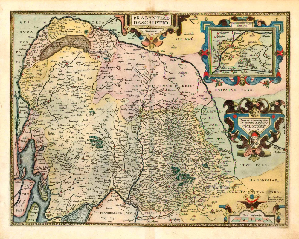
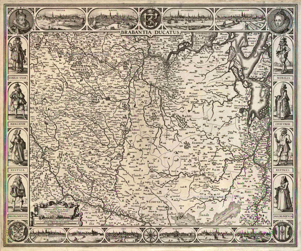
Brabant, by A. Ortelius. 1595
Brabantiae Descriptio.
[Item number: 25573]
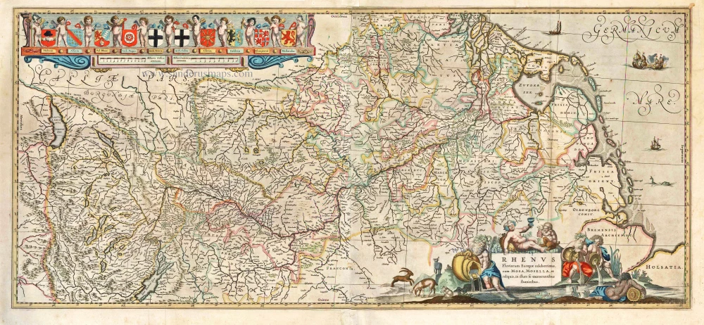
Rhine River, by H. Hondius & J. Janssonius. 1641
Rhenus Fluviorum Europae Celeberrimus, cum Mosa, Mosella, et...
[Item number: 26281]

Rare map
Kennemerland (Noord-Holland) by widow Nicolaas Visscher II, published by Petrus Schenk. c. 1715
Nieuwe Kaart van t' Baljuwschap van Kennemerland met de Bannen...
[Item number: 28277]
Overijssel, by Claes Jansz. Visscher. 1634
De Heerlyckheyt van Over-Yssel.
[Item number: 28032]
Scarce
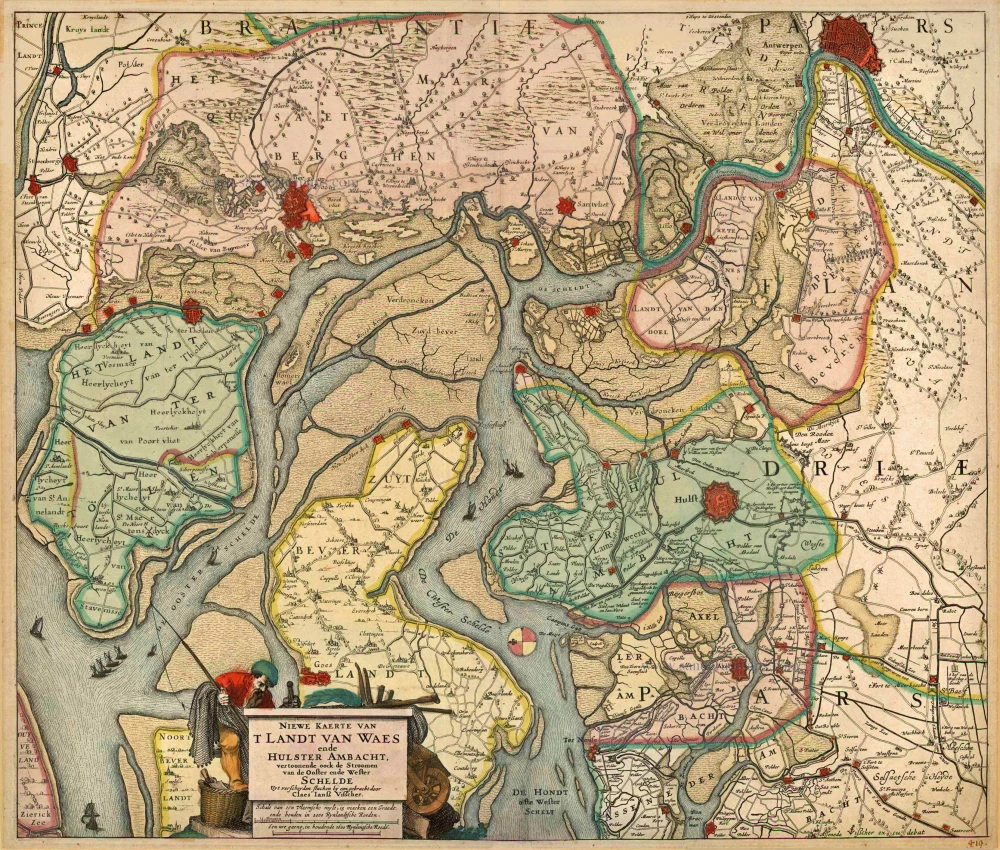
'T Land van Waas by CJ Visscher 1634
Niewe Kaerte van 't Landt van Waes ende Hulster Ambacht,...
[Item number: 18648]
Big and decorative map.
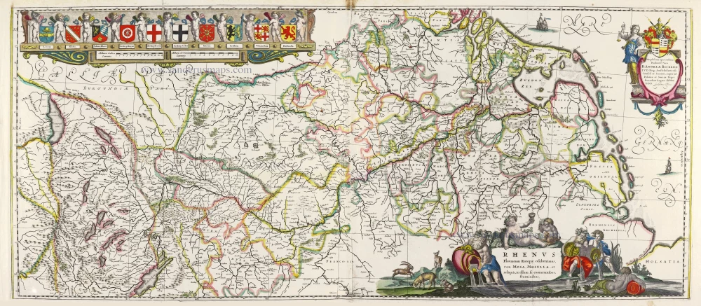
Rhine River, by Willem Blaeu. 1643
Rhenus Fluviorum Europae Celeberrimus, cum Mosa, Mosella, et...
[Item number: 29927]
Early edition
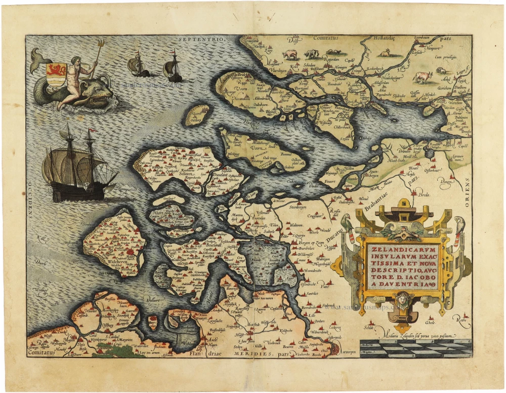
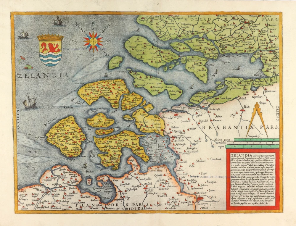
Zeeland by Abraham Ortelius. 1573
Zelandicarum Insularum exactissima et nova descriptio,
[Item number: 30967]
![[No title - With inset view of the town of Middelburg:] Middelburgum. [Costumed figures:] Seelandi](https://sanderusmaps.com/assets/WEBP/m30935.webp)
Zeeland by Petrus Kaerius, published by C.J. Visscher. c. 1630-1650
[No title - With inset view of the town of Middelburg:]...
[Item number: 30935]
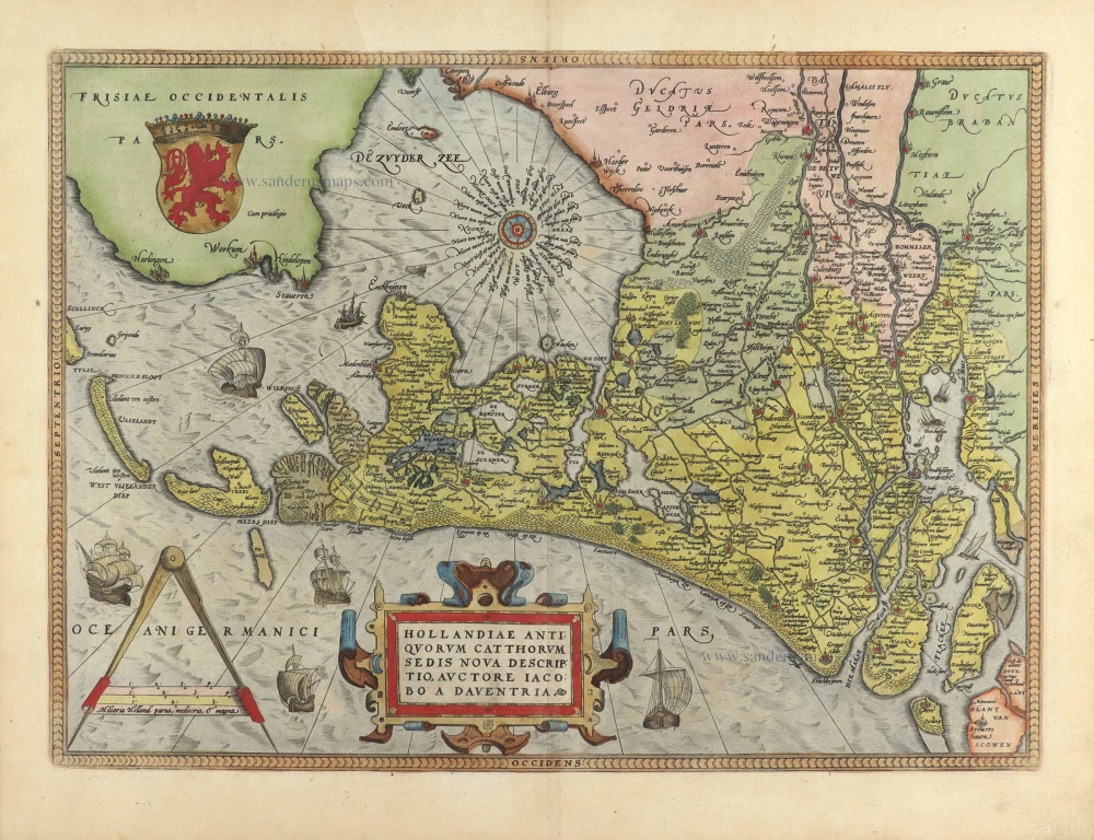
Holland, by Abraham Ortelius. 1584
Hollandiae Antiquorum Catthorum Sedis Nova Descriptio.
[Item number: 29547]
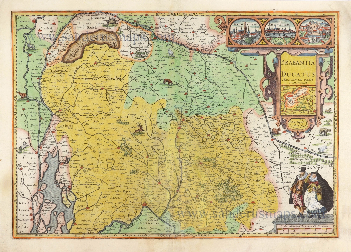
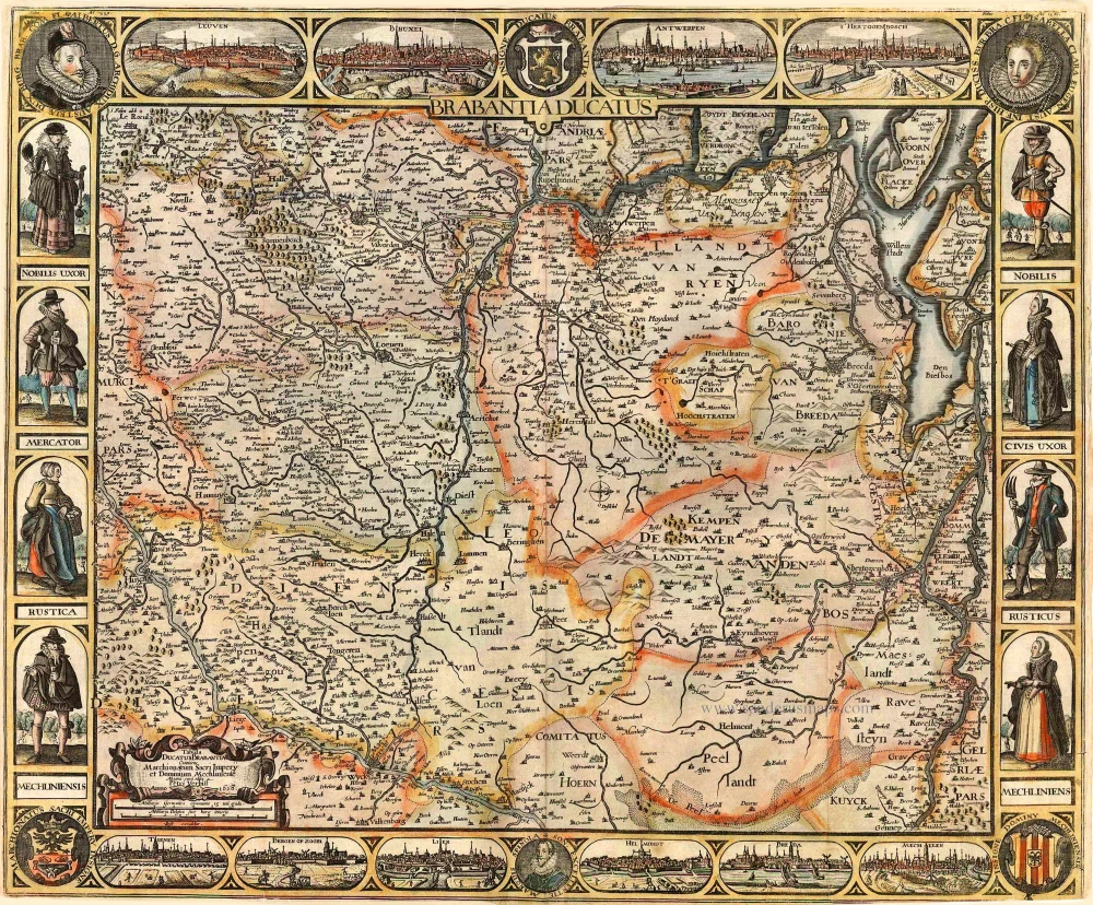
The Duchy of Brabant by Pieter van den Keere (Petrus Kaerius). 1617
Brabantia Ducatus Machliniae Urbis Dominium.
[Item number: 28672]
Holland by Petrus Kaerius (Pieter Van den Keere). 1617
Hollandia.
[Item number: 30257]
Scarce and decorative map
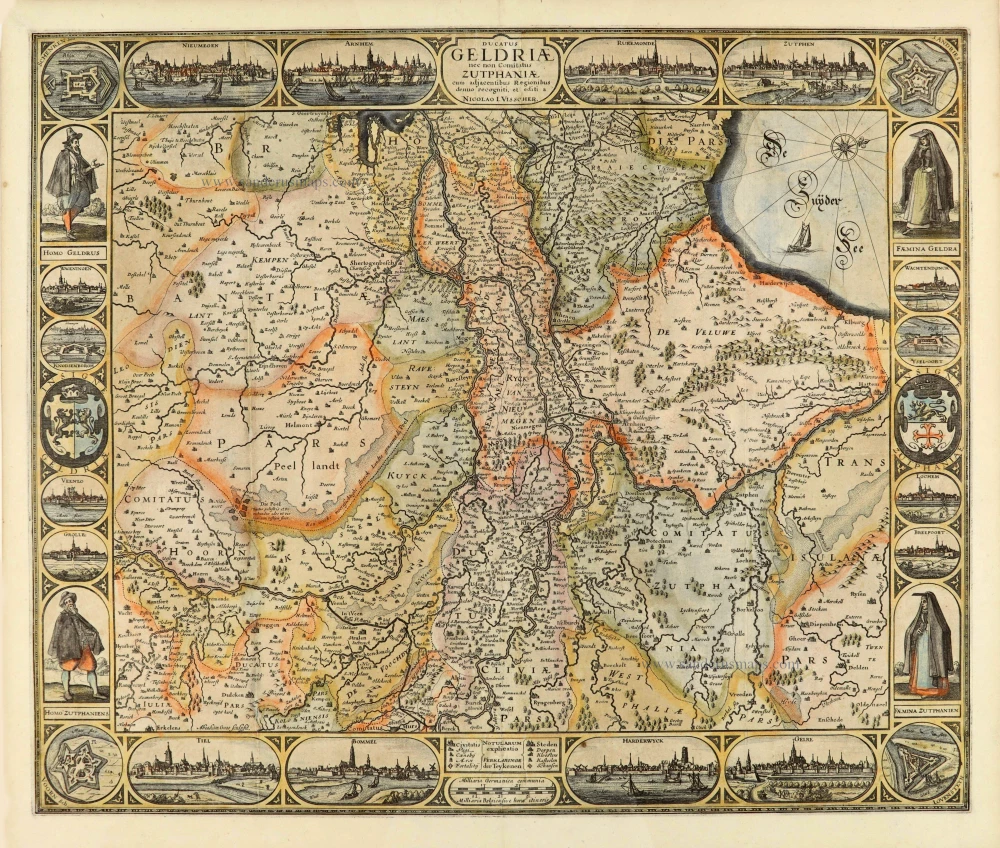
Gelderland, by Claes Jansz Visscher. 1634
Ducatus Geldriae nec non Comitatus Zutphiae cum adjacentibus...
[Item number: 28004]
Rare
Zeeland, by Gerard de Jode. 1593
Zelandia inferioris Germaniae pars ...
[Item number: 30910]
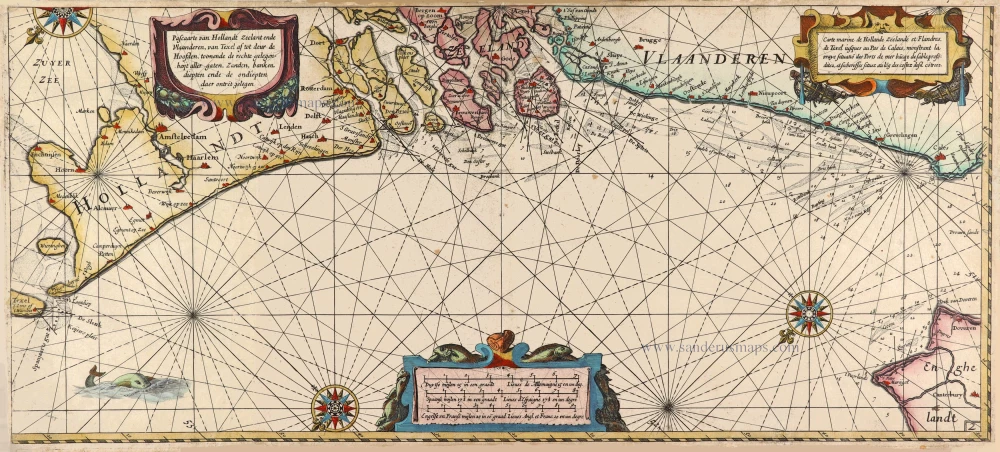
Rare sea chart of the Netherlands.
Willem Blaeu, pirate edition by Joannes Janssonius. 1620-1634
Pascaarte van Hollandt Zeelandt ende Vlaanderen, van Texel af...
[Item number: 30058]
Brabant by C.J. Visscher. 1622
Brabantia Ducatus / Tabula Ducatus Brabantiae Continens...
[Item number: 2640]
Very rare!
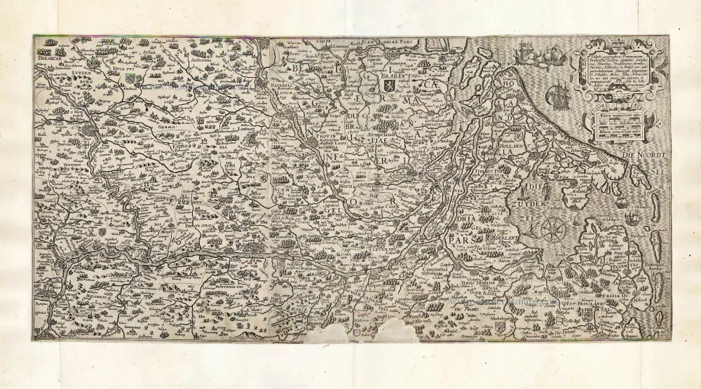
Rhine River by Cornelis Claesz. After 1630
Tabula geographica Prouinciarum Brabantiae, Geldriae comitatus...
[Item number: 27065]
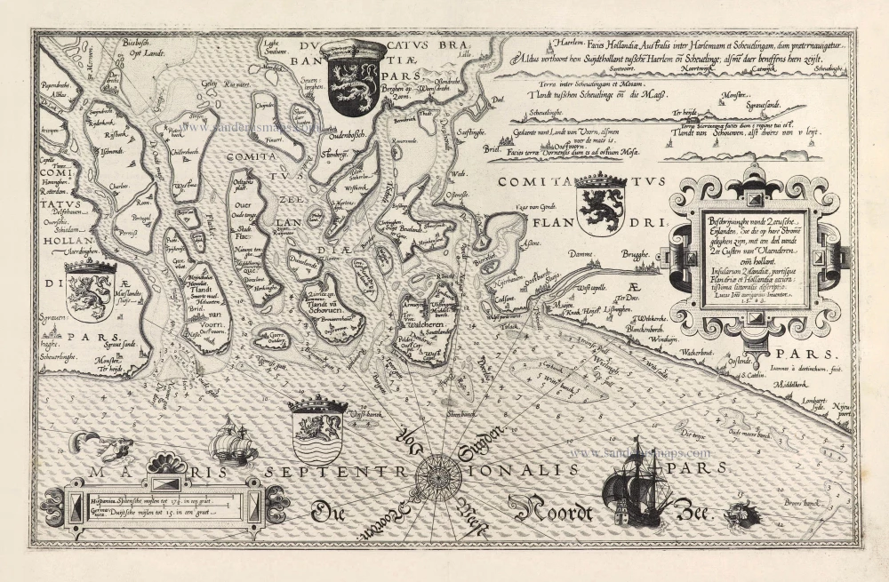
Rare and important sea chart.
Lucas Janszoon Waghenaer, Zeeland and Flanders. 1586
Beschrijvinghe vande Zeeusche Eijlanden Soe die op hare Strome...
[Item number: 28469]
Rare!
Brabant by Pieter Verbiest 1628
Brabantia Ducatus / Tabula Ducatus Brabantiae Continens...
[Item number: 27743]

Important and rare map.
Brabant, by Michele Tramezini. 1558
Brabantiae Belgarum Provinciae Recens Exactaque Descriptio.
[Item number: 26713]
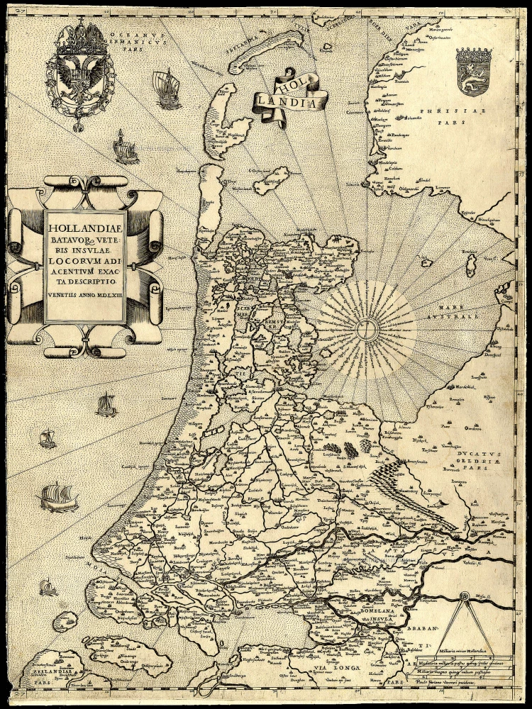
Rare and important map!
Holland, by Camocio G.F. - Forlani P. 1563
Hollandiae Batavor Veteris Insulae Locorum Adiacentium Exacta...
[Item number: 9232]
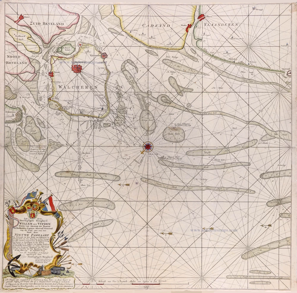
Very rare and important chart
Seachart of Oostende—Knokke by Stephanus van der Loeff en Bonifacius Cau, published van Joannes Van Keulen. 1799
Nieuwe Paskaart Van Oostende tot den Hoek van Schouwen en...
[Item number: 31168]
![[No title]](https://sanderusmaps.com/assets/WEBP/m25614.webp)
Navigation chart of utmost importance. Third known copy.
Zeeland and Flanders, Willem den Dooven, 1617.
[No title]
[Item number: 25614]