Antique maps catalogue
- All recent additions
-
Antique maps
- World and Polar
-
Europe
- Europe Continent
- Belgium
- Belgium - Cities
- The Low Countries
- The Netherlands
- The Netherlands - Cities
- Luxembourg
- France
- France - Cities
- Germany
- Germany - Cities
- Austria
- Italy
- Italy - Cities
- Spain and Portugal
- Greece & Greek Islands
- Switzerland
- British Isles
- British Isles - Cities
- Northern Europe
- Central Europe
- Eastern Europe
- Southeastern Europe
- America
- Asia
- Africa
- Mediterranean Sea
- Australia
- Oceans
- Celestial Maps
- Curiosities
- Books
- Medieval manuscripts
- Prints
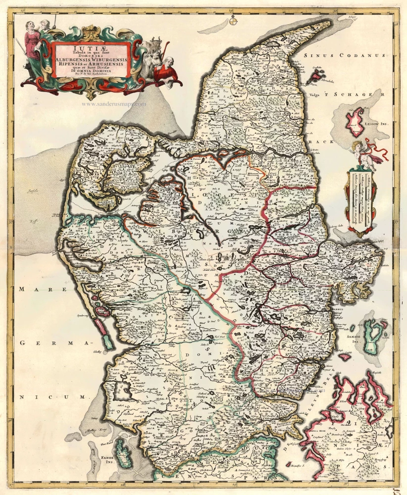
Denmark - Jutland, by F. De Wit. c. 1680
Iutiae Tabula in qua sunt Dioecesis Alburgensis, Wiburgensis, ...
[Item number: 2669]
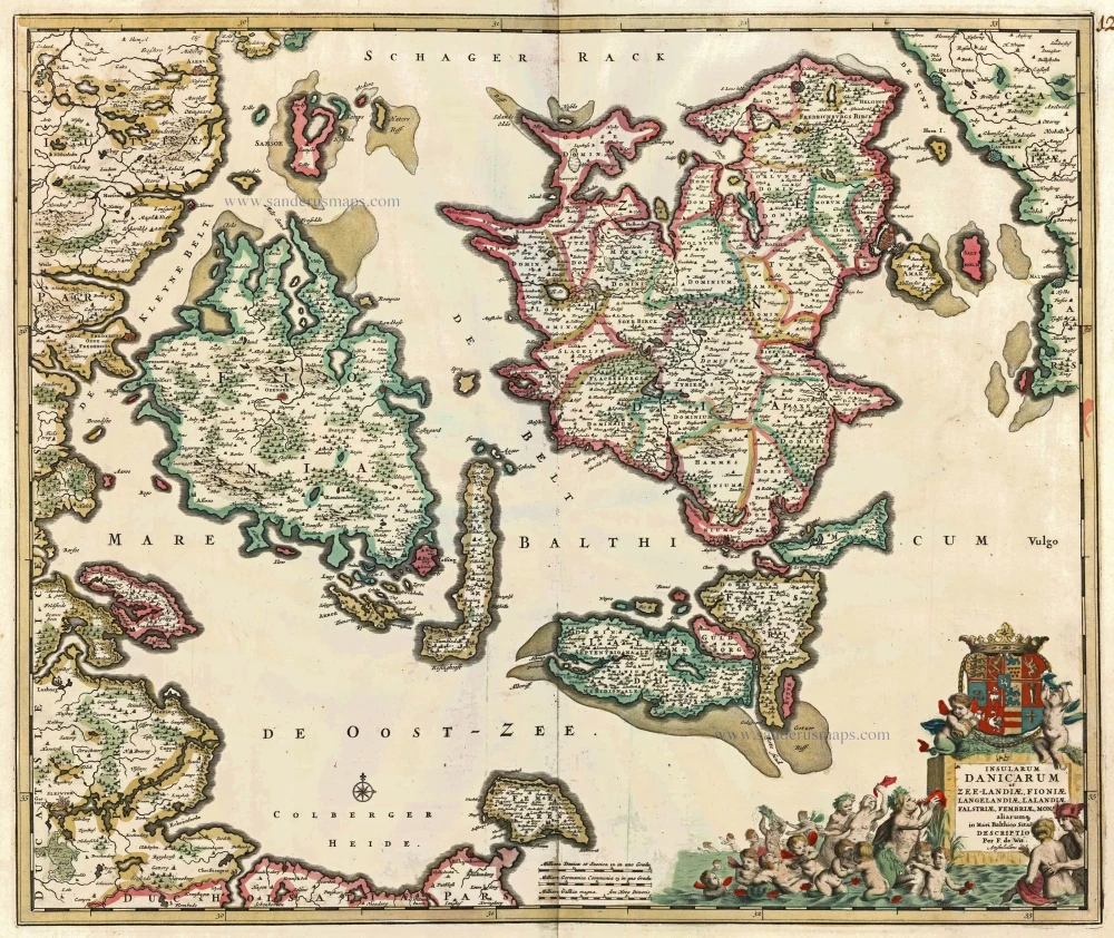
Danish Islands by de Wit F. c. 1682-86
Insularum Danicarum ut Zee-Landiae, Fioniae, Langelandiae, ...
[Item number: 24504]
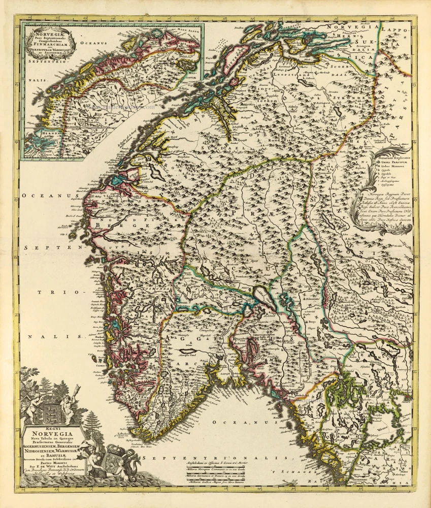
Norway by Frederik de Wit, published by Covens & Mortier. c. 1715
Regni Norvegia Nova Tabula in Quinque Praefecturas Generalis ...
[Item number: 28266]

Finland & Sweden by Frederik de Wit, published by Covens & Mortier. c. 1715
Regni Sueciae Tabula Generalis, divisa in Sueciae, Gotiae Regna ...
[Item number: 28267]
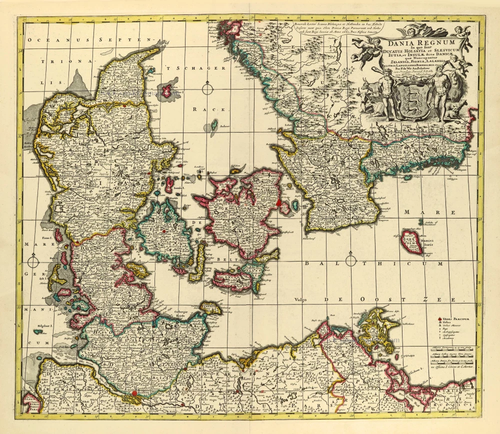
Denmark by Frederik de Wit, published by Covens & Mortier. after 1721
Dania Regnum In quo sunt Ducatus Holsatia et Slesvicum Iutia, et ...
[Item number: 28268]
First edition
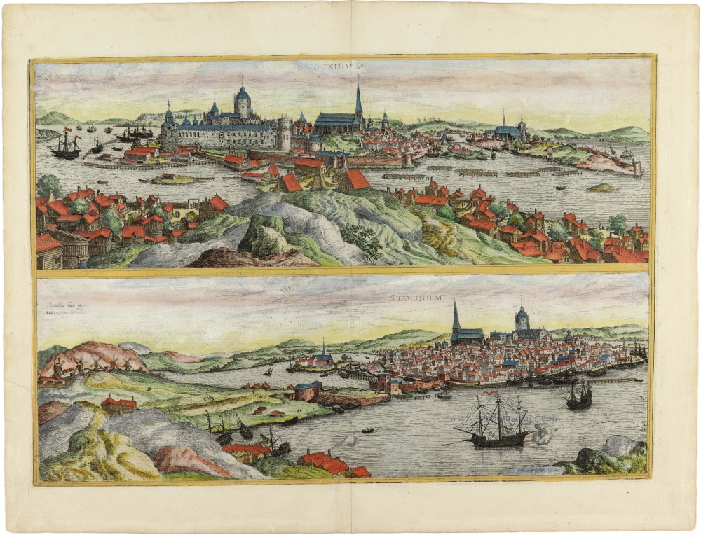
Stockholm, by Georg Braun and Frans Hogenberg. 1588
Stockholm.
[Item number: 30937]
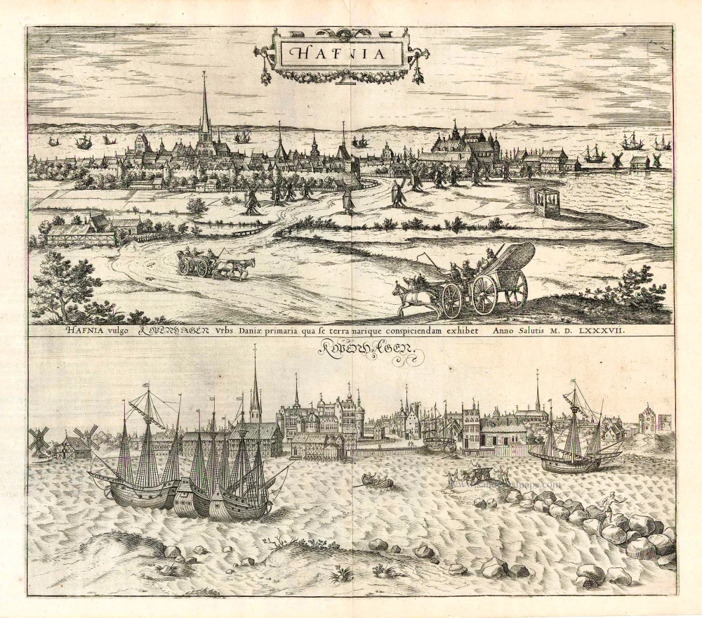
Copenhagen, by Georg Braun and Frans Hogenberg. 1590
Hafnia vulgo Kopenhagen.
[Item number: 26783]
First edition
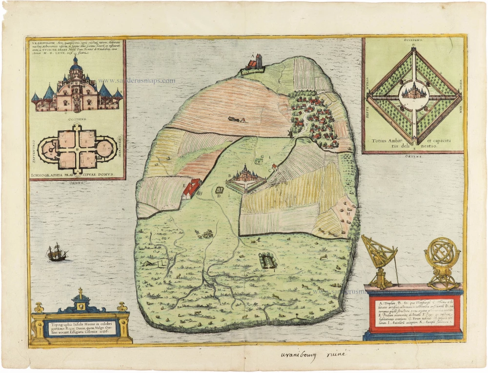
The Island of Hven (Denmark), by Georg Braun & Frans Hogenberg. 1588
Topographia Insulae Huenae in Celebri Porthmo Regni Daniae, quem ...
[Item number: 30959]
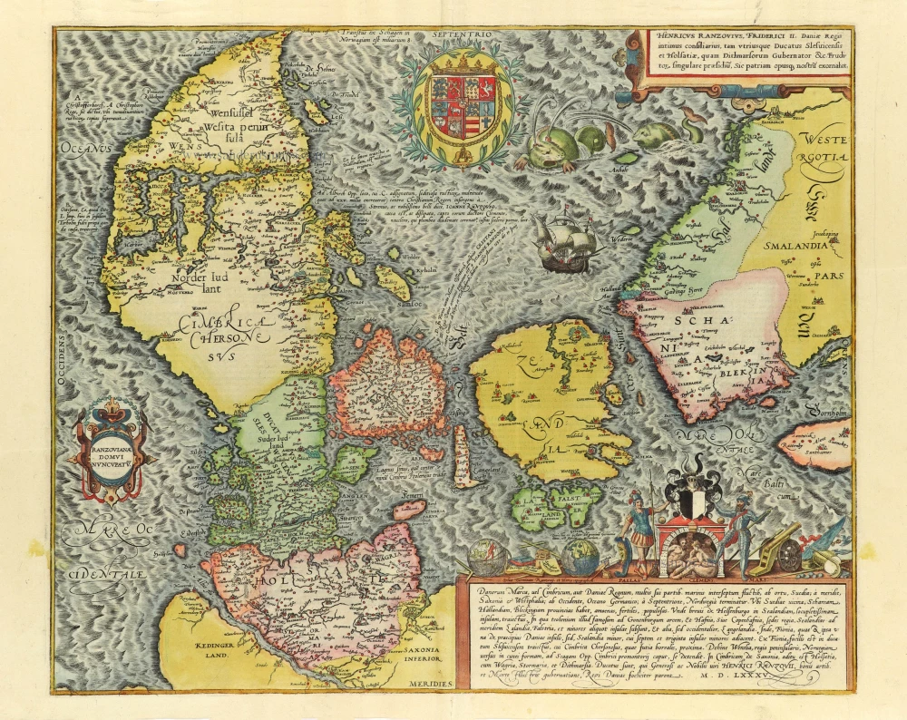
Famous map of Denmark by Marcus Jordan
Denmark, by Georg Braun & Frans Hogenberg. c. 1593
Danorum Marca, vel Cimbricum, aut Daniae Regnum ...
[Item number: 31044]
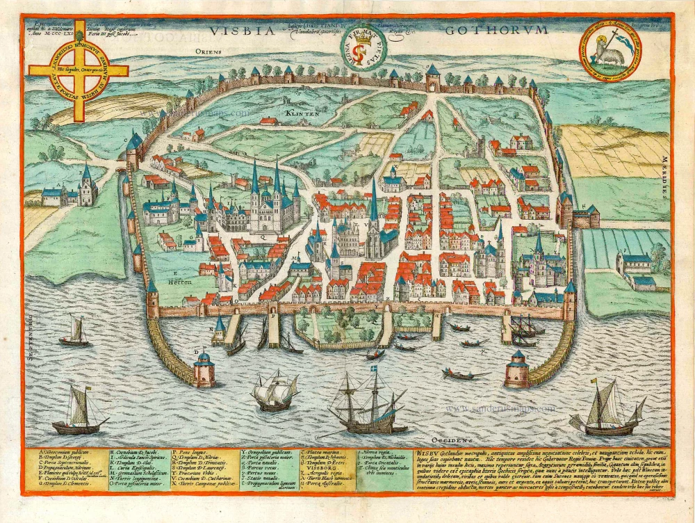
Visby on Gotland, by Georg Braun and Frans Hogenberg. 1600
Visbia Gothorum.
[Item number: 27635]
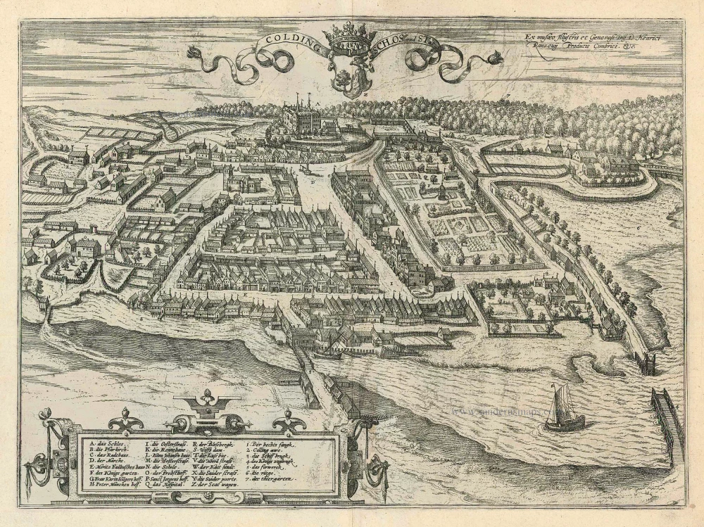
Kolding by Braun and Hogenberg 1596
Colding Schloss und Stat
[Item number: 24163]
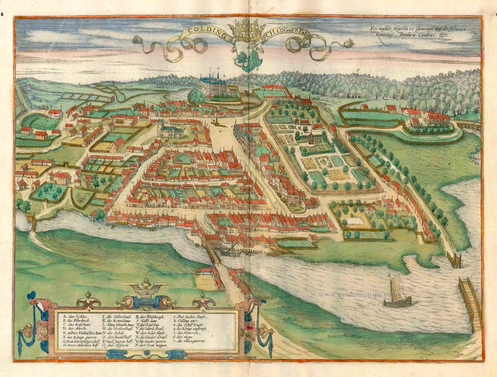
Kolding, by Georg Braun and Frans Hogenberg. c. 1610
Colding Schloss und Stat
[Item number: 16693]
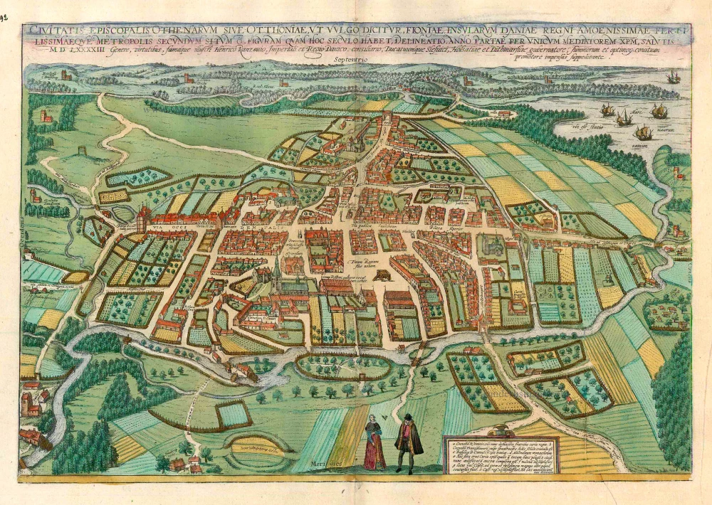
Odense, by Georg Braun and Frans Hogenberg. c. 1610
Civitates Episcopalis Othenarum sive Otthoniae, ut vulgo ...
[Item number: 16703]
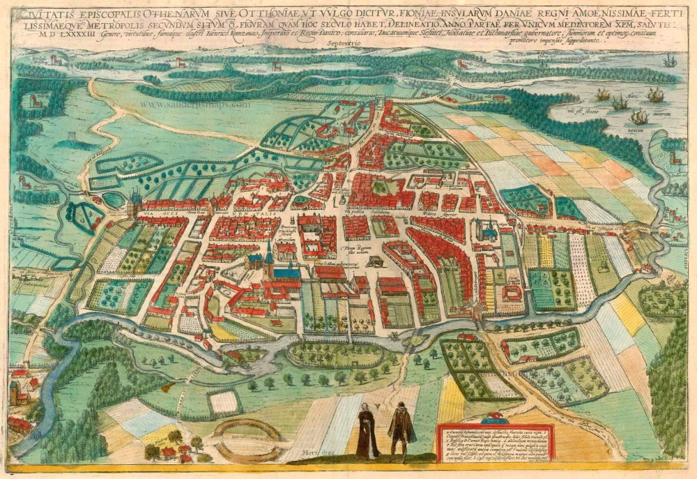
Odense, by Georg Braun and Frans Hogenberg. 1596-1640
Civitates Episcopalis Othenarum sive Otthoniae, ut vulgo ...
[Item number: 23372]
![Elsenor [on sheet with] Ripen](https://sanderusmaps.com/assets/WEBP/m23375.webp)
Helsingør (Sjaelland) & Ribe (Jutland), by Georg Braun and Frans Hogenberg. 1596-1640
Elsenor [on sheet with] Ripen
[Item number: 23375]
![Danorum Marchiae seu Cimbrici Regnum Continentis Iutiae Ducatum [on sheet with] Chorographica Ducatum Holstatiae Schleswicae et Stormariae](https://sanderusmaps.com/assets/WEBP/m30947.webp)
Rare
Norway - Denmark by Gerard de Jode 1593
Danorum Marchiae seu Cimbrici Regnum Continentis Iutiae Ducatum ...
[Item number: 30947]
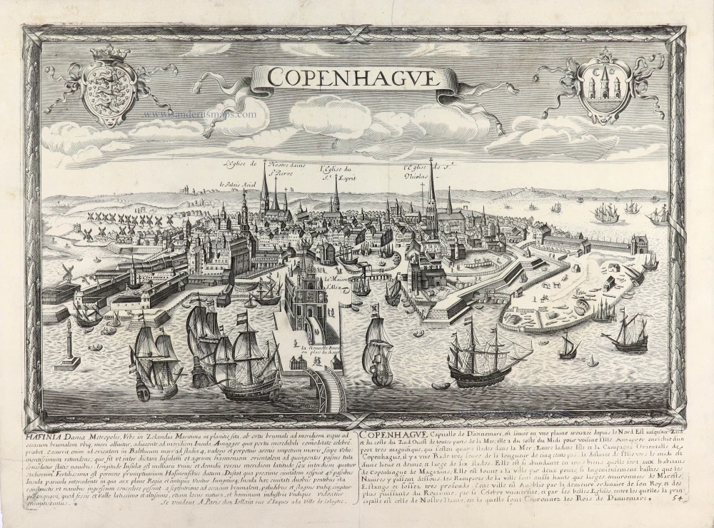
Panoramic view of Copenhagen by Gerard Jollain. c. 1678
Copenhague - Hafinia Daniae Metropolis, Urbs in Zelandia ...
[Item number: 31339]
Rare
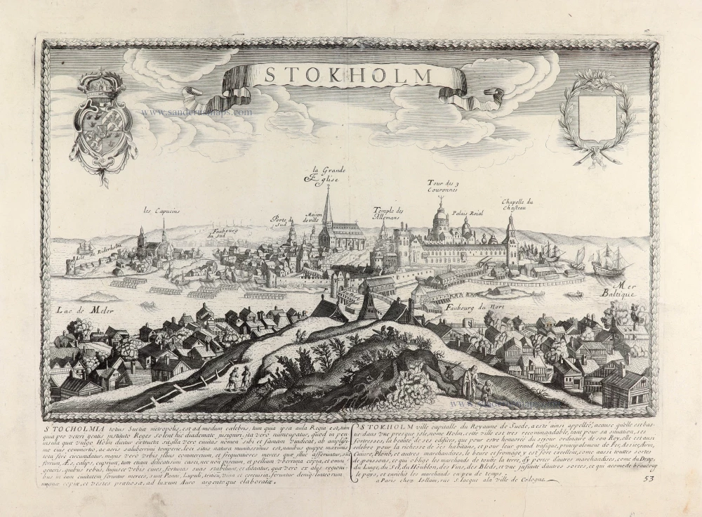
Gerard Jollain, panoramic view of Stockholm c. 1678
Stokholm - Stocholmia totius Suetia metropolis, est admodum ...
[Item number: 31340]
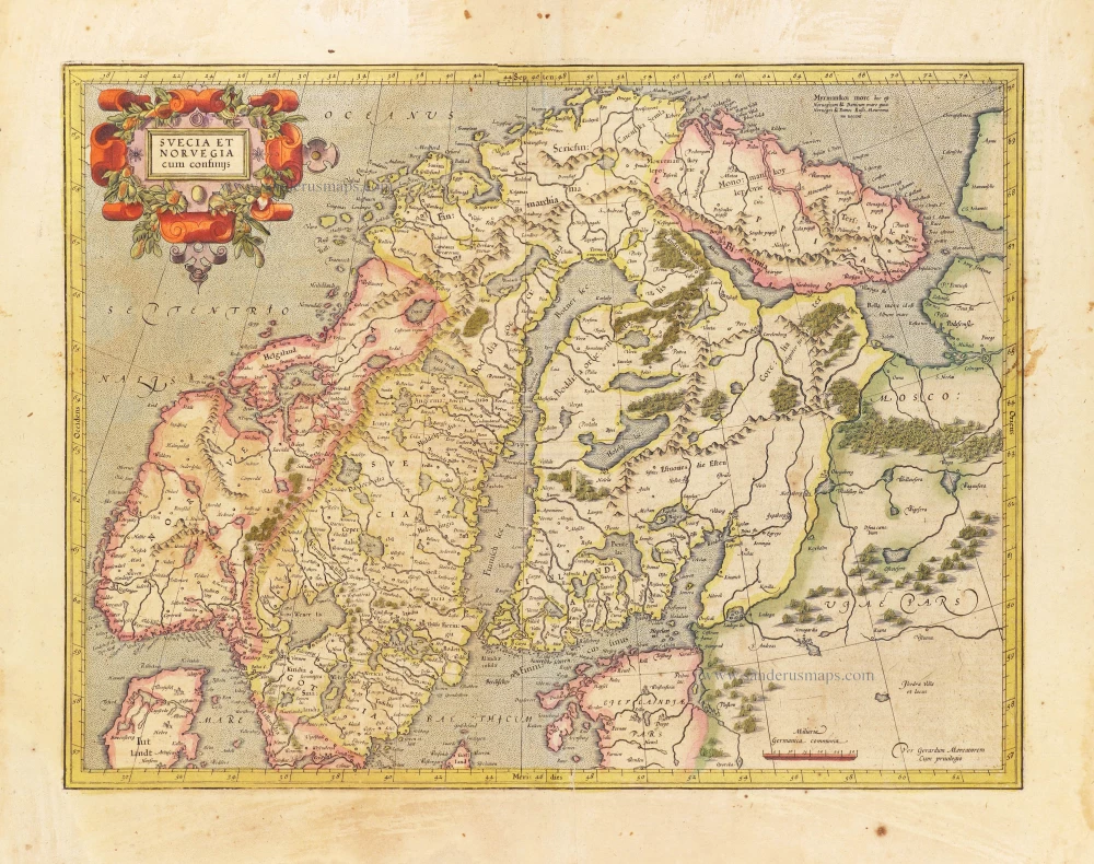
Scandinavia, by Gerard Mercator. 1628
Svecia et Norvegia cum confinijs.
[Item number: 28815]
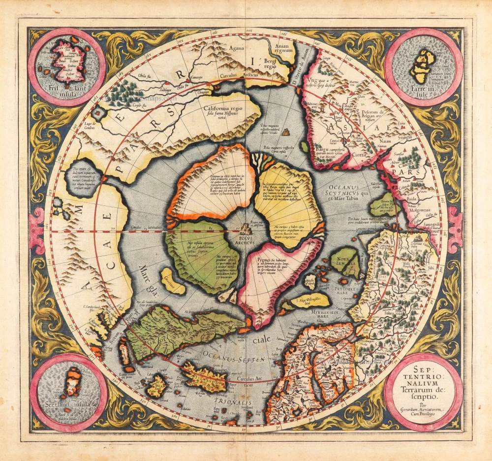
Very rare first state of Mercator's North Pole map.
Arctic Region - North Pole by Gerard Mercator, first state published by Rumold Mercator. 1595
Septentrionalium Terrarum descriptio.
[Item number: 29799]
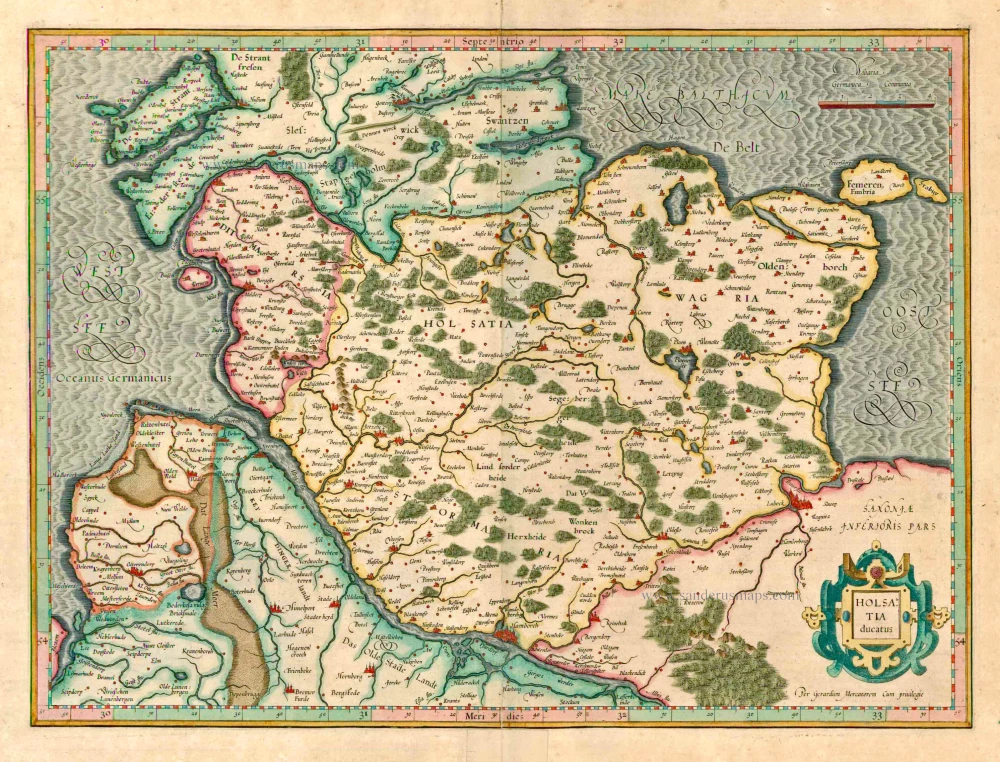
Holstein, by G. Mercator. 1623
Holsatia ducatus.
[Item number: 12555]
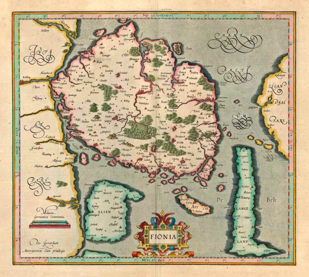
Denmark - Fyn, by Gerard Mercator. 1623
Fionia
[Item number: 12559]
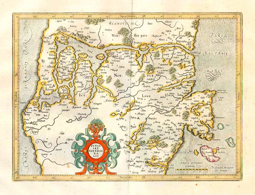
Jylland (North), by G. Mercator. 1641
Iutia Septentrionalis.
[Item number: 26286]
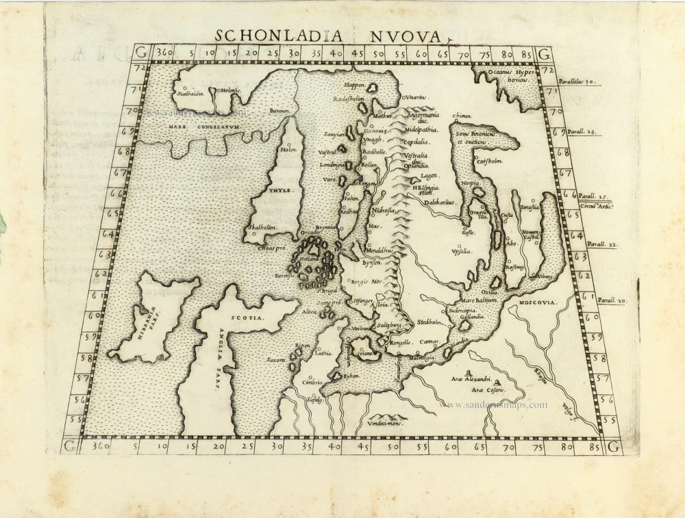
First edition.
Scandinavia by Girolamo Ruscelli. 1561
Schonladia Nuova.
[Item number: 31087]
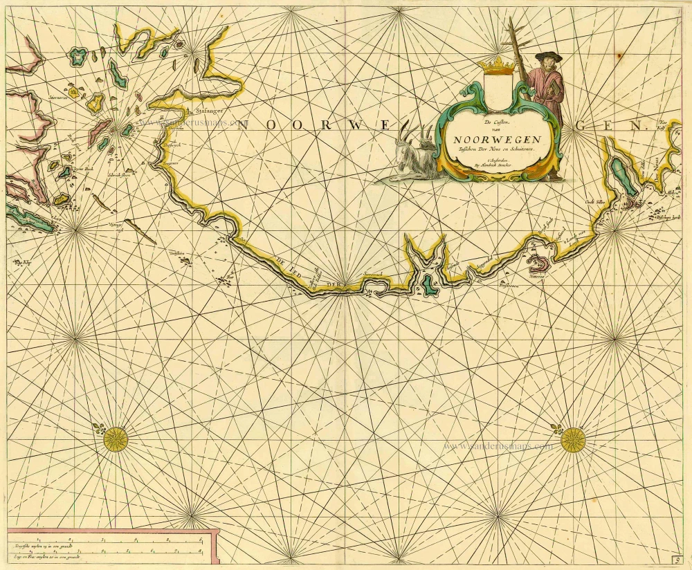
Sea chart of Norway, by Doncker H. 1686
De Custen van Noorwegen tusschen Der Neus en Schuitenes.
[Item number: 15775]
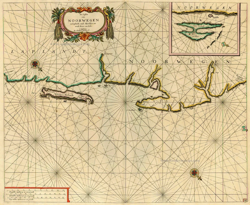
Sea chart of the coast of Norway, by Doncker H. 1686
De Custen van Noorwegen en Laplandt, vande Noord-kyn tot aende ...
[Item number: 12920]
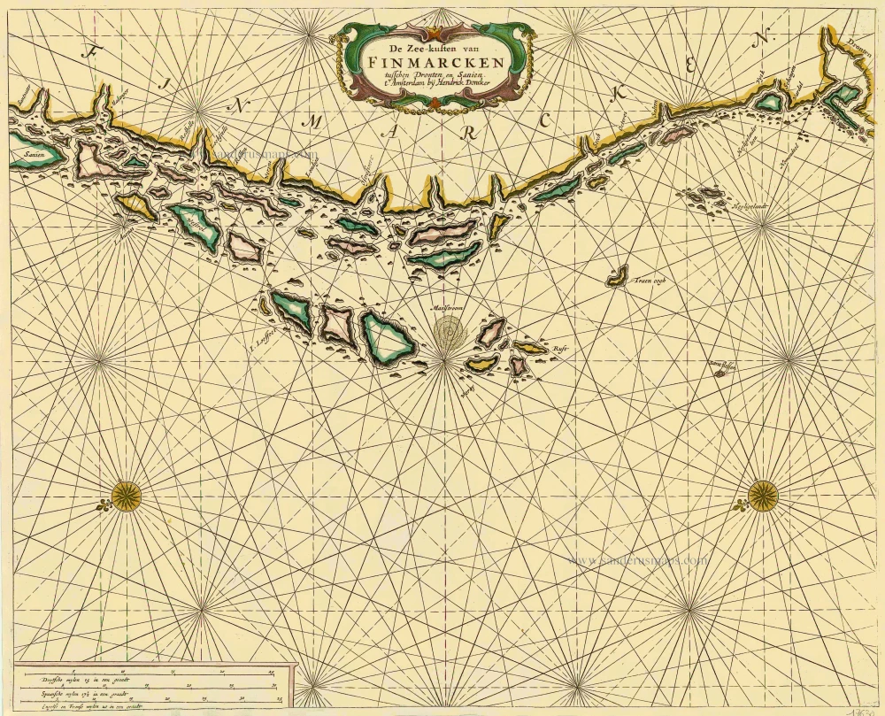
Sea chart of Norway - Finnmark, by Doncker H. 1686
De Zee-kusten van Finmarcken tusschen Dronten en Sanien.
[Item number: 17630]

Sea chart of Norway - Finnmark, by Doncker H. 1686
Caarte van Finmargken van 't Eylandt Sanien tot Noordkyn.
[Item number: 17900]
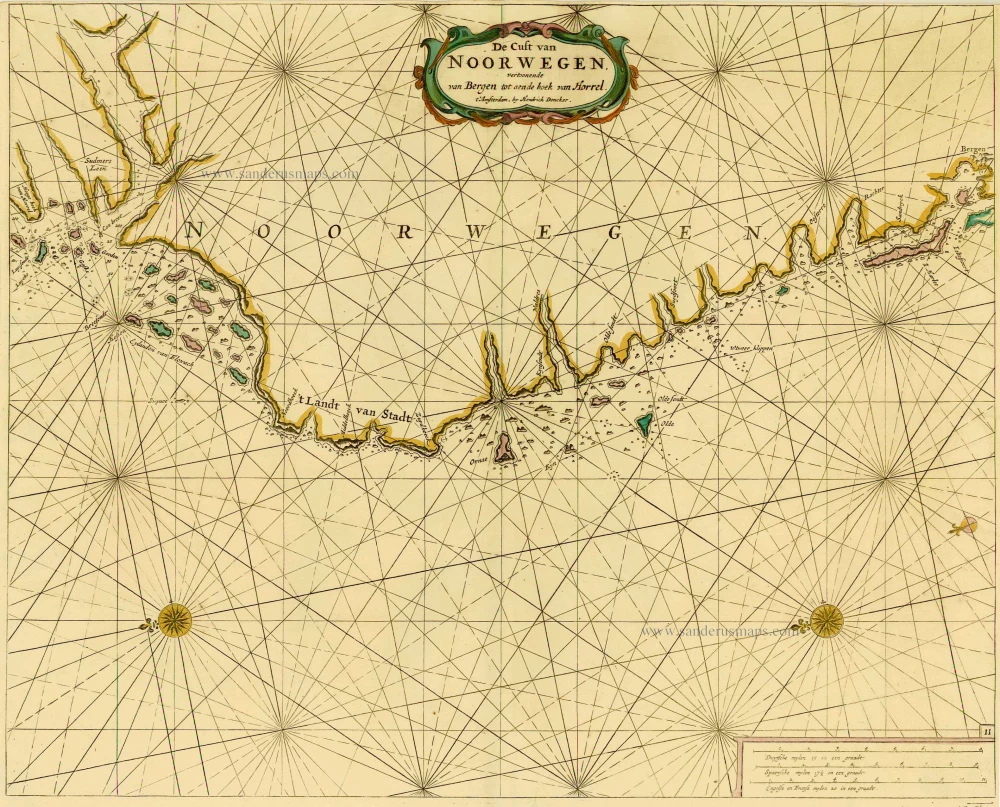
Norway, by Doncker H. 1686
De Cust van Noorwegen vertoonende van Bergen tot aen de hoek van ...
[Item number: 17064]
![Caarte van 't gat van Abbo, ofte Uttoy. [on sheet with] Caarte van 't Stochomse Liet.](https://sanderusmaps.com/assets/WEBP/m14593.webp)
Sea chart of Finland - Sweden, by Doncker H. 1686
Caarte van 't gat van Abbo, ofte Uttoy. [on sheet with] Caarte ...
[Item number: 14593]
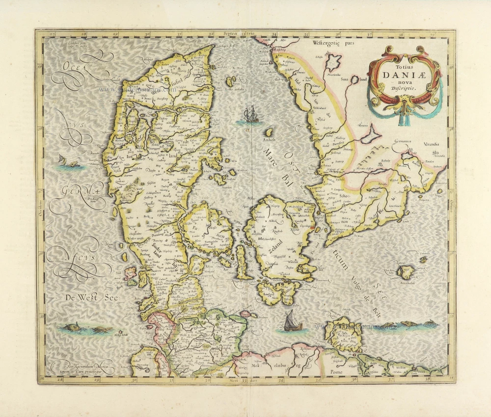
Denmark by Henricus Hondius. 1639-42
Totius Daniae nova descriptio.
[Item number: 28699]
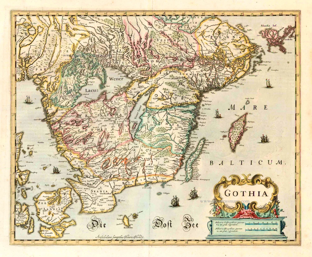
Götaland, by Henricus Hondius. 1641
Gothia.
[Item number: 26260]
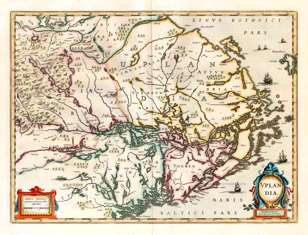
Uppland, by Henricus Hondius. 1641
Uplandia.
[Item number: 26261]
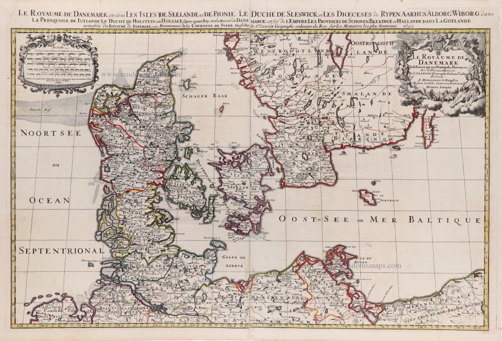
Denmark by N. Sanson, so-called published by Hubert Jaillot. (Pirated edition by Pierre Mortier). 1692
Le Royaume de Danemark Subdivisé en ses Principales Provinces.
[Item number: 31169]

Scandinavia by N. Sanson, so-called published by Hubert Jaillot. (Pirated edition by Pierre Mortier). 1692
La Scandinavie, et les Environs, ou sont les Royaumes de Suede ...
[Item number: 31170]
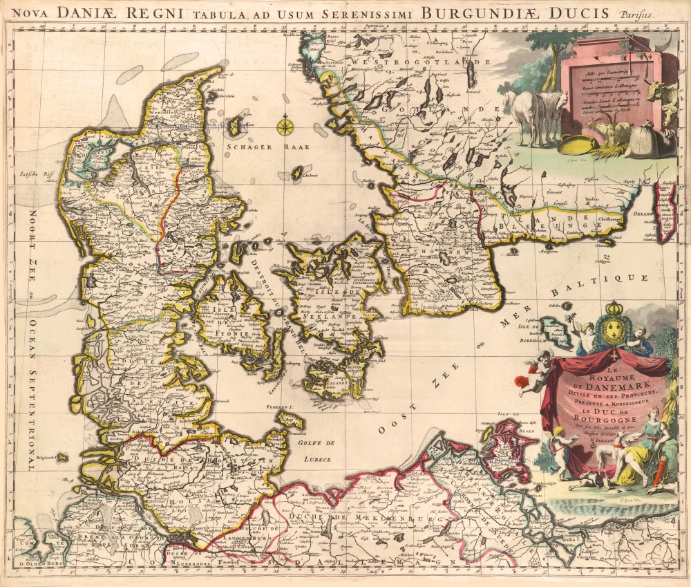
Denmark by Hubert Jaillot. c. 1709
Le Royaume de Danemark, Divisé en ses Provinces.
[Item number: 29589]