Antique maps catalogue
- All recent additions
-
Antique maps
- World and Polar
-
Europe
- Europe Continent
- Belgium
- Belgium - Cities
- The Low Countries
- The Netherlands
- The Netherlands - Cities
- Luxembourg
- France
- France - Cities
- Germany
- Germany - Cities
- Austria
- Italy
- Italy - Cities
- Spain and Portugal
- Greece & Greek Islands
- Switzerland
- British Isles
- British Isles - Cities
- Northern Europe
- Central Europe
- Eastern Europe
- Southeastern Europe
- America
- Asia
- Africa
- Mediterranean Sea
- Australia
- Oceans
- Celestial Maps
- Curiosities
- Books
- Medieval manuscripts
- Prints
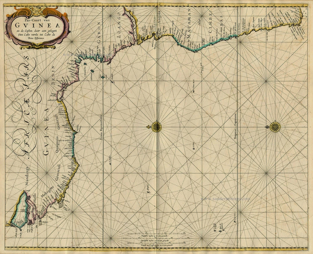
Sea chart of Guinea, by Pieter Goos. 1667
Pas-Caart van Guinea en de Custen daer aen Gelegen van Cabo ...
[Item number: 19060]
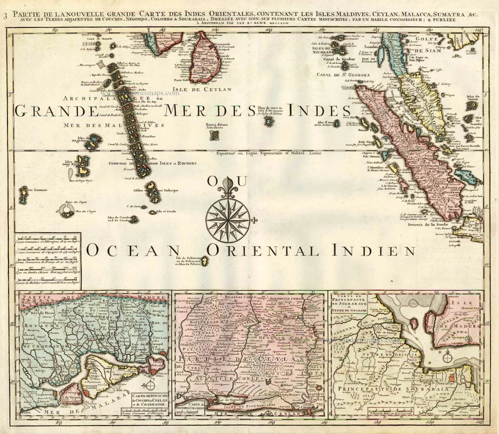
Indian Ocean (North), by J.B. Elwe. 1792
Partie de la Nouvelle Grande Carte des Indes Orientales, ...
[Item number: 2363]
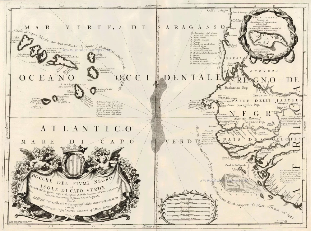
Cape Verde Islands, by Coronelli V.M. 1691
Bocche del Fiume Negro et Isole di Capo Verde
[Item number: 23167]
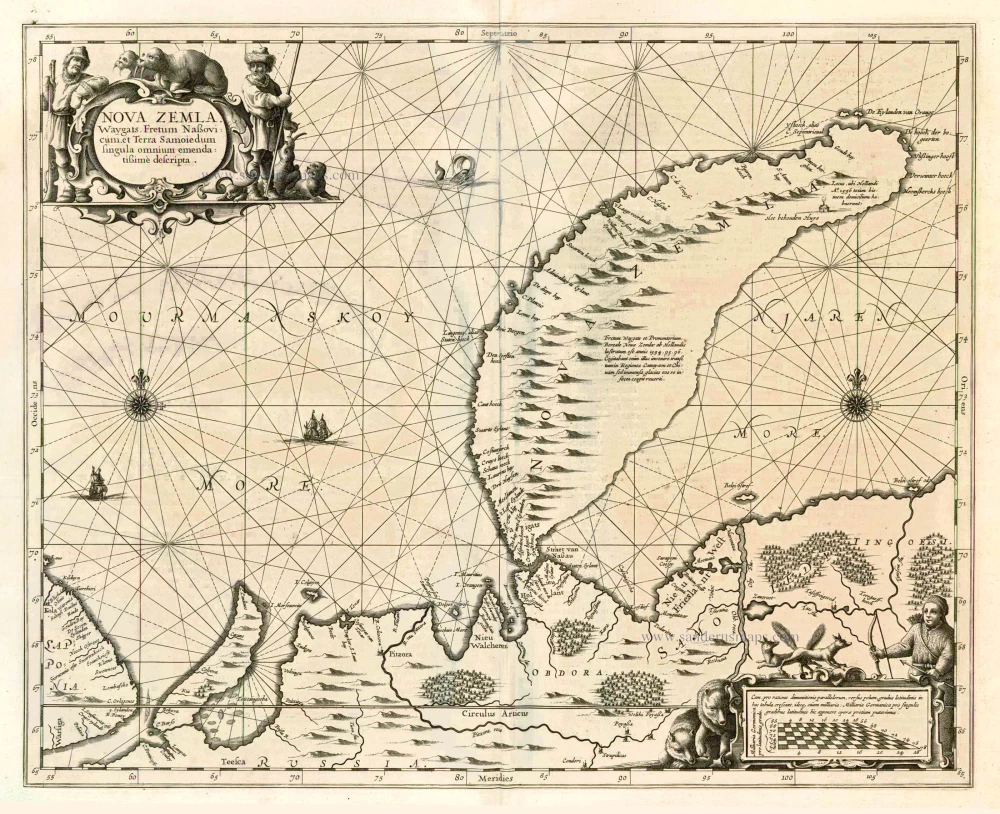
Chart of Novaya Zemlya, by J. Janssonius 1650
Nova Zemla, Waygats, Fretum Nassovicum, et Terra Samoiedum ...
[Item number: 6435]
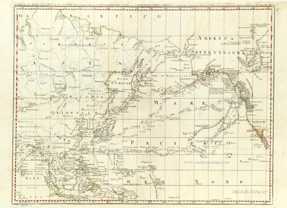
Chart of the Northern Pacific Ocean, Northeastern Asia, and Alaska by John Meares. 1796
Carta del Mar Pacifico del Nord che comprende la Costa ...
[Item number: 30731]
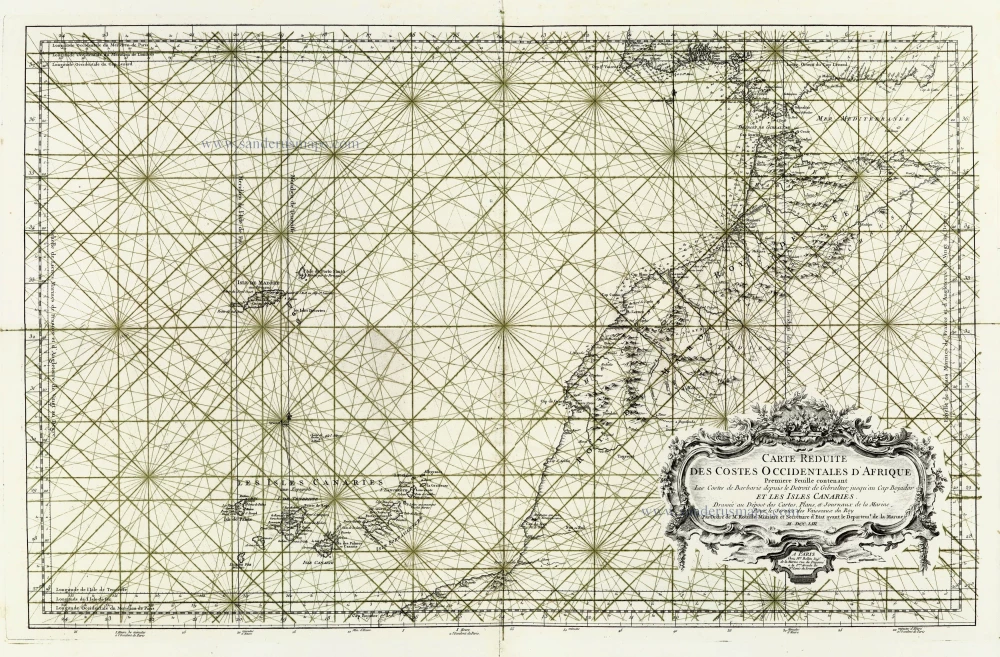
Canary Islands - Madeira , by J.N. Bellin. 1756-1770
Carte Reduite des Costes Occidentales d'Afrique ... et les Isles ...
[Item number: 28116]
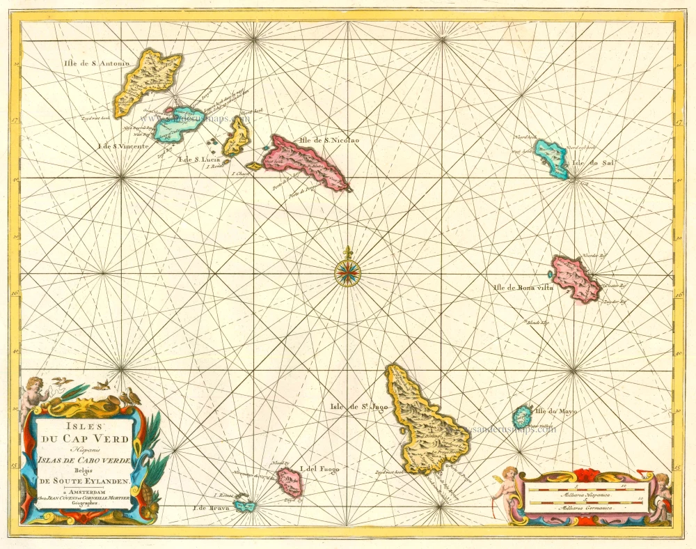
Cape Verde Islands, by Covens & Mortier. 1721-41
Isles du Cap Verd Hispanis Islas de Cabo Verde Belgis de Soute ...
[Item number: 23621]
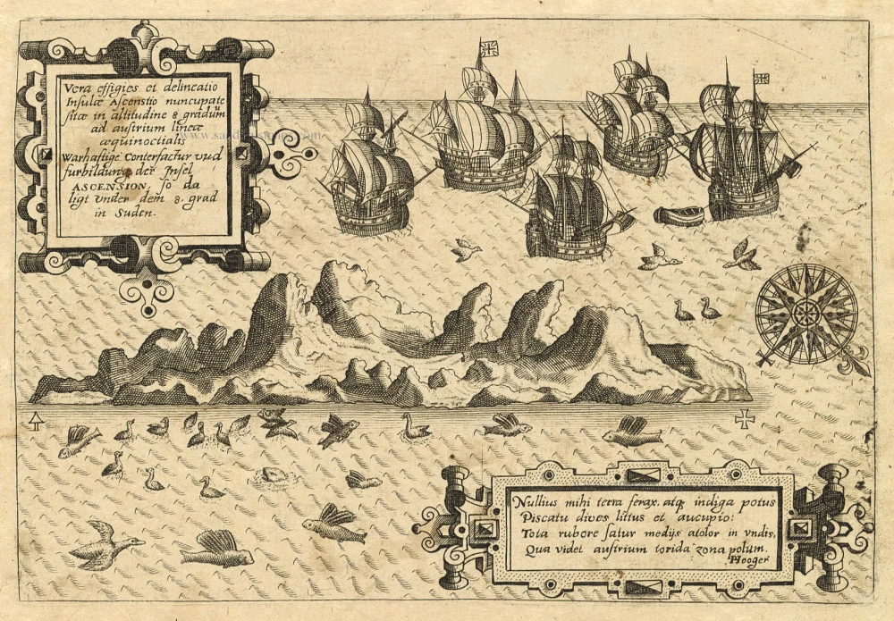
Old antique map of Ascension by Th. de Bry 1598-1613
Vera Effigies et Delineatio Insulae, Ascenstio Nuncupatae Sitae ...
[Item number: 20732]
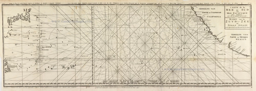
Map of the southern Pacific, showing a part of the path of George Anson's voyage around the world. 1751
Carte de la Mer du Sud ou Mer Pacifique entre l'Equateur et le ...
[Item number: 30609]
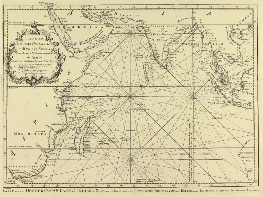
Indian Ocean by Jacques Nicolas Bellin. 1747
Carte de L'Ocean Oriental ou Mer des Indes.
[Item number: 28190]
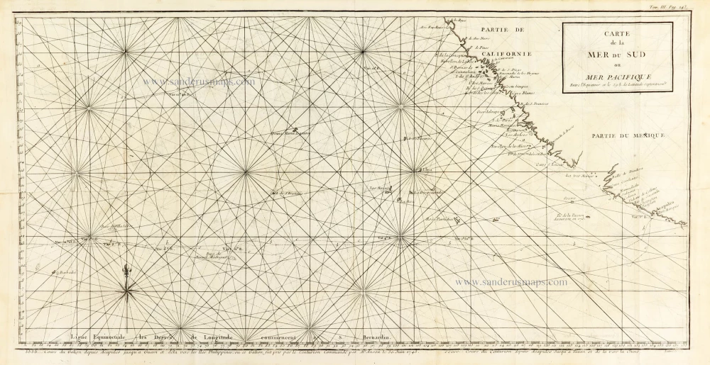
Map of the southern Pacific, showing a part of the path of George Anson's voyage around the world. 1748
Carte de la Mer du Sud ou Mer Pacifique. Entre l'Equateur et le ...
[Item number: 30330]