Antique maps catalogue
- All recent additions
-
Antique maps
- Polar maps
- World
-
Europe
- Europe Continent
- Belgium
- Belgium - Cities
- The Low Countries
- The Netherlands
- The Netherlands - Cities
- Luxembourg
- France
- France - Cities
- Germany
- Germany - Cities
- Austria
- Italy
- Italy - Cities
- Spain and Portugal
- Greece & Greek Islands
- Switzerland
- British Isles
- British Isles - Cities
- Northern Europe
- Central Europe
- Eastern Europe
- Southeastern Europe
- America
- Asia
- Africa
- Mediterranean Sea
- Australia
- Oceans
- Celestial Maps
- Curiosities
- Title Pages
- Books
- Medieval manuscripts
- Prints

The first sea chart - wall map - relating to North America to use the Mercator projection
Atlantic Ocean. by P. Goos - J. Van Keulen c. 1680
West-Indische Paskaert waer in de graden der breedde over...
[Item number: 25938]

First state of one of the most beautiful and important portolan charts of Europe.
Europe by L.J. Waghenaer 1585
Universe Europae Maritime eiusque Navigationis Descriptio. |...
[Item number: 32269]
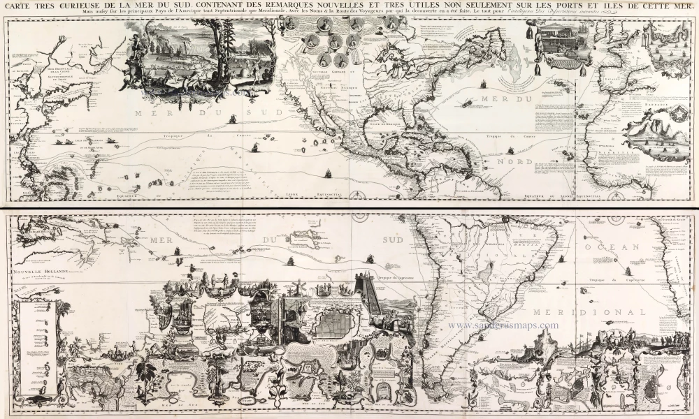
One of the most elaborately engraved maps ever published.
Pacific by Zacharias Châtelain after Nicolas de Fer. 1719
Carte tres Curieuse de la Mer du Sud, Contenant des Remarques...
[Item number: 29466]
Very rare second state, including the Tasman discoveries (Australia).
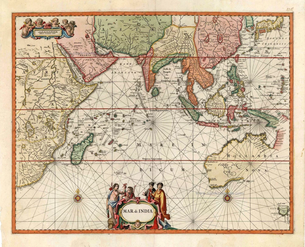
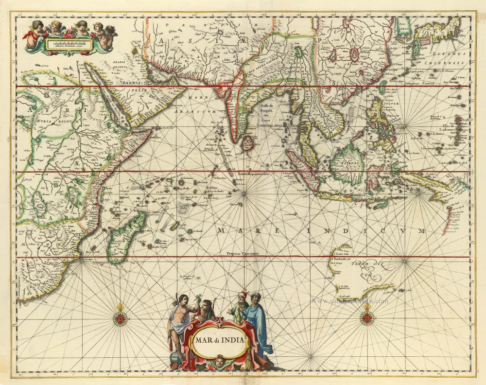
Indian Ocean, by Petrus Schenk c. 1700
Mar di India.
[Item number: 27775]
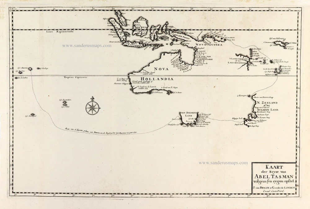
Important map with Tasman's first voyage
Valentyn François, Australia 1726
Kaart der Reyse van Abel Tasman Volgens syn eygen Opstel.
[Item number: 31086]
Important map.
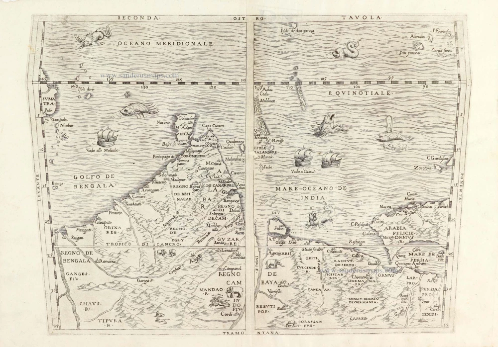
South Asia by G.B. Ramusio. 1563
Seconda Tavola.
[Item number: 29488]
First folio sea chart from the Dutch Golden Age
Indian Ocean by J. Janssonius 1650
Mar di India.
[Item number: 32184]

Important map
West Africa, by Linschoten J.H. van 1596
Typus orarum maritimarum Guineae, Manicongo, & Angolae ... /...
[Item number: 32214]
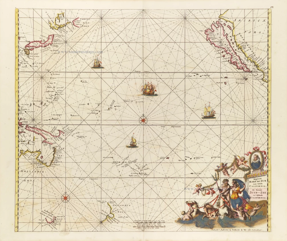
Pacific Ocean, by Frederick de Wit. c. 1680
Magnum Mare del Zur cum Insula California = De Groote Zuyd-Zee...
[Item number: 29241]

Secret Atlas Chart - very rare
Mauritius, by J. Van Keulen II. 1753
Paskaart van 't Eyland MAURITIUS, geleegen in de Oostindische...
[Item number: 30986]
![[No title]](https://sanderusmaps.com/assets/WEBP/m27086.webp)
Rare.
Atlantic Ocean - Europe, Africa & Eastern Canada by Giovanni Francesco Camocio c. 1575
[No title]
[Item number: 27086]
Heightened in gold!
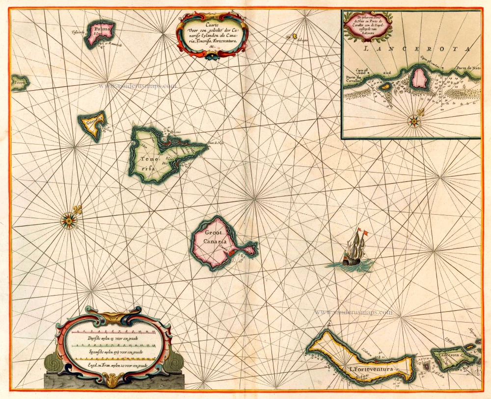
The Canary Islands, by Pieter Goos. 1666
Caarte voor en Gedeelte der Canarise Eylanden als Canaria,...
[Item number: 25612]
![[No title] Svalbard](https://sanderusmaps.com/assets/WEBP/m32420.webp)
Scarce and decorative map
Spitzbergen by Samuel Purchas 1625
[No title] Svalbard
[Item number: 32420]
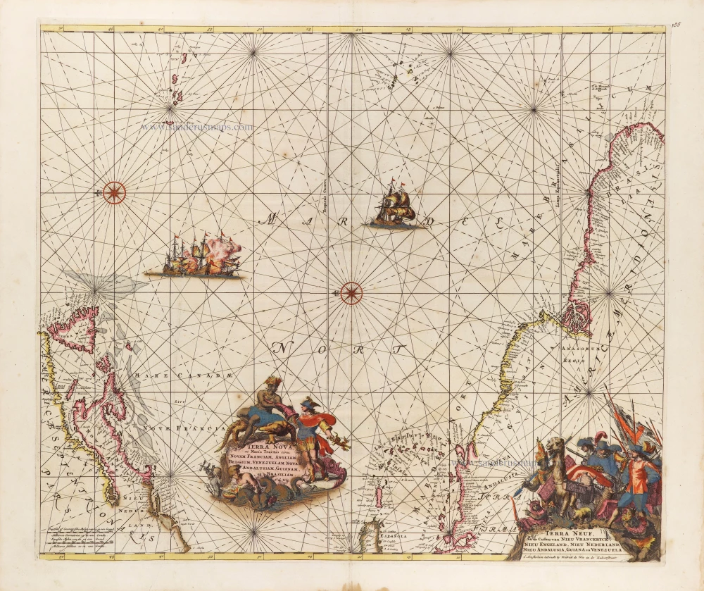
The Western Atlantic Ocean, by Frederick de Wit. c. 1680
Terra Nova ac Maris Tractus circa Novam Franciam, Angliam,...
[Item number: 29175]
![[No title]](https://sanderusmaps.com/assets/WEBP/m30730.webp)
Heightened in gold and silver
Atlantic Ocean by Theodore De Bry, Great Voyages, 1599
[No title]
[Item number: 30730]
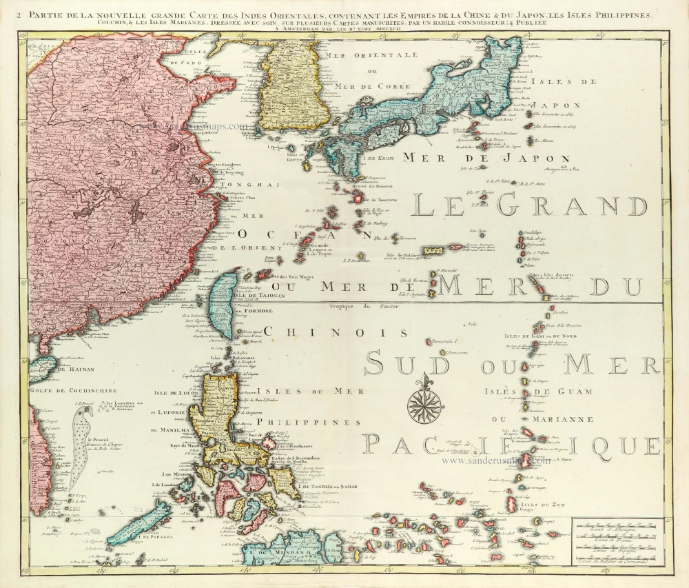
East Asia (Japan - Philippines) by J.B. Elwe. 1792
Partie de la Nouvelle Grande Carte des Indes Orientales...
[Item number: 31803]
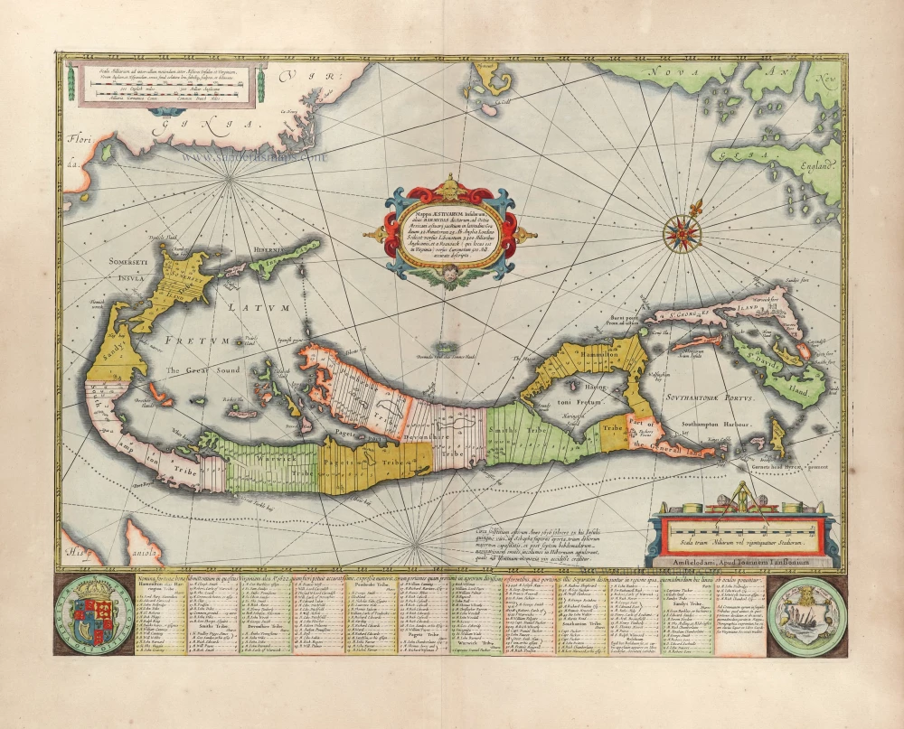
Bermuda by Joannes Janssonius. 1666
Mappa Aestivarum Insularum alias Barmudas dictarum, ...
[Item number: 29951]
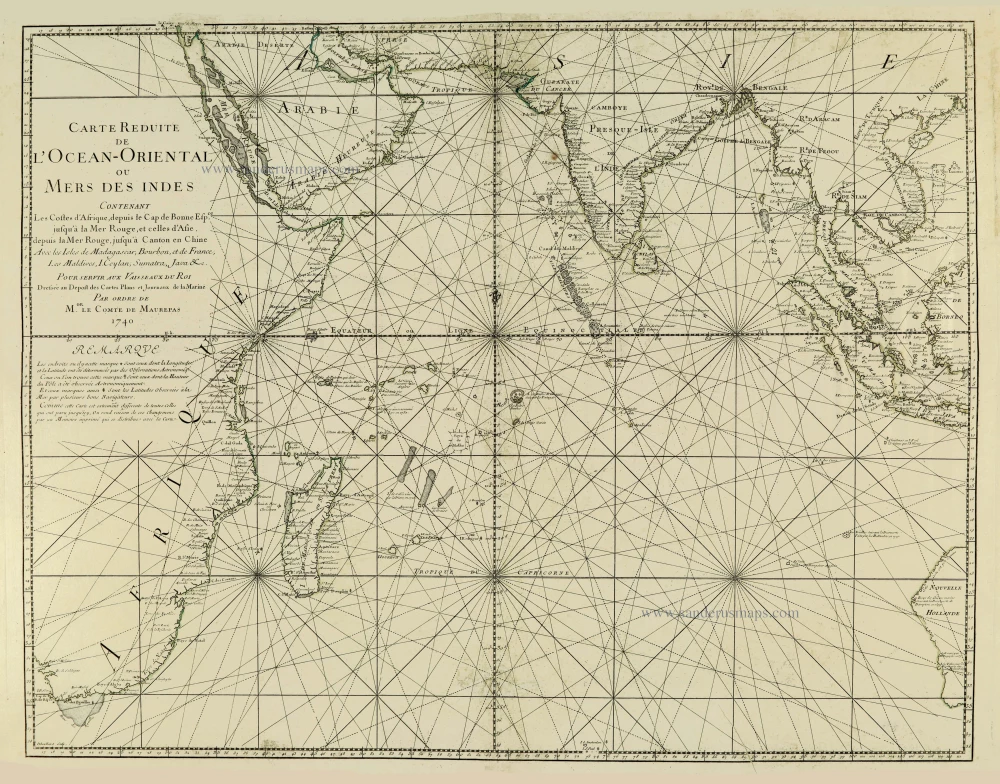
Indian Ocean, by J.N. Bellin. 1756-1770
Carte Réduite de l'Océan Oriental ou Mers des Indes.
[Item number: 28148]
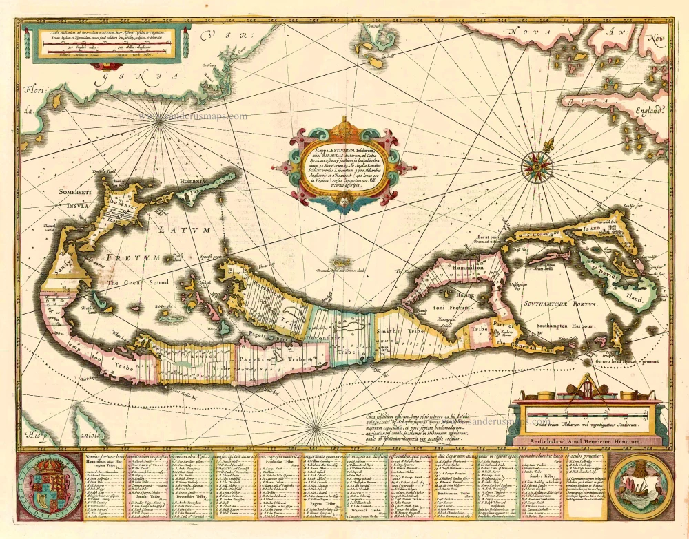
Bermuda, by Johannes Janssonius. 1641
Mappa Aestivarum Insularum alias Barmudas dictarum, ...
[Item number: 26460]

The Atlantic Ocean, by G.L. Le Rouge. 1778
Ocean Atlantique et Mers Adjacentes en Quatre Feuilles Contenant...
[Item number: 14086]
![[No title]](https://sanderusmaps.com/assets/WEBP/m28826.webp)
Half globe gore of the Indian Ocean - Madagascar. 1696
[No title]
[Item number: 28826]
The Atlantic Ocean, by J. Van Keulen. 1697-1709
Nieuwe Paskaert vande Gheheele Westersche Scheep-Vaert, op Nieus...
[Item number: 11218]
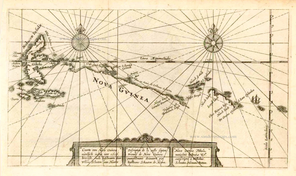
New Guinea, by W.C. Schouten 1618
Caarte van Nova Guinea, Nieulijck inden iare 1616 bezeijlt, ende...
[Item number: 25400]
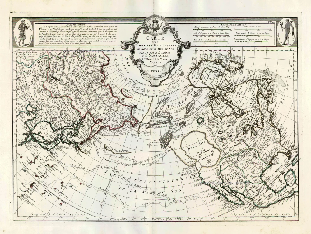
Pacific Ocean (North) by Francesco & Paolo Santini 1776-79
Carte des Nouvelles Decouvertes au Nord de la Mer du Sud, tant à...
[Item number: 26979]
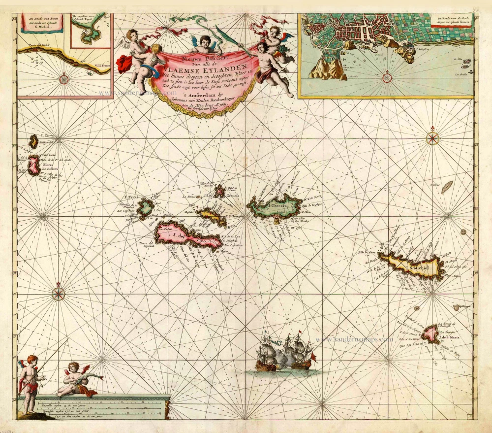
The Azores, by Johannes Van Keulen. 1681
Nieuwe Pascaert van Alle de Vlaemse Eylanden
[Item number: 12094]

Early map of the North Atlantic
Northern Atlantic Ocean by Girolamo Ruscelli. 1574
Septenirionalium Partium Nova Tabula.
[Item number: 32185]

Rare chart showing the route taken by Schouten and le Maire from South America to New Guinea, by Michiel Colijn. 1622
Caerte van de zeylage van Jacob le Maire over de Zuydzee,...
[Item number: 25104]
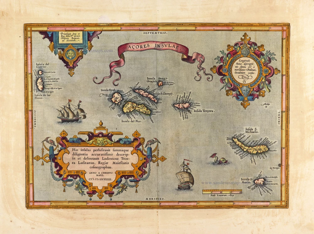
Azores, by Abraham Ortelius. 1612
Açores Insulae.
[Item number: 29890]
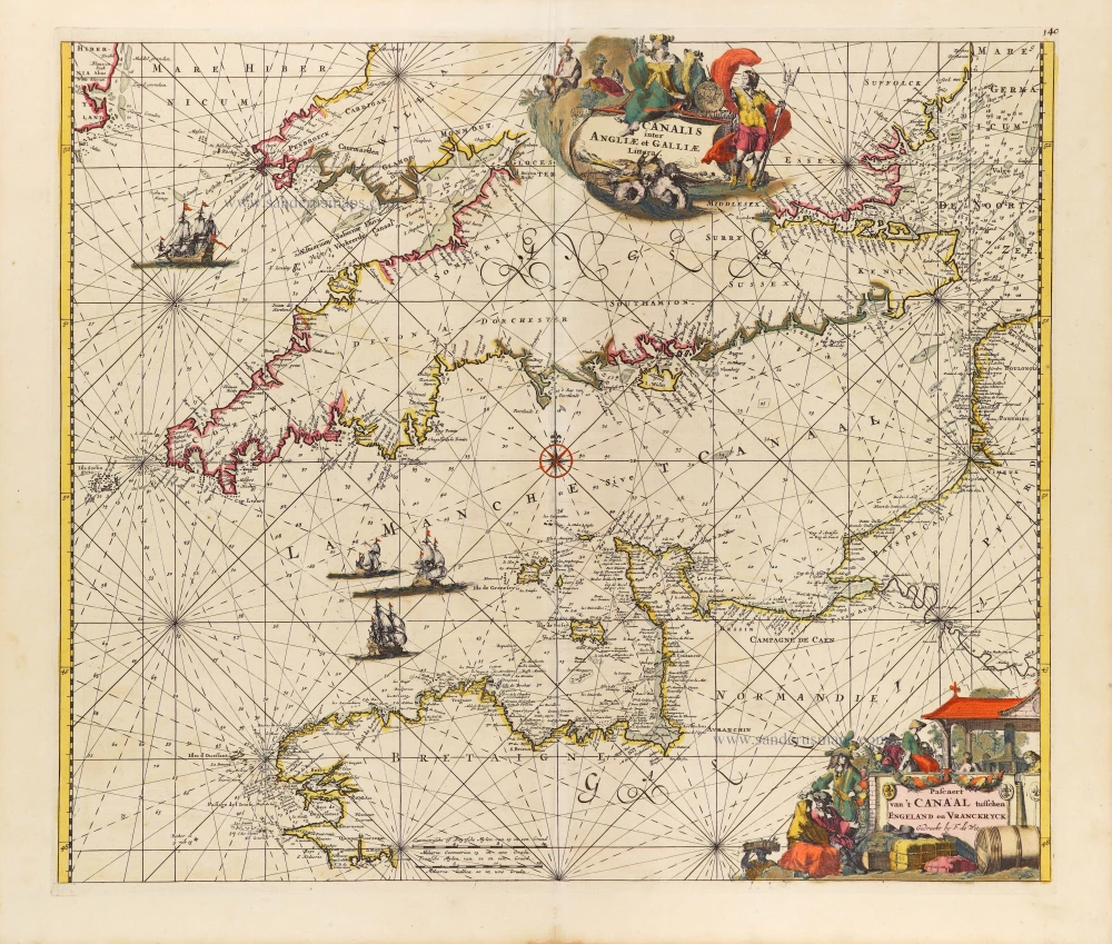
The English Channel, by Frederick de Wit. c. 1680
Canalis inter Angliae et Galliae Littera. - Pascaert van 't...
[Item number: 29171]
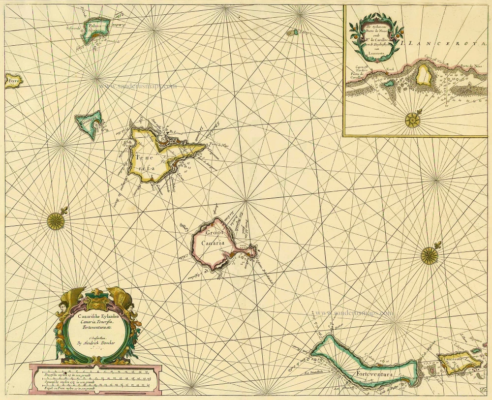
Canary Islands, by Hendrick Doncker. 1686
Canarische Eylanden Canaria Tenerifa, Forteventura etc. t'...
[Item number: 15419]
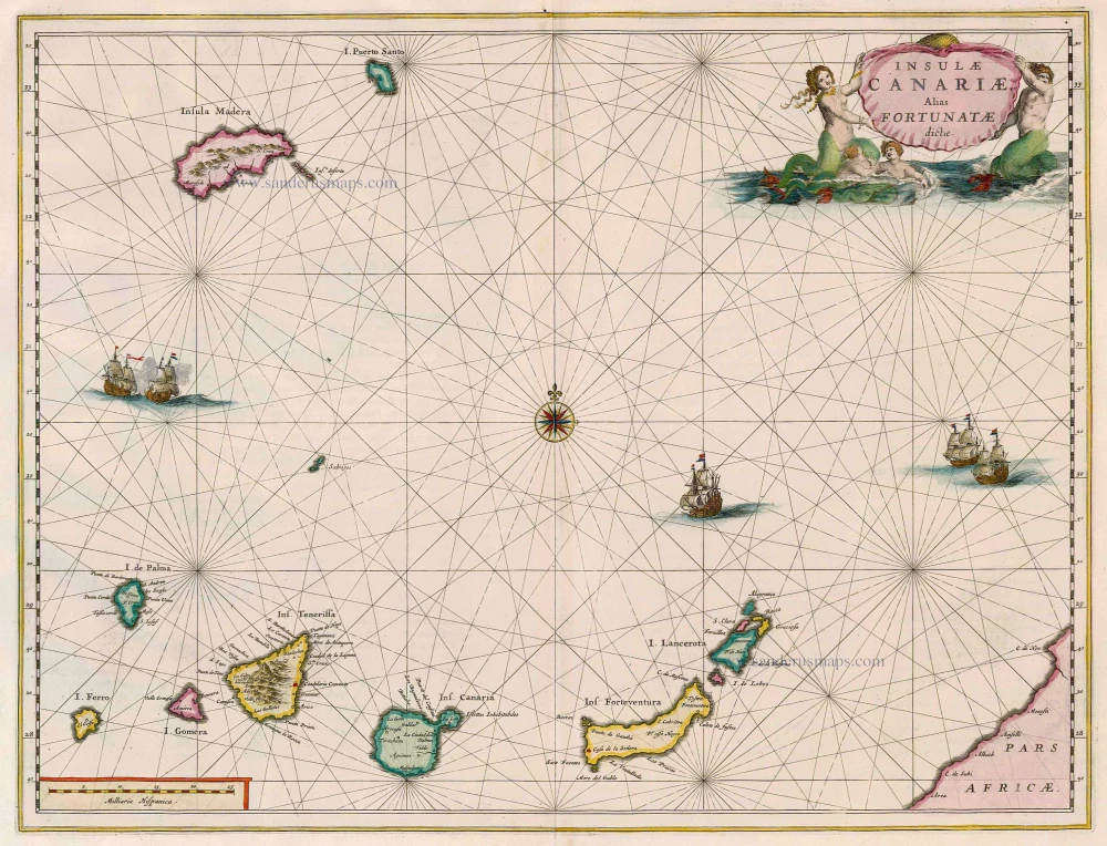
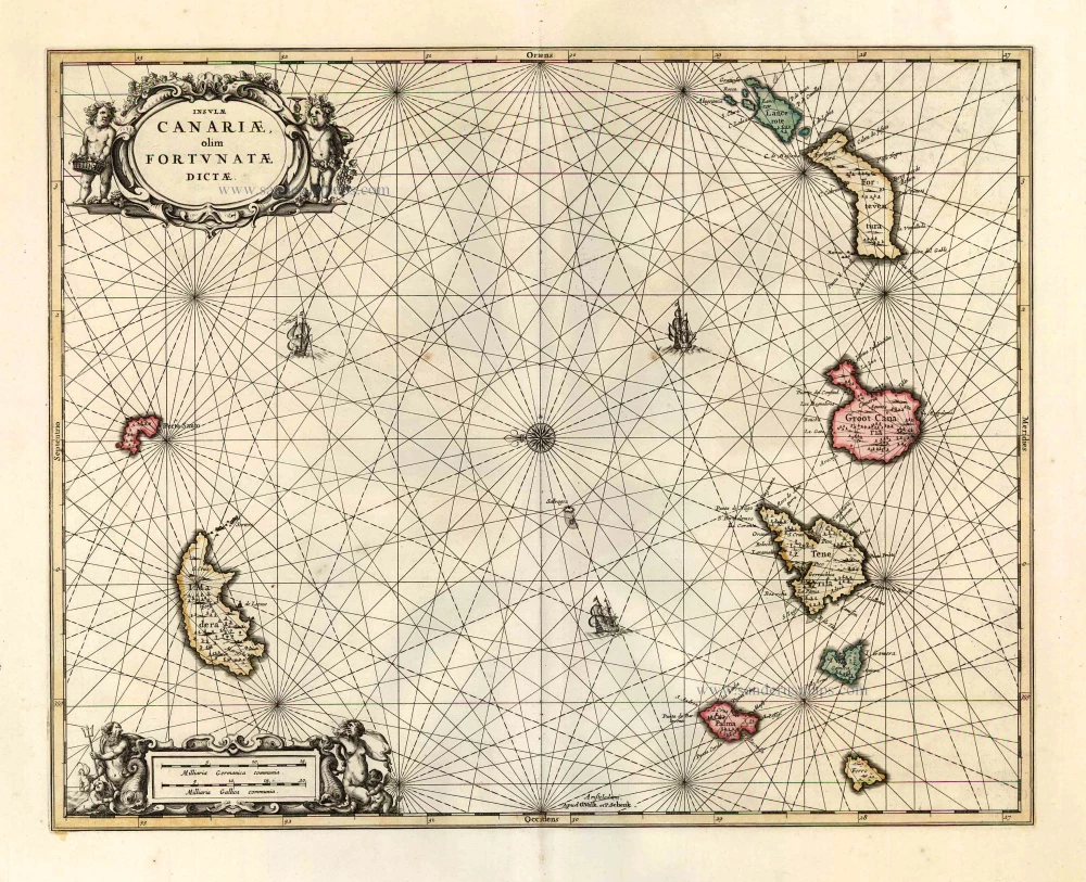
Canary Islands, by Joan Blaeu. 1664-65
Insulae Canariae alias Fortunatae Dictae
[Item number: 14157]
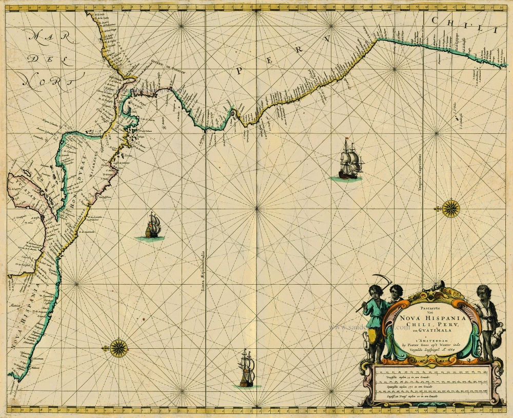
Central America, by Pieter Goos. 1667
Pascaerte van Nova Hispania Chili, Peru, en Guatimala
[Item number: 19031]
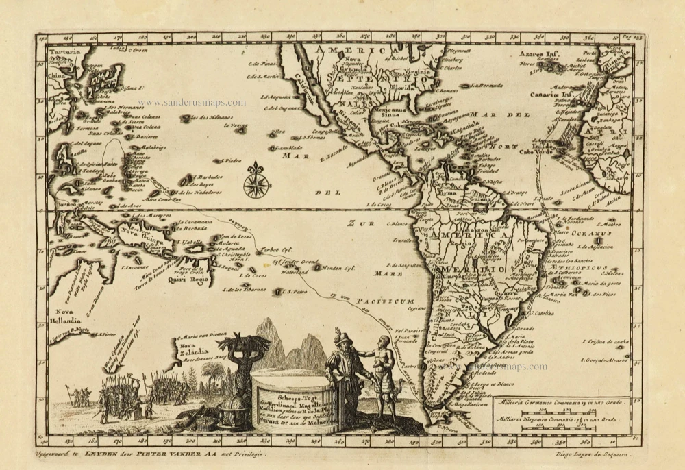
Rare and interesting map
Voyage of Magellan from Spain to Asia, by Pieter Van der Aa. 1707
Scheeps-Togt door Ferdinand Magellaan uit Kastilien gedaan na R....
[Item number: 32347]

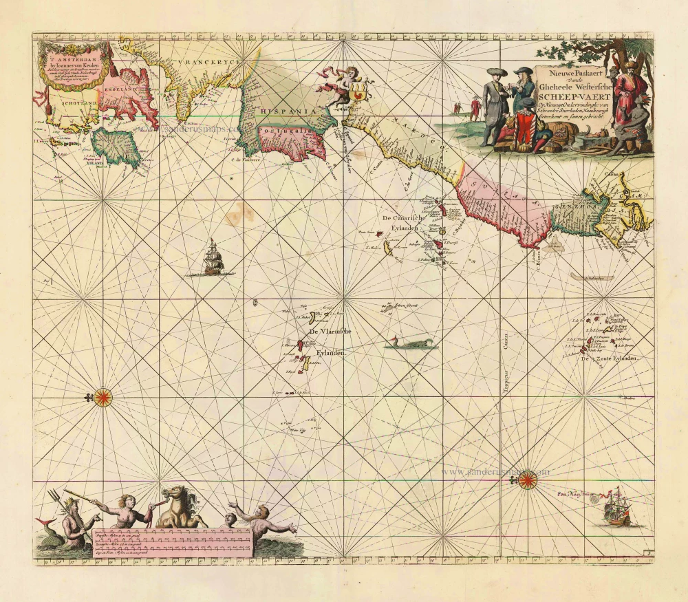
Sea chart of the northwest coast of Africa, with the Azores, Canary Islands and Cape Verde Islands, by Johannes Van Keulen. 1680-1694
Paskaart van de Cust van Portugal, Barbaria, en Genehoa...
[Item number: 26808]
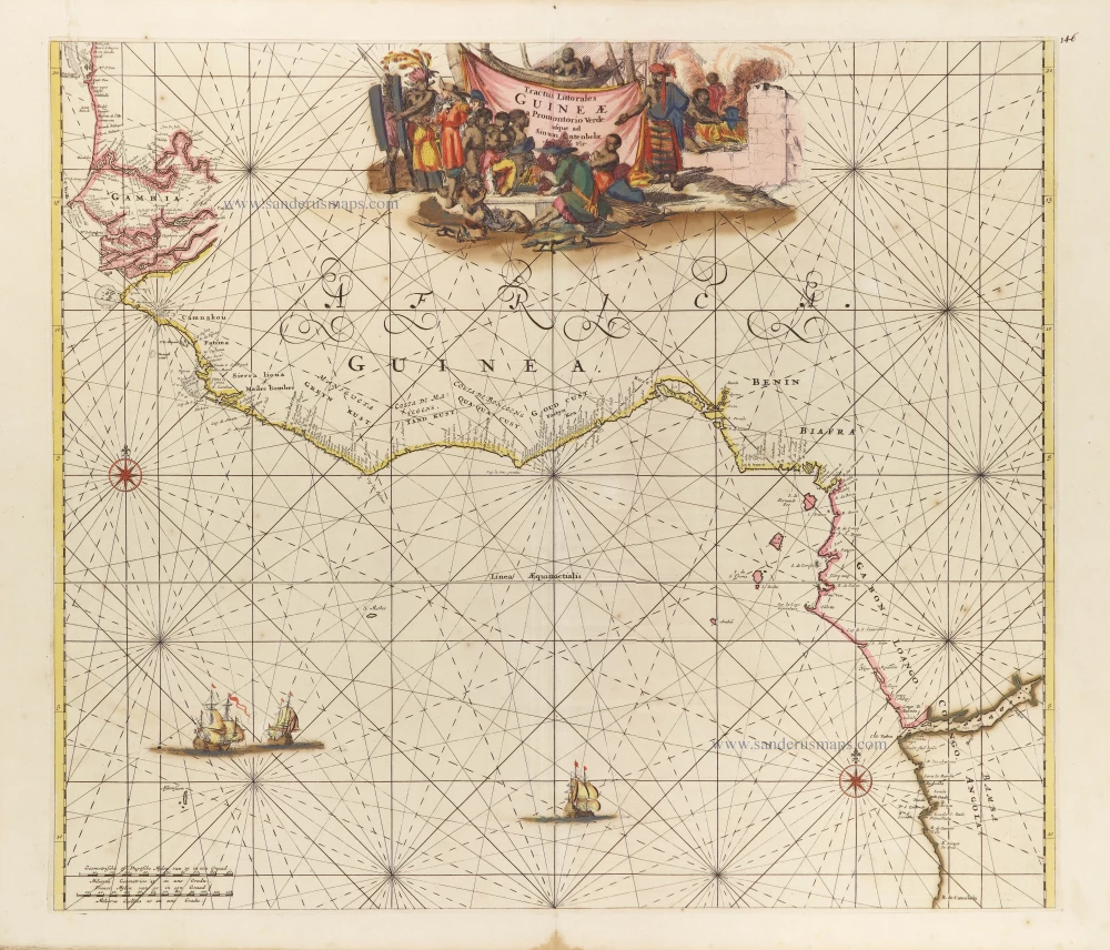
Tropical Atlantic Coast of Africa, by Frederick de Wit. c. 1691-97
Tractus Littorales Guineae a Promontorio Verde usque ad Sinum...
[Item number: 29258]
Canary Islands by Covens & Mortier 1721-41
Insulae Canariae olim Fortunatae Dictae.
[Item number: 25829]