Antique maps catalogue
- All recent additions
-
Antique maps
- Polar maps
- World
-
Europe
- Europe Continent
- Belgium
- Belgium - Cities
- The Low Countries
- The Netherlands
- The Netherlands - Cities
- Luxembourg
- France
- France - Cities
- Germany
- Germany - Cities
- Austria
- Italy
- Italy - Cities
- Spain and Portugal
- Greece & Greek Islands
- Switzerland
- British Isles
- British Isles - Cities
- Northern Europe
- Central Europe
- Eastern Europe
- Southeastern Europe
- America
- Asia
- Africa
- Mediterranean Sea
- Australia
- Oceans
- Celestial Maps
- Curiosities
- Title Pages
- Books
- Medieval manuscripts
- Prints
Spice islands
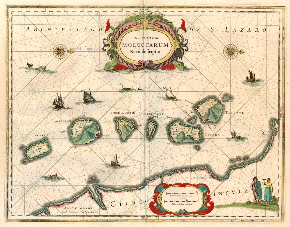
Moluccas by Joannes Janssonius. 1646
Insularum Moluccarum Nova Descriptio.
[Item number: 23718]

The Spice Islands
Moluccas by Willem Blaeu 1640
Moluccae Insulae Celeberimae.
[Item number: 31047]
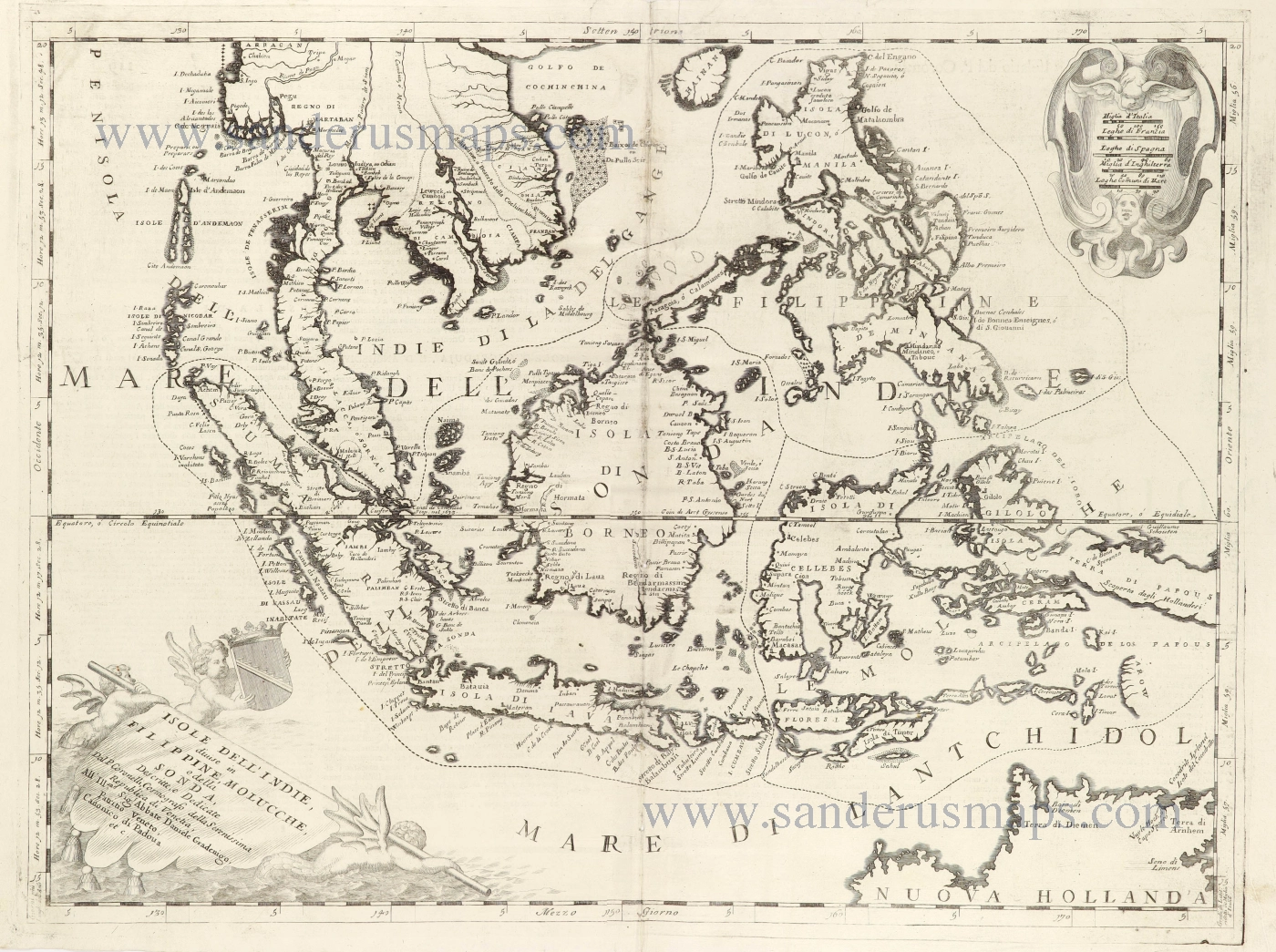
Southeast Asia and Northwest Australia by Vincenzo Coronelli. 1696
Isole dell'Indie, Divise in Filippine, Molucche, e della Sonda.
[Item number: 28670]
![Isole Molucche.- [Above map :] Descrittione del l'Isole Molucche.](https://sanderusmaps.com/assets/WEBP/m29788.webp)
Southeast Asia by Tommaso Porcacchi. 1590
Isole Molucche.- [Above map :] Descrittione del l'Isole Molucche.
[Item number: 29788]
From the Cloppenburg edition
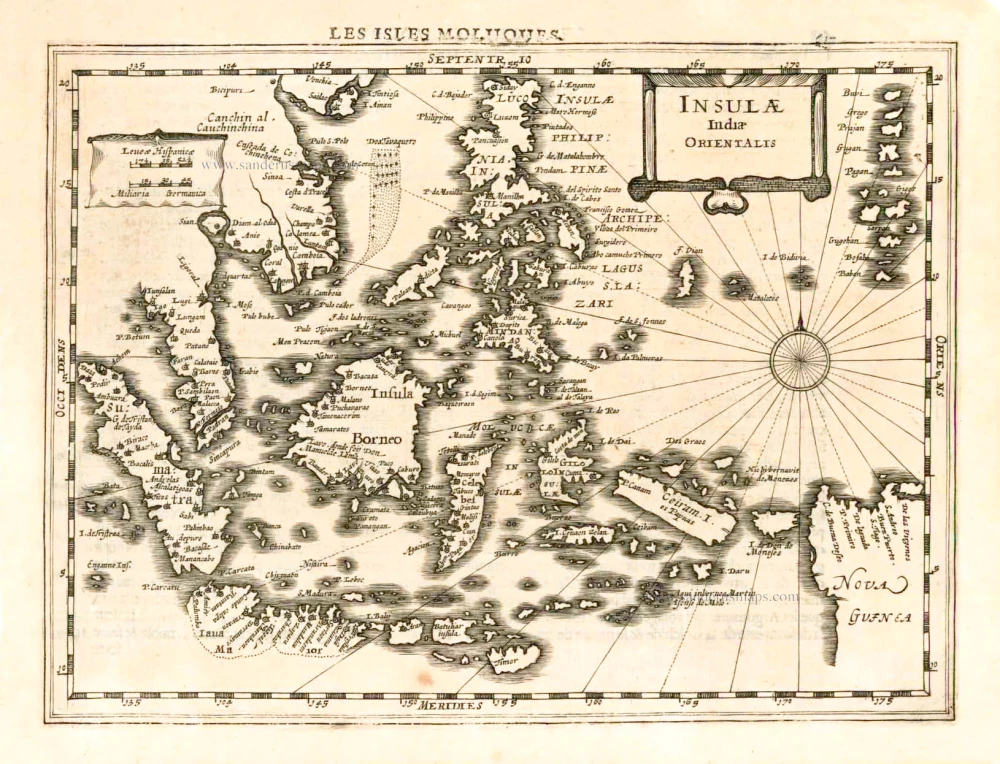
Southeast Asia, by G. Mercator - J. Hondius. 1630
Insulae Indiae Orientalis.
[Item number: 25234]
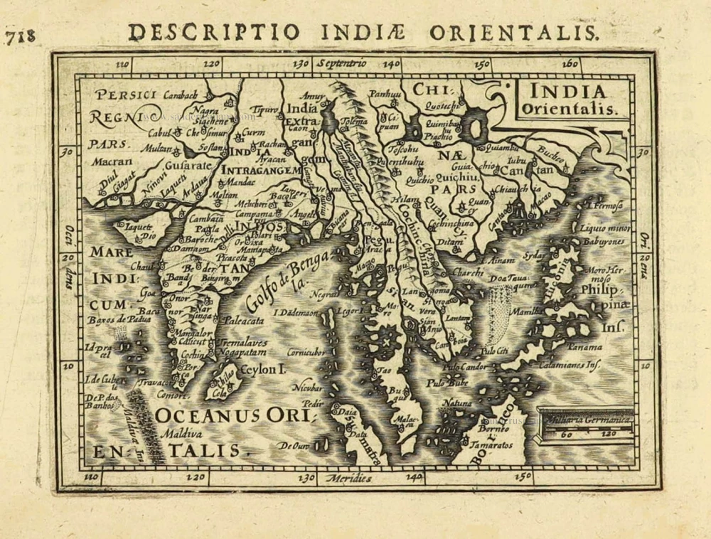
East Indies by Petrus Bertius. 1616
India Orientalis.
[Item number: 28162]
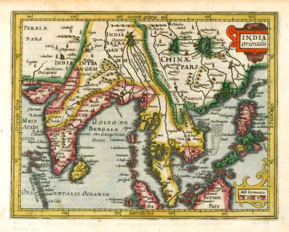
Southeast Asia, by G. Mercator - J. Hondius (small) 1607
India Orientalis.
[Item number: 25186]
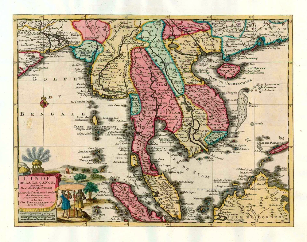
Southeast Asia, by Pieter van der Aa. 1713
L'Inde de la le Gange,
[Item number: 26097]
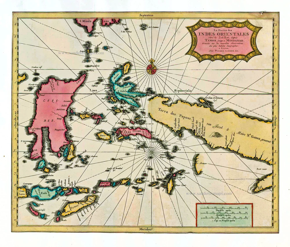
Indonesia by P. Van der Aa 1713
La Partie des Indes Orientales vers le Zud-Est, depuis Timor...
[Item number: 26101]
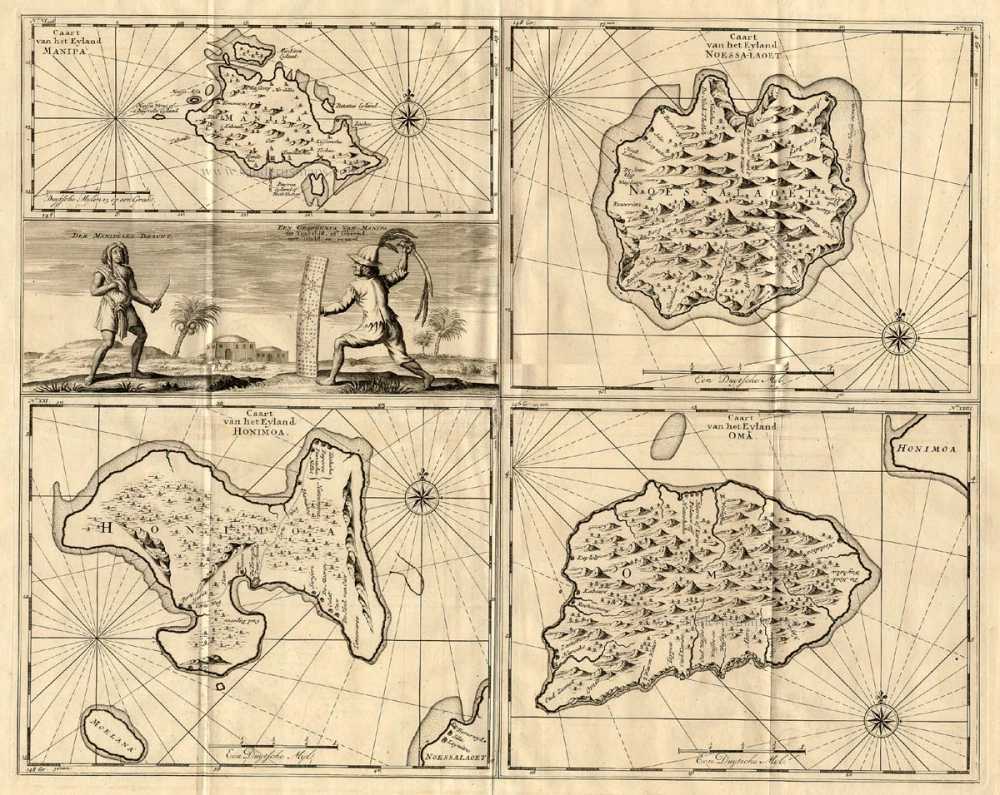
The Ambon Islands by Valentyn. 1724-26
Caart van het Eyland Manipa - Caart van het Eyland Noessa-Laoet...
[Item number: 17212]
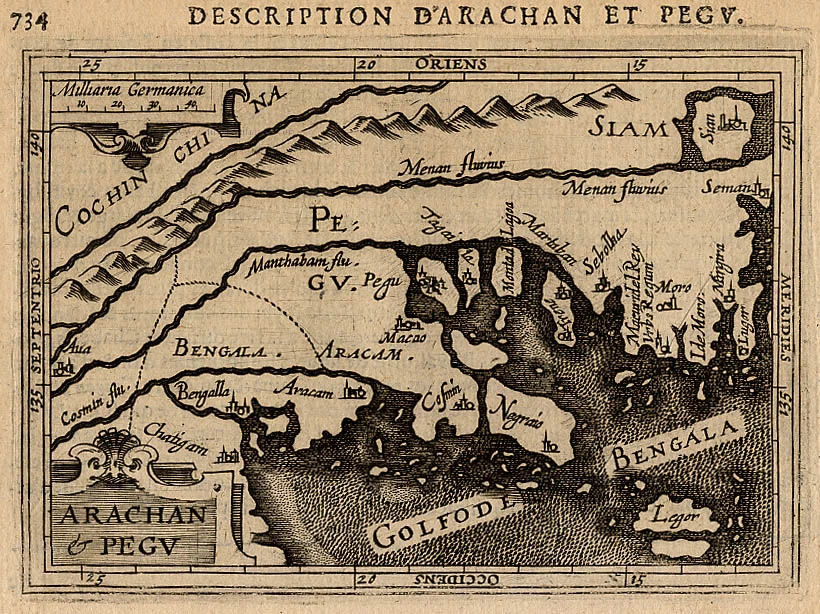
Arakan and Pegu, by Petrus Bertius. 1618
Arachan & Pegu.
[Item number: 18301]
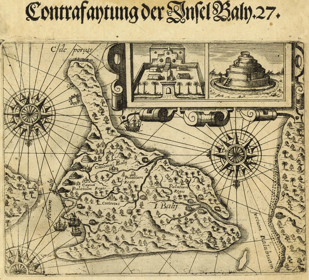
Bali, by Theodore de Bry. 1598-1613
Contrafaytung der Insel Baly . 27.
[Item number: 20721]
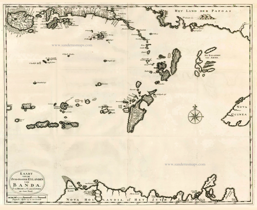
The Banda Islands (Southeast) & Northern Australia, by Fr. Valentyn. 1724-26
Kaart van de Zuyd-Ooster Eylanden van Banda.
[Item number: 26608]
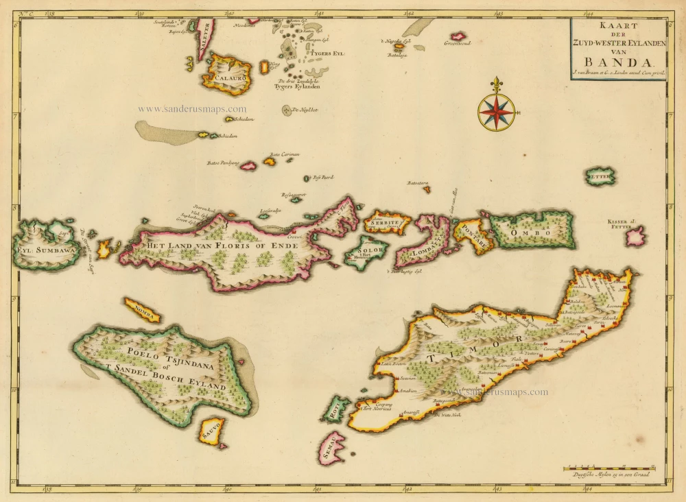
The Banda Islands, by François Valentyn. 1724-26
Kaart der Zuyd-Wester Eylanden van Banda
[Item number: 17794]
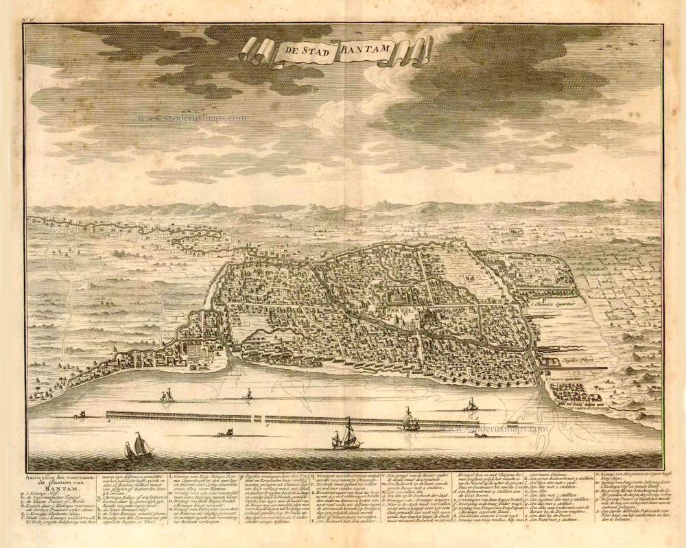
Bantam (Java), by François Valentyn (Valentijn). 1724
De Stad Bantam.
[Item number: 27939]
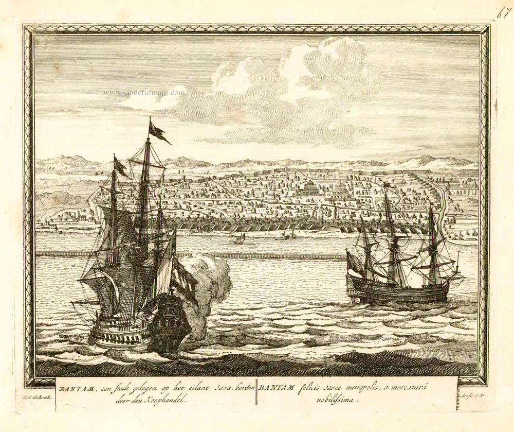
Banten (Bantam - Indonesia), by Petrus Schenk. 1702
Bantam, een stadt gelegen op het eilant Java, beroemt door den...
[Item number: 26661]

SCARCE !
View of Banten (Indonesia), by Carel Allard. 1685/90
Bantam.
[Item number: 30580]
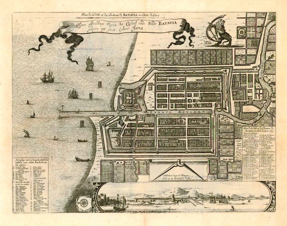
Batavia (Jakarta - Indonesia), by Pieter Van der Aa. 1728
Plan de la Ville er du Château de Batavia en l'Isle de Iava. |...
[Item number: 27887]
SCARCE !
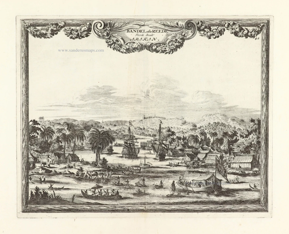
View of Baungdwet (Myanmar), by Carel Allard. 1685/90
Bandel ofte Reede Voorde Stadt Arakan.
[Item number: 30581]
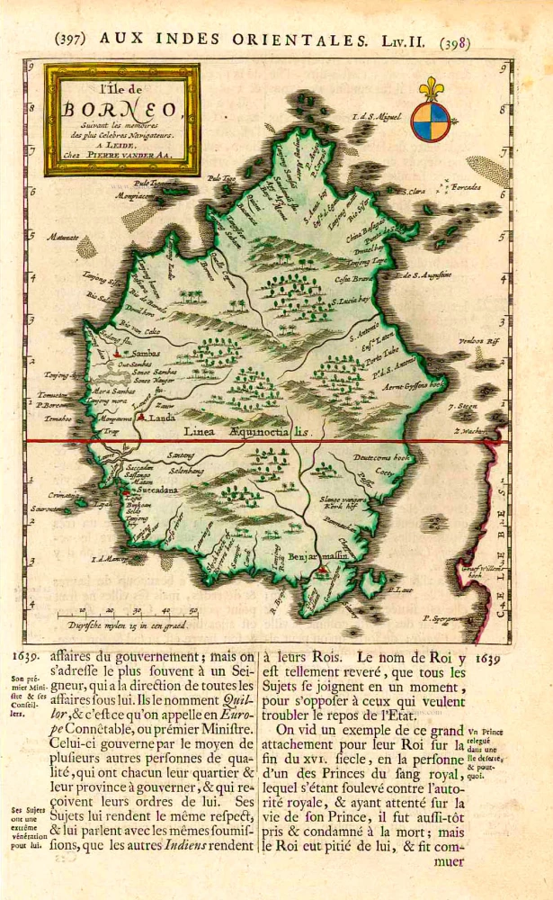
Borneo, by Pieter Van der Aa. 1719
L'Île de Borneo.
[Item number: 26419]
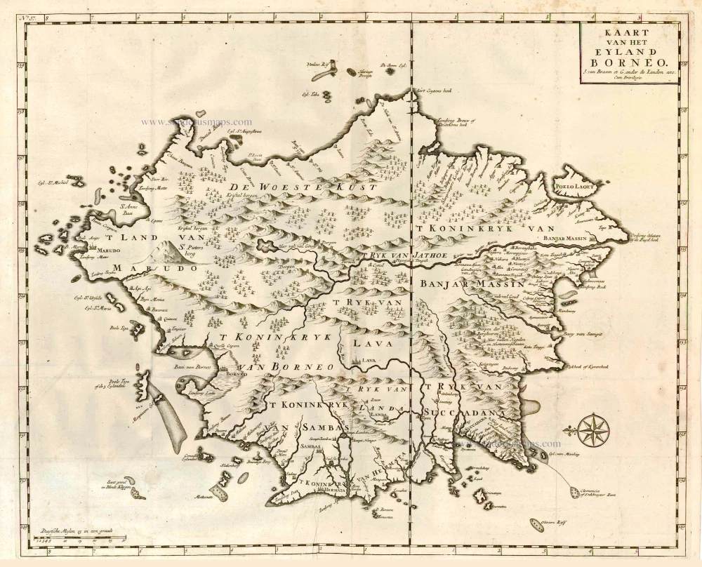
Borneo, by François Valentyn. 1726
Kaart van het Eyland Borneo.
[Item number: 27892]
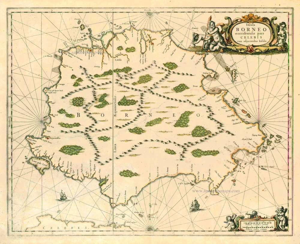
Borneo, by J. Janssonius. 1657-62
Insula Borneo et occidentalis pars Celebis cum adjacentibus...
[Item number: 26456]
Borneo, by J.L. Gottfried. 1631
Borneo Insula.
[Item number: 31565]
Borneo, by Langenes, published by P. Bertius. 1602
Borneo.
[Item number: 26540]
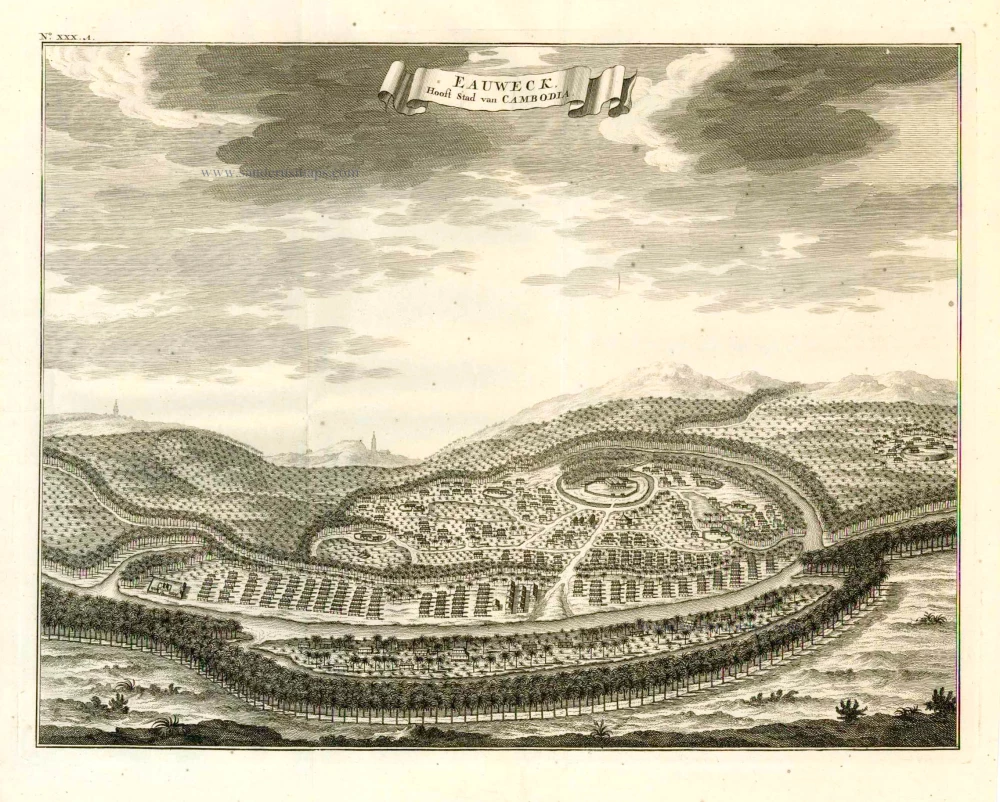
Lovek (Longvek - Camboia), by François Valentyn (Valentijn). 1724-26
Eauweck, Hoofd-Stad van Cambodia.
[Item number: 26891]

Chart of the route of Schouten and Le Maire north of New Guinea, and the Moluccas, by A. de Herrera, published by M. Colijn. 1622
Caerte vande Landen vande Papouas ofte Nova Guinea nae de...
[Item number: 4165]

Scarce
Indian Ocean by Pieter Vander Aa 1714
Basora En de Landschappen Tussen den Eufrat en Tiger stroom, een...
[Item number: 31082]
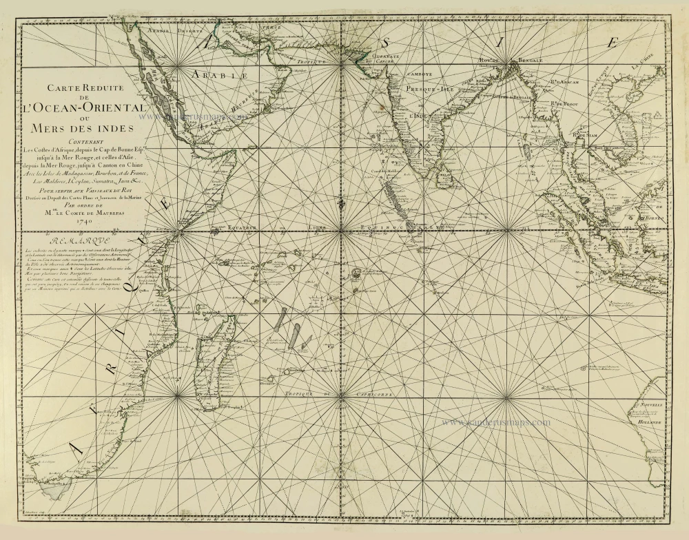
Indian Ocean, by J.N. Bellin. 1756-1770
Carte Réduite de l'Océan Oriental ou Mers des Indes.
[Item number: 28148]
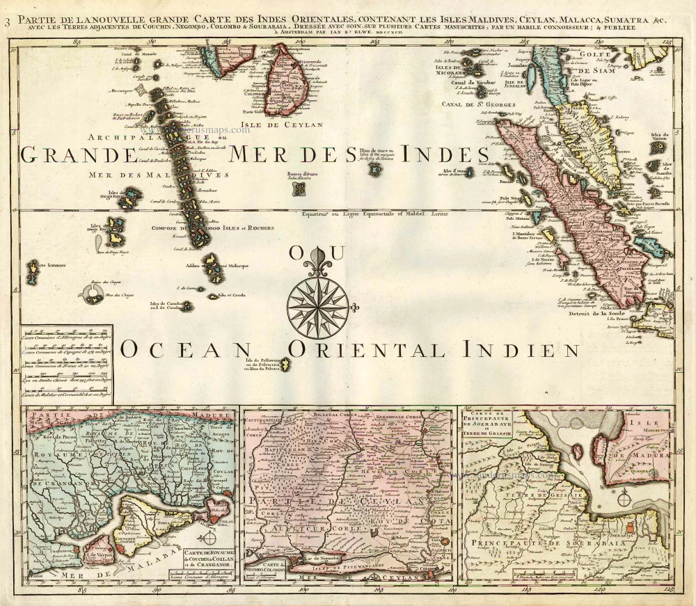
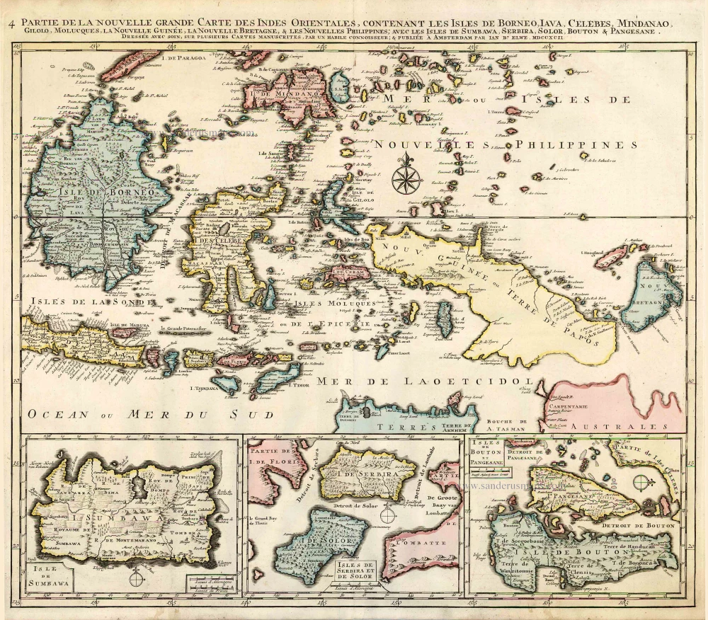
Indian Ocean (North), by J.B. Elwe. 1792
Partie de la Nouvelle Grande Carte des Indes Orientales,...
[Item number: 2363]
Scarce
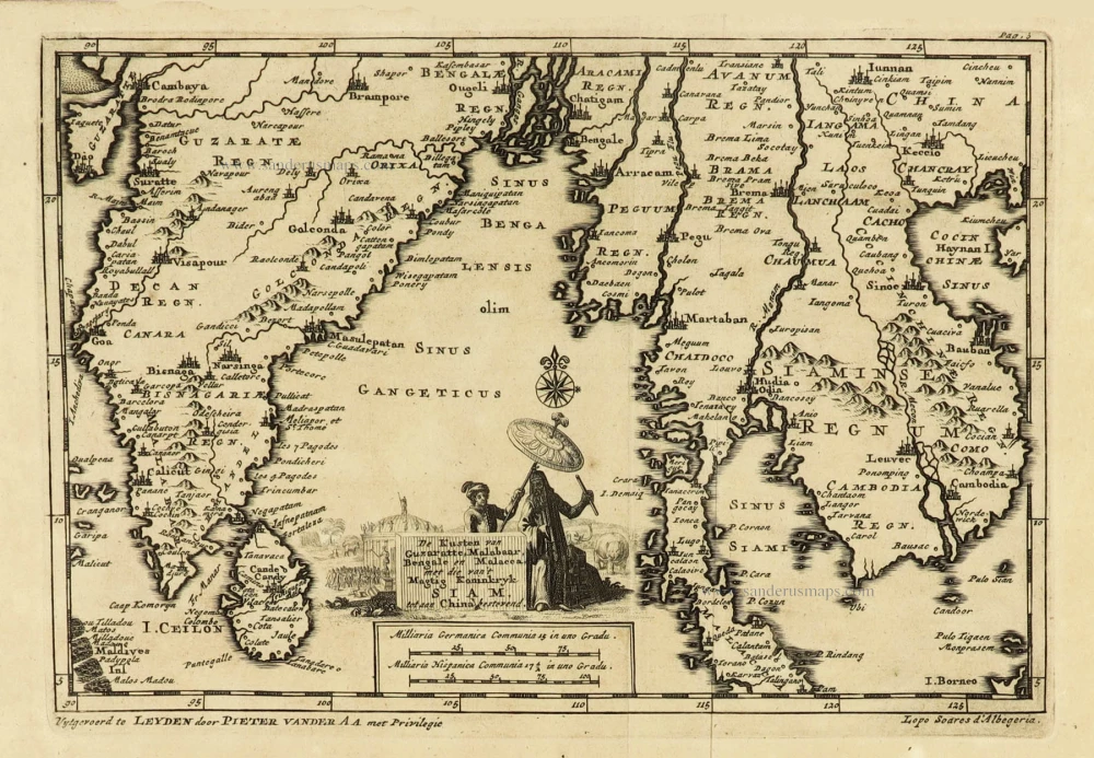
Indian Ocean, India, Thailand, and Siam by Pieter Van der Aa. 1707
De Kusten van Guzaratte, Malabar, Bengale en Malacca met die...
[Item number: 32323]
Scarce
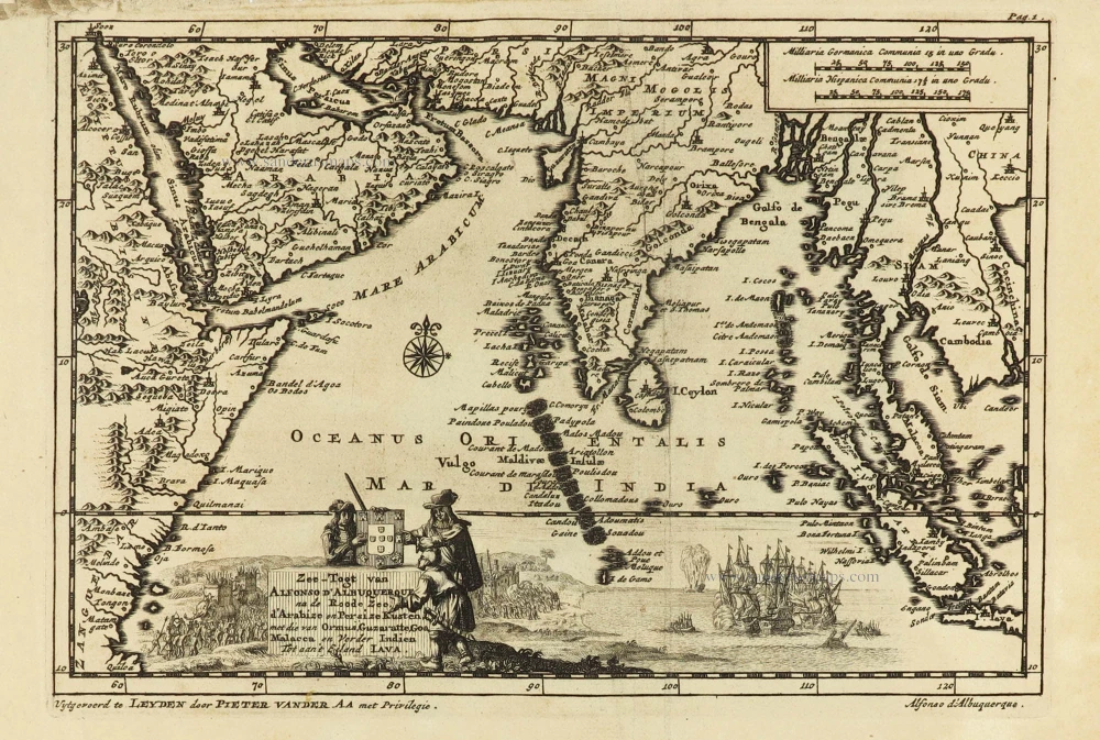
Indian Ocean & Southeast Asia by Pieter Van der Aa. 1707
Zee-togt van Alfonso d'Albuquerque na de Roode Zee, d'Arabize en...
[Item number: 32321]

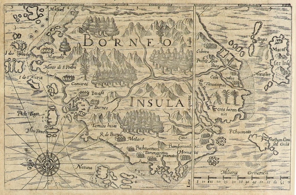
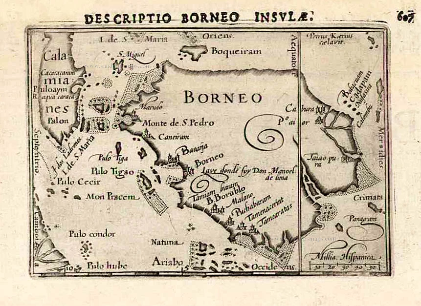
Borneo, by Petrus Bertius 1618
Borneo insula.
[Item number: 32172]
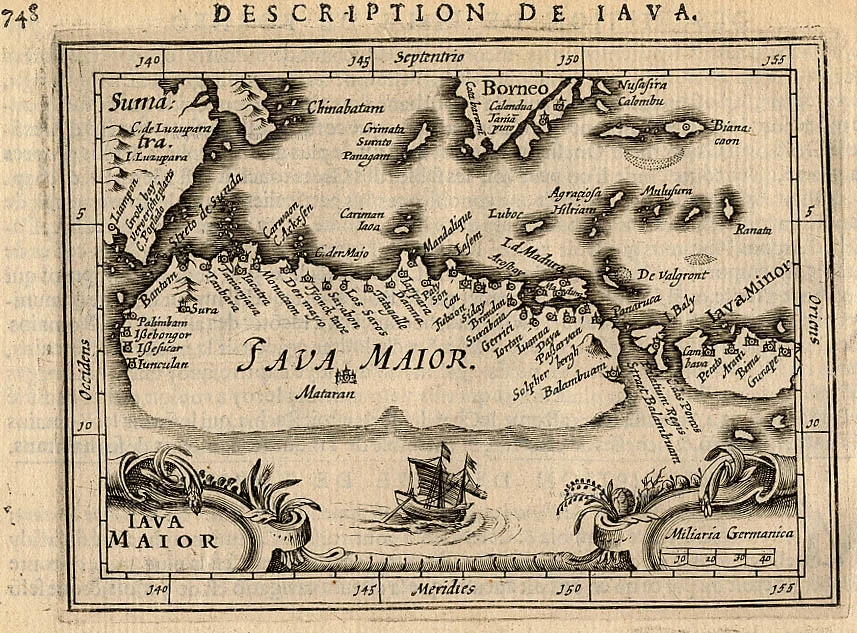
Java, by Bertius P. 1618
Iava Maior.
[Item number: 18307]

Indonesia - Java and the Sunda Strait, by Pieter Van der Aa. 1707
't Koninkryk Sunda met dat van Iava, by d'Inwoonderen voor een...
[Item number: 32360]

Indonesia - Java and the Sunda Strait, by Pieter Van der Aa. 1707
Het Eiland Java zoo als het sederd de tyden der Portugysen by de...
[Item number: 32361]
Indonesia - New Guinea - Australia by J.B. Elwe. 1792
Partie de la Nouvelle Grande Carte des Indes Orientales,...
[Item number: 2293]