Antique maps catalogue
- All recent additions
-
Antique maps
- World and Polar
-
Europe
- Europe Continent
- Belgium
- Belgium - Cities
- The Low Countries
- The Netherlands
- The Netherlands - Cities
- Luxembourg
- France
- France - Cities
- Germany
- Germany - Cities
- Austria
- Italy
- Italy - Cities
- Spain and Portugal
- Greece & Greek Islands
- Switzerland
- British Isles
- British Isles - Cities
- Northern Europe
- Central Europe
- Eastern Europe
- Southeastern Europe
- America
- Asia
- Africa
- Mediterranean Sea
- Australia
- Oceans
- Celestial Maps
- Curiosities
- Title Pages
- Books
- Medieval manuscripts
- Prints
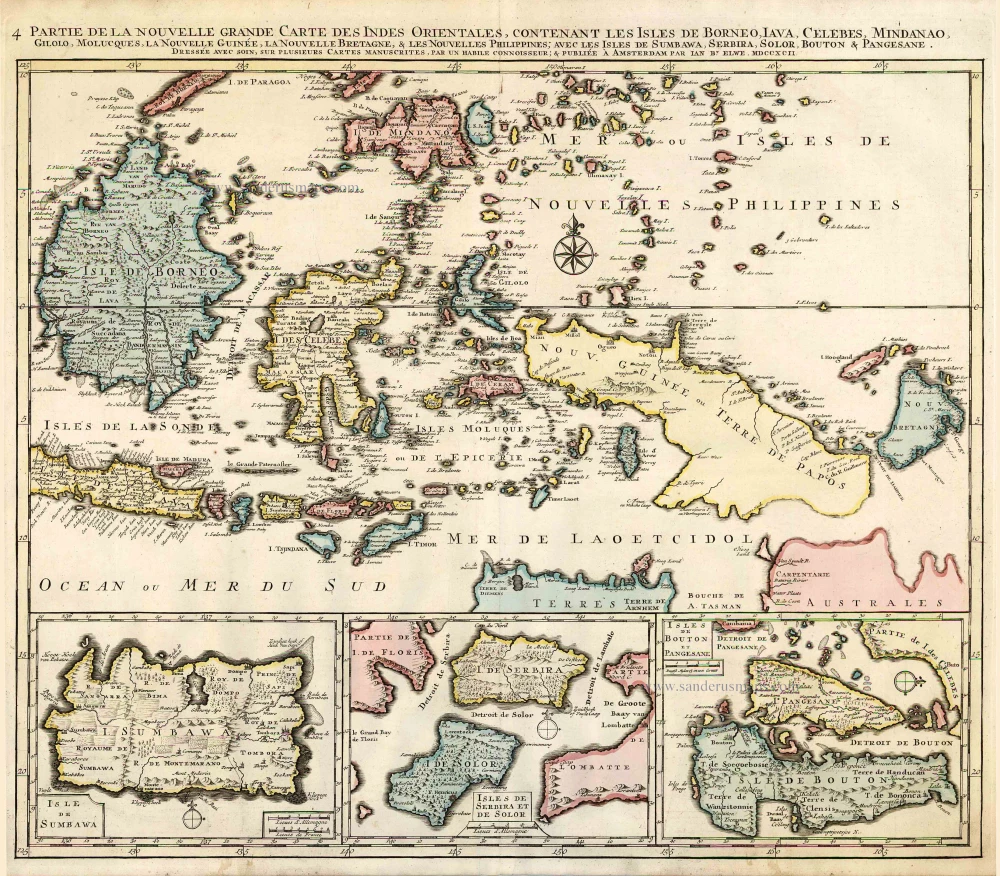
Indonesia - New Guinea - Australia by J.B. Elwe. 1792
Partie de la Nouvelle Grande Carte des Indes Orientales,...
[Item number: 2293]

Sumatra, by G. Valk & P. Schenk. c. 1700
Sumatrae et Insularum Locorumque Nonnullorum Circumiacentium...
[Item number: 25714]
![[No title]](https://sanderusmaps.com/assets/WEBP/m32054.webp)
Rare
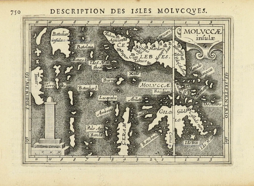
Spice Islands by Hulsius Levinus. 1608
[No title]
[Item number: 32054]

Jakarta (Batavia), by Petrus Schenk 1702
Batavia, gelegen op het eiland Java, een beroemde volkplanting...
[Item number: 26660]
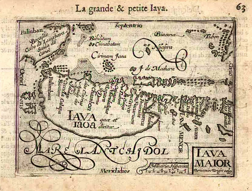
Java by Barent Langenes & Cornelis Claesz c. 1600
Iava Maior.
[Item number: 26935]
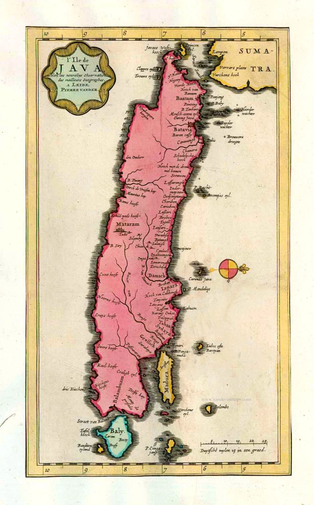
Java, by Pieter van der Aa. 1713
L'Ile de Java.
[Item number: 26127]
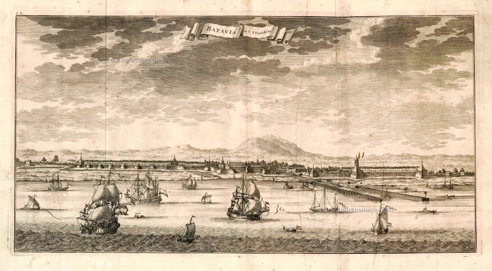
Batavia, by François Valentyn. 1726
Batavia in 't Verschiet.
[Item number: 27896]
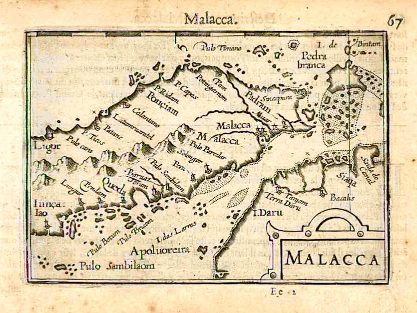
Malacca by Barent Langenes & Cornelis Claesz c. 1600
Malacca.
[Item number: 26934]

Malacca by Petrus Bertius, published by Jodocus Hondius II. 1618
Malacca.
[Item number: 32150]
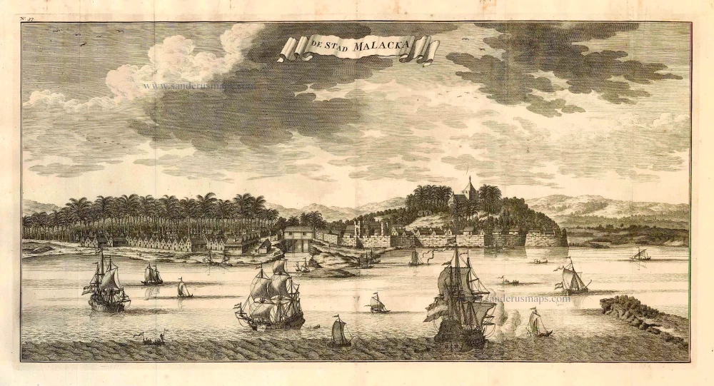
Malacca, by François Valentyn. 1726
De Stad Malacka.
[Item number: 27898]
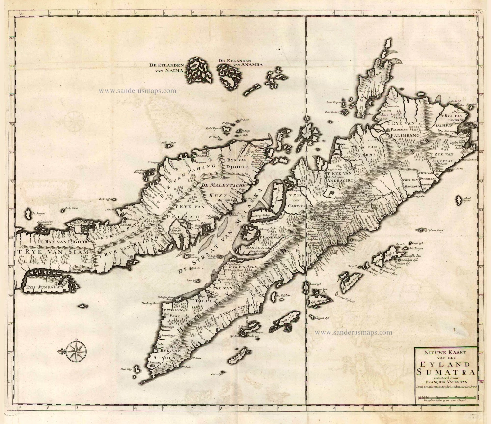
Malaysia - Sumatra by François Valentyn (Valentijn) 1724-26
Nieuwe Kaart van het Eyland Sumatra.
[Item number: 26898]
Scarce
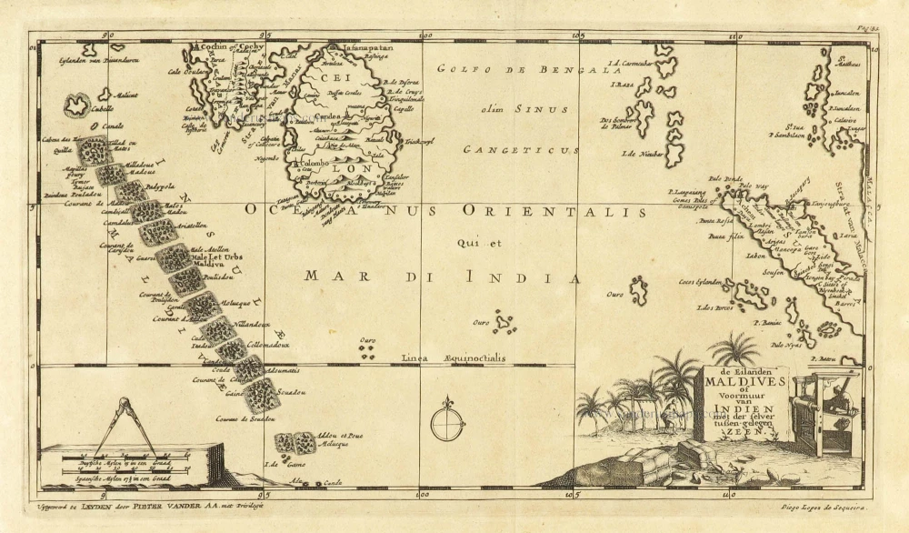
Maldives and Ceylon, by Pieter Van der Aa. 1707
De Eilanden Maldives of Voormuur van Indien met der selver...
[Item number: 32342]
Moluccas, by Petrus Bertius 1618
Moluccae insulae.
[Item number: 32174]
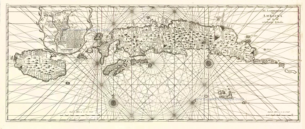
Ambon (Moluccas), by François Valentyn (Valentijn). 1724-26
De Landvoogdy van Amboina met de elf onderhoorige Eylanden
[Item number: 17566]
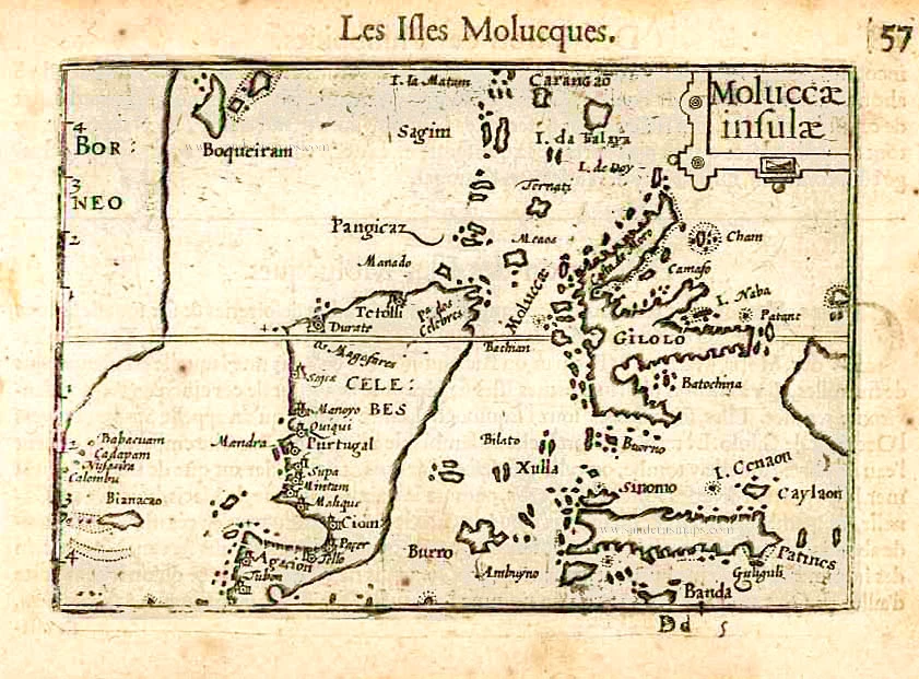
Moluccas by Barent Langenes & Cornelis Claesz c. 1600
Moluccae Insulae.
[Item number: 26996]

The Moluccas by François Valentyn (Valentijn). 1724
De Landvoogdy der Moluccos, met de aangrenzende Eylanden.
[Item number: 17559]
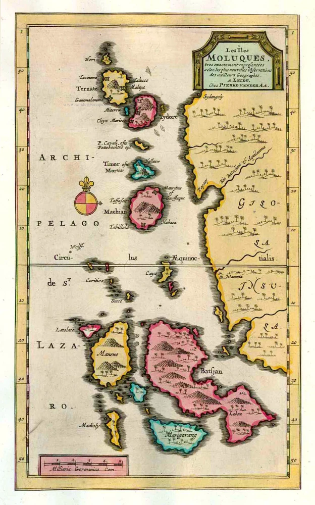
The Moluccas - Ternate and adjacent islands, by Pieter Van der Aa. 1713
Les Îles Moluques.
[Item number: 26124]
Scarce
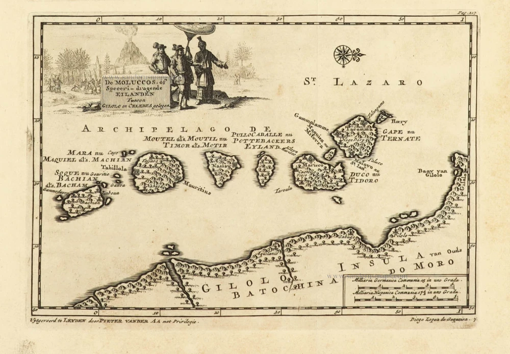
Moluccas, by Pieter Van der Aa. 1707
De Moluccos, of Speceri-dragende Eilanden Tussen Gigolo en...
[Item number: 32346]
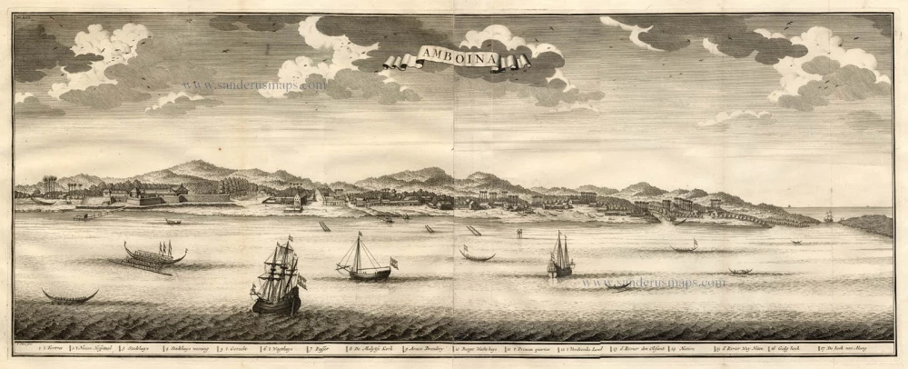
Ambon Island (Moluccas), by François Valentyn. 1724-26
Amboina.
[Item number: 17791]
![[No title]](https://sanderusmaps.com/assets/WEBP/m20926.webp)
Moluccas - Buru and Ambelou, by Valentyn. 1724-26
[No title]
[Item number: 20926]
![[No title]](https://sanderusmaps.com/assets/WEBP/m20928.webp)
Moluccas - Buru & Ambelou, by Valentyn. 1724-26
[No title]
[Item number: 20928]
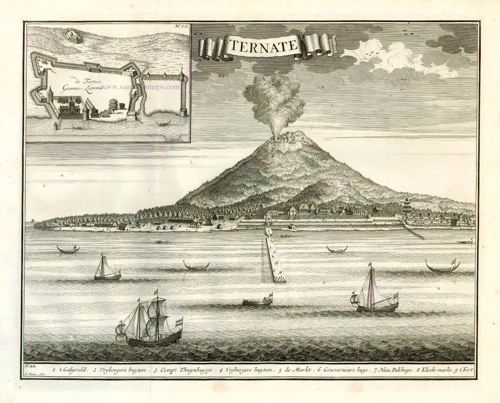
View of Ternate (Moluccos) showing the eruption of the Gamalama volcano, by François Valentyn (Valentijn). 1724-26
Ternate.
[Item number: 26875]
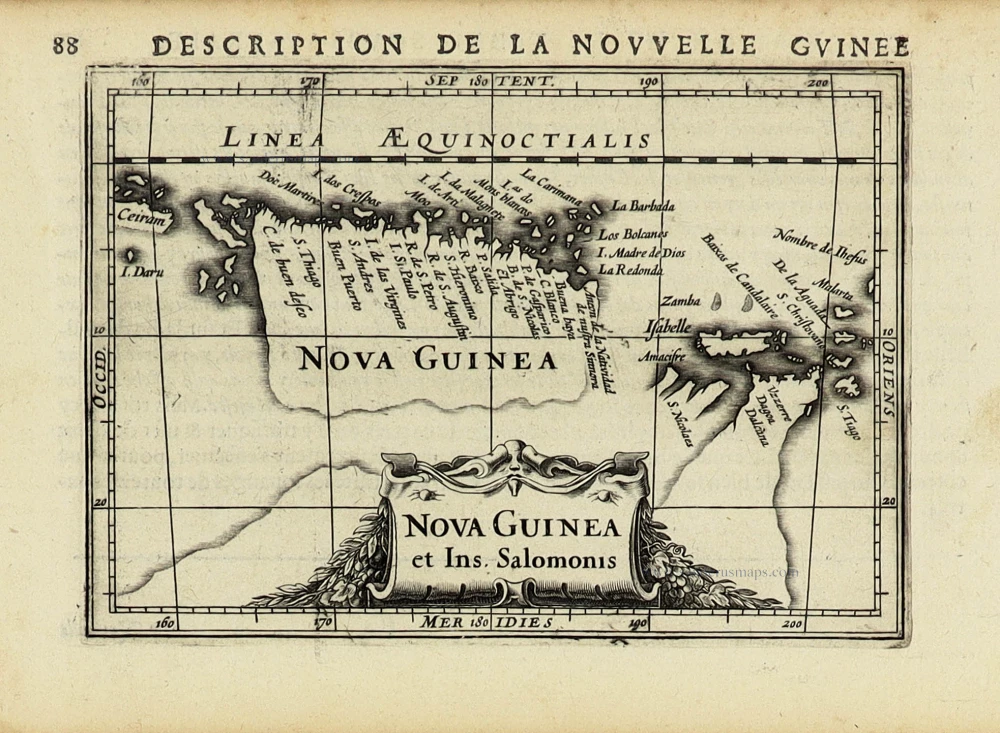
New Guinea by Petrus Bertius, published by Jodocus Hondius II. 1618
Nova Guinea et Ins. Salomonis.
[Item number: 31528]

New Guinea, by Tirion I. c. 1770
Kaart van de Papoasche Eilanden.
[Item number: 19203]
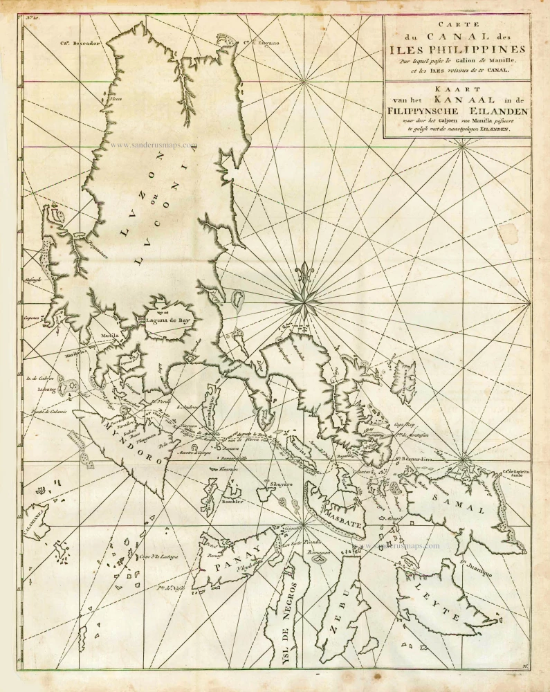
The Philippines, by George Anson. 1748
Carte du Canal des Iles Philippines par lequel Passe le Galion...
[Item number: 27036]
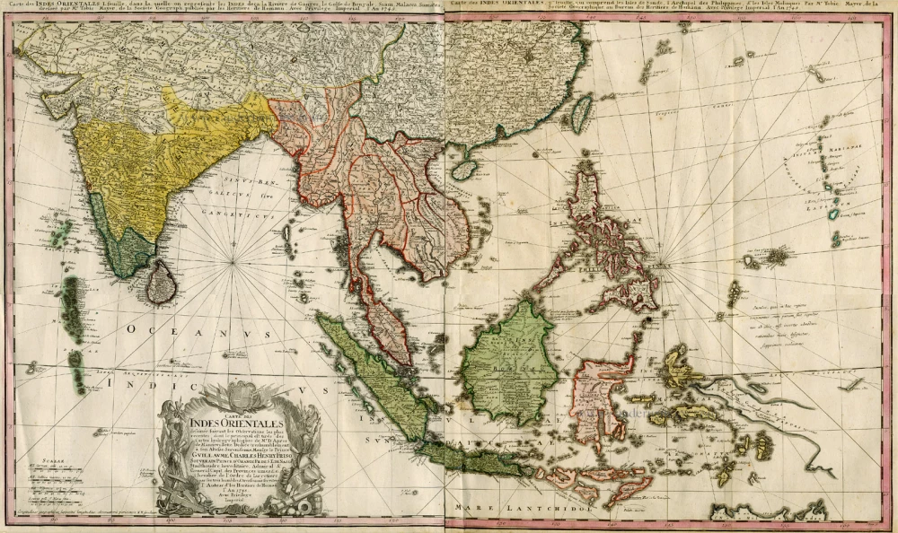
Southern Asia, by Homann Heirs. c. 1759
Carte des Indes Orientales ...
[Item number: 994]
![D'Indize kusten van Bengale, Pegu, Malacca en Siam tot in China, met d'Eylanden Sumatra, Iava, Borneo, Moluccos en andere. [with:] De vaste kusten en eylanden van Indien, van Pegu en Malacca af, tot aan de Moluccos, etc.](https://sanderusmaps.com/assets/WEBP/m31123.webp)
Scarce
Southeast Asia by Pieter Vander Aa, two maps. 1714
D'Indize kusten van Bengale, Pegu, Malacca en Siam tot in China,...
[Item number: 31123]
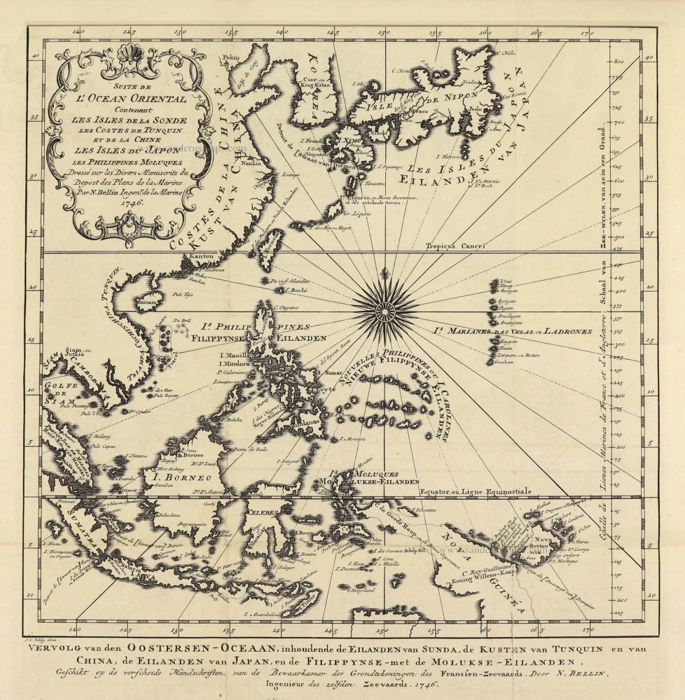
Southeast Asia by Jacques Nicolas Bellin. 1747
Suite de L'Ocean Oriental Contenant Les Isles de la Sonde Les...
[Item number: 28189]
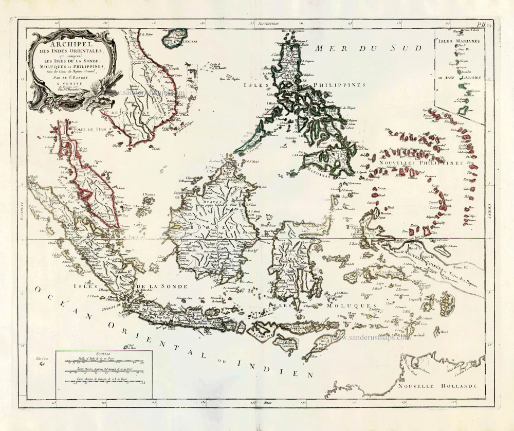
Southeast Asia, by Francesco Santini. 1776-79
Archipel des Indes Orientales qui comprend les Isles de la...
[Item number: 26977]
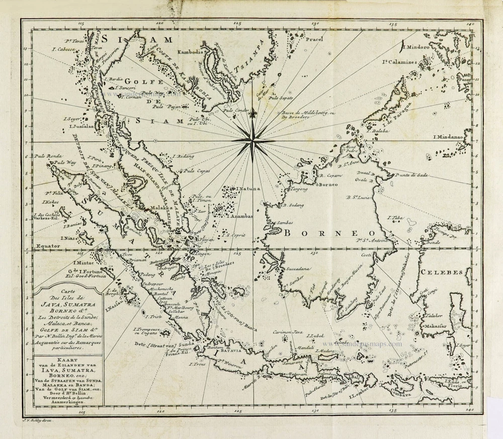
Southeast Asia by J.N. Bellin, published by A.F. Prévost. 1747
Carte Des Isles de Java, Sumatra, Borneo &a Les Detroits de la...
[Item number: 31882]
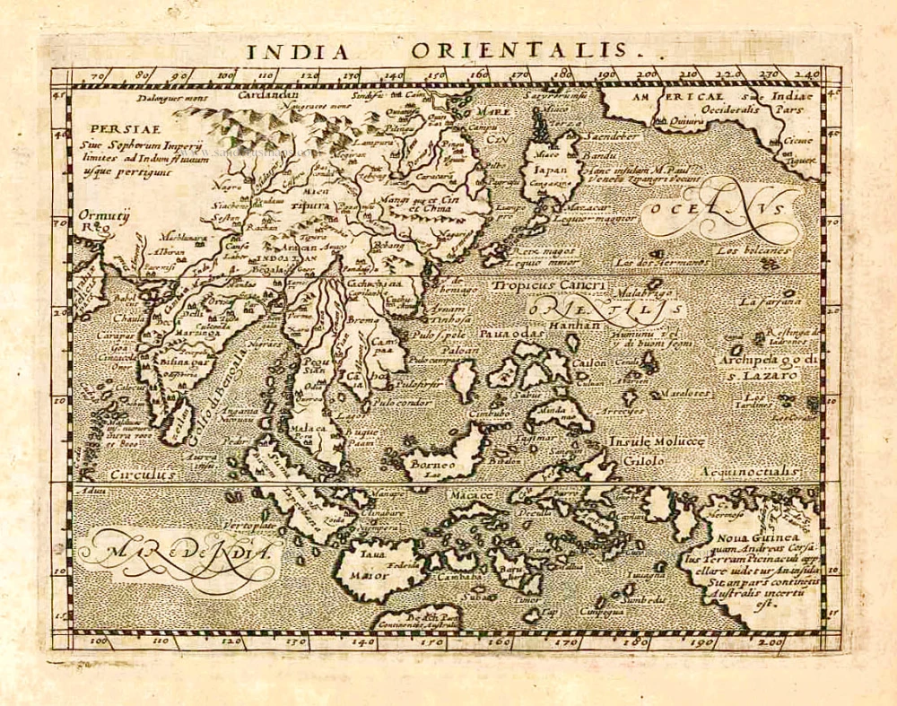
Southeast Asia, by Giovanni Magini. 1597
India Orientalis.
[Item number: 26521]
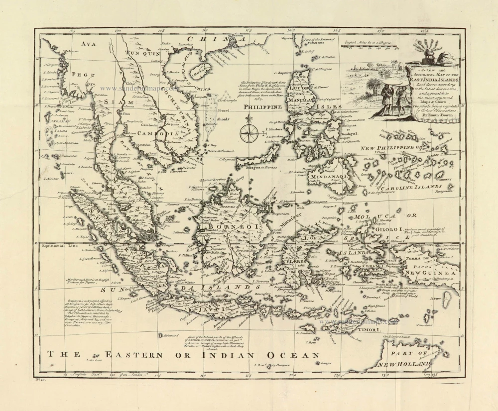
Southeast Asia, by Emanuel Bowen. 1747
A New and Accurate Map of the East India Islands.
[Item number: 28012]
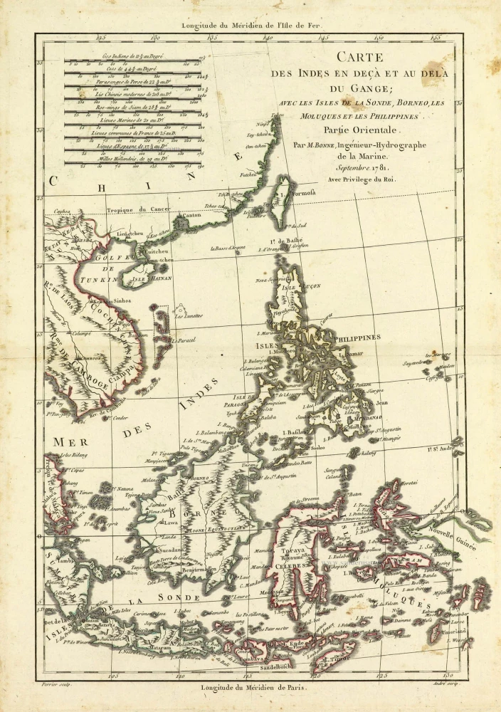
Southeast Asia by Rigobert Bonne. 1690
Carte des Indes en deçà et au dela du Gange; avec les Isles de...
[Item number: 28304]
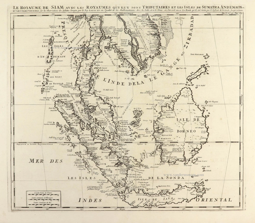
Antique map of Southeast Asia by Châtelain 1719
Le Royaume de Siam avec les Royaumes qui luy sont Tributaires et...
[Item number: 29372]

Southeast Asia, by Z. Châtelain. 1719
Carte des Indes, de la Chine & des Iles de Sumatra, Java &c.
[Item number: 29376]
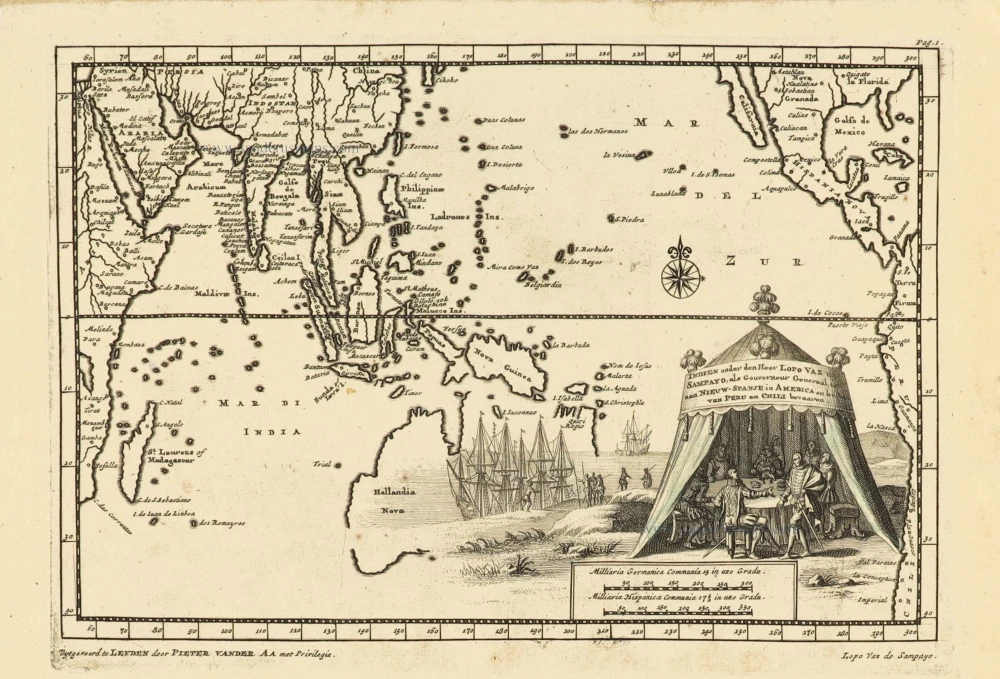
Southeast Asia and Australia, by Pieter Van der Aa. 1707
Indien onder den Heer Lopo Vaz de Sampayo, als Gouverneur...
[Item number: 32359]