Antique maps catalogue
- All recent additions
-
Antique maps
- World and Polar
-
Europe
- Europe Continent
- Belgium
- Belgium - Cities
- The Low Countries
- The Netherlands
- The Netherlands - Cities
- Luxembourg
- France
- France - Cities
- Germany
- Germany - Cities
- Austria
- Italy
- Italy - Cities
- Spain and Portugal
- Greece & Greek Islands
- Switzerland
- British Isles
- British Isles - Cities
- Northern Europe
- Central Europe
- Eastern Europe
- Southeastern Europe
- America
- Asia
- Africa
- Mediterranean Sea
- Australia
- Oceans
- Celestial Maps
- Curiosities
- Books
- Medieval manuscripts
- Prints
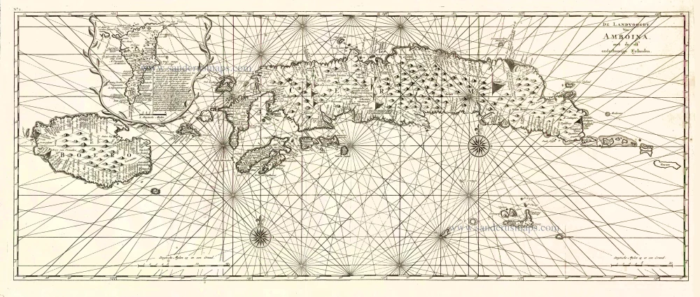
Ambon (Moluccas), by François Valentyn (Valentijn). 1724-26
De Landvoogdy van Amboina met de elf onderhoorige Eylanden
[Item number: 17566]
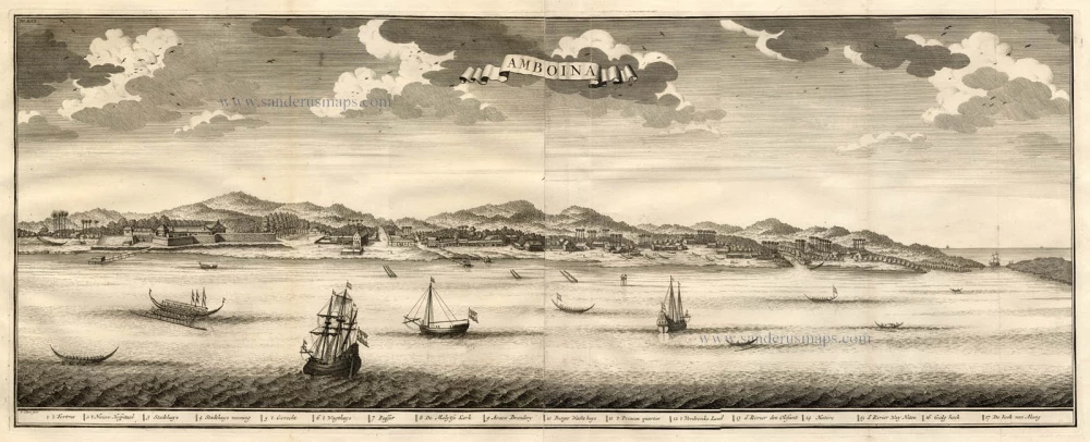
Ambon Island (Moluccas), by François Valentyn. 1724-26
Amboina.
[Item number: 17791]
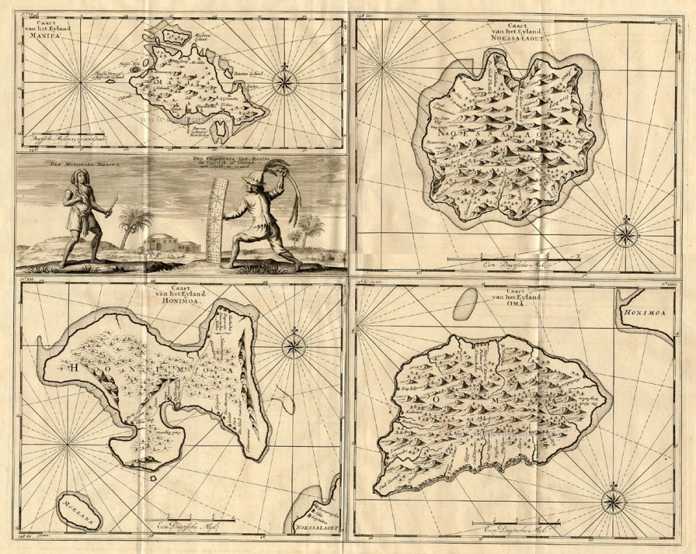
The Ambon Islands by Valentyn. 1724-26
Caart van het Eyland Manipa - Caart van het Eyland Noessa-Laoet...
[Item number: 17212]
![[No title]](https://sanderusmaps.com/assets/WEBP/m20928.webp)
Moluccas - Buru & Ambelou, by Valentyn. 1724-26
[No title]
[Item number: 20928]

New Guinea, by Tirion I. c. 1770
Kaart van de Papoasche Eilanden.
[Item number: 19203]
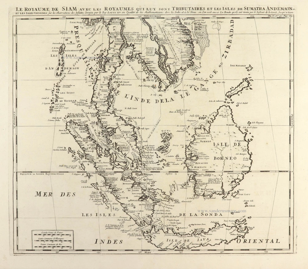
Antique map of Southeast Asia by Châtelain 1719
Le Royaume de Siam avec les Royaumes qui luy sont Tributaires et...
[Item number: 29372]
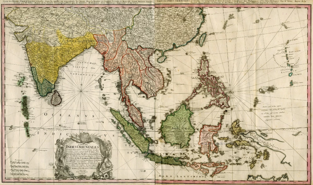
Southern Asia, by Homann Heirs. c. 1759
Carte des Indes Orientales ...
[Item number: 994]
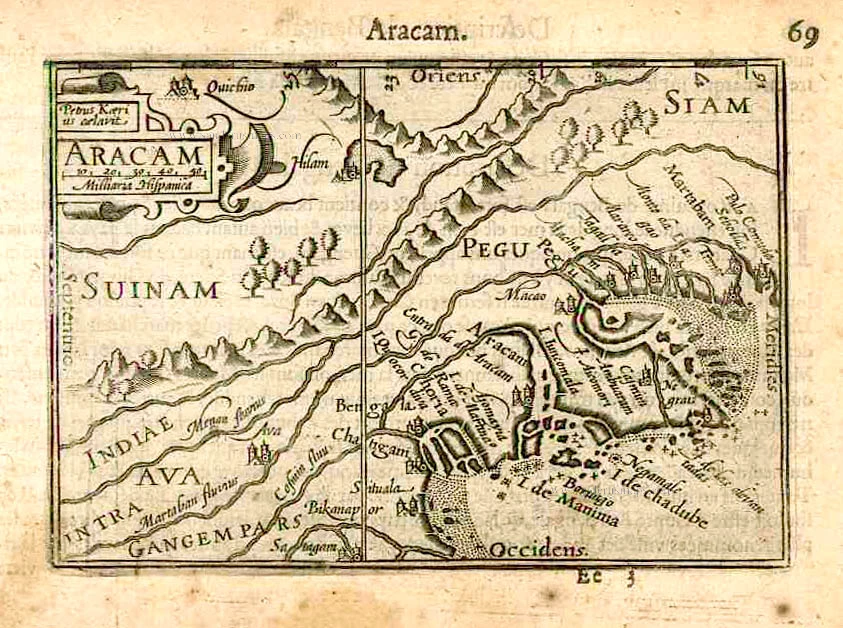
Arakan and Pegu by Barent Langenes & Cornelis Claesz c. 1600
Aracam.
[Item number: 26936]
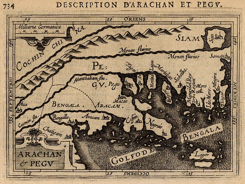
Arakan and Pegu, by Petrus Bertius. 1618
Arachan & Pegu.
[Item number: 18301]
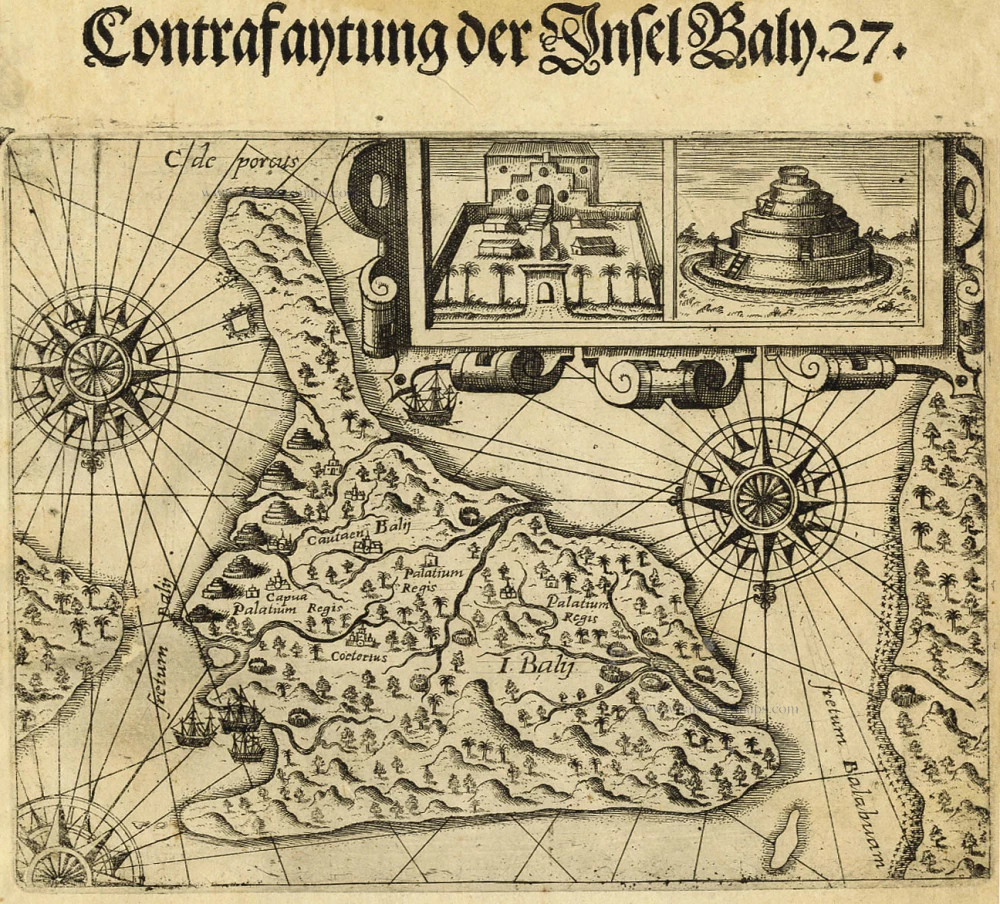
Bali, by Theodore de Bry. 1598-1613
Contrafaytung der Insel Baly . 27.
[Item number: 20721]
Scarce
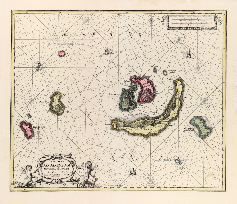
Banda Islands by Joannes van Loon, published by Valk & Schenk. c. 1700
Insularum Bandanensium Novissima delineatio.
[Item number: 30147]
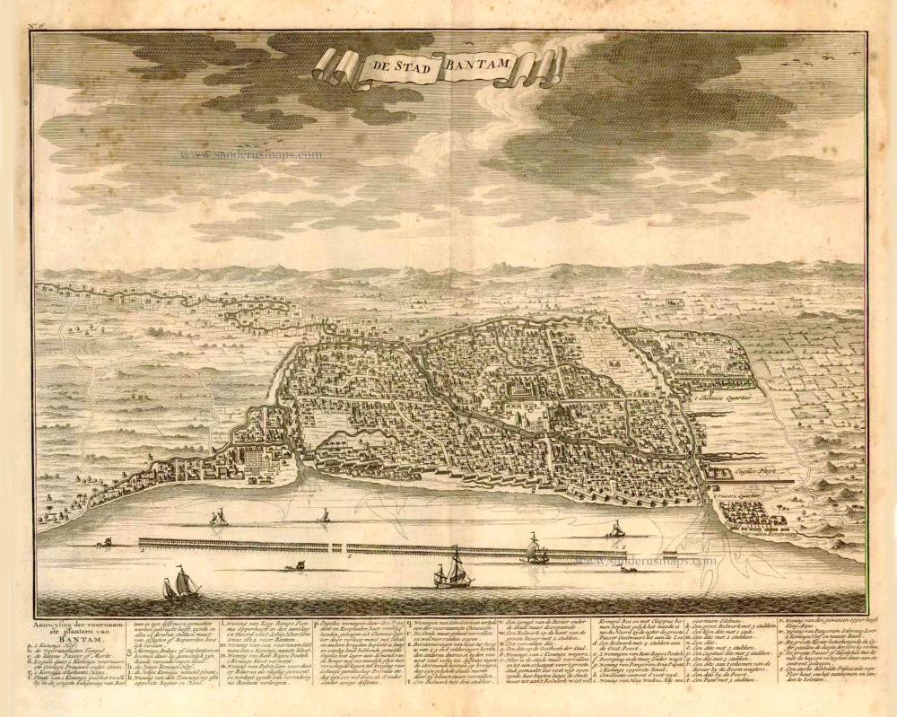
Bantam (Java), by François Valentyn (Valentijn). 1724
De Stad Bantam.
[Item number: 27939]
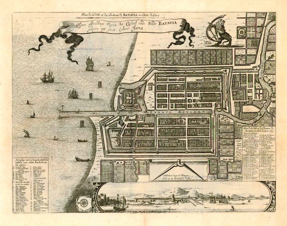
Batavia (Jakarta - Indonesia), by Pieter Van der Aa. 1728
Plan de la Ville er du Château de Batavia en l'Isle de Iava. |...
[Item number: 27887]
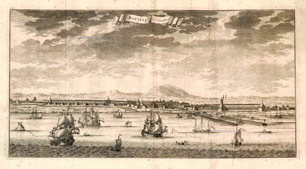
Batavia, by François Valentyn. 1726
Batavia in 't Verschiet.
[Item number: 27896]
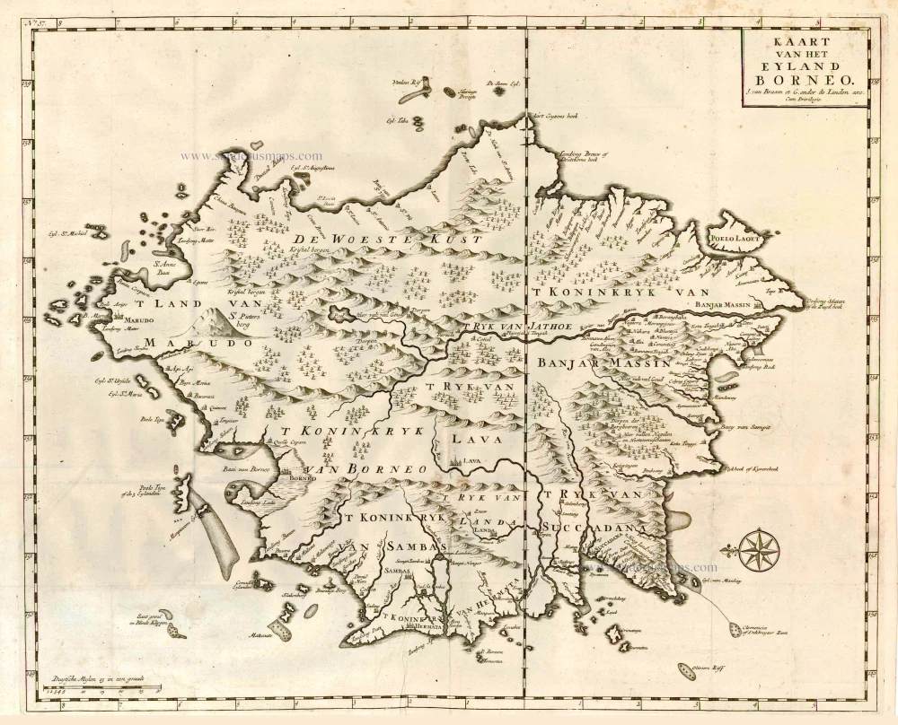
Borneo, by François Valentyn. 1726
Kaart van het Eyland Borneo.
[Item number: 27892]
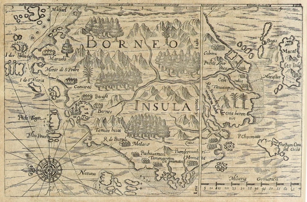
Borneo, by J.L. Gottfried. 1631
Borneo Insula.
[Item number: 31565]
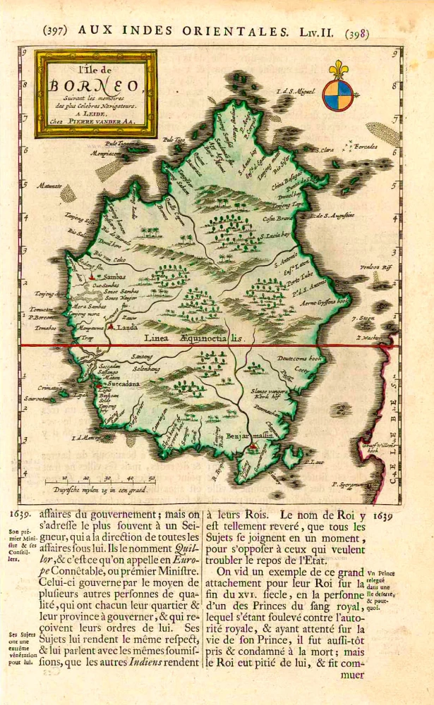
Borneo, by Pieter Van der Aa. 1719
L'Île de Borneo.
[Item number: 26419]

Chart of the route of Schouten and Le Maire north of New Guinea, and the Moluccas, by A. de Herrera, published by M. Colijn. 1622
Caerte vande Landen vande Papouas ofte Nova Guinea nae de...
[Item number: 4165]
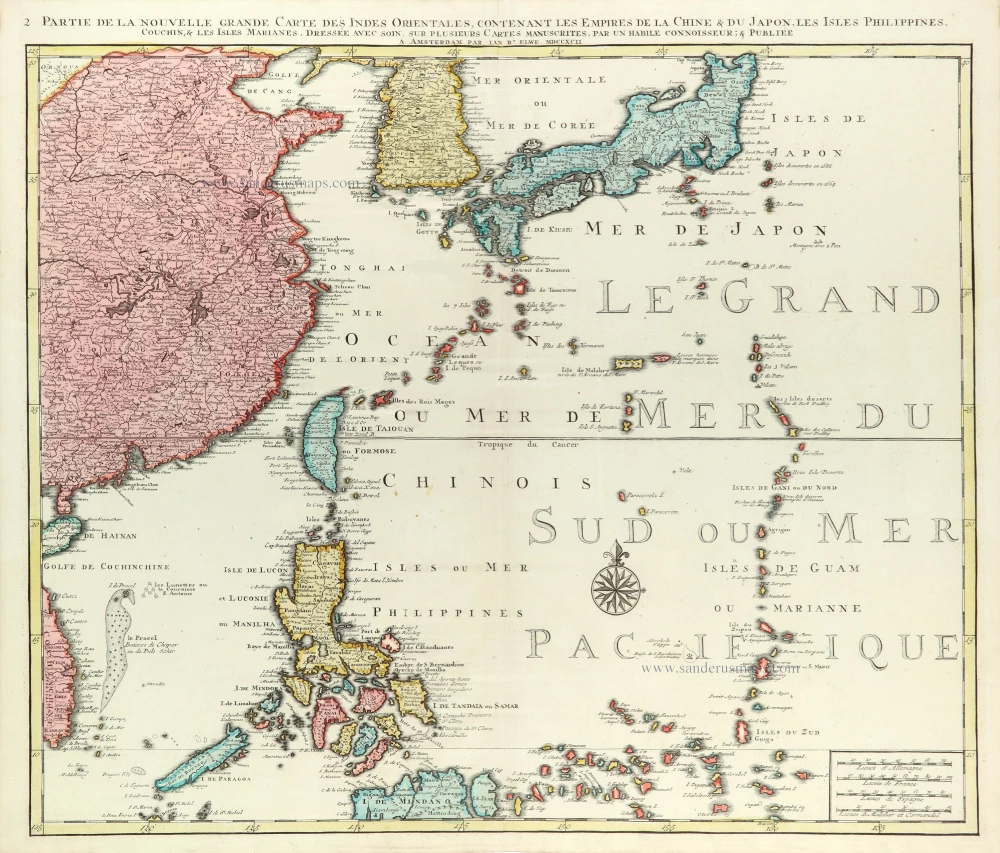
East Asia (Japan - Philippines) by J.B. Elwe. 1792
Partie de la Nouvelle Grande Carte des Indes Orientales...
[Item number: 31803]

The most elegant and decorative map of the region
East Indian Archipelago by Jodocus Hondius. 1630
Insulae Indiae Orientalis Praecipuae, in quibus Moluccae...
[Item number: 29863]
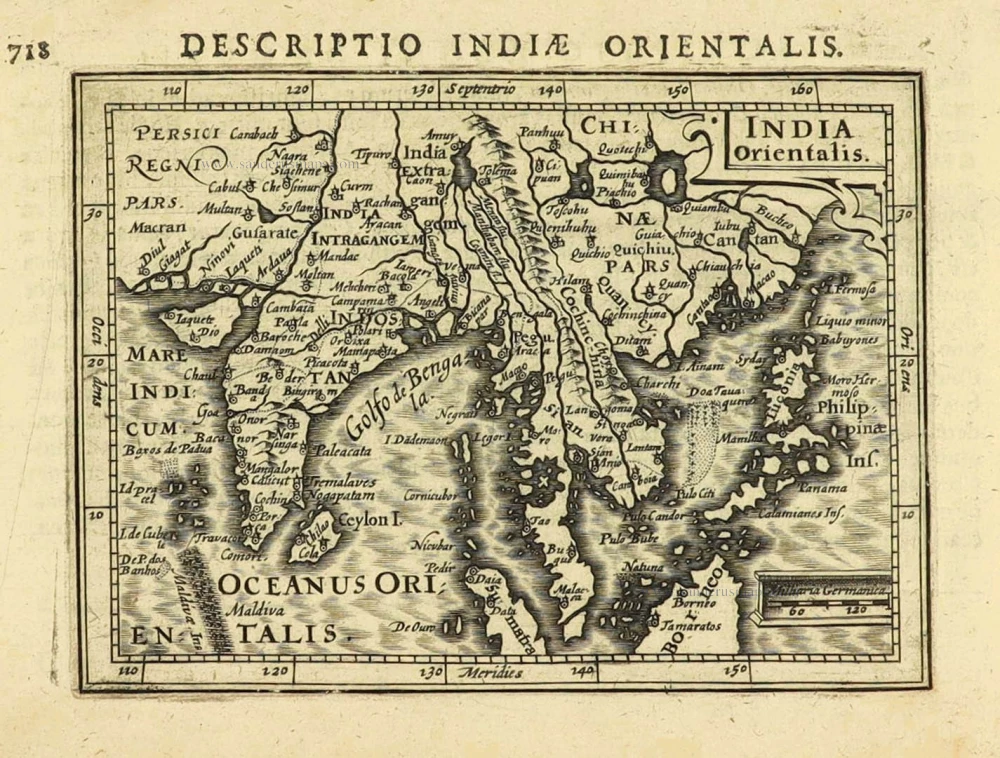
East Indies by Petrus Bertius. 1616
India Orientalis.
[Item number: 28162]

Fries 1525 edition of the first modern map of Southeast Asia
South Asia by Lorenz Fries. 1525
Tab. Moderna Indiae.
[Item number: 27929]
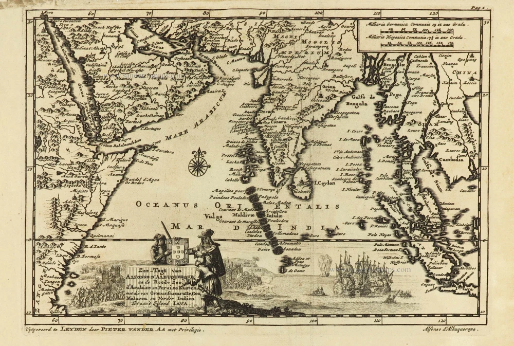
Indian Ocean & Southeast Asia by Pieter Van der Aa. 1707
Zee-togt van Alfonso d'Albuquerque na de Roode Zee, d'Arabize en...
[Item number: 32321]
new
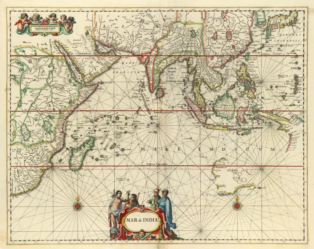
First folio sea chart from the Dutch Golden Age
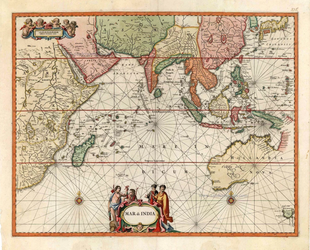
Indian Ocean by J. Janssonius 1650
Mar di India.
[Item number: 32184]
new

Scarce
Indian Ocean by Pieter Vander Aa 1714
Basora En de Landschappen Tussen den Eufrat en Tiger stroom, een...
[Item number: 31082]
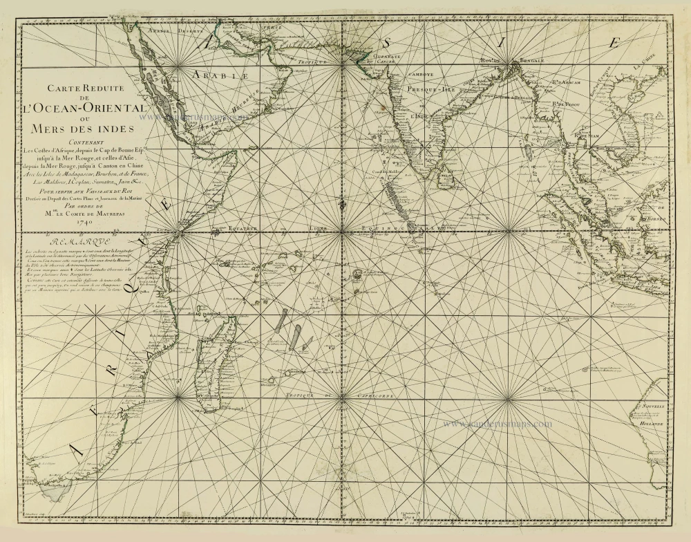
Indian Ocean, by J.N. Bellin. 1756-1770
Carte Réduite de l'Océan Oriental ou Mers des Indes.
[Item number: 28148]
Very rare second state, including the Tasman discoveries (Australia).
Indian Ocean, by Petrus Schenk c. 1700
Mar di India.
[Item number: 27775]
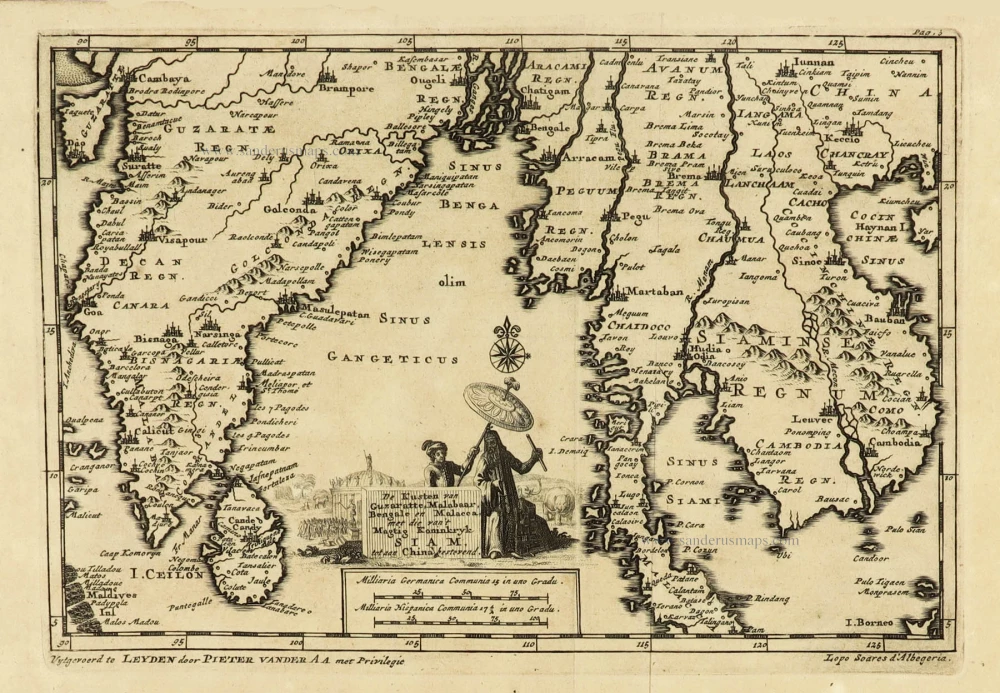
Indian Ocean, India, Thailand, and Siam by Pieter Van der Aa. 1707
De Kusten van Guzaratte, Malabar, Bengale en Malacca met die...
[Item number: 32323]
new
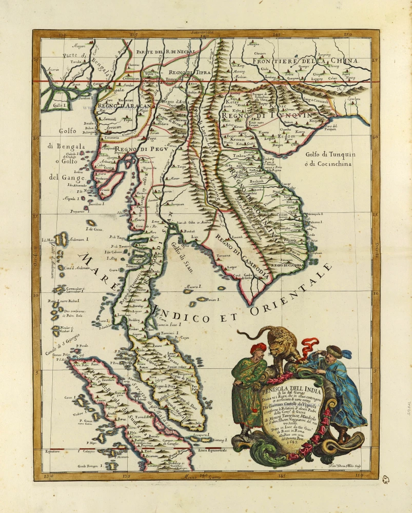
Indochina by Cantelli da Vignola, published by Giovanni Giacomo de Rossi. 1692
Penisola Dell India di la dal Gange Divisa ne i Regni, che in...
[Item number: 28371]

Borneo, by Petrus Bertius 1618
Borneo insula.
[Item number: 32172]
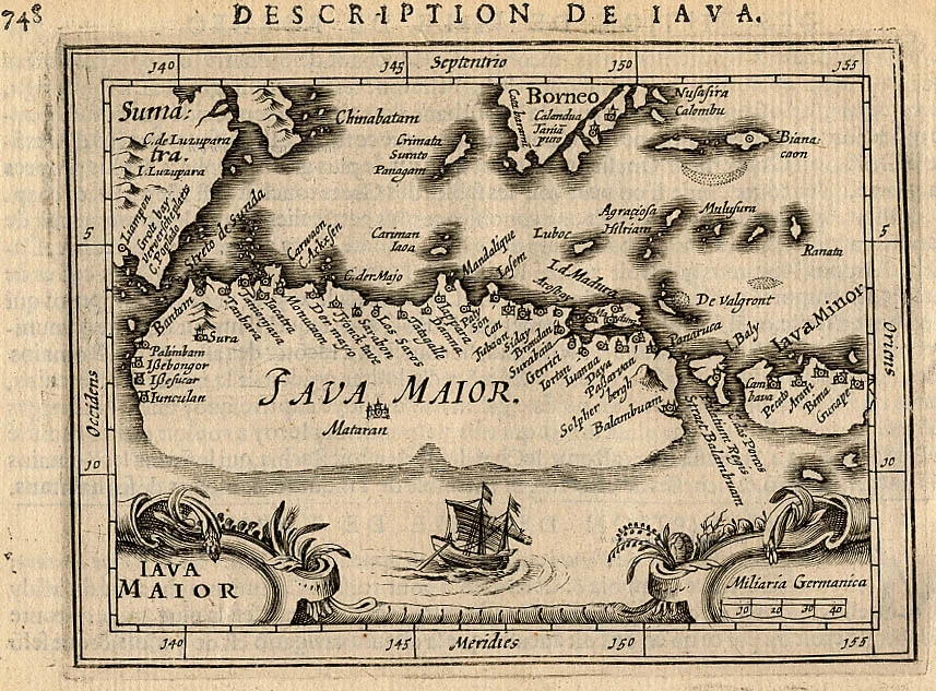
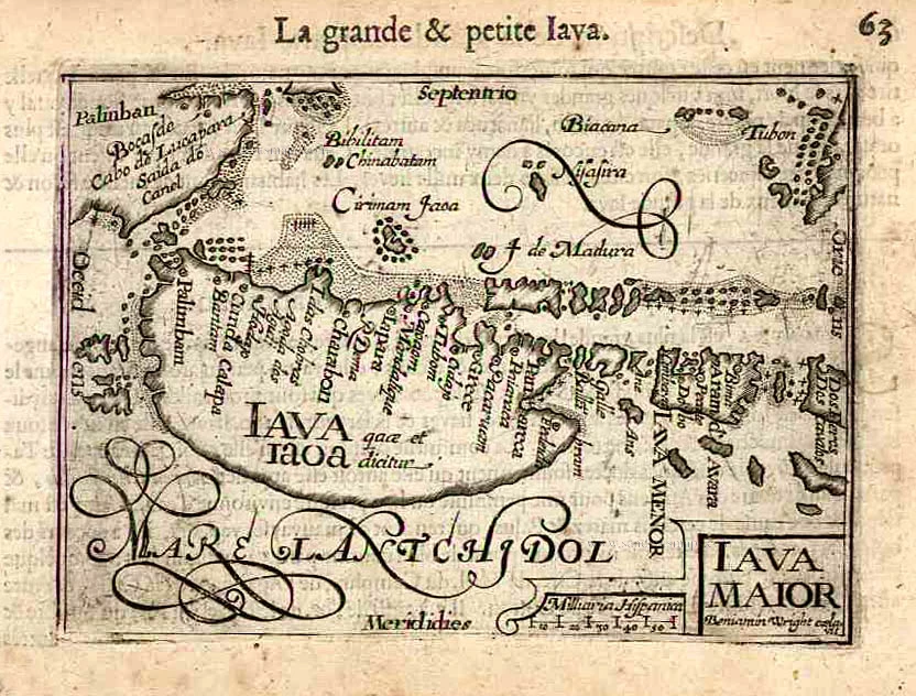
Java, by Bertius P. 1618
Iava Maior.
[Item number: 18307]
![[No title]](https://sanderusmaps.com/assets/WEBP/m32054.webp)
Rare
Spice Islands by Hulsius Levinus. 1608
[No title]
[Item number: 32054]
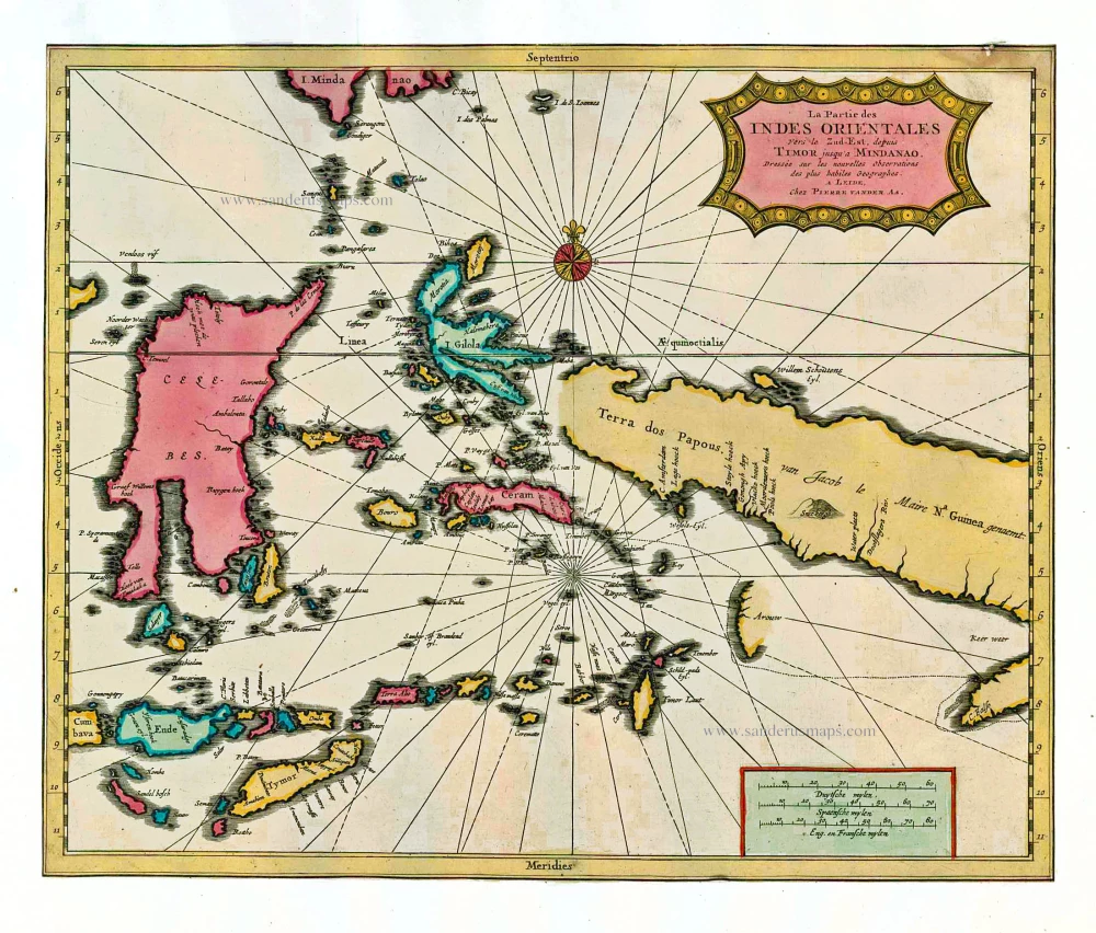
Indonesia by P. Van der Aa 1713
La Partie des Indes Orientales vers le Zud-Est, depuis Timor...
[Item number: 26101]
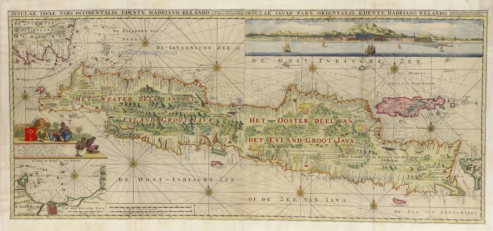
Rare and important chart
Java by Gerard Van Keulen. 1728
Insulae Iavae Pars Occidentalis edente Hadriano Relando. -...
[Item number: 32293]
new
Java by Barent Langenes & Cornelis Claesz c. 1600
Iava Maior.
[Item number: 26935]
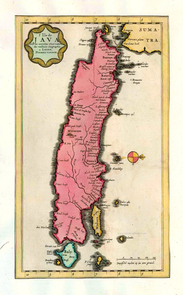
Java, by Pieter van der Aa. 1713
L'Ile de Java.
[Item number: 26127]