Antique maps catalogue
- All recent additions
-
Antique maps
- World and Polar
-
Europe
- Europe Continent
- Belgium
- Belgium - Cities
- The Low Countries
- The Netherlands
- The Netherlands - Cities
- Luxembourg
- France
- France - Cities
- Germany
- Germany - Cities
- Austria
- Italy
- Italy - Cities
- Spain and Portugal
- Greece & Greek Islands
- Switzerland
- British Isles
- British Isles - Cities
- Northern Europe
- Central Europe
- Eastern Europe
- Southeastern Europe
- America
- Asia
- Africa
- Mediterranean Sea
- Australia
- Oceans
- Celestial Maps
- Curiosities
- Books
- Medieval manuscripts
- Prints
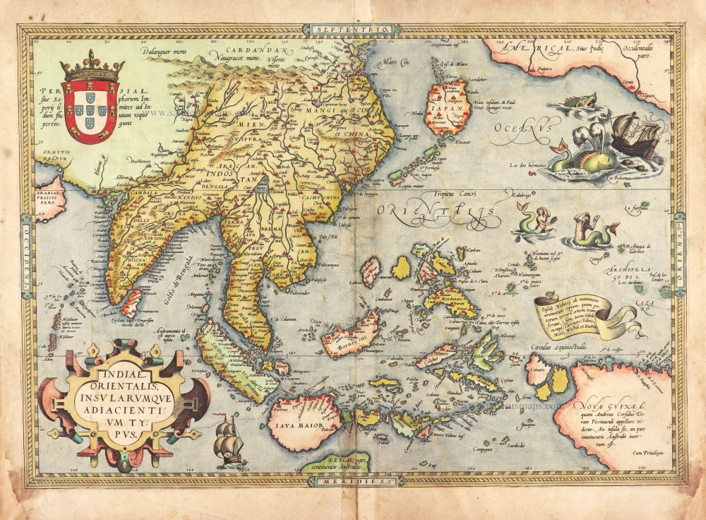
Very rare first 1570 A edition.
Southeast Asia, by Abraham Ortelius. 1570
Indiae Orientalis Insularumque Adiacientium Typus.
[Item number: 30592]
A very important map of the region
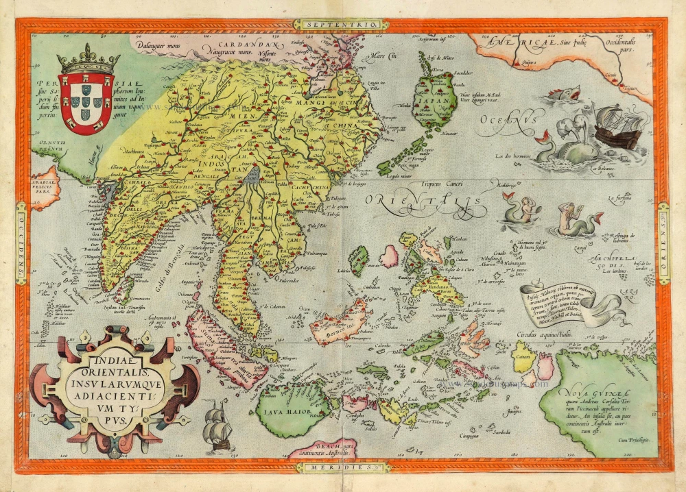
Southeast Asia, by Abraham Ortelius. 1572
Indiae Orientalis Insularumque Adiacientium Typus.
[Item number: 28046]

Chart of the route of Schouten and Le Maire north of New Guinea, and the Moluccas, by A. de Herrera, published by M. Colijn. 1622
Caerte vande Landen vande Papouas ofte Nova Guinea nae de ...
[Item number: 4165]
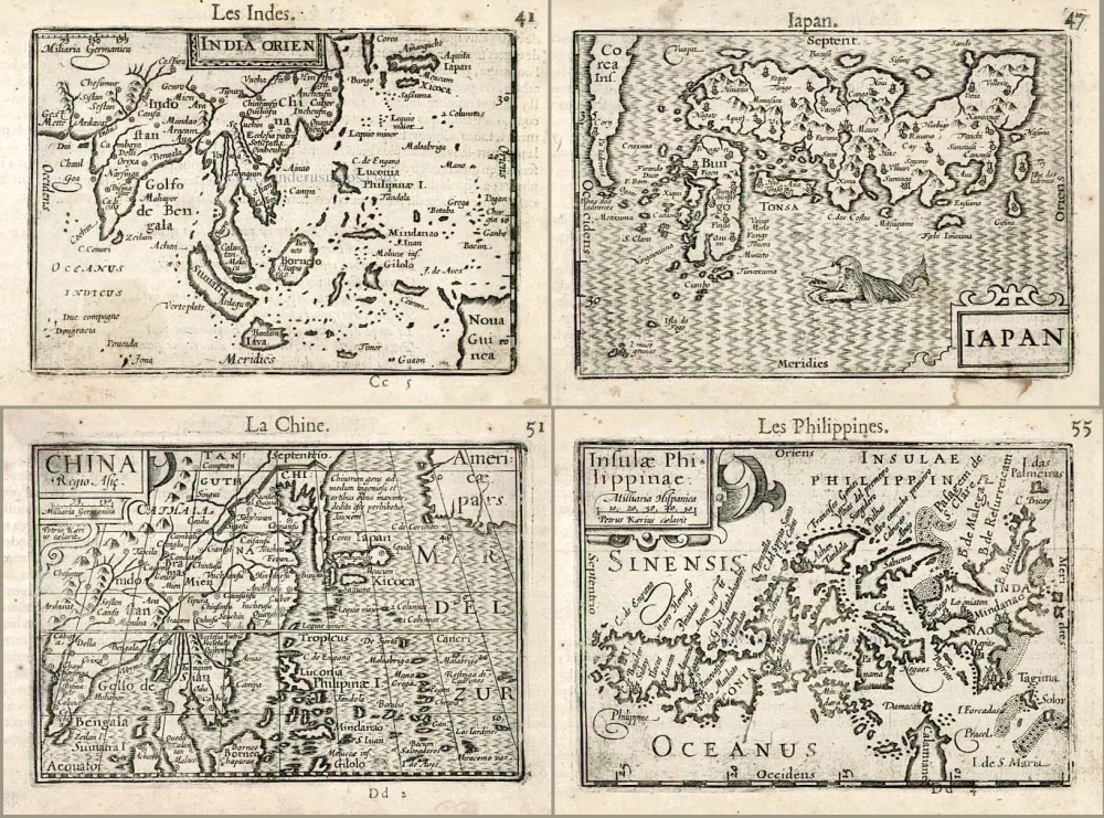
Including the first map of the Philippines.
Barent Langenes & Cornelis Claesz.: Southeast Asia, Japan, China, and the Philippines. 1602
India Orien. - Iapan. - China. - Insulae Philippinae.
[Item number: 27705]
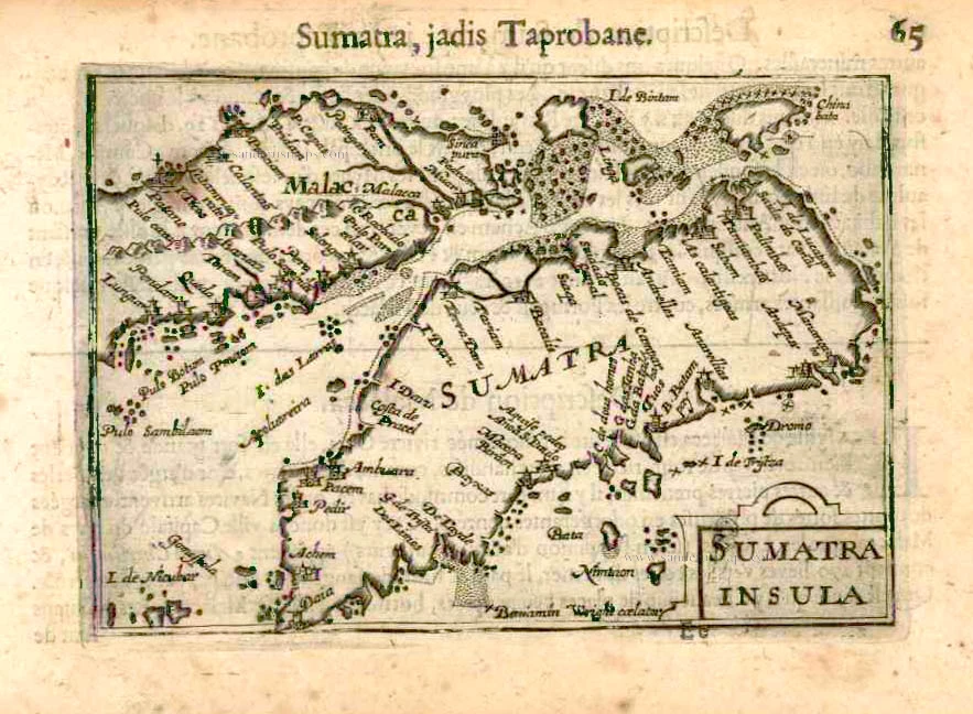
Sumatra by Barent Langenes & Cornelis Claesz c. 1600
Sumatra Insula.
[Item number: 26932]
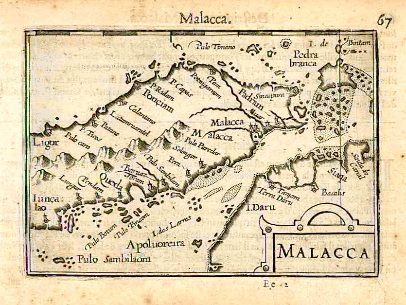
Malacca by Barent Langenes & Cornelis Claesz c. 1600
Malacca.
[Item number: 26934]
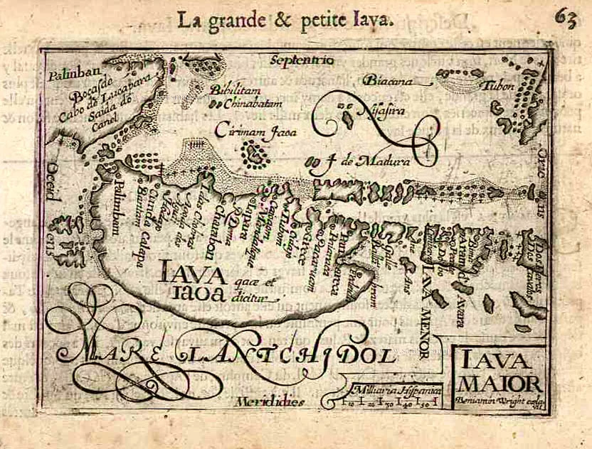
Java by Barent Langenes & Cornelis Claesz c. 1600
Iava Maior.
[Item number: 26935]
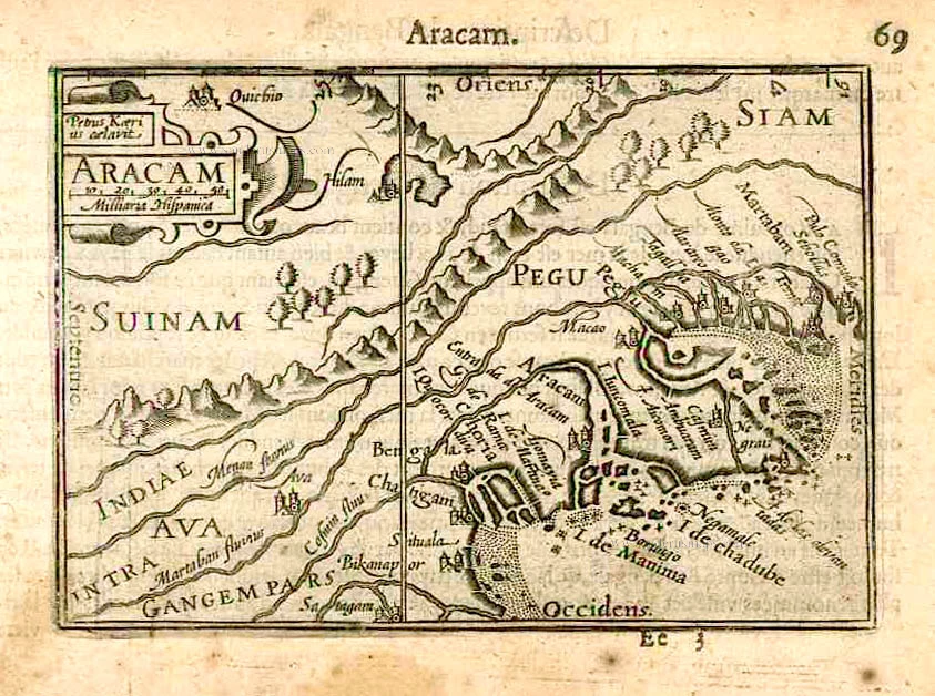
Arakan and Pegu by Barent Langenes & Cornelis Claesz c. 1600
Aracam.
[Item number: 26936]
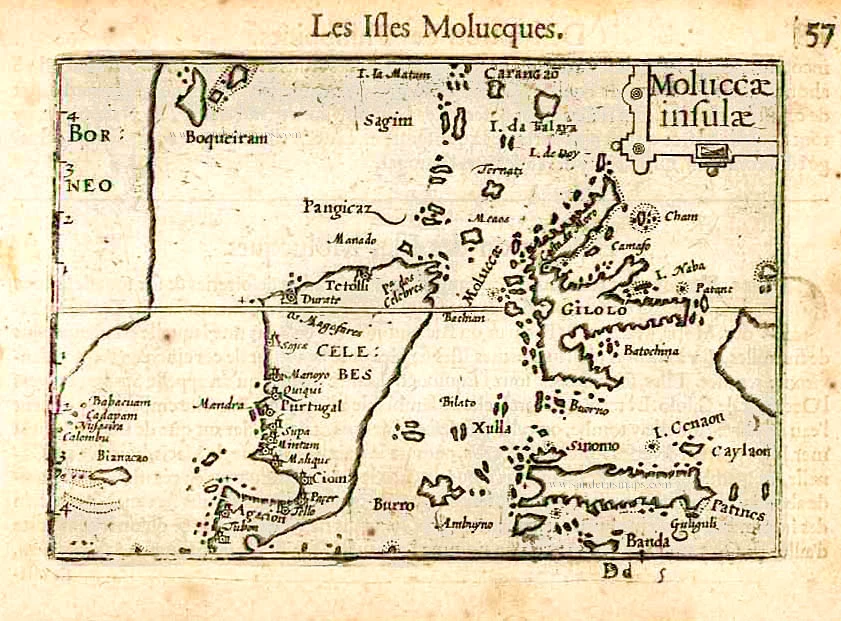
Moluccas by Barent Langenes & Cornelis Claesz c. 1600
Moluccae Insulae.
[Item number: 26996]

Moluccas by Willem Blaeu 1640
Moluccae Insulae Celeberimae.
[Item number: 31047]

This map has the first accurate depiction of the Philippines
Southeast Asia by Willem & Joan Blaeu 1640-43
India quae Orientalis dicitur et Insulae Adiacentes.
[Item number: 26566]

SCARCE !
View of Banten (Indonesia), by Carel Allard. 1685/90
Bantam.
[Item number: 30580]
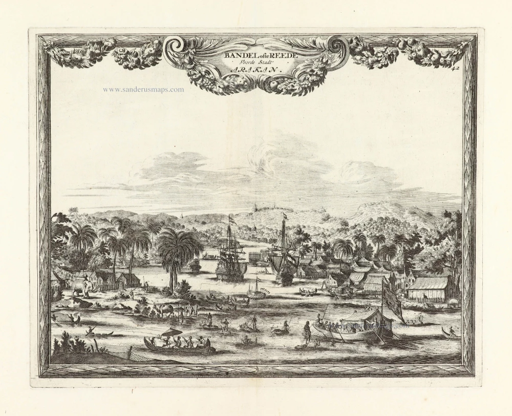
SCARCE !
View of Baungdwet (Myanmar), by Carel Allard. 1685/90
Bandel ofte Reede Voorde Stadt Arakan.
[Item number: 30581]
![Tabu. Moder. Indiae [together with] India Orien talis.](https://sanderusmaps.com/assets/WEBP/m30141.webp)
Two early modern maps of Southeast Asia by L. Fries and M. Waldseemüller
South Asia by Lorens Fries 1535
Tabu. Moder. Indiae [together with] India Orien talis.
[Item number: 30141]
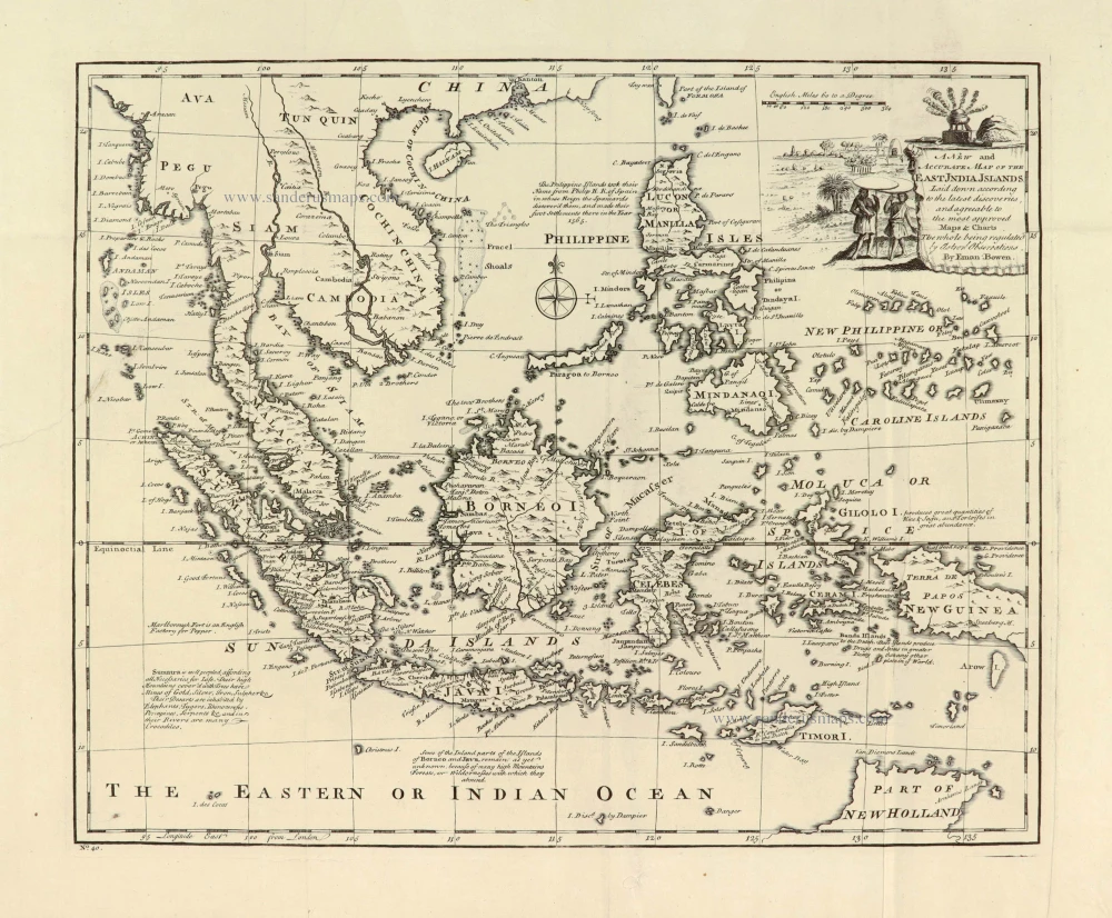
Southeast Asia, by Emanuel Bowen. 1747
A New and Accurate Map of the East India Islands.
[Item number: 28012]
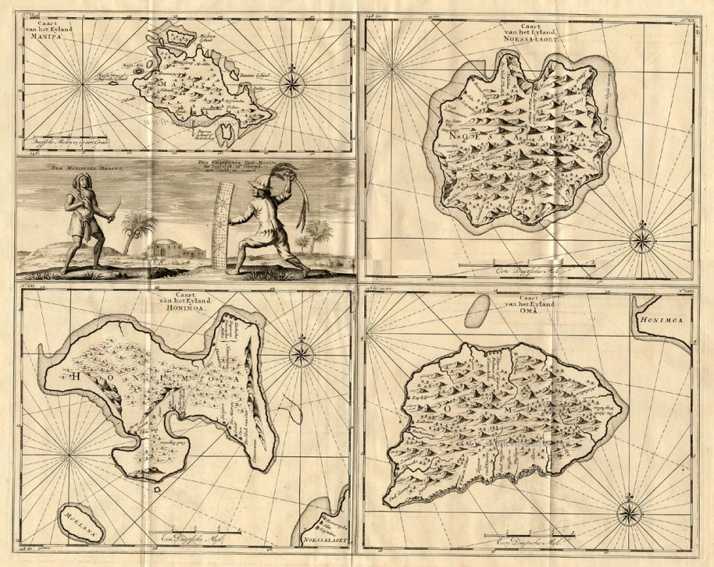
The Ambon Islands by Valentyn. 1724-26
Caart van het Eyland Manipa - Caart van het Eyland Noessa-Laoet ...
[Item number: 17212]
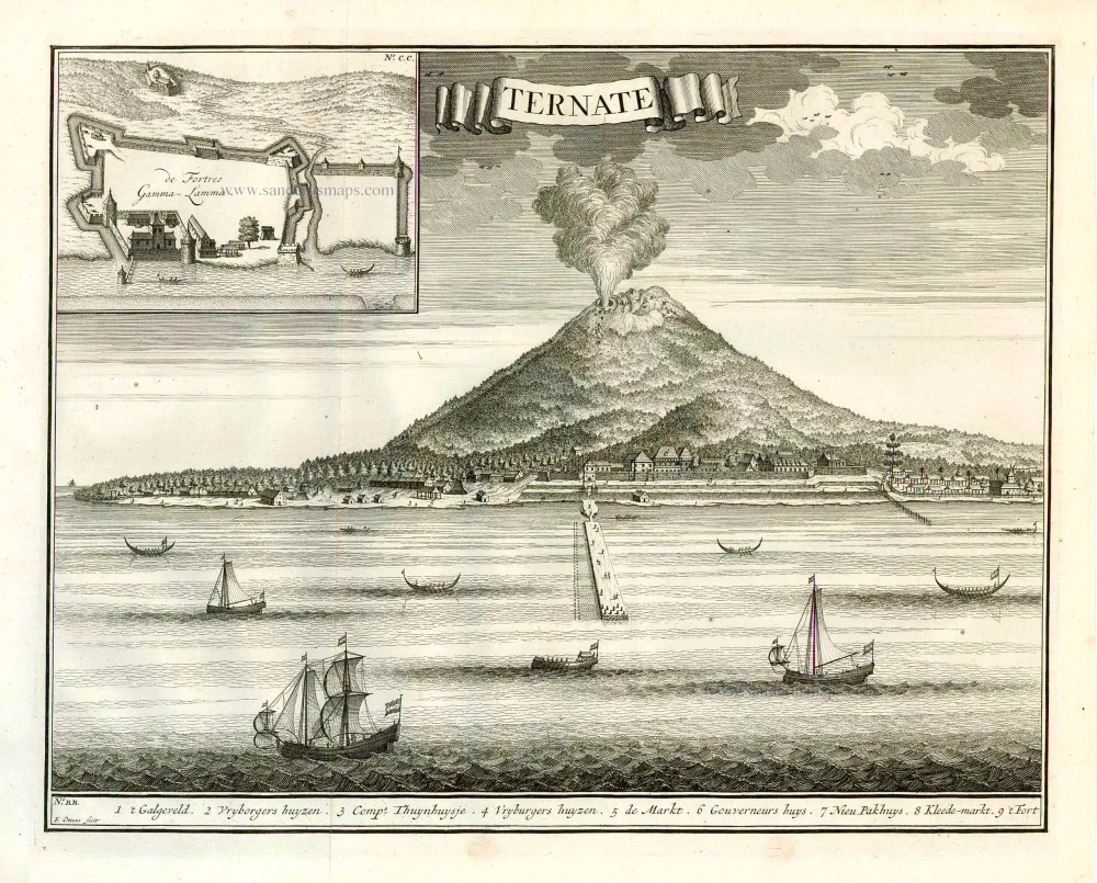
View of Ternate (Moluccos) showing the eruption of the Gamalama volcano, by François Valentyn (Valentijn). 1724-26
Ternate.
[Item number: 26875]
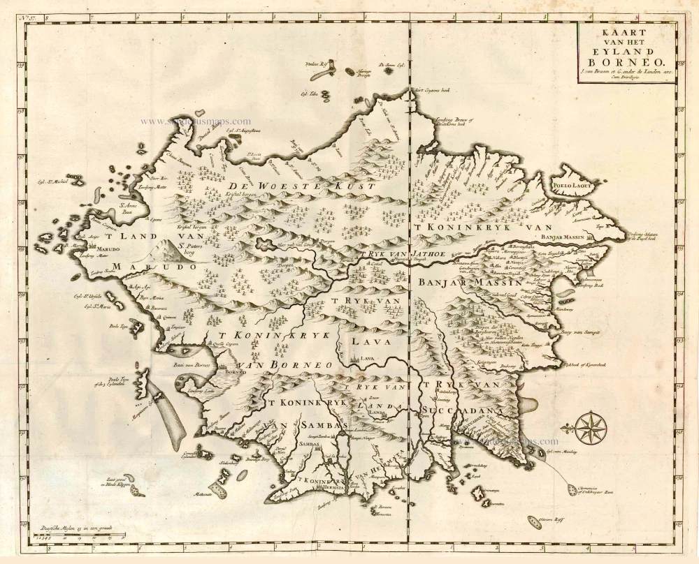
Borneo, by François Valentyn. 1726
Kaart van het Eyland Borneo.
[Item number: 27892]
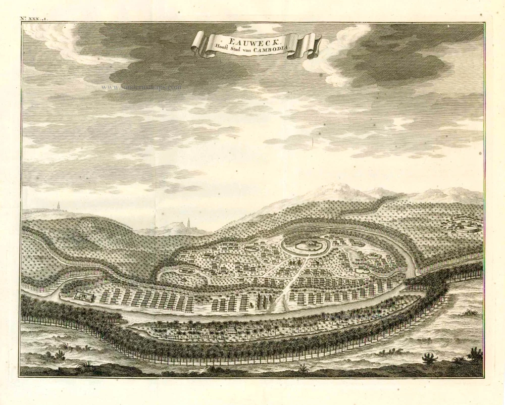
Lovek (Longvek - Camboia), by François Valentyn (Valentijn). 1724-26
Eauweck, Hoofd-Stad van Cambodia.
[Item number: 26891]
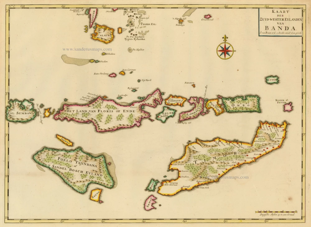
The Banda Islands, by François Valentyn. 1724-26
Kaart der Zuyd-Wester Eylanden van Banda
[Item number: 17794]
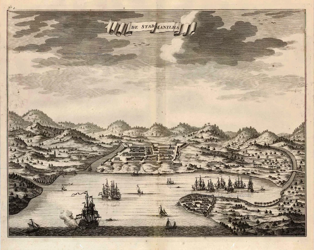
Philippines - Manilla by François Valentyn (Valentijn) 1726
De Stad Manilha.
[Item number: 27894]
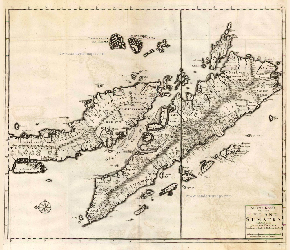
Malaysia - Sumatra by François Valentyn (Valentijn) 1724-26
Nieuwe Kaart van het Eyland Sumatra.
[Item number: 26898]
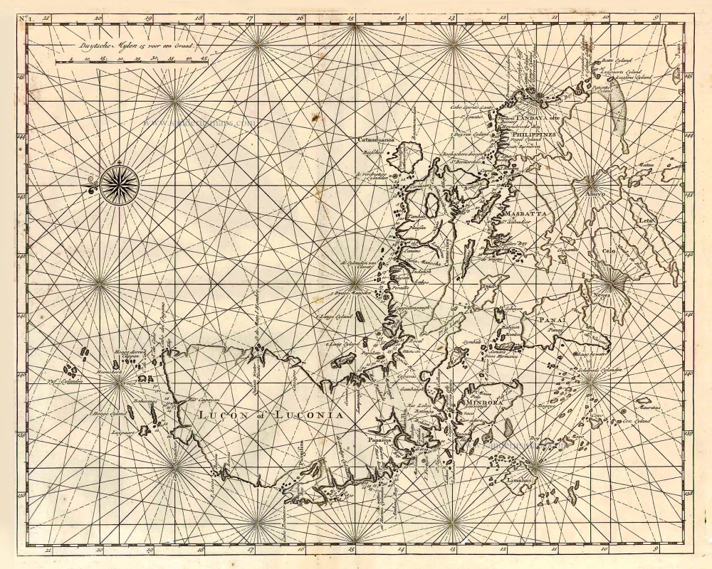
Philippines, by François Valentyn. 1726
Lucon of Luconia.
[Item number: 27895]
![[No title]](https://sanderusmaps.com/assets/WEBP/m20926.webp)
Moluccas - Buru and Ambelou, by Valentyn. 1724-26
[No title]
[Item number: 20926]
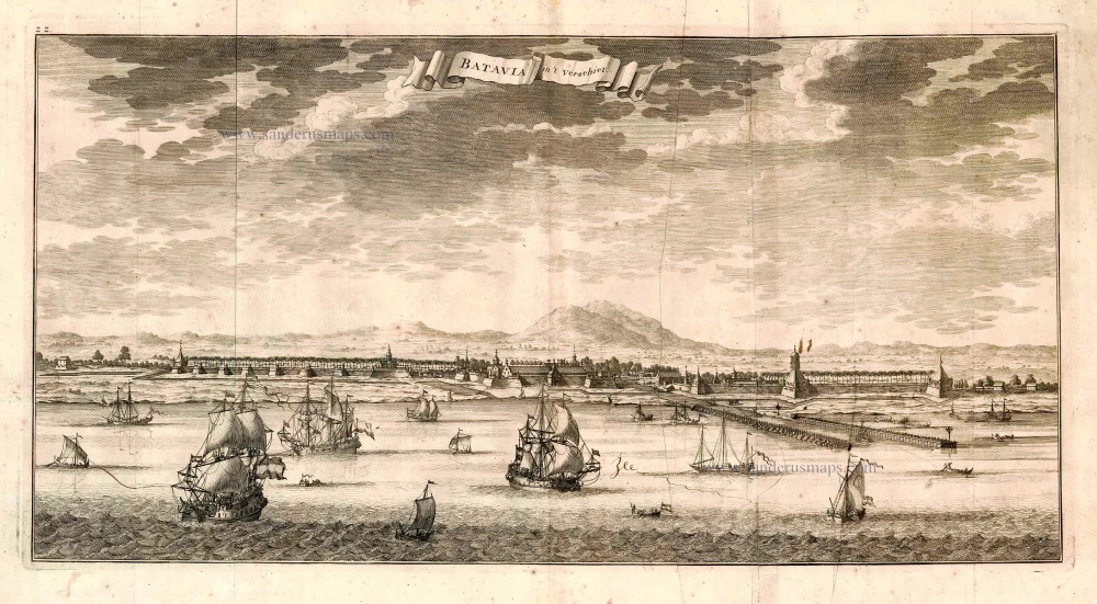
Batavia, by François Valentyn. 1726
Batavia in 't Verschiet.
[Item number: 27896]
![[No title]](https://sanderusmaps.com/assets/WEBP/m20928.webp)
Moluccas - Buru & Ambelou, by Valentyn. 1724-26
[No title]
[Item number: 20928]
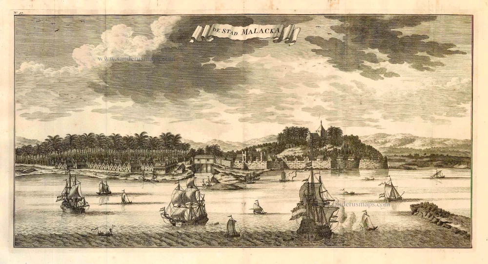
Malacca, by François Valentyn. 1726
De Stad Malacka.
[Item number: 27898]
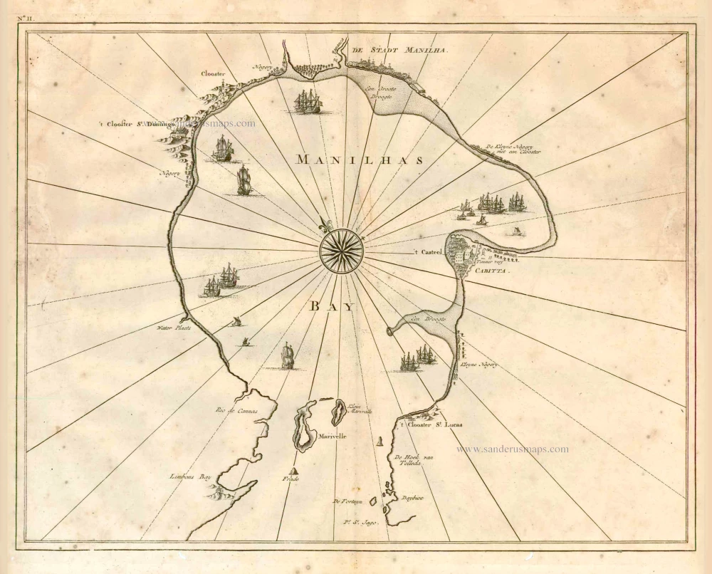
Philippine Islands - Manila Bay by François Valentyn (Valentijn) 1724-26
Manilhas Bay.
[Item number: 27904]
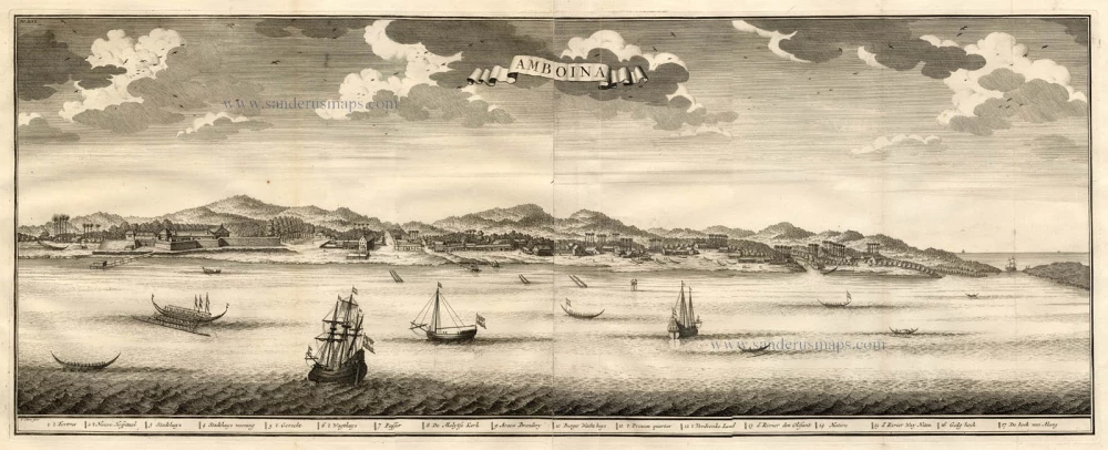
Ambon Island (Moluccas), by François Valentyn. 1724-26
Amboina.
[Item number: 17791]
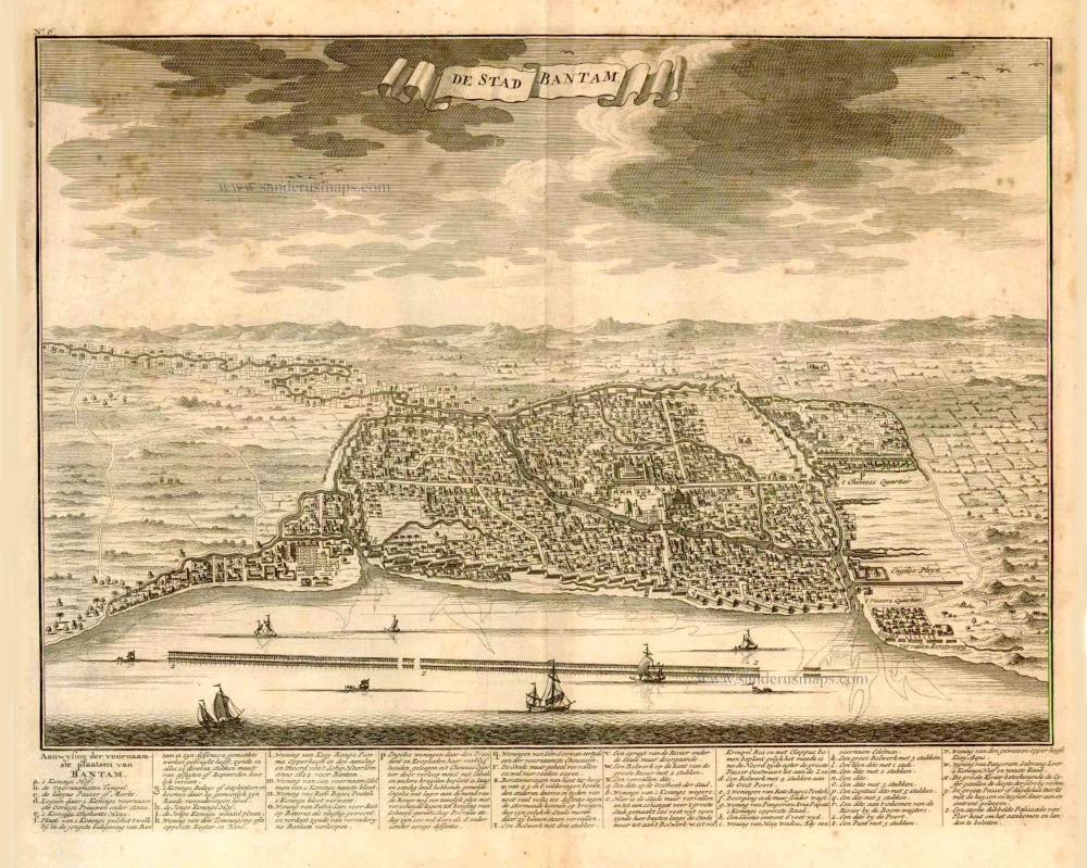
Bantam (Java), by François Valentyn (Valentijn). 1724
De Stad Bantam.
[Item number: 27939]

Big and important map.
Java, by François Valentyn (Valentijn). 1724-26
Nieuwe en zeer naaukeurige kaart van t Eyland Java Major of ...
[Item number: 27054]
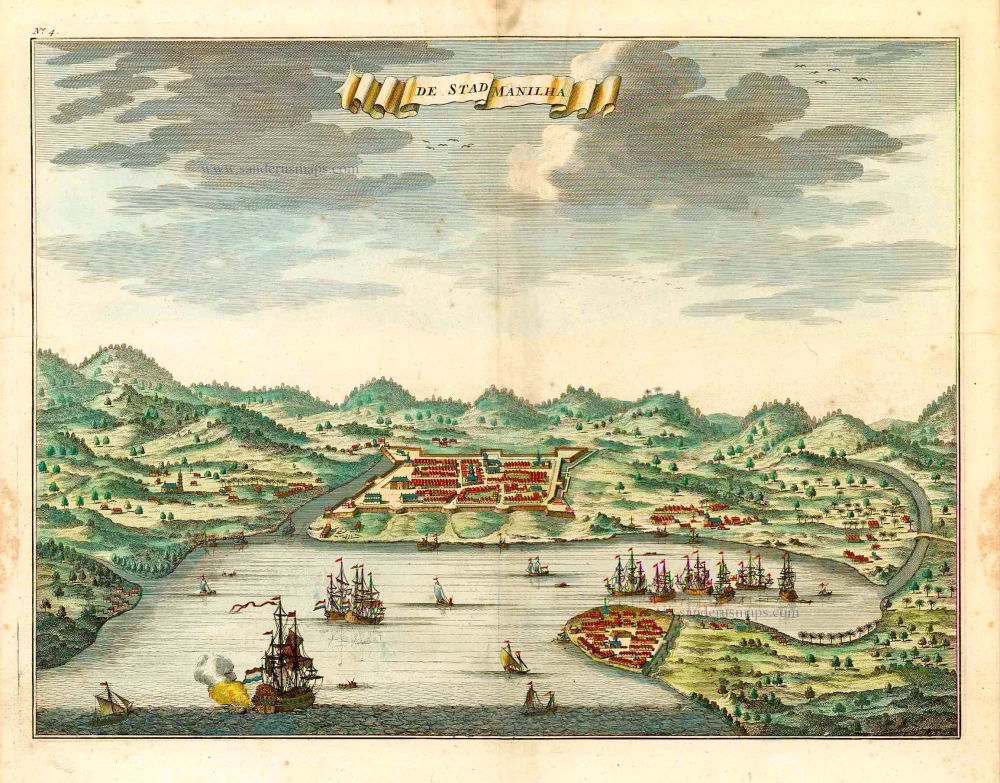
Philippines - Manilla by François Valentyn (Valentijn) 1724-26
De Stad Manilha.
[Item number: 27064]
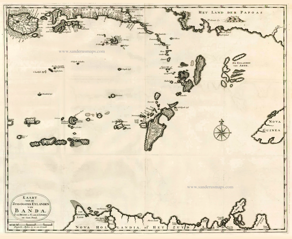
The Banda Islands (Southeast) & Northern Australia, by Fr. Valentyn. 1724-26
Kaart van de Zuyd-Ooster Eylanden van Banda.
[Item number: 26608]

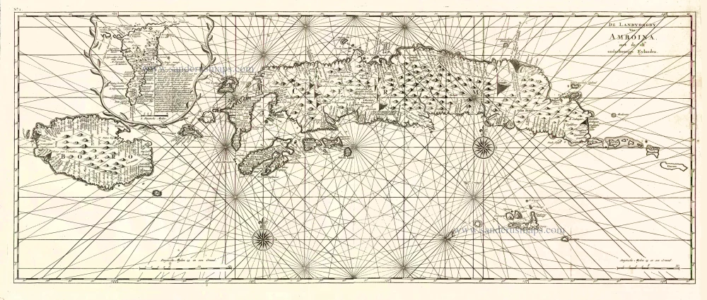
The Moluccas by François Valentyn (Valentijn). 1724
De Landvoogdy der Moluccos, met de aangrenzende Eylanden.
[Item number: 17559]
Ambon (Moluccas), by François Valentyn (Valentijn). 1724-26
De Landvoogdy van Amboina met de elf onderhoorige Eylanden
[Item number: 17566]
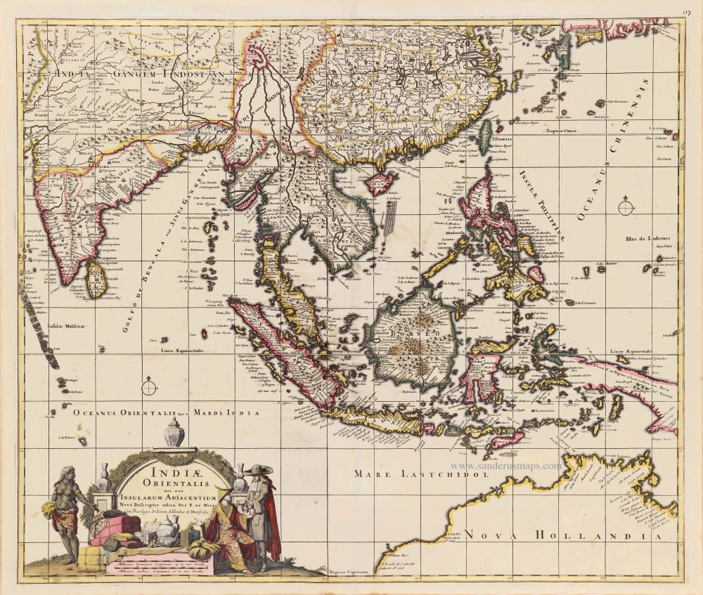
Southeast Asia - Australia by Frederick de Wit. c. 1691-97
Indiae Orientalis nec non Insularum Adiacentium.
[Item number: 29091]