Antique maps catalogue
- All recent additions
-
Antique maps
- World and Polar
-
Europe
- Europe Continent
- Belgium
- Belgium - Cities
- The Low Countries
- The Netherlands
- The Netherlands - Cities
- Luxembourg
- France
- France - Cities
- Germany
- Germany - Cities
- Austria
- Italy
- Italy - Cities
- Spain and Portugal
- Greece & Greek Islands
- Switzerland
- British Isles
- British Isles - Cities
- Northern Europe
- Central Europe
- Eastern Europe
- Southeastern Europe
- America
- Asia
- Africa
- Mediterranean Sea
- Australia
- Oceans
- Celestial Maps
- Curiosities
- Books
- Medieval manuscripts
- Prints
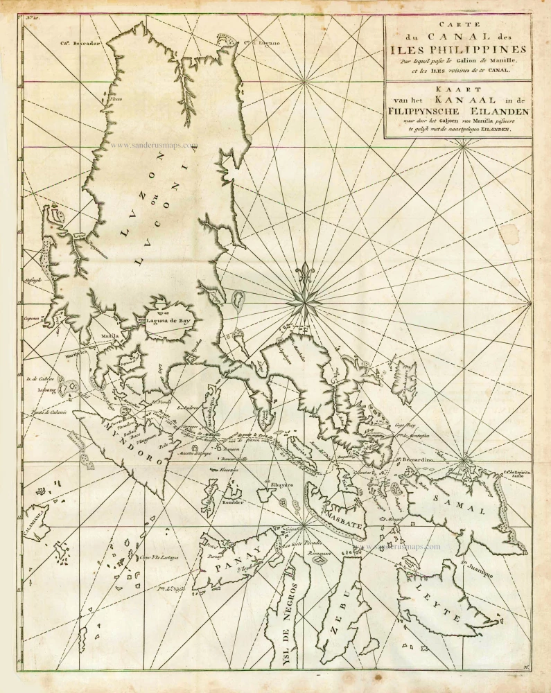
The Philippines, by George Anson. 1748
Carte du Canal des Iles Philippines par lequel Passe le Galion ...
[Item number: 27036]
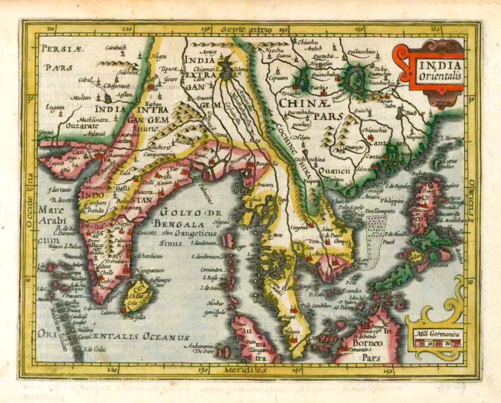
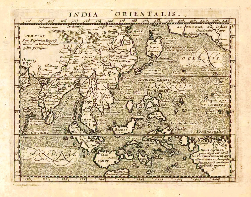
Southeast Asia, by G. Mercator - J. Hondius (small) 1607
India Orientalis.
[Item number: 25186]
From the Cloppenburg edition
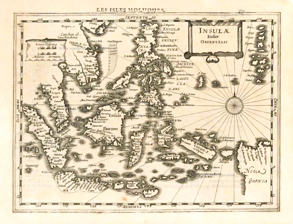
Southeast Asia, by G. Mercator - J. Hondius. 1630
Insulae Indiae Orientalis.
[Item number: 25234]

Sumatra, by G. Valk & P. Schenk. c. 1700
Sumatrae et Insularum Locorumque Nonnullorum Circumiacentium ...
[Item number: 25714]
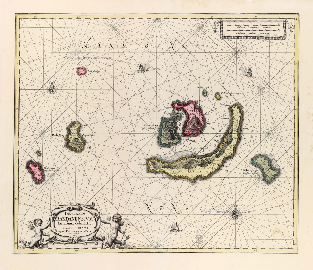
Banda Islands by Joannes van Loon, published by Valk & Schenk. c. 1700
Insularum Bandanensium Novissima delineatio.
[Item number: 30147]
Scarce
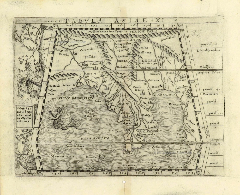
Southeast Asia by Giacomo Gastaldi / Ptolemy. 1548
Tabula Asiae XI.
[Item number: 28362]
Southeast Asia, by Giovanni Magini. 1597
India Orientalis.
[Item number: 26521]
![Les Isles Philippines [on sheet with] Islas de los Ladrones ou Isle des Larrons.](https://sanderusmaps.com/assets/WEBP/m30304.webp)
Philippines, by Nicolas Sanson, published by Prevost d'Exiles. 1747-74
Les Isles Philippines [on sheet with] Islas de los Ladrones ou ...
[Item number: 30304]
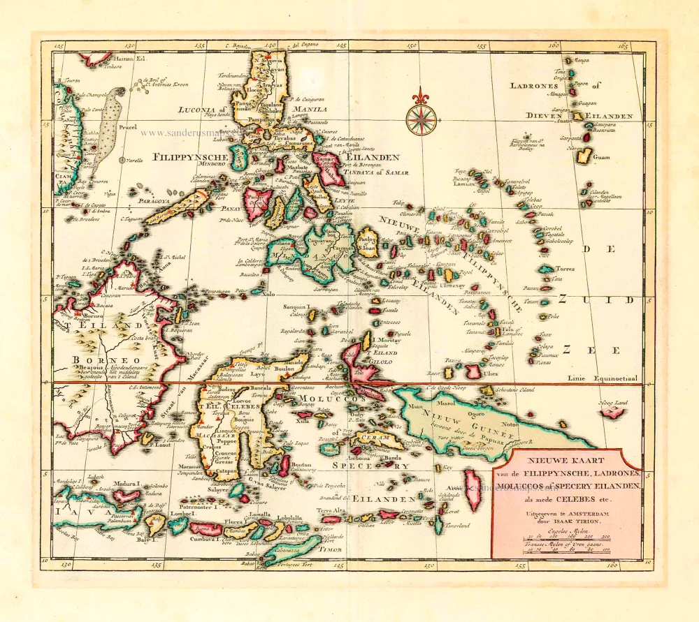
Philippines - Indonesia by Tirion I. 1744
Nieuwe Kaart van de Filippynsche, Ladrones, Moluccos of Specery ...
[Item number: 26584]

New Guinea, by Tirion I. c. 1770
Kaart van de Papoasche Eilanden.
[Item number: 19203]
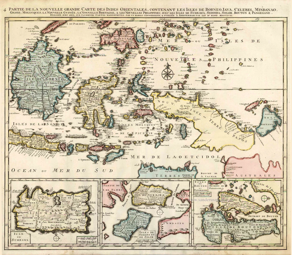
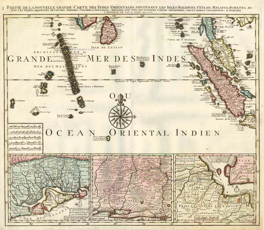
Indonesia - New Guinea - Australia by J.B. Elwe. 1792
Partie de la Nouvelle Grande Carte des Indes Orientales, ...
[Item number: 2293]
Indian Ocean (North), by J.B. Elwe. 1792
Partie de la Nouvelle Grande Carte des Indes Orientales, ...
[Item number: 2363]
Southern Asia, by Homann Heirs. c. 1759
Carte des Indes Orientales ...
[Item number: 994]
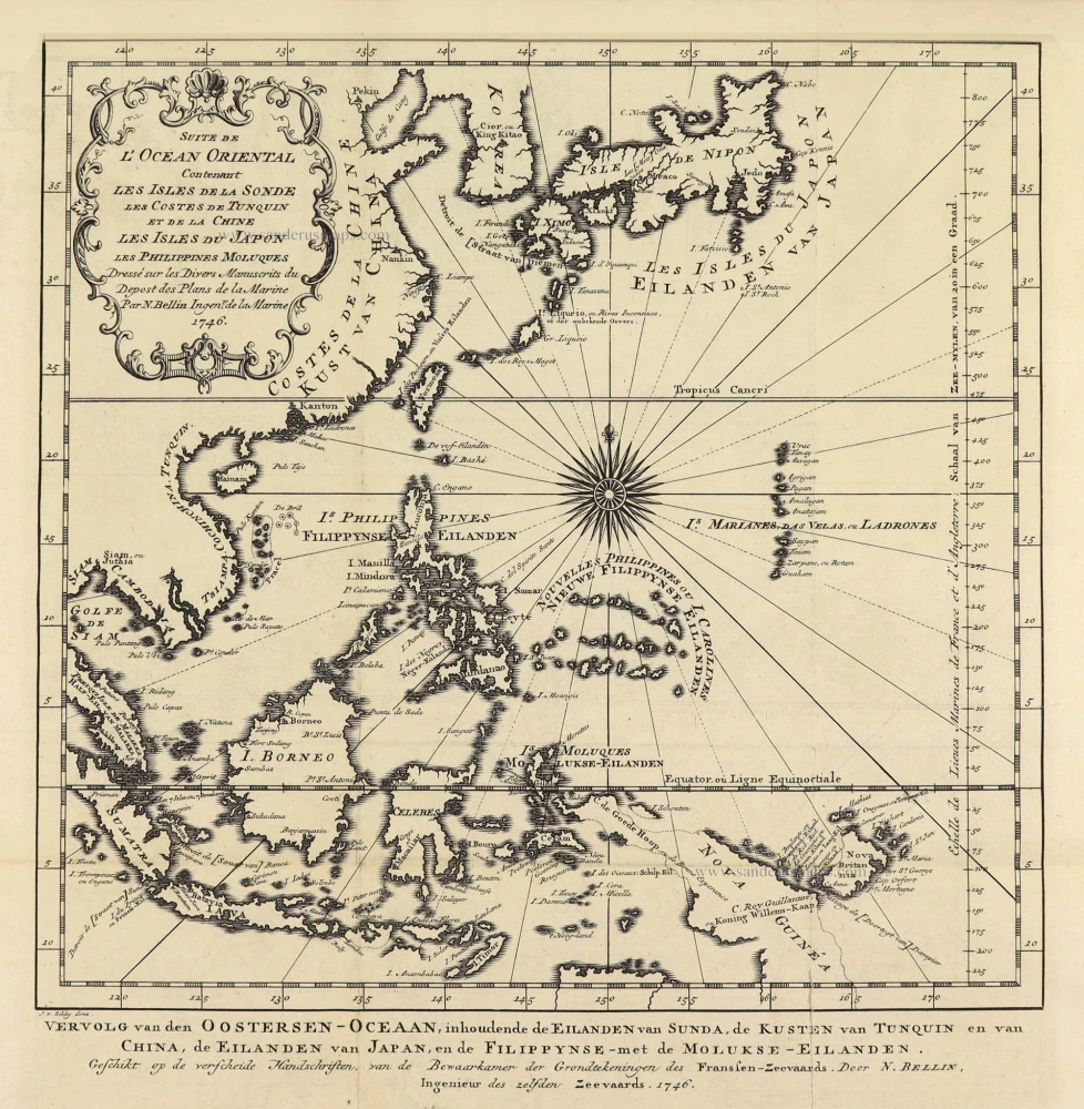
Southeast Asia by Jacques Nicolas Bellin. 1747
Suite de L'Ocean Oriental Contenant Les Isles de la Sonde Les ...
[Item number: 28189]
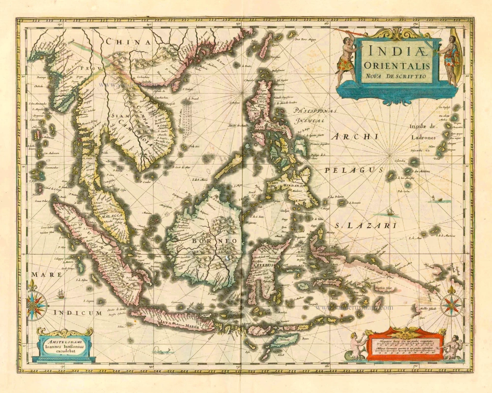
The most accurate and one of the most elegant seventeenth-century maps of the East Indies
Southeast Asia by Janssonius, Johannes c. 1630-1650
Indiae Orientalis Nova Descriptio.
[Item number: 30855]
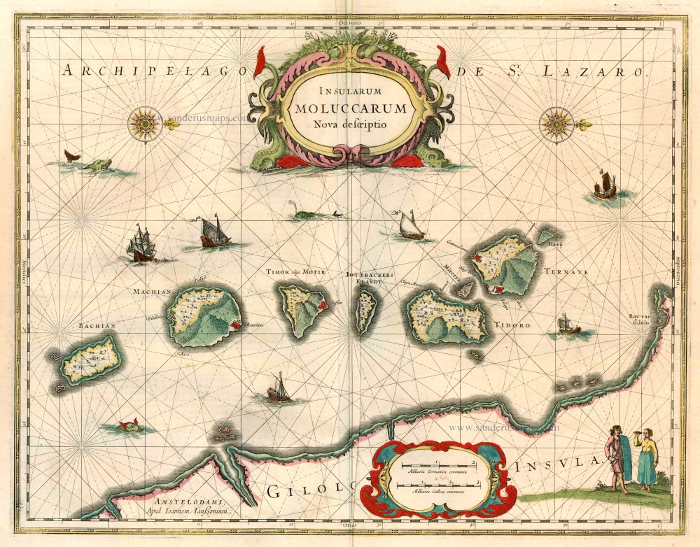
Moluccas by Joannes Janssonius. 1646
Insularum Moluccarum Nova Descriptio.
[Item number: 23718]
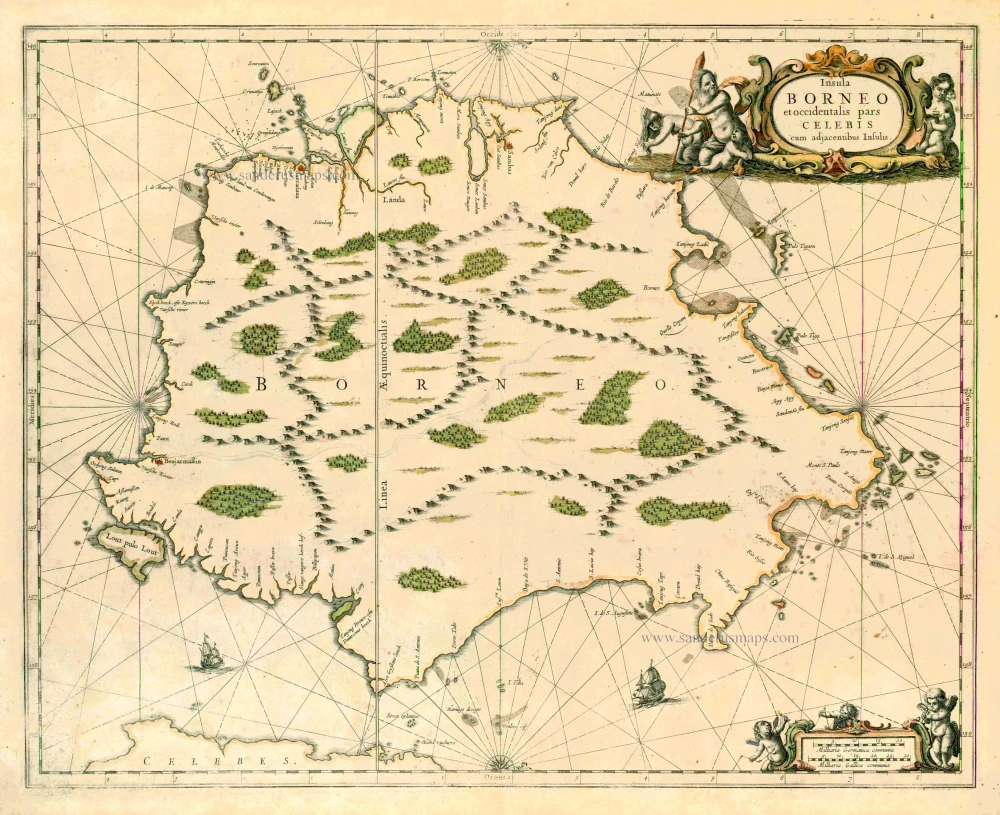
Borneo, by J. Janssonius. 1657-62
Insula Borneo et occidentalis pars Celebis cum adjacentibus ...
[Item number: 26456]
The most accurate and one of the most elegant seventeenth-century maps of the East Indies
Southeast Asia by Janssonius, Johannes 1644-58
Indiae Orientalis Nova Descriptio.
[Item number: 10013]

The most elegant and decorative map of the region
East Indian Archipelago by Jodocus Hondius. 1630
Insulae Indiae Orientalis Praecipuae, in quibus Moluccae ...
[Item number: 29863]
![[No title] - 'Mar di India'.](https://sanderusmaps.com/assets/WEBP/m30057.webp)
Rare
East Indies by van Spilbergen Joris. 1645
[No title] - 'Mar di India'.
[Item number: 30057]
![[No titel - from verso:] Tab. Moderna Indiae.](https://sanderusmaps.com/assets/WEBP/m30650.webp)
Rare 1525 edition in nice old colour.
Ptolemy map of southern Asia by Lorenz Fries, after Martin Waldseemüller. 1525
[No titel - from verso:] Tab. Moderna Indiae.
[Item number: 30650]
![[No title - on verso:] Tabula Moder. Indiae Orientalis.](https://sanderusmaps.com/assets/WEBP/m30658.webp)
Rare 1525 edition in nice old colour.
Ptolemy map of Southeast Asia by Lorenz Fries, after Martin Waldseemüller. 1525
[No title - on verso:] Tabula Moder. Indiae Orientalis.
[Item number: 30658]

Fries 1525 edition of the first modern map of Southeast Asia
South Asia by Lorenz Fries. 1525
Tab. Moderna Indiae.
[Item number: 27929]
In rare original colour.
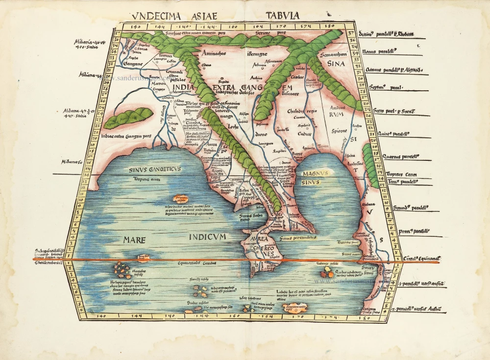
South Asia by Waldseemüller Martin 1513
Undecima Asiae Tabula.
[Item number: 29249]
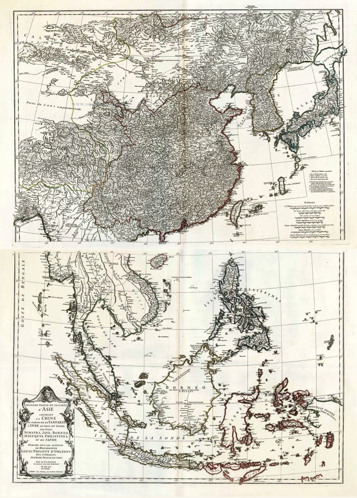
Southeast Asia, by J.B. d'Anville. 1746-53
Seconde Partie de la Carte d'Asie Contenant la Chine et Partie ...
[Item number: 27401]
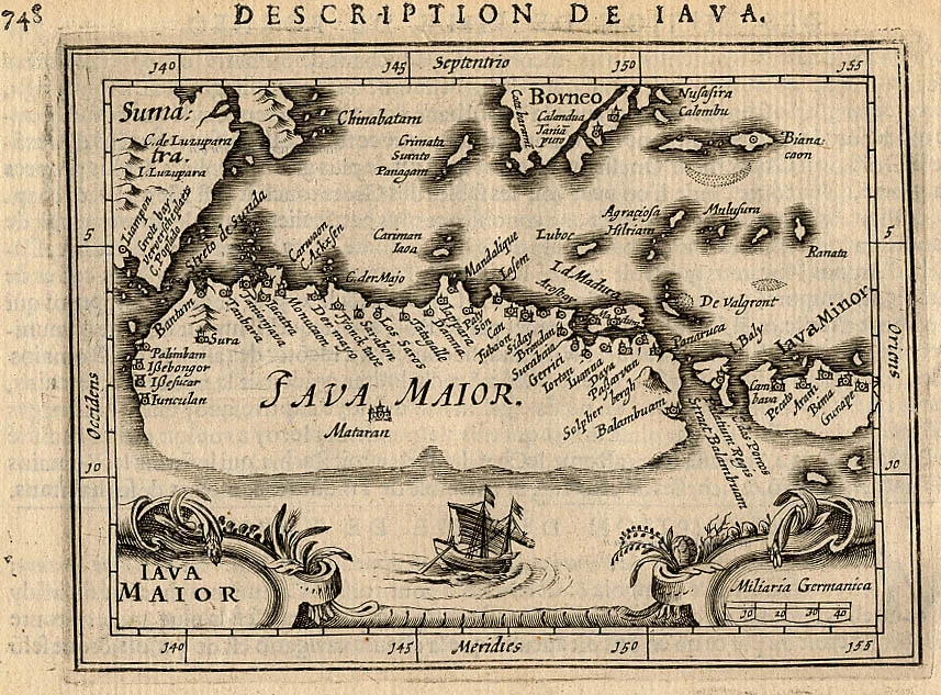
Java, by Bertius P. 1618
Iava Maior.
[Item number: 18307]
![Sumatra [Title above map:] Description de Sumatre.](https://sanderusmaps.com/assets/WEBP/m28393.webp)
Sumatra by Petrus Bertius. 1618
Sumatra [Title above map:] Description de Sumatre.
[Item number: 28393]
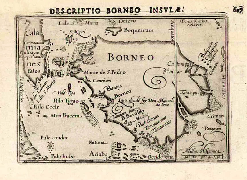
Borneo, by Langenes, published by P. Bertius. 1602
Borneo.
[Item number: 26540]
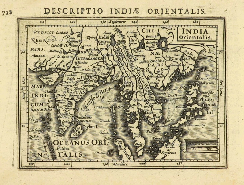
East Indies by Petrus Bertius. 1616
India Orientalis.
[Item number: 28162]
First edition
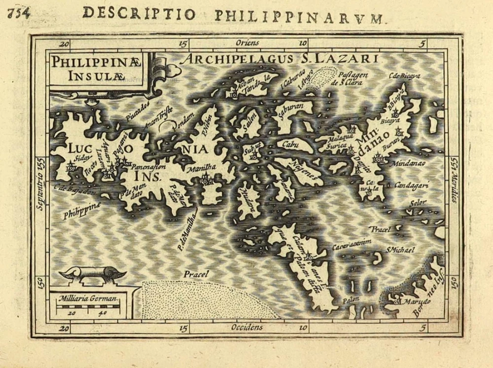
Philippines by Petrus Bertius. 1616
Philippinae Insulae.
[Item number: 28166]
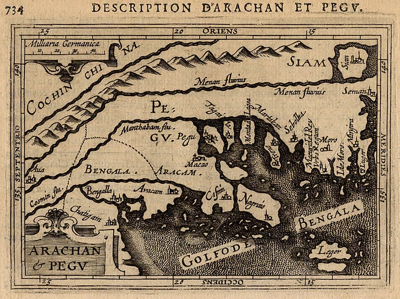
Arakan and Pegy, by Petrus Bertius. 1618
Arachan & Pegu.
[Item number: 18301]

Jakarta (Batavia), by Petrus Schenk 1702
Batavia, gelegen op het eiland Java, een beroemde volkplanting ...
[Item number: 26660]
Very rare second state, including the Tasman discoveries (Australia).
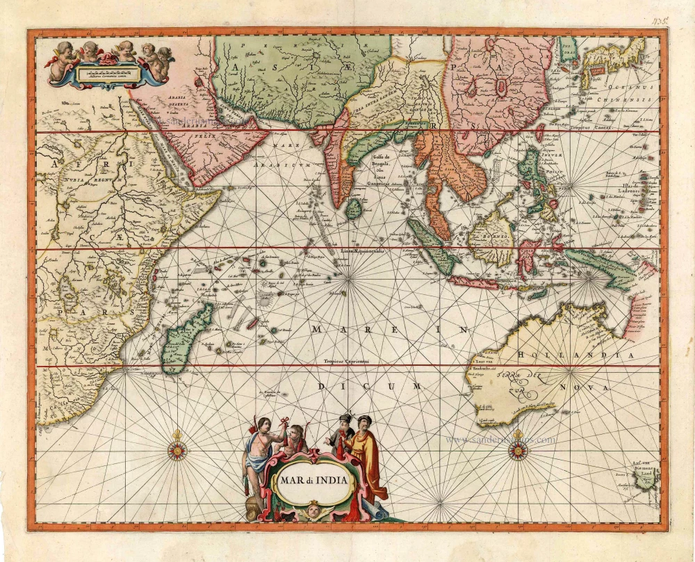
Indian Ocean, by Petrus Schenk c. 1700
Mar di India.
[Item number: 27775]
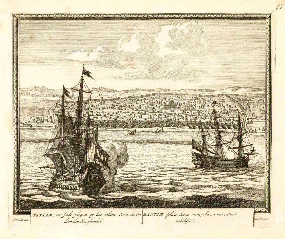
Banten (Bantam - Indonesia), by Petrus Schenk. 1702
Bantam, een stadt gelegen op het eilant Java, beroemt door den ...
[Item number: 26661]
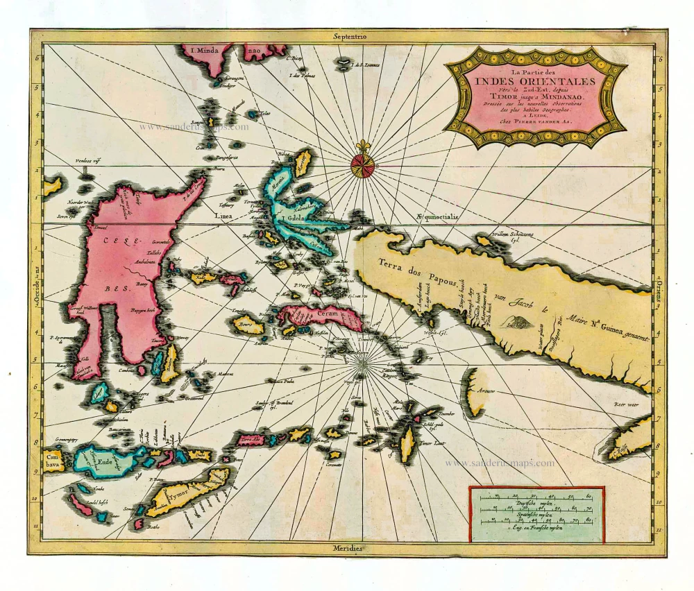
Indonesia by P. Van der Aa 1713
La Partie des Indes Orientales vers le Zud-Est, depuis Timor ...
[Item number: 26101]
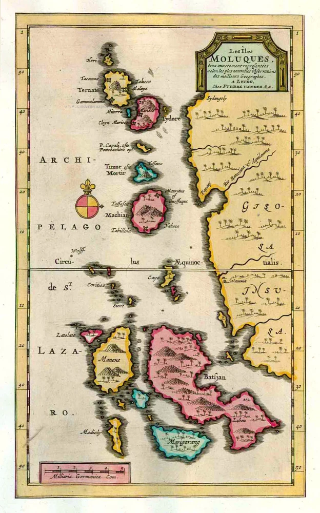
The Moluccas - Ternate and adjacent islands, by Pieter Van der Aa. 1713
Les Îles Moluques.
[Item number: 26124]