Antique maps catalogue
- All recent additions
-
Antique maps
- Polar maps
- World
-
Europe
- Europe Continent
- Belgium
- Belgium - Cities
- The Low Countries
- The Netherlands
- The Netherlands - Cities
- Luxembourg
- France
- France - Cities
- Germany
- Germany - Cities
- Austria
- Italy
- Italy - Cities
- Spain and Portugal
- Greece & Greek Islands
- Switzerland
- British Isles
- British Isles - Cities
- Northern Europe
- Central Europe
- Eastern Europe
- Southeastern Europe
- America
- Asia
- Africa
- Mediterranean Sea
- Australia
- Oceans
- Celestial Maps
- Curiosities
- Title Pages
- Books
- Medieval manuscripts
- Prints

The Marquisate of Antwerp, by Willem Blaeu. 1641-42
Tertia Pars Brabantiae qua continetur Marchionat S.R.I. horum...
[Item number: 17537]

Brabant by Henricus Hondius, published by J. Janssonius. 1638
Novissima et Accuratissima Brabantiae Ducatus Tabula.
[Item number: 19012]

Flanders (Vlaanderen) by L. Guicciardini. 1567
Descrittione Particulare di Fiandra.
[Item number: 31517]
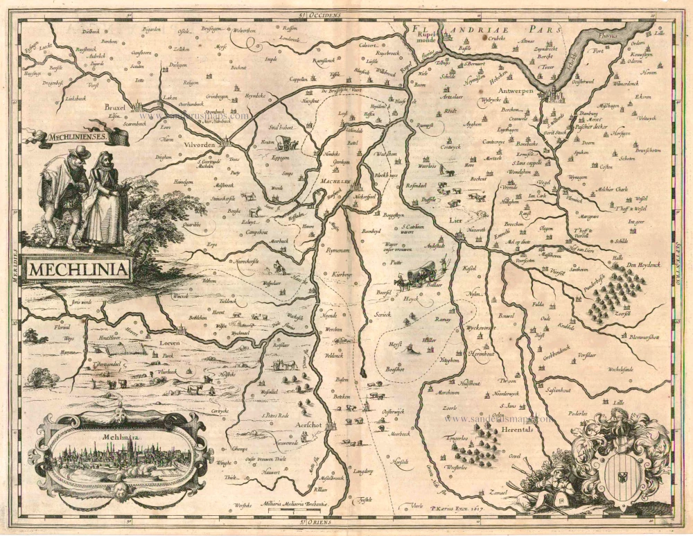
Mechelen, by Petrus Kaerius (Pieter Van den Keere) 1617
Mechlinia.
[Item number: 15408]

Brabant by Johannes Danckerts. c. 1704-1706
Ducatus Brabantiae Tabula continens Sacri Imperii Marchionatum...
[Item number: 32498]
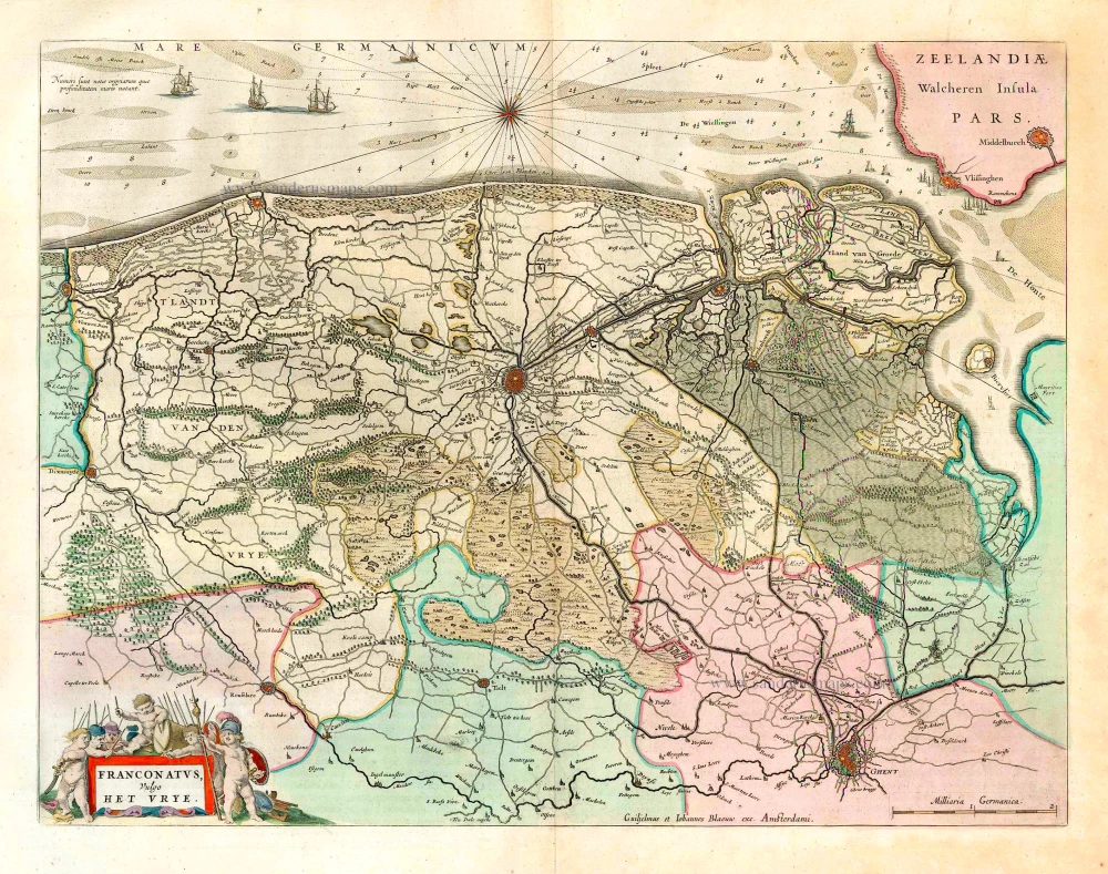
The vicinity of Bruges, by W. & J. Blaeu. 1662
Franconatus Vulgo Het Vrye.
[Item number: 26029]
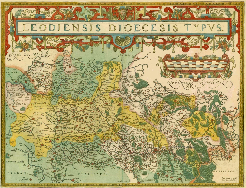
Liège, by Abraham Ortelius. 1598
Leodiensis Dioecesis Typus.
[Item number: 6346]
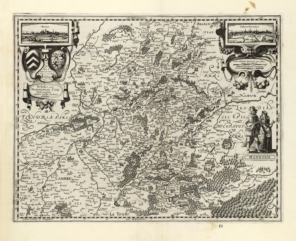
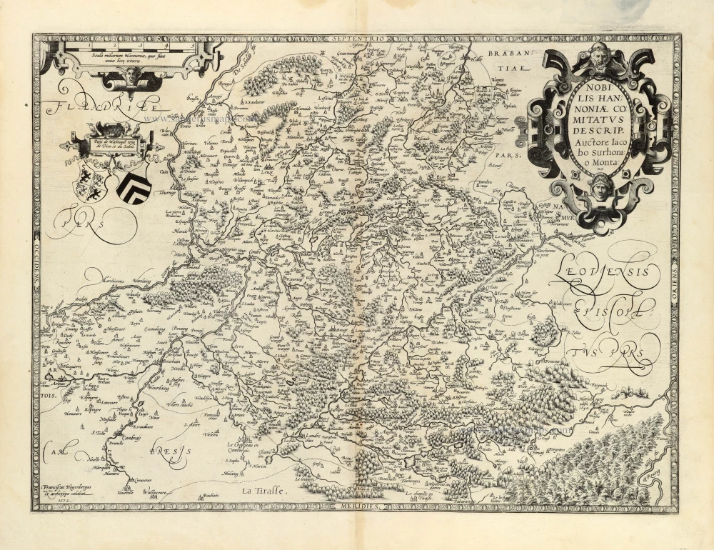
Hainaut by Petrus Kaerius (Pieter Van den Keere), published by Claes Jansz. Visscher. 1634
Nobilis Hannoniae Com. Descriptio.
[Item number: 30736]
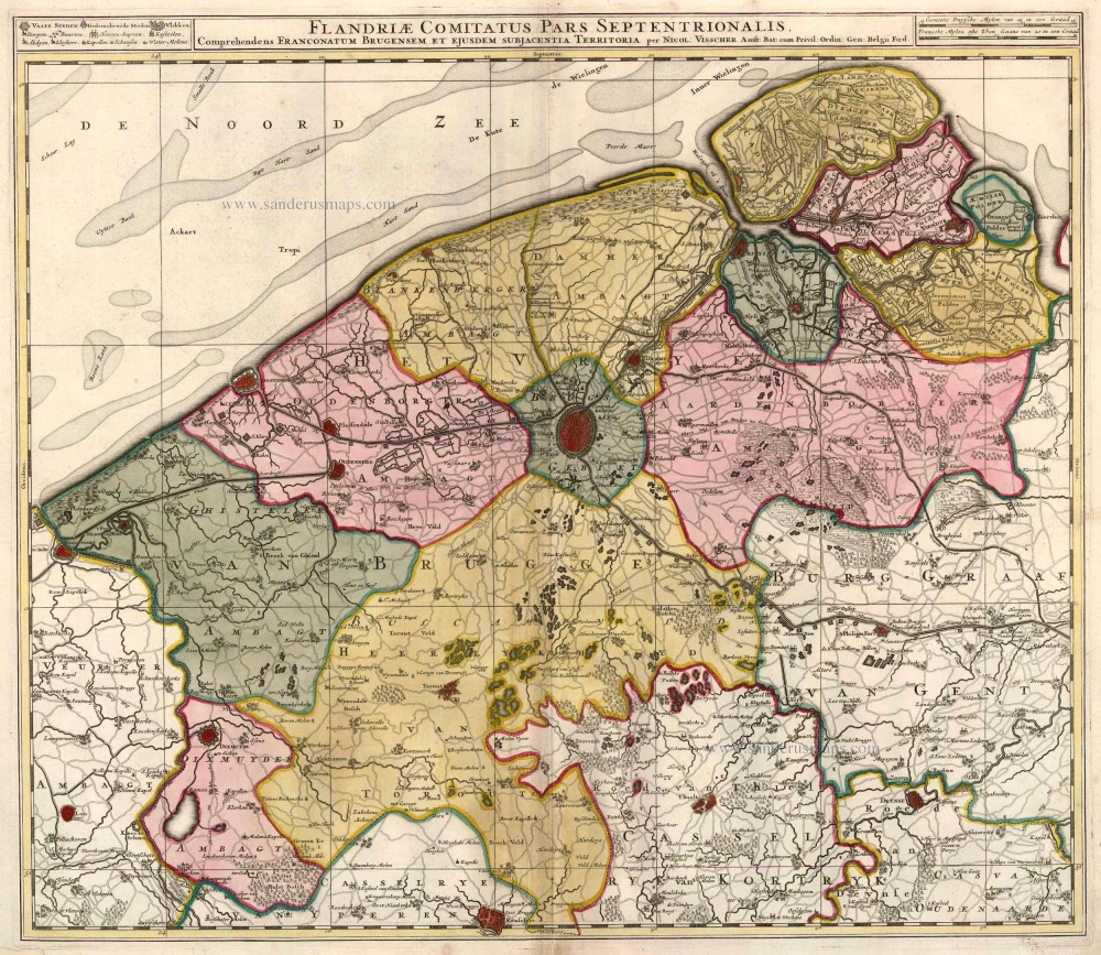
Western Flanders (West Vlaanderen) by N. Visscher II. 1683-1696
Flandriae Comitatus Pars Septentrionalis, comprehendens...
[Item number: 13092]
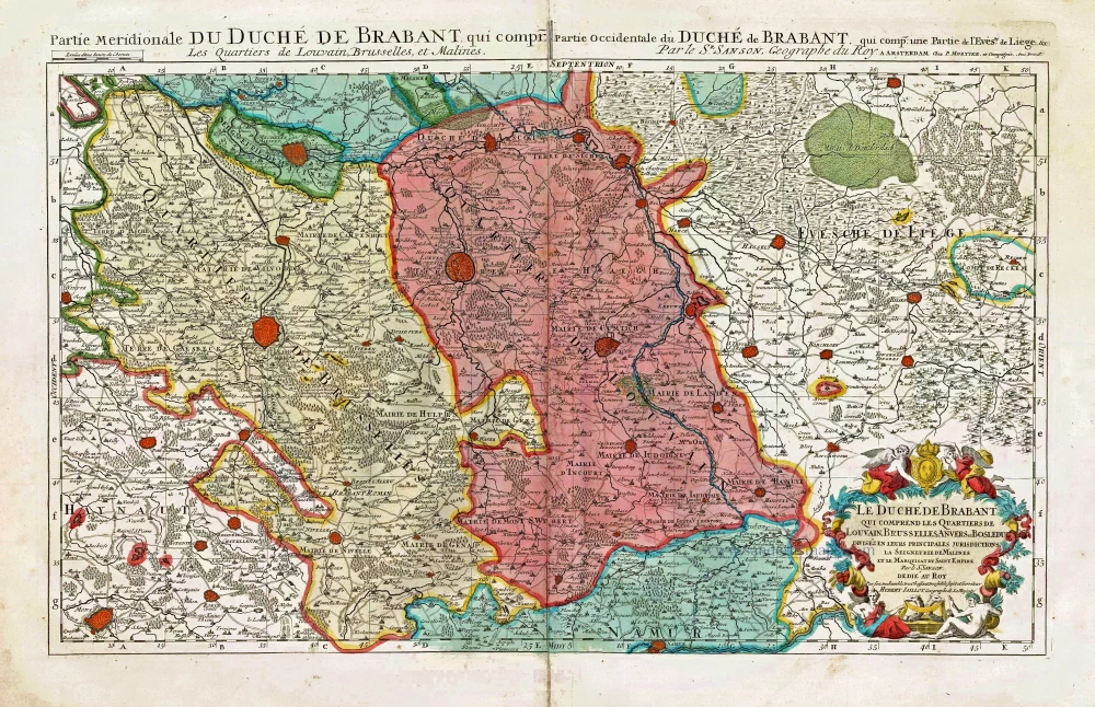
Southern Brabant, by Pieter Mortier. c. 1705
Le Duché de Brabant qui comprend les Quartiers de Louvain,...
[Item number: 27801]
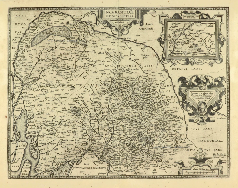
Brabant, with an inset map of the district of Mechelen, by Abraham Ortelius. 1601
Brabantiae Descriptio
[Item number: 12909]
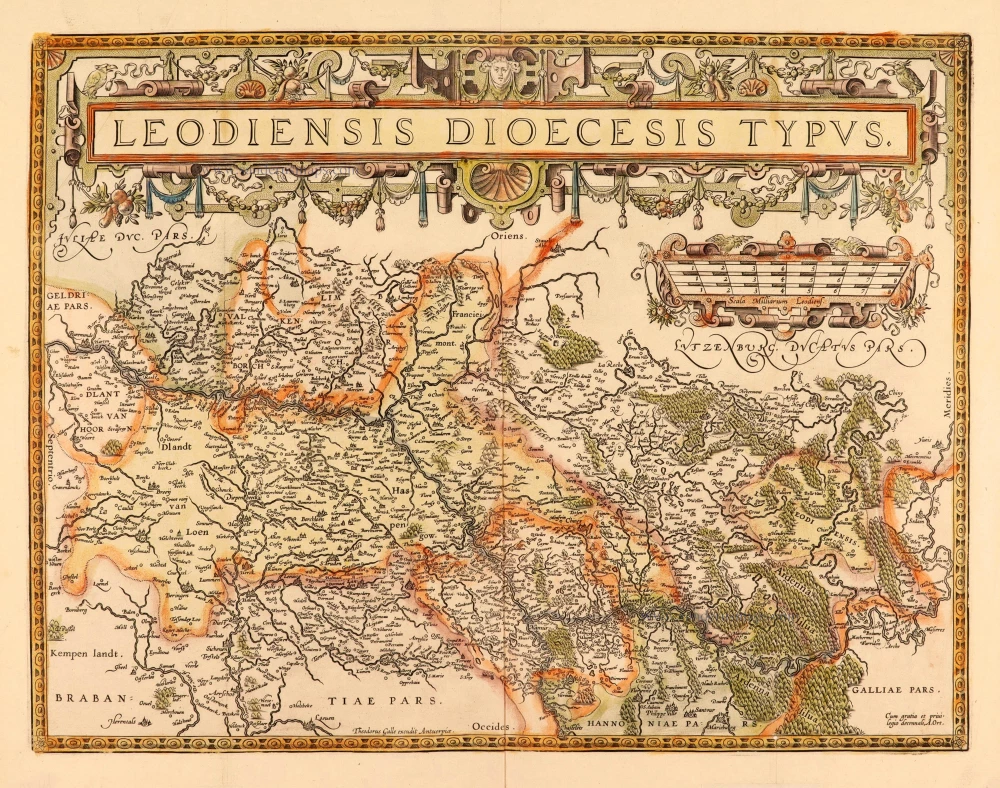
Liège, by Abraham Ortelius. After 1612
Leodiensis Dioecesis Typus.
[Item number: 28111]

Flanders (Vlaanderen) and Zeeland, by Willem Blaeu. 1640-43
Flandria et Zeelandia Comitatus.
[Item number: 27409]
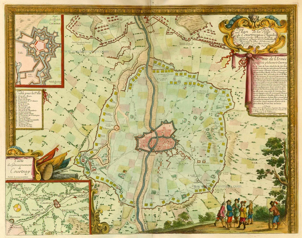
Kortrijk, by de Beaulieu S. 1694
Plan de la Ville de Courtray en Flandre, ...
[Item number: 21937]
Westerschelde -Waasland
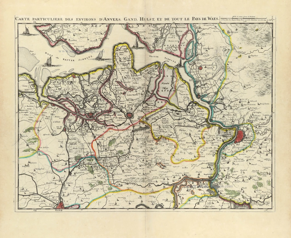
Land van Waas by E.H. Fricx. 1712
Carte Particulière des environs d'Anvers, Gand, Hulst, et de...
[Item number: 32591]

Limburg - Maastricht - Tongeren - Valkenburg, by E.H. Fricx. 1712
Carte Particulière des environs de Maestricht, Partie de Liège,...
[Item number: 32597]
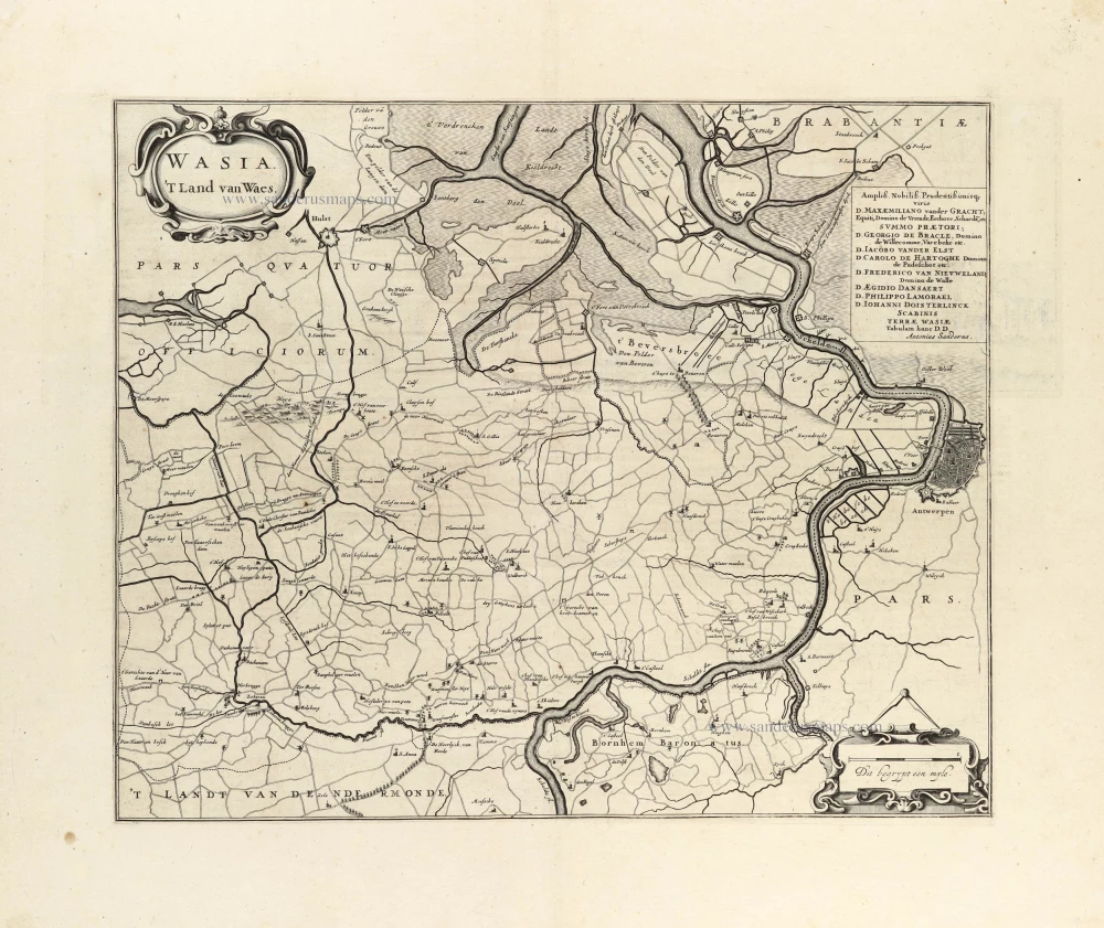
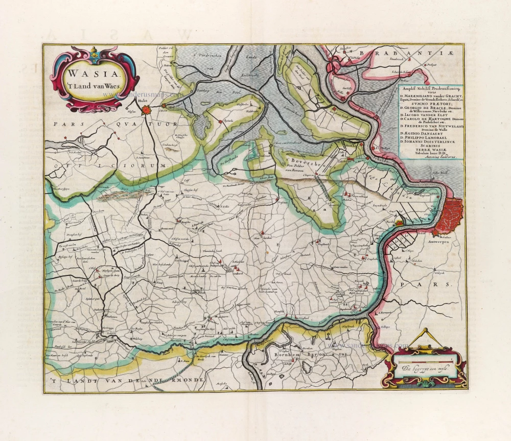
Land van Waas by Antonius Sanderus. 1644
Wasia. 't Land van Waes.
[Item number: 29997]

Aalst - Brussels by E.H. Fricx. 1712
Carte Particulière des environs de Bruxelles avec le Bois de...
[Item number: 32595]
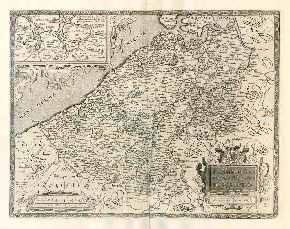
Flanders (Vlaanderen) by Abraham Ortelius. 1612
Flandriae Comitatus Descriptio.
[Item number: 22978]
Land van Waas by Antonius Sanderus, published by Joan Blaeu. 1662
Wasia. 't Land van Waes.
[Item number: 31255]
The scarce censored first issue of Ortelius's Hainault map, dated 1572.
Hainault (Hainaut) by Abraham Ortelius. 1584
Nobilis Hannoniae Comitatus Descrip.
[Item number: 30676]

Military manuscript map of the western vicinity of Namur. 1746
Plan qui représente les Environs et la Circonvallation de Namur,...
[Item number: 24865]
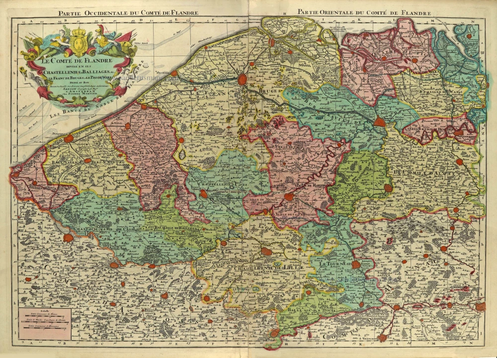
Flanders (Vlaanderen), by Pieter Mortier. c. 1705
Le Comté de Flandre divisé en ses Chastellenies, et Balliages,...
[Item number: 28129]

Flanders (Vlaanderen) by Theodore Danckerts. 1696-1713
Novissima Flandriae Comitatus Tabula cum omnibus praefecturis,...
[Item number: 32497]
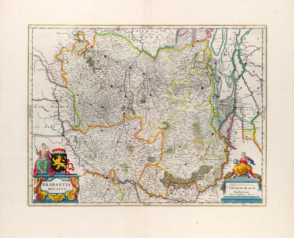
Brabant by Willem Blaeu 1664-65
Brabantia Ducatus
[Item number: 20955]
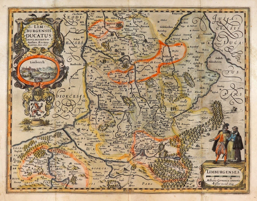
Limburg, by C.J. Visscher. 1634
Limburgensis Ducatus Nova Descriptio.
[Item number: 27969]
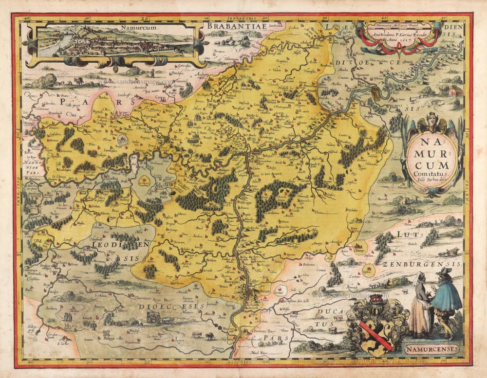
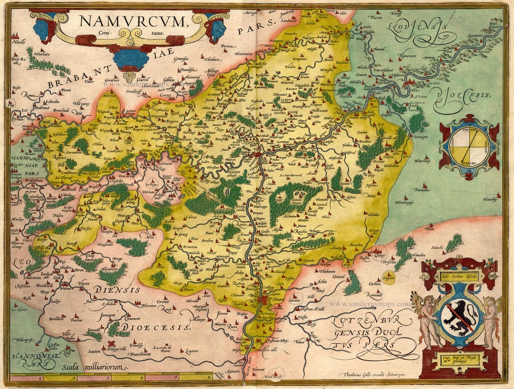
Namur by Pieter Van den Keere (Petrus Kaerius). 1617
Namurcum.
[Item number: 30654]
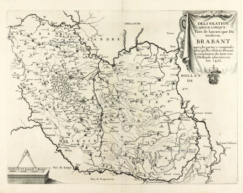
Very rare first state.
Historical map of Brabant by Christophe Butkens. 1637
Delineation Geographique. Tant de lancien que Du moderne....
[Item number: 30291]
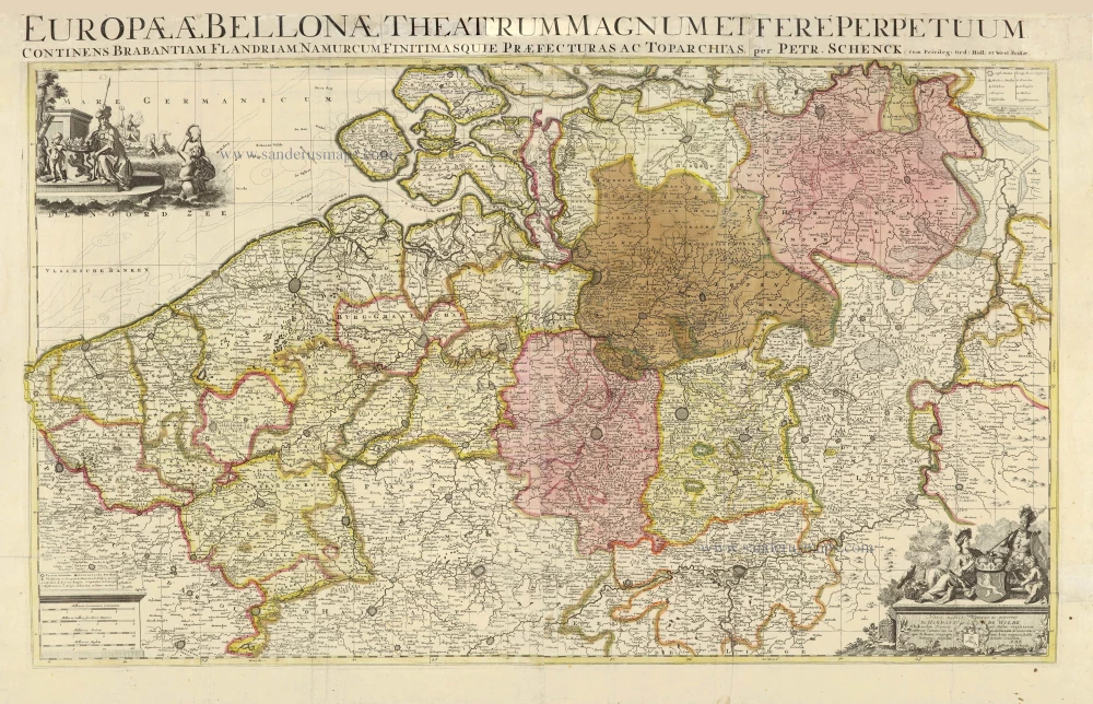
Southern Netherlands, by Petrus Schenk. c. 1730-1760
Europae (Ae) Bellonae Theatrum Magnum et Fere Perpetuum...
[Item number: 28008]
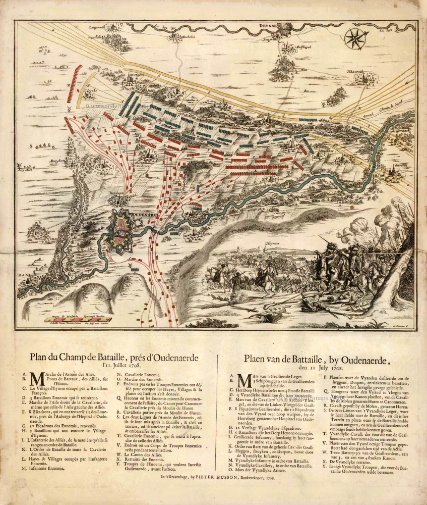
The vicinity of Oudenaarde, by Pieter Husson. c. 1709
Plan du Champ de Bataille, prés d'Oudenaerde l'11. Juillet 1708....
[Item number: 27525]
Namur, by Ortelius A. - Galle Th. Na 1612.
Namurcum Comitatus.
[Item number: 15490]
Rare.
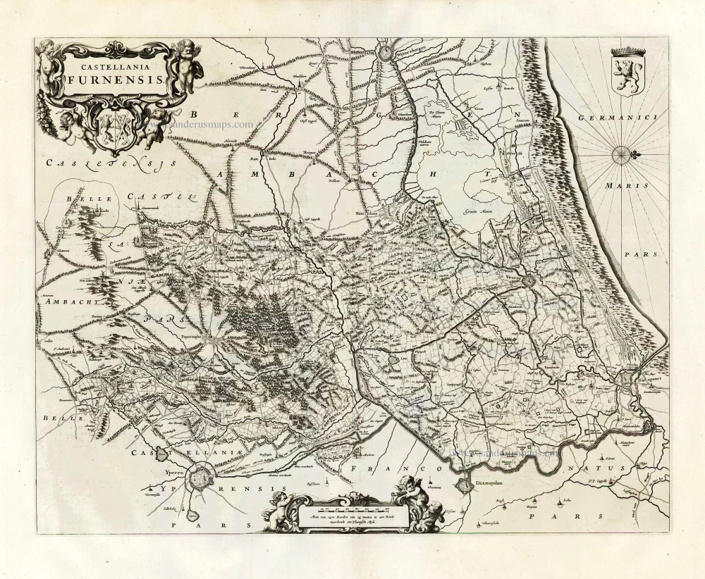
The vicinity of Veurne, by Joan Blaeu. 1664-65
Castellania Furnensis.
[Item number: 27083]
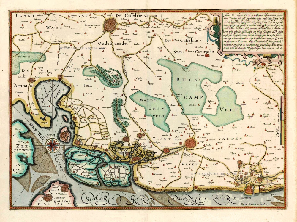
Western Flanders (West Vlaanderen) by Jodocus Hondius. 1619
Habes hic Novam & accuratissimam descriptionem tractus illius...
[Item number: 27325]
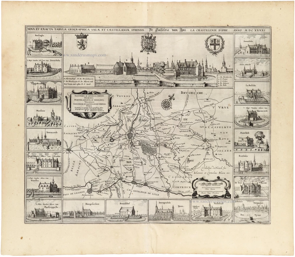
Ieper (Castellania), by A. Sanderus. 1641
Nova Et Exacta Tabula Geographica Salae Et Castellaniae Iprensis...
[Item number: 32725]
new
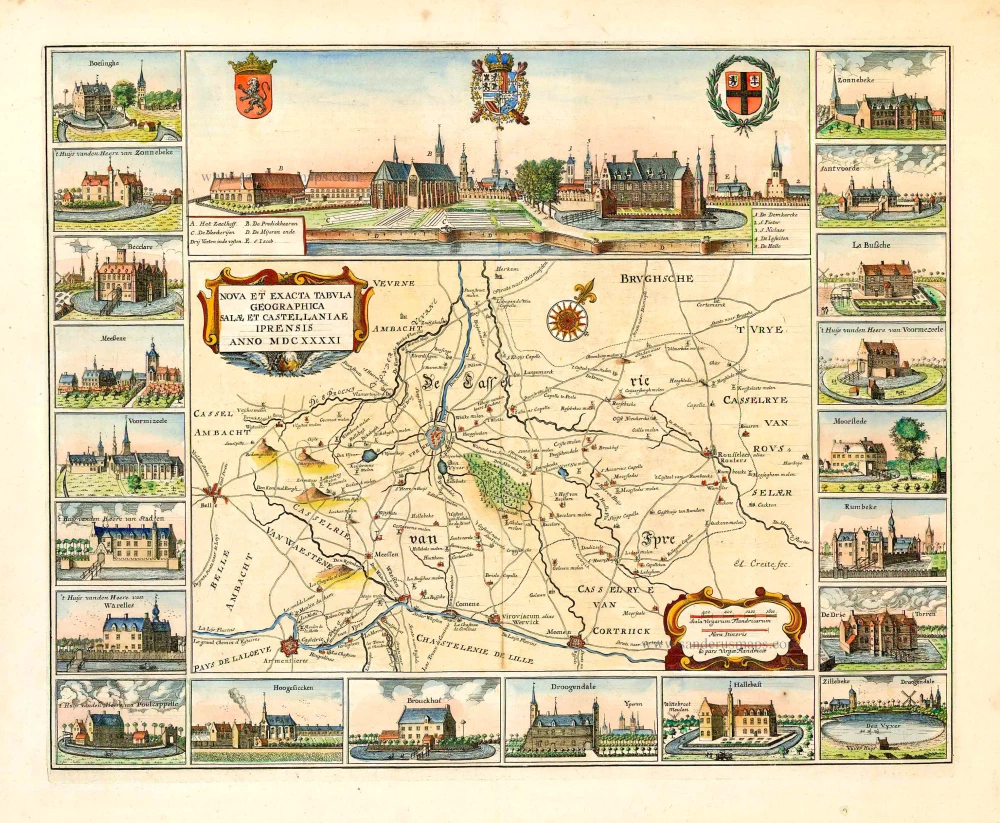
Famous and beautiful map
Ypres (Ieper) Castellania, by Sanderus A. 1732
Nova et Exacta Tabula Geographica Salae et Castellaniae Iprensis...
[Item number: 27434]

Brabant by Abraham Ortelius 1572
Brabantiae Germaniae Inferioris Nobilissimmae Provinciae...
[Item number: 26734]