Antique maps catalogue
- All recent additions
-
Antique maps
- World and Polar
-
Europe
- Europe Continent
- Belgium
- Belgium - Cities
- The Low Countries
- The Netherlands
- The Netherlands - Cities
- Luxembourg
- France
- France - Cities
- Germany
- Germany - Cities
- Austria
- Italy
- Italy - Cities
- Spain and Portugal
- Greece & Greek Islands
- Switzerland
- British Isles
- British Isles - Cities
- Northern Europe
- Central Europe
- Eastern Europe
- Southeastern Europe
- America
- Asia
- Africa
- Mediterranean Sea
- Australia
- Oceans
- Celestial Maps
- Curiosities
- Books
- Medieval manuscripts
- Prints
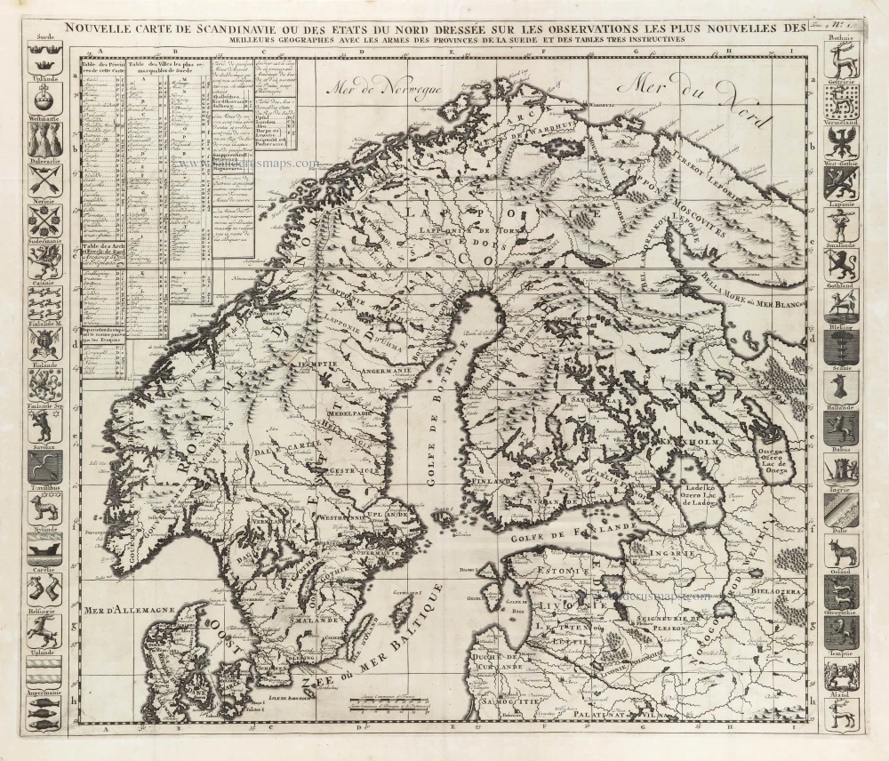
Scandinavia, by Zacharias Châtelain. 1714
Nouvelle Carte de Scandinavie ou des Etats du Nord Dressée sur ...
[Item number: 29499]
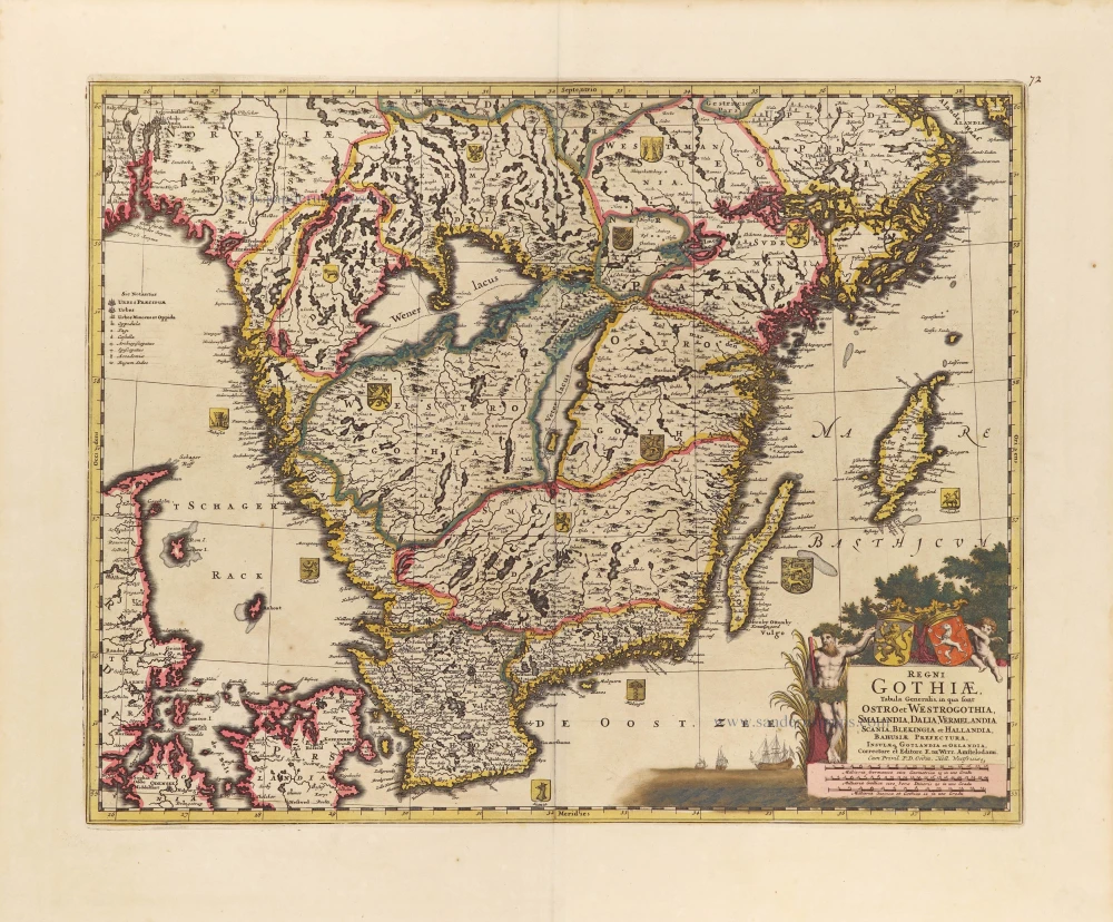
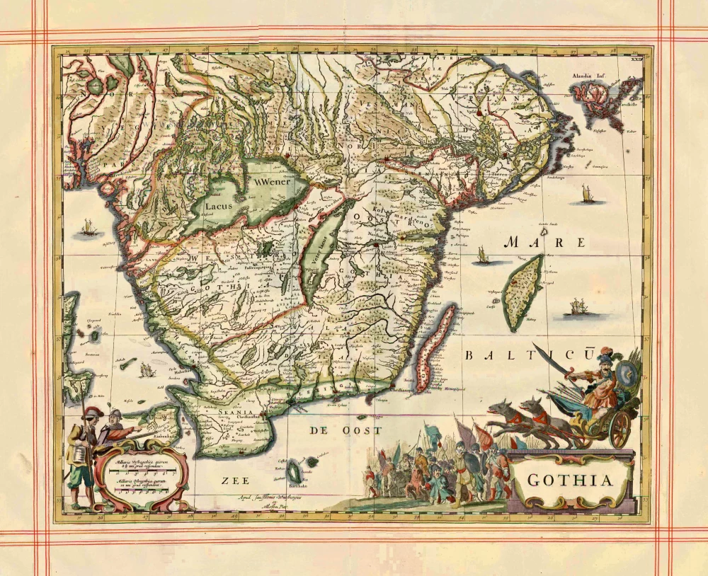
Southern Sweden by Frederick de Wit. c. 1690
Regni Gothiae, Tabula Generalis, in qua sont Ostro et ...
[Item number: 28812]
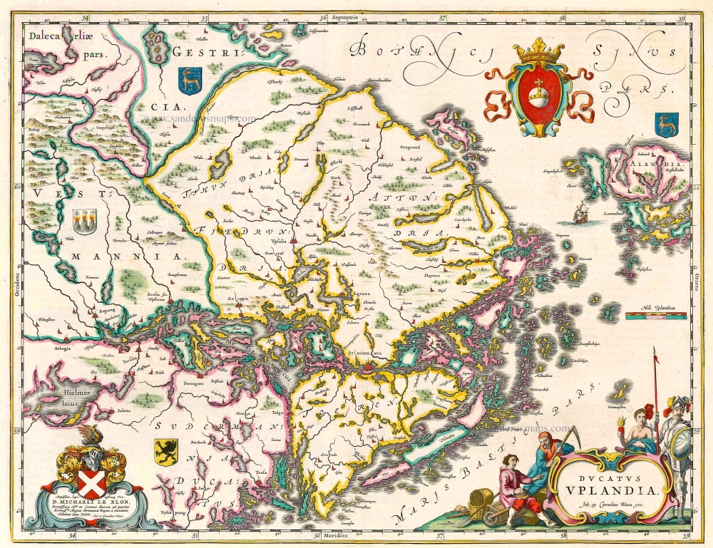
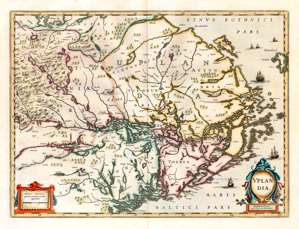
Uppland (Sweden), by Joan Blaeu. 1644
Ducatus Uplandia
[Item number: 21398]
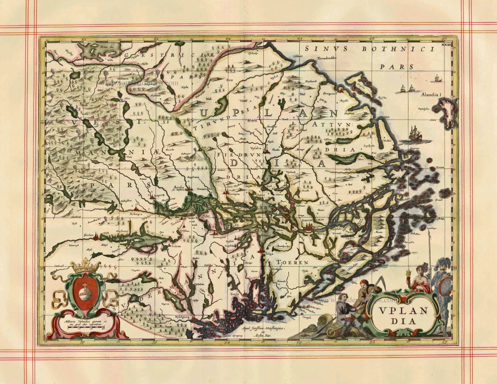
Uppland by J. Janssonius, published by Moses Pitt and J. Janssonius-Waesberge. 1680
Uplandia
[Item number: 1246]
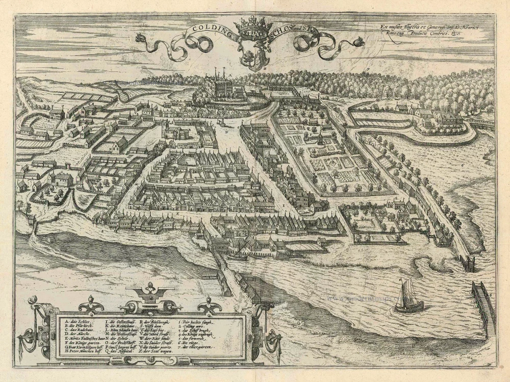
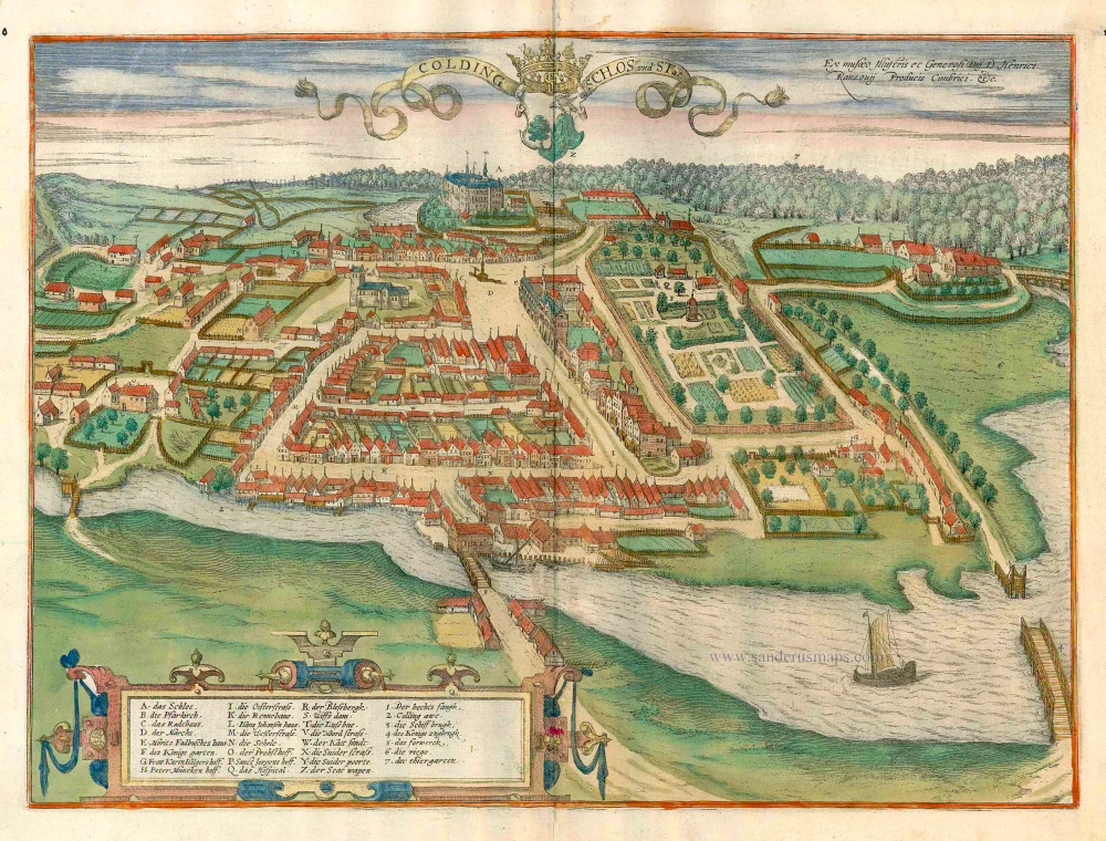
Kolding by Braun and Hogenberg 1596
Colding Schloss und Stat
[Item number: 24163]
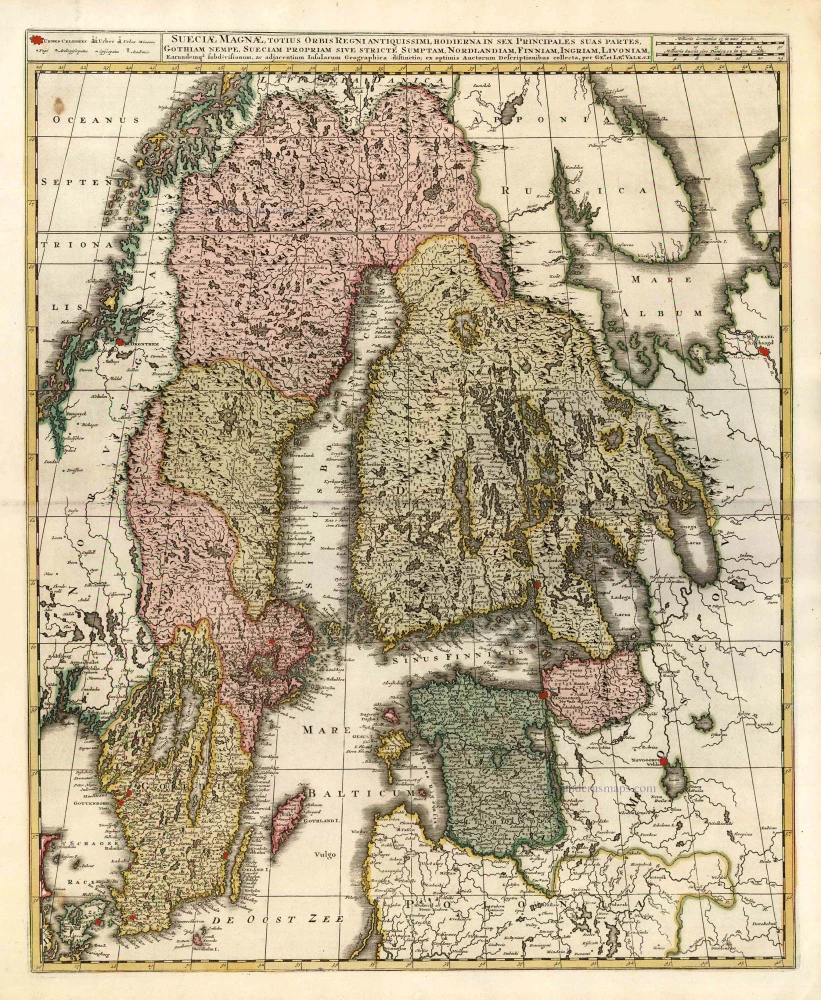
Finland, Sweden, Latvia, by Valk G. & L. - Ottens R. & I. c. 1745
Sueciae Magnae, totius Orbis Regniantiquissimi, hodierna in sex ...
[Item number: 25846]
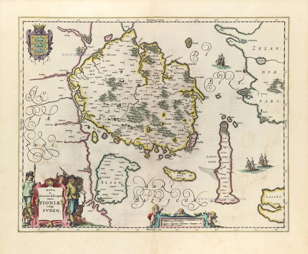
Denmark - Fyn by Johannes Janssonius. 1653
Nova et Accurata descriptio totius Fioniae vulgo Funen.
[Item number: 30344]
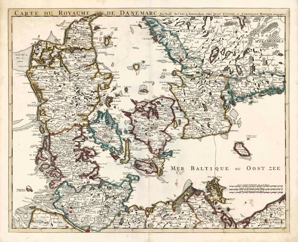
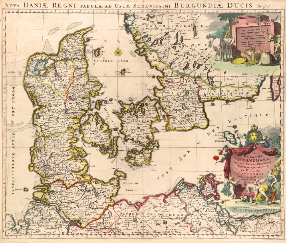
Denmark by Guillaume Delisle, published by Covens & Mortier. 1730
Carte du Royaume de Danemarc.
[Item number: 25900]
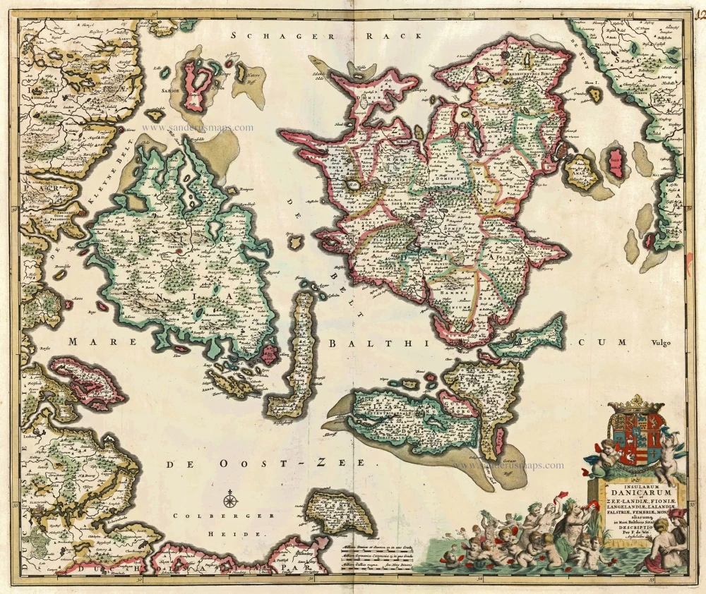
Danish Islands by de Wit F. c. 1682-86
Insularum Danicarum ut Zee-Landiae, Fioniae, Langelandiae, ...
[Item number: 24504]
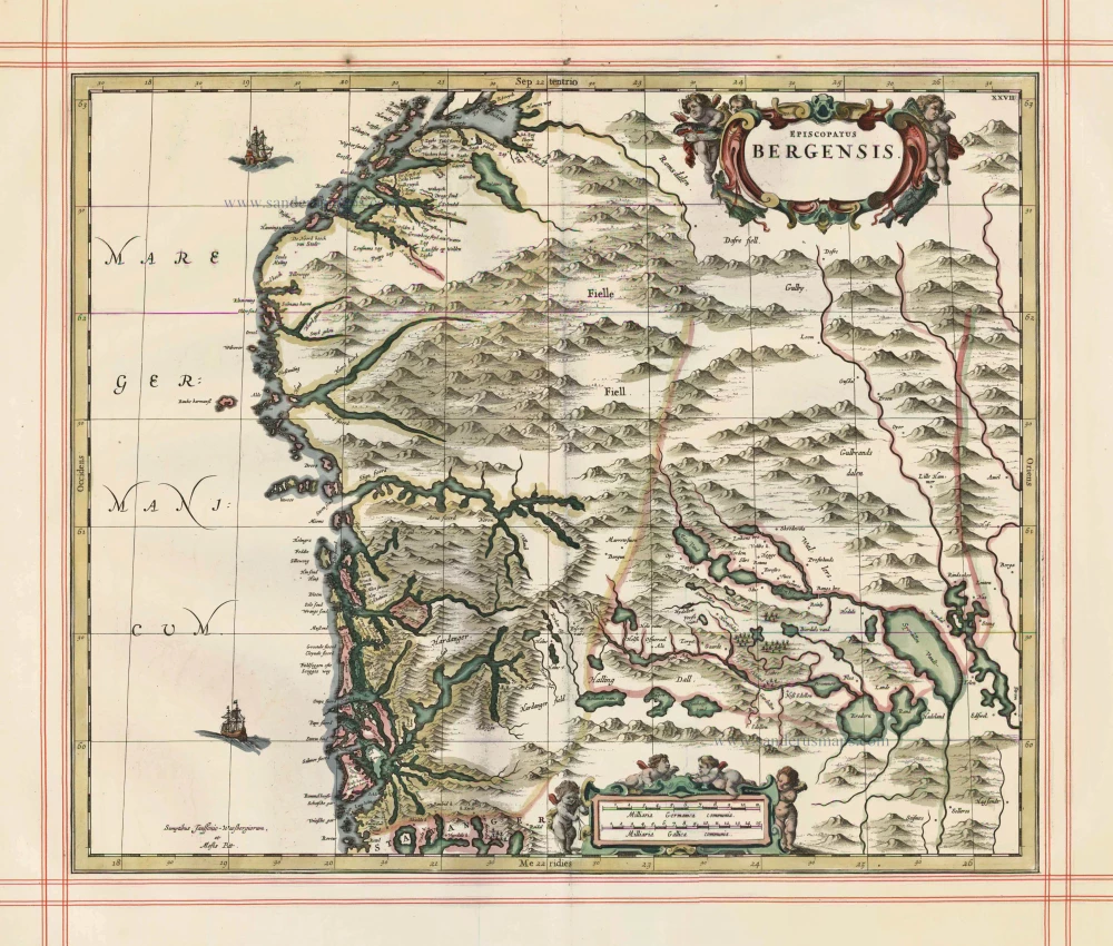
Norway - Bergen, by J. Janssonius, published by Moses Pitt and J. Janssonius-Waesberge. 1680
Episcopatus Bergensis
[Item number: 25068]
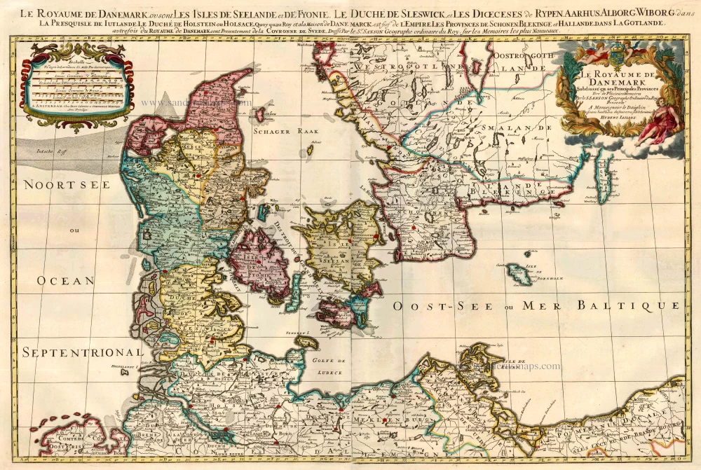
Denmark by Sanson - Covens & Mortier. 1710
Le Royaume de Danemark Subdivisé en ses Principales Provinces.
[Item number: 23736]
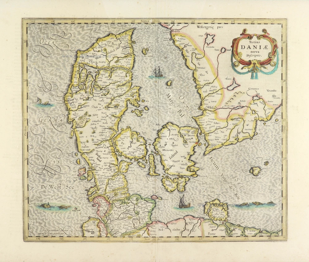
Denmark by Henricus Hondius. 1639-42
Totius Daniae nova descriptio.
[Item number: 28699]
![Oitinense oppidulum et arx Episcopi Lubecensis sedes [on sheet with] Delineatio Civitatis Tonderensis](https://sanderusmaps.com/assets/WEBP/m24595.webp)
Eutin - Tønder by Braun & Hogenberg c. 1610
Oitinense oppidulum et arx Episcopi Lubecensis sedes [on sheet ...
[Item number: 24595]
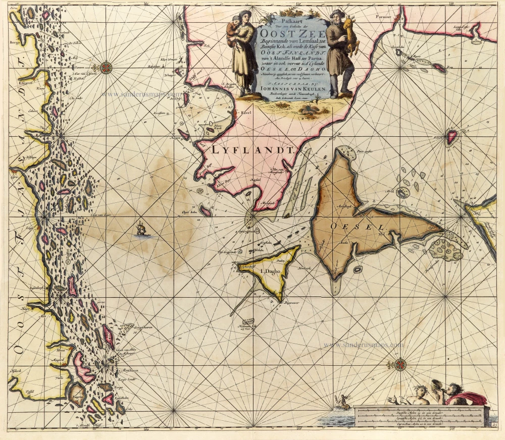
Finland - Estonia, by J. Van Keulen. 1697-1709
Paskaart voor een Gedeelte der Oost Zee Beginnende van Lemsaal, ...
[Item number: 25288]
Sweden - Götaland, by J. Janssonius, published by Pitt Moses & J. Janssonius-Waesberge. 1680
Gothia
[Item number: 1290]
Uppland, by Henricus Hondius. 1641
Uplandia.
[Item number: 26261]

Southern Sweden by Frederick De Wit. c. 1705
Accurata Scaniae, Blekingiae, et Hallandiae Descriptio.
[Item number: 28832]

Finland & Sweden by Frederik de Wit, published by Covens & Mortier. c. 1715
Regni Sueciae Tabula Generalis, divisa in Sueciae, Gotiae Regna ...
[Item number: 28267]
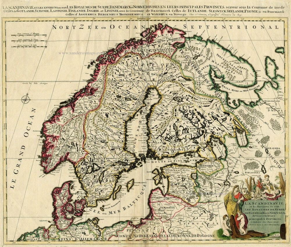
SCANDINAVIA by Schenk P. c. 1700
La Scandinavie, et les Environs, ou sont les Royaumes de Suede, ...
[Item number: 19145]
Kolding, by Georg Braun and Frans Hogenberg. c. 1610
Colding Schloss und Stat
[Item number: 16693]
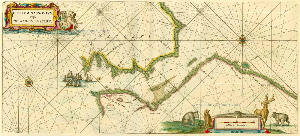
Russia - Nassau Strait, by J. Blaeu. 1664-65
Fretum Nassovium Vulgo De Straet Nassou.
[Item number: 14225]
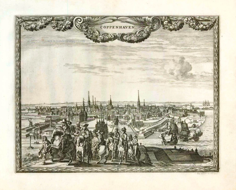
Copenhagen, by N. Visscher & P.H. Schut. 1658/60
Coppenhaven.
[Item number: 26633]
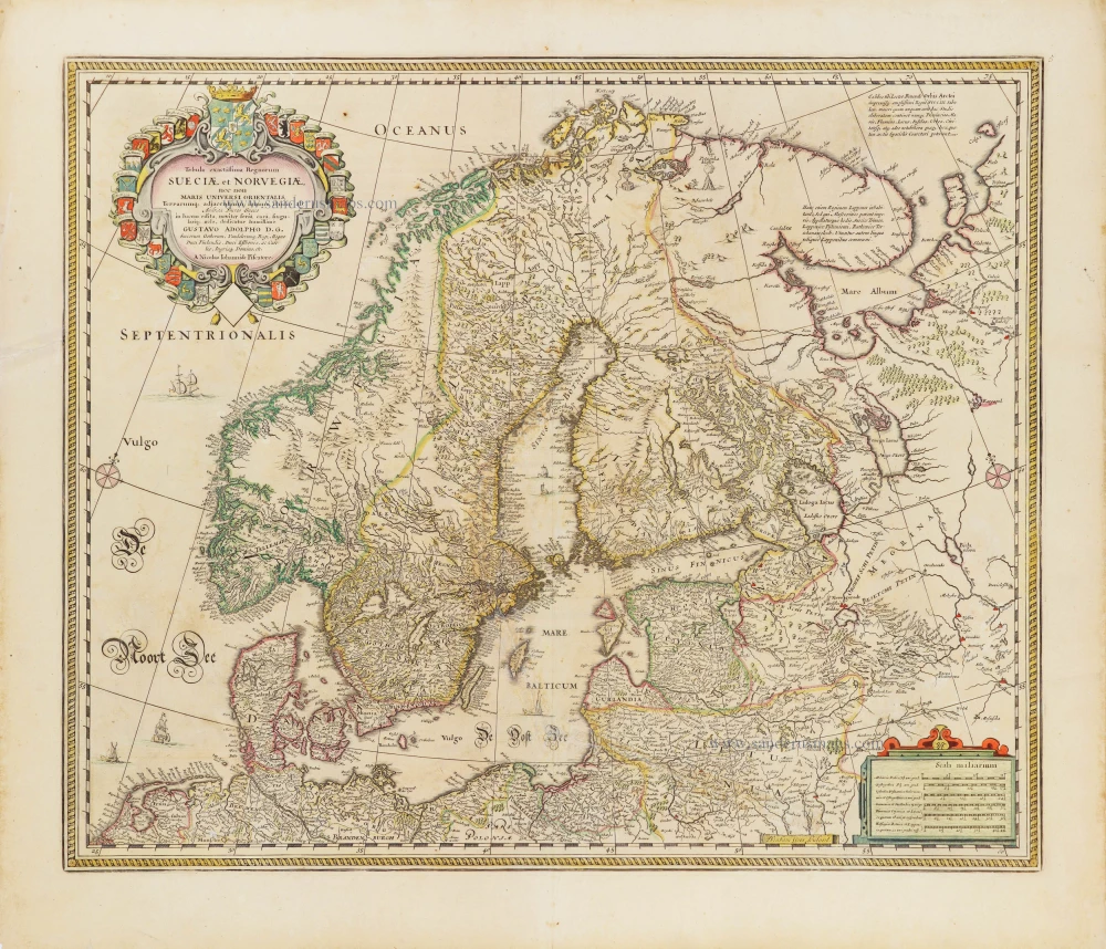
Scandinavia by Nicolaas Visscher. 1656-80
Tabula exactissima Regnorum Sueciae et Norvegiae, nec non Maris ...
[Item number: 28742]
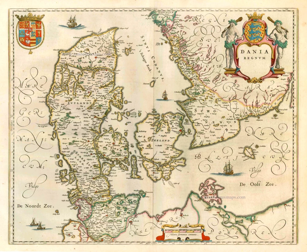
Denmark, by W. & J. Blaeu. 1649-55
Dania Regnum.
[Item number: 25266]
Denmark by Hubert Jaillot. c. 1709
Le Royaume de Danemark, Divisé en ses Provinces.
[Item number: 29589]

Scandinavia by Nicolas Sanson. 1652
La Scandinavie et les environs ou sont les Estats et Royaumes de ...
[Item number: 29607]
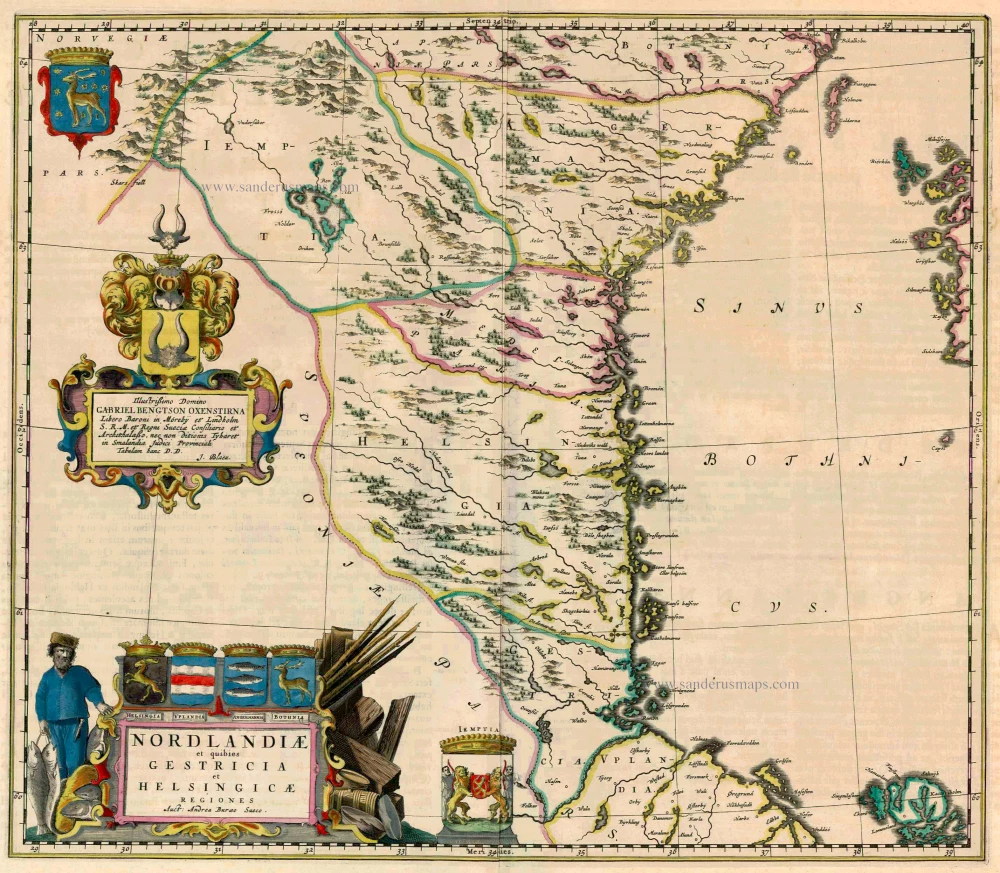
Sweden - Norrland by Blaeu J. 1662
Nordlandiae et quibies Gestricia et Helsingicae
[Item number: 23141]
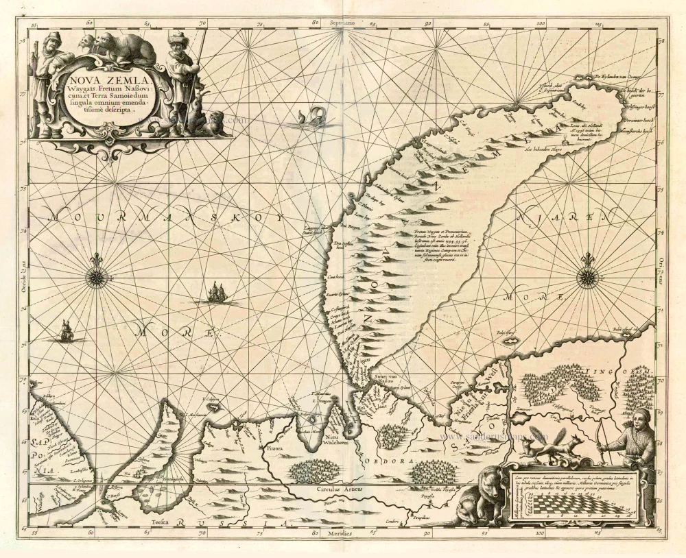
Chart of Novaya Zemlya, by J. Janssonius 1650
Nova Zemla, Waygats, Fretum Nassovicum, et Terra Samoiedum ...
[Item number: 6435]
![Caarte van 't gat van Abbo, ofte Uttoy. [on sheet with] Caarte van 't Stochomse Liet.](https://sanderusmaps.com/assets/WEBP/m14593.webp)
Sea chart of Finland - Sweden, by Doncker H. 1686
Caarte van 't gat van Abbo, ofte Uttoy. [on sheet with] Caarte ...
[Item number: 14593]
Heightened in gold
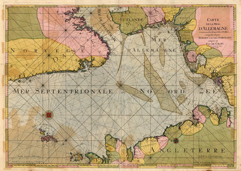
The North Sea by P. Mortier. 1693
Carte de la Mer d'Allemagne ...
[Item number: 15485]
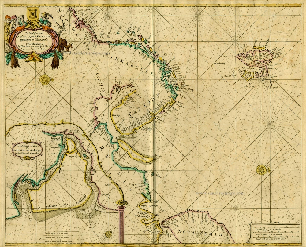
Sea chart of Northern Europe, by Goos P. 1667
De Zee Custen van Ruslant, Laplant, Finmarcken, Spitsbergen en ...
[Item number: 19052]
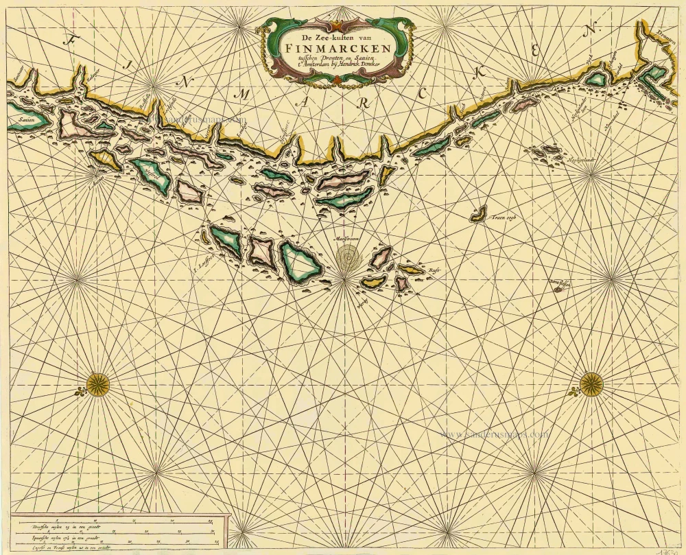
Sea chart of Norway - Finnmark, by Doncker H. 1686
De Zee-kusten van Finmarcken tusschen Dronten en Sanien.
[Item number: 17630]

Sea chart of Norway - Finnmark, by Doncker H. 1686
Caarte van Finmargken van 't Eylandt Sanien tot Noordkyn.
[Item number: 17900]
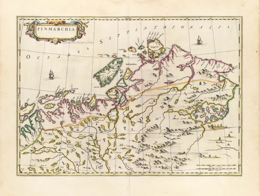
Finnmark by Joan Blaeu. 1659-72
Finmarchia.
[Item number: 30251]
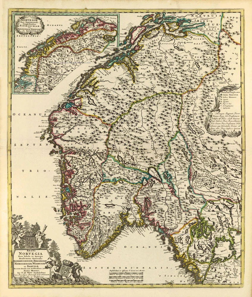
Norway by Frederik de Wit, published by Covens & Mortier. c. 1715
Regni Norvegia Nova Tabula in Quinque Praefecturas Generalis ...
[Item number: 28266]
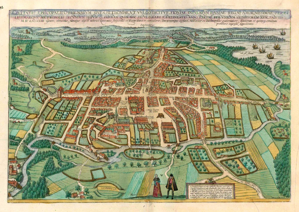
Odense, by Georg Braun and Frans Hogenberg. c. 1610
Civitates Episcopalis Othenarum sive Otthoniae, ut vulgo ...
[Item number: 16703]