Antique maps catalogue
- All recent additions
-
Antique maps
- World and Polar
-
Europe
- Europe Continent
- Belgium
- Belgium - Cities
- The Low Countries
- The Netherlands
- The Netherlands - Cities
- Luxembourg
- France
- France - Cities
- Germany
- Germany - Cities
- Austria
- Italy
- Italy - Cities
- Spain and Portugal
- Greece & Greek Islands
- Switzerland
- British Isles
- British Isles - Cities
- Northern Europe
- Central Europe
- Eastern Europe
- Southeastern Europe
- America
- Asia
- Africa
- Mediterranean Sea
- Australia
- Oceans
- Celestial Maps
- Curiosities
- Books
- Medieval manuscripts
- Prints
In rare original colour.
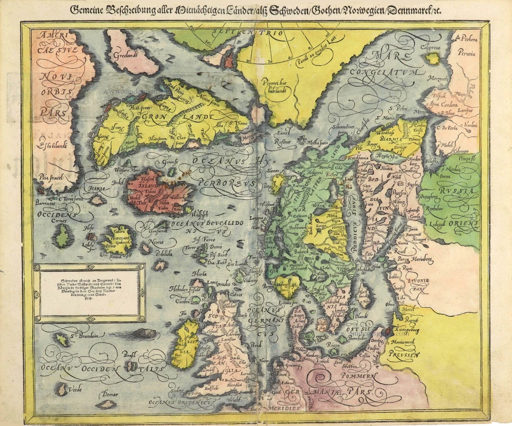
North Atlantic by Sebastian Münster. 1592
Gemeine Beschreibung aller Mittnächtigen Länder / alß Schweden / Go ...
[Item number: 29469]
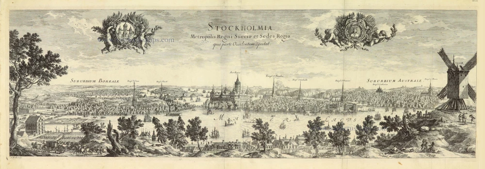
Stockholm, by E. Dahlberg. 1660-1715
Stockholmia metropolis regni Sueciae et sedes regia qua parte ...
[Item number: 28009]
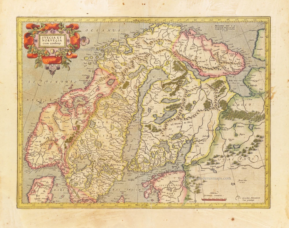
Scandinavia, by Gerard Mercator. 1628
Svecia et Norvegia cum confinijs.
[Item number: 28815]
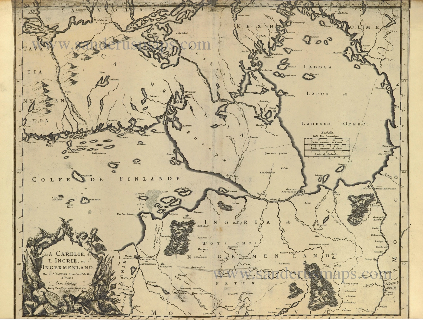
Finland and Estonia by Guillaume Sanson. 1703
La Carelie, et l'Ingrie, ou Ingermenland.
[Item number: 28500]

The Coast of Lapland, by Frederick de Wit. ca. 1680
Finmarchiae et Laplandiae Maritima. = Nieuwe Pascaert vande ...
[Item number: 29219]
![Helsheborch [on sheet with] Lunden [and] Elbogen [and] Landeskron.](https://sanderusmaps.com/assets/WEBP/m30136.webp)
First edition
Braun and Hogenberg : Malmö, Helsingborg, Lund, Landskrona. 1588
Helsheborch [on sheet with] Lunden [and] Elbogen [and] ...
[Item number: 30136]
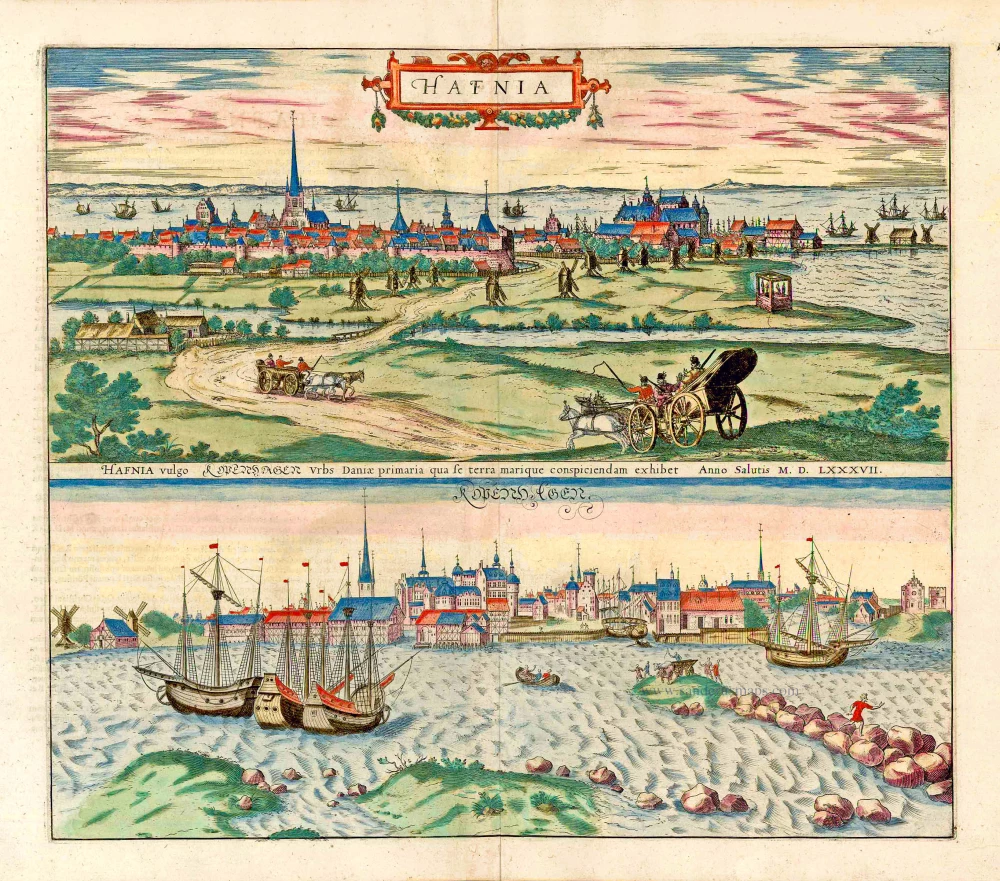
Copenhagen, by Georg Braun and Frans Hogenberg. 1635
Hafnia vulgo Kopenhagen.
[Item number: 27650]
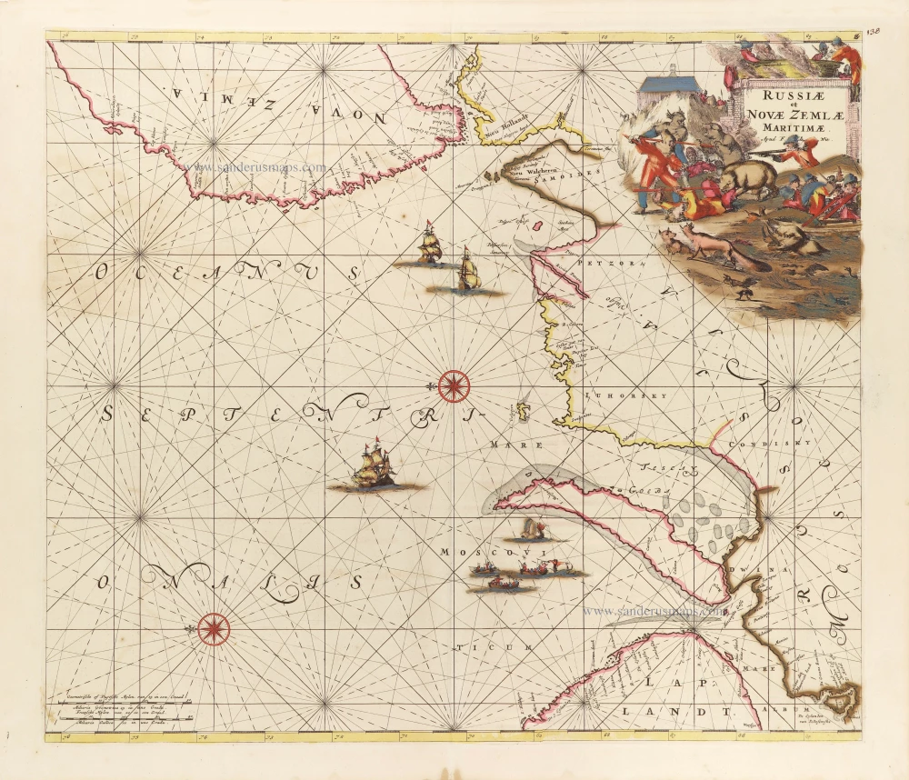
Northern Coast of Russia, by Frederick de Wit. c. 1680
Russiae et Novae Zemlae Maritimae.
[Item number: 29178]
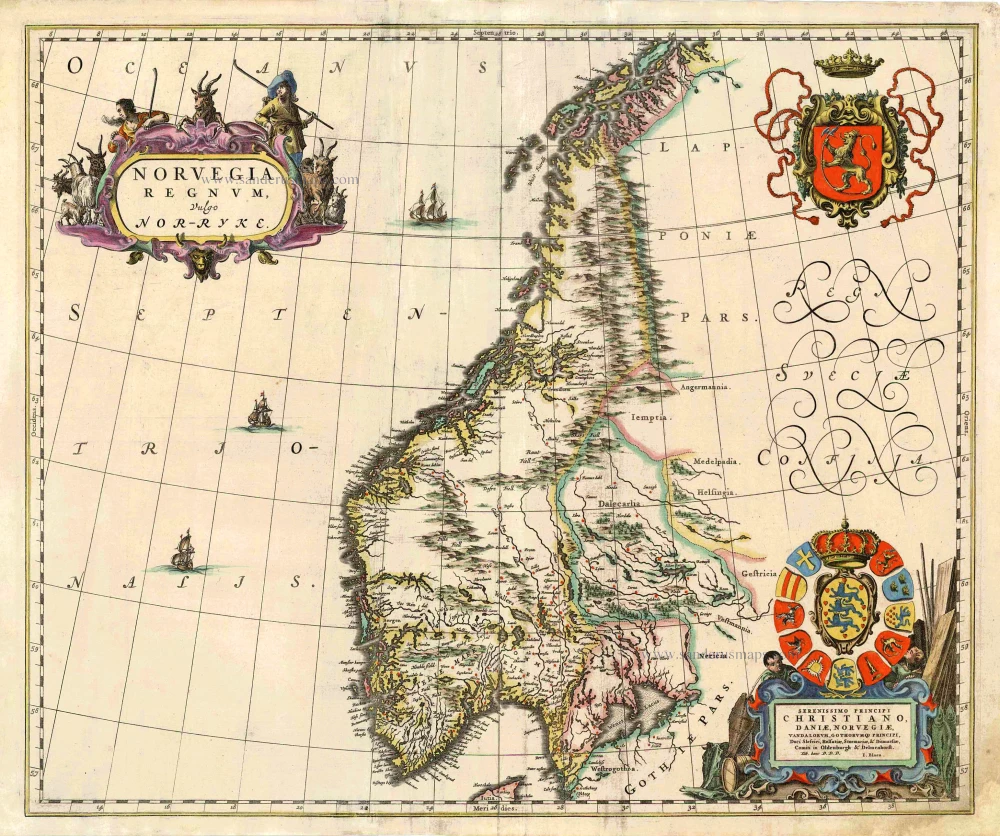
Norway, by J. Blaeu. 1667
Norvegia Regnum, Vulgo Nor-Ryke.
[Item number: 26585]
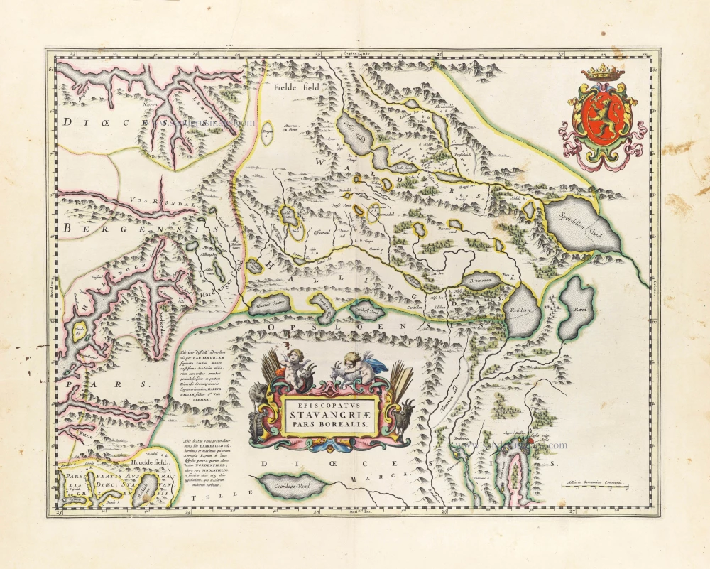
Northern Stavanger (Norway) by Joan Blaeu. 1659
Episcopatus Stavangriae Pars Borealis.
[Item number: 30209]
![[Title above map:] La Description des Hyperborees.](https://sanderusmaps.com/assets/WEBP/m28390.webp)
Scarce.
Arctic Region by Petrus Bertius. 1618
[Title above map:] La Description des Hyperborees.
[Item number: 28390]
Only in the Atlas Maior.
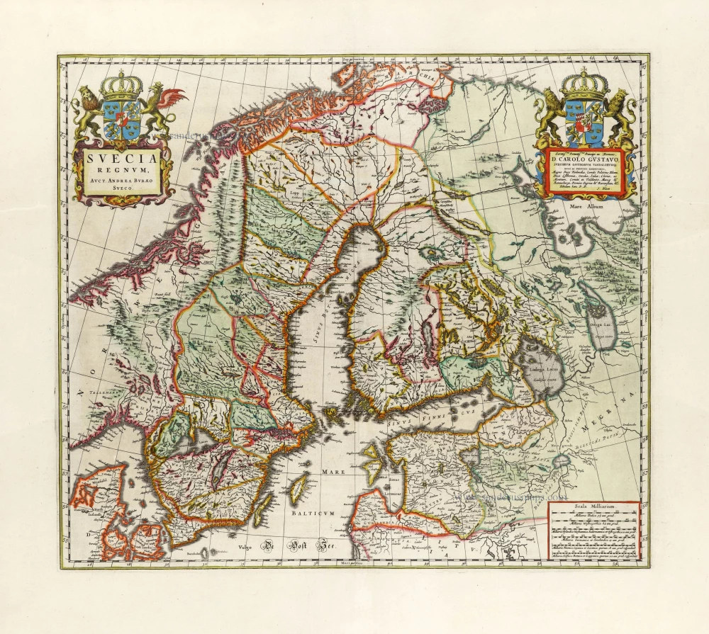
Sweden, by Joan Blaeu. 1663
Suecia Regnum,
[Item number: 30098]
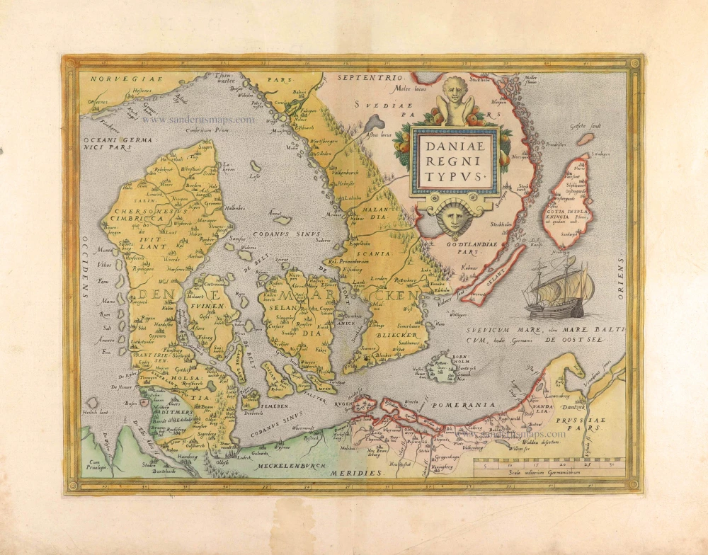
Denmark by Abraham Ortelius. 1574
Daniae Regni Typus.
[Item number: 29601]
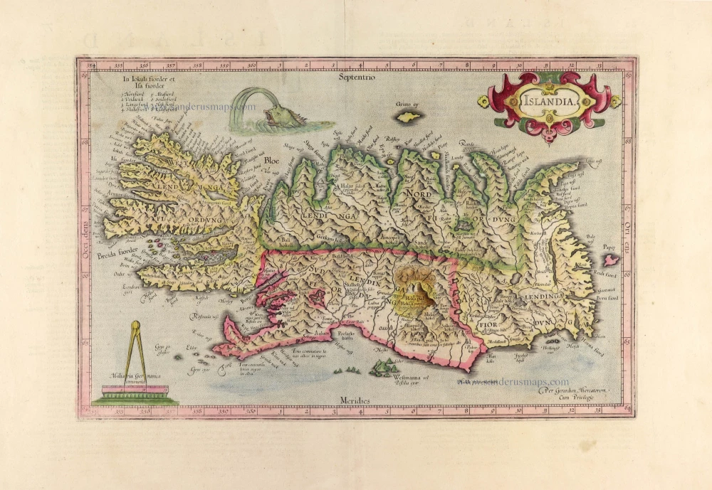
Iceland, by Gerard Mercator. 1628.
Islandia.
[Item number: 30382]
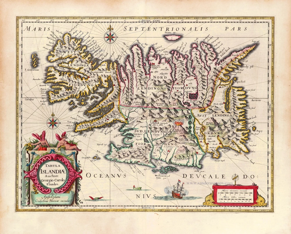
Iceland, by Willem Blaeu. 1643
Tabula Islandiae.
[Item number: 29867]
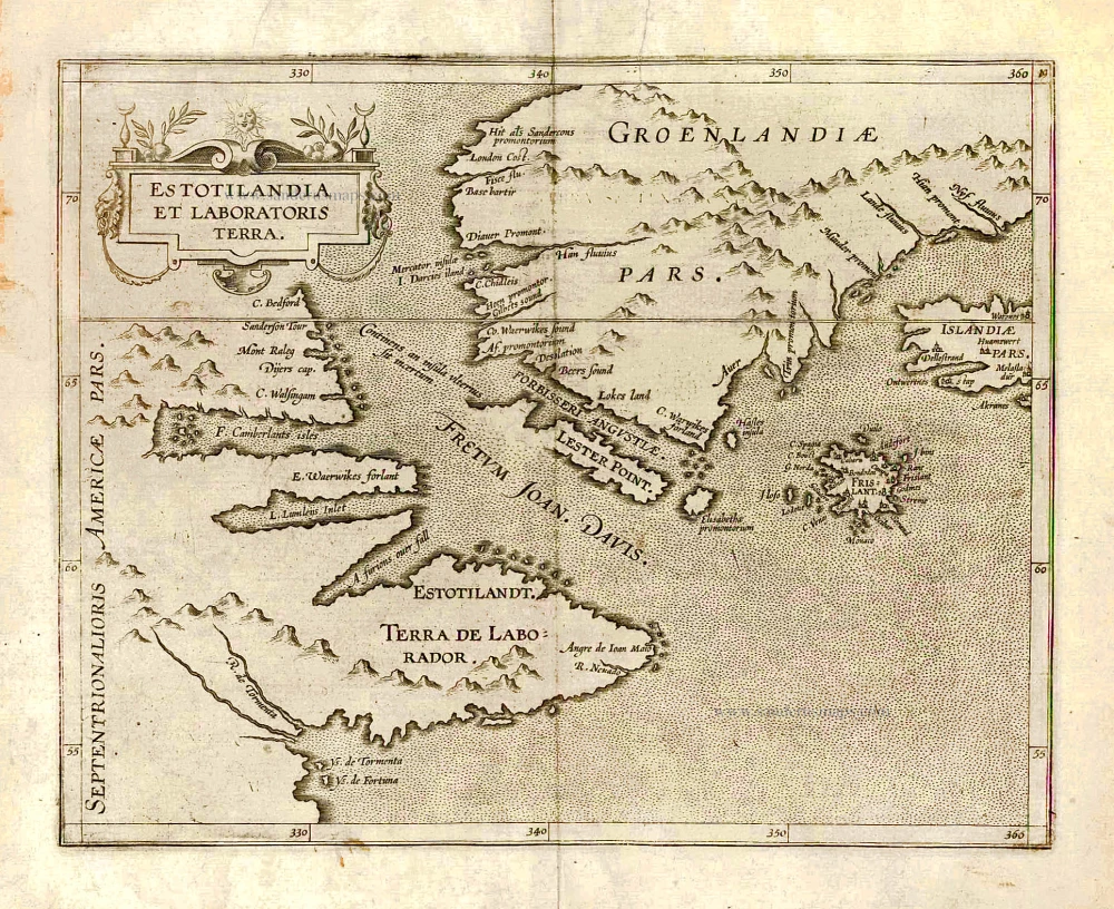
Greenland and Northeast Canada, by C. van Wytfliet. 1607
Estotilandia et Laboratoris Terra.
[Item number: 26499]
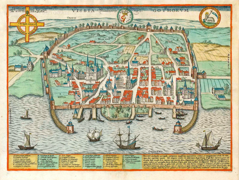
Visby on Gotland, by Georg Braun and Frans Hogenberg. 1600
Visbia Gothorum.
[Item number: 27635]
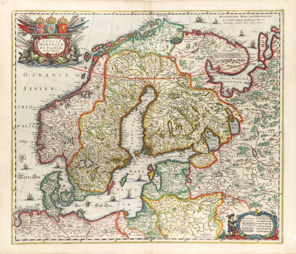
Scandinavia, by Johannes Janssonius. 1666
Sueciae, Norvegiae, et Daniae, Nova Tabula.
[Item number: 30290]
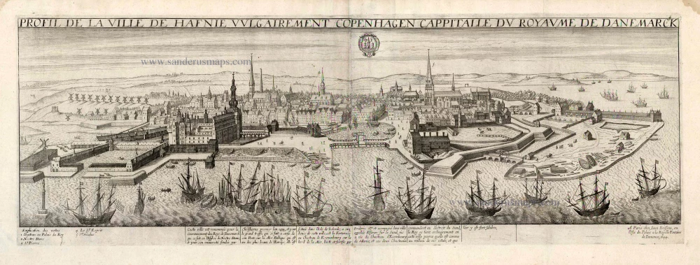
Copenhagen, by J. Boisseau. 1648
Profil de la Ville de Hafnie vulgairement Copenhagen Cappitalle ...
[Item number: 25597]
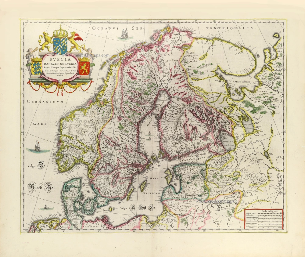
Scandinavia by Joan Blaeu. 1643
Suecia, Dania et Norvegia, Regna Europae Septentrionalia.
[Item number: 29998]
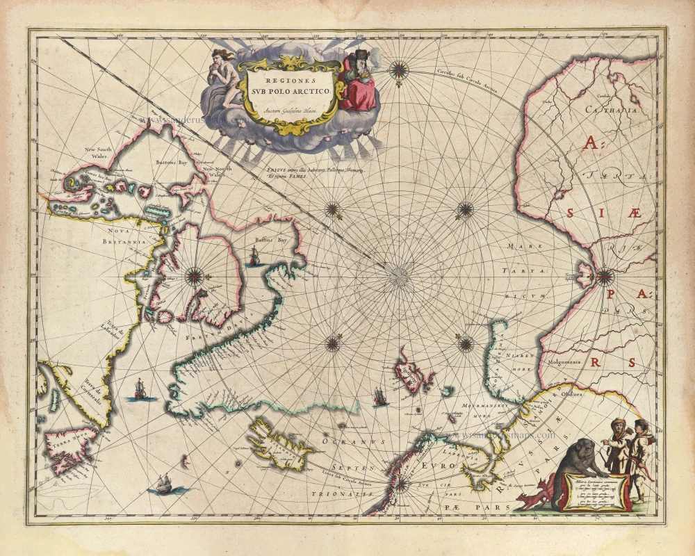
Arctic Region, by Joan Blaeu 1643
Regiones sub Polo Arctico.
[Item number: 29447]

Iceland by Johannes Janssonius. 1666
Tabula Islandiae.
[Item number: 30306]
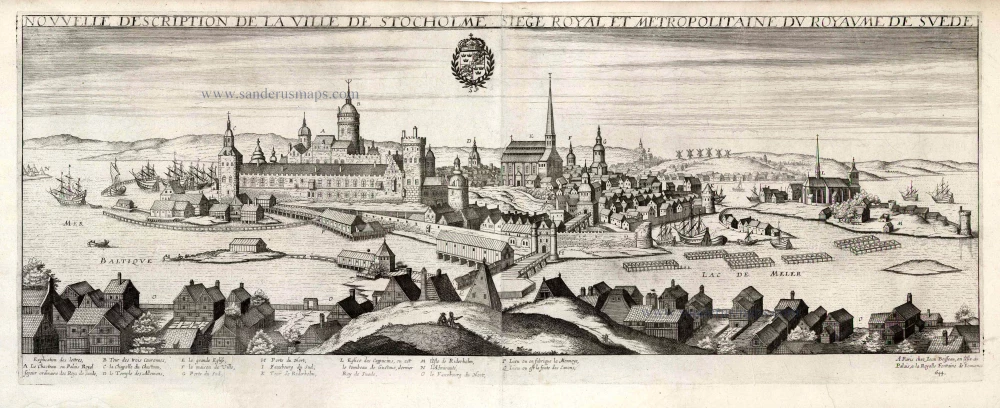
Stockholm by Jean Boisseau 1648
Nouvelle Description de la Ville de Stockholme Siege Royal et ...
[Item number: 25690]
Scarce and decorative map.
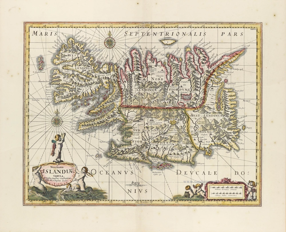
Iceland by Moses Pitt. 1680
Novissima Islandiae Tabula.
[Item number: 30151]
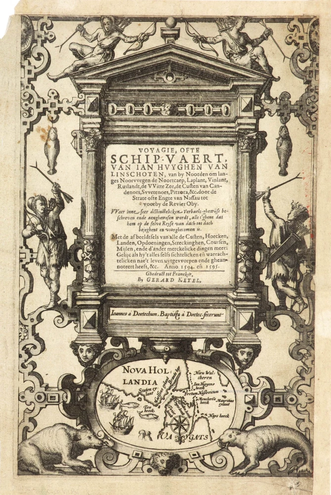
Title page of the first edition of Linschoten's Arctic voyages in search of the North-East Passage to China.
Linschoten's Voyagie, ofte Schip-Vaert Anno 1594 en[de] 1595. With inset of Yugor Strait. 1601
Voyagie, ofte Schip-Vaert, van Ian Huyghen van Linschoten
[Item number: 30292]
Rare and decorative map from Janssonius' 'Appendix'. Strong impression.
Denmark by Joannes Janssonius. 1630
Daniae Regni Typum.
[Item number: 28950]
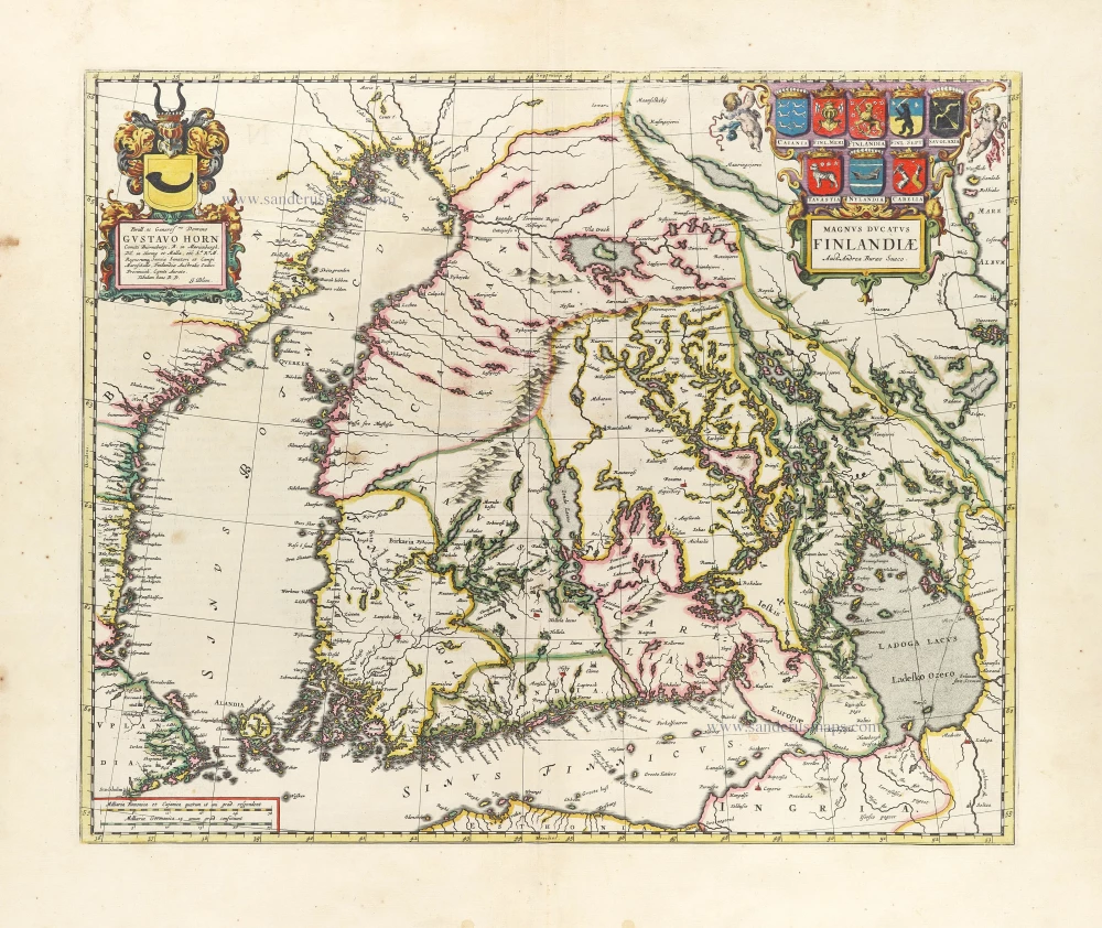
First printed map of Finland.
Finland by Joan Blaeu. 1659
Magnus Ducatus Finlandiae.
[Item number: 30242]
![[Title on verso:] Tab. Nova Norbegiae et Gottiae](https://sanderusmaps.com/assets/WEBP/m27930.webp)
Early edition with Durer's woodcut panels on verso.
Scandinavia, by Lorenz Fries. 1525
[Title on verso:] Tab. Nova Norbegiae et Gottiae
[Item number: 27930]
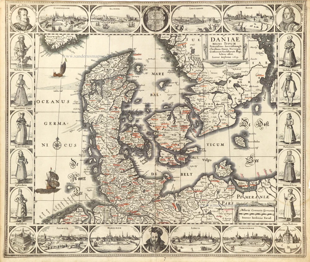
First edition, first state of this famous map of Denmark by Marcus Jordan, published by Braun & Hogenberg.
Denmark, by Georg Braun & Frans Hogenberg. 1588
Danorum Marca, vel Cimbricum, aut Daniae Regnum ...
[Item number: 30175]
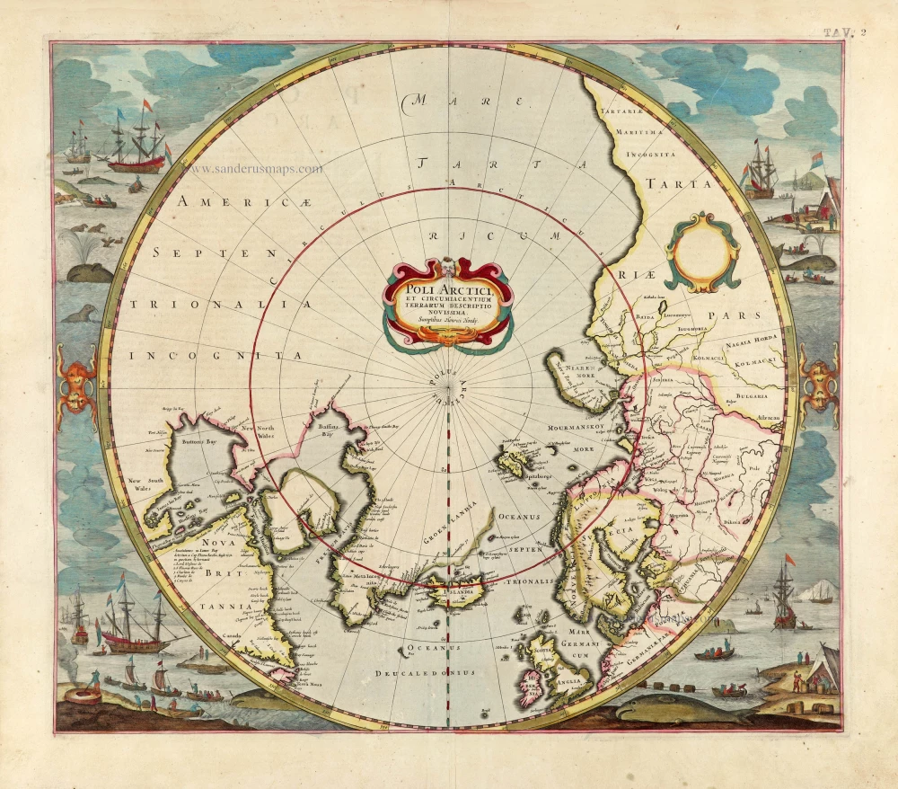
North Pole by Henricus Hondius. 1637
Poli Arctici et Circumiacentium Terrarum Descriptio Novissima.
[Item number: 30055]
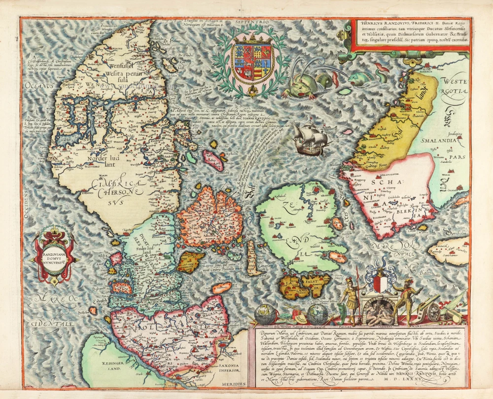
Important map
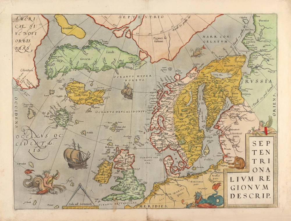
North Atlantic by Abraham Ortelius 1574
Septentrionalium Regionum Descrip.
[Item number: 29710]
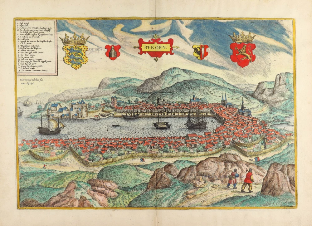
Bergen, by Georg Braun & Frans Hogenberg. (Norway) 1588
Bergen.
[Item number: 30616]
new
Second state of the first separate map of the Arctic Regions.
North Pole, by Mercator Gerard. 1628
Septentrionalium Terrarum descriptio.
[Item number: 30315]
![Septemtrionalium Regionum Svetiae Gothiae Norvegiae Daniae et terrarum adiacentium recens exactaq[ue] descriptio.](https://sanderusmaps.com/assets/WEBP/m27045.webp)
Rare and important map.
Scandinavia, by Michele Tramezini. 1558
Septemtrionalium Regionum Svetiae Gothiae Norvegiae Daniae et ...
[Item number: 27045]
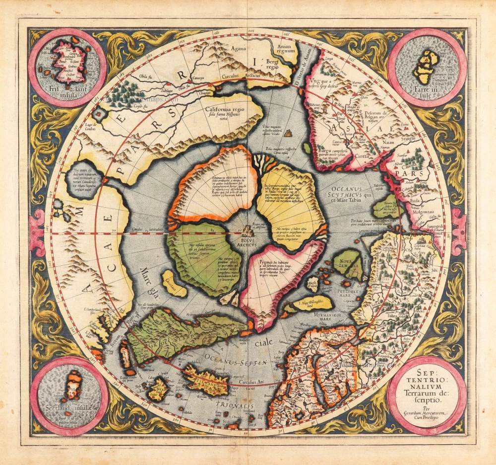
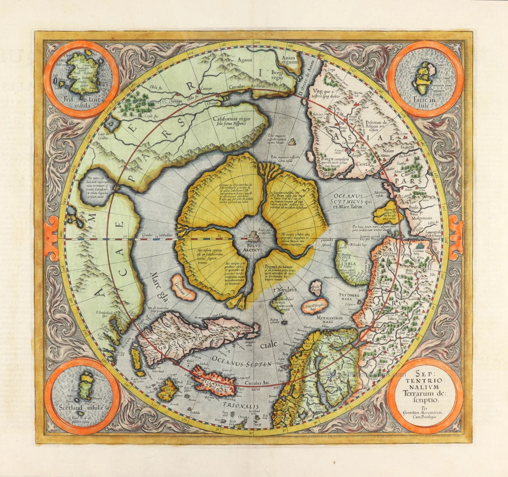
Very rare first state of Mercator's North Pole map.
Arctic Region - North Pole by Gerard Mercator, first state published by Rumold Mercator. 1595
Septentrionalium Terrarum descriptio.
[Item number: 29799]