Antique maps catalogue
- All recent additions
-
Antique maps
- World and Polar
-
Europe
- Europe Continent
- Belgium
- Belgium - Cities
- The Low Countries
- The Netherlands
- The Netherlands - Cities
- Luxembourg
- France
- France - Cities
- Germany
- Germany - Cities
- Austria
- Italy
- Italy - Cities
- Spain and Portugal
- Greece & Greek Islands
- Switzerland
- British Isles
- British Isles - Cities
- Northern Europe
- Central Europe
- Eastern Europe
- Southeastern Europe
- America
- Asia
- Africa
- Mediterranean Sea
- Australia
- Oceans
- Celestial Maps
- Curiosities
- Books
- Medieval manuscripts
- Prints
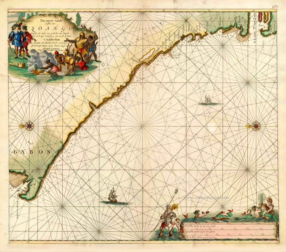
Chart of Gabon, by J. Van Keulen. 1683
Pas caerte vande Custen van Loango, Angoy als mede en gedeelte ...
[Item number: 16451]
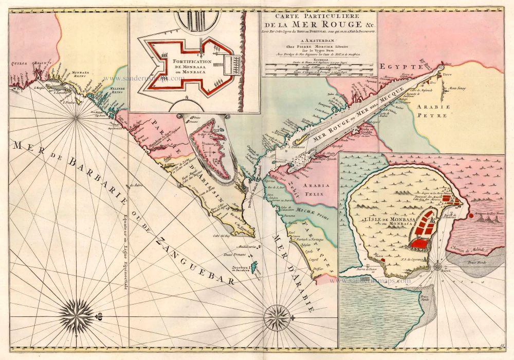
Red Sea by Covens & Mortier 1721-41
Carte Particuliere de la Mer Rouge &c. ...
[Item number: 23601]
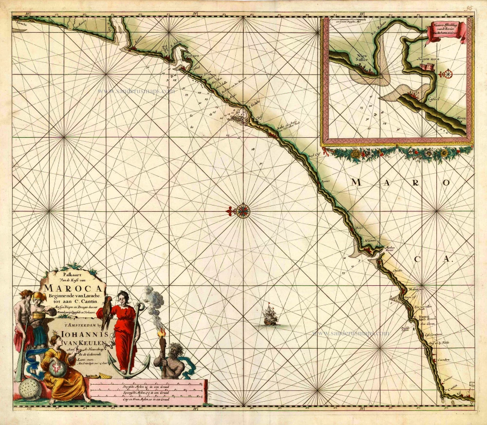
Sea chart of the west coast of Morocco, by Johannes Van Keulen. 1681
Paskaart van de Kust van Maroca Beginnende van Larache, tot aan ...
[Item number: 16452]
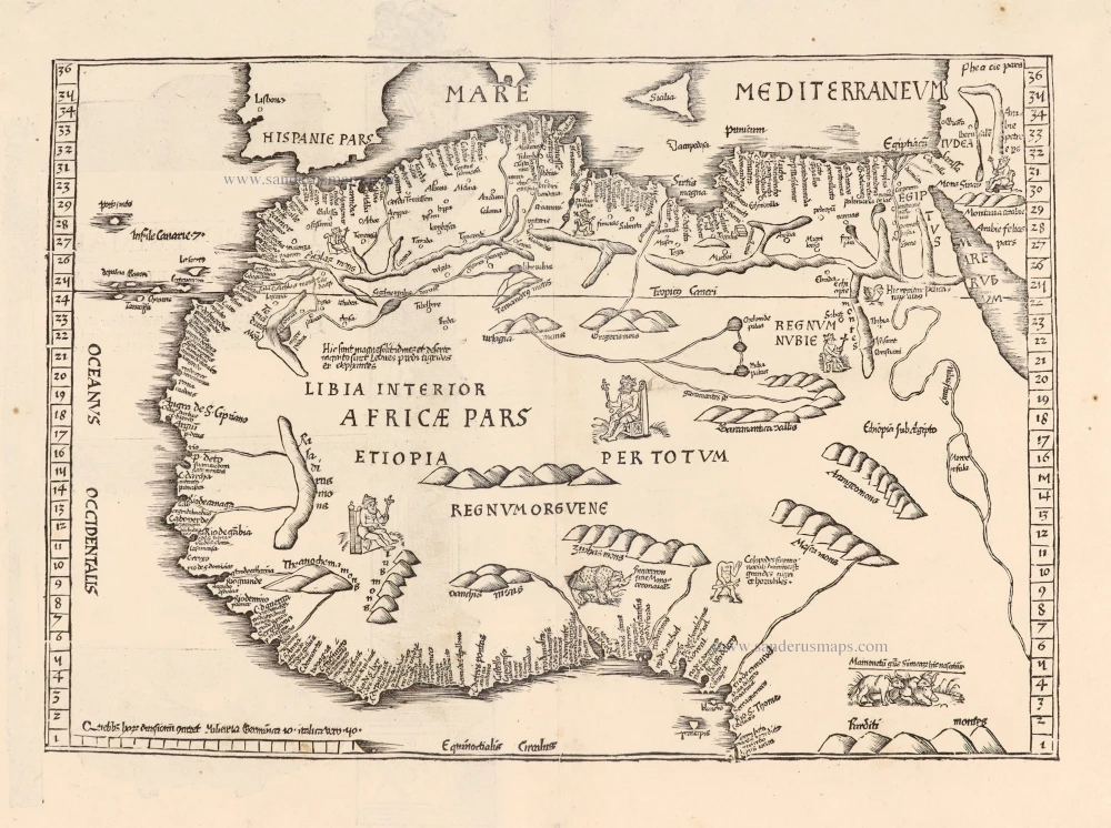
Northern Africa by Lorenz Fries 1525
Tabula nova partis Africae.
[Item number: 27946]
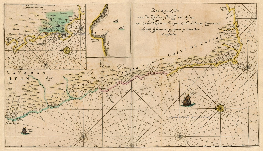
Sea chart of South-West African Coast, by Pieter Goos. 1667
Pas-Kaarte van de Zuyd-West-Kust van Afrika; van Cabo Negro tot ...
[Item number: 19073]
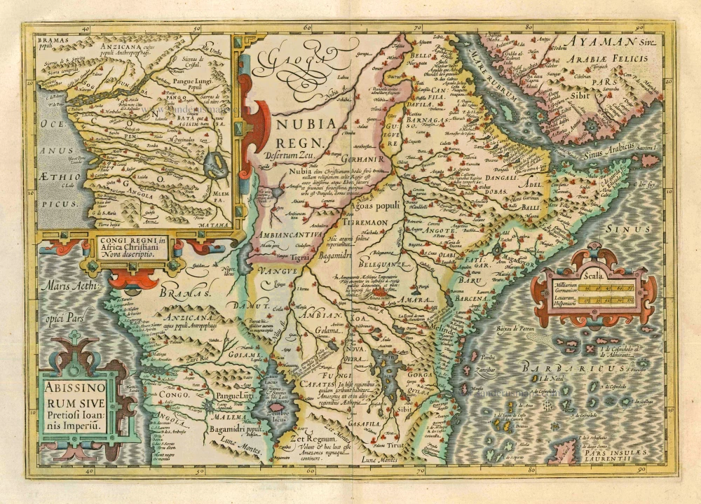
Central Africa, by Jodocus Hondius. 1628.
Abissinorum Sive Pretiosi Ioannis Imperiu
[Item number: 7749]
![Tunes Oppidum Barbarie & Regina fedes; Anno 1535 ... [on sheet with] Africa olim Aphrodisum [and] Penon de Veles.](https://sanderusmaps.com/assets/WEBP/m22417.webp)
Tunis, Mahdia & Penon de Veles, by Georg Braun & Frans Hogenberg. 1575
Tunes Oppidum Barbarie & Regina fedes; Anno 1535 ... [on sheet ...
[Item number: 22417]
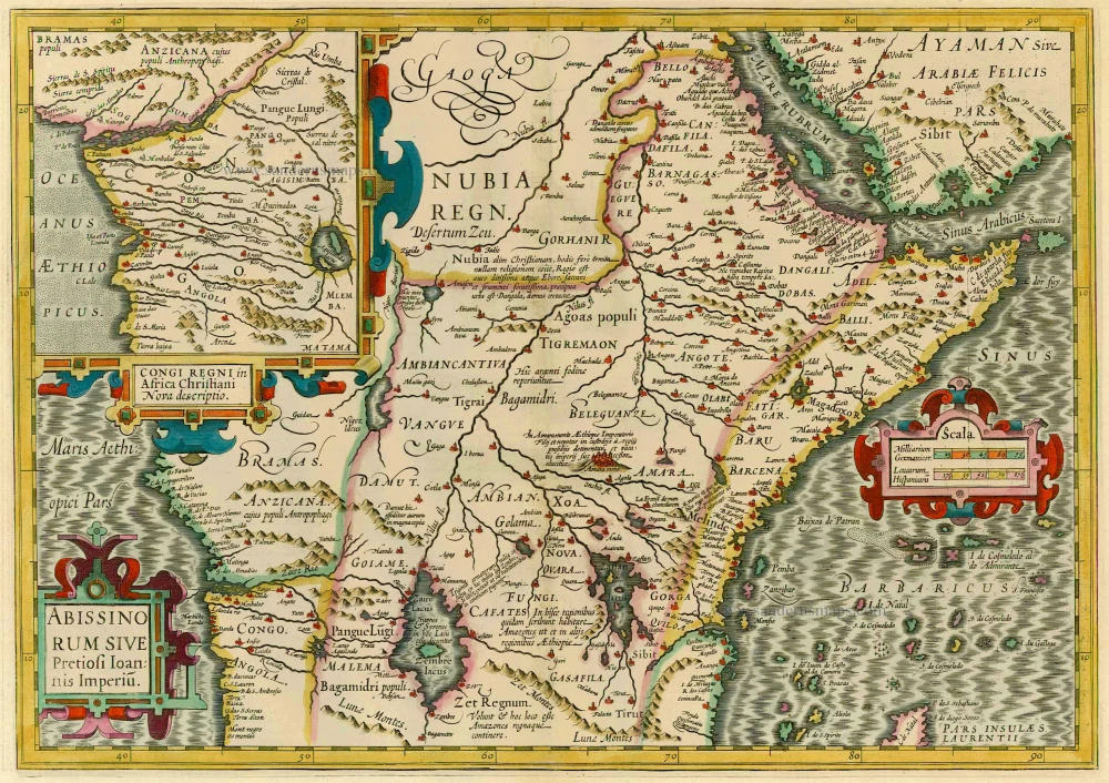
Central Africa by J. Hondius 1630
Abissinorum Sive Pretiosi Ioannis Imperiu.
[Item number: 887]
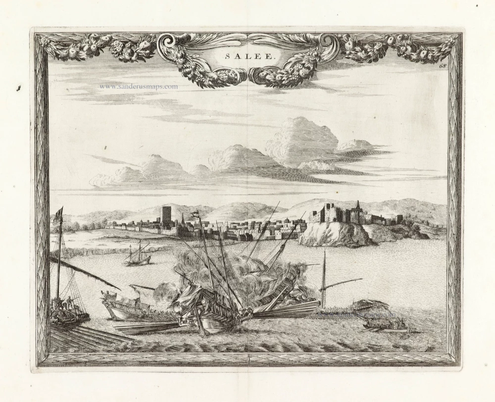
SCARCE !
View of Salé (Morocco), by Carel Allard. 1685/90
Salee;
[Item number: 30587]
new
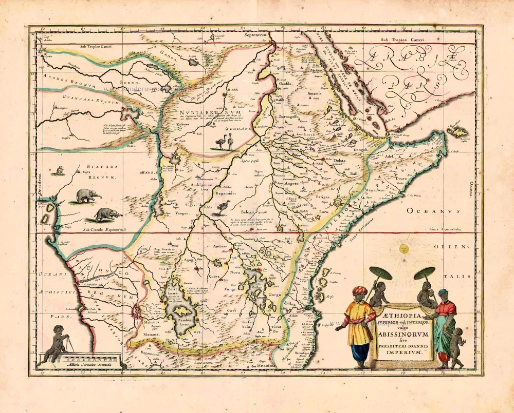
East and Central Africa, by Willem Blaeu. 1640
Aethiopia Superior vel Interior; vulgo Abissinorum sive ...
[Item number: 27693]
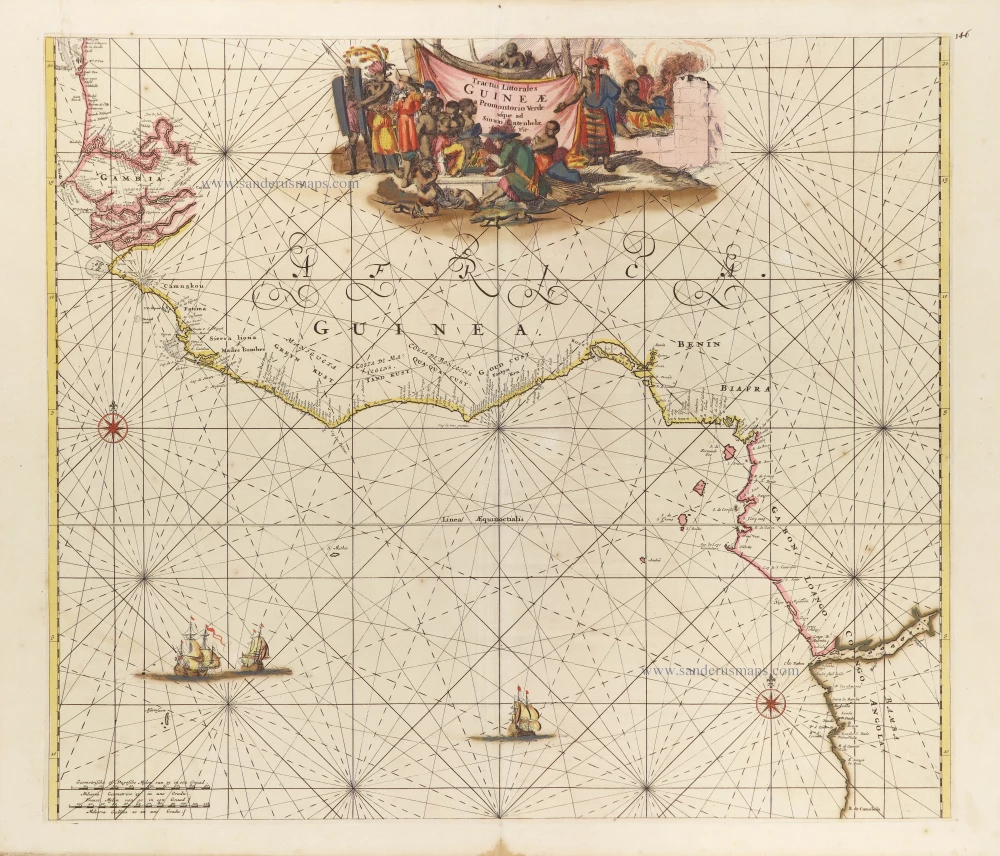
Tropical Atlantic Coast of Africa, by Frederick de Wit. c. 1691-97
Tractus Littorales Guineae a Promontorio Verde usque ad Sinum ...
[Item number: 29258]
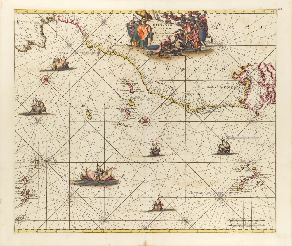
Northern Atlantic Coast of Africa, by Frederick de Wit. c. 1691-97
Barbariae et Guineae Maritimi à Freto Gibralter ad Fluvium ...
[Item number: 29278]
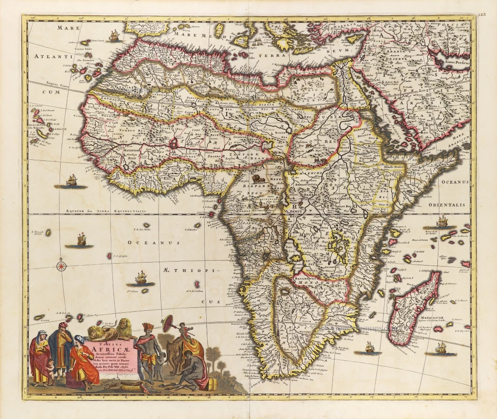
Africa, by Frederick De Wit. c. 1697-1704
Totius Africae Accuratissima Tabula,
[Item number: 29289]

Sea chart of Guinea, by J. Van Loon. 1661
Pascaerte van Guinea, tusschen C. Verde, tot Cabo de bona ...
[Item number: 24328]
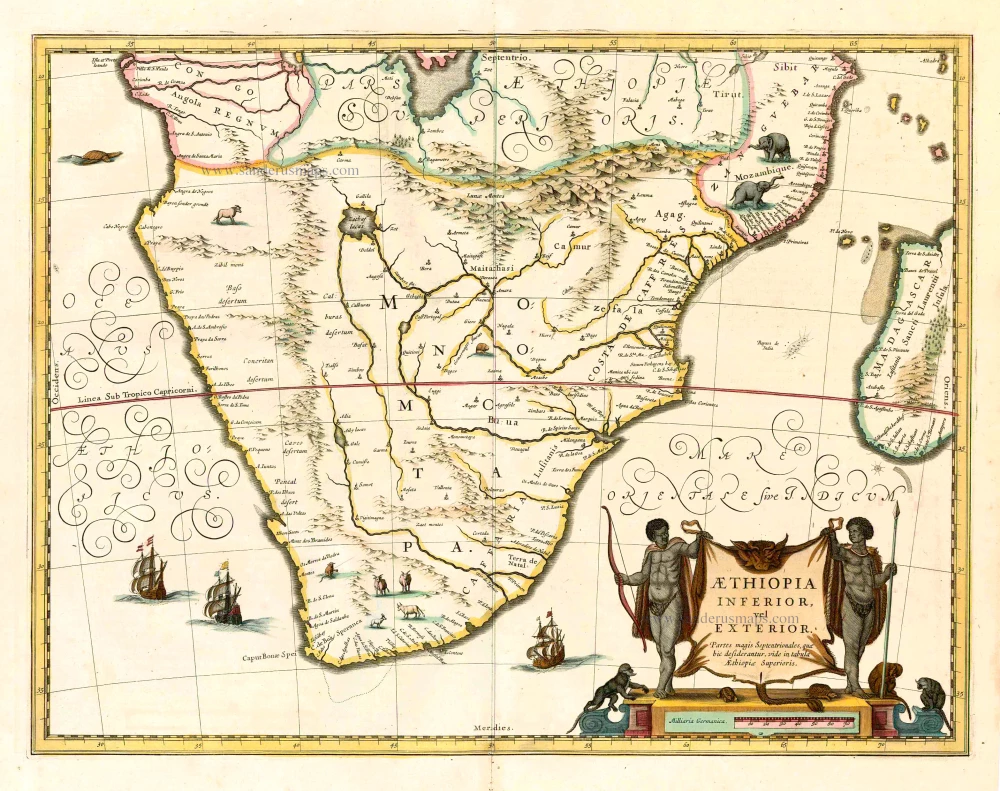
Johannes Janssonius, Southern Africa. 1641
Aethiopia Inferior, vel Exterior.
[Item number: 26450]
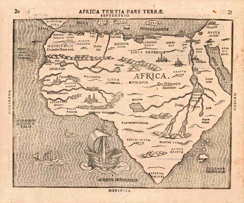
Africa, by H. Bünting. 1581
Africa Tertia Pars Terrae.
[Item number: 26228]
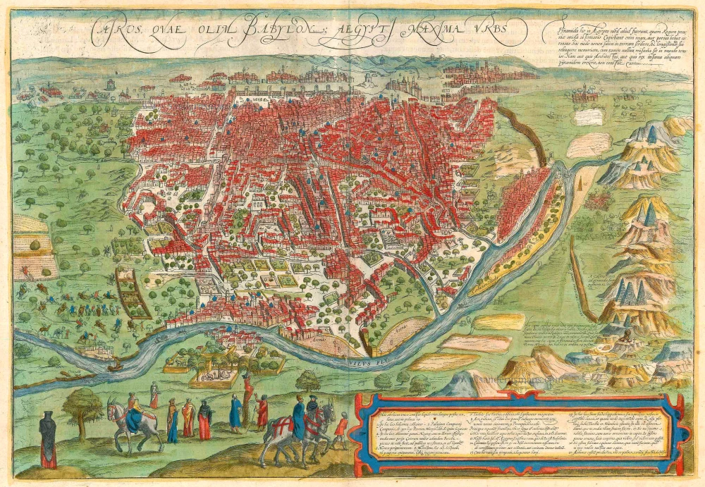
Cairo, by Georg Braun and Frans Hogenberg. 1599
Cairus, quae olim Babylon; Aegypti Maxima Urbs.
[Item number: 23244]
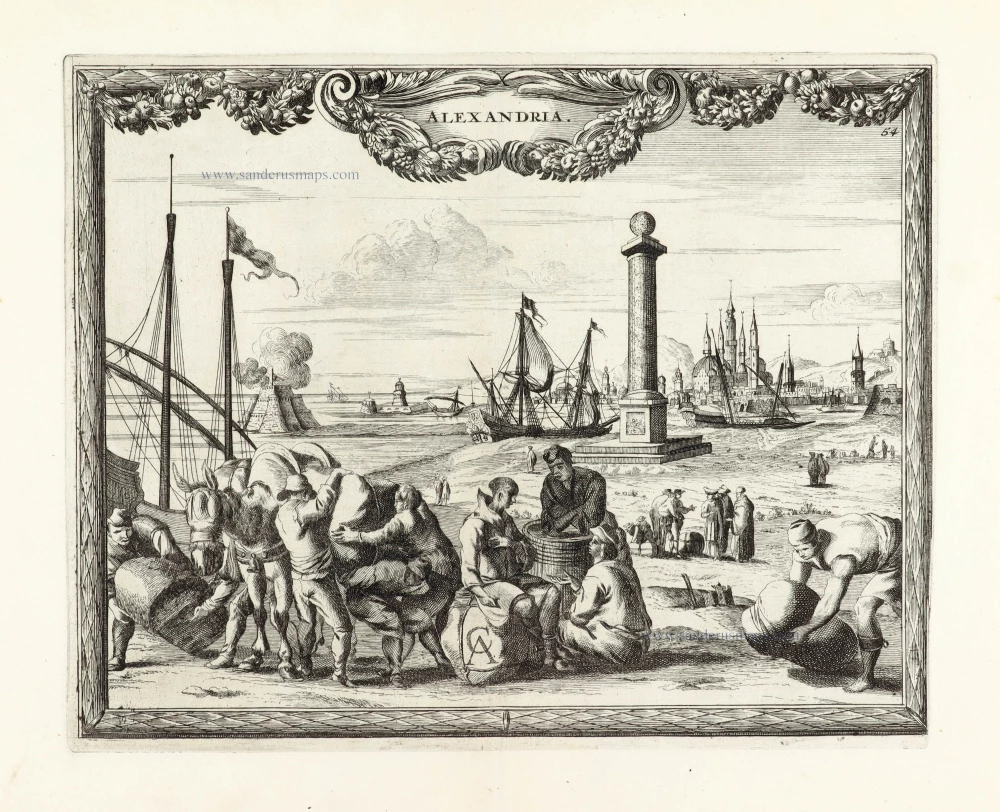
SCARCE !
View of Alexandria, by Carel Allard. 1685/90
Alexandria.
[Item number: 30578]
new
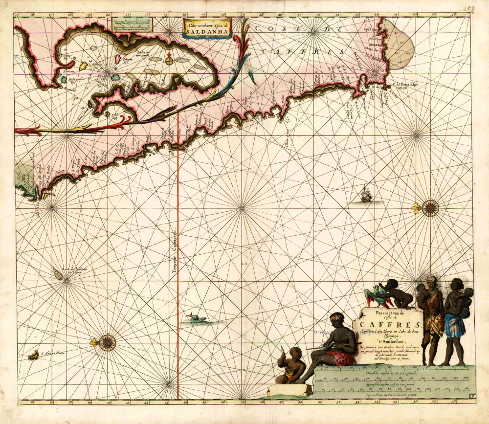
South Africa, by Johannes Van Keulen. 1683
Pascaert van de Costa de Caffres, tusschen Cabo Negro en Cabo de ...
[Item number: 10082]

Sea chart of the northwest coast of Africa, with the Azores, Canary Islands and Cape Verde Islands, by Johannes Van Keulen. 1680-1694
Paskaart van de Cust van Portugal, Barbaria, en Genehoa ...
[Item number: 26808]
![Aden, Arabiae Foelicis Emporium Celeberrimi Nominis, quo ex India, Aethiopia ... [on sheet with] Mombaza [and] Quiloa [and] Cefala.](https://sanderusmaps.com/assets/WEBP/m23242.webp)
Aden - Mombasa - Kilwa - Sofala, by Georg Braun and Frans Hogenberg. 1635
Aden, Arabiae Foelicis Emporium Celeberrimi Nominis, quo ex ...
[Item number: 23242]
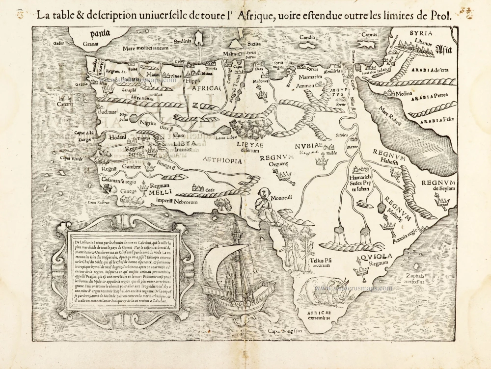
AFRICA by Sebastian Münster 1568
La table & description universelle de toute l' Afrique, voire ...
[Item number: 30519]
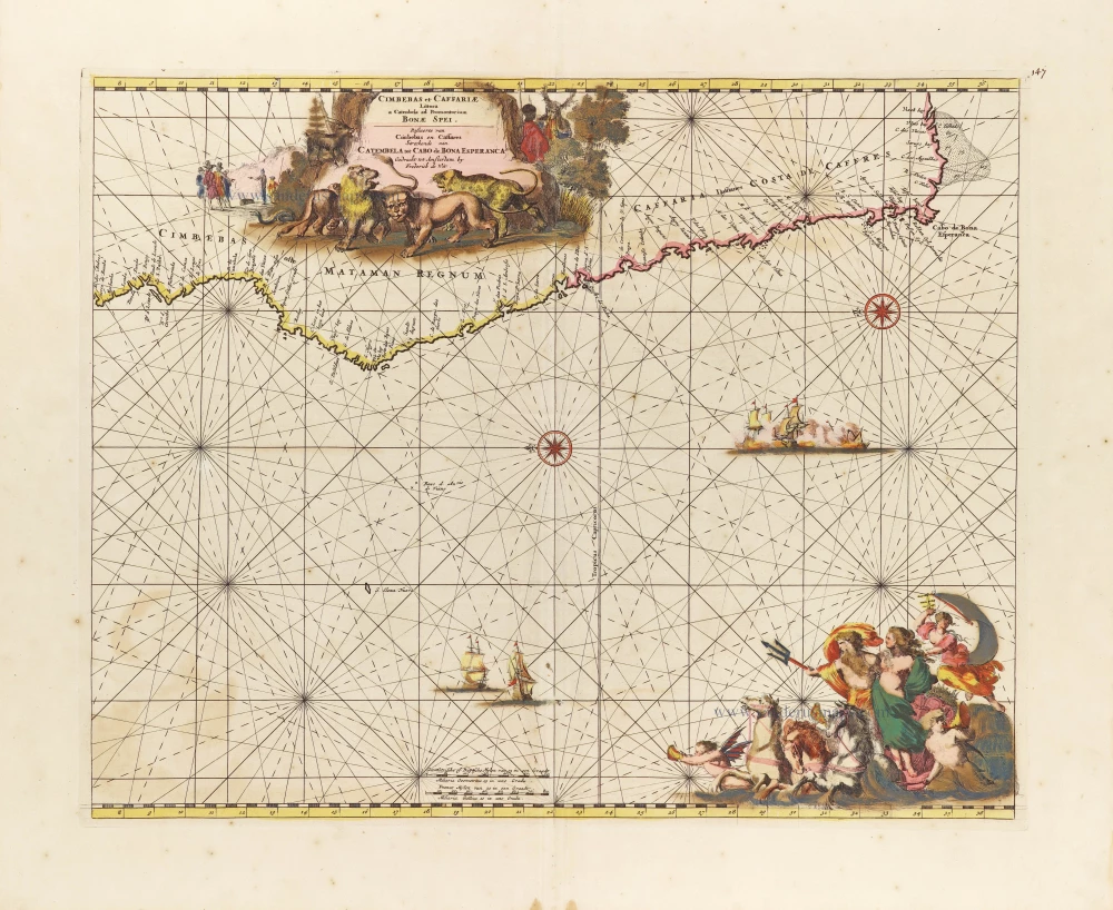
Southern Atlantic Coast of Africa, by Frederick de Wit. c. 1689-90
Cimbebas et Caffariae Littora a Catenbela ad Promontorium Bonae ...
[Item number: 29257]

Cape Verde Islands, by Pieter van der Aa. 1713
Les Iles du Cap Verd, nommées par quelques Auteurs Iles de Sel.
[Item number: 26164]
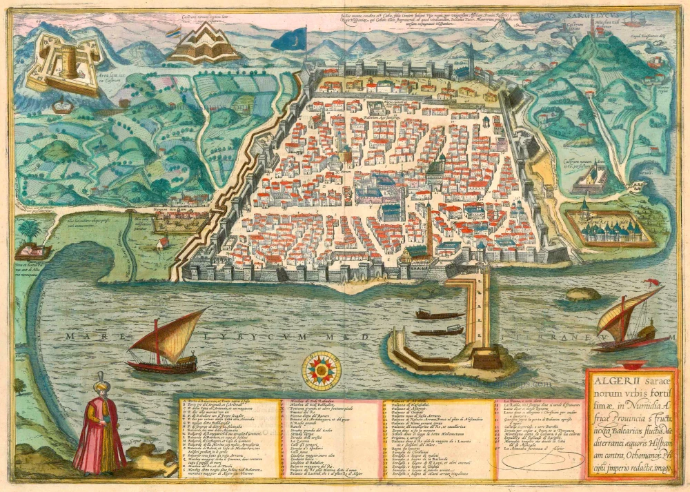
Algiers, by Georg Braun and Frans Hogenberg. 1575-1612
Algerii Saracenorum Urbis Fortissimae ...
[Item number: 23292]
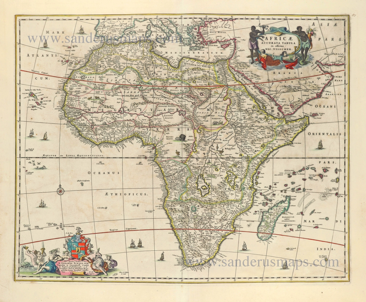
Africa by Nicolaes Visscher I. 1656-77
Africae Accurata Tabula.
[Item number: 28551]
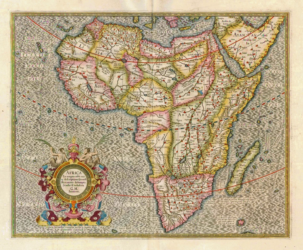
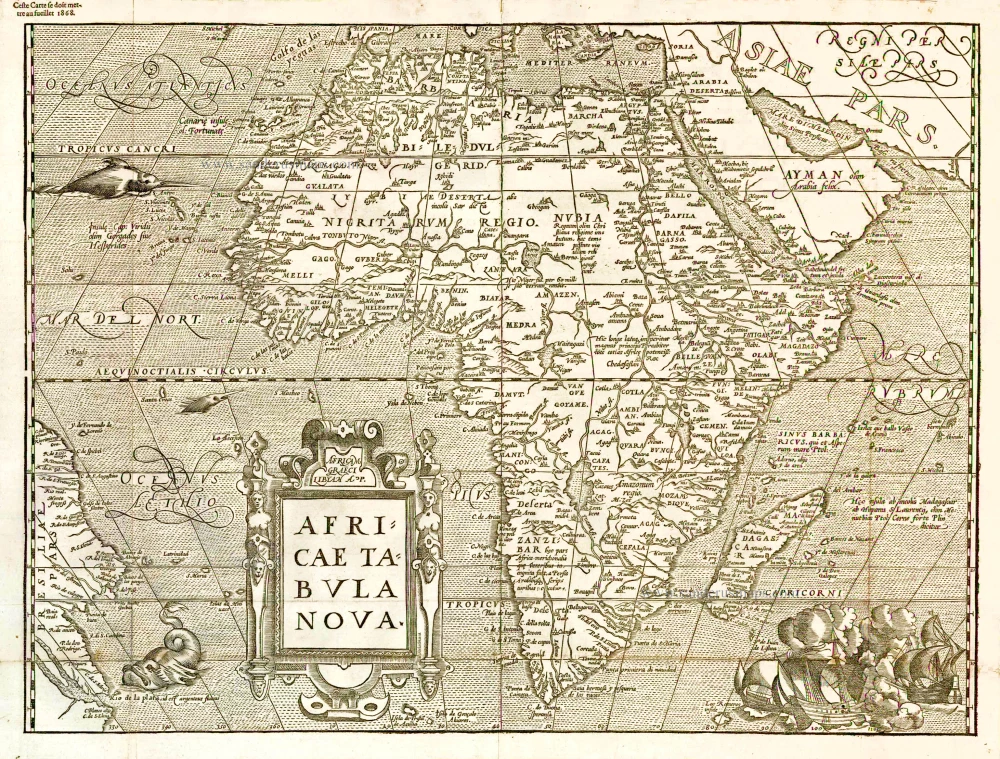
Africa, by G. Mercator. 1633
Africa Ex magna orbis terre
[Item number: 1452]
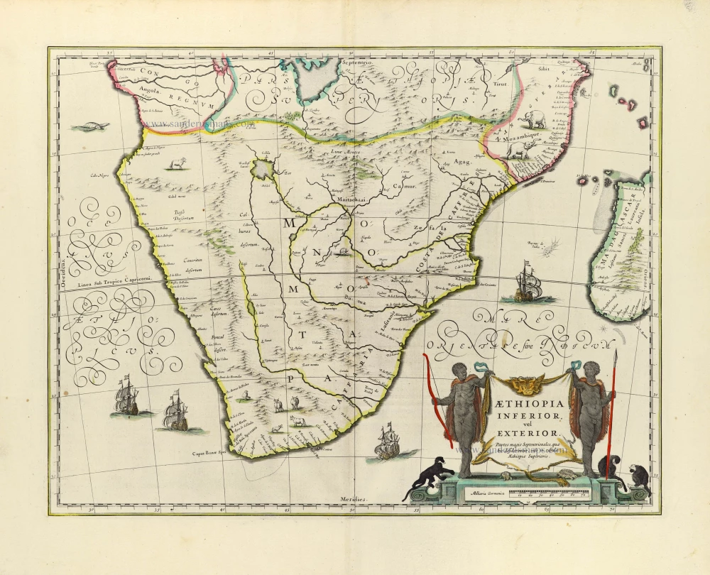
Willem Blaeu, Southern Africa. 1643
Aethiopia Inferior, Vel Exterior.
[Item number: 30122]
![[No title]](https://sanderusmaps.com/assets/WEBP/m28826.webp)
Half globe gore of the Indian Ocean - Madagascar. 1696
[No title]
[Item number: 28826]
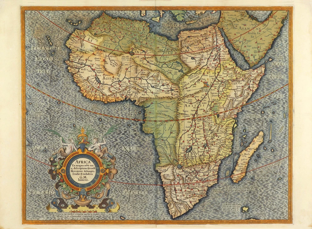
Africa by Gerard Mercator. 1623
Africa Ex magna orbis terre.
[Item number: 28678]
![[No title]](https://sanderusmaps.com/assets/WEBP/m27941.webp)
Fries' edition of the first map of Southern Africa.
Southern Africa, by Lorenz Fries. 1525
[No title]
[Item number: 27941]
Scarce
Africa, by François de Belleforest. 1575
Africae Tabula Nova.
[Item number: 27380]
Important map
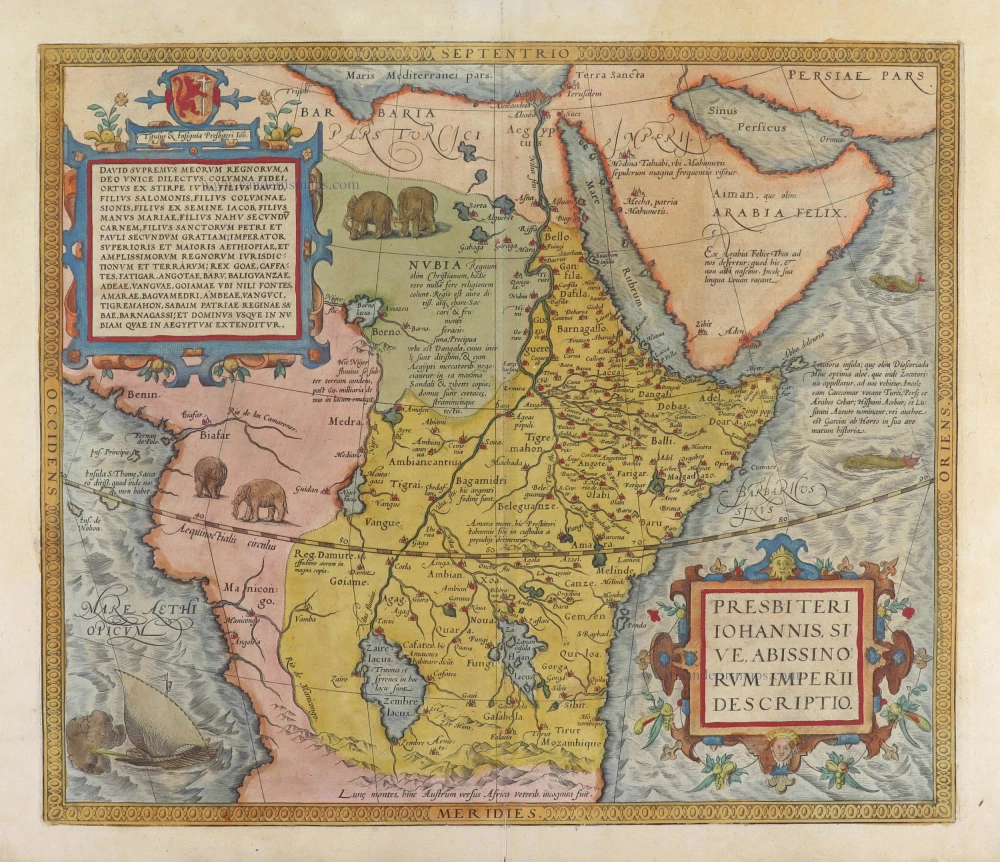
Prestor John Map (Western & Central Africa), by Abraham Ortelius. 1584
Presbiteri Iohannis, sive, Abissinorum Imperii Descriptio.
[Item number: 29722]
Luxury colour
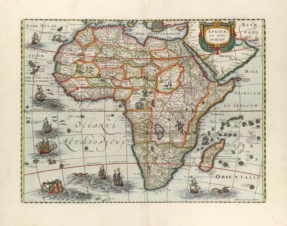
Africa by Henricus Hondius. 1666
Africae nova Tabula.
[Item number: 29955]
Big and beautiful map.
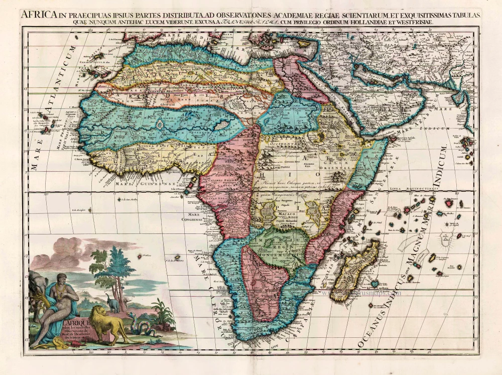
Africa, by François Halma. Before 1713
L'Afrique Selon les Nouvelles Observations de Messrs. de ...
[Item number: 27853]
![[No title]](https://sanderusmaps.com/assets/WEBP/m27086.webp)
Rare.
Atlantic Ocean - Europe, Africa & Eastern Canada by Giovanni Francesco Camocio c. 1575
[No title]
[Item number: 27086]