Antique maps catalogue
- All recent additions
-
Antique maps
- World and Polar
-
Europe
- Europe Continent
- Belgium
- Belgium - Cities
- The Low Countries
- The Netherlands
- The Netherlands - Cities
- Luxembourg
- France
- France - Cities
- Germany
- Germany - Cities
- Austria
- Italy
- Italy - Cities
- Spain and Portugal
- Greece & Greek Islands
- Switzerland
- British Isles
- British Isles - Cities
- Northern Europe
- Central Europe
- Eastern Europe
- Southeastern Europe
- America
- Asia
- Africa
- Mediterranean Sea
- Australia
- Oceans
- Celestial Maps
- Curiosities
- Books
- Medieval manuscripts
- Prints
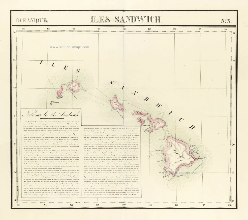
Hawaii by Vandermaelen Philippe. (Sandwich Islands) 1827
Iles Sandwich.
[Item number: 29556]
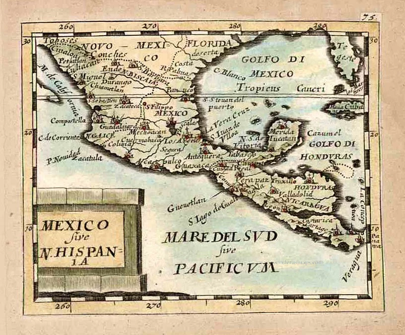
Mexico, by Pierre Duval. 1661
Mexico sive N. Hispania.
[Item number: 27839]
Big and spectacular map, heightened in gold.
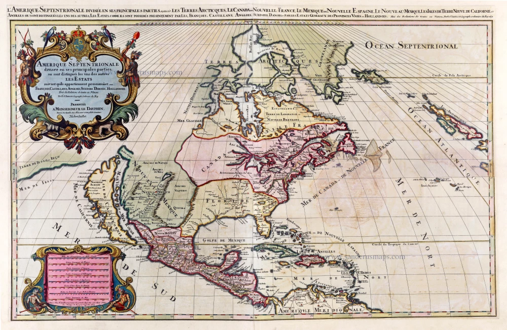
North America by A. H. Jaillot, published by Pierre Mortier. 1692
Amerique Septentrionale, divisée en ses principales parties, ou ...
[Item number: 29895]
![Temistitan - [Above map :] Descrittione della Gran Citta e Isola Temistitan.](https://sanderusmaps.com/assets/WEBP/m29826.webp)
Mexico City by Tommaso Porcacchi. 1590
Temistitan - [Above map :] Descrittione della Gran Citta e Isola ...
[Item number: 29826]
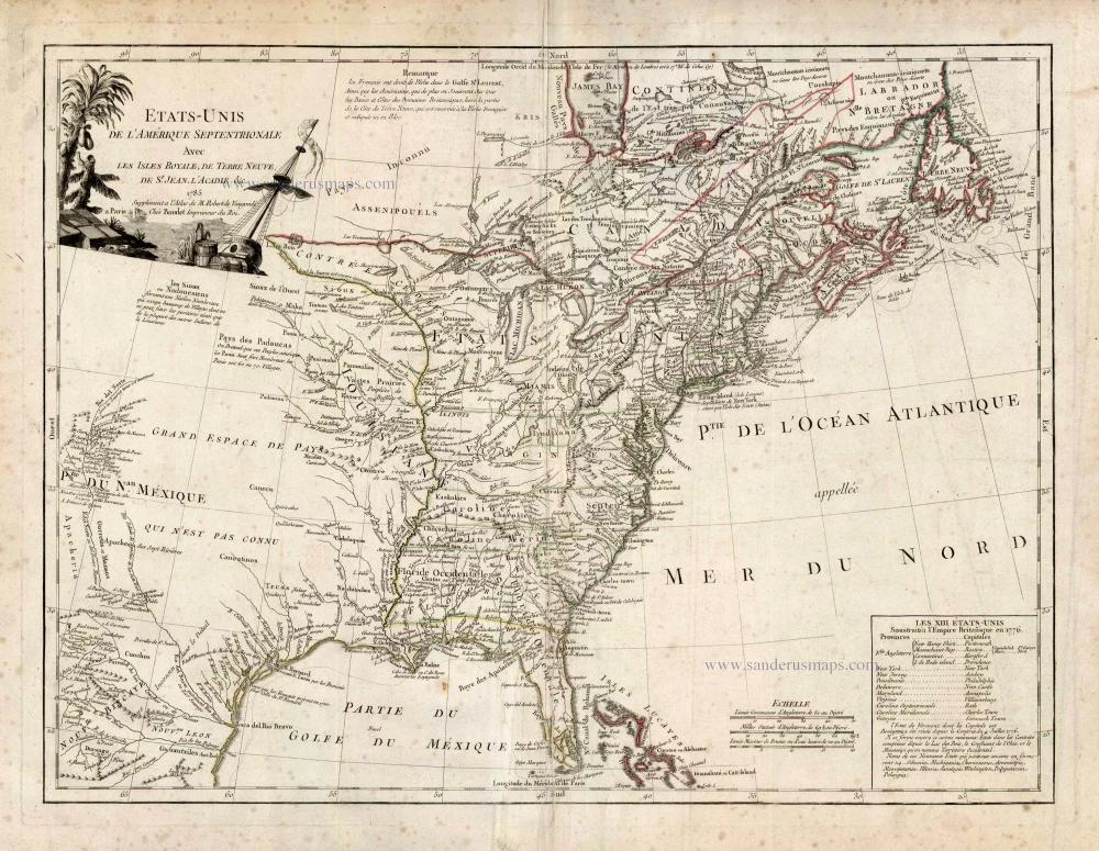
United States (East) by Boudet A. - de Vaugondy R. 1786
Etats-Unis de l'Amerique Septentrionale avec les Isles Royale, ...
[Item number: 25265]
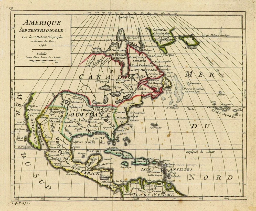
North America by Robert de Vaugondy. 1748
Amerique Septentrionale.
[Item number: 28157]
From 'Diderot & d'Alembert'
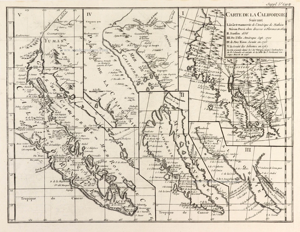
California by Robert de Vaugondy. 1777
Carte de la Californie Suivant I. La Carte manuscrite de ...
[Item number: 30091]

California as an island.
North America by Giovanni Giacomo de Rossi. 1677
L'America Settentrionale.
[Item number: 30088]
Important map.
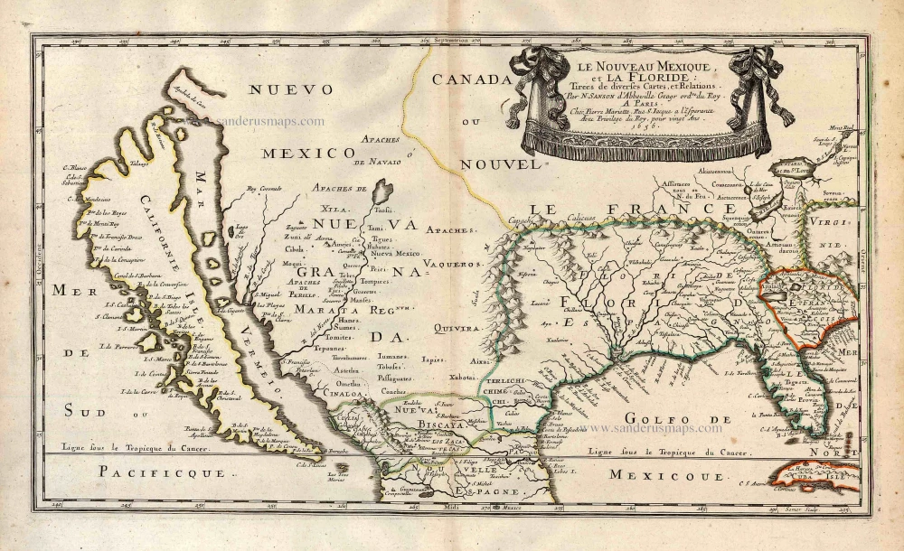
Southern North America, by Nicolas Sanson. 1658
Le Nouveau Mexique, et la Floride:
[Item number: 27917]
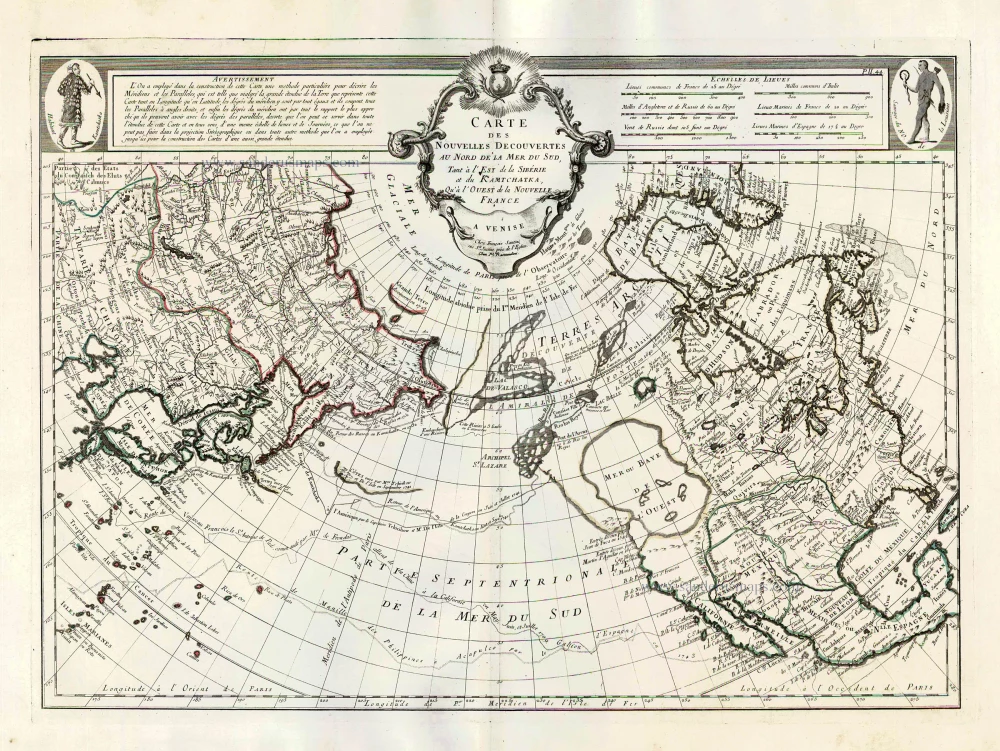
Pacific Ocean (North) by Francesco & Paolo Santini 1776-79
Carte des Nouvelles Decouvertes au Nord de la Mer du Sud, tant à ...
[Item number: 26979]
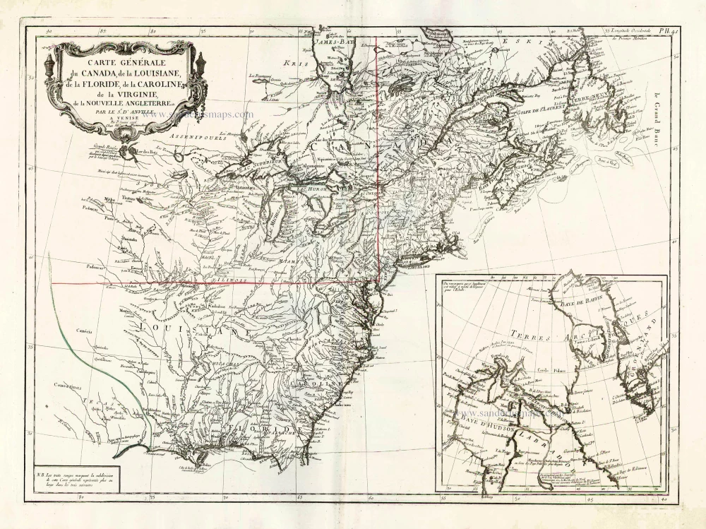
North America (East), by Paolo Santini. 1776-79
Carte Générale du Canada, de la Louisiane, de la Floride, de la C ...
[Item number: 26980]
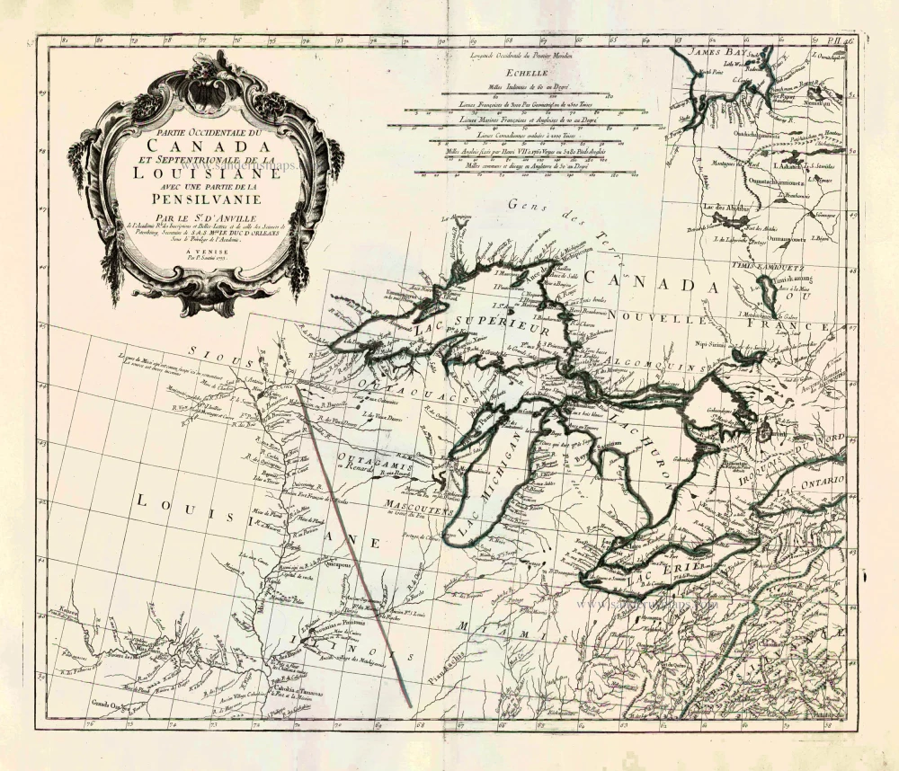
Great Lakes, by Paolo Santini. 1776-79
Partie Occidentale du Canada et Septentrionale de la Louisiane ...
[Item number: 26981]
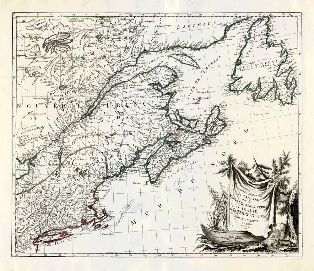
New England and Northeastern Canada, by Paolo Santini. 1776-79
Partie Orientale du Canada, avec la Nouvelle Angleterre, ...
[Item number: 26982]
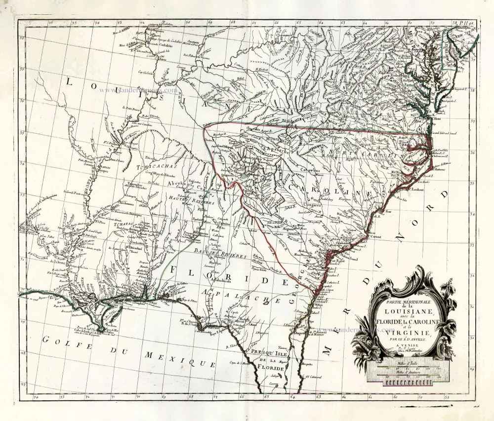
The United States (Southeast), by Francesco Santini. 1776-79
Partie Méridionale de la Louisiane, avec la Floride, la Caroline ...
[Item number: 26983]
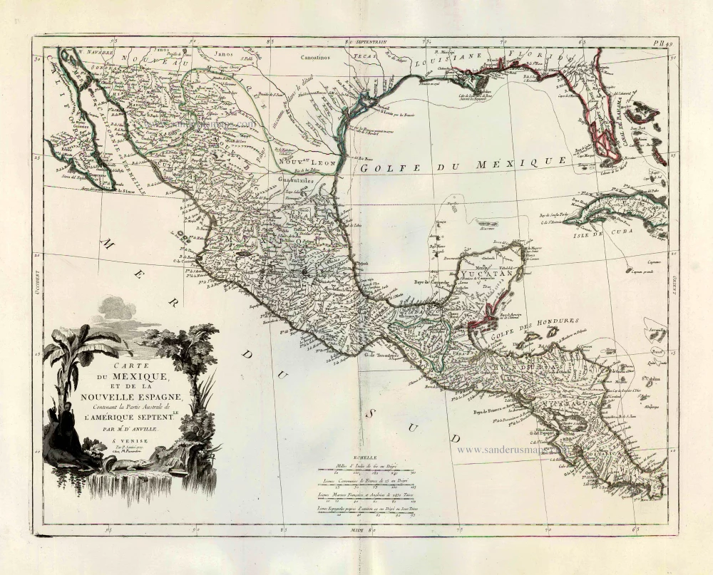
Mexico, by Paolo Santini. 1776-79
Carte du Mexique, et de la Nouvelle Espagne, Contenant la Partie ...
[Item number: 27009]

Sea chart of the Gulf of Mexico, Yucatan Channel, by J. Van Keulen. 1680-1694
Pas Kaart van de Boght van Florida met de Canaal tusschen ...
[Item number: 16285]
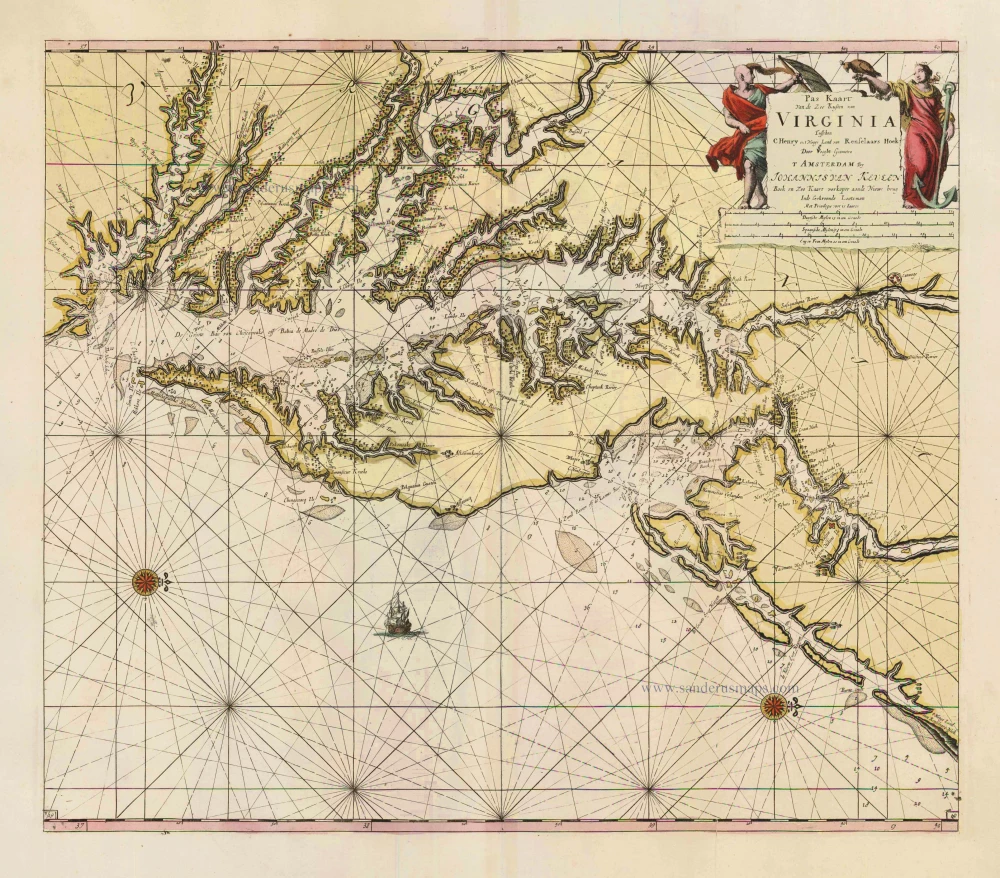
Virginia by Johannes van Keulen 1702
Pas Kaart van de Zee Kusten van Virginia tusschen C. Henry en t ...
[Item number: 1332]
![[No title]](https://sanderusmaps.com/assets/WEBP/m30730.webp)
Heightened in gold and silver
Atlantic Ocean by Theodore De Bry, Great Voyages, 1599
[No title]
[Item number: 30730]
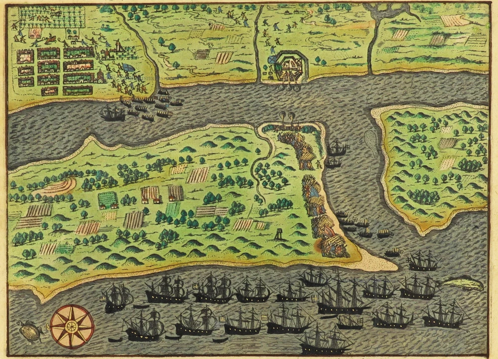
The earliest obtainable view of any city within the United States
Drake's raids against St. Augustine, Cartagena, Santo Domingo and Praia, Great Voyages, De Bry, 1599
Expugnato civitatis S. Augustini in America sitae. / Franciscus ...
[Item number: 30739]
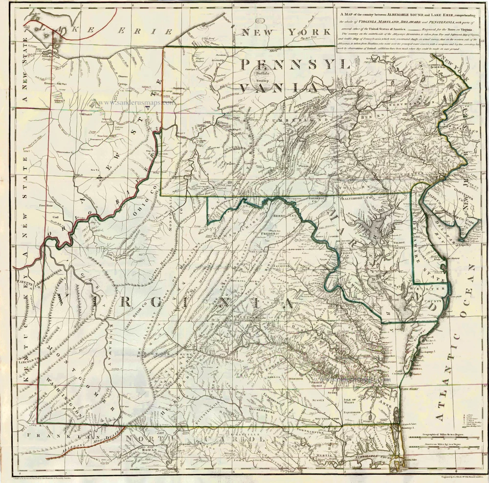
Virginia by Thomas Jefferson 1787
A Map of the country between Albemarle Sound, and Lake Erie, ...
[Item number: 27301]
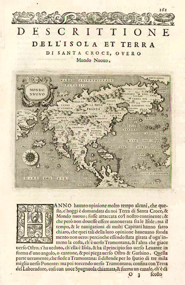
Earliest obtainable map of North America
North America, by Tomaso Porcacchi. 1576
Mondo Nuovo - Descrittione del l'Isola et Terra di Sancta Croce, ...
[Item number: 27651]
![Vincenzo Coronelli [No title]](https://sanderusmaps.com/assets/WEBP/m29448.webp)
Rare. Four gores.
North America by Coronelli Vincenzo 1696
Vincenzo Coronelli [No title]
[Item number: 29448]
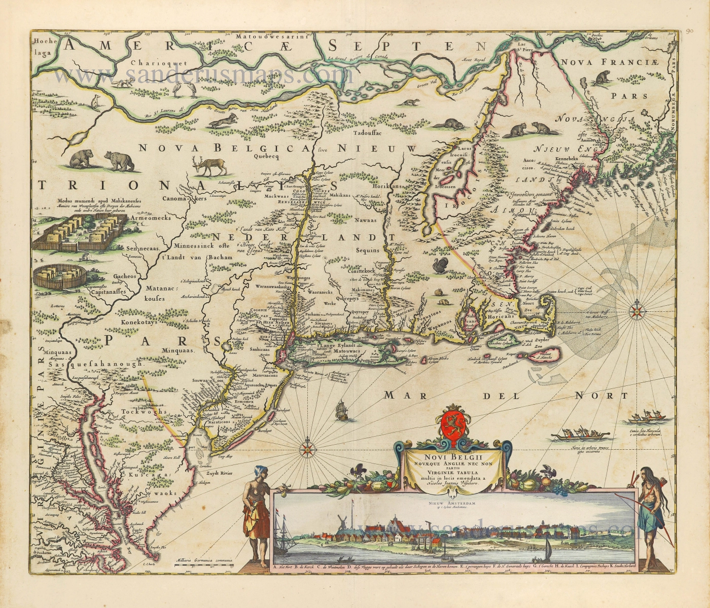
Extremely important map with a view of New York
New England by Nicolaes Visscher I. 1656-77
Novi Belgii novaeque Angliae nec non partis Virginiae Tabula.
[Item number: 28549]
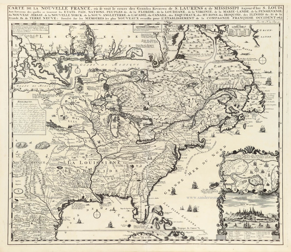
Eastern North America (U.S.), by Zacharias Châtelain. 1719
Carte de la Nouvelle France, ou se Voit le Cours des Grandes ...
[Item number: 29365]
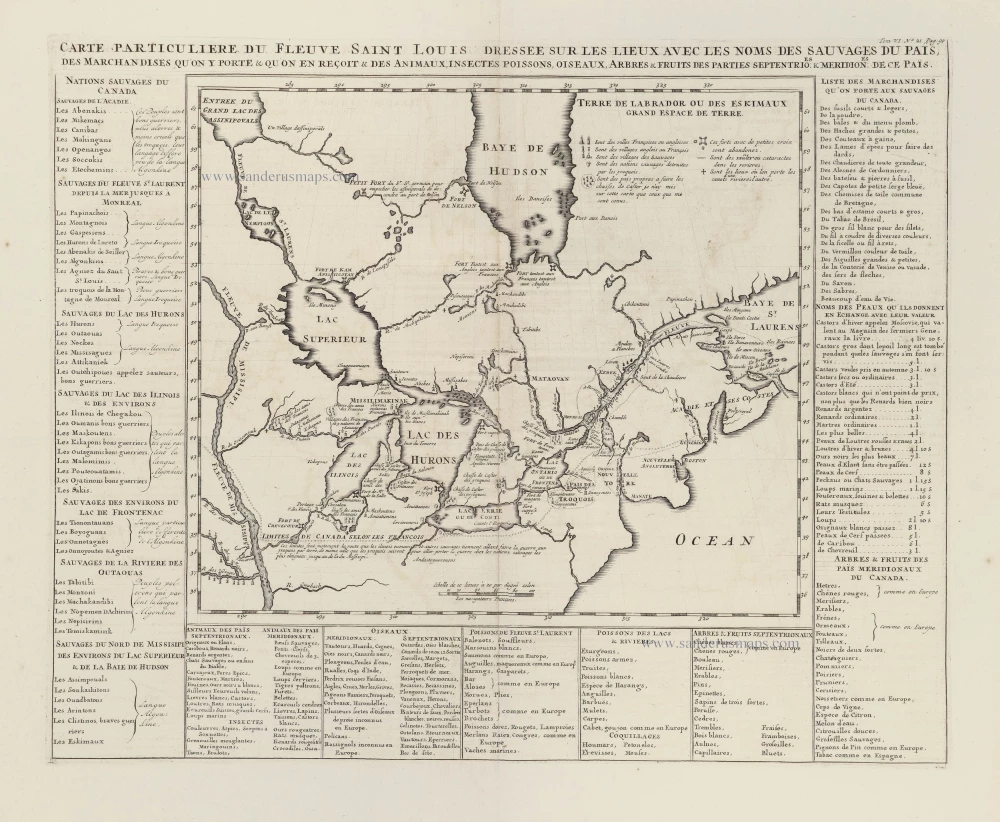
Great Lakes and the course of the Mississippi, by Zacharias Châtelain. 1719
Carte Particuliere du Fleuve Saint Louis dressée sur les lieux ...
[Item number: 29366]
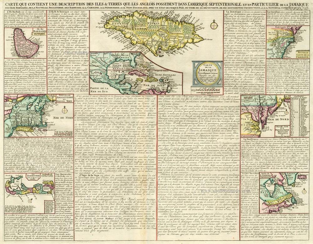
West Indies, Bermuda, New England, Virginia by Châtelain. 1713-1719
Carte qui Contient une Description des Iles & Terres que les ...
[Item number: 16834]
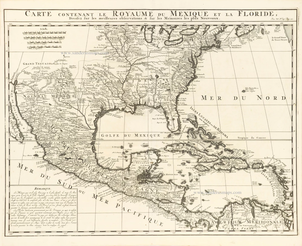
United States, Central America, and the West Indies, by Zacharias Châtelain. 1719
Carte Contenant le Royaume du Mexique et la Floride,
[Item number: 29409]

North America, by Zacharias Châtelain. 1713
Nouvelle carte de l'Amérique Septentrionale dressée sur les plus n ...
[Item number: 29445]

Canada by Zacharias Châtelain. 1719
Carte du Canada ou de la Nouvelle France, & des découvertes qui ...
[Item number: 28328]