Antique maps catalogue
- All recent additions
-
Antique maps
- Polar maps
- World
-
Europe
- Europe Continent
- Belgium
- Belgium - Cities
- The Low Countries
- The Netherlands
- The Netherlands - Cities
- Luxembourg
- France
- France - Cities
- Germany
- Germany - Cities
- Austria
- Italy
- Italy - Cities
- Spain and Portugal
- Greece & Greek Islands
- Switzerland
- British Isles
- British Isles - Cities
- Northern Europe
- Central Europe
- Eastern Europe
- Southeastern Europe
- America
- Asia
- Africa
- Mediterranean Sea
- Australia
- Oceans
- Celestial Maps
- Curiosities
- Title Pages
- Books
- Medieval manuscripts
- Prints
Pacific Ocean (North) by Francesco & Paolo Santini 1776-79
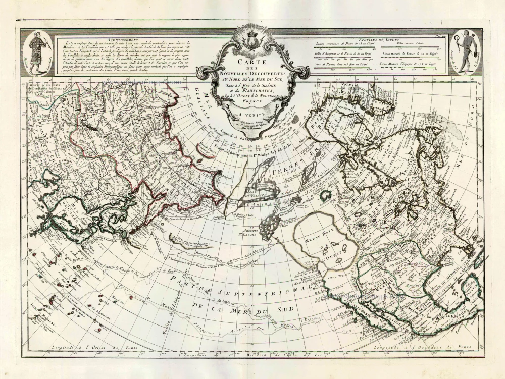
Carte des Nouvelles Decouvertes au Nord de la Mer du Sud, tant à...
[Item number: 26979]
![[No title]](https://sanderusmaps.com/assets/WEBP/m28826.webp)
Half globe gore of the Indian Ocean - Madagascar. 1696
[No title]
[Item number: 28826]
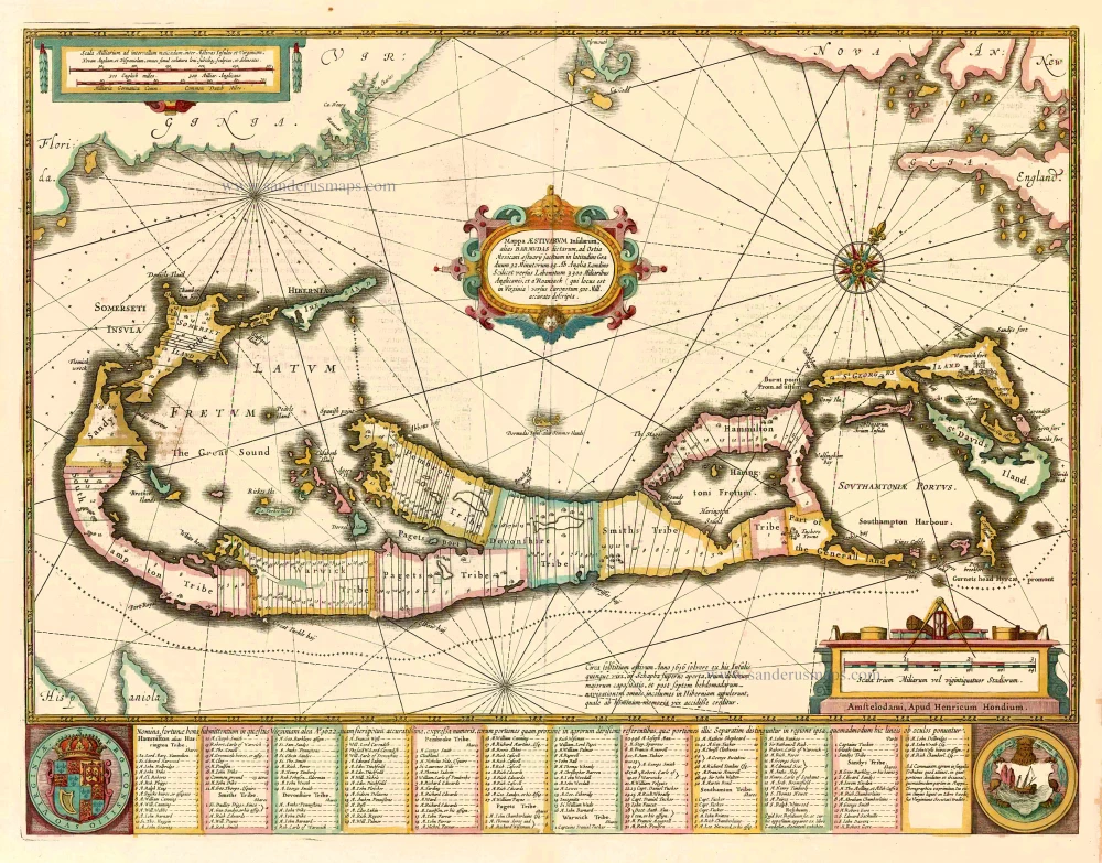
Bermuda, by Johannes Janssonius. 1641
Mappa Aestivarum Insularum alias Barmudas dictarum, ...
[Item number: 26460]

The Atlantic Ocean, by G.L. Le Rouge. 1778
Ocean Atlantique et Mers Adjacentes en Quatre Feuilles Contenant...
[Item number: 14086]
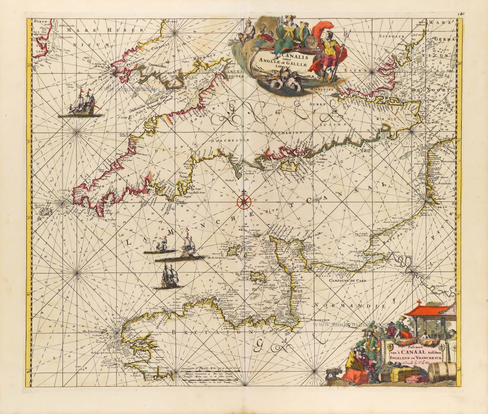
The English Channel, by Frederick de Wit. c. 1680
Canalis inter Angliae et Galliae Littera. - Pascaert van 't...
[Item number: 29171]
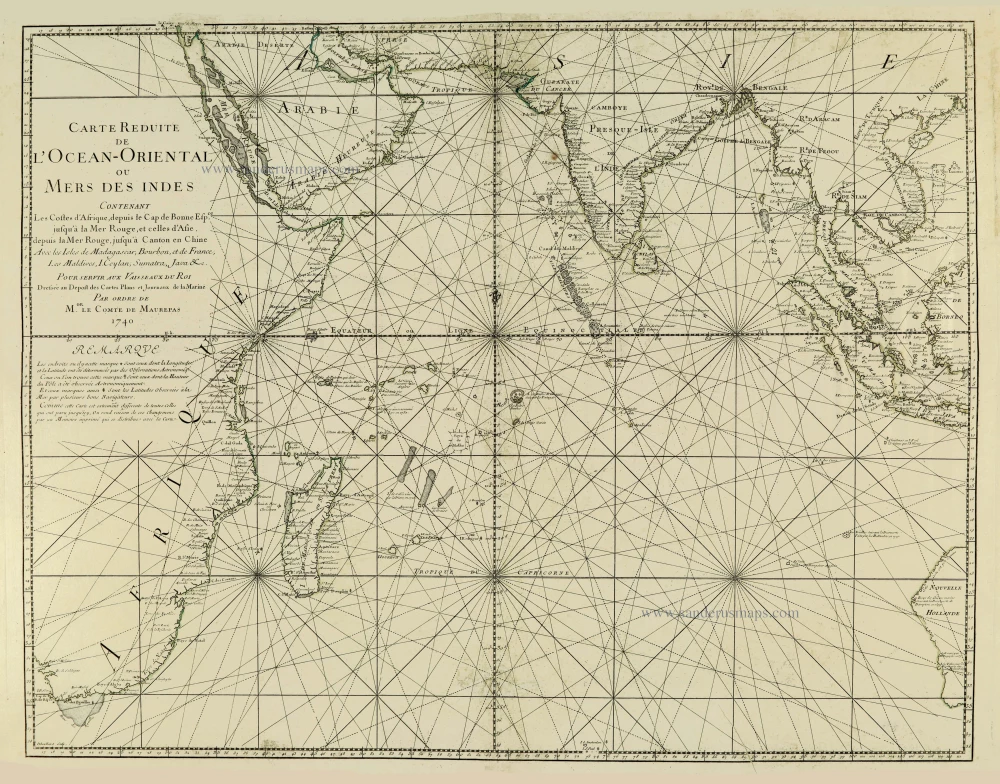
Indian Ocean, by J.N. Bellin. 1756-1770
Carte Réduite de l'Océan Oriental ou Mers des Indes.
[Item number: 28148]
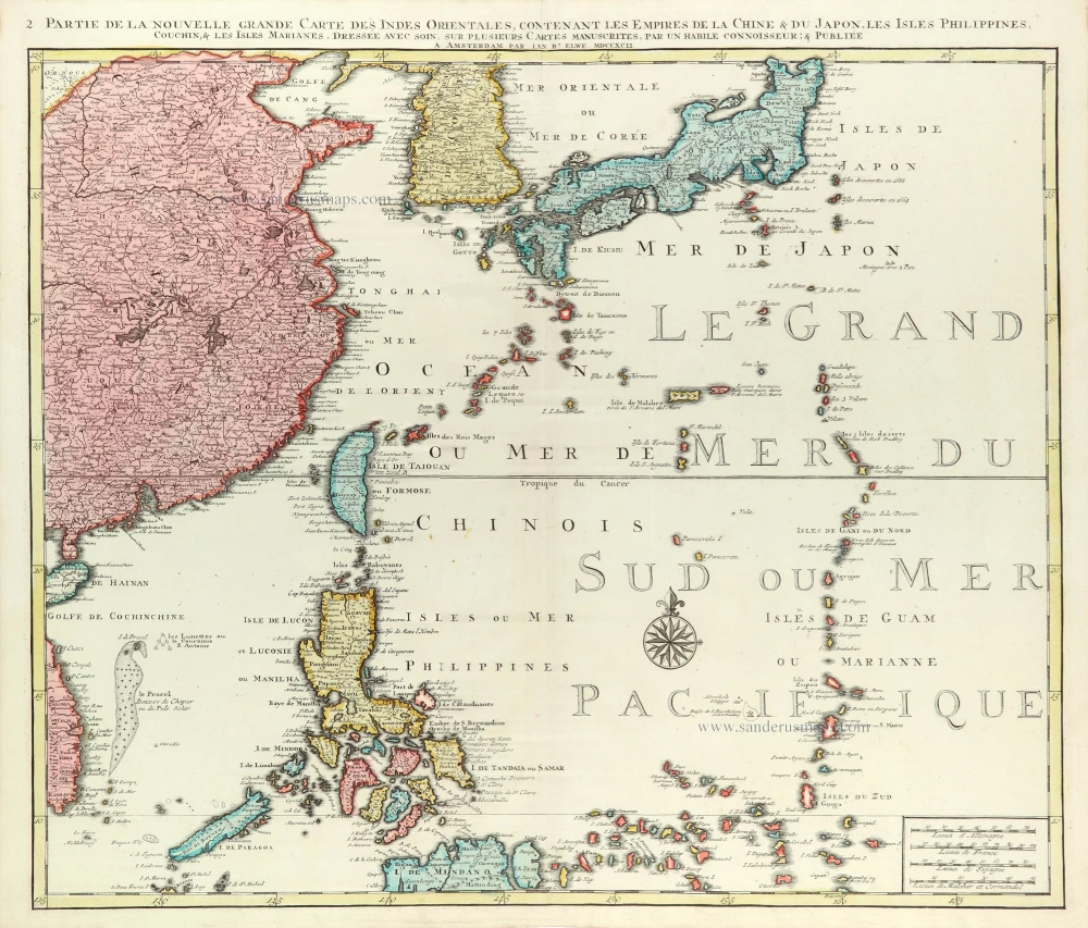
East Asia (Japan - Philippines) by J.B. Elwe. 1792
Partie de la Nouvelle Grande Carte des Indes Orientales...
[Item number: 31803]
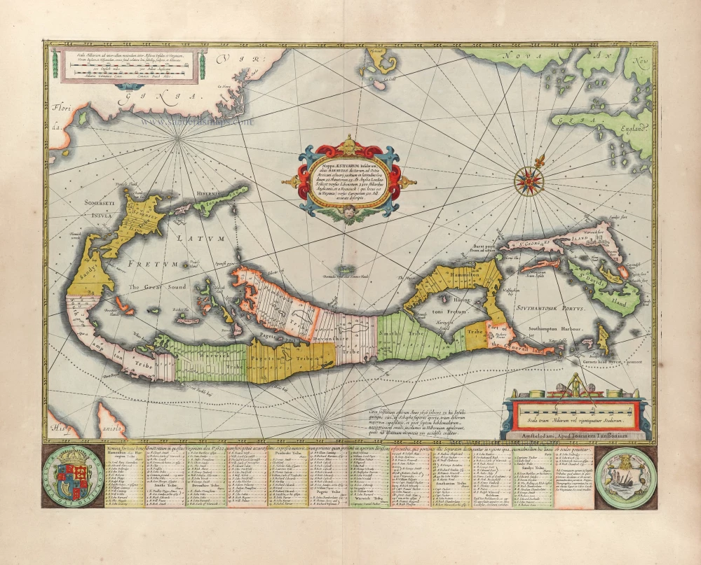
Bermuda by Joannes Janssonius. 1666
Mappa Aestivarum Insularum alias Barmudas dictarum, ...
[Item number: 29951]
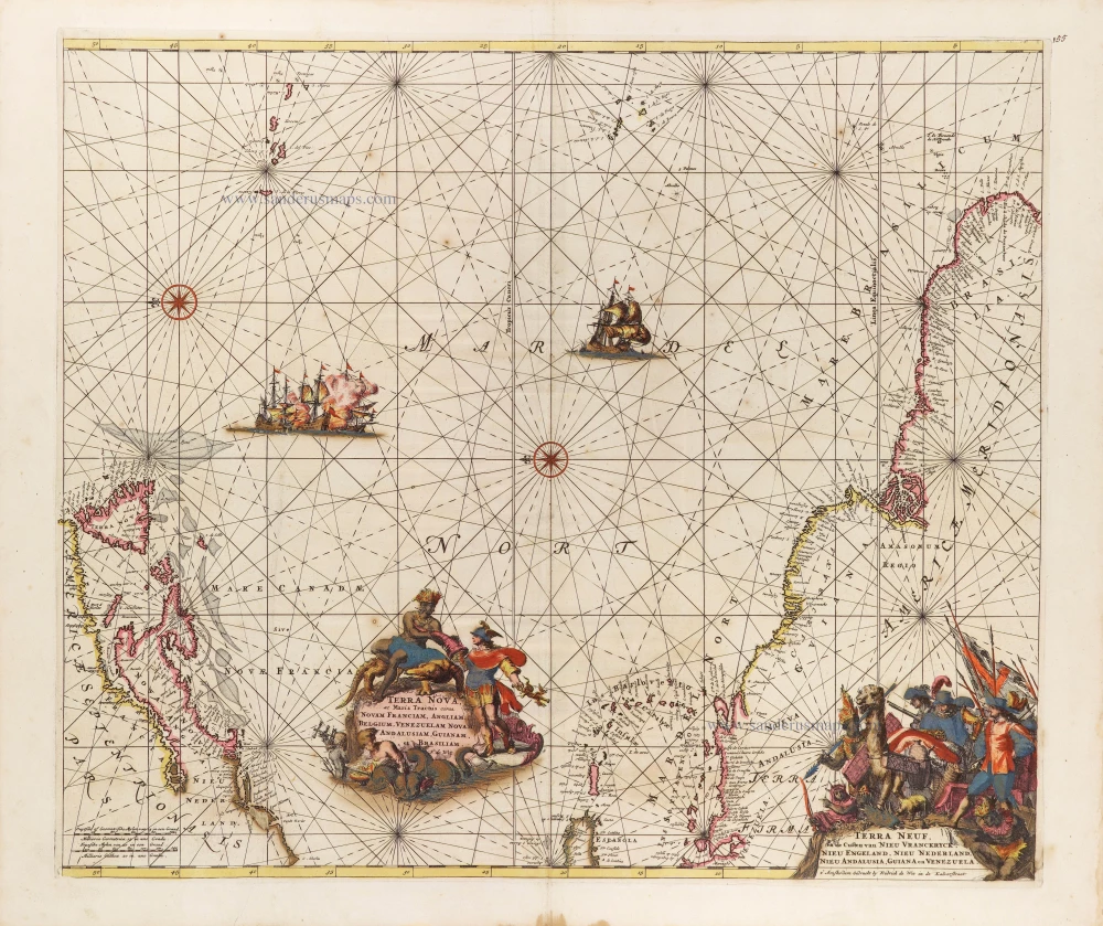
The Western Atlantic Ocean, by Frederick de Wit. c. 1680
Terra Nova ac Maris Tractus circa Novam Franciam, Angliam,...
[Item number: 29175]
![[No title]](https://sanderusmaps.com/assets/WEBP/m30730.webp)
Heightened in gold and silver
Atlantic Ocean by Theodore De Bry, Great Voyages, 1599
[No title]
[Item number: 30730]
![[No title]](https://sanderusmaps.com/assets/WEBP/m32420.webp)
Svalbard (Spitzbergen) by Samuel Purchas 1625
[No title]
[Item number: 32420]
Heightened in gold!
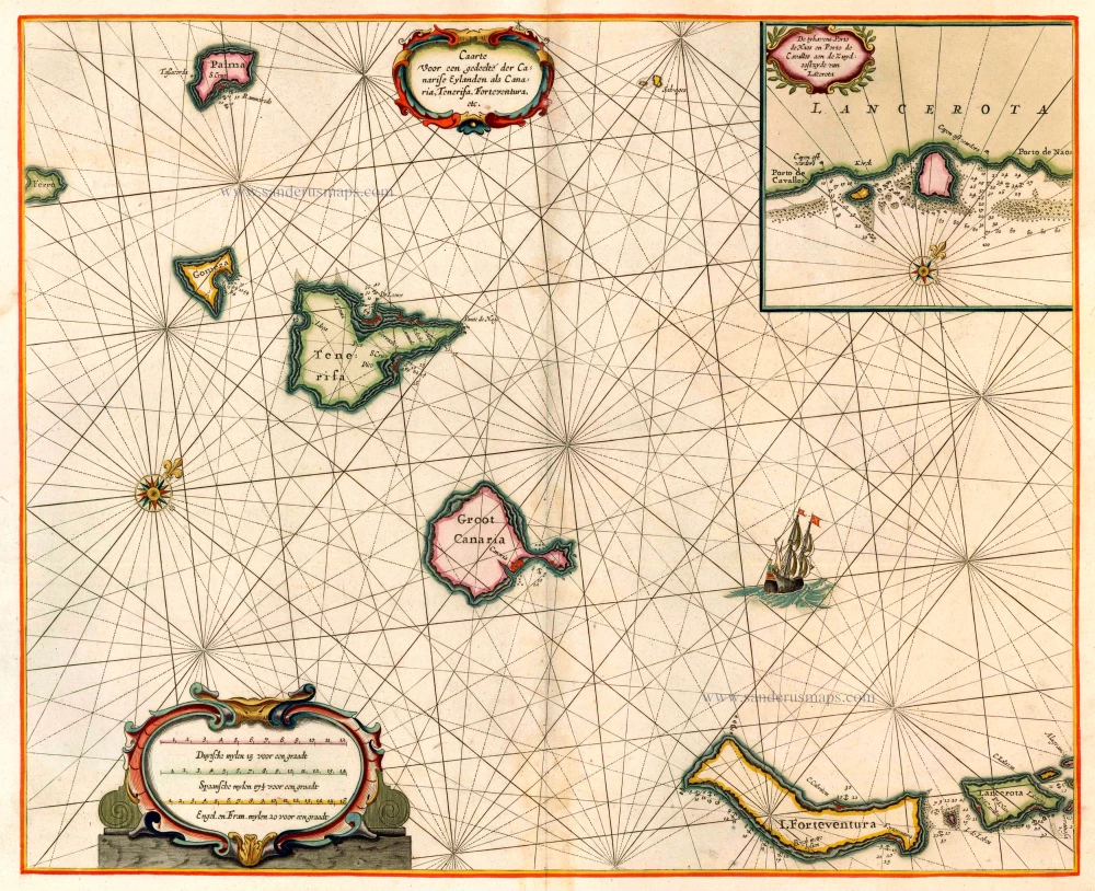
The Canary Islands, by Pieter Goos. 1666
Caarte voor en Gedeelte der Canarise Eylanden als Canaria,...
[Item number: 25612]
![[No title]](https://sanderusmaps.com/assets/WEBP/m27086.webp)
Rare.
Atlantic Ocean - Europe, Africa & Eastern Canada by Giovanni Francesco Camocio c. 1575
[No title]
[Item number: 27086]
Scarce
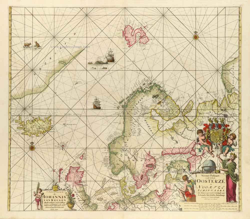
North Atlantic Ocean by J. Van Keulen. 1706
Nieuwe Paskaart vande Geheele Oosterzé en Noortzé schip-vaart.
[Item number: 31737]
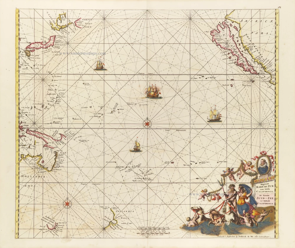
Pacific Ocean, by Frederick de Wit. c. 1680
Magnum Mare del Zur cum Insula California = De Groote Zuyd-Zee...
[Item number: 29241]

Secret Atlas Chart - very rare
Mauritius, by J. Van Keulen II. 1753
Paskaart van 't Eyland MAURITIUS, geleegen in de Oostindische...
[Item number: 30986]

Important map
West Africa, by Linschoten J.H. van 1596
Typus orarum maritimarum Guineae, Manicongo, & Angolae ... /...
[Item number: 32214]
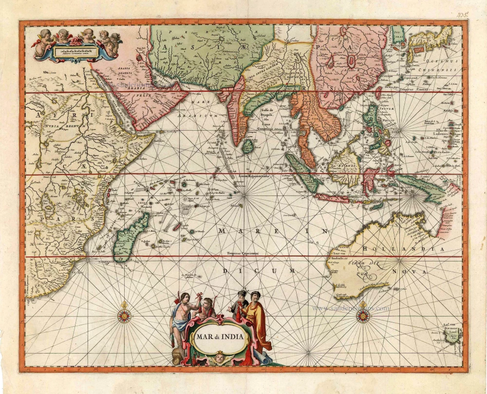
First folio sea chart from the Dutch Golden Age
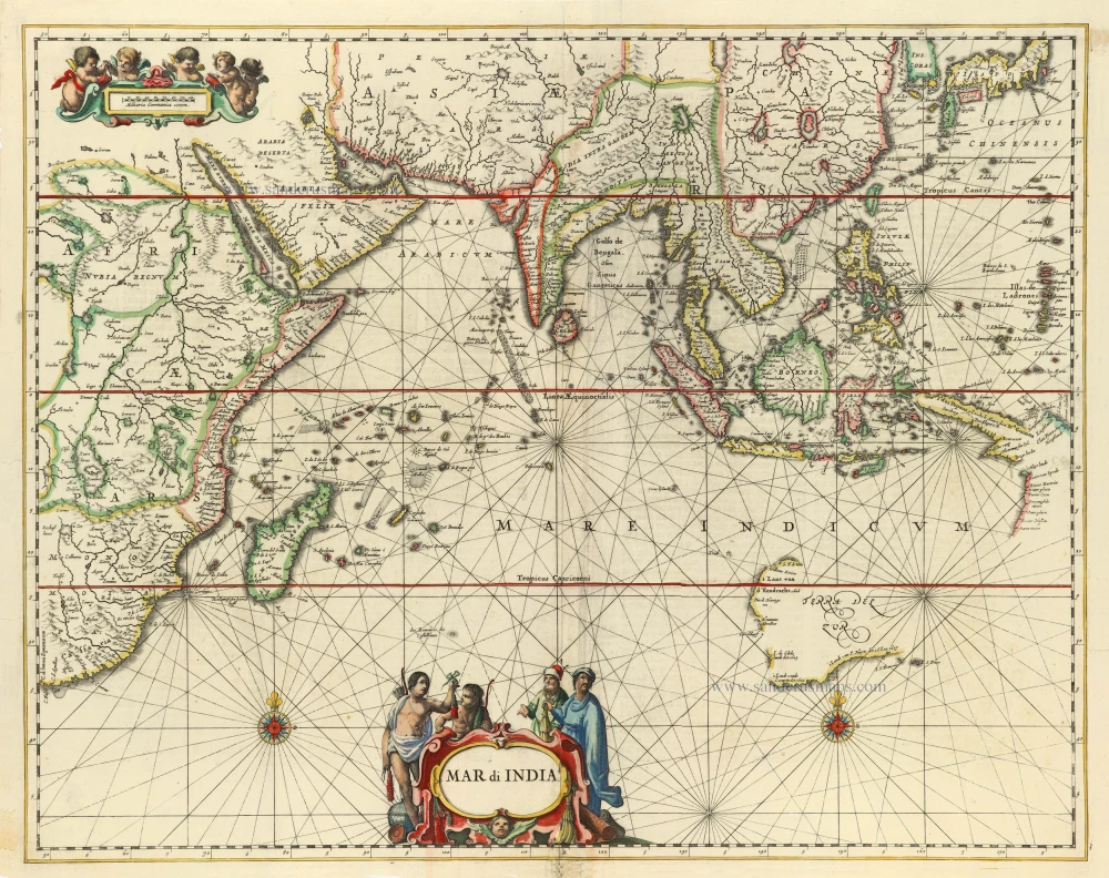
Indian Ocean by J. Janssonius 1650
Mar di India.
[Item number: 32184]
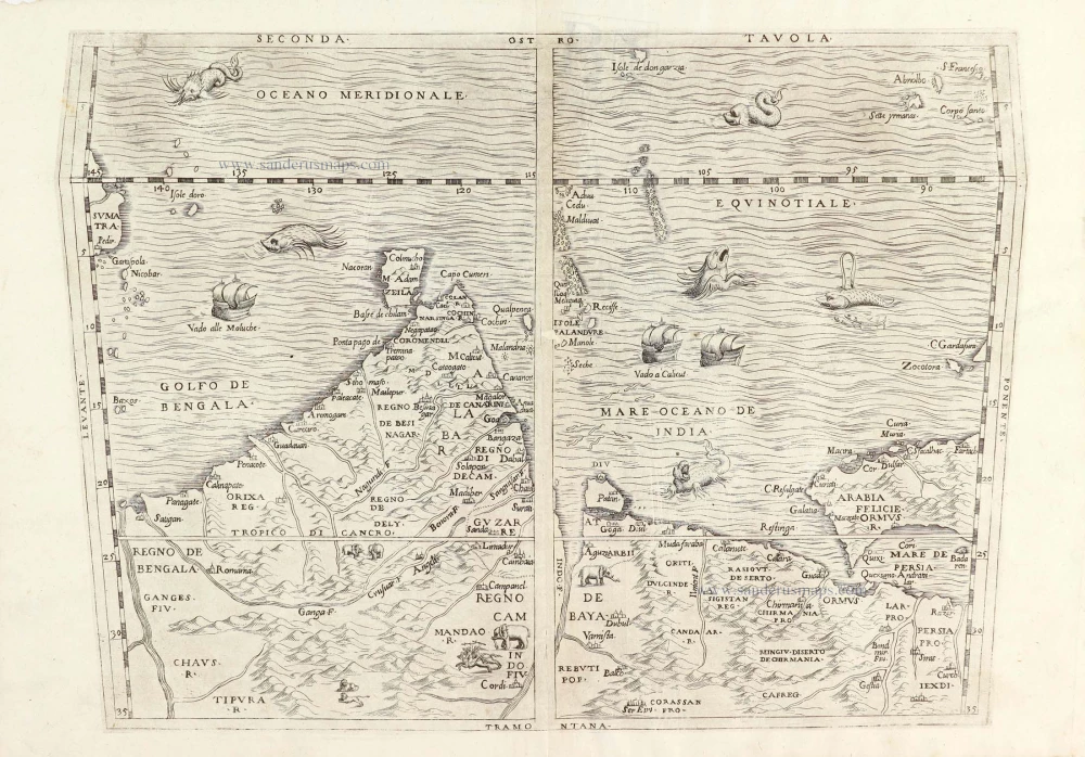
Important map.
South Asia by G.B. Ramusio. 1563
Seconda Tavola.
[Item number: 29488]
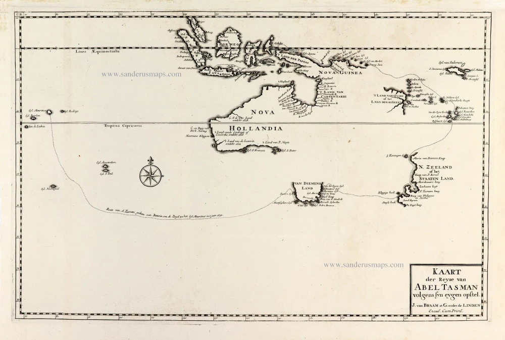
Important map with Tasman's first voyage
Valentyn François, Australia 1726
Kaart der Reyse van Abel Tasman Volgens syn eygen Opstel.
[Item number: 31086]
Very rare second state, including the Tasman discoveries (Australia).
Indian Ocean, by Petrus Schenk c. 1700
Mar di India.
[Item number: 27775]
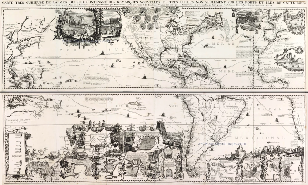
One of the most elaborately engraved maps ever published.
Pacific by Zacharias Châtelain after Nicolas de Fer. 1719
Carte tres Curieuse de la Mer du Sud, Contenant des Remarques...
[Item number: 29466]

First state of one of the most beautiful and important portolan charts of Europe.
Europe by L.J. Waghenaer 1585
Universe Europae Maritime eiusque Navigationis Descriptio. |...
[Item number: 32269]

The first sea chart - wall map - relating to North America to use the Mercator projection
Atlantic Ocean. by P. Goos - J. Van Keulen c. 1680
West-Indische Paskaert waer in de graden der breedde over...
[Item number: 25938]