Antique maps catalogue
- All recent additions
-
Antique maps
- Polar maps
- World
-
Europe
- Europe Continent
- Belgium
- Belgium - Cities
- The Low Countries
- The Netherlands
- The Netherlands - Cities
- Luxembourg
- France
- France - Cities
- Germany
- Germany - Cities
- Austria
- Italy
- Italy - Cities
- Spain and Portugal
- Greece & Greek Islands
- Switzerland
- British Isles
- British Isles - Cities
- Northern Europe
- Central Europe
- Eastern Europe
- Southeastern Europe
- America
- Asia
- Africa
- Mediterranean Sea
- Australia
- Oceans
- Celestial Maps
- Curiosities
- Title Pages
- Books
- Medieval manuscripts
- Prints
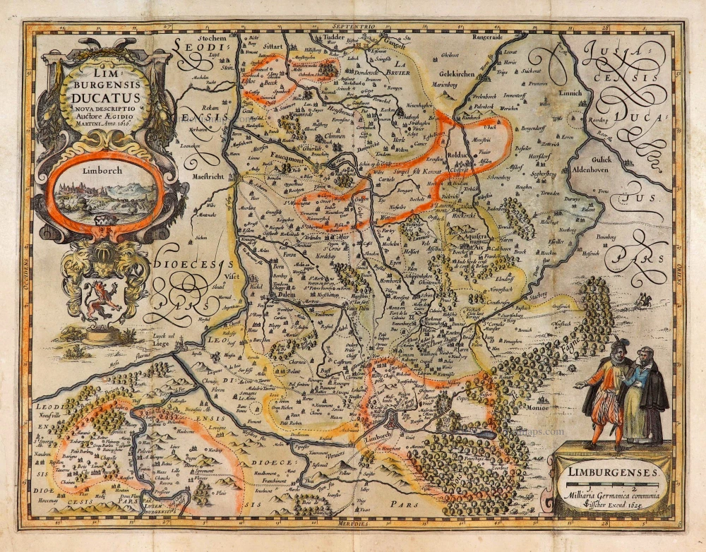
Limburg, by C.J. Visscher. 1634
Limburgensis Ducatus Nova Descriptio.
[Item number: 27969]
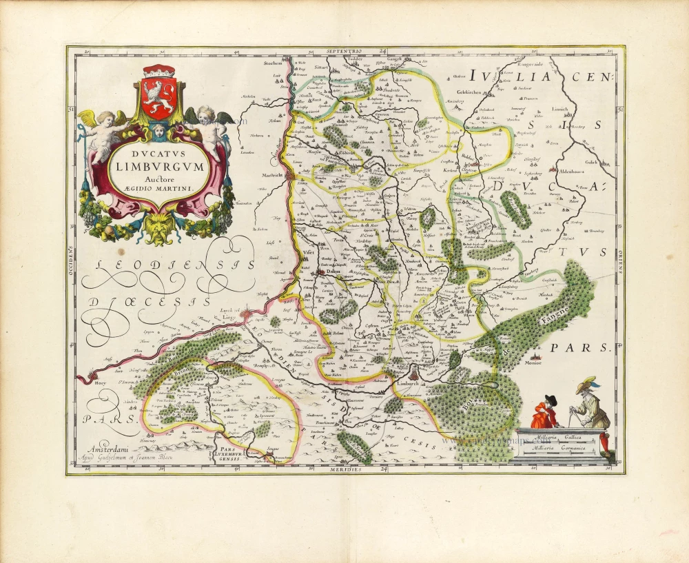
Limburg by W. & J. Blaeu. 1643
Ducatus Limburgum.
[Item number: 29931]
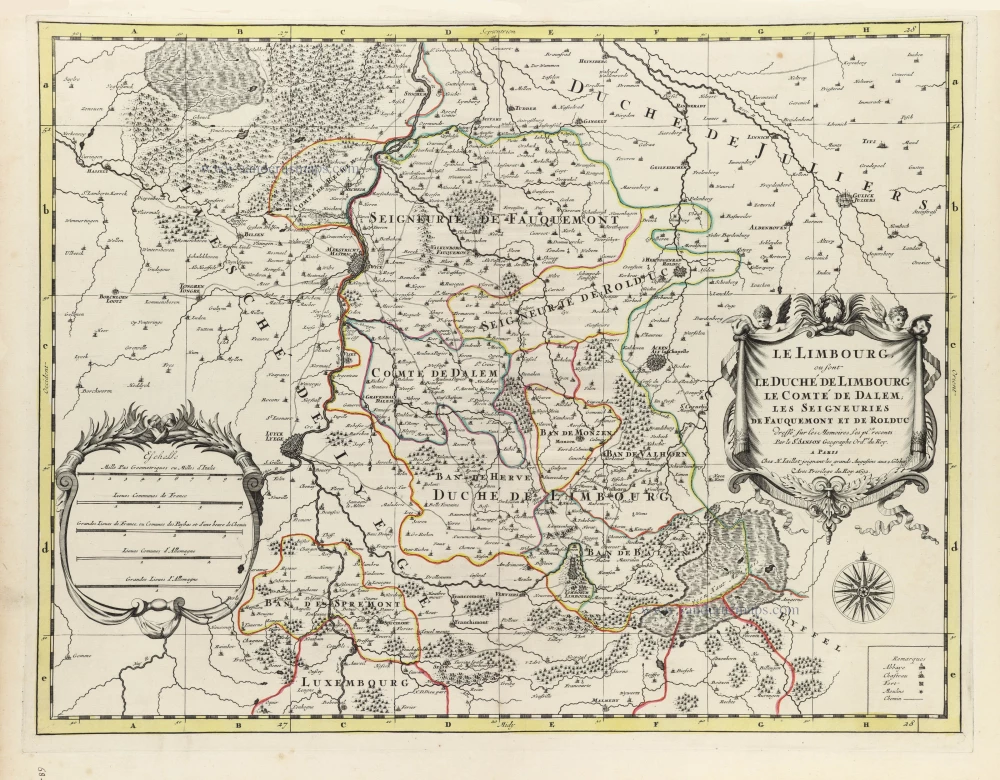
Limburg by Nicolas Sanson, published by Hubert Jaillot. 1692
Le Limbourg, ou sont le Duché de Limbourg le Comté de Dalem, les...
[Item number: 32537]
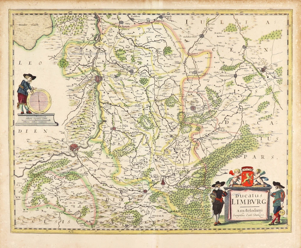
Limburg by Cornelis Danckerts. c. 1636
Ducatus Limburg.
[Item number: 28772]
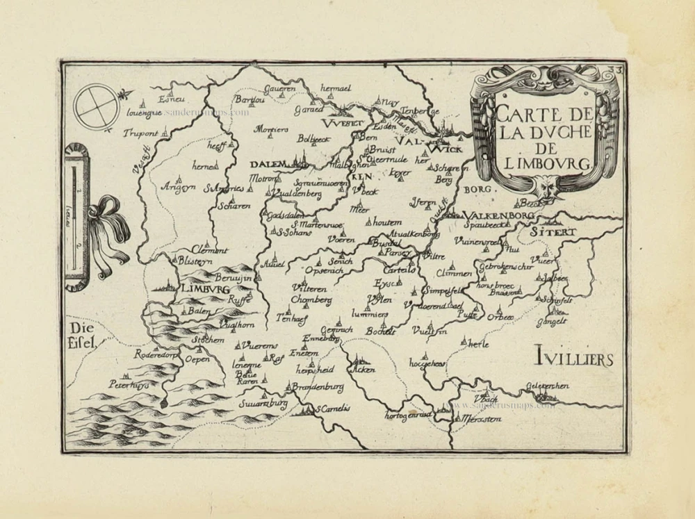
Limburg by Christophe Tassin. 1633
Carte de la Duché de Limbourg.
[Item number: 32008]

Limburg - Maastricht - Tongeren - Valkenburg, by E.H. Fricx. 1712
Carte Particulière des environs de Maestricht, Partie de Liège,...
[Item number: 32597]
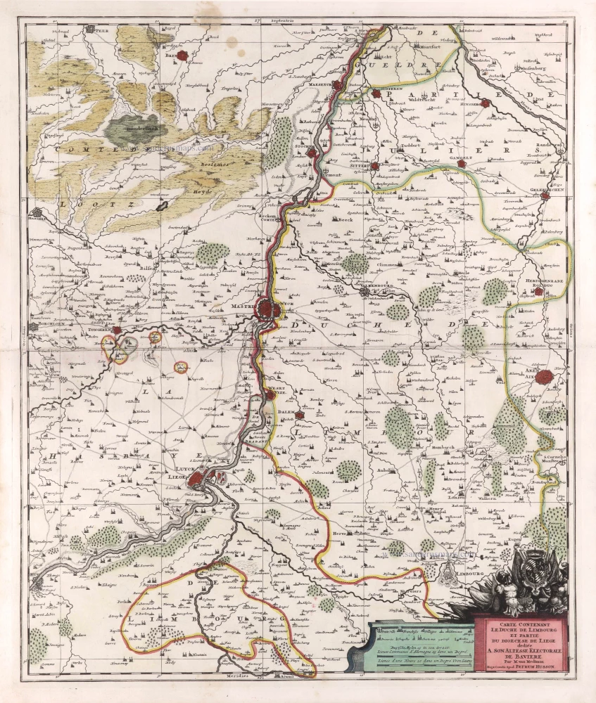
Limburg - Liège by Pierre Husson. c. 1709
Carte contenant le Duché de Limbourg et partie du Diocèse de...
[Item number: 29590]
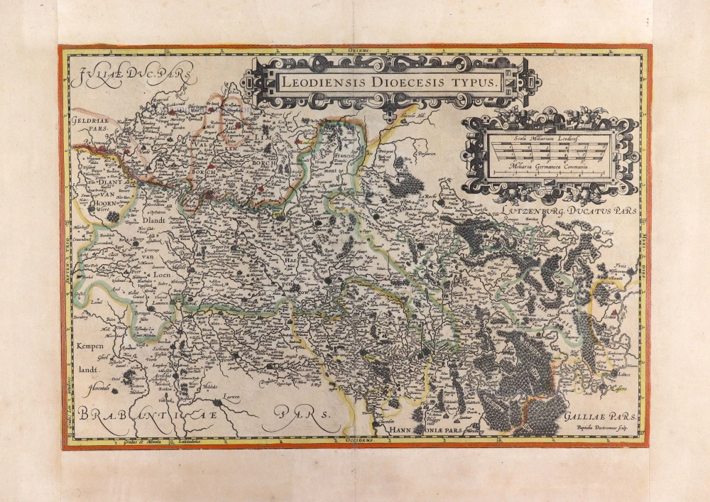
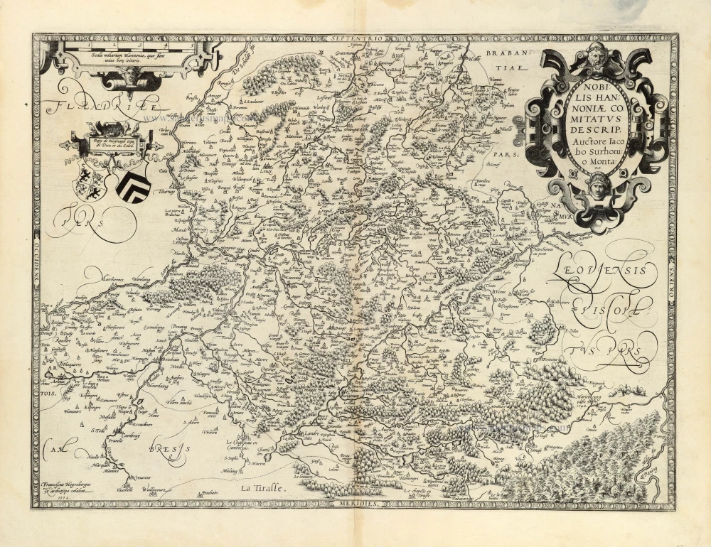
Liège, by Jodocus Hondius. c. 1610-1650
Leodiensis Dioecesis Typus.
[Item number: 31214]
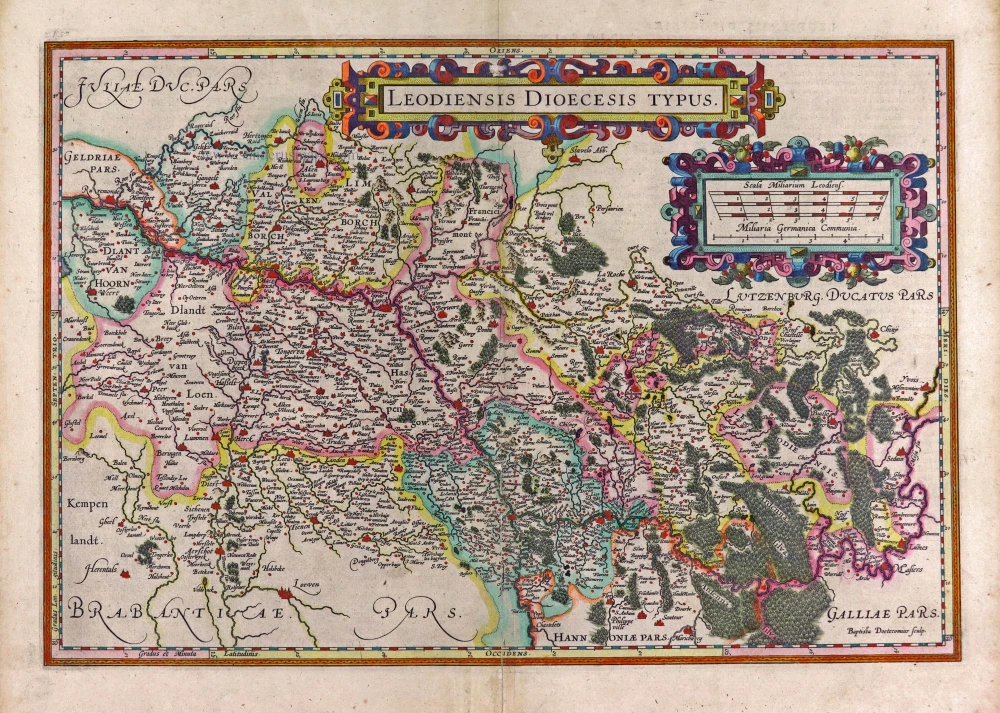
Liège, by Jodocus Hondius. 1623
Leodiensis Dioecesis Typus.
[Item number: 27964]
Liège, by Covens & Mortier. 1721-41
Carte Particulière des environs de Liège, Limbourg et Partie de...
[Item number: 23682]
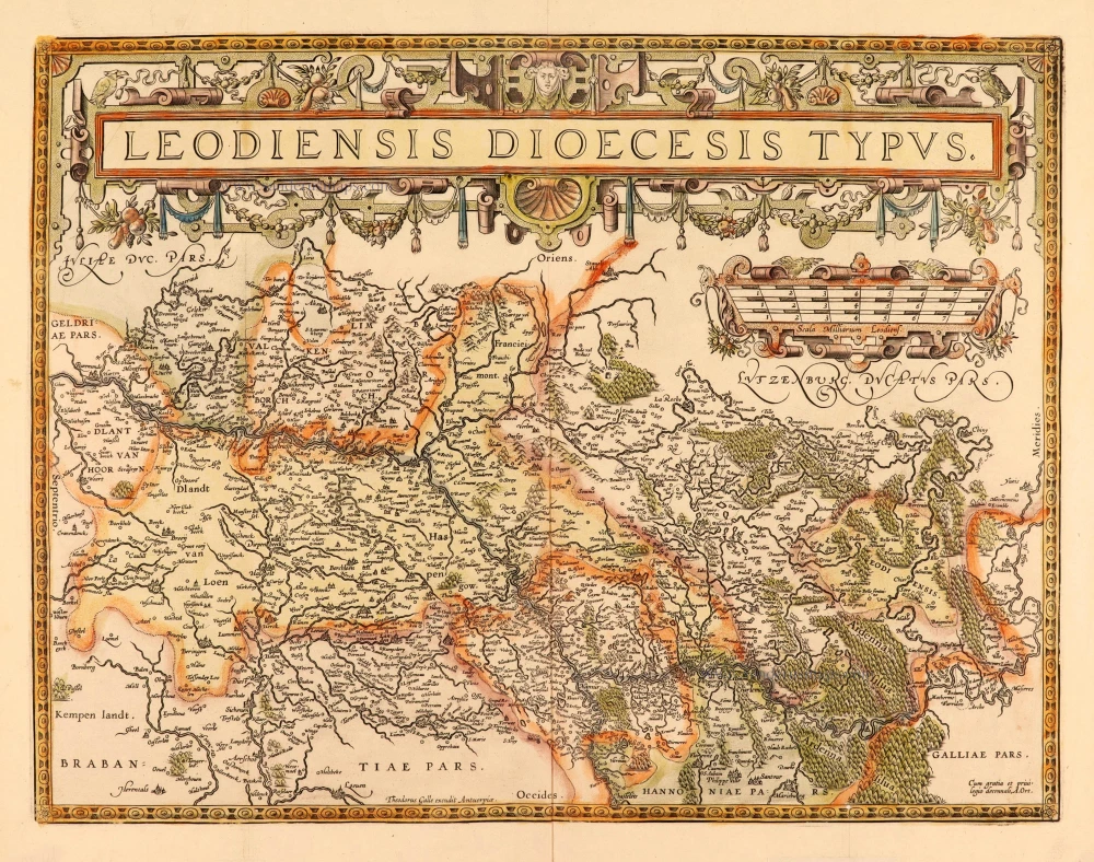
Liège, by Abraham Ortelius. After 1612
Leodiensis Dioecesis Typus.
[Item number: 28111]
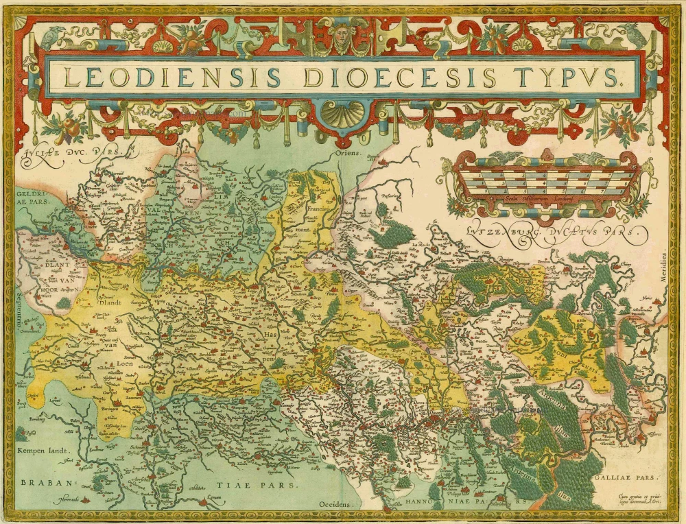
Liège, by Abraham Ortelius. 1598
Leodiensis Dioecesis Typus.
[Item number: 6346]
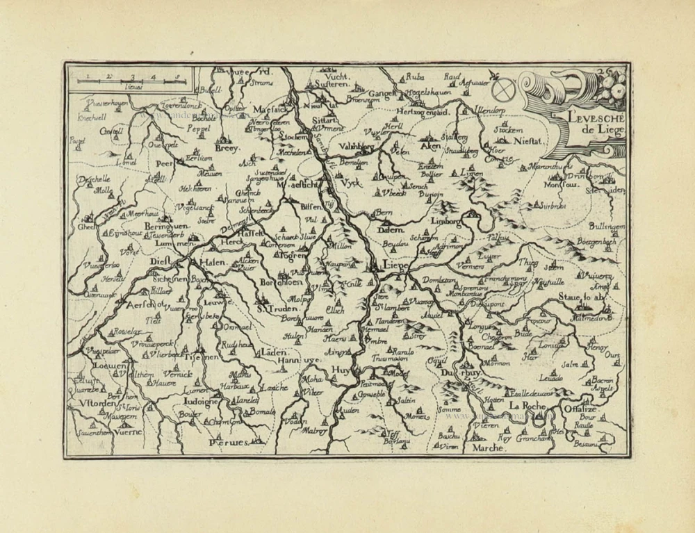
Liège by Christophe Tassin. 1633
L'Evesché de Liège.
[Item number: 31935]

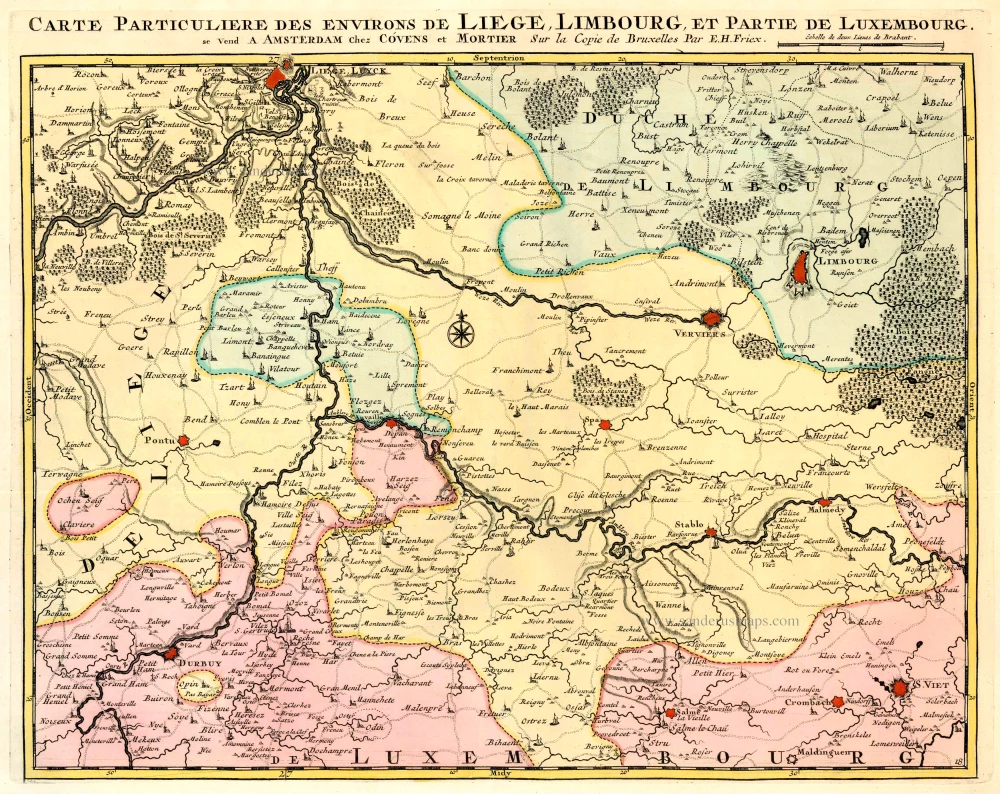
Liège - Verviers - Durbuy, by E.H. Fricx. 1712
Carte Particulière des environs de Liège, Limbourg, et partie de...
[Item number: 32829]
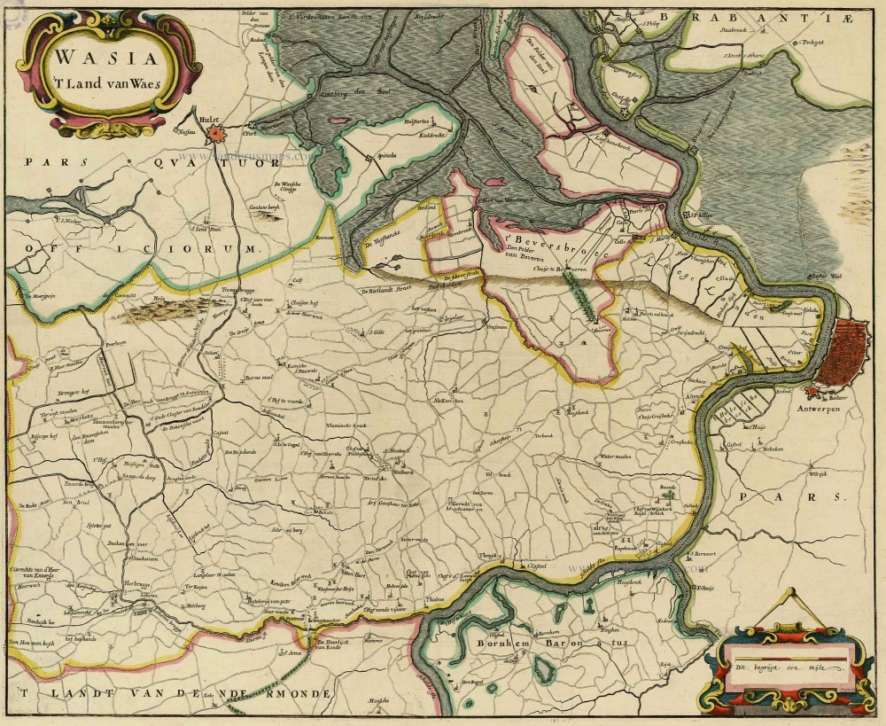
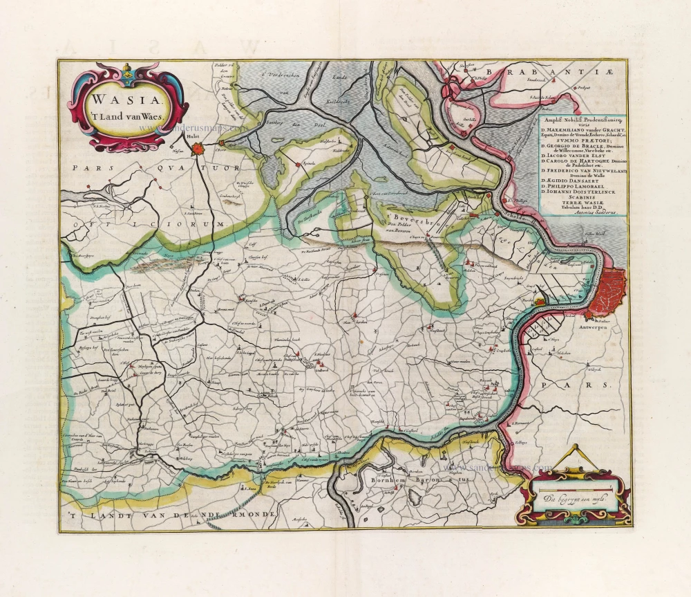
Land van Waas by Antonius Sanderus. 1732
Wasia. 't Land van Waes.
[Item number: 20792]
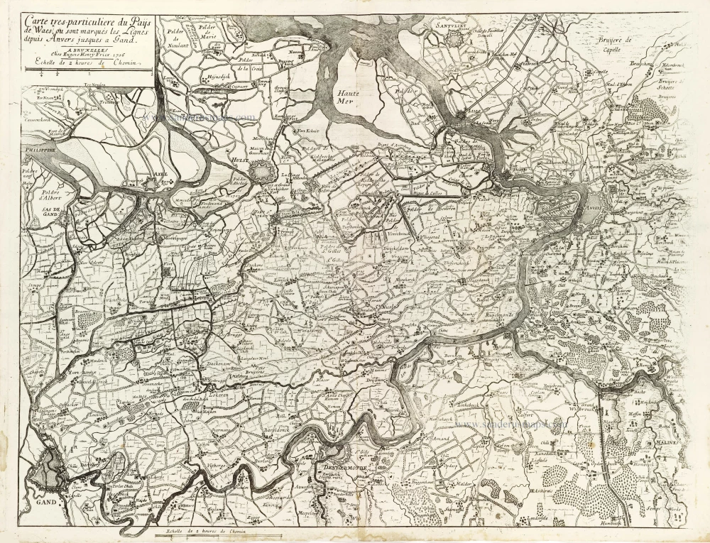
Land van Waas by Eugène Fricx. 1712
Carte tres-particuliere du Paijs de Waes, ou sont marqués les...
[Item number: 29545]
Westerschelde -Waasland
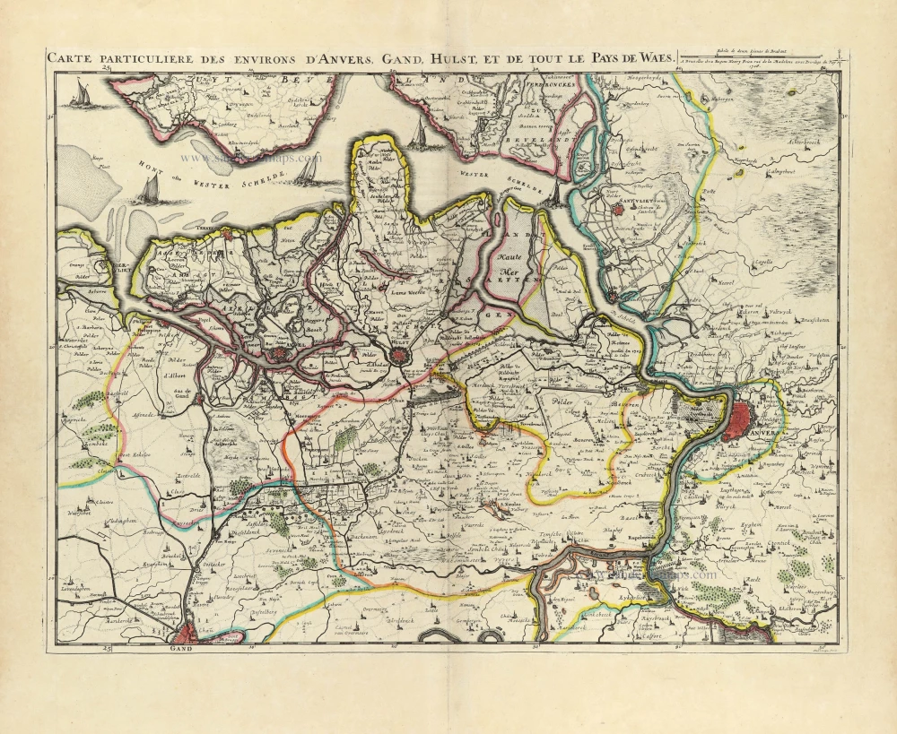
Land van Waas by E.H. Fricx. 1712
Carte Particulière des environs d'Anvers, Gand, Hulst, et de...
[Item number: 32591]
Land van Waas by Antonius Sanderus. 1644
Wasia. 't Land van Waes.
[Item number: 29997]
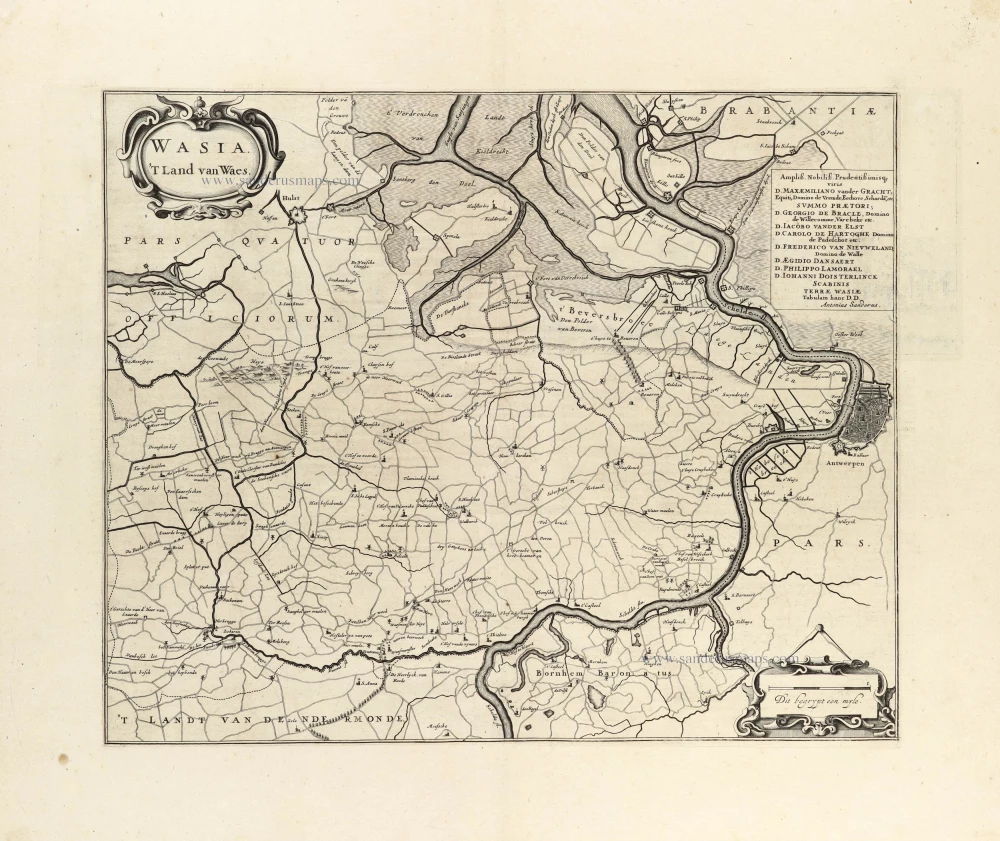
Land van Waas by Antonius Sanderus, published by Joan Blaeu. 1662
Wasia. 't Land van Waes.
[Item number: 31255]
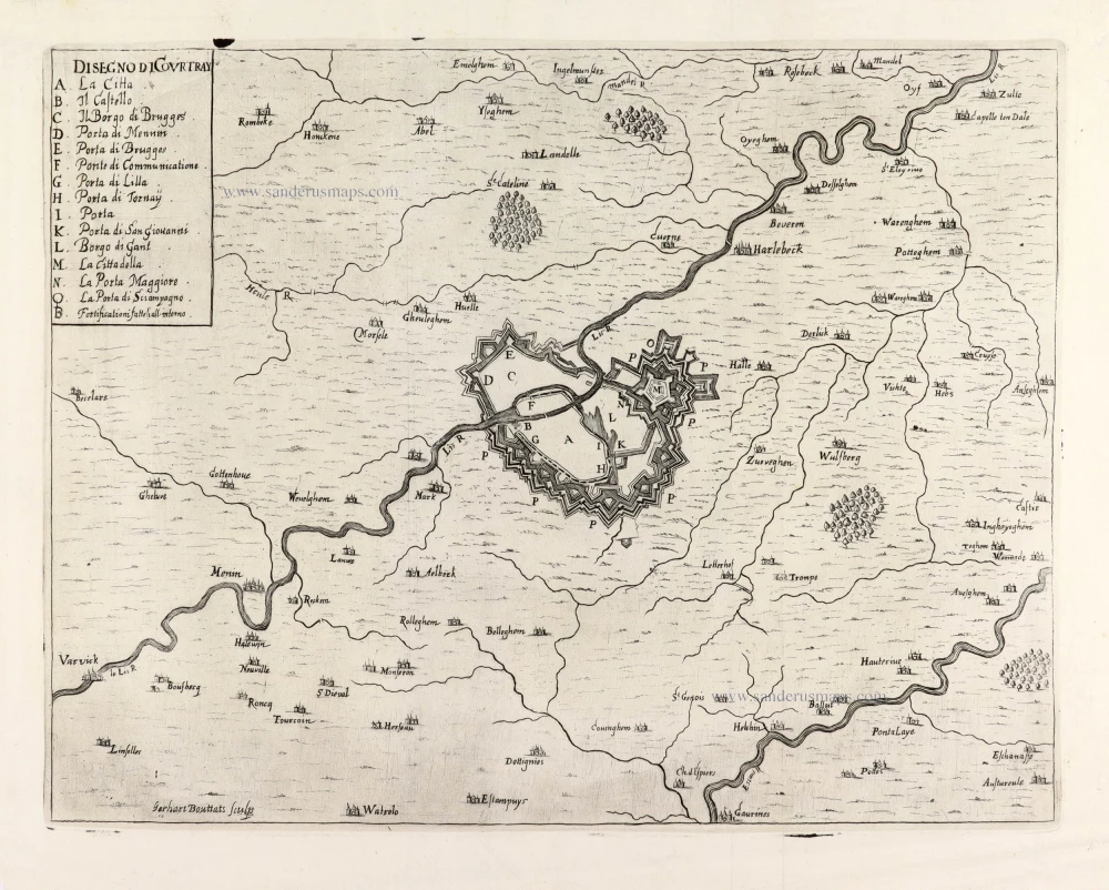
Kortrijk and surrounding, by Gualdo Priorato. 1670
Disegno di Courtray.
[Item number: 31429]
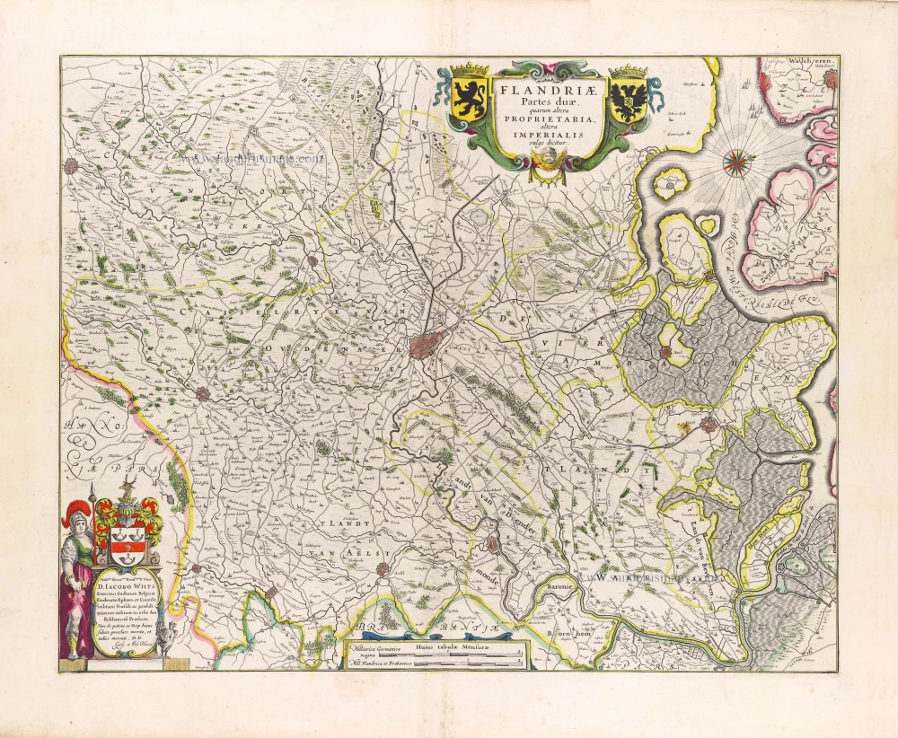
Keizerlijk Vlaanderen of Oost Vlaanderen (Imperial Flanders or Eastern Flanders), by Willem Blaeu. 1643
Flandriae Partes duae, quarum altera Proprietata altera...
[Item number: 29935]
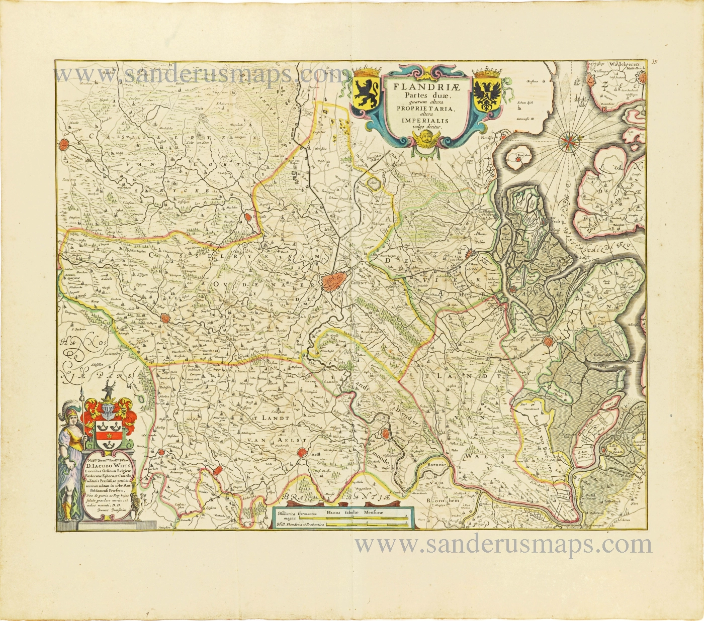
Imperial Flanders (Oost-Vlaanderen) by Johannes Janssonius. 1656-80
Flandriae Partes duae, quarum altera Proprietaria, altera...
[Item number: 28618]
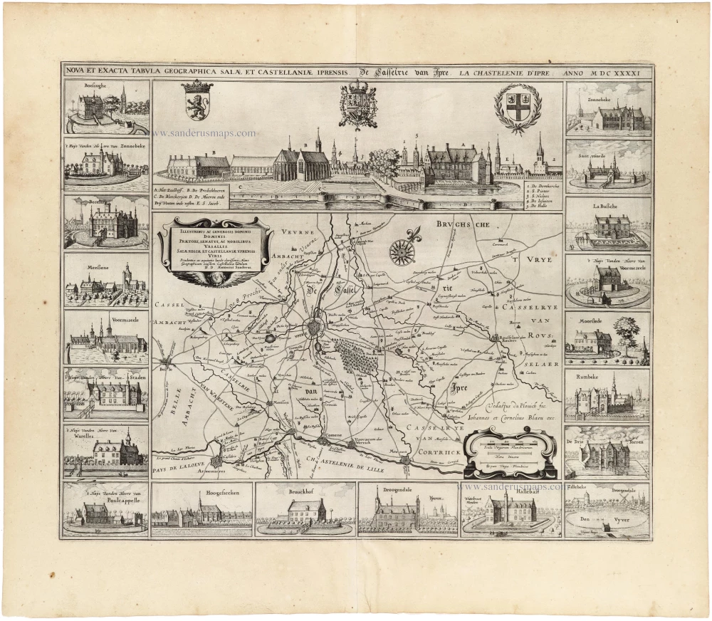
Ieper (Castellania), by A. Sanderus. 1641
Nova Et Exacta Tabula Geographica Salae Et Castellaniae Iprensis...
[Item number: 32725]
![Menapii. Dioecese de l'Archev[es]ché de Malines. Partie meridionale du Duché de Brabant, ou sont les quartiers de Louvain, et du Brusselles; et la seign[eu]rie de Malines.](https://sanderusmaps.com/assets/WEBP/m30520.webp)
Historical map of Southern Brabant, by Guillaume Sanson, published by P. Mariette. 1679-1710
Menapii. Dioecese de l'Archev[es]ché de Malines. Partie...
[Item number: 30520]
Very rare first state.
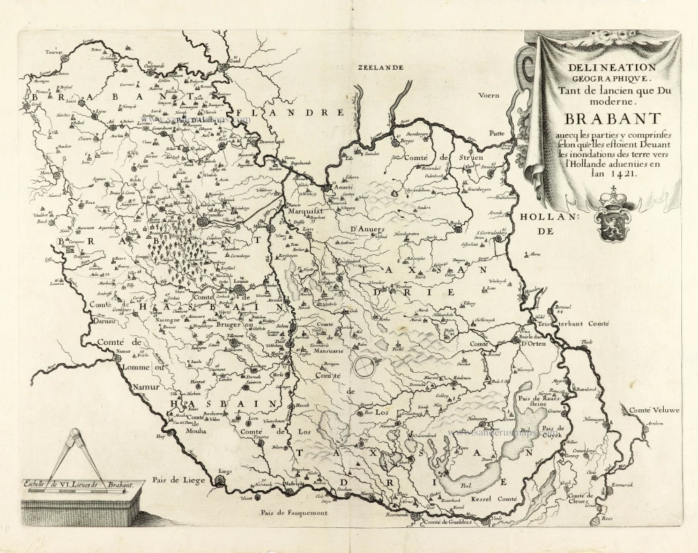
Historical map of Brabant by Christophe Butkens. 1637
Delineation Geographique. Tant de lancien que Du moderne....
[Item number: 30291]

Extremely rare map of Het Zwin (Knokke - Belgium)
Het Zwin - Knokke, Sluis, and Cadzand by Claes Jansz Visscher. 1627-37
Kaerte van Sluys, het Zwin ende de Schansen aen weder Syden.
[Item number: 30256]
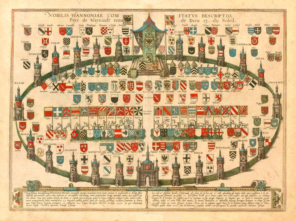
Heraldic Garden of the County of Hainaut, by Georg Braun and Frans Hogenberg. 1581
Nobilis Hannoniae Comitatus Descriptio. Pays de Haynault Tenu de...
[Item number: 25340]
Hainaut by Petrus Kaerius (Pieter Van den Keere), published by Claes Jansz. Visscher. 1634
Nobilis Hannoniae Com. Descriptio.
[Item number: 30736]

Hainaut by N. Visscher After 1705
Comitatus Hannoniae Tabula,
[Item number: 32629]
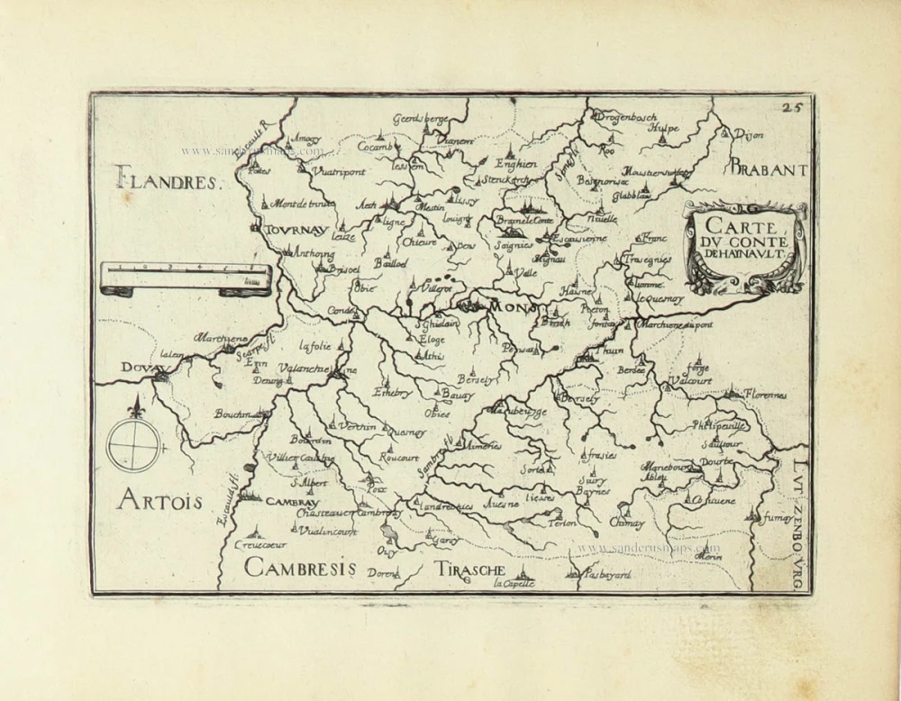
Hainaut by Christophe Tassin. 1633
Carte du Conté de Haynault.
[Item number: 31934]
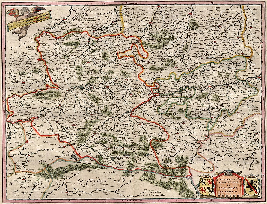
Hainaut - Namur, by Blaeu W. & J. 1640-43
Comitatuum Hannoniae Et Namurci Descriptio
[Item number: 13985]

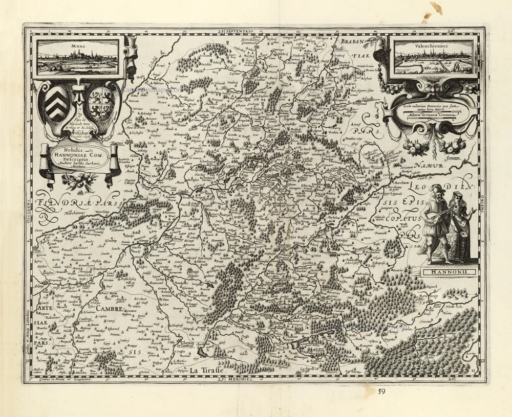
Hainaut - Cambrai, by Pieter Mortier. 1708
Le Comté de Haynaut, divisé en Chatellenies, Balliages,...
[Item number: 28223]
The scarce censored first issue of Ortelius's Hainault map, dated 1572.
Hainault (Hainaut) by Abraham Ortelius. 1584
Nobilis Hannoniae Comitatus Descrip.
[Item number: 30676]
![Praenobili Magnifico Amplissimoq[ue] Magistratui inclytae civitatis Gandavensis](https://sanderusmaps.com/assets/WEBP/m30121.webp)
Extremely rare map of Ghent and surroundings.
Ghent (Gent), by Henricus Hondius.
Praenobili Magnifico Amplissimoq[ue] Magistratui inclytae...
[Item number: 30121]

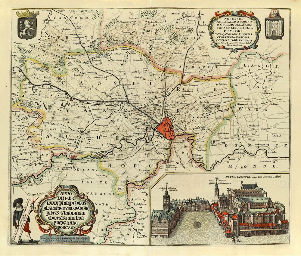
Aalst - Brussels by E.H. Fricx. 1712
Carte Particulière des environs de Bruxelles avec le Bois de...
[Item number: 32595]
With 'Gravensteen'.
Gent (Castellania) by Antonius Sanderus, published by Joan Blaeu. 1662
... Hanc Veteris Burgis novam tabulam ...
[Item number: 28138]