Antique maps catalogue
- All recent additions
-
Antique maps
- World and Polar
-
Europe
- Europe Continent
- Belgium
- Belgium - Cities
- The Low Countries
- The Netherlands
- The Netherlands - Cities
- Luxembourg
- France
- France - Cities
- Germany
- Germany - Cities
- Austria
- Italy
- Italy - Cities
- Spain and Portugal
- Greece & Greek Islands
- Switzerland
- British Isles
- British Isles - Cities
- Northern Europe
- Central Europe
- Eastern Europe
- Southeastern Europe
- America
- Asia
- Africa
- Mediterranean Sea
- Australia
- Oceans
- Celestial Maps
- Curiosities
- Books
- Medieval manuscripts
- Prints
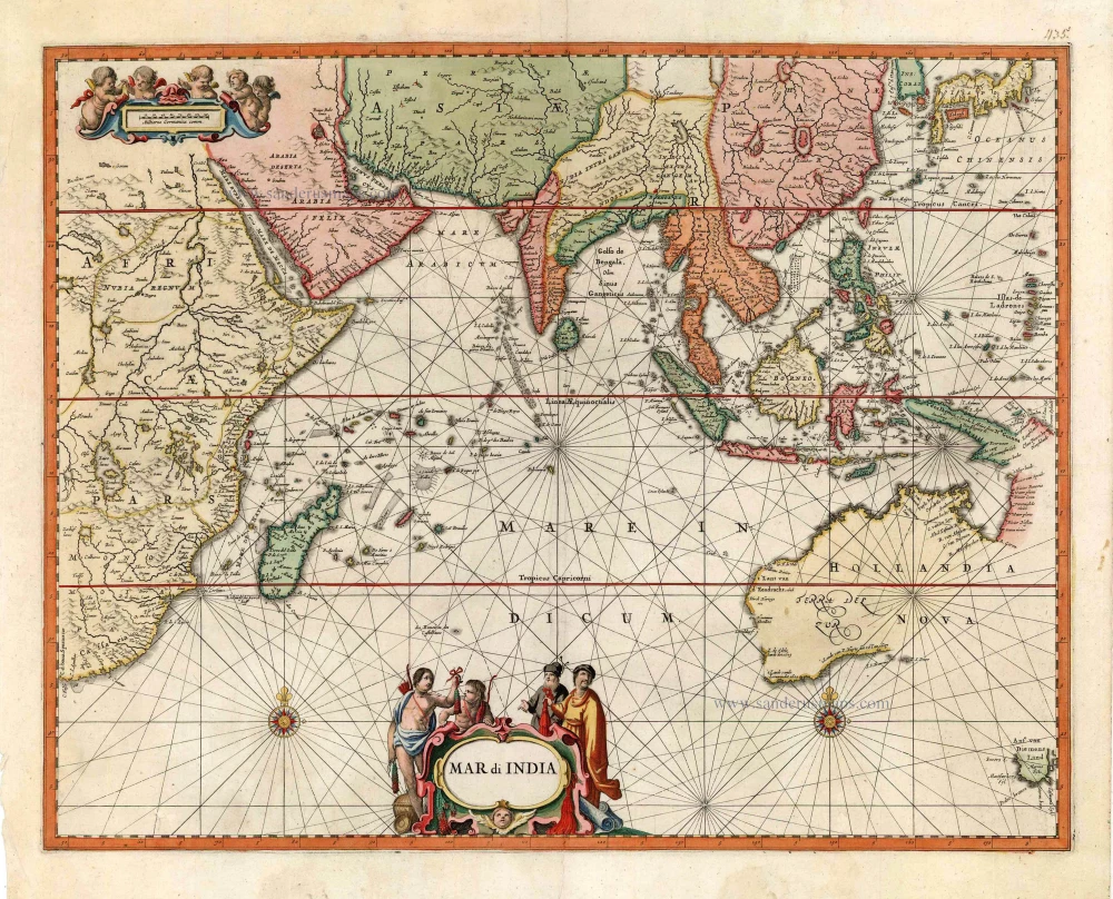
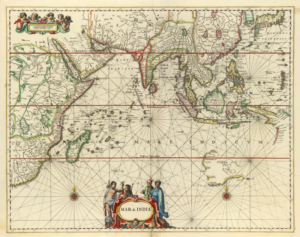
Very rare second state, including the Tasman discoveries (Australia).
Indian Ocean, by Petrus Schenk c. 1700
Mar di India.
[Item number: 27775]
![[No title - on verso:] Tabula Moder. Indiae Orientalis.](https://sanderusmaps.com/assets/WEBP/m30658.webp)
Rare 1525 edition in nice old colour.
Ptolemy map of Southeast Asia by Lorenz Fries, after Martin Waldseemüller. 1525
[No title - on verso:] Tabula Moder. Indiae Orientalis.
[Item number: 30658]
Very rare first 1570 A edition.
Southeast Asia, by Abraham Ortelius. 1570
Indiae Orientalis Insularumque Adiacientium Typus.
[Item number: 30592]
![Tabu. Moder. Indiae [together with] India Orien talis.](https://sanderusmaps.com/assets/WEBP/m30141.webp)
Two early modern maps of Southeast Asia by L. Fries and M. Waldseemüller
South Asia by Lorens Fries 1535
Tabu. Moder. Indiae [together with] India Orien talis.
[Item number: 30141]
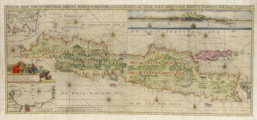
Rare and important chart
Java by Gerard Van Keulen. 1728
Insulae Iavae Pars Occidentalis edente Hadriano Relando. -...
[Item number: 32293]
new

The most elegant and decorative map of the region
East Indian Archipelago by Jodocus Hondius. 1630
Insulae Indiae Orientalis Praecipuae, in quibus Moluccae...
[Item number: 29863]
![[No titel - from verso:] Tab. Moderna Indiae.](https://sanderusmaps.com/assets/WEBP/m30650.webp)
Rare 1525 edition in nice old colour.
Ptolemy map of southern Asia by Lorenz Fries, after Martin Waldseemüller. 1525
[No titel - from verso:] Tab. Moderna Indiae.
[Item number: 30650]
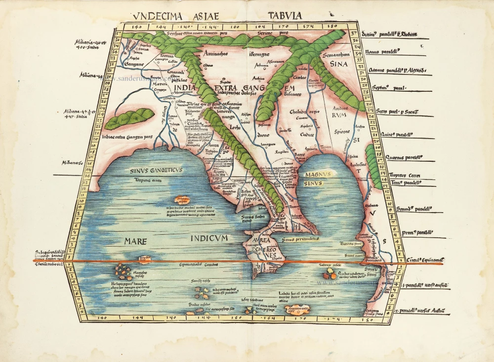
In rare original colour.
South Asia by Waldseemüller Martin 1513
Undecima Asiae Tabula.
[Item number: 29249]
First folio sea chart from the Dutch Golden Age
Indian Ocean by J. Janssonius 1650
Mar di India.
[Item number: 32184]
new

Fries 1525 edition of the first modern map of Southeast Asia
South Asia by Lorenz Fries. 1525
Tab. Moderna Indiae.
[Item number: 27929]

Big and important map.
Java, by François Valentyn (Valentijn). 1724-26
Nieuwe en zeer naaukeurige kaart van t Eyland Java Major of...
[Item number: 27054]
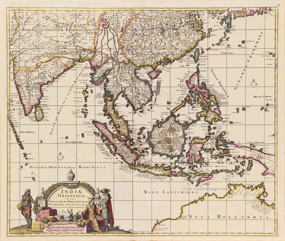
Southeast Asia - Australia by Frederick de Wit. c. 1691-97
Indiae Orientalis nec non Insularum Adiacentium.
[Item number: 29091]

Scarce and important map
Philippines by Petrus Bertius. 1618
Philippinae Insulae.
[Item number: 32158]
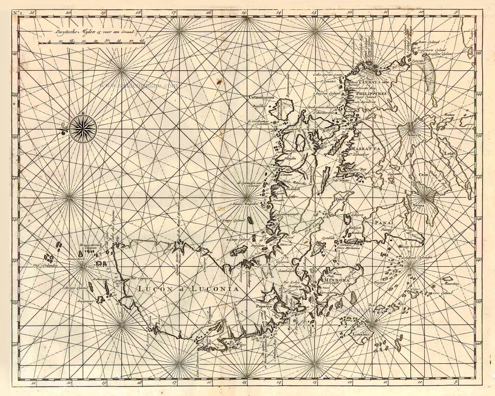
Important map
Philippines, by Valentyn François 1726
Lucon of Luconia.
[Item number: 27895]
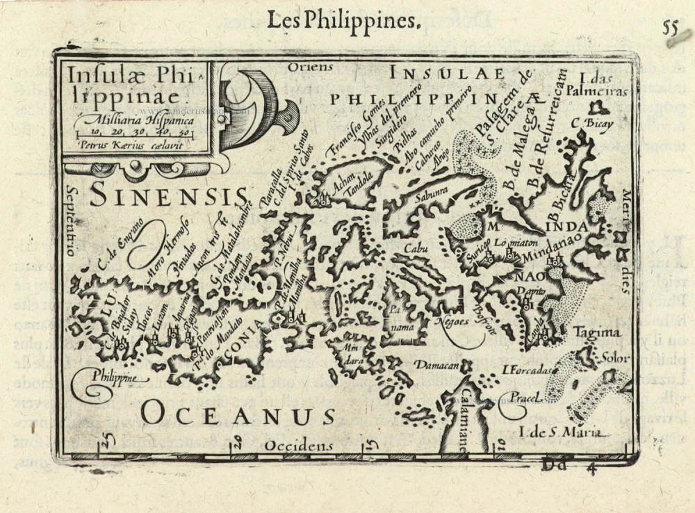
First printed map of the Philippines.
Philippines by Langenes Barent 1600
Insulae Philippinae.
[Item number: 32282]
new
![[No title] - 'Mar di India'.](https://sanderusmaps.com/assets/WEBP/m30057.webp)
Rare
East Indies by van Spilbergen Joris. 1645
[No title] - 'Mar di India'.
[Item number: 30057]
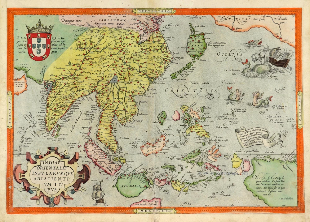
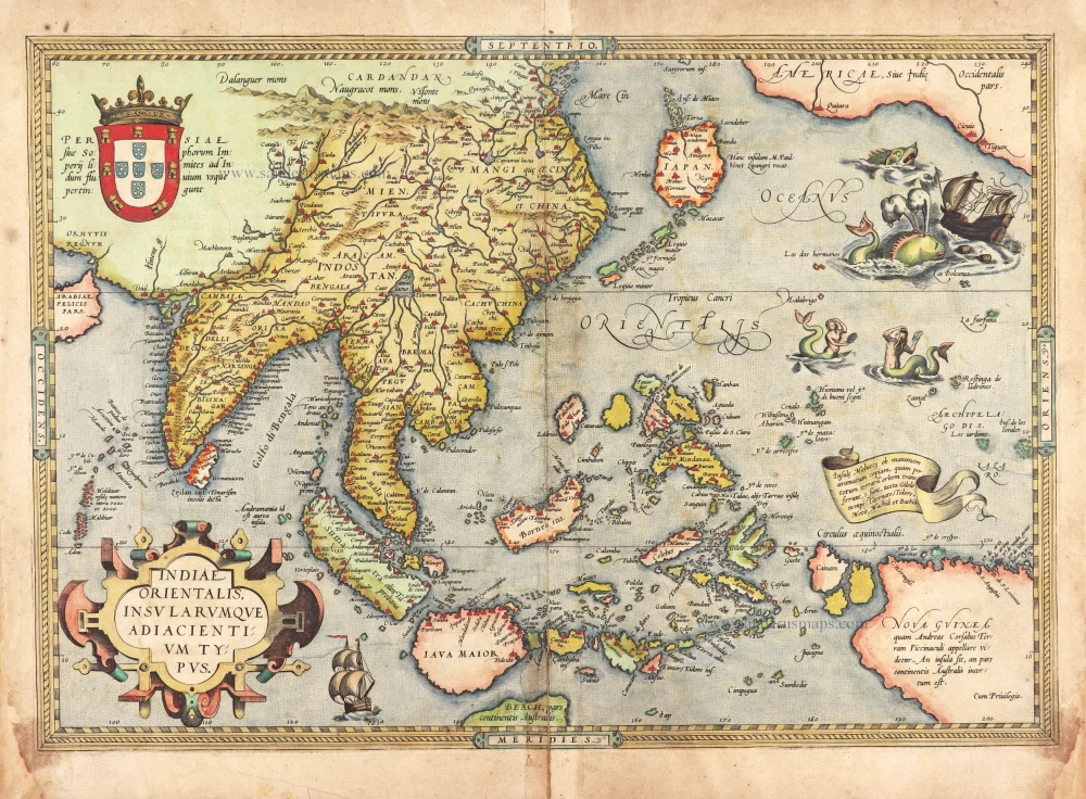
A very important map of the region
Southeast Asia, by Abraham Ortelius. 1572
Indiae Orientalis Insularumque Adiacientium Typus.
[Item number: 28046]

This map has the first accurate depiction of the Philippines
Southeast Asia by Willem & Joan Blaeu 1640-43
India quae Orientalis dicitur et Insulae Adiacentes.
[Item number: 26566]
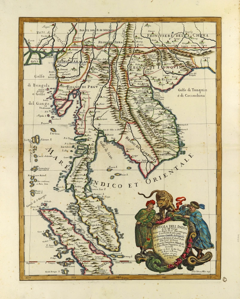
Indochina by Cantelli da Vignola, published by Giovanni Giacomo de Rossi. 1692
Penisola Dell India di la dal Gange Divisa ne i Regni, che in...
[Item number: 28371]
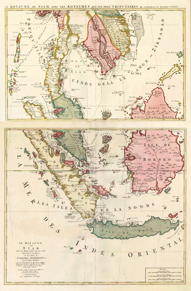
Southeast Asia, by J. Ottens. c. 1700
Le Royaume de Siam avec les Royaumes qui luy sont Tributaires,...
[Item number: 25716]
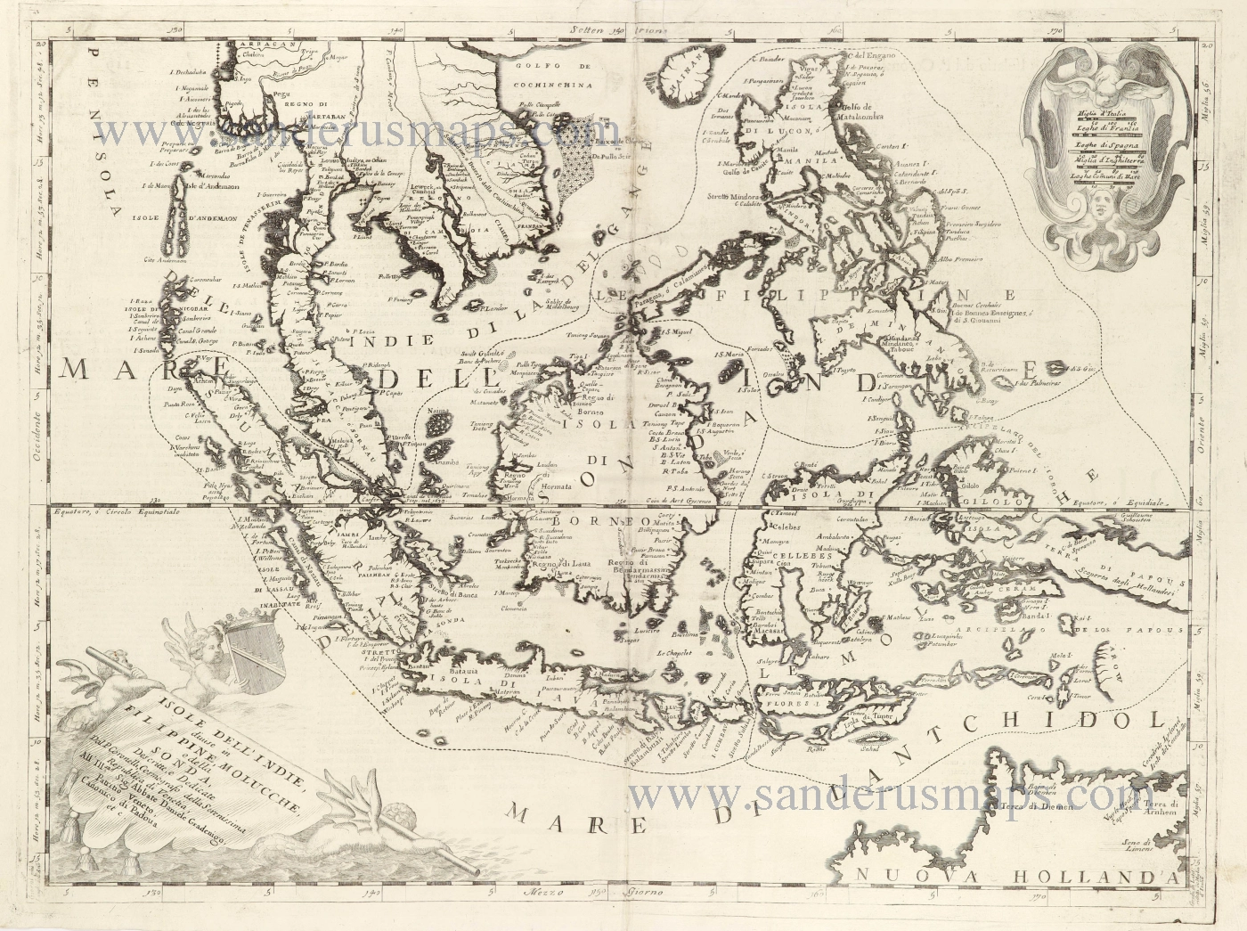
Southeast Asia and Northwest Australia by Vincenzo Coronelli. 1696
Isole dell'Indie, Divise in Filippine, Molucche, e della Sonda.
[Item number: 28670]
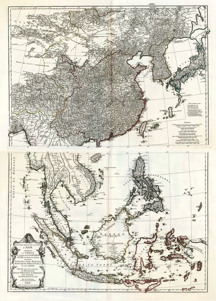
Southeast Asia, by J.B. d'Anville. 1746-53
Seconde Partie de la Carte d'Asie Contenant la Chine et Partie...
[Item number: 27401]
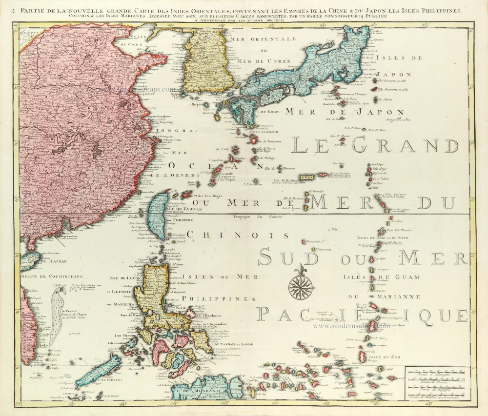
East Asia (Japan - Philippines) by J.B. Elwe. 1792
Partie de la Nouvelle Grande Carte des Indes Orientales...
[Item number: 31803]
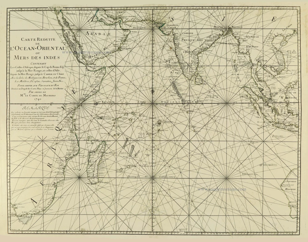
Indian Ocean, by J.N. Bellin. 1756-1770
Carte Réduite de l'Océan Oriental ou Mers des Indes.
[Item number: 28148]
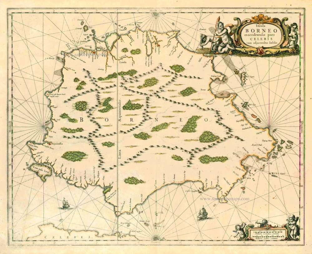
Borneo, by J. Janssonius. 1657-62
Insula Borneo et occidentalis pars Celebis cum adjacentibus...
[Item number: 26456]
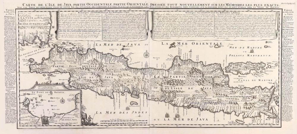
Java, by Z. Châtelain. 1719
Carte de L'Ile de Java: Partie Occidentale, Partie Orientale,...
[Item number: 29377]
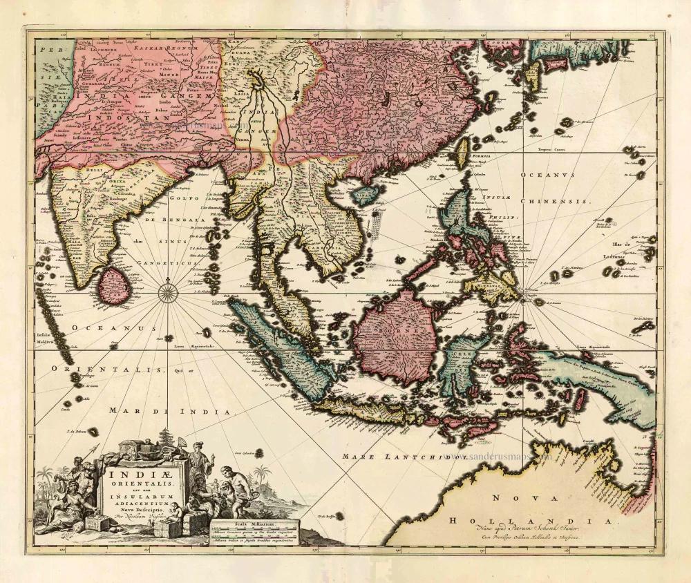
Southeast Asia by Nicolaes Visscher, published by Petrus Schenk. c. 1740
Indiae Orientalis nec non Insularum Adiacentium Nova Descriptio.
[Item number: 25718]
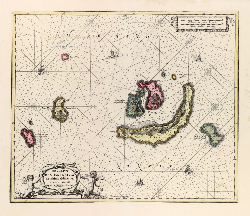
Scarce
Banda Islands by Joannes van Loon, published by Valk & Schenk. c. 1700
Insularum Bandanensium Novissima delineatio.
[Item number: 30147]
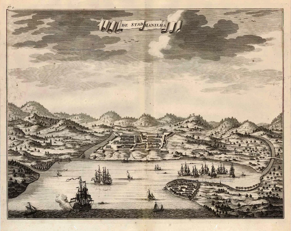
Philippines - Manilla by François Valentyn (Valentijn) 1726
De Stad Manilha.
[Item number: 27894]
The most accurate and one of the most elegant 17th c. maps of the East Indies
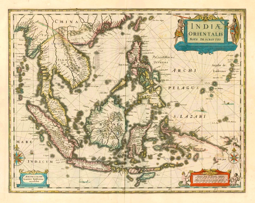
Southeast Asia by Janssonius, Johannes 1644-58
Indiae Orientalis Nova Descriptio.
[Item number: 10013]
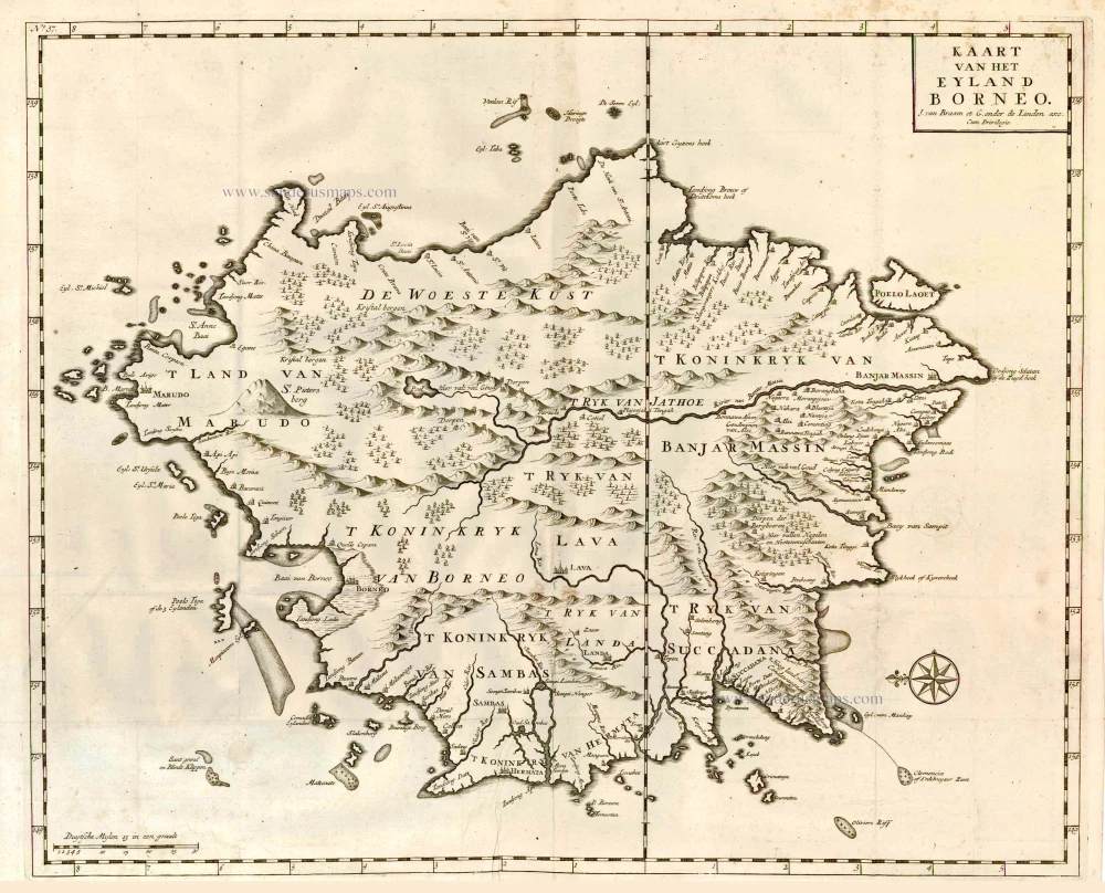
Borneo, by François Valentyn. 1726
Kaart van het Eyland Borneo.
[Item number: 27892]
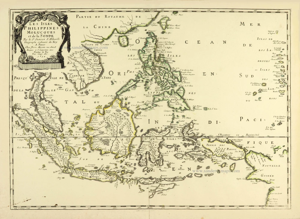
Southeast Asia par Nicolas Sanson. 1658
Les Isles Philippines Molucques et de la Sonde.
[Item number: 28378]
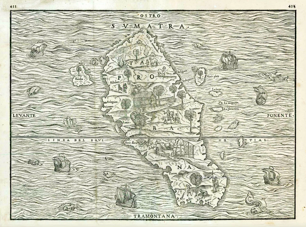
Sumatra, by G.B. Ramusio. 1563
Sumatra.
[Item number: 26313]

Sumatra, by G. Valk & P. Schenk. c. 1700
Sumatrae et Insularum Locorumque Nonnullorum Circumiacentium...
[Item number: 25714]
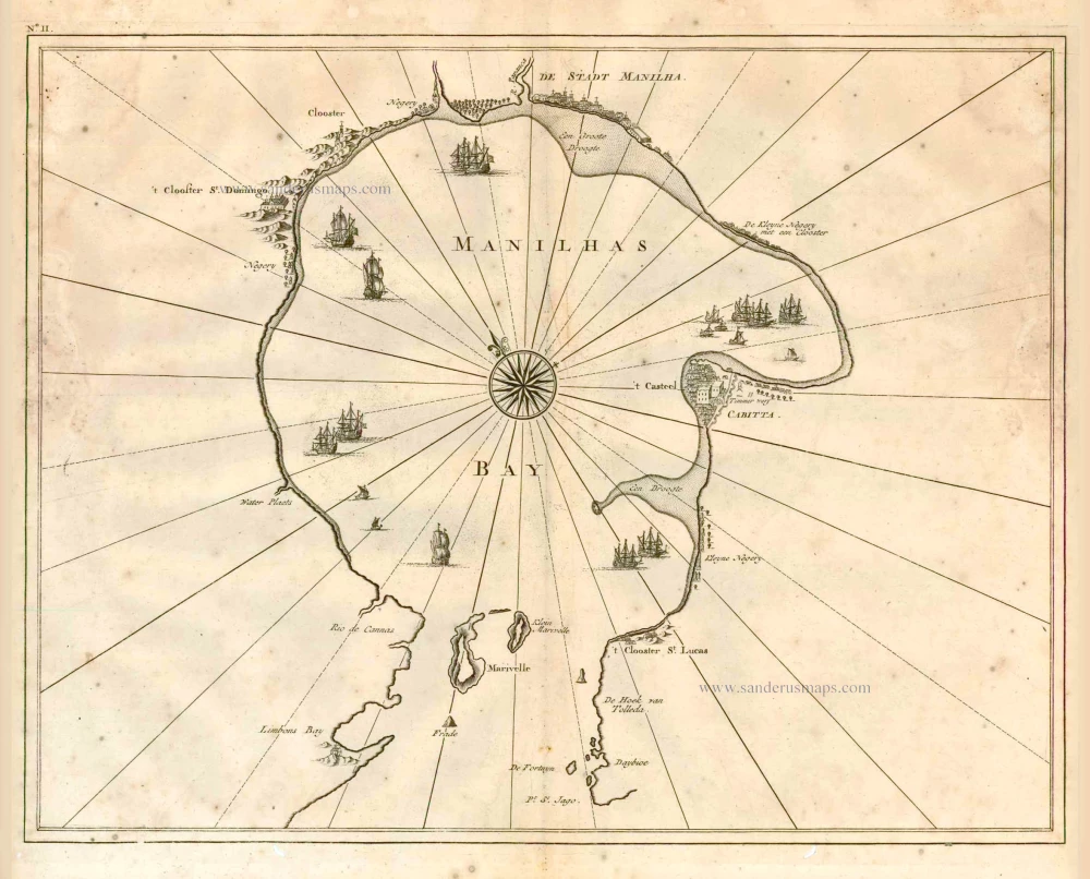
Philippine Islands - Manila Bay by François Valentyn (Valentijn) 1724-26
Manilhas Bay.
[Item number: 27904]
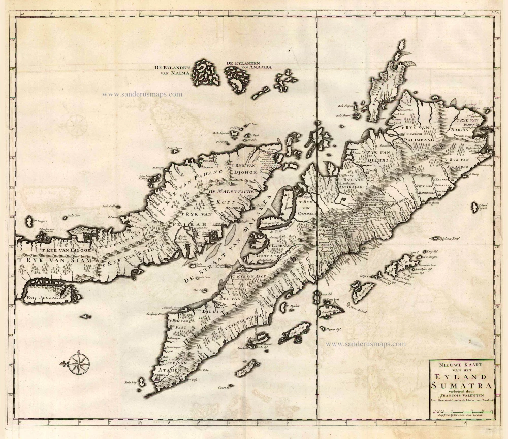
Malaysia - Sumatra by François Valentyn (Valentijn) 1724-26
Nieuwe Kaart van het Eyland Sumatra.
[Item number: 26898]