Antique maps catalogue
- All recent additions
-
Antique maps
- Polar maps
- World
-
Europe
- Europe Continent
- Belgium
- Belgium - Cities
- The Low Countries
- The Netherlands
- The Netherlands - Cities
- Luxembourg
- France
- France - Cities
- Germany
- Germany - Cities
- Austria
- Italy
- Italy - Cities
- Spain and Portugal
- Greece & Greek Islands
- Switzerland
- British Isles
- British Isles - Cities
- Northern Europe
- Central Europe
- Eastern Europe
- Southeastern Europe
- America
- Asia
- Africa
- Mediterranean Sea
- Australia
- Oceans
- Celestial Maps
- Curiosities
- Title Pages
- Books
- Medieval manuscripts
- Prints

Limburg, by C.J. Visscher. 1634
Limburgensis Ducatus Nova Descriptio.
[Item number: 27969]

Limburg, by Nicolaas Visscher I. 1683-1696
Limburgi Ducatus Et Comitatus Valckenburgi.
[Item number: 26216]

Low Countries (Ancient) by Kaerius (Van den Keere) P 1617
Belgii Veteris Typus cui adjunximus veterum Belgocorum mores...
[Item number: 13664]

Early map of the Low Countries, 1561-1574
Low Countries by Girolamo Ruscelli. 1574
Fiandra, Brabantia, et Holanda Nuova.
[Item number: 31083]

Mechelen by Petrus Van den Keere (Kaerius). 1617
Mechlinia.
[Item number: 30655]

Mechelen, by Petrus Kaerius (Pieter Van den Keere) 1617
Mechlinia.
[Item number: 15408]
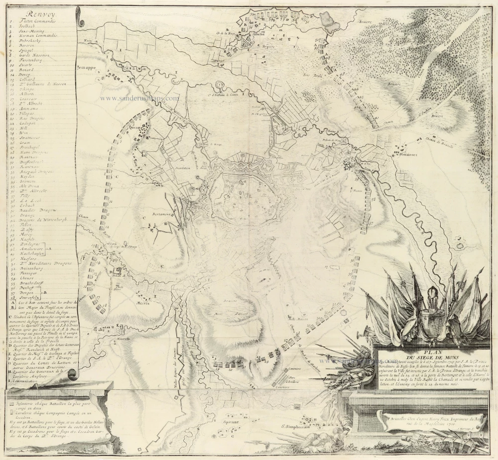
Mons by Eugène Fricx. 1712
Plan du Siege de Mons
[Item number: 30791]

Namur by Abraham Ortelius. 1612
Namurcum, Comitatus
[Item number: 22940]

Namur by Pieter Van den Keere (Petrus Kaerius). 1617
Namurcum.
[Item number: 30654]

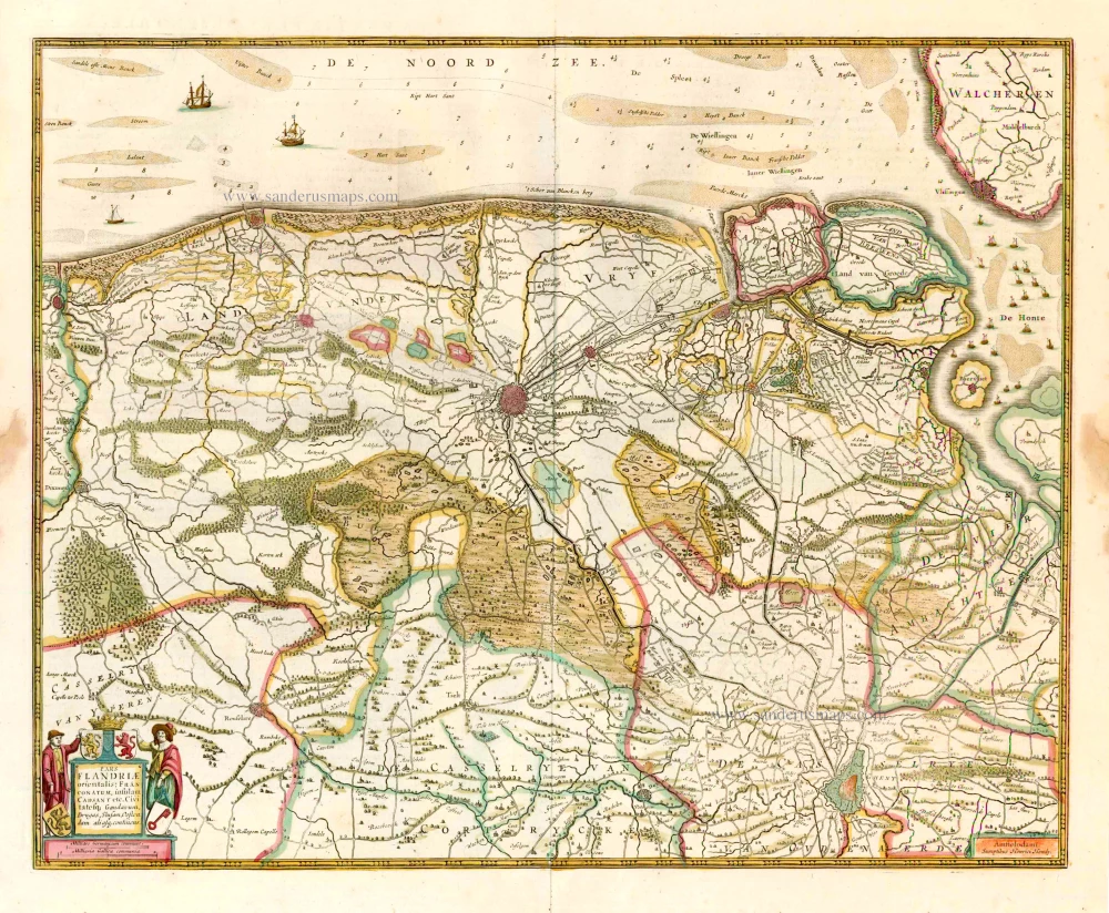
Northern West-Vlaanderen by Eugène Fricx, published by Pierre Mortier. 1745
Carte particulière des environs de Bruges, Ostende, Damme,...
[Item number: 29594]

North West Flanders, by Willem & Joan Blaeu. 1643
Flandriae Teutonicae Pars Orientalior.
[Item number: 27403]

Northern Brabant, by N. Sanson, so-called published by Hubert Jaillot. (Pirated edition by Pierre Mortier). 1692
Le Duché de Brabant qui comprend les quartiers de Louvan,...
[Item number: 31721]
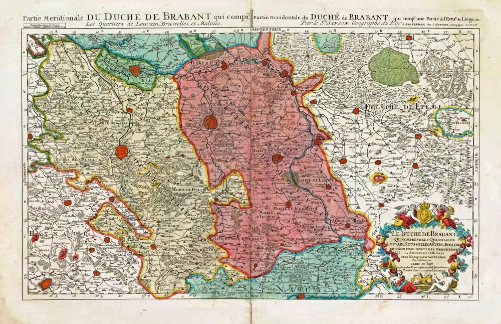
Southern Brabant, by Pieter Mortier. c. 1705
Le Duché de Brabant qui comprend les Quartiers de Louvain,...
[Item number: 27801]

Northwest Brabant by G.L. Le Rouge. 1747
Le Brabant Hollandois et Autrichien.
[Item number: 30255]

Spectacular 'Romain de Hooghe' map
Sea chart of the Channel - Flanders (Vlaanderen) - Zeeland, by Pieter Mortier. 1700
Carte Nouvelle des Costes de Hollande, Zeelande, Flandre,...
[Item number: 27176]

Brabant, by A. Ortelius. 1595
Brabantiae Descriptio.
[Item number: 25573]

Brabant by M. Quad - J. Bussemacher. 1602
Brabantiae Belgarum provinciae recens exactaque descriptio.
[Item number: 25235]

Important and rare map.
Brabant, by Michele Tramezini. 1558
Brabantiae Belgarum Provinciae Recens Exactaque Descriptio.
[Item number: 26713]

Flanders (Vlaanderen) by Domenico Zenoi. 1559
Exactissima Flandriae descriptio. Flandria, Caroli V. Aug. Imp....
[Item number: 25774]

Flanders (Vlaanderen), by Pieter Verbiest. 1637
Comitatus Flandria.
[Item number: 27128]

Gallo-Flandria, by Willem Blaeu. 1643
Galloflandria in qua Castellaniae Lilana, Duacena, &Orchiesa,...
[Item number: 27125]

Hainaut - Namur, by G. Mercator 1619
Hannonia Namurcum Comitatus.
[Item number: 12182]

The bishopric of Ieper, by J. Blaeu. 1663
Iprensis Episcopatus.
[Item number: 26221]

Limburg, by Henricus Hondius. 1641
Ducatus Limburg.
[Item number: 26308]

Limburg, by Henricus Hondius. 1619
Limburgensis Ducatus.
[Item number: 26774]

Limburg, by Willem and Joan Blaeu. 1659-72
Ducatus Limburgum.
[Item number: 8841]

Namur by N. Visscher II, published by P. Schenk. 1720-30
Nieuwe Kaart van 't Graafschap Namen, met een groot gedeelte van...
[Item number: 25921]

Scarce
'T Land van Waas by CJ Visscher 1634
Niewe Kaerte van 't Landt van Waes ende Hulster Ambacht,...
[Item number: 18648]

The Marquisate of Antwerp, by Willem Blaeu. 1641-42
Tertia Pars Brabantiae qua continetur Marchionat S.R.I. horum...
[Item number: 17537]
![[No title]](https://sanderusmaps.com/assets/IMG/webp/m26355.webp)
Vlaanderen - Brabant, by J. Janssonius - J. Hondius. 1633
[No title]
[Item number: 26355]
West-Vlaanderen (East), by Henricus Hondius. 1641
Pars Flandriae Orientalis; Franconatum, insulam Cadsant etc....
[Item number: 26320]

Western Flanders (West Vlaanderen), by Henricus Hondius. 1641
Flandriae Pars Occidentalis continens ...
[Item number: 26319]
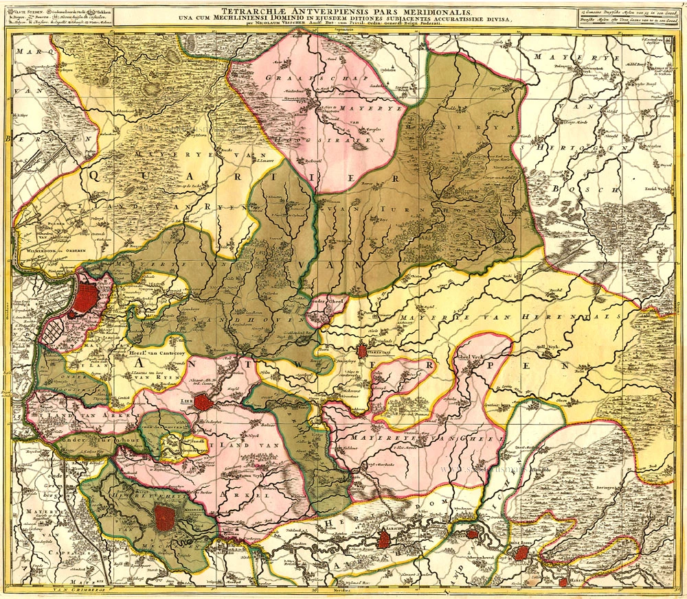
Antwerpen - Mechelen by Visscher N. II. 1683-1696
Tetrarchiae Antverpiensis Pars Meridionalis
[Item number: 14777]

Famous Mercator map of Flanders
Vlaanderen by A. Ortelius. 1579
Flandria.
[Item number: 22228]

Flanders, by Pieter Van der Aa. 1713
Carte du Comté de Flandre.
[Item number: 26053]

Scarce map by Vrients
Limburg, by Ortelius A. 1612
Limburgensis Ducatus Tabula Nova.
[Item number: 22979]