Antique maps catalogue
- All recent additions
-
Antique maps
- World and Polar
-
Europe
- Europe Continent
- Belgium
- Belgium - Cities
- The Low Countries
- The Netherlands
- The Netherlands - Cities
- Luxembourg
- France
- France - Cities
- Germany
- Germany - Cities
- Austria
- Italy
- Italy - Cities
- Spain and Portugal
- Greece & Greek Islands
- Switzerland
- British Isles
- British Isles - Cities
- Northern Europe
- Central Europe
- Eastern Europe
- Southeastern Europe
- America
- Asia
- Africa
- Mediterranean Sea
- Australia
- Oceans
- Celestial Maps
- Curiosities
- Books
- Medieval manuscripts
- Prints
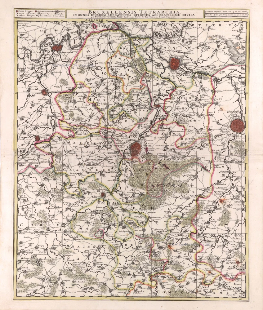
Brussels (Bruxelles) by Nicolaas Visscher II 1683-1696
Bruxellensis Tetrarchia, in omnes ejusdem subjacentes ditiones ...
[Item number: 29592]
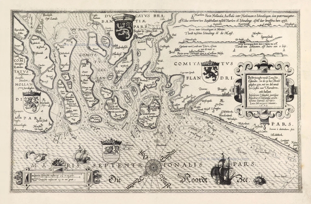
Rare and important sea chart.
Lucas Janszoon Waghenaer, Zeeland and Flanders. 1586
Beschrijvinghe vande Zeeusche Eijlanden Soe die op hare Strome ...
[Item number: 28469]
![Typus octo longaru[m] naviu[m]. Anno M.VI.c.II ab Hispaniae rege missaru[m] ad Oceanum Belgicum infestandu[m]. quarum naviu[m] quatuor Angloru[m] atq³ Hollandoru[m] virtute conquassatae sunt et submersae: ceterae naufragio periere.](https://sanderusmaps.com/assets/WEBP/m26804.webp)
Very important naval print: The first print published by the Blaeu family
Defeat of Spanish galleys by an Anglo-Dutch naval force off the coast of Flanders, 3-4 Oct. 1602. by Willem Blaeu c. 1602
Typus octo longaru[m] naviu[m]. Anno M.VI.c.II ab Hispaniae rege ...
[Item number: 26804]
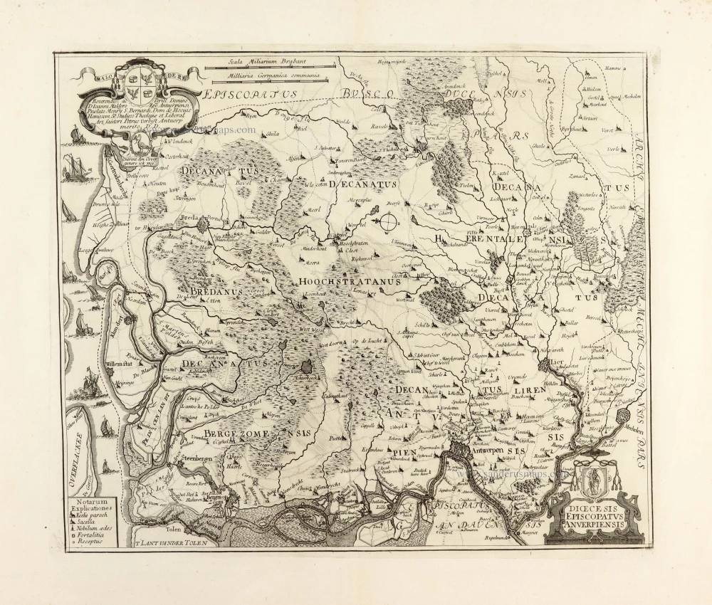
Diocese of Antwerp by Petrus Verbiest. Before 1678
Dioecesis Episcopatus Anverpiensis.
[Item number: 30172]

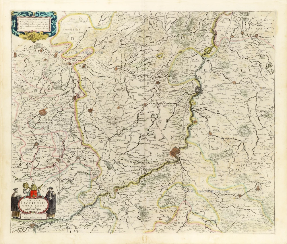
Diocese of Liège by Henricus Hondius. c. 1630-1650
Dioecesis Leodiensis Accurata Tabula.
[Item number: 31215]
new
Diocese of Liège by Johannes Janssonius. 1653
Dioecesis Leodiensis Accurata Tabula.
[Item number: 30372]
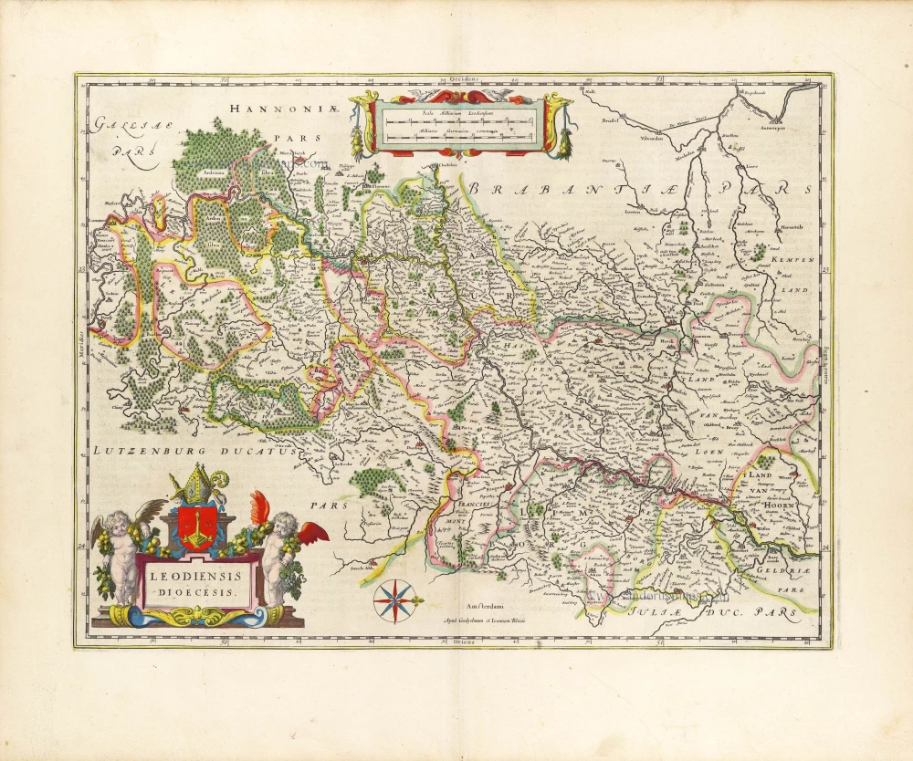
Diocese of Liège, by Willem Blaeu. 1643
Leodiensis Dioecesis.
[Item number: 29933]

Flanders (Vlaanderen) and Zeeland, by Willem Blaeu. 1640-43
Flandria et Zeelandia Comitatus.
[Item number: 27409]
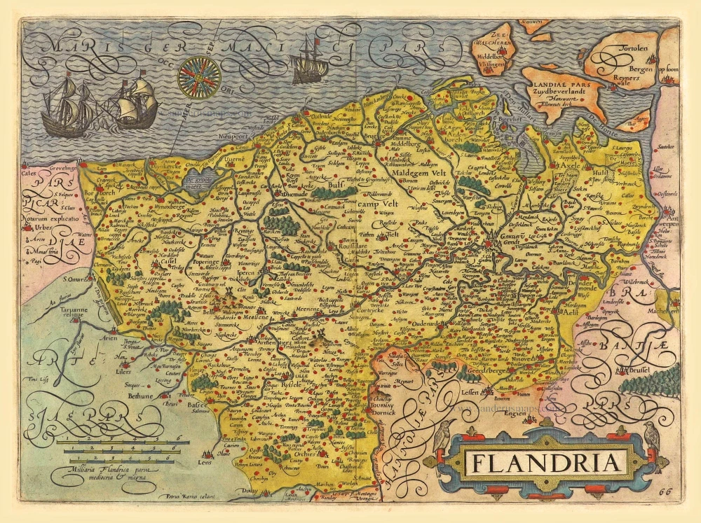
Flanders (Vlaanderen) by Abraham Ortelius. 1612
Flandriae Comitatus Descriptio.
[Item number: 22978]
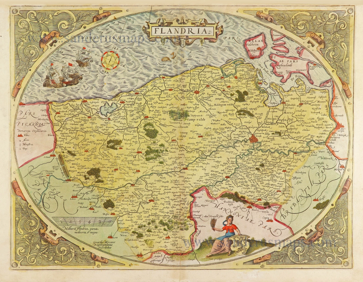
First state.
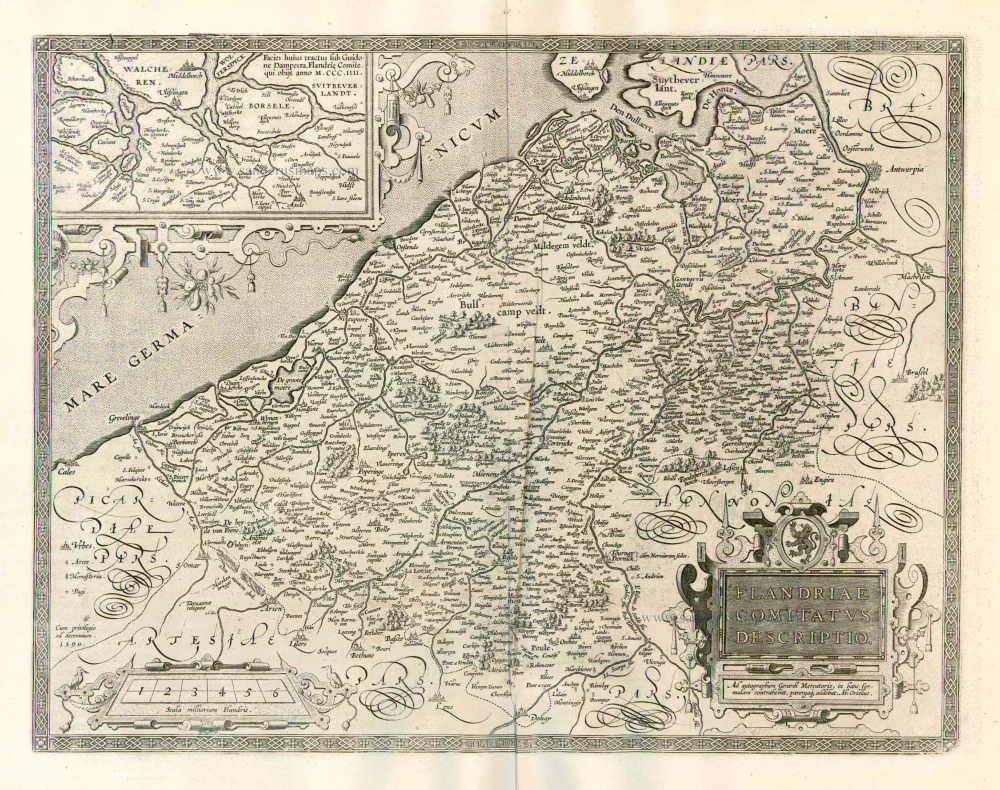
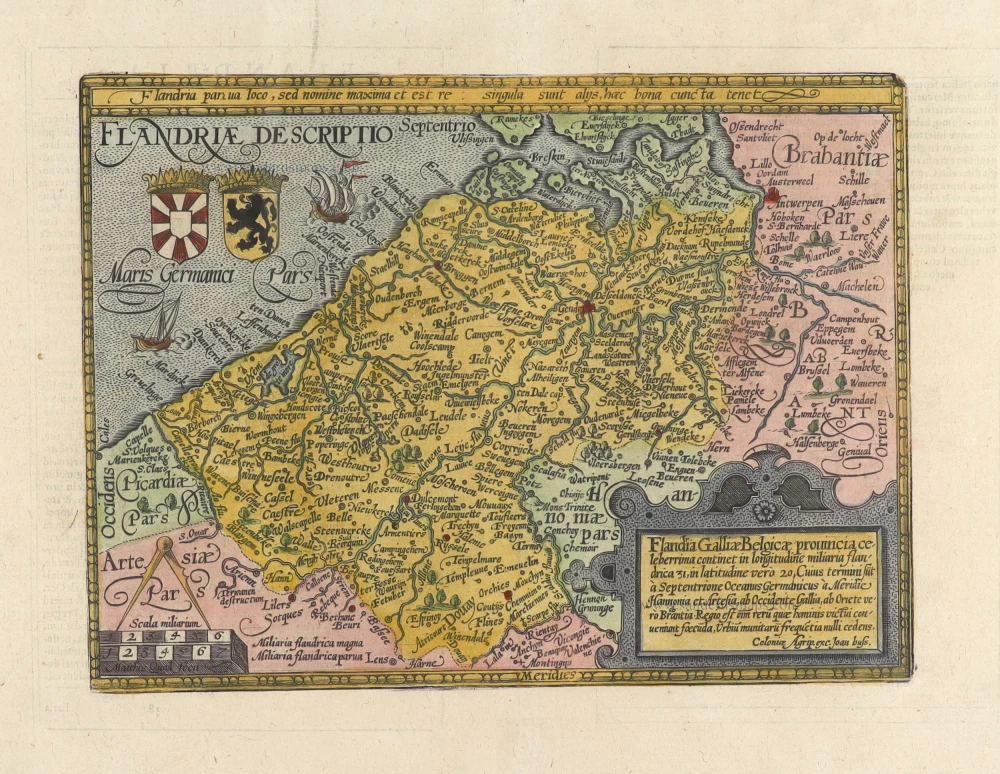
Flanders (Vlaanderen) by Abraham Ortelius. 1575.
Flandria.
[Item number: 28673]
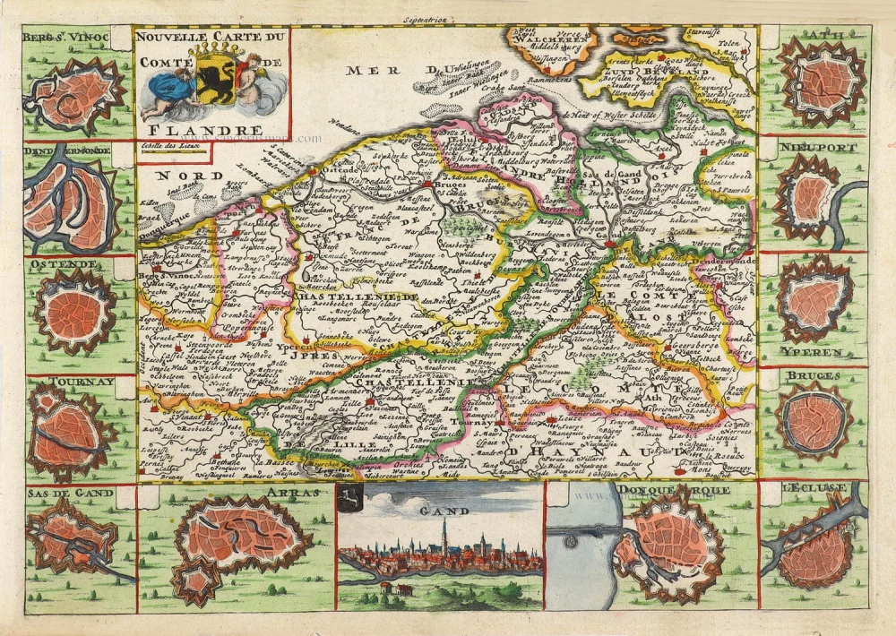
Flanders (Vlaanderen) by Daniel De la Feuille. 1706
Nouvelle Carte du Comté de Flandre.
[Item number: 29889]
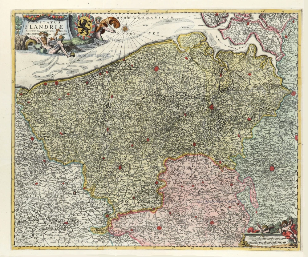
Flanders (Vlaanderen) by G. van Schagen, published by Pieter van der Aa. 1728
Comitatus Flandriae.
[Item number: 31254]
new
Flanders (Vlaanderen) by Lodovico Guicciardini. 1612
Flandria.
[Item number: 18166]
Flanders (Vlaanderen) by Matthias Quad, published by J. Bussemacher. 1694
Flandriae Descriptio.
[Item number: 31256]
new

Flanders (Vlaanderen) by Matthias Quad, published by J. Rauw. 1597
Flandriae Descriptio.
[Item number: 31257]
new
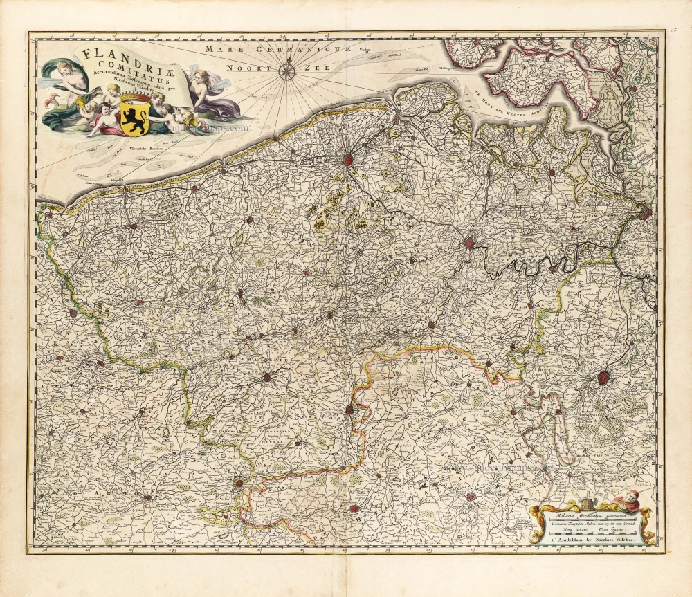
Flanders (Vlaanderen) by Nicolaas Visscher I. c. 1658
Flandriae Comitatus Accuratissima Descriptio.
[Item number: 29980]
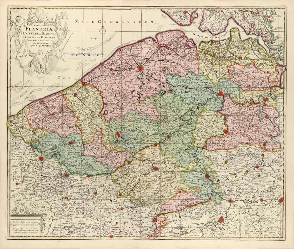
Flanders (Vlaanderen) by Ottens R. & J. 1730-45
Comitatus Flandriae Universe in Ditiones Peculiares Distinctae.
[Item number: 30524]
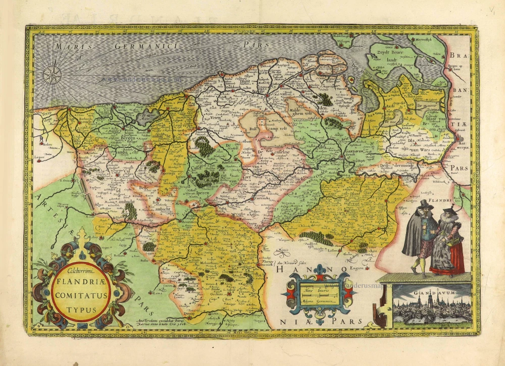
Flanders (Vlaanderen) by Petrus Kaerius (Pieter Van den Keere). 1617
Celeberrimi Flandriae Comitatus Typus.
[Item number: 28453]
![Flàdern. [Above map:] Von dem Landt Flandern.](https://sanderusmaps.com/assets/WEBP/m28922.webp)
Flanders (Vlaanderen) by Sebastian Münster. 1550
Flàdern. [Above map:] Von dem Landt Flandern.
[Item number: 28922]
Rare
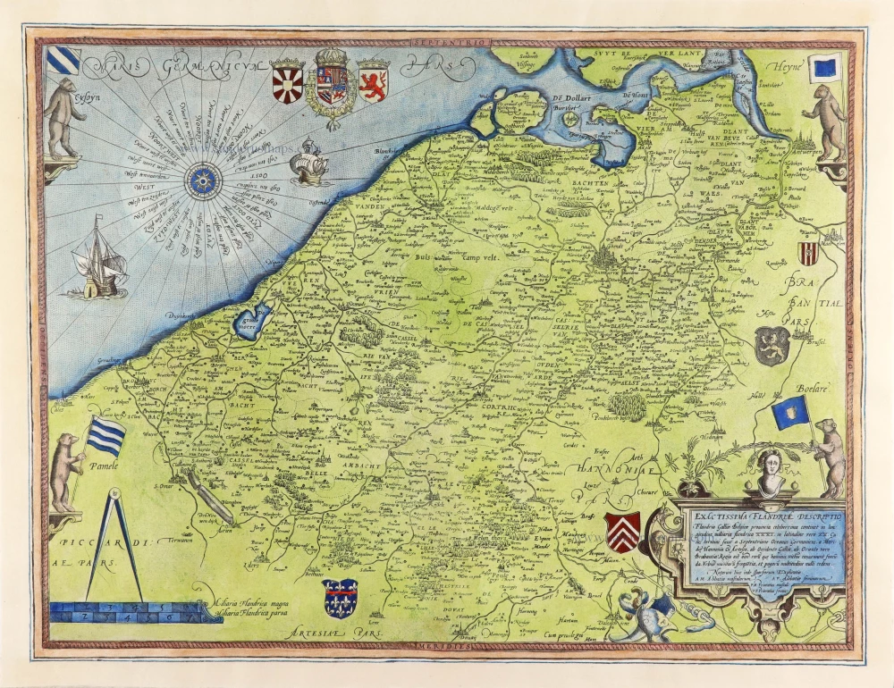
Flanders (Vlaanderen), by Gerard de Jode. 1593
Exactissima Flandriae Descriptio.
[Item number: 30309]
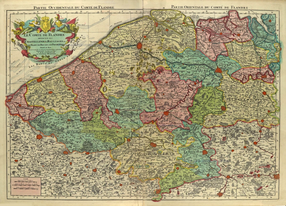
Flanders (Vlaanderen), by Pieter Mortier. c. 1705
Le Comté de Flandre divisé en ses Chastellenies, et Balliages, & ...
[Item number: 28129]
Rare.
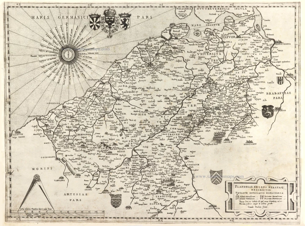
Flanders, by Claudio Duchetti, after Gerard Mercator. c. 1570
Flandriae recens exactaq descriptio.
[Item number: 29729]
Important and rare map.
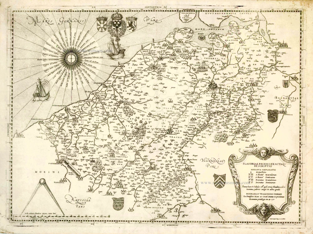
Flanders, by Michele Tramezzino. 1555
Flandriae recens exactaq descriptio.
[Item number: 27454]
![[No title]](https://sanderusmaps.com/assets/WEBP/M31002.webp)
Very rare!
Four atlas maps by Henricus Hondius, adapted to form a wall map of Flanders. c. 1630-1635
[No title]
[Item number: 31002]
![[No title]](https://sanderusmaps.com/assets/WEBP/m22635.webp)
French Flanders (Frans Vlaanderen) by Henricus Hondius. 1633 (or earlier)
[No title]
[Item number: 22635]
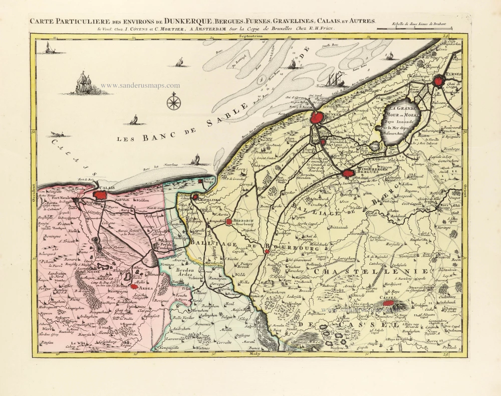
French Flandres (West) by E.H. Fricx, published by Covens & Mortier. 1745
Carte Particulière des Environs de Dunkerque, Bergues, Furnes, ...
[Item number: 30544]
With 'Gravensteen'.
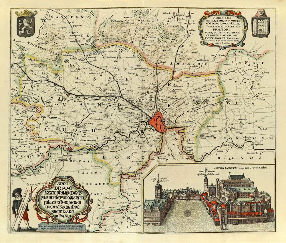
Gent (Castellania) by Antonius Sanderus, published by Joan Blaeu. 1662
... Hanc Veteris Burgis novam tabulam ...
[Item number: 28138]
![Praenobili Magnifico Amplissimoq[ue] Magistratui inclytae civitatis Gandavensis](https://sanderusmaps.com/assets/WEBP/m30121.webp)
Extremely rare map of Ghent and surroundings.
Ghent (Gent), by Henricus Hondius.
Praenobili Magnifico Amplissimoq[ue] Magistratui inclytae ...
[Item number: 30121]
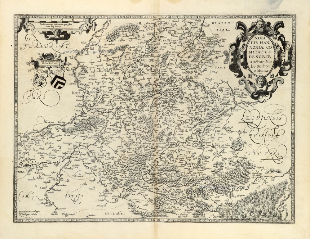
The scarce censored first issue of Ortelius's Hainault map, dated 1572.
Hainault (Hainaut) by Abraham Ortelius. 1584
Nobilis Hannoniae Comitatus Descrip.
[Item number: 30676]

Hainaut - Cambrai, by Pieter Mortier. 1708
Le Comté de Haynaut, divisé en Chatellenies, Balliages, P ...
[Item number: 28223]
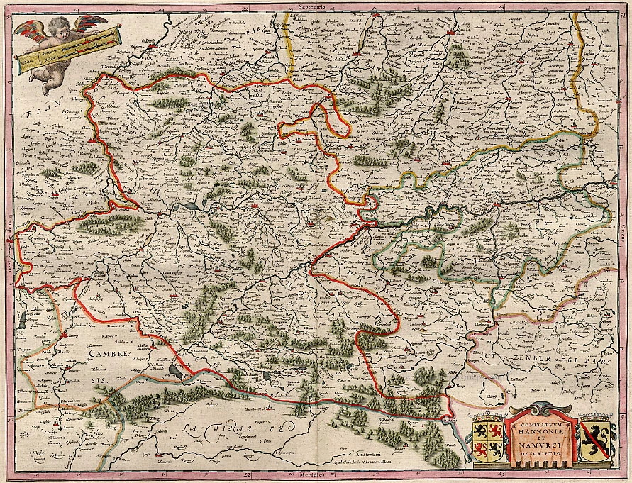
Hainaut - Namur, by Blaeu W. & J. 1640-43
Comitatuum Hannoniae Et Namurci Descriptio
[Item number: 13985]
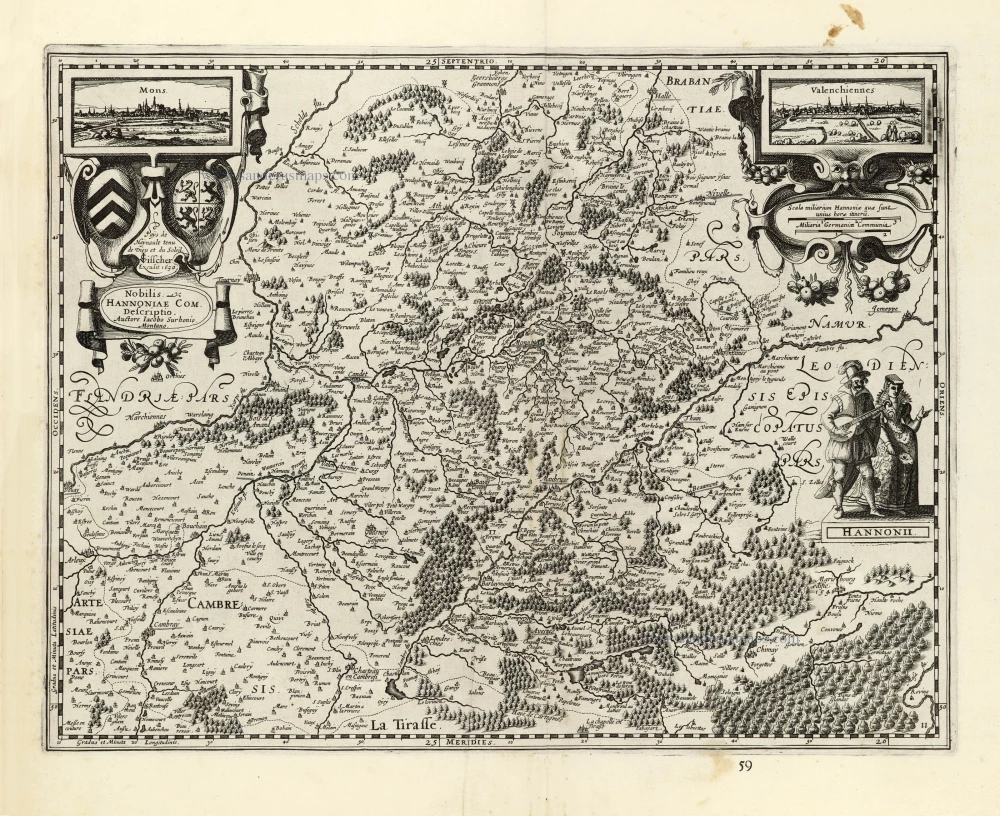
Hainaut by Petrus Kaerius (Pieter Van den Keere), published by Claes Jansz. Visscher. 1634
Nobilis Hannoniae Com. Descriptio.
[Item number: 30736]
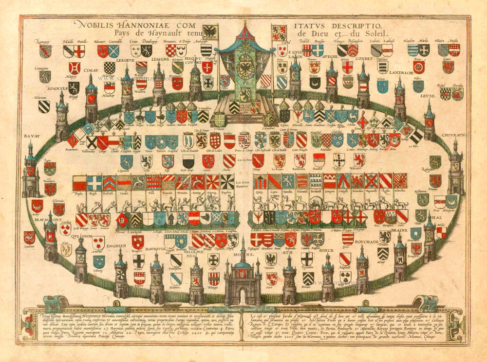
Heraldic Garden of the County of Hainaut, by Georg Braun and Frans Hogenberg. 1581
Nobilis Hannoniae Comitatus Descriptio. Pays de Haynault Tenu de ...
[Item number: 25340]

Extremely rare map of Het Zwin (Knokke - Belgium)
Het Zwin - Knokke, Sluis, and Cadzand by Claes Jansz Visscher. 1627-37
Kaerte van Sluys, het Zwin ende de Schansen aen weder Syden.
[Item number: 30256]
Very rare first state.
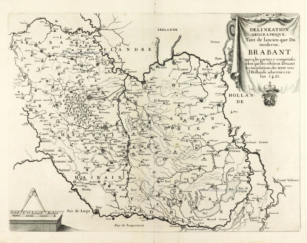
Historical map of Brabant by Christophe Butkens. 1637
Delineation Geographique. Tant de lancien que Du moderne. ...
[Item number: 30291]
![Menapii. Dioecese de l'Archev[es]ché de Malines. Partie meridionale du Duché de Brabant, ou sont les quartiers de Louvain, et du Brusselles; et la seign[eu]rie de Malines.](https://sanderusmaps.com/assets/WEBP/m30520.webp)
Historical map of Southern Brabant, by Guillaume Sanson, published by P. Mariette. 1679-1710
Menapii. Dioecese de l'Archev[es]ché de Malines. Partie ...
[Item number: 30520]