Antique maps catalogue
- All recent additions
-
Antique maps
- Polar maps
- World
-
Europe
- Europe Continent
- Belgium
- Belgium - Cities
- The Low Countries
- The Netherlands
- The Netherlands - Cities
- Luxembourg
- France
- France - Cities
- Germany
- Germany - Cities
- Austria
- Italy
- Italy - Cities
- Spain and Portugal
- Greece & Greek Islands
- Switzerland
- British Isles
- British Isles - Cities
- Northern Europe
- Central Europe
- Eastern Europe
- Southeastern Europe
- America
- Asia
- Africa
- Mediterranean Sea
- Australia
- Oceans
- Celestial Maps
- Curiosities
- Title Pages
- Books
- Medieval manuscripts
- Prints

Rare and interesting map
Voyage of Magellan from Spain to Asia, by Pieter Van der Aa. 1707
Scheeps-Togt door Ferdinand Magellaan uit Kastilien gedaan na R....
[Item number: 32347]
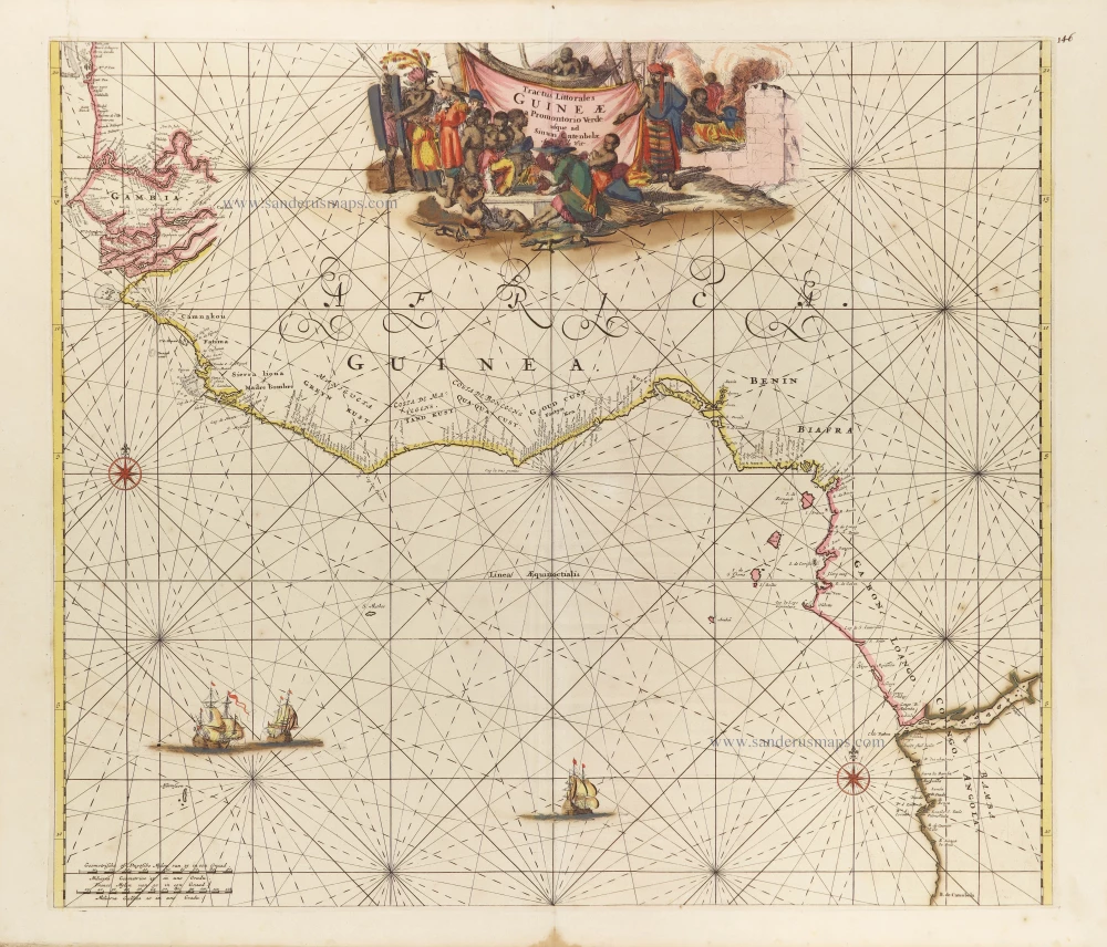
Tropical Atlantic Coast of Africa, by Frederick de Wit. c. 1691-97
Tractus Littorales Guineae a Promontorio Verde usque ad Sinum...
[Item number: 29258]
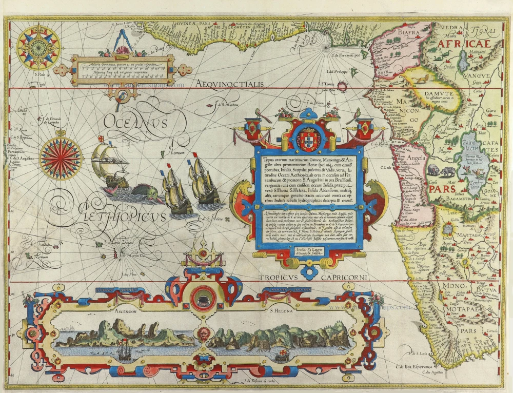
Important map
West Africa, by Linschoten J.H. van 1596
Typus orarum maritimarum Guineae, Manicongo, & Angolae ... /...
[Item number: 32214]
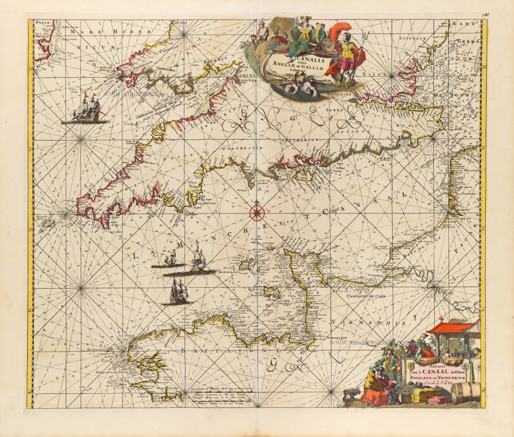
The English Channel, by Frederick de Wit. c. 1680
Canalis inter Angliae et Galliae Littera. - Pascaert van 't...
[Item number: 29171]

The Azores, by Johannes Van Keulen. 1681
Nieuwe Pascaert van Alle de Vlaemse Eylanden
[Item number: 12094]
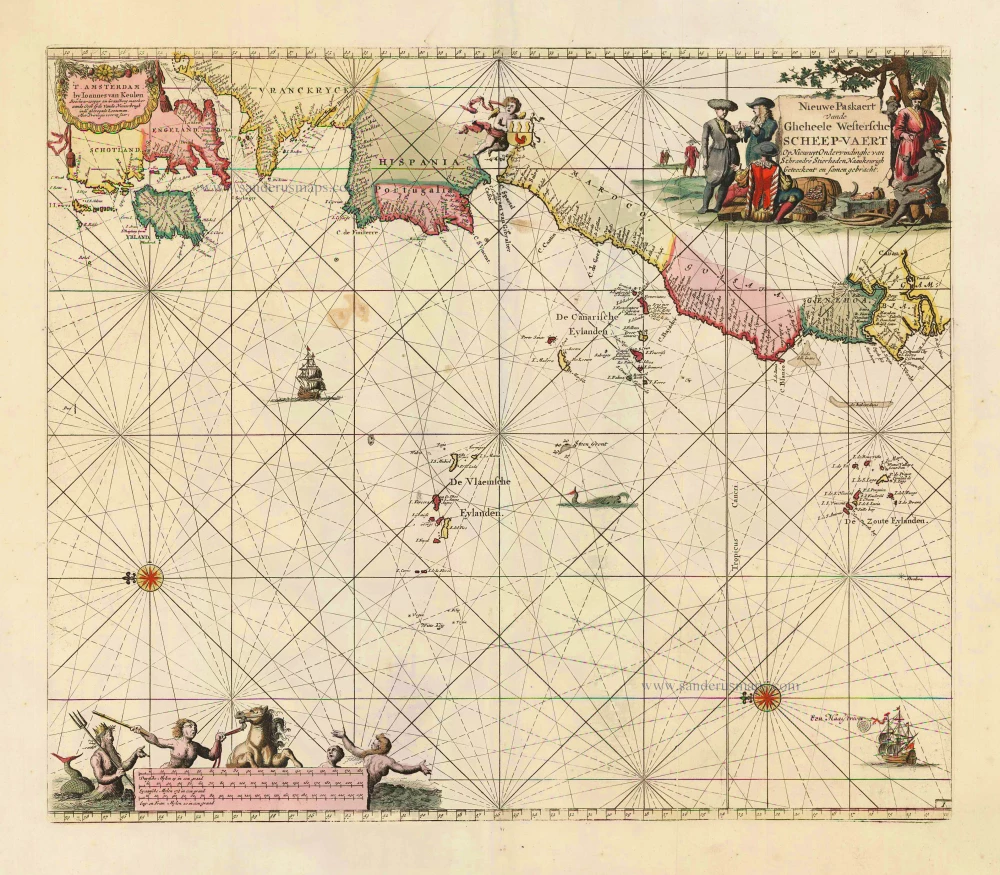
The Atlantic Ocean, by J. Van Keulen. 1697-1709
Nieuwe Paskaert vande Gheheele Westersche Scheep-Vaert, op Nieus...
[Item number: 11218]
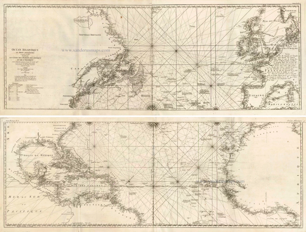
The Atlantic Ocean, by G.L. Le Rouge. 1778
Ocean Atlantique et Mers Adjacentes en Quatre Feuilles Contenant...
[Item number: 14086]
![[No title]](https://sanderusmaps.com/assets/IMG/webp/m30730.webp)
Heightened in gold and silver
Atlantic Ocean by Theodore De Bry, Great Voyages, 1599
[No title]
[Item number: 30730]

Important map with Tasman's first voyage
Valentyn François, Australia 1726
Kaart der Reyse van Abel Tasman Volgens syn eygen Opstel.
[Item number: 31086]
![[No title] Svalbard](https://sanderusmaps.com/assets/IMG/webp/m32420.webp)
Scarce and decorative map
Spitzbergen by Samuel Purchas 1625
[No title] Svalbard
[Item number: 32420]
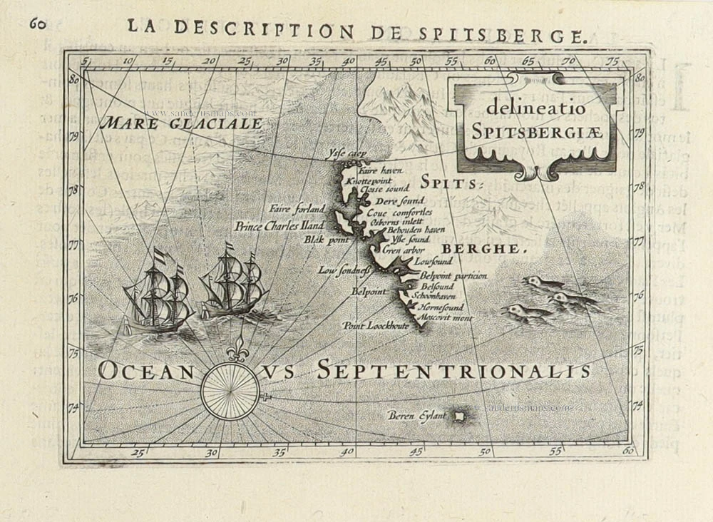
Spitsbergen (Svalbard) by Petrus Bertius 1618
Delineatio Spitsbergiae.
[Item number: 31456]
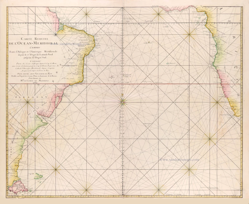
Southern Atlantic Ocean by Jacques Nicolas Bellin. 1765
Carte réduite de l'Océan-méridional, compris entre l'Afrique et...
[Item number: 31446]
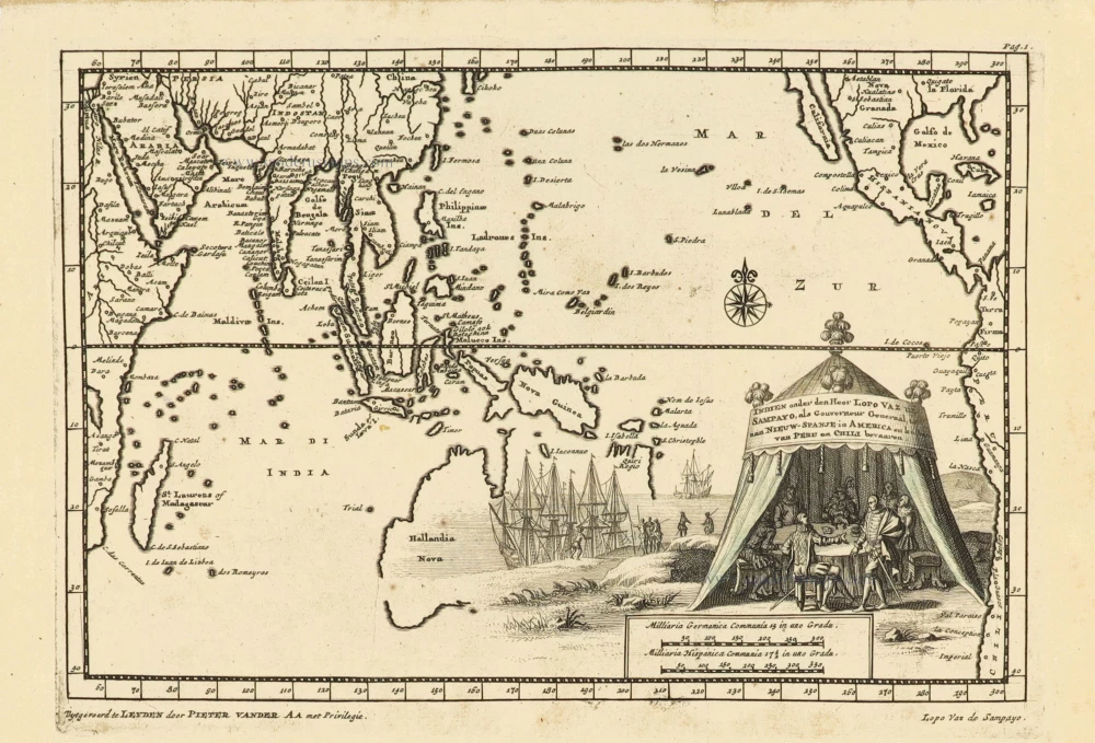
Southeast Asia and Australia, by Pieter Van der Aa. 1707
Indien onder den Heer Lopo Vaz de Sampayo, als Gouverneur...
[Item number: 32359]

Sea chart of South African Coast, by Pieter Goos. 1667
Pas-Kaarte van de Zuyd-West-Kust van Afrika; van Cabo Negro tot...
[Item number: 19073]

Secret Atlas Chart - very rare
Mauritius, by J. Van Keulen II. 1753
Paskaart van 't Eyland MAURITIUS, geleegen in de Oostindische...
[Item number: 30986]

Sea chart of Guinea, by Pieter Goos. 1667
Pas-Caart van Guinea en de Custen daer aen Gelegen van Cabo...
[Item number: 19060]
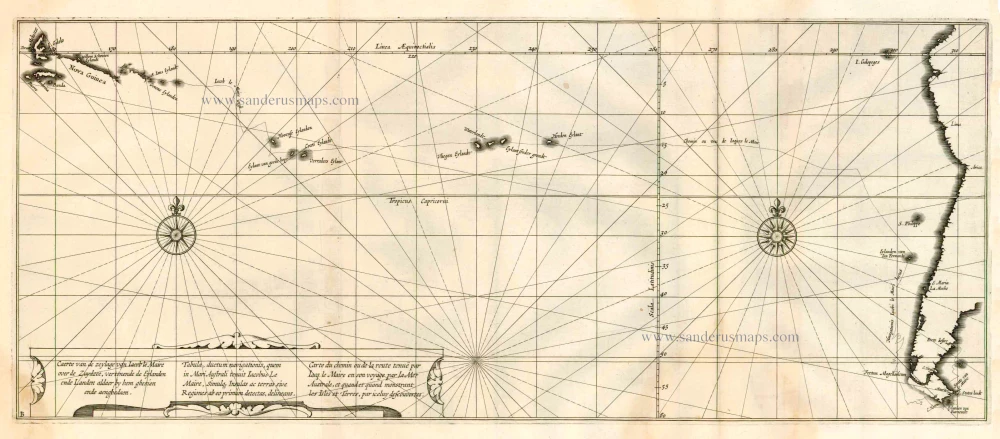
Rare chart showing the route taken by Schouten and le Maire from South America to New Guinea, by Michiel Colijn. 1622
Caerte van de zeylage van Jacob le Maire over de Zuydzee,...
[Item number: 25104]

Pacific Ocean, by Frederick de Wit. c. 1680
Magnum Mare del Zur cum Insula California = De Groote Zuyd-Zee...
[Item number: 29241]

Pacific Ocean (North) by Francesco & Paolo Santini 1776-79
Carte des Nouvelles Decouvertes au Nord de la Mer du Sud, tant à...
[Item number: 26979]

Indian Ocean (North), by J.B. Elwe. 1792
Partie de la Nouvelle Grande Carte des Indes Orientales,...
[Item number: 2363]

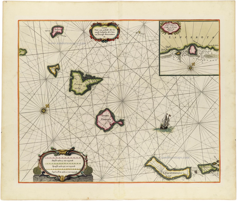
Canary Islands, by Hendrick Doncker. 1686
Canarische Eylanden Canaria Tenerifa, Forteventura etc. t'...
[Item number: 15419]

Canary Islands by Pieter van der Aa. 1713
Canaries, ou Iles Fortunées.
[Item number: 26163]
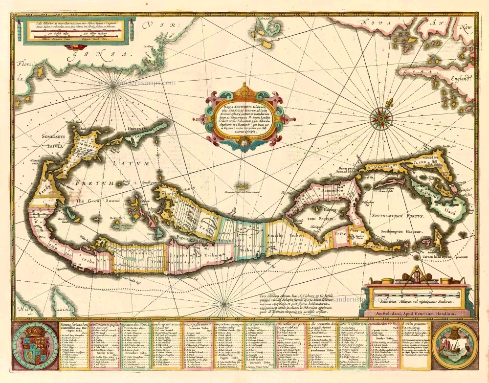
Bermuda, by Johannes Janssonius. 1641
Mappa Aestivarum Insularum alias Barmudas dictarum, ...
[Item number: 26460]
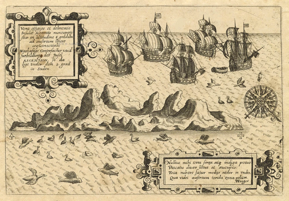
Old antique map of Ascension by Th. de Bry 1598-1613
Vera Effigies et Delineatio Insulae, Ascenstio Nuncupatae Sitae...
[Item number: 20732]
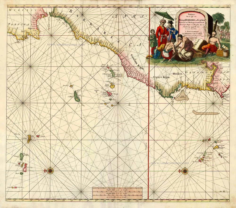
Sea chart of the northwest coast of Africa, with the Azores, Canary Islands and Cape Verde Islands, by Johannes Van Keulen. 1680-1694
Paskaart van de Cust van Portugal, Barbaria, en Genehoa...
[Item number: 26808]

The Northern Pacific Ocean, by T.C. Lotter. 1780
Carte de l'Ocean Pacifique au Nord de l'Equateur, et des Cotes...
[Item number: 11984]
Heightened in gold!
The Canary Islands, by Pieter Goos. 1666
Caarte voor en Gedeelte der Canarise Eylanden als Canaria,...
[Item number: 25612]

New Guinea, by W.C. Schouten 1618
Caarte van Nova Guinea, Nieulijck inden iare 1616 bezeijlt, ende...
[Item number: 25400]
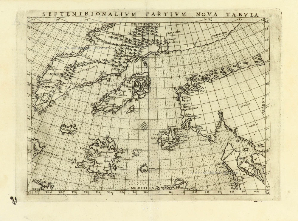
Early map of the North Atlantic
Northern Atlantic Ocean by Girolamo Ruscelli. 1574
Septenirionalium Partium Nova Tabula.
[Item number: 32185]
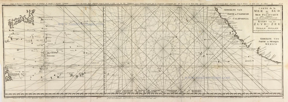
Map of the southern Pacific, showing a part of the path of George Anson's voyage around the world. 1751
Carte de la Mer du Sud ou Mer Pacifique entre l'Equateur et le...
[Item number: 30609]

Map of the southern Pacific, showing a part of the path of George Anson's voyage around the world. 1748
Carte de la Mer du Sud ou Mer Pacifique. Entre l'Equateur et le...
[Item number: 30330]
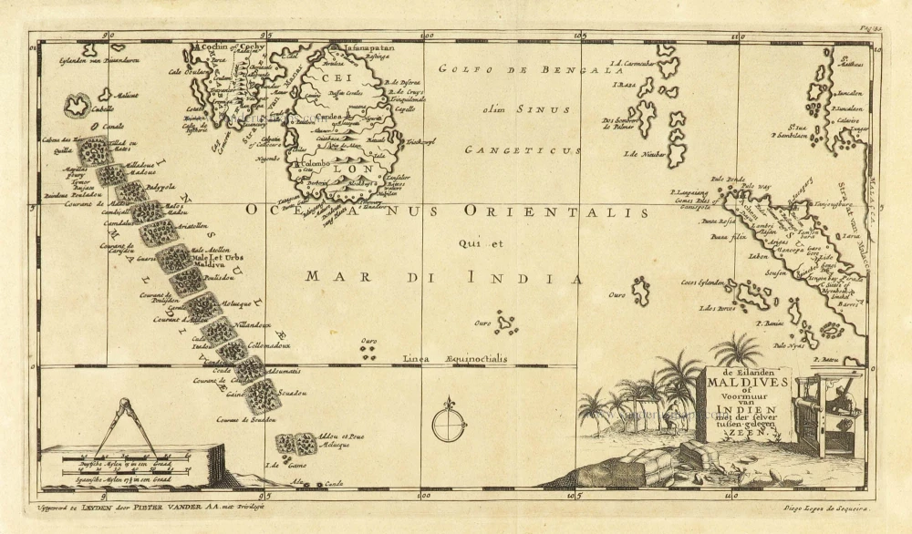
Scarce
Maldives and Ceylon, by Pieter Van der Aa. 1707
De Eilanden Maldives of Voormuur van Indien met der selver...
[Item number: 32342]

Scarce
Indian Ocean, India, Thailand, and Siam by Pieter Van der Aa. 1707
De Kusten van Guzaratte, Malabar, Bengale en Malacca met die...
[Item number: 32323]
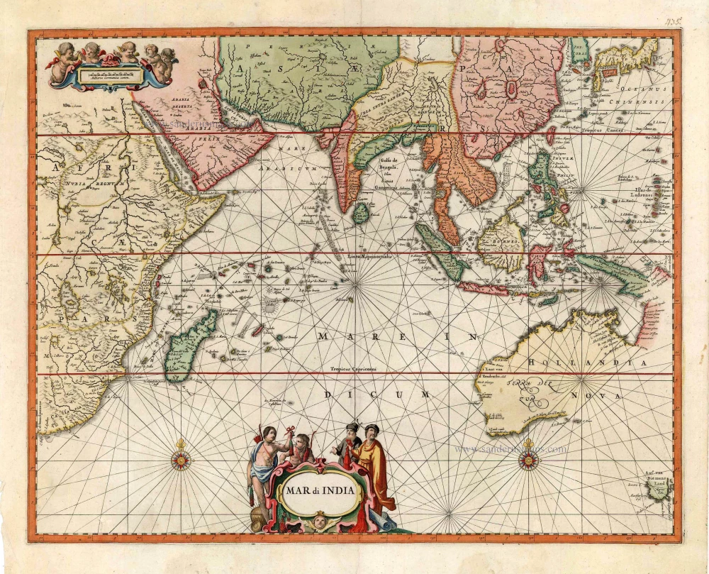
Very rare second state, including the Tasman discoveries (Australia).
Indian Ocean, by Petrus Schenk c. 1700
Mar di India.
[Item number: 27775]

Indian Ocean, by J.N. Bellin. 1756-1770
Carte Réduite de l'Océan Oriental ou Mers des Indes.
[Item number: 28148]

Scarce
Indian Ocean by Pieter Vander Aa 1714
Basora En de Landschappen Tussen den Eufrat en Tiger stroom, een...
[Item number: 31082]